Geophysical and photogrammetric survey at Castle Pulverbatch, Shropshire
Sum awarded: £2,995
The grant award is for geophysical and photogrammetric surveys at Castle Pulverbatch in order to better understand the character and extent of archaeological features. The project plan will very similar to that carried out for fellow Shropshire castle, Caus, last year that revealed a number of points of interest.
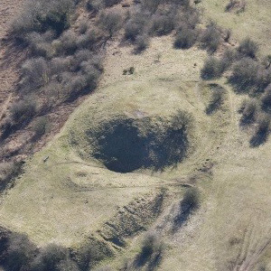
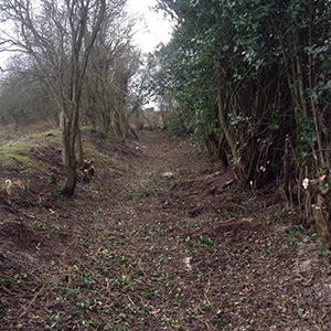
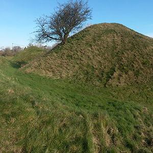
Castle Pulverbatch has been described as one of the finest examples of a Norman motte and bailey castle in Shropshire. However, the interest lies in the fact that no detailed archaeological study of its substantial extant earthworks and undisturbed interior has been undertaken and equally importantly that the castle was probably derelict by 1202. This gives potential for us to learn more about the form of early castles in general and along the Welsh border in particular.
The castle was probably build towards the end of the 11th century either by Roger Venator or his son (also called Roger). The Domesday Manor of Pulverbatch comprised both the modern settlements of Castle Pulverbatch and Church Pulverbatch. The manor became the caput or principal manor of the baronry of Pulverbatch by the end of the 12th century. Roger Venator’s lands passed to his son, Roger, then to Reginald de Pulverbatch in the reign of Henry II.
Our project
In 2017 the Trust awarded the Stiperstones and Corndon Hill Country Landscape Partnership Scheme a grant of £2,995 to survey the castle. From 2013 to 2018 they worked to conserve natural and heritage sites. Using photogrammetry and geophysics, the project aimed to comprehensively map the site and help with interpretation.
Aerial-Cam carried out the photogrammetric survey – done by flying a drone with a camera around the site – while Archaeological Services carried out resistivity and magnetometer surveys. The results were so promising that the Shropshire Archaeological and Historical Society provided more funding so that a ground-penetrating radar survey could be carried out.
Explore the castle
Photogrammetry involves taking thousands of photos of an object or landscape and stitching them together to create a 3D model. You can explore the model of Castle Pulverbatch below.
