In its latest round of grants the Castle Studies Trust has awarded £34,000 to five projects including two projects outside the UK. As well as covering a wide geographic area the projects will also undertake a broad range of technics to boost our understanding of castles.
Subscribe to our quarterly newsletter
Dating medieval towers in the hinterland of Medieval Chalkida, Greece:

Stand-alone medieval towers, often part of castles or larger fortifications, are common in Central Greece. Often thought to have been built by the Frankish nobility during their period of dominance between 1204-1470, there is minimal evidence to back this up. By taking wood and mortar samples, the project aims to answer that question.
The present project forms part of the five-year survey ‘Beyond Chalkida: Landscape and Socio-Economic Transformations of its Hinterland from Byzantine to Ottoman times’ (authorised in July 2021 by the Greek State)
Samples will be taken from six towers of wood used laterally within tower walls to increase their structural strength, and mortar from within the core of the walls (both therefore probably
contemporaneous to the original period of construction). Specialists will use dendrochronological and
Carbon 14 methodology for the wood (8 samples), and optical microscopy, Scanning Electron Microscopy (SEM), and X-ray fluorescence (XRF) and diffraction (XRD) Spectroscopy (mortar – 21 samples).
Work will start at the earliest in late 2022 and may not actually take place until next year due to the time it is likely to take to get official permission from the government.
Kilmacahill, Co. Westmeath
Geophysical survey of deserted medieval settlement close to Jamestown motte & bailey castle. The aim is to understand the morphology of settlement and its relationship with the castle and medieval monastery.
This survey will contribute to a larger project: the Human-Environmental Exchanges in the Landscapes of Medieval Ireland Project (HELM Project) which aims to use a combination of multispectral imaging, UAV drone survey along with geophysical survey to gain a much better understanding of the form of the deserted medieval village through non-invasive methods.
At time of writing it was unclear when the survey will take place.
Pontefract, West Yorkshire

The project funded will be a geophysical survey of two parts of the castle, which during its history was the main royal castle in Northern England, not previously investigated. The survey will be of two areas of the castle using Magnetometry, Resistivity and Ground Penetrating Radar (GPR)
The focus is on parts of the castle not previously explored by excavations in the 1980s, especially around the northern ramparts. This area stretches from the Swillington Tower towards the Kings Tower, and includes several earthwork features which remain unidentified, or unconfirmed. Geophysical investigation is likely to reveal several interesting features including the link wall between the curtain wall and the Swillington Tower, which is unique in that it was built outside the main castle defences.
A second area that we have very little information on is part of the castle known as the “service buildings”. This area has never been excavated and we have very little knowledge regarding the layout or function of this part of the castle.
As yet it is unclear when the survey will be undertaken.
Raby, Co Durham:
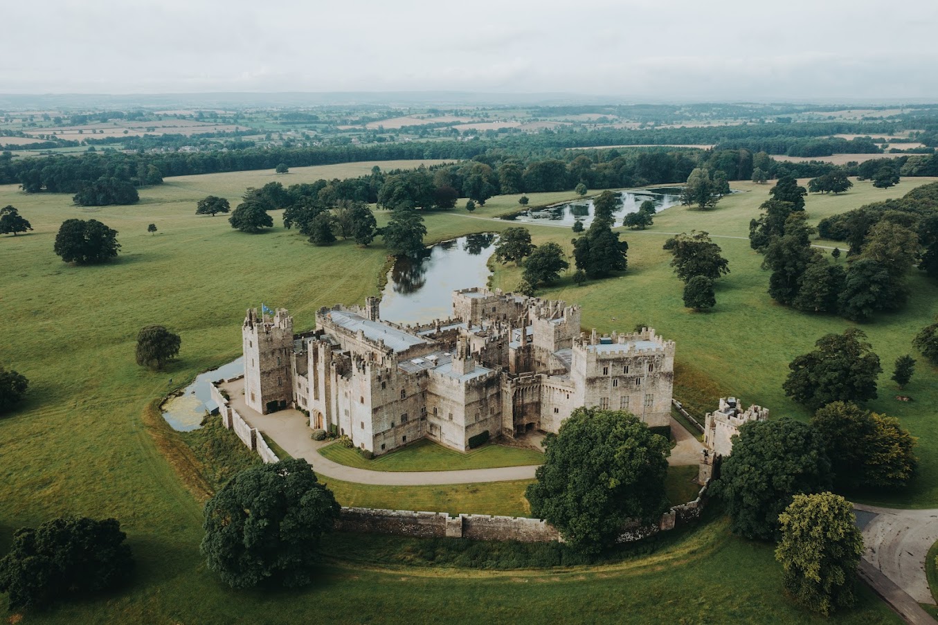
The Trust will be co-funding the project which aims to improve the understanding of the castle in the medieval period, especially around 1400 in the decades immediately after the licence to crenellate, with a buildings survey and development of a 3D model.
Once a stronghold of the Neville family, it moved into the ownership of the Vane family in 1626 and has been much altered and modernised, especially in the Victorian period, into a palatial family home. Large sections of the medieval castle survive intact, albeit intersected and extended with more recent architectural additions.
This project seeks to strip back the more recent layers, to make sense of the medieval castle. Our aim is to create a 3D visualisation of Raby Castle in around AD 1400, helping us to visualise and to understand (where possible) how it functioned before the later additions.
In addition to boosting our understanding of the castle, the plan is also to train up a team of volunteers in how to carry out a building survey.
The aim is to start the survey work in April.
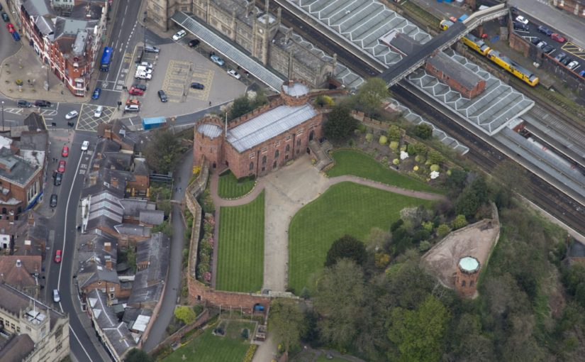
Shrewsbury, Shropshire:
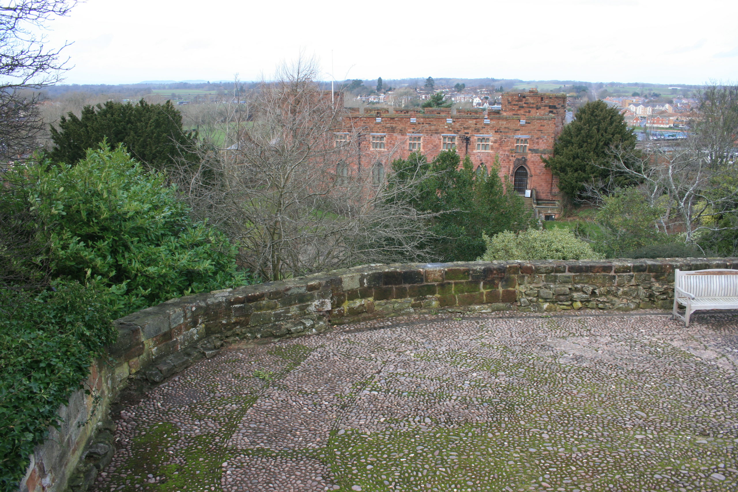
This is the third project the Trust has funded on this important castle of the Welsh Marches and is an excavation of the motte top. The first two excavations in the inner bailey discovered that the original inner bailey was a lot smaller than it is today with little room for any substantial buildings, especially the royal hall.
This leaves only the motte and the aim is to understand the structural sequence and assess the character and the status of the buildings there: specifically to identify the royal hall known to be present during the Middle Ages.
The excavation is due to take place in the second half of July.
Subscribe to our quarterly newsletter
Featured image Shrewsbury Castle by air courtesy of Shropshire Council