A castle in context: exploring the settlement context of Castle Pulverbatch

Giles Carey project lead for the Castle Pulverbatch survey, funded by the Castle Studies Trust,  presents an overview of the wider settlement context for the motte and bailey at Castle Pulverbatch, central Shropshire.

“It is a truism that medieval castles ‘dominated’ their landscapes. But this apparently simple statement obscures, and indeed misrepresents the many and varied ways in which castles were both embedded in the medieval landscape and contributed to its evolution and character.” (Creighton and Higham, 2004: 5).

Subscribe to our quarterly newsletter

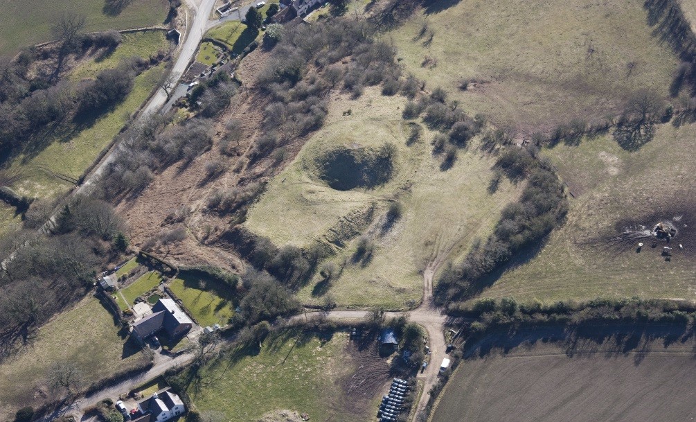
Pulverbatch is a village situated in central Shropshire, about 13km southwest of Shrewsbury on a minor road from Shrewsbury to Wentnor. The modern village is formed of two distinct centres, with a small nucleated settlement around the church (Church Pulverbatch, known as ‘Churcheton’, then Churton since at least the 13th century (Gaydon, 1968: 138)), and Castle Pulverbatch lying c.1km to the SW. One of Shropshire’s best-preserved motte and bailey castles is situated on the edge of a small steep-sided ridge at the southern end of the village (figure 1).
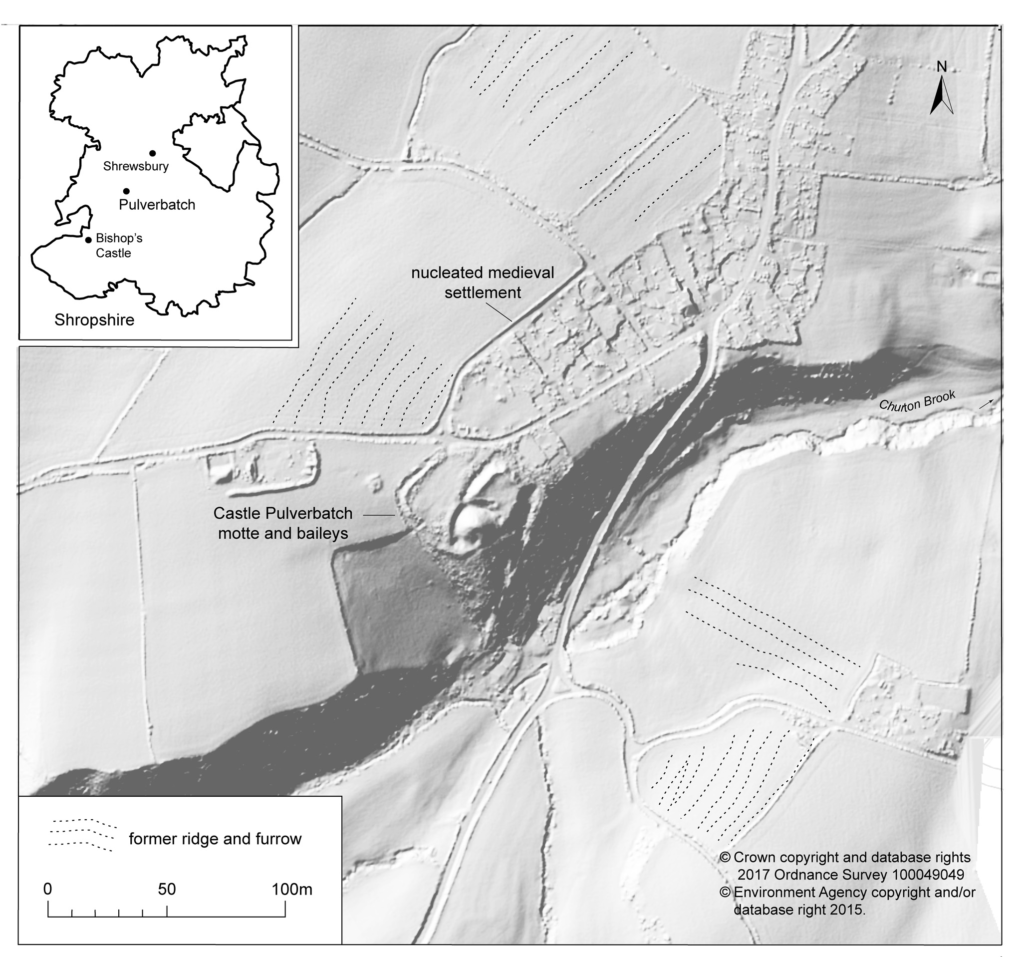
Figure 1. The immediate area around Castle Pulverbatch. Probable medieval ridge and furrow ploughing (plotted after Stillman 1980) is superimposed on a LiDAR image – much of this has been removed by more recent ploughing, though traces can be still seen in the field at the top of the image – just north of the village. LiDAR data collected for the Stiperstones and Corndon Landscape Partnership Scheme. © Giles Carey

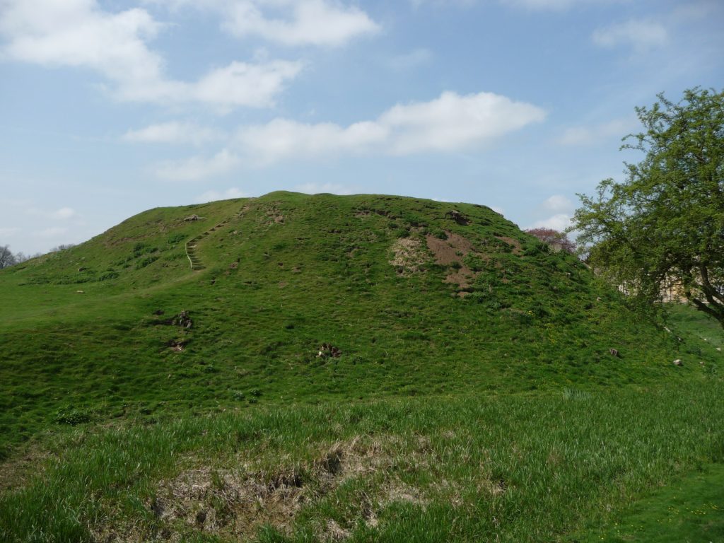
The castle comprises a roughly circular motte, with a base diameter of 35m standing up to 8m high, constructed on the edge of a ridge to make the best use of the natural topography. A substantial ditch 7m wide and 2.6m wide, with a counterscarp bank 4m wide and 0.8m high, separates the castle motte from the flat ground to the west. The inner bailey, situated to the north-east of the motte, is roughly rectangular in plan. It measures 28m north-east to south-west by 30m south-east to north-west. Around its north-west and north-east sides, the bailey is defended by a substantial bank up to 10m wide and 4.2m high on its outside, 1.5m high on its inside. The south-east side of the inner bailey is not defined by a bank but makes strategic use of the natural topography to provide a defendable location. The outer bailey, standing to the west, is, by contrast, defined by much slighter defences. This difference in construction has been suggested as indicating a two-phase construction for the site, with the outer bailey representing the enlargement of a compact and strongly defended initial structure (Stillman, 1980: 3). The outer bailey extends 80m north-south by 40m east-west. A defensive bank up to 6.5m wide and 1.4m high runs along its north-west side, defining a deep hollow-way which runs adjacent to the field boundary in this location.
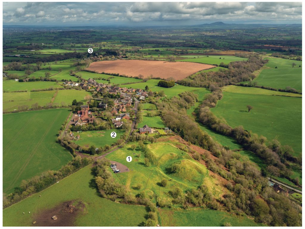
Figure 1: Castle Pulverbatch in context. 1. Motte and bailey; 2. Possible medieval settlement; 3. Church of St. Edith. © Aerial Cam, 2017.

Strategically, the castle occupies a dominant location on the edge of a spur extending south from the village of Castle Pulverbatch. From the top of the motte, views run along the valley of the Churton Brook, and cover the road network (figure 2). It has been suggested that the castle could have provided a control point over “the route from hill country to the Severn valley, perhaps levying a toll on traffic” (Stillman, 1980: 18).

Castle Pulverbatch is typical of rural earthwork castles in Shropshire and the wider Marches. It appears to form an outlier for a concentration of 12 similar motte and baileys in the Vale of Montgomery, from Montgomery in the south-west to Caus in the north-east (Cathcart King and Spurgeon, 1965). These small, rural castles have a number of key characteristics – mottes with a very restricted top, which would have been capable of carrying only a small structure – a ‘blockhouse or pill-box’ as Cathcart King and Spurgeon refer to them, overlooking strategic points on the road network. Pulverbatch certainly meets this criterion – it’s motte ‘dominates’ routeways at the northern approaches to the Long Mynd and the western flank of the entrance to the Stretton Valley.
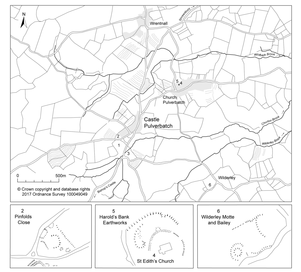
Figure 3. Key sites mentioned in the text: 1 – Castle Pulverbatch (HER PRN 01051); 2 – Possible tenement plot, Pinfold’s Close and medieval settlement (HER PRN 03703); 3 – mill site (HER PRN 03704); 4 – Church of St Edith, within circular churchyard (HER PRN 33037); 5 – earthwork enclosure (HER PRN 03702); 6 – Motte and bailey at Wilderley Hall (HER PRN 01052). Derived from sketch survey by Nigel Stillman (1980) with additional detail added from LiDAR imagery. © Giles Carey

In 2017-2018, The Castle Studies Trust, and the Shropshire Archaeological and Historical Society provided grant-funding for geophysical surveys on the site, together with a level 2 earthwork survey using photogrammetry (Donaldson and Sabin, 2017; Stanford, 2017; Ashby, 2018). The results of this work were informative, and suggestive of a substantial building, measuring 22m by 18m in the inner bailey. Background research, however, drew attention to the wider landscape. It soon became clear that the story of the castle would only be ever half-complete if one focused on the earthworks and buildings of the inner and the outer bailey. The inter-relationship between the motte and bailey, its associated settlement and the parish church of St. Edith was evidently worthy of further exploration (figure 2).

Castle, settlement and church

Pulverbatch is first mentioned in the Domesday Survey of 1086 when it appears as ‘Polrebec’. The name derives from Old English, a combination of pulfre of unknown meaning and bǣce meaning stream valley (Gelling 1990, 245–7). At Domesday, the manor of Pulverbatch, combining both modern settlements of Church and Castle Pulverbatch, was held by Roger Venator [The Hunter]. Roger Venator was a tenant of Roger de Montgomery, Earl of Shrewsbury. Along with his brother Norman, he was a huntsman for the Earl and was consequently granted land in the Shropshire forests. He also held nearby Wrentnall.

Domesday records Pulverbatch as comprising two hides of land which paid tax, and there was land for five ploughs: two ploughs in the lordship with four slaves, while seven villagers had a further three ploughs between them. There were also two ‘radmans’ [riding men – the lord’s servants] in the manor. There was enough woodland for the fattening of 100 pigs. Before 1066, the manor had been worth £6 in tax; that had dropped to 20s in 1066, but by 1086its value had risen  to 30s (Eyton 1854, 189).

Subscribe to our quarterly newsletter

The evidence suggests that the castle was built towards the end of the 11th century, either by Roger Venator or his son, also called Roger. Castle Pulverbatch is one of eighteen or more earthwork castles in south-west Shropshire that were built by the first Norman lords installed by Roger de Montgomery, himself one of three key lieutenants installed by William the Conqueror following rebellions in the Welsh Marches in the later 1060s. Documentary sources refer to the castle still being occupied in 1205, but there is no trace of a manor-house here in documents of 1292 (Gaydon 1968, 131).

Another motte and bailey lies 1.2km to the south-east, north of Wilderley Hall Farm (Figure 3, site 6), which at Domesday was held by another minor tenant of Roger of Montgomery, Hugh Fitz Turgis (Eyton 1854, 258). Probably, like Castle Pulverbatch, Wilderley was positioned strategically to command a route running northwards from the Long Mynd towards the Severn Valley (Gaydon 1968, 132). Little is known about the  history of Wilderley so establishing any chronological link between the two castle sites remains challenging.

In 1254 Philip Marmion was granted the right to hold a weekly market at Pulverbatch on Mondays, and an annual three-day fair around the day [16th September]of St Edith the Virgin’, to whom the church in Church Pulverbatch was dedicated (Eyton 1858, 197).

At an inquest on the death of Philip Marmionon January 14 1292, his estate at Pulverbatch included a ‘capital messuage [house, yard, outbuildings and land], a carucate of arable land, and two acres of meadow. A Mill realised 30s…’ (Eyton 1858, 199). The latter was presumably on the site indicated by slight earthworks in a field identified on the tithe map as Upper Mill Meadow (Figure 3, site 3).

There is no clear dating evidence concerning settlement at Pulverbatch. The chronological picture is further complicated by the suggested early date for a church at Church Pulverbatch (Figure 3, site 4). The present building is medieval in origin, although it was largely rebuilt in 1853 (Newman and Pevsner 2006, 203–4). (A lovely watercolour of the pre-19th century form of the church is held by Shropshire Archives, and a small version can be accessed via their online catalogue: https://www.shropshirearchives.org.uk/collections/getrecord/CCA_X6001_19_372B_4)
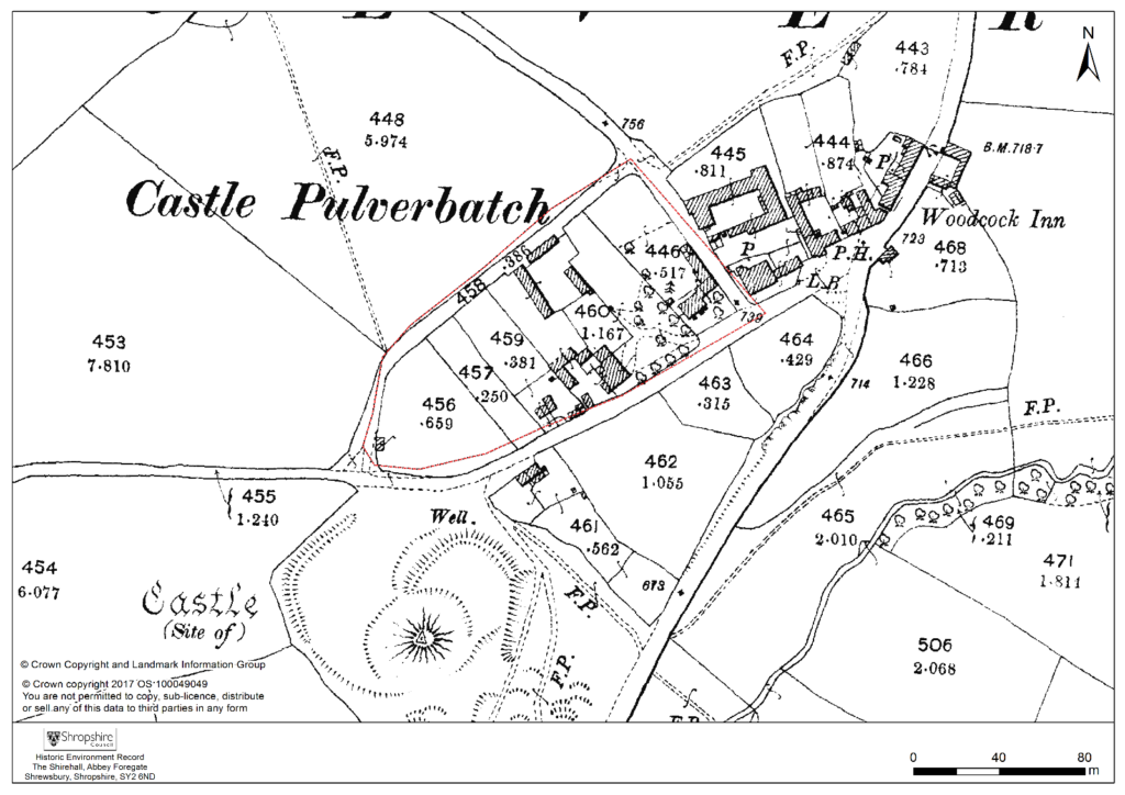
Figure 4 – 2nd edition 1:2500 Ordnance Survey map of 1903, showing suggested extent of settlement to immediate NE of the Castle site.

The church lies within a circular, embanked churchyard, which has been suggested as indicating an early, possibly pre-conquest origin, drawing upon other examples from the Marches (Rowley 1972, 81), although this hypothesis is untested in the county (see Ludlow 2009, 71-76 for discussion of examples from south-west Wales). A number of other circular churchyards are known in Shropshire (Cardeston, Stanton upon Hine Heath, Llanymynech, Loppington and Leighton, inter alia), but the importance of that at Pulverbatch is heightened by the presence of additional earthworks to the north of the churchyard, occupying a high point within the wider landscape (Figure 2, site 5).

A number of authors have speculated about the development of the medieval settlement sited immediately north and west of the castle (figure 4). Little earthwork evidence survives of this settlement, although a slight bank was recorded in the 1980s by Stillman on a triangle of land known as Pinfold’s Close, directly to the north of the castle’s outer bailey. This triangle was suggested as a possible plot division (see Figure 2, site 2) and subsequently recorded as a property/field boundary by Wendy Horton on a site visit in 1991 (Shropshire HER PRN 03703). Sadly, this area has been extensively disturbed since then, and little trace of any earthworks was found during the 2017-2018 survey work.

Higham and Barker see the village ‘growing up around a castle founded in previously open countryside’ (Higham and Barker 1992, 200) while Rowley suggests that its regularity indicates a deliberately planned settlement unit laid out by the lord of the manor in the 12th or 13th century (Rowley 1972, 86). Creighton goes further in identifying the development at Castle Pulverbatch as representing a nucleation point, “a regular settlement” growing up adjacent to the “new seigneurial centre” (Creighton 2002, 203). This would accord well with the manor of Pulverbatch becoming the caput baroniae, or principal manor of the baronry of Pulverbatch by the end of the 12th century (Gaydon 1968, 131). Stillman suggests that the settlement around the castle may have been a fairly speculative endeavour from the lord of the manor that was ultimately unsuccessful, with settlement shifting downhill to the modern settlement at Church Pulverbatch (Stillman 1980, 18). There is no evidence of the settlement at Castle Pulverbatch ever expanding into ‘anything more than a small farming community’ (Gaydon 1968, 132).

This relationship between the development of a settlement, and the development of a castle site has been little explored in the region. Whilst the extensive work at the motte-and-bailey site of Hen Domen in the 1970s revolutionised our understanding of the likely former structural complexity of timber castles in general (Higham and Barker, 1972), there has been little opportunity to further investigate the significant group of motte and bailey castles in the Vale of Montgomery and SW Shropshire, including inter-relations between settlements and castle.

Some of these complexities can be seen at the site of Caus Castle, was subject to a detailed programme of earthwork and geophysical survey in 2016, also funded by the Castle Studies Trust (Fradley and Carey, 2016). Although a castle of quite different status, size and setting to that at Pulverbatch, work here provided evidence of a castle, borough, market (and later fair) in states of flux, and indicated that the fortunes of the castle and the fortunes of the town were not always aligned.

A number of other small, earthwork castles in this part of the march would repay such further study. We might think  the  castle at More, for instance. A motte and bailey castle developed here from an earlier ringwork castle, with its associated earthwork remains of a deserted settlement, with the remains of house plots and toft boundaries (figure 5).
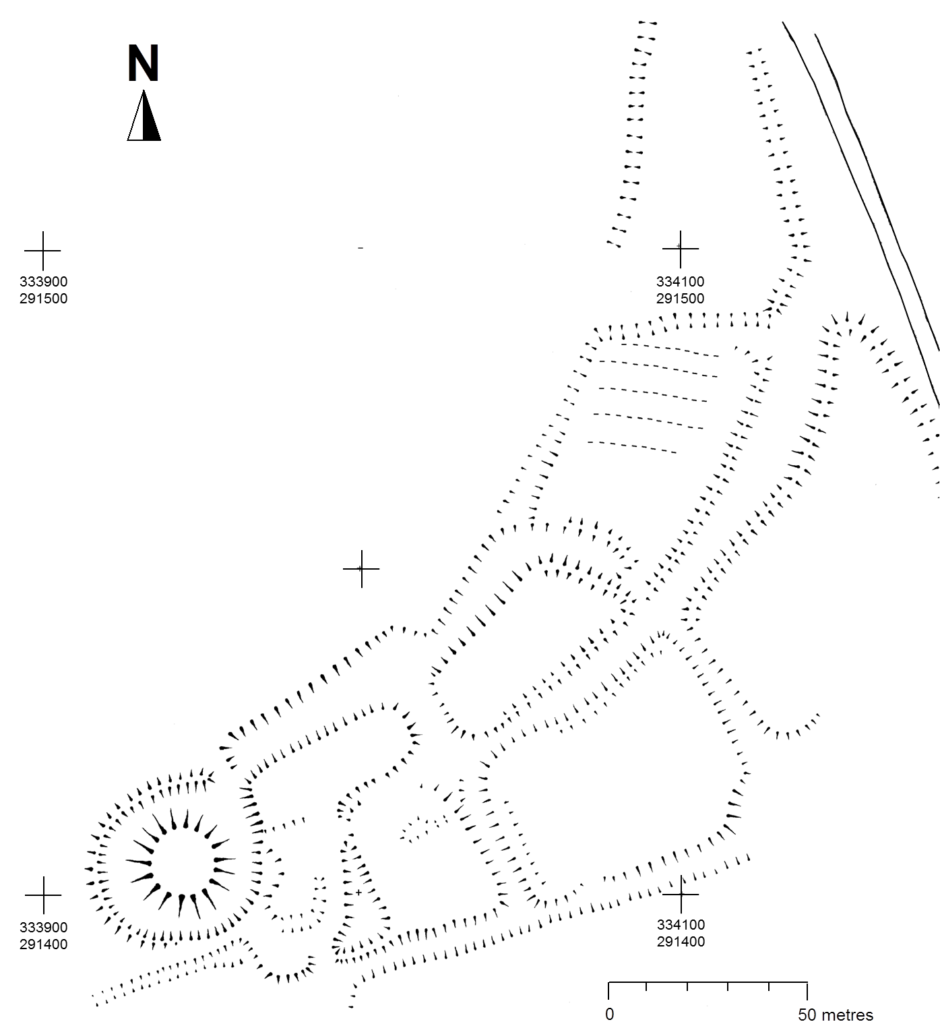
Figure 5 – Hachure plan of More Castle, scale 1:1250. © Shropshire Council Archaeology Service / Hannaford and Sylvester, 2015.

Non-intrusive landscape survey, as funded by the Castle Studies Trust, allows us to place these sites in some context, and allows a glimpse at the bigger seigneurial, tenurial and topographic picture of these earthwork castles.

Subscribe to our quarterly newsletter

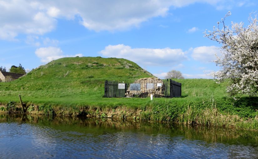
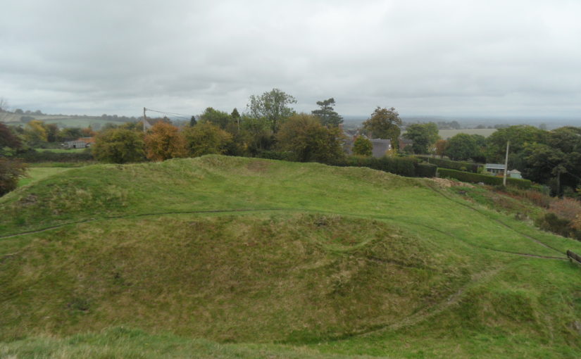
Featured image Castle Pulverbatch bailey from motte top.

Bilbliography

Ashby, D., 2018. ‘Castle Pulverbatch, Shropshire: Ground Penetrating Radar Report’, unpublished report, ARCA, University of Winchester.

Carey, G., 2018. Capturing the Castle: recent survey work at Castle Pulverbatch Motte and Bailey, Shropshire, Transactions of the Shropshire Archaeological and Historical Society 93 pp.31-44

Cathcart King, D. and Spurgeon, C., 1965. ‘The Mottes in the Vale of Montgomery’, Archaeologia Cambrensis 114 pp.69–86.

Creighton, O. and Higham, R., 2006. ‘Castle studies and the ‘landscape’ agenda’, Landscape History 26 pp.5–18

Creighton, O. H., 2002. Castles and Landscapes. London: Continuum

Donaldson, K., and Sabin, D., 2017. ‘Castle Pulverbatch Motte and Bailey, Shropshire: earth resistance & magnetometer survey report’, unpublished report, Archaeological Surveys Ltd., report no. J708. Shropshire HER ESA 8253.

Eyton, R., 1854. Antiquities of Shropshire Volume 6. London. John Russell Smith.

Fradley, M. and Carey, G., 2016. ‘Archaeo-topographical survey: Caus Castle, Westbury — a preliminary report’, unpublished report. Shropshire HER ESA 8179.

Gaydon, A. (ed.), 1968. The Victoria History of Shropshire: Volume VIII. London. Oxford University Press.

Gelling, M., 1990. The Place Names of Shropshire. EPNS, Vols. LXII/LXIII (Part One).

Hannaford, H., and Silvester, R., 2015. ‘Desk-based studies of four castles in the Welsh Marches: Castle Pulverbatch, More Castle, Wilmington Castle & Hyssington Castle’, unpublished report, SCAS, report no. 371. Shropshire HER ESA 7514.

Highham, R. and Barker, P., 1992. Timber Castles. Exeter: University of Exeter Press

Ludlow, N., 2009. Identifying Early Medieval Ecclesiastical Sites in South-West Wales In: Edwards, N. (ed.) The Archaeology of the Early Medieval Celtic Churches London: Routledge, pp.61–84.

Pevsner, N. and Newman, J. 2006. Buildings of England: Shropshire. London: Yale.

Rowley, T. 1972. The Shropshire Landscape. London: Hodder and Stoughton.

Stanford, A., 2017. ‘Castle Pulverbatch Processing Report’, unpublished report, Aerial Cam, report no. C-P-01042017.
Shropshire HER ESA 8254.

Stillman, N., 1980. ‘Castle Pulverbatch: a field survey of a motte and bailey earthwork in Shropshire’, unpublished report, University of Birmingham. Shropshire HER ESA 1137.

Thorn, F., and Thorn, C. (eds), 1986. Domesday Book: Shropshire. Chichester
Fresh from Fotheringhay

We have the results of the survey at Fotheringhay Castle. You can find out more about what we found in Steve Parry’s excellent blogpost, complete with the earliest depiction of the castle.

The castle is most famous as the place where Mary Queen of Scots was tried and executed. It was thoroughly dismantled in the first half of the 17th century, leaving the motte intact but little else above ground. Thanks to work by the Museum of London Archaeology and funded by the Castle Studies Trust, we now have a better idea of how the castle was arranged.

Piecing together Lathom Castle

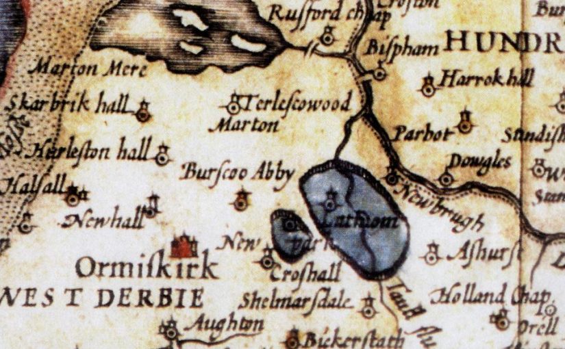
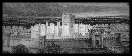
I’d heard of Lathom House, but the familiar reconstruction of this principal monument of Tudor England is a Victorian engraving that may bear little relation to historical fact. Those engravers never saw it, as it had long gone by then. No drawings survive, but enigmatic descriptions of nine (or was it eighteen?) towers, the space they occupied now thin air and branches.

Lathom House is in a garden – or rather, here lay its site. This garth is isolated, bounded by a sandstone wall and a ditch in a flat Lancashire landscape that in winter stretches the concept of fallow into a deeper somnolence. In summer its shrubs and trees burst into colour and scent, and you may be caught off-guard by the cry of its peacock strutting in the remnants of a nineteenth-century planting scheme. There is no sign at all of the medieval house, but for the occasional scrape of a trowel blade on revealed cobbles and footings.

Fifty yards from this lost garden is the rump of the last Lathom House, built in the 1720s to the designs of Giacomo Leoni. After two centuries, this Palladian mansion was demolished in 1925–9. It had provided a replacement for a house that was also ravaged – but not totally destroyed – during the civil war, and whose central ‘Eagle Tower’ was the principal monument of the Stanley family, kingmakers at Bosworth Field in 1485. After the battle brought Henry VII (1485–1509) to the throne they built to the scale expected for a residence of Margaret Beaufort as the Lancastrian king’s mother, and Thomas Stanley, the last King of Mann who presided over Lancashire and Cheshire with a view across the Irish Sea. Lathom was so grand it was termed ‘The Northern Court’ in 1572, with the claim Henry VII, who visited in 1495, had based Richmond Palace on its turreted skyline. It has recently been demonstrated that the king left his marriage bed here, having executed William Stanley his Lord Chamberlain on charges of plotting. It inspired the basis of a school of joinery centered on Lathom. Much of this furniture survived the civil war, as heavy beds were propped against the great gates against cannon fire, whereupon the chattels escaped with the family.

The comparison of Lathom and Richmond is hard to substantiate, and so completely lost was this grand house that its location has been hotly disputed. In the last twenty years, the occasional archaeological investigations in the garden and at the dilapidated remains of the Georgian house have revealed a wide array of footings and salvaged cut stones. The Lathom Park Trust and latterly the Kingmaker 1485 project led by Steve Baldwin with Dr Rob Philpott, Dr Clea Paine and George Luke have championed a deeper understanding of the site and brought public access and involvement in archaeological discovery, training and recording.

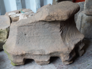
The involvement of diverse groups at separate digs has resulted in the need for a collation and analysis of discoveries, which have not hitherto been catalogued in one place nor attributed with an original context. The Castle Studies Trust funded a project to analyse the scattered masonry and identify it as far as possible through comparative evidence. After several months of looking, measuring, thinking, discussing and researching, the results have set the diverse stones within a timescale stretching from the fifteenth century – some perhaps earlier – to the Jacobean age, exactly as expected if they were the remains of Lathom House.

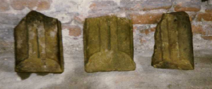
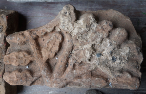
The most diagnostic features include chimney caps, early seventeenth-century window mullions and sills, carved stones with oak leaves compatible with the Stanley arms, and the tantalising possibility of a medieval memorial slab. These offer a clear picture of the waves of construction, which peak at the era of Bosworth, and the turn of the seventeenth century. The latter may tally with another royal visit, that of James I in 1617.

I write this ahead of giving a talk on the findings to the local community. The biggest realisation is that Lathom’s Eagle Tower was almost certainly based on the polygonal Eagle Tower at Caernarfon – Edward I’s fortress – for which the Stanleys became responsible in the 1480s just at the time they rebuilt Lathom to represent their role as kingmakers. The internal area of this building and the number of stories tally closely with Caernarfon, allowing us to begin to reconstruct lost Lathom and – as importantly – appreciate its significance in the minds of those who knew it.

We don’t yet have the full picture, but understanding the masonry undoubtedly establishes the building blocks for the years of archaeology that lie ahead.

Jonathan Foyle will be speaking about his work at Lathom on Wednesday 25th October.

Clifford: investigating one of England’s oldest castles

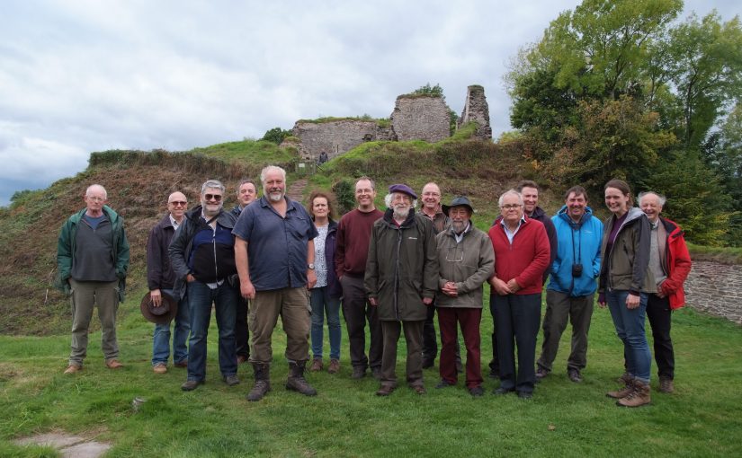
The Castle Studies Trust’s supporters and trustees, joined by castle experts from far and wide, were hosted by Keith Hill, owner of Clifford Castle, Herefordshire, to hear the results of the recent work funded by the Trust at the castle.

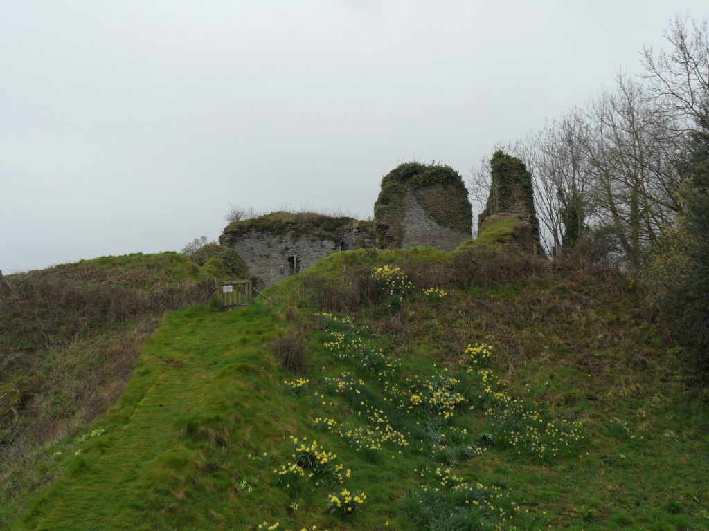
Clifford Castle is a large motte with remains of a stone castle on top, a vast bailey with elaborate stone gatehouse on the one side, and a mysterious earthwork known as the hornwork on the other, standing beside the river Wye. Originally founded in the first years after the Norman conquest Clifford became home to a baronial family whose wealth allowed them to erect the substantial stone structures now visible. The new work led by archaeologist Tim Hoverd and Nigel Barker has made it possible to confirm that these were almost certainly built at the end of the twelfth or in the first decades of the thirteenth century.

It was suggested that what has always been described as a great hall was probably a chamber block over a basement, reinforced by comparison with the structure at nearby Grosmont castle. Excavation recovered a door as well as the end wall of this block, which turned out to be very close to the external curtain wall. Pottery found on the motte confirmed a date of late twelfth/early thirteenth century. The arrow loops in the surviving mural tower are of the same era. The curtain wall also contains a large number of latrine chutes discharging down the motte side facing the long-abandoned earthwork on the far side and cut off by a man-made ditch. What it was remains a subject for speculation, as does the presence of buildings in the outer ward, because a post-medieval orchard was found to have removed most of the evidence.

The Trust is delighted that its funding has significantly improved our understanding of an important castle of the Welsh Marches. A full report will be made in due course.

Visiting Dinas Bran

Standing out in the landscape

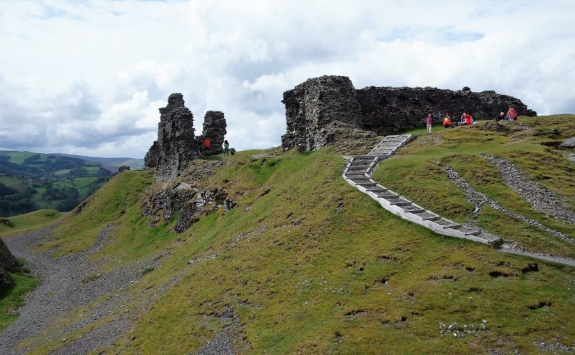
Every year we organise visits to the projects we’ve supported. These visits are open to our donors and typically involve a guided tour and a sneak peek at the results. In May we journeyed to Castell Dinas Bran near Llangollen in North Wales.

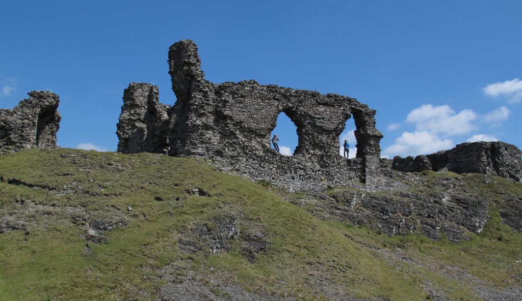
The Welsh built the medieval castle on the site of an Iron Age hillfort and it dominates the surrounding area. It’s a steep climb up, making you appreciate the effort involved to bring in building materials or even everyday supplies. And the higher you get, the stronger the winds are. Now in ruins, it must have been an imposing site visible for miles around in the landscape.

Fiona Gale, County Archaeologist for Denbighshire County Council, lent her expert eye to the guided tour. She explained the important consolidation work over the past few years as well as the recent archaeological fieldwork. The castle is mostly built from slate, and in many places the weathered walls have needed modern intervention to make them safe and prevent further collapse.

The castle might owe its present condition partly to slighting (deliberate partial demolition) and archaeologists noticed patches of scorched stone before ramps were added to mitigate erosion.

The survey at Castell Dinas Bran

With funding from ourselves and CADW, archaeologists could carry out a geophysical survey of the castle, using resistivity and magnetometry to peer beneath the surface. The report is nearly ready, and when signed off will be shared on our website. The results are tantalising, and give us more information about the use of the castle, while leaving some questions which might have to be answered by excavation.

Castell Dinas Bran is an important Welsh castle, and one of the better surviving examples. After important steps to preserve the site and keep it open to the public, we have been able to add to our understanding of the castle.

Subscribe to our newsletter for updates from the projects we support.

Castle Studies Trust Awards Five Grants to Advance the Understanding of Castles

The Castle Studies Trust is delighted to announce the award of five grants, totalling £21,000.

Castle Pulverbatch, Shropshire, England

©Shropshire County Council

Geophysical and photogrammetric surveys of this motte and bailey castle. Abandoned by c.1200 this has the potential for us to advance our understanding of early castles along the Welsh border.

Clifford, Herefordshire, England

One of the earliest castles in the UK and one of the most important along the Welsh border the geophysical survey and excavations, along with separately funded building analysis, will help understand the morphology of this little understood site. The CSG visited it as part of the 2016 annual conference. Please note this is a privately owned site and not accessible to the general public.

Dinas Bran, Denbighshire, Wales

Photo by Eva Mostraum, CC-by-NC-SA

Co-funding with Cadw a geophysical survey of the most complete, but little understood, native Welsh built castle to discover what structures lie beneath the surface.

Fotheringhay, Northamptonshire, England

Photo by Iain Simpson, CC-by-SA

With almost nothing left above ground the geophysical and earthwork surveys will help shed light on the form of castle with strong royal associations, in particular the C15 palace associated with the House of York and birthplace of Richard III. Please note this is a privately owned site and not accessible to the general public.

Lathom, Lancashire, England

Analysis of castle masonry from the completely destroyed late C15 castle built by Thomas, Lord Stanley either found via excavations or reused in the current building. This will help understand what the castle looked like and early Tudor palaces around London, like Richmond.  Please note this is a privately owned site and not accessible to the general public.

To find out more like our Facebook page and sign up to our quarterly newsletters.

2017 grants: who has applied?

The deadline for grant applications passed on 15th December and we’re going through the various projects now. Altogether the 11 projects, coming from all parts of the British Isles and Italy, are asking for over £50,000. They cover a wide period of history and types of research. For a little more detail, here are the applications we’ve received:

  • Abergavenny Castle, Wales – a geophysical survey of the whole site. The castle was an important baronial site and saw a lot of military action from when it was first built in the 11th century up until it was slighted (partially demolished) in the Civil War.
  • Bamburgh, England – assess and conserve a large collection of medieval metal work dating from the 8th to the 11th century discovered in the west ward. Bamburgh was a major elite fortress from the early medieval period so the project should help potentially understand how the site changed over the centuries.
  • Caldicot Castle, Wales – geophysical of the whole scheduled area. Building on the previous resistivity survey in the project will use all three types of survey technique to get the best understanding of any below ground remains of this major baronial site.
  • Castle Pulverbatch, England – geophysical and photogrammetric surveys of the site, one of the finest examples of a Norman motte-and-bailey castle in Shropshire.
  • Clifford Castle, England – geophysical survey and excavations to help understand the morphology of one of the earliest castle sites in the UK, and one of the principal castles on the Anglo-Welsh border. Please note this is a privately owned site and not accessible to the general public.
  • Dinas Bran, Wales – geophysical survey of the most extensive and complete Welsh-built castle to understand what structures lie beneath the surface.
  • Edinburgh Castle, Scotland – mapping and categorising suspected conflict damage at this iconic castle.
  • Fotheringhay, England – understanding the morphology of the caput of the honor of Huntingdon and 15th-century palace associated with the House of York and birthplace of Richard III, using ground penetrating radar and small unmanned aircraft. Please note this is a privately owned site and not accessible to the general public.
  • Lathom House, England – analysis of masonry dating from the late 15th-century castle built by Thomas, Lord Stanley either found via excavations or potential reused in the current building.
  • Lecce, Italy – to help with the publication of a history of the castle of Lecce which was founded by the Normans.
  • Lough Key, Ireland – to improve understanding of the medieval MacDermot lordship of Moylurg and its relationship with the Rock of Lough Key.

The applications have been sent to our expert assessors who will go over them. You can see how the assessment process works from our blog back in January 2016.

The Castle Studies Trust grants are now open!

1st September can mean only one thing: the Castle Studies Trust is now accepting applications for funding. The deadline for submissions is 15th December.

There is one very important change on previous years: the maximum award per grant has been increased from £5,000 to £7,500. Previous grants have provided excellent value for money, and the increase allows for more ambitious projects.

We have also broadened our criteria for sites for which we will award grants to include sites managed by major heritage bodies subject to caveats. For full details please view our grant giving criteria.

We already have a number of very interesting possible applications and we are looking forward to receiving more. If anyone would be interested in applying, please do not hesitate to contact the chair of trustees, Jeremy Cunnington at admin@castlestudiestrust.org

Want to learn more about previous grants or looking for inspiration? Read our grants page for details of projects from the last three years.