Reconstructing Holt Castle, Denbighshire

Little physically now remains of Holt Castle, however, one of the first projects the Castle Studies Trust was for leading buildings reconstruction artist Chris Jones-Jenkins and the late and much missed Dr Rick Turner to digitally reconstruct the castle using a mixture of historical sources and recent archaeological excavations to bring the castle back to life with a series of images and a video fly through. Here, in a piece first published in History Extra in 2015 explains how it was done.

Subscribe to our quarterly newsletter

History:

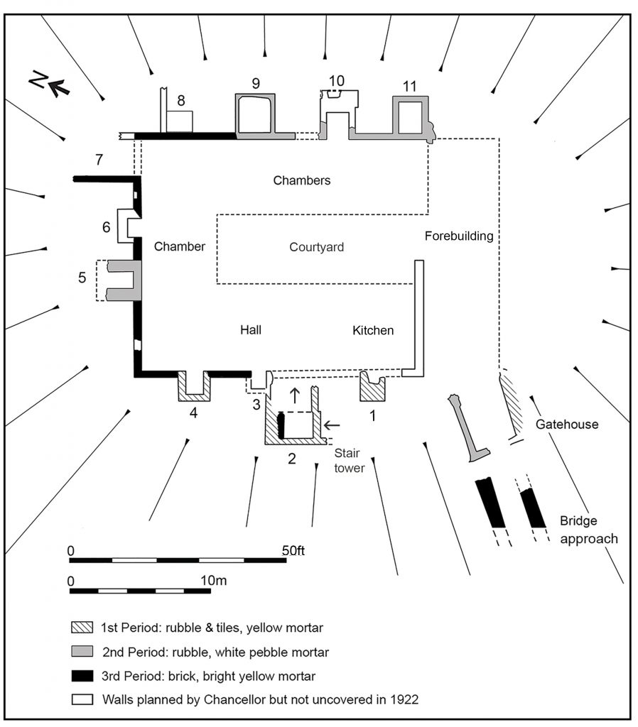
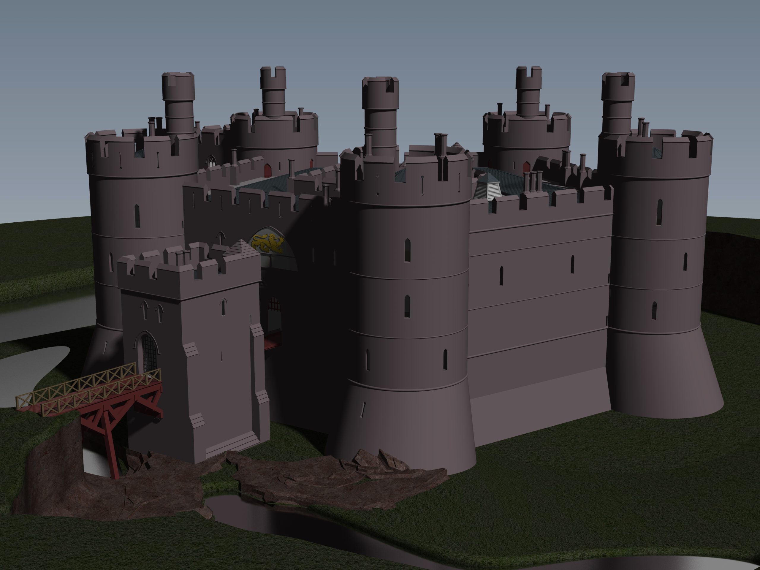
To secure his conquest of north-east Wales, Edward I created five new Marcher lordships in 1282, and gave them as reward to his political allies and close friends in recognition of their loyal service. The lordship of Bromfield and Yale was granted to John de Warenne, sixth earl of Surrey (1231-1304). It is not known when he started building Castrum Leonis or ‘Chastellion’ as Holt Castle was known in the Middle Ages. The castle is first referred to in 1311 some years after it was probably completed. Warenne’s master mason chose an open and relatively flat site above the west bank of the River Dee, close to one of the ferry crossings into Cheshire. This allowed him to create a symmetrical pentagonal castle with a tall round tower at each corner, and the main rooms ranged around an inner courtyard. There were up to three storeys raised above the original ground level, with the moat and up to additional three basement levels cut down into the sandstone bedrock. It was a revolutionary design and was one of a group of similar architectural experiments being undertaken by the other new Marcher Lords at castles such as Denbigh, Ruthin and Chirk. At all these sites geometrical complexity, architectural grandeur and the provision of well-appointed accommodation seemed to be more important than their defensive capabilities.

Holt Castle as it was in its pomp courtesy of Chris Jones Jenkins

            The sixth earl was succeeded by his grandson John, the seventh earl of Surrey (1286-1347). Described by Alison Weir as ‘a nasty, brutal man with scarcely one redeemable quality’, he was involved with the political upheavals of Edward II’s reign, including the loss of Holt Castle for a time to Thomas, earl of Lancaster. This John died without a legitimate heir, and Edward III intervened to settle his estates upon Richard FitzAlan, third earl of Arundel (c.1313-1376). His son, Richard the fourth earl (1346-1397) was one of the ‘Lords Appellant’, who had curbed Richard II’s powers and had the king’s closest allies executed or exiled during the ‘Merciless Parliament’ of 1388. It took nine years before the king was able to wreak his revenge on these powerful men. Arundel was brought to trial for treason at Westminster on 21 September 1397, and was convicted and beheaded on the same day. Richard II seized his estates and incorporated Bromfield and Yale into his new principality of Cheshire, with Holt Castle as its main stronghold. Building work was commissioned in 1398, which saw the Chapel Tower extended and included a water-gate, called ‘Pottrell’s Pit’ in later documents, linked to the river. Over the next year more than £40,000 in coin, jewellery, gold and silver plate was transferred from the royal treasury in London to Holt for safe keeping. When Henry Bolingbroke – later Henry IV – returned to England in 1399, he shadowed Richard II up the Welsh Marches and was quick to recapture Holt Castle. Despite being defended by 100 men-at-arms and being well provisioned, Henry’s men, including the French chronicler Jean Creton, were able to enter through the new water-gate and ascend ‘on foot, step by step’, to take the castle unopposed and so recover this vast proportion of the king’s disposable wealth.

Subscribe to our quarterly newsletter

            Over the next 139 years, three more owners or stewards of the lordship of Bromfield and Yale were to be executed for treason. The first was Henry Stafford, second duke of Buckingham (1455-83). A year after his death, Sir William Stanley (c.1435-1495) acquired the lordship from Richard III. Despite his role at the Battle of Bosworth which brought his relative Henry VII to the throne, he was implicated in the Perkin Warbeck affair and was executed in 1495 after which Holt Castle reverted to the Crown. The last of this group was William Brereton (c.1487×90-1536) who was appointed steward of the castle where he held ‘great porte and solemnities’, before he was convicted of adultery with Anne Boleyn and beheaded.

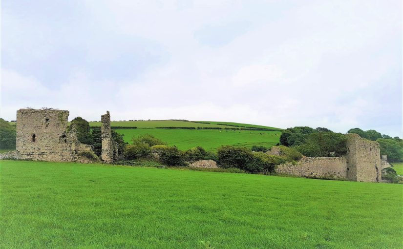
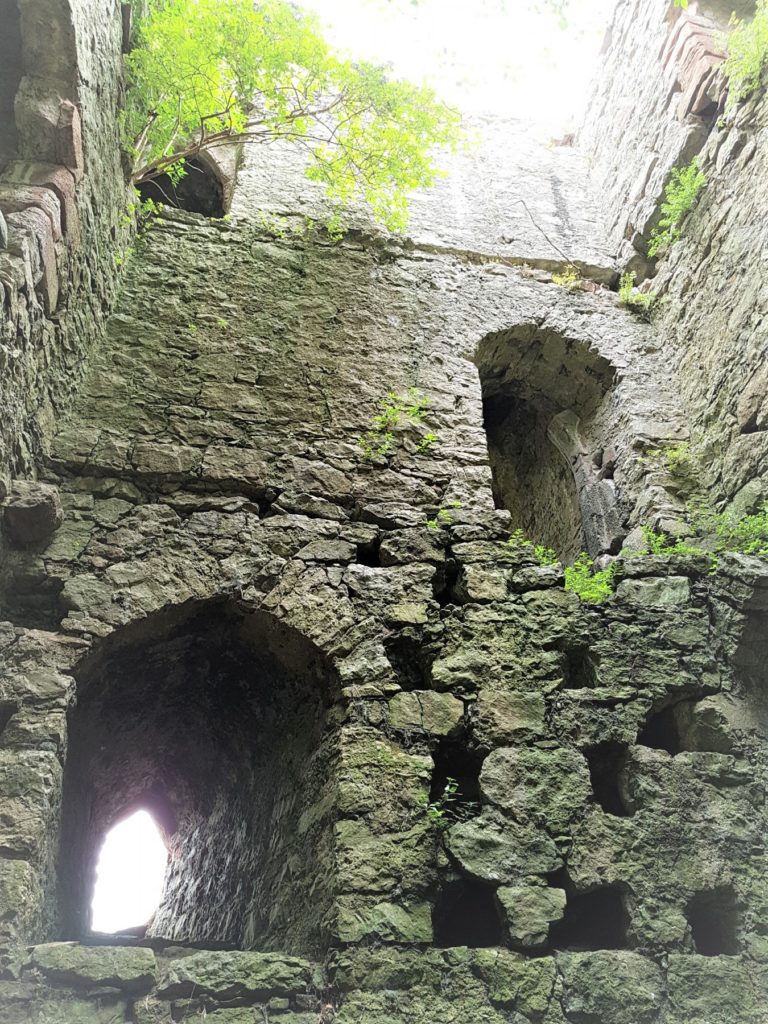
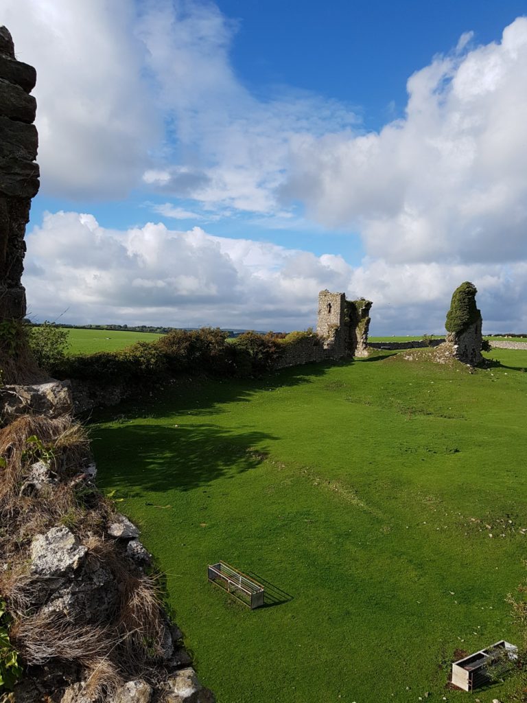
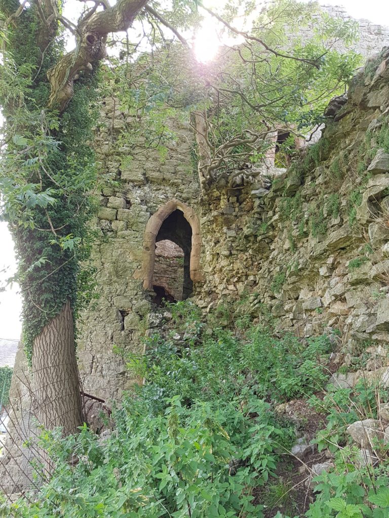
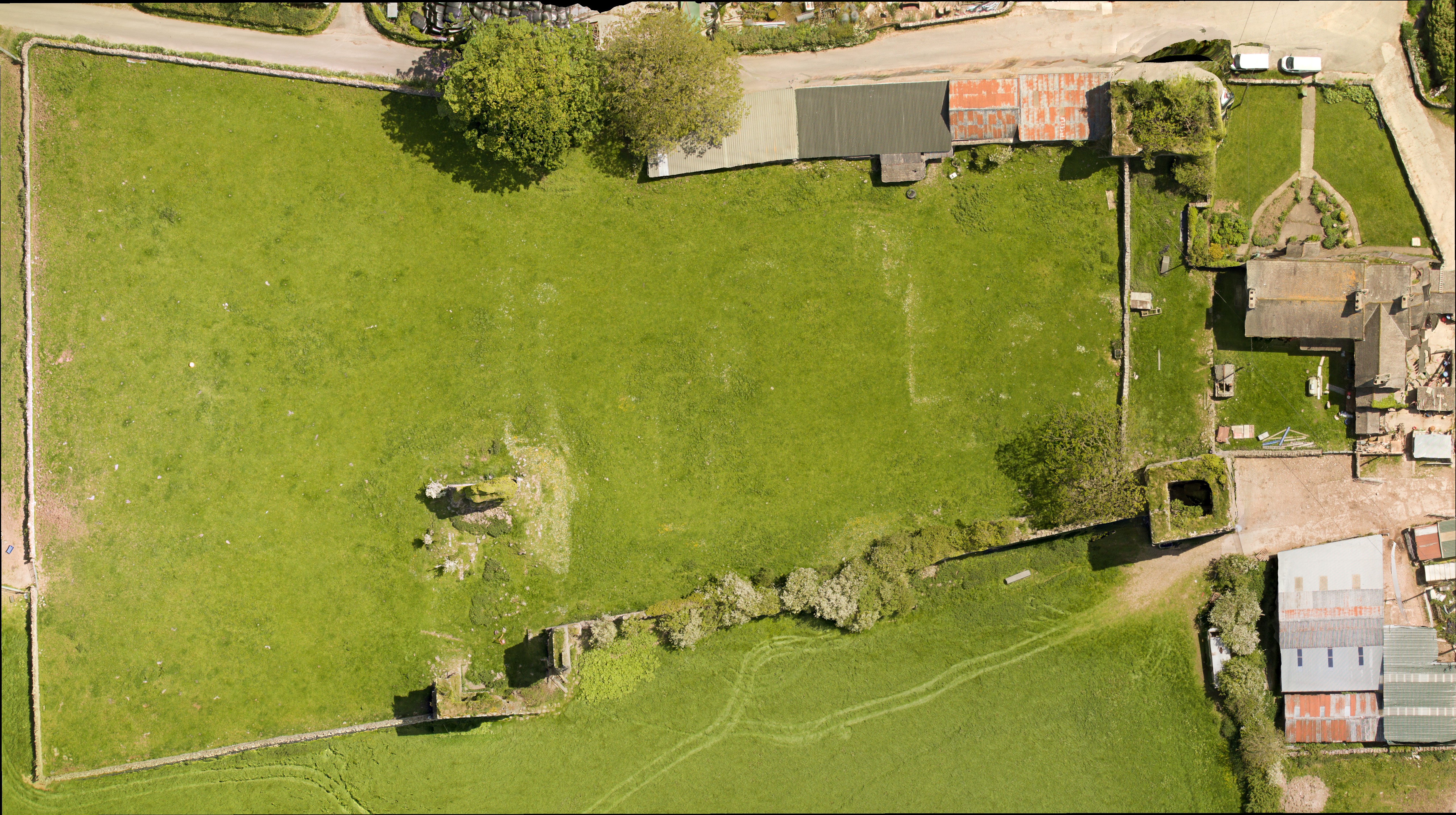
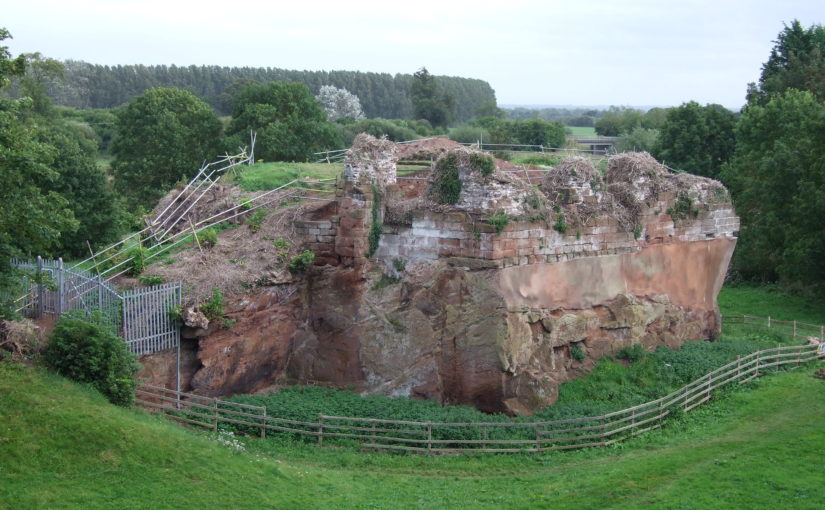
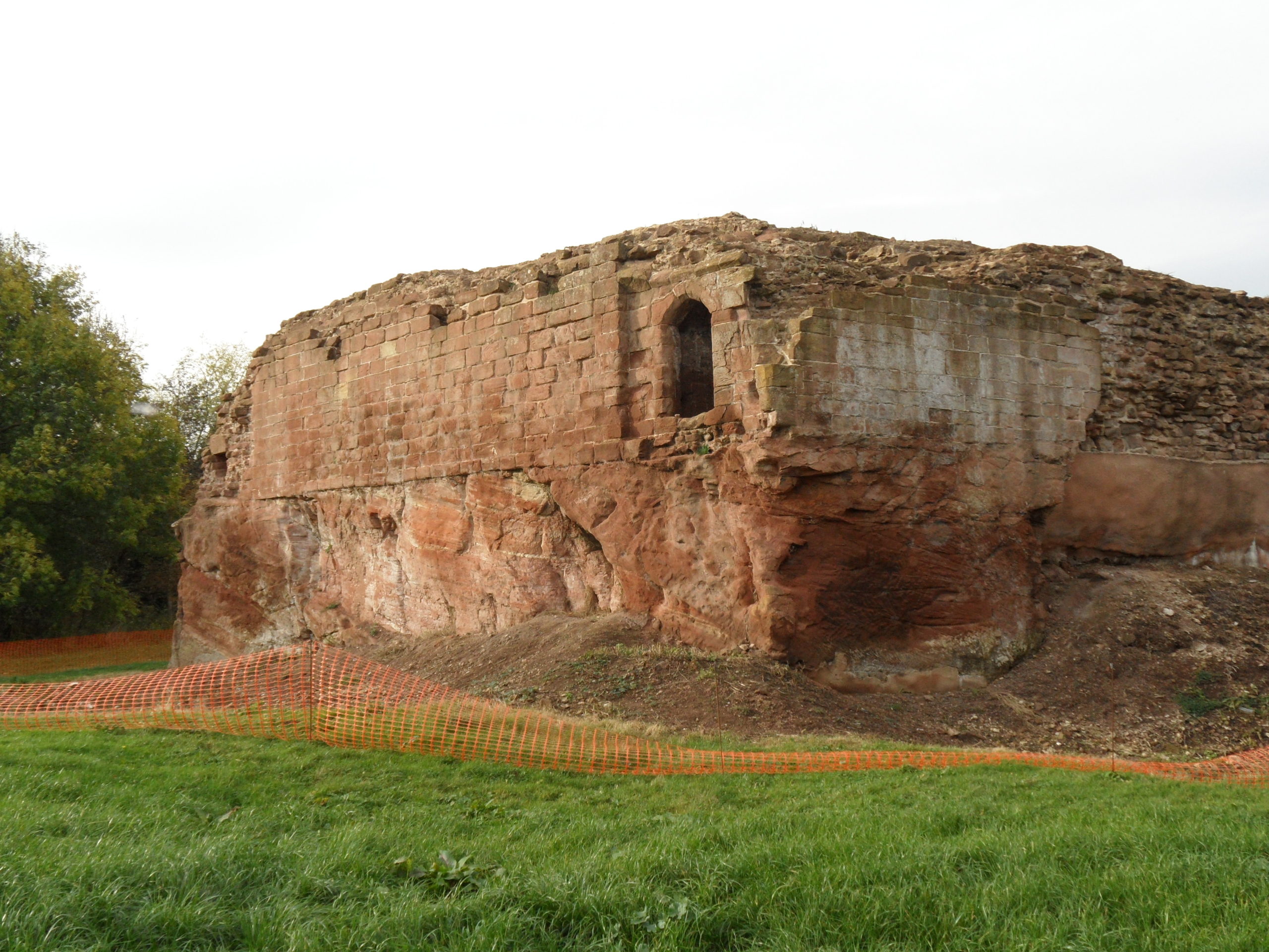
            Holt Castle remained the property of the Crown and was to form part of the estates of the Princes of Wales. It was held for the king during the Civil War and in the 1670s, the buildings were sold off to Sir Thomas Grosvenor, who systematically dismantled nearly all the fabric and transported it to help in the building of his Eaton Hall, a few miles south of Chester. This has left us with the stump of rock and walling which survives today.

Reconstructing the Castle:

Two attempts have been made to understand the original the former appearance of Holt Castle: by Alfred Palmer in 1907 and Lawrence Butler in 1987. They had access to plans and views of the castle drawn in 1562 and 1620. The problem they faced was that these two sets of drawings are contradictory and they were hard to relate to what survived. Since 1987, new evidence has been made available:

  1. Documentary evidence for Richard II’s building work.
  2. The publication of a transcript of the Holt Castle inventory taken after Sir William Stanley’s arrest in 1495.
  3. The discovery of a new early-seventeenth century plan of the castle in the National Library of Wales.
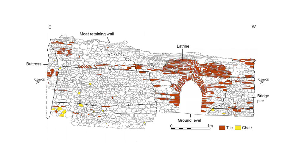
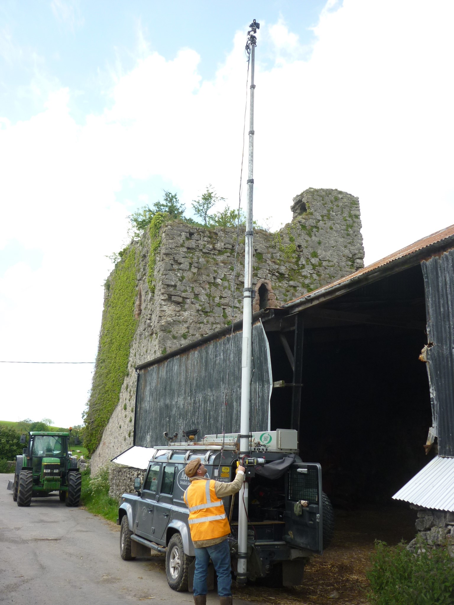
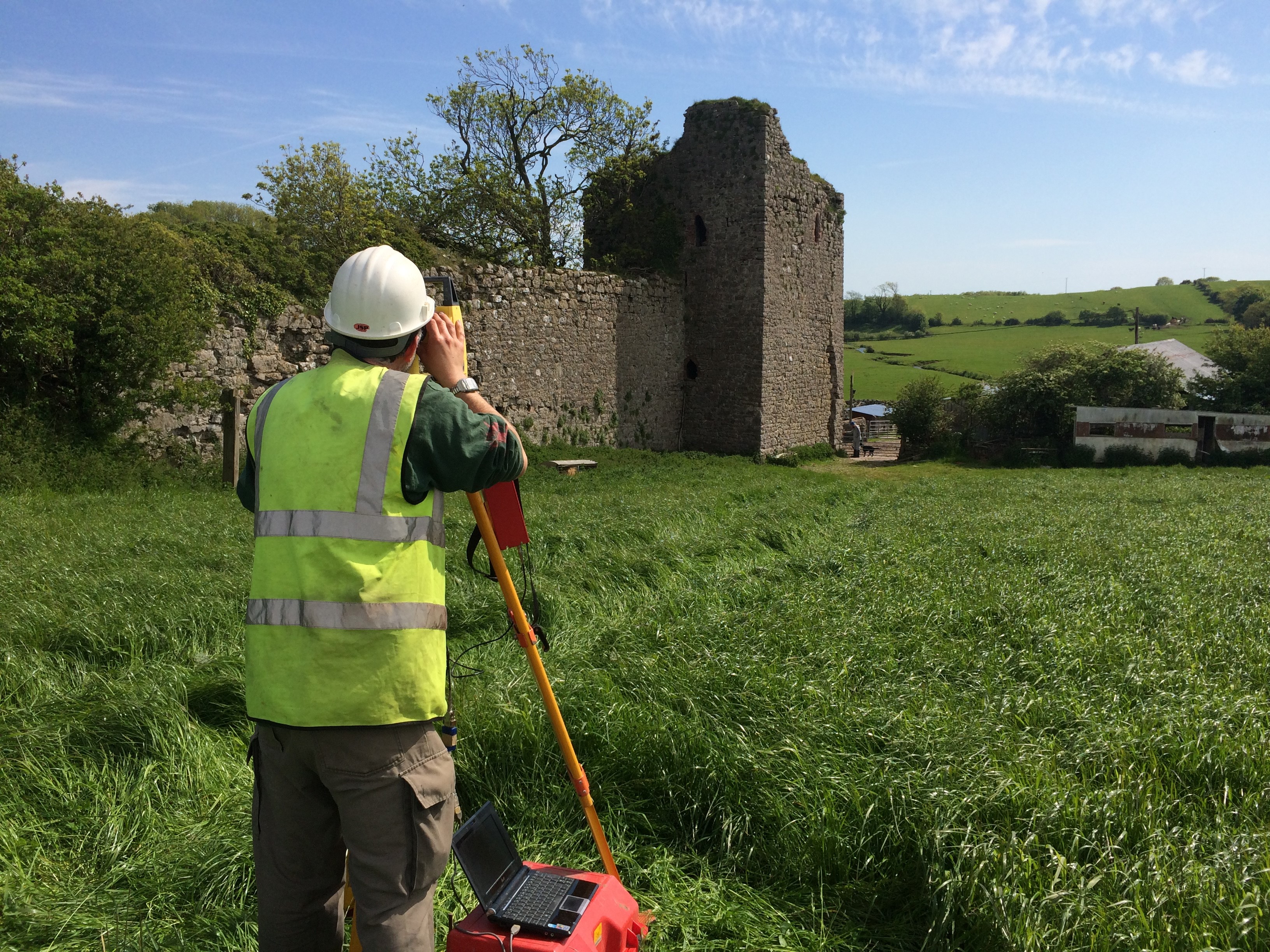
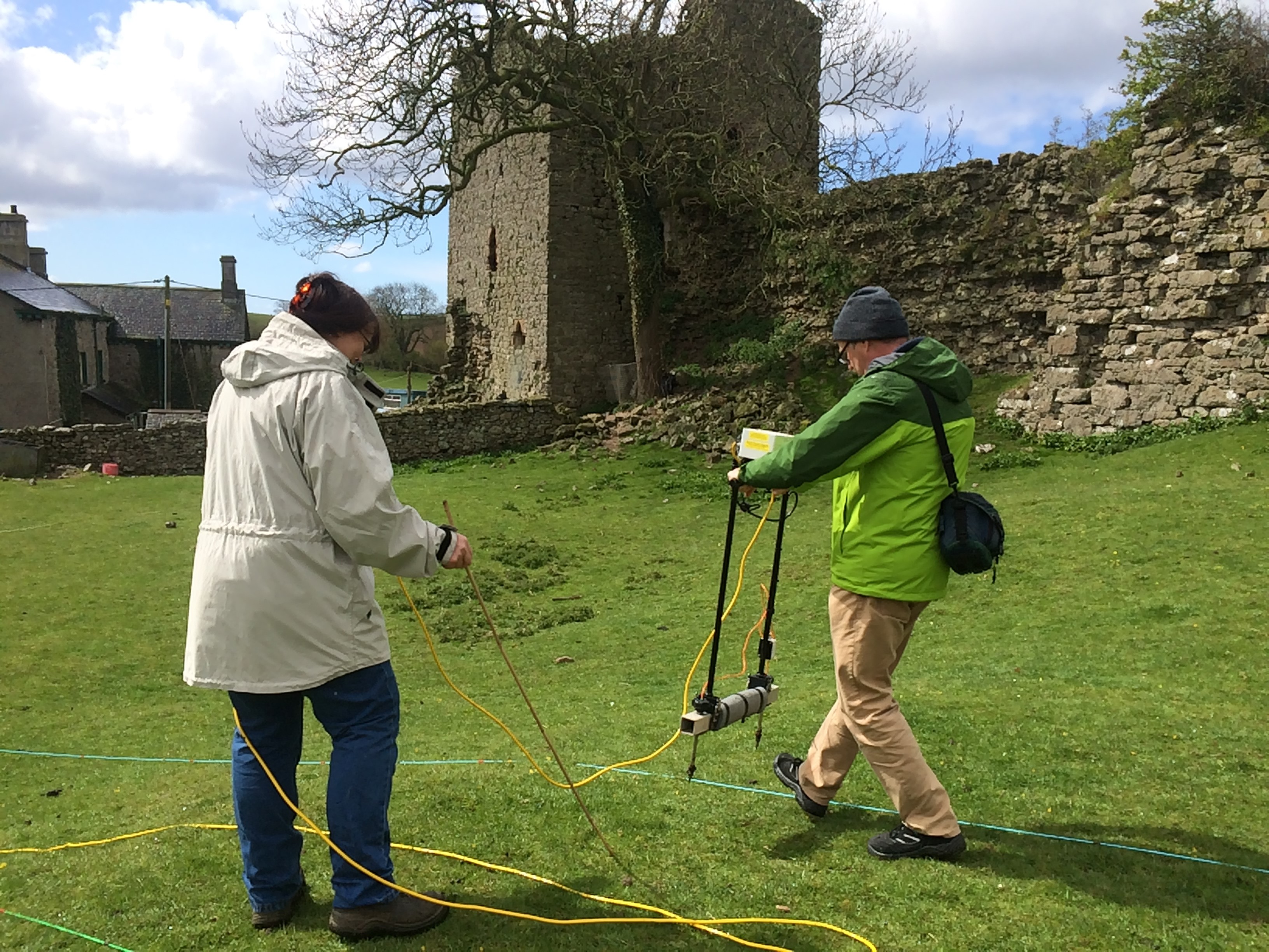
  4. A programme of masonry consolidation, archaeological excavation and survey led by Steve Grenter, Wrexham County Borough Council, in partnership with the Holt Local History Society.

This new work prompted me to undertake another attempt to reconstruct Holt Castle. With the help of a grant from the Castle Studies Trust, I was able to commission the well-known castle reconstruction artist, Chris Jones-Jenkins, to develop a 3D digital model which was flexible enough to capture and assimilate the new data and modify the structure as new insights were gained.

The challenge has been to weigh each source of evidence and identify which strands should have precedence when contradictions emerge. A hierarchy was developed:

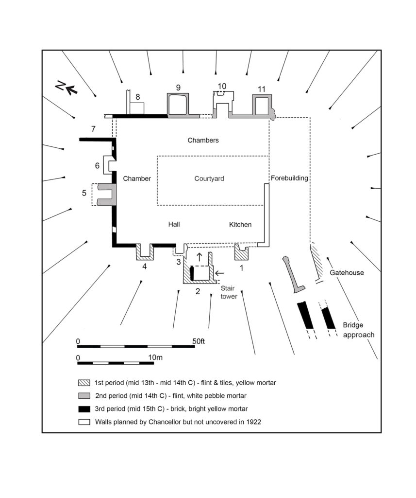
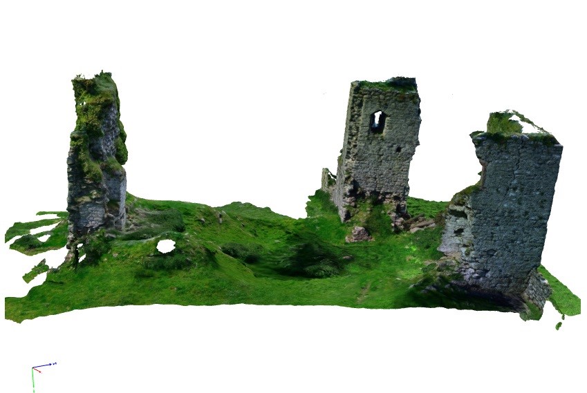
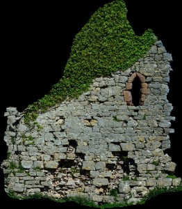
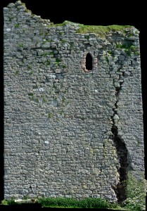
  1. The visible masonry of the castle and the modern topographical survey of the site provided the primary terrain model on which the remainder of the castle was constructed.
  2. The archaeological evidence for the rock-cut footings, the bases of three of the towers and the line of the channel leading into the water-gate provided other fixed points in the model.
  3. By considering the content and the potential reasons for the drawing of the three, early-modern ground plans and the two associated views, that of 1562 was assessed to be the most reliable for the details that it showed, the early seventeenth century plan for its dimensions, and those by John Norden of 1620 to be the most inaccurate, despite them being the ones most frequently published.
  4. The list of rooms and the route followed by the appraisers of the 1495 inventory provides the most comprehensive source for the internal layout of the castle. However, it became clear that those rooms without contents, such as the triangular ante-rooms to the towers and the latrines, were not listed.
  5. None of the views of the castle were architecturally detailed, and none showed all of the exterior or much of the inner courtyard. This information had to be derived from surviving details from other Edwardian castles in North Wales or from work undertaken in Richard II’s reign, when considering the projection from the Chapel Tower.
Holt First floor floor plan with with watergate to the fore and great hall and stable section to the right, copyright Chris Jones-Jenkins

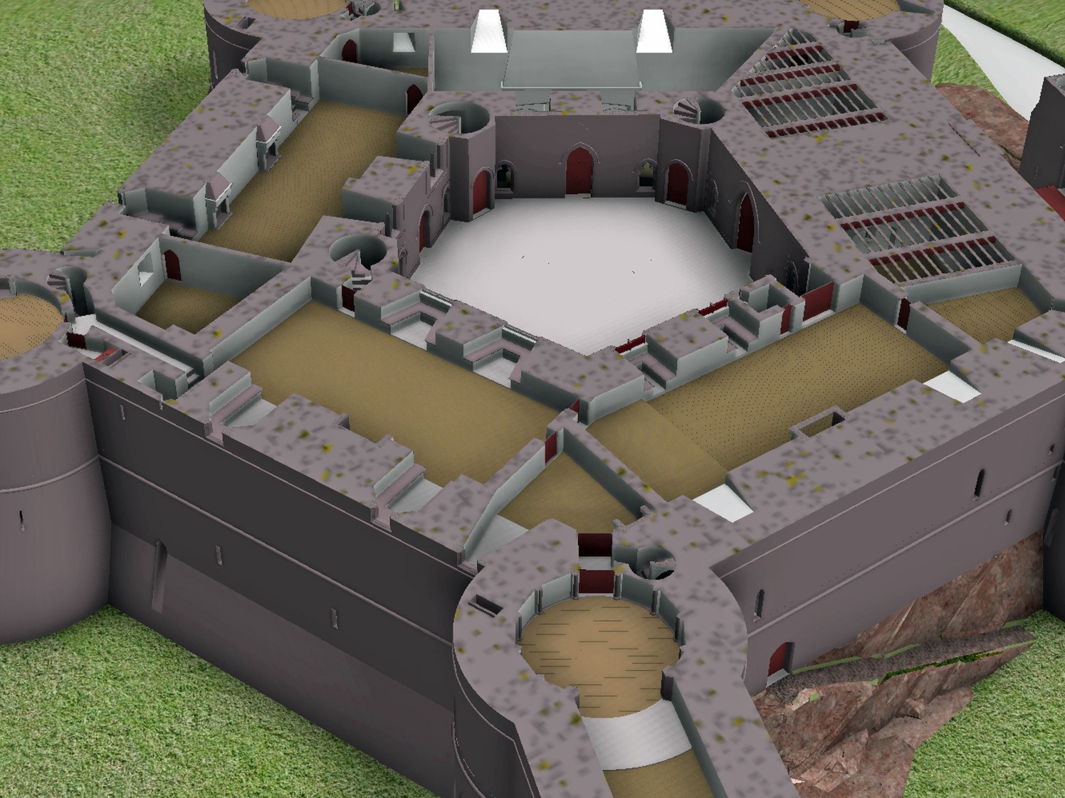
The development of the model became an iterative process between the historian and the artist. Different combinations of layout and floor heights were tried, building on the fixed points surviving at basement level and rising up in an effort to accommodate all the rooms. Suites of accommodation began to emerge. Sir William Stanley’s great chamber led off the high end of the hall and controlled access in one direction to his counting house and the chapel, and in the other to the Treasure House and the High Wardrobe, where all the valuables were kept. Across the courtyard his wife, Elizabeth, had her own great and bed chamber, linked to the nursery. Above her accommodation was a chamber for her gentle women, well away from the yeomen’s dormitory under the lord’s great chamber. One range was dominated by the kitchen, rising the full height of the castle, connected at basement level to a larder, pastry house, well house and a wine cellar on one side and offices for the cook and butler on the other. As was normal the constable had a suite over the inner gate, but unusually a stable for 20 horses was created in a basement below the hall with access for the animals across the moat and up a ramp into the castle.

Holt Great Hall and Stables copyright Chris Jones-Jenkins

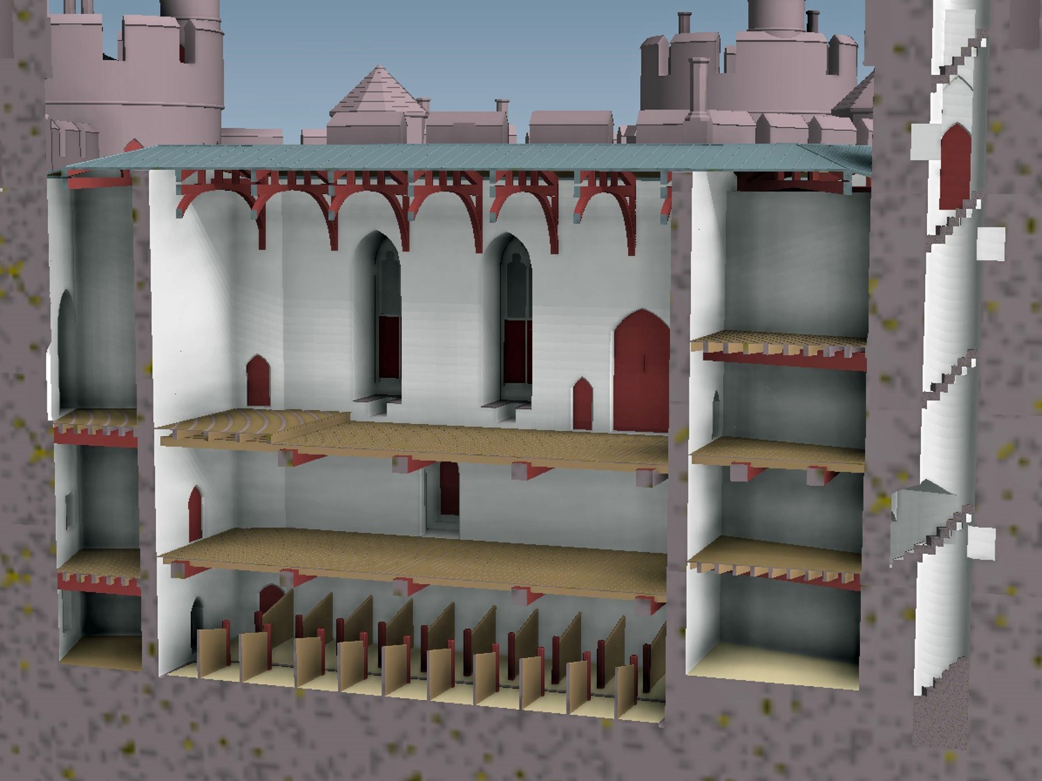
Working on this reconstruction, our admiration only grew for the original designer. He created a symmetrical plan and external appearance but produced complex internal arrangements to meet his patron’s needs. Holt is as much a chivalric ideal as a practical castle. An animation of the reconstruction of Holt Castle has been produced by Mint Motion of Cardiff and can be viewed here:

Subscribe to our quarterly newsletter

Feature image courtesy of Wrexham Borough Council

Rethinking Pleshey Castle – new discoveries from old records

Back in 2015 the Castle Studies Trust co-funded the post excavation & publication of Steven Bassett’s excavations 1972-1981 of Pleshey Castle in Essex. In the November 2018 issue of Current Archaeology (334) Patrick Allen explains how the review of the excavation materials has transformed our understanding of the castle and provided new insights into its character and development.

Around 5 miles northwest of Chelmsford in Essex we find a classic example of a motte and bailey fortification. Pleshey Castle offers invaluable insights into constructions of this kind, as while all of its buildings have long been demolished (apart from the late 15th-century brick bridge over the motte moat), its medieval earthworks have survived intact thanks to their never having been rebuilt in stone.

Subscribe to our quarterly newsletter

Its motte is original, dating from c.1100, while the ramparts of the south bailey are largely the result of refortification which took place in 1167. A second bailey to the north of the motte is now buried beneath the modern village, but its original outline can still be seen in Pleshey’s semi-circular street plan and in 1988 was confirmed by excavation. Its defences were levelled in the 13th century and replaced by a much larger town enclosure, whose earthworks still surround the modern village.

Planof the castle shows the keep and buildings in the south bailey with excavation areas in red

Previous descriptions of the castle had assumed that the north bailey was part of the original castle and the south bailey added later – but recent reassessment of all available evidence has transformed this picture completely.

Evolving the castle

What can we unpick about the castle’s origins? Its earliest documentary reference comes from 1143, when Geoffrey II de Mandeville surrendered all his lands, including Pleshey Castle, to King Stephen. Yet scientific research suggests the site is much older. Analysis of topsoil buried beneath the motte, and a calculation of the rate of its formation, suggests that the castle was completed 30-40 years after the Norman Conquest.

As for when construction began, tree-ring dating of a timber from the north bailey palisade provides a date no earlier than 1083, and a construction date of c.1100 seems entirely plausible. This would link the castle’s creation not to Geoffrey II de Mandeville, but to Geoffrey I – a logical conclusion as the core of his extensive estates lay in mid-Essex and Pleshey is close to his chief manor of Waltham (now Great Waltham).

A section through the south bailey rampart shows how its earliest incarnation, as constructed c.1100 (Period 1), still survives at its base. Period 2 reflects the boundary’s englargement and refortification after 1167.

It is also becoming increasingly clear how the fortifications developed; Chelmsford Museums Service has been revisiting unpublished reports from an excavation that Steven Bassett undertook immediately to the south-east of the brick bridge in 1972-1981. Interestingly, a section that he recorded through the outer rampart confirms that the south bailey was also part of the original construction of the castle – that is, Pleshey boasted two baileys from its inception. Within this rampart (which was dated to the later 12th century by previous excavations headed by Philip Rahtz in 1959-1963), Bassett also found traces of a smaller, earlier rampart which had been built up in two stages, suggesting an initial temporary earthwork which was completed after a short interval.

As for later developments, historical accounts record that in 1157-1158 Henry II returned the de Mandeville lands to Geoffrey III on the condition that he dismantled the defences of his castles – but in 1167, Geoffrey’s younger brother William II de Mandeville was given permission to refortify. There is good archaeological evidence for a large-scale restoration of the castle defences after this date, following the same plan as before. Bassett’s excavation uncovered clear signs of a comprehensive clearing out of the moat during this period, and sections recorded by both Bassett and Rahtz (in an early dig) show the south bailey rampart being massively enlarged at the same time.

This, though, was the last major improvement to the castle defences. Its earth and timber fortifications provided sufficient protection against local insurrection, but the castle was not defensible against a major attack, and during the civil war that followed King John’s rejection of Magna Carta it changed hands twice. On Christmas Eve 1215 Pleshey Castle was seized by a detachment of the king’s army, and in the winter of 1216-1217 it was recaptured by the rebel barons – both times it was surrendered without a siege. The castle was militarily outdated, and after it was inherited by the powerful de Bohun family in 1227/1228 it became increasingly important not as a fortification but as their main residence and the administrative centre of a great aristocratic estate.

Subscribe to our quarterly newsletter

Bridges and bailey buildings

Between Pleshey’s refortification in 1167 and the late 14th/early 15th century four successive wooden bridges spanned the motte moat. Traces of these trestle structures were recorded by Bassett as well as in a small trench excavated by Elizabeth and John Sellers. The final development of the south end of the bridge consisted of two stone pier bases which would have supported box-frame timber uprights and, in front of these, a wooden structure supporting massive raked timbers which carried the central span of the bridge over the wet part of the moat.

At the south end of the timber bridge (its late C14 foundations are shown on this plan) was a gatehouse whose uppper space has been identified as the Queen’s chamber described in the building accounts

These strong foundations were needed at the bailey end of the bridge to support the greater load there from the bridge’s superstructure, whose walkway would have sloped steeply from the motte down to the bailey. Meanwhile, the elevation of the outer face of the northern bridge pier shows its solid construction and its continuation to the east to form a retaining wall for the moat. This pier was later reworked to create a latrine in the late 15th century – when the wooden bridge was replaced by a brick one – evidence of this change still survives in the form of an inserted arch and changes to the upper stonework.

This elevation shows the northernmost pier base of the late C14 bridge and the retaining wall to its east (the lower stonework) that shored up the moat. It was rebuilt in the late C15 as a latrine with an arched outlet.

What of other structures? As mentioned before, all of the castle’s buildings have long been demolished, but it is possible to piece together some clues. A plan of the buildings that were present in the south bailey from the 14th century onwards can be reconstructed using evidence from Bassett’s excavations and a 1960s parchmark survey by Elizabeth and John Sellers. Furthermore, the function of some specific buildings can be identified thanks to Pat Ryan’s study of the surviving mid-15th-century Duchy of Lancaster building accounts for the castle.

We are able to locate the chapel at the west end of the bailey, which was excavated by Rahtz in 1959-1963. To the east, the hall is easily identifiable, with its adjoining kitchen, pantry, and buttery. On its north side, storehouses were ranged around a kitchen yard which was accessible from the main gate immediately to the east. To the west of the hall was a range of large private chambers at first-floor level, above a wardrobe and other storerooms. These were a ‘revealing chamber’ (audience chamber), and at the west end of the range lay the ‘King’s chamber’ and, beyond it, the ‘Queen’s chamber’. This relates to the period 1421-1483 when Pleshey became part of the Duchy of Lancaster, the private estate of the Lancastrian kings, and was granted to three successive Queens of England: Catherine of Valois, Margaret of Anjou, and Elizabeth Woodville, the wives of Henry V, Henry VI, and Edward IV respectively.

Bassett’s excavations also recorded part of a stone-built gatehouse at the south end of the bridge, whose upper chamber can be identified as the Queen’s chamber in the building accounts. The gateway and the room to its west, possibly a guard chamber, were surfaced in gravel and mortar, but material found in the demolition rubble indicates that the Queen’s chamber above was much grander, with a floor of Penn-type decorated tiles, painted plastered walls, and leaded glazed windows.

Bassett’s investigations date the completion of the building range along the north side of the bailey to the late 14th century. These buildings would have been constructed by the de Bohuns and completed by Thomas of Woodstock, Duke of Gloucester (the youngest son of Edward III), who married Eleanor, the elder de Bohun heiress. It is she, as Duchess of Gloucester, who would have originally occupied the Queen’s chamber in its initial guise.

Exploring the keep

Our project also reassessed the results of the excavations focusing on the castle keep in 1907 and 1921-1922. There, the original excavators were puzzled by the ‘extreme thinness of the walls’, but we suggest that they should be interpreted as facades built around a timber-framed courtyard structure. The keep’s great hall has been located using its description in the building accounts, while the other ranges are thought to represent chambers with ‘ensuite’ accommodation, each with a fireplace and a privy (which survive as rectangular projections that are open to the interior, and enclosed, respectively).

A reconstructed plan of the keep, with added stair tower, fireplaces/chimneys and latrines

The final renovation of the keep – carried out on the orders of Margaret of Anjou and described in detail in the building accounts for 1458-1459, where the keep is referred to as a ‘tower’ – was finished in brick. The accounts also record that 29 oaks were felled for the work and that most of the money was spent on employing carpenters – confirmation that the keep was mainly built in timber, as suggested above. Two earlier periods of flint facades and additional structures are dated to the mid-13th/mid-14th century and the late 14th century respectively (by comparison of mortar types with well-dated structures recorded in Bassett’s excavations). No doubt the stone and brick facades made an essentially timber structure look more impressive.

The renovation of the keep was completed by building the brick bridge over the moat, probably in 1477-1480, according to Pat Ryan’s study of the building accounts. This was 20 years after the work on the keep itself – perhaps the works were delayed by the Wars of the Roses (1455-1487). The brick bridge is one of the earliest of its type in Europe and, with its wide span, was a very advanced design for its time. By the mid-16th century, though, the castle had become derelict, with the motte mound used as a rabbit warren, and it was sold by Elizabeth I in 1559. Ironically, the brick bridge was preserved only because the Duchy of Lancaster surveyors recommended that it be retained to maintain access to the warren. Today, it still stands as one of the few elements of the castle surviving above ground. Analysis of excavated evidence has enabled us to add much more colour to this picture, and to reconstruct Pleshey Castle’s appearance once more.

Subscribe to our quarterly newsletter

The author would like to thank the following for grants towards the project: the Castle Studies Trust, the Marc Fitch Fund, the Essex Heritage Trust, and the Essex Society for Archaeology and History.

Featured image: Aerial view of Pleshey courtesy of Chelmsford Museums Service

Gleaston Castle: On the edge of collapse – an attempt at rescue

In 2018 Historic England commissioned reports to be carried out on Gleaston Castle near Ulverston, where the Castle Studies Trust have previously funded a survey of the site. The reports commissioned by Historic England were led by Chloe Granger of Crosby Granger Architects, and included a condition survey and concept feasibility study. The feasibility study was aimed at reviewing any potential repair and/or development that could allow the site to become sustainable.

Formerly, in 2015 the Castle Studies Trust grant-funded preparatory works at Gleaston Castle that included a Conservation Statement, geophysical surveys and 3D imagery, to begin the process of understanding more about the castle and its development. From this initial research, the follow-up condition survey and feasibility study prepared by Chloe and her team sets the scene for future repair works and lays the foundations for a potential sustainable future.

Subscribe to our quarterly newsletter

Gleaston Castle, listed Grade I and Scheduled under the Ancient Monuments and Archaeological Areas Act, is located on the Furness Peninsula, Cumbria in what appears to be a remote location and strange position for a fortified castle. It is an enclosure castle dating to the 14th century, now a ruin, and has been recorded as such since the mid-16th century. The location on the Furness Peninsula would have historically been less remote, as access was via boat or by crossing the sands of the Morecambe Bay estuary at low tide – a mere short walk.

Gleaston Castle: south east tower interior. Copyright Chloe Granger

The exact date of construction of Gleaston Castle is not known; it was almost certainly built by John Harrington (knighted in 1306) and marked a move from the earlier coastal manorial residence at Aldingham, which had passed to the Harringtons in 1291, possibly in part prompted by early-14th century Scots raids. A date of c1325 is sometimes quoted although the earliest documentary reference is in the 1350s; several sources suggest that it was never finished. It appears to have been abandoned as a manorial residence after the death of Sir William Harrington in 1457 and c1540 it was recorded by Leland as lying in ruins, although some parts may have been re-occupied in the 17th century.

Gleaston is the probably nearest approach to a ‘quadrangular’ castle of a type more common in the North East, and typical of the earlier 14th century. It is not an exact rectangle in plan – the enclosure, 80 m in length north to south, narrows from 55 m at the north end to 45 m at the south. It has had corner towers, with the north-western, by far the largest, clearly containing the hall and subsidiary apartments.

Gleaston Castle: Great Hall from south east tower. Copyright Chloe Granger

The ruinous remains of the castle are in private ownership, incorporated into a working farm, which makes access difficult for the visitor. The structures are in a perilous condition, with falling masonry not an uncommon sight. General vegetation and rigorous ivy are the main culprits. The ivy on the south-east tower is known to Historic England as the largest, most substantial and ancient ivy known on a structure in the country. The scale of the issue is enormous. There is no management plan and no funding to enable a comprehensive strategy of repair to be carried out to safeguard the structures.

Gleaston Castle: entrance to sw tower. Copyright Chloe Granger

Through Chloe, the Society for the Protection of Ancient Buildings (SPAB) have become involved and are planning a working party to begin to make a start on rescuing the castle. It is a colossal task, but the aim of the working party will be to raise awareness and put Gleaston castle on the map, which the team hopes will generate support for the cause. The volunteer working party team is hoping to carry out some initial vegetation clearance and some consolidation, with professionals offering their time pro-bono; the first required are an ecologist and an arboriculturalist. The initial working party is planned for September,

If anyone is interested in either contributing time or funds, your support would be greatly appreciated! For more information contact Chloe Granger on chloe at crosbygrangerarchitects dot co dot uk 

Subscribe to our quarterly newsletter

Featured image: Gleaston Castle from the West and where its main entrance was. Copyright Chloe Granger.

Keeping up with Pleshey

If you visit Pleshey Castle on one of its open days, you are struck by the size of the place. The castle was probably founded by Geoffrey I de Mandeville in the late 11th century, and while no buildings survive above ground the earthworks are impressive. Excavations at Pleshey in the 20th century uncovered a tower or keep on top of the motte, and buildings in the south bailey. The Castle Studies Trust and Chelmsford Museums Service are working together to interpret the results and make sure they are publicly available.

The castle is laid out in three segments: a north bailey, a south bailey, and a motte in between. The northern bailey, which contained a small market place, has been built over, but the motte and the bailey to the south still survive. A timber keep probably stood on top of the mound, and was modified over the 13th, 14th, and 15th centuries.

The keep had a courtyard at the centre, with ranges along the north, west, and south sides, and a forebuilding to the east. The south range contained a hall (important for entertaining guests) and a kitchen (important for keeping the guests fed!). It was probably built after 1167, which was when William II de Mandeville was given permission to refortify the castle after it had been slighted.

Plan of Pleshey Castle’s keep. Drawing by Iain Bell, ©Chelmsford Museums Service.

In the mid-13th to mid-14th century, the keep on the motte was clad in flint, and the hall refurbished. In the late 14th century the living accommodation on the north and east sides of the keep was renovated, and fireplaces and garderobes (privies) were added.

Starting in 1458, the keep was clad in brick, replacing the flint walls. The work was ordered by Queen Margaret of Anjou and records from the Duchy of Lancaster (researched by Pat Ryan) mean we know a lot about how the work was carried out. A new bridge over the inner moat was built entirely in brick in 1477-80, and the gatehouse to the forebuilding was reconstructed in brick in 1482–83. Brick castles are not very common in England, but you can see an excellent example at Tattershall in Lincolnshire.

The chronology of the mid-15th-century changes to the castle should be understood in the wider historical context of the Wars of the Roses. The major refurbishment of the keep in brick was ordered by Queen Margaret of Anjou, but the outbreak of civil war in 1459–61 led to the usurpation of Henry VI by the Yorkist Edward IV, and Margaret went into exile. Edward IV ordered a refurbishment of the castle buildings when he married Elizabeth Woodville in 1464-5 and Pleshey was granted to her as part of her jointure. However, Edward IV was hard-pressed in the 1460s and had to fight to regain his throne in 1470–71, and most of the building works in this period appear to be routine repairs. The rebuilding of the bridge and keep gatehouse in brick in 1477–83 after an interval of 20 years appears to be the completion of Queen Margaret’s scheme of building works in quieter and more prosperous times.

This blog post was prepared by Patrick Allen and Richard Nevell. The photograph of the bridge is copyright Patrick Allen.

Gleaston Castle

This post was written by Louise Martin, Cultural Heritage Officer for Morecambe Bay Partnership

Gleaston Castle is a gem of a site; a little known and poorly understood courtyard or enclosure castle, located in the beautiful Furness Peninsula. The history of the site is scant and whilst it has been the subject of antiquarian and more recent documentary research, its origins and reason for construction still remain unclear. Some writers have proposed that the castle was constructed in the early 14th century as a response to the Scottish raids, although the site is not mentioned in documentary sources until some 30 years after these raids and may simply be a reflection of the wealth and status of the Lord of the Manor.

Today the site survives as the ruins of three towers with an associated curtain wall. As a Grade I listed building and Scheduled Monument this unique site is protected from development or destruction, however, this site is currently on the Heritage at Risk register with many conservation concerns.

Its crumbling stature is not new, the site is believed to have been dismantled after it ceased to be a manorial residence. It was described as a ruin in the mid-16th century and is depicted as such in engravings from the early 18th century.

Engraving of Gleaston Castle by Samuel and Nathanial Buck, 1727 showing the site in a ruinous state
Engraving of Gleaston Castle by Samuel and Nathaniel Buck, 1727 showing the site in a ruinous state

Whilst the site was subject to antiquarian attention, with plans and descriptions produced in the early 19th century, I was surprised to discover that the site had never been fully recorded, in particular the elevations of the structures which survive from its original layout.

To bridge this gap in the archaeological record and gain a better understanding of the site, Morecambe Bay Partnership applied to the Castle Studies Trust for a grant in late 2014. I was thrilled and delighted to hear the news that our application had been accepted and a generous £5,000 grant had been awarded to enable an aerial photographic survey and 3D model of the site to be produced. In addition, the grant would fund the production of a conservation assessment, outlining the historical background and current issues for the site.

Greenlane Archaeology Ltd. was commissioned to run the project, bringing in professional archaeological photographer Adam Stanford from Aerial-Cam to undertake the survey work. During the summer of 2015 Adam flew over the site with Remotely Piloted Aircraft (RPA)-a DJI Inspire 1 quadracopter fitted with an X3 gimballed camera producing still images at 12 megapixels. Professional photographers, such as Adam, have to follow strict guidance and regulations as part of their licence to undertake such work.

Many precautions had to be put in place before the RPA survey was undertaken by Adam a CAA licenced pilot

Adam from Aerial-Cam operating the quadracopter RPA

The photographic record from the air was supplemented by high-resolution (24 megapixel) images captured with a high-level telescopic pole and more traditional ground-based photography to obtain close up images of the structure.

Over 600 overlapping photographic images were taken to capture a detailed record of the site. Back in the office Adam used Agisoft Photoscan to process the data collected. The results were stunning, including aerial images and the creation of a 3D model, which enables the site to be ‘explored’ from the safety and comfort of a PC or tablet through Sketchfab.

Adam capturing some of the elevated images that would be used alongside the RPA images to produce an accurate and detailed 3D record of the site


"<em

One of the most important outcomes of this project was the detailed orthophotos that were captured of the elevations of the castle’s ruins. We have been using these images to inspect the construction and conservation issues for the site, but primarily they form a permanent record of the castle that was lacking until this survey in 2015.

The aerial image and subsequent grey scale shading was particularly informative revealing furrows and a possible track way to the north-east of the castle. The track appears to lead to the north-western tower, the largest structure at the site and probably once the manorial residence. Within the curtain walls, areas of terracing and possible building platforms could be identified – but what could they be?

Aerial view of the site © Aerial-cam

Shaded aerial view of the side which highlighted ridge and furrow and possible track way to the north-east of the castle, in addition to terracing and possible building platforms within the castle’s courtyard. © Aerial-cam

Supplementing the photographic work Greenlane Archaeology also undertook a topographic survey of the site to complement and enhance the results obtained.

Dan Ellsworth from Greenlane Archaeology undertaking the topographic survey of the south-east tower
Daniel Elsworth from Greenlane Archaeology undertaking the topographic survey of the south-east tower

In August 2015 we were delighted to host some of the trustee’s from the Castle Studies Trust (CST) along with supporters of the CST charity, who travelled to the Furness Peninsula to see the survey work in action. We were joined by the Historic England Heritage at Risk Officer, the Lead Archaeologist from Cumbria County Council, and Helen Evans who had compiled the Conservation Statement. Adam from Aerial-Cam gave a detailed demonstration on how the RPA captures the photographic images and how these are enhanced and combined to form the incredible 3D records of the site.

Adam from Aerial-cam demonstrating to Trustee’s and supporters of the Castle Studies Trust how the RPA captures the images from the air

To put the site of Gleaston into context, the visitors were also taken on a tour of Piel Castle, which can be seen from the elevated position of the north-west tower at Gleaston. Piel Castle is positioned on a tidal island and we had to use the local ferry service to reach the site.

Boarding the ferry to Piel Island and castle

It was some months later, during discussions with Dr Richard Peterson and Dr James Morris of University of Central Lancashire (UCLan) Archaeology and Anthropology Department that the next piece of fieldwork was being determined. Each year UCLan host a field school for their first year archaeology students and the team were looking for a site to use to teach the concepts and theories of geophysical survey and laser scanning. We had some interesting research questions to answer, which had been formulated following the photographic survey – do any buildings survive within the courtyard formed by curtain wall and what are the features shown to the north of the castle? Together we thought that Gleason was the ideal site for this year’s field school.

Before any plans to be laid out we had to get permission from the landowners to allow this work to go ahead. Once this had been secured, we had to apply to Historic England for a Section 42 licence, as the site is Scheduled and such work is strictly monitored by Historic England inspectors.

Permission was granted for the work and the fieldwork was scheduled for the end of April 2016. In addition to UCLan students, the survey training was opened up to the community, with fifteen places available per day through the Heritage Lottery Funded Headlands to Headspace (H2H) Landscape Partnership Scheme, which I am currently running part of for Morecambe Bay Partnership.

On 25th April we started the work at the site, using earth resistance and magnetometry to survey areas within the curtain wall and to the north of the castle, where we had identified ridge and furrow and the track way. The training attracted participants from as far afield as Liverpool and Carlisle as well as some local residents to Gleaston Village. The north-west tower was also subject to detailed laser scanning, which will supplement the photographic record produced by Aerial-Cam. The weather was, well, challenging especially for the end of April with heavy downpours and even snow hampering our progress on site!

H2H Volunteers undertaking an earth resistance survey at the site
H2H volunteers undertaking an earth resistance survey at the site

One of the first year students from UCLan undertaking a magnetometry survey. Still smiling despite the cold!

The team of students, together with volunteers and the fabulous UCLan staff persevered and we completed a significant amount of survey across the site. The results of the survey work are currently being processed by the team at UCLan, however, initial interpretation of the data is highlighting garden features to the north of the site and possible post-built structures to the south-west of the courtyard.

Interpreted results of geophysical survey at Gleaston Castle by Richard Peterson of UCLan. Base mapping contains OS data © Crown Copyright and Database right 2015. An EDINA/Digimap supplied service.

All this recent work is enabling professionals to gain a better understanding of the site. For the first time we have an accurate photographic record of all the standing remains and have started investigating what below-ground remains may survive beneath the soil.

Morecambe Bay Partnership would like to thank the Castle Studies Trust and all their supporters for enabling the survey work to take place and highlight the importance of this site and the conservation issues the site currently faces.

We would also like to thank the landowners who have provided us with special permission to undertake this survey work and the team from Historic England and Cumbria County Councils Lead Archaeological Advisor who have provided advice and guidance along the way.

It is hoped that the work undertaken so far will be built on in future years with additional survey and assessment, finding positive solutions to protect this rare and fascinating site.

Small Unmanned Aircraft and archaeology – why now?

In 2015 the Castle Studies Trust and the Morecambe Bay Partnership worked together to record the remains of Gleaston Castle in Cumbria. By using an unmanned drone to photograph the castle we were able to reach every part of the building. Below is an excellent explanation from Museum of London Archaeology’s Dr. Peter Rauxloh of how this technique works. It was originally published on MOLA’s blog.

Archaeologists have known about the benefits of investigating archaeology from an aerial perspective for more than 150 years, arguably longer, but the day-to-day use of aerial survey in MOLA’s work has been hampered by cost.

The model drone was a very popular Christmas present last year; a clear indication that cheap aerial photography has arrived. The big innovation from the perspective of archaeological aerial survey is the arrival of affordable digital photogrammetric software and automated flight control.

Photogrammetry is the practice of taking measurements from images. It is based on the fact that the position of an unknown point in 3D can be calculated if it is viewed from at least two other known points. This is the principle of triangulation, as important to map makers in the 17th century, as it is today.

The software in question uses the principle of photogrammetry and applies it to the processing of digital images to create 2D orthomosaics and 3D models. In essence, the traditional technique of aerial photogrammetry used a small number of high quality images taken with expensive specialist cameras from real aircraft, on which a small number of common points were identified between adjacent images. The new method uses a large number of images, taken with a standard consumer grade digital camera from cheap aerial platforms and is able to identify thousands of common points between images. Thus the technique tightly locks together overlapping areas to create robust orthogonal mosaic and highly detailed 3D models.

The amount of overlap required between images in order to create robust models is very high, typically 75-85% between each successive image. This means that 85% of one image must still be visible in the next image, but how does one ensure that critical degree of overlap is maintained?

Typically an aerial survey will be flown in a grid, much like a tractor ploughing a field, and each successive image needs 75-85% overl ap with its predecessor. Moreover once it has turned and starts to fly back over the site, it must also get 60-70% overlap between the images on each leg. For small survey areas the aircraft is flown manually since it is easy to ensure the area is well covered with images,  but it is far more difficult to maintain the required consistency on a large site.  This is why MOLA use an autopilot and have it follow a flight plan.

A flight plan is a group of 3D coordinates or waypoints between which the aircraft navigates using its on-board GPS. To position these waypoints so the images overlap a number of variables need to be balanced. These include the camera’s field of view, frequency of image capture and the desired flight height and the speed of the aircraft. These in turn need to be considered against the size of the area to be flown and how long the aircraft can safely stay in the air.

Below you can fly round the model of Gleaston Castle.

Gleaston Castle
by aerial-cam
on Sketchfab

Bringing Pleshey Castle’s history to the public

Betrayal, intrigue, fire, a king arresting one of his men, and the richest man in England. In 850 years Pleshey Castle has seen it all.

The village and castle owe their existence to Geoffrey de Mandeville who founded both in the 12th century. At the height of his power he was the richest man in England apart from the king, but lost it all when he was accused of being a traitor. Pleshey was owned by his descendants (though in the hands of the king) before it passed to the Bohun family by marriage. It remained with them until 1380 and in 1419 Pleshey Castle became part of the Duchy of Lancaster. Because of the Duchy’s ownership we have detailed accounts of building work in the 15th century. By 1559 the castle stood empty, and now survives as some very impressive earthworks.

Throughout its history the castle was remodelled several times – sometimes to improve the accommodation, at least once to repair fire damage, and once because it had been partly demolished. Excavations between 1972 and 1981 led by S.R. Bassett tried to shed light on this complicated history. Unfortunately this important work never saw the light of day. Notebooks and context sheets were left in the archives, out of reach of all but the most determined until now.

Our tour group in the outer bailey

Patrick Allen and Nick Wickenden are leading the efforts to get the results of the excavation published. The Castle Studies Trust have funded the creation of detailed drawings showing the work. They provide an invaluable visual reference, and show how parts of the castle have developed.

Earlier this month we visited the castle with some of our donors. As well as exploring the castle it was a chance for donors to talk to trustees and see first-hand how valuable the charity’s work is.

Crossing the moat surrounding the castle you get an idea of how impressive the site is. The motte at the heart of Pleshey is an impressive 17m tall while the ramparts are nearly 5m high and cut you off from the outside world. You can still see where the chapel was excavated and a section was cut through the rampart.

Pleshey is privately owned so if you want to visit you have to arrange it in advance. This is typically of the sites we work with, and we give donors the opportunity to look round. Patrick and Nick gave us a tour, explaining the colourful history of the site and what they were doing to publish the excavations. Behind the scenes, the illustrations complemented the research and helped understand the phasing of the site.

It can take years for excavations to be fully processed and reach the stage where the results are ready for the general public. Sometimes that stage is never reached making it much more difficult for people to access information. Because of your donations we’re bridging the gap.

We’re looking forward to seeing the final results!

To keep informed about the Trust’s activities sign up to our newsletter.