Lowther Castle excavation: season one results and what to look forward to in season two

Phase Two excavations at the putative partial ringwork castle at Lowther (Cumbria) will get underway on Sunday 12th May 2024. The project team leaders Drs Sophie Ambler and Jim Morris look at one they found in season one and look forward to what the want to will be examining in season two.

The Lowther Medieval Castle and Village Project unites History and Archaeology through Lancaster University, the University of Central Lancaster, and Allen Archaeology, with the support of Lowther Castle and Gardens Trust and the Lowther estate team.  Phase One excavations in summer 2023, generously funded by the Castle Studies Trust (CST), saw a geophysical survey of Lowther’s north park and excavations of the ‘castlestead’ earthwork. Phase Two will see further excavations of the castle earthwork, funded by the CST, and a geophysical survey of the area to the north, funded by the Cumberland and Westmorland Antiquarian and Archaeological Society (CWAAS).

Subscribe to our quarterly newsletter

The site at Lowther is potentially of great significance for castle studies and the medieval history of Britain. We have good reason to think the site is associated with the second phase of the Norman Conquest: the annexation and plantation settlement of the Kingdom of Cumbria under William Rufus in 1092.

Thanks to the 2023 excavations and their interim report, we can begin to investigate how Lowther sits within ringwork castle typology. This is a partial ringwork, sited on the edge of a promontory, its banks built up on the landward sides. It thus took advantage of its landscape to be seen and to see. This conforms to a model for castle siting that aimed to produce (in the words of Oliver Creighton) ‘a conspicuous symbol of power with a panoptical viewshed over the surrounding territory’. At approximately 27m X 22m, Lowther sits at the smaller end of the ringwork spectrum. In that its central area is raised above external ground level, with landward circumferential banks elevated further, it bears comparison with ringworks of Norman Ireland.

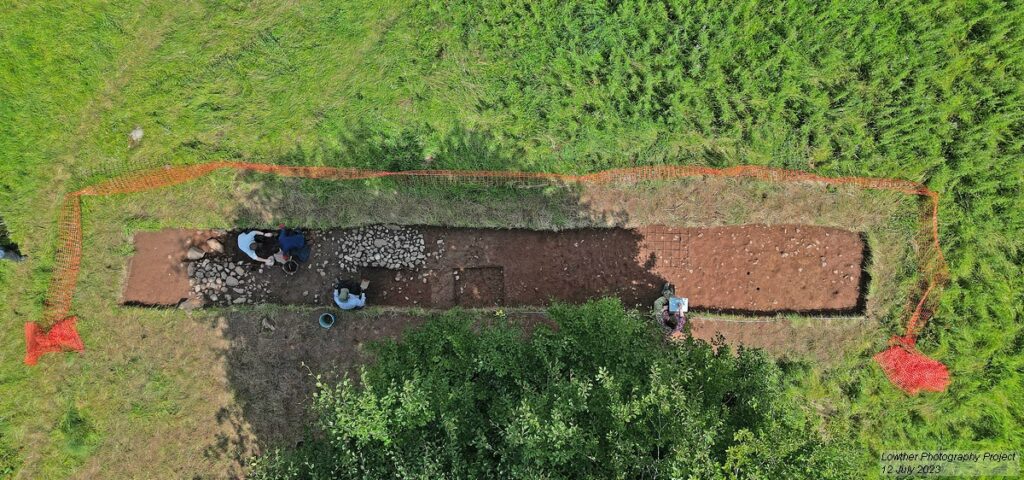
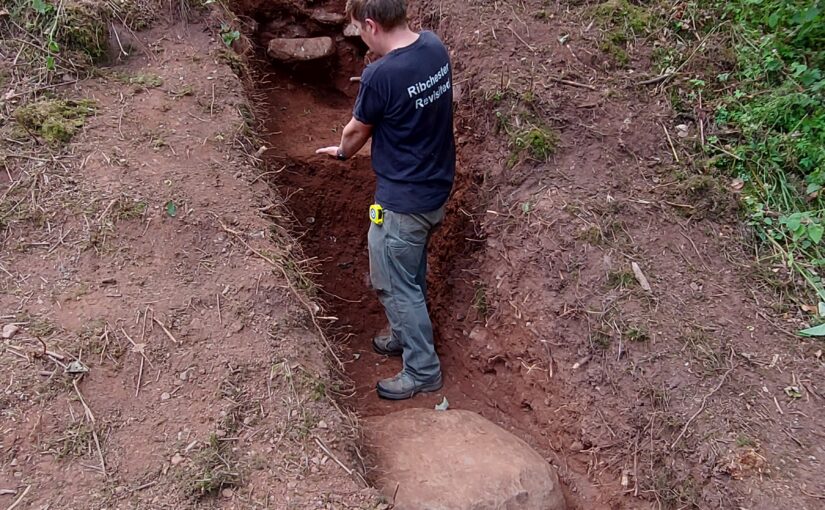
Trench Two investigated the construction of the castle’s north bank. This was one of our biggest undertakings in 2023: the trench measured 15m north-south, and 1m east-west, cutting through the northern bank, all excavated by hand. It was certainly worth the toil. A large block of limestone appears to represent the first layer of the castle’s construction; this is followed by at least four separate building deposits. Seemingly the bank was built up from a number of earthen layers with some smaller stone layers incorporated into the bank, perhaps for stability.
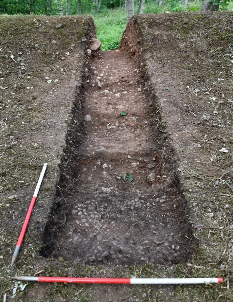
Lowther Castle excavation trench 2 looking north. Copyright Jim Morris

The trench’s southern part, within the castle interior, was also revealing. The stratigraphy, together with the clear level difference between the interior and northern exterior of the castle, suggest how the castle was constructed, first with a great mound, then with bank layers added around the northern, southern, and eastern banks to create the partial ringwork. No evidence has yet been found of a fosse associated with the castle, although Trench Two revealed a small feature at the far north of the trench, of a silty fill cut into the subsoil, running east-west (with a north-south width of 1.52m), possibly a drainage ditch the filled up gradually.

Lowther Castle: west facing section of trench 2. Copyright James Morris

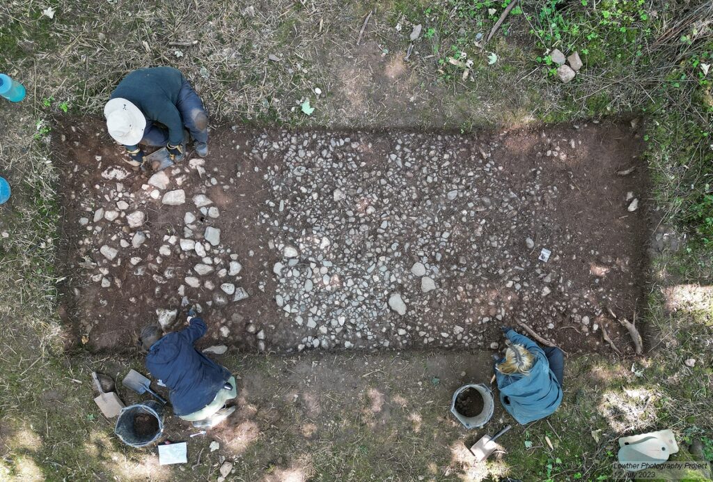
Trench Four began to uncover the castle’s entranceway, in a break in the eastern bank. The removal of topsoil and subsoil revealed a metalled surface, comprising river stones ranging from 0.04 to 0.11m, between 0.20 and 0.15m deep. This seems to be the metalled interior surface of the castle, starting at the entranceway.

Lowther Castle: trench four under excavation. Copyright James Morris

Our 2023 excavation yielded little in the way of small finds, although this is not unusual for medieval Cumbria, and may also suggest that the castle was not long occupied. Meanwhile, in the hopes of finding good dating evidence, bulk soil samples of 40 litres (or 100% of a deposit if less was available) were taken from potentially datable features and layers for flotation for charred plant remains and for the recovery of small bones and artefacts. Bulk soil samples were processed using standard water flotation at the University of Central Lancashire. The results will be incorporated in the project’s final report.

Phase Two excavations will go further in investigating the castle’s construction – this time focusing on the interior. Can we identify a gatehouse structure? A potential comparator for Lowther is Castle Tower, Penmaen (Glamorgan), a partial ringwork sited on a promontory, of similar size and likewise with an entranceway gap: excavations here revealed a substantial Norman timber gatehouse, supported by six posts, and fosse. Phase Two will thus excavate an extended area over the entranceway and beyond. And can we identify interior structures (such as the small timber hall evidenced at Penmaen)? Phase Two will open a substantial area – a quadrant of the interior – to reveal the metalled surface, aimed at identifying postholes as well as maximising chances of recovering small finds.

Subscribe to our quarterly newsletter

Meanwhile, a partner investigation will get underway in the area around St Michael’s church, just north of the partial ringwork. The castle, village, and Norman church of St Michael’s represent a typical configuration for a medieval manor. The presence of Hogback and other stone sculptures (c.700-1000) at St Michael’s hints at an earlier religious site: can this be established and, if so, what form did it take and how did the Norman settlement overwrite it? And how far did the medieval settlement, attached to the castle, extend northward? Building on our geophysical survey from Phase One, Phase Two’s geophysical survey, supported by CWAAS, takes in the surrounds of St Michael’s.

There is more information on the Lowther Medieval Castle and Village Project on the project website. The 2023 investigation was also featured on BBC2’s Digging for Britain (Series 11 Episode 1), available on BBC iPlayer. The May issue of BBC History Magazine also includes an article on the early medieval Kingdom of Cumbria, placing Lowther’s ringwork castle in its broader context.

Excavations will run on weekdays at Lowther Castle and Gardens from 13th to 31st May 2024. The north park, where our site lies, is free to access. Visitors are welcome! Entrance to the nineteenth-century castle and gardens offers further opportunities to explore the site’s history: the partial ringwork castle features in Lowther Castle’s new exhibition. Information on visits can be found on the Lowther Castle website.

Subscribe to our quarterly newsletter

You can find the interim report of last year’s excavation here: Grants and Results 2023 | Castle Studies Trust
Dig Diary Six: Lowther Castle and Village Project Highlights

In her final blog piece (for now) Project Lead, Sophie Ambler, looks back at the three excavation at Lowther

The on-site investigation of the medieval castle and village at Lowther (Cumbria) has now drawn to a close. Over the past month, a team from Allen Archaeology, UCLan, and Lancaster University has been exploring the site through geophysical surveying, excavation and archival research. We now have a geophysical survey of the village to analyse alongside LiDAR and the original earthworks survey. Over the coming months, our small finds will be analysed, together with soil samples, in the hopes that they yield dating evidence, and a report will be prepared drawing together the results from our trenches.

Subscribe to our quarterly newsletter

Meanwhile, we have the chance to reflect on what’s been a thrilling month of investigation.

Uncovering the construction of the ringwork castle and assessing its situation has helped us to get a sense of the site’s place in the broader landscape. Since the area in which the castle stands is now wooded, this takes some imagination.

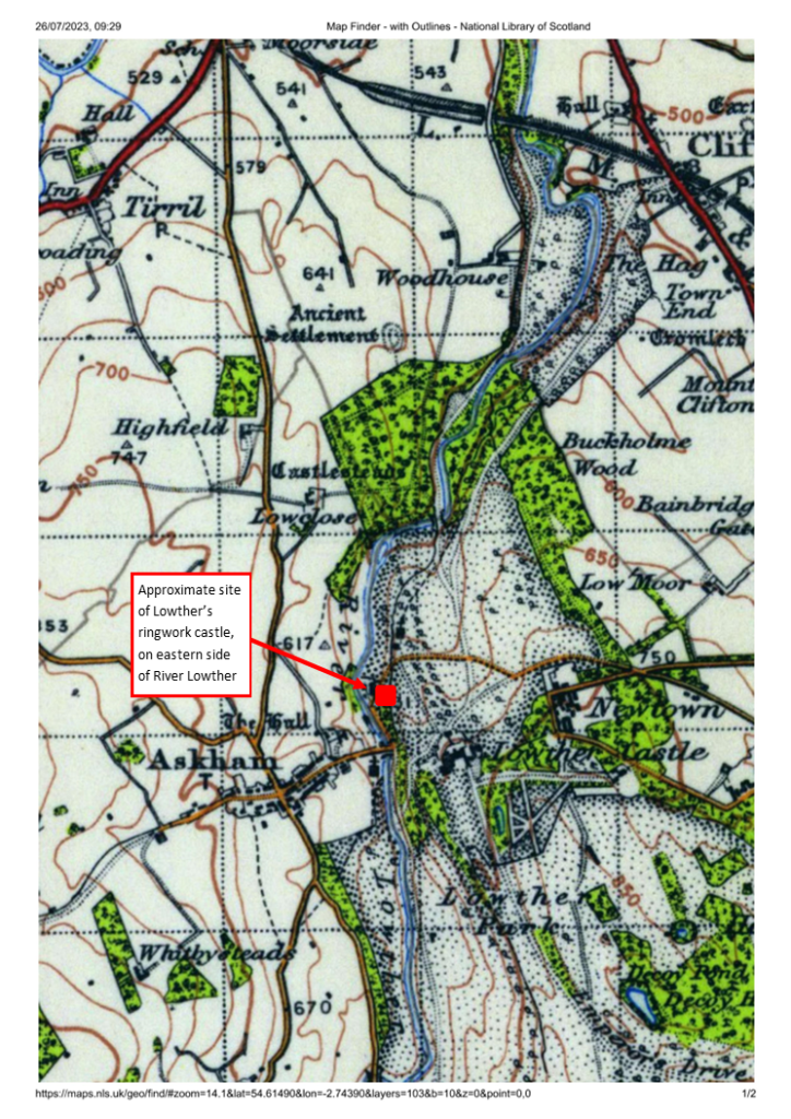
1. Lowther medieval castle OS map with label

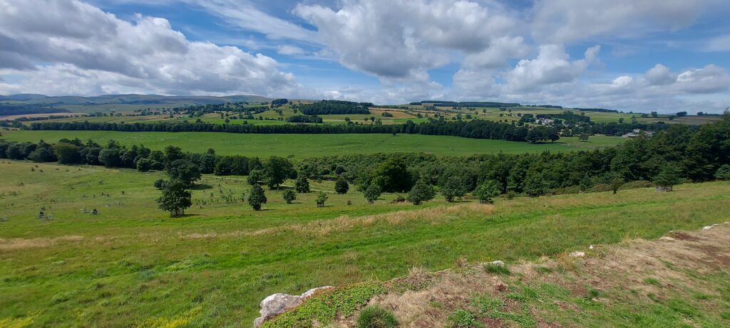
The ringwork castle is sited on the edge of Lowther’s western escarpment, which runs down to the River Lowther. The ringwork’s positioning is clearer in OS maps (image 1), where its proximity to the river and the steepness of the escarpment are evident. Today, one can get some sense of the impact of this positioning by heading eight hundred metres or so south to take the view over the escarpment from the Jubilee Summer House, in the grounds of the nineteenth-century castle (image 2, and view the panorama on Google Maps.), although the escarpment is far less steep here. Originally, the castle would have commanded wide-ranging views to the west, across the river to Askham Fell, and would have been a highly visible – perhaps dominant – landmark for miles around.

View of western escarpment down to River Lowther from south of 19C castle

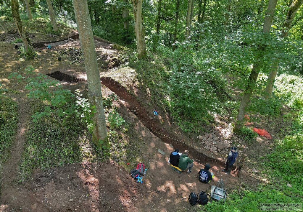
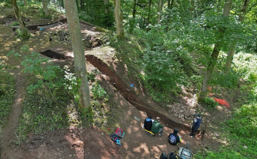
The scale and the construction of the ringwork castle has also become clearer. Again, given the tree coverage and overgrowth, it’s long been hard to perceive the earthwork’s size and form. It’s been hard also to capture the earthwork in photographs – but throughout the project Lowther’s resident photographer, Tony Rumsey, has been busy. His drone footage gives a much clearer sense of the site (image 3). To the top of the picture, the western escarpment drops steeply down from the earthwork to the river. In the foreground, Trench Two cuts into the earthwork’s northern bank.

Drone Trench 2 bank of ringwork castle in woods_Tony Rumsey

The image also shows how the floor level of the earthwork’s interior is significantly higher than the exterior ground level. As Trench Two revealed, the ringwork was constructed as a large, roughly square mound with layers of earth and stone, with its banks built up further to gird the mound. Meanwhile, the interior was topped with a metalled surface. We expect that the banks would have been surmounted by a simple fence or palisade (Trench Two did not reveal any postholes to indicate this palisade, but this is not surprising given that the top of the bank has almost certainly been lost to slippage).

Drone Trench 4 metalled surface entrance to ringwork castle Tony Rumsey

The metalled surface covering the interior of the ringwork is also clear in Trench Four (image 4). This trench takes in the approximate area of the ringwork castle’s entranceway, which cuts through the eastern bank. The entranceway may have included a wooden gateway, although we haven’t found firm evidence of one in Trench Four, and perhaps would need to open a larger area to be sure. Trench Three picked up a trackway (image 5), noted in the earthworks and geophysical surveys, which linked village to castle and brought visitors to the entranceway.

5. Drone Trench 3 trackway into castle_Tony Rumsey_

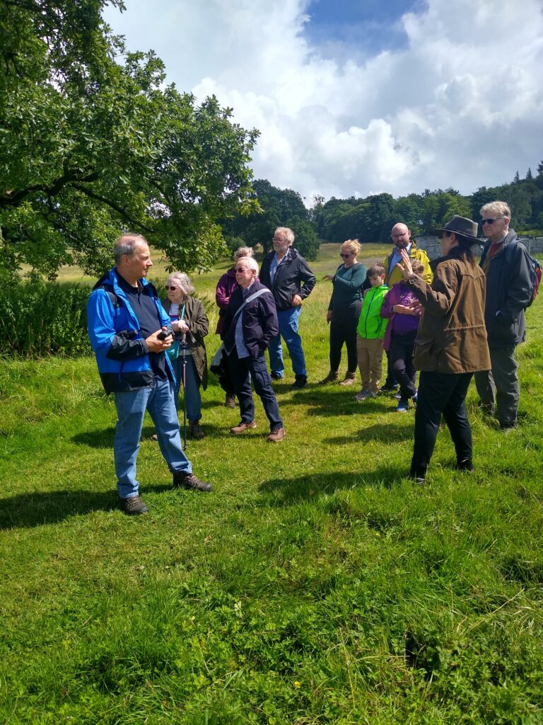
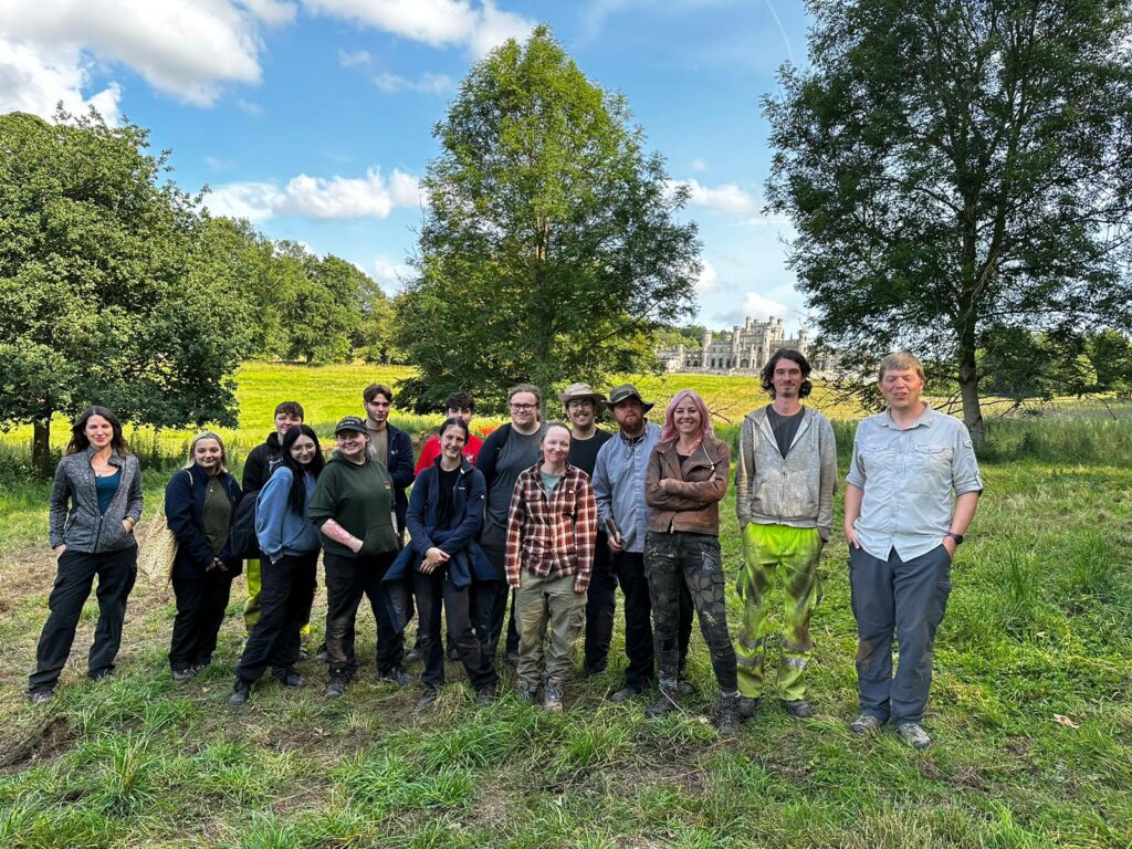
One of the highlights throughout the project has been welcoming visitors to the site. The project’s archaeology students from UCLan have been giving tours to those who’ve ventured down to the site during the course of the dig, keen to know more about what we’ve been uncovering. On Saturday 15 July, we were delighted to welcome representatives of the Castle Studies Trust and share with them our ongoing work (image 6), as well as members of several regional history and archaeology societies. We also had a visit from Professor Alice Roberts and the team from BBC2’s Digging for Britain (image 7), who plan to feature the project in their next series.

6. Visit of CST
7.Digging for Britain with project team

We still have further to go in analysing our findings and expanding our investigation of Lowther’s medieval castle and village, but are very pleased with how the on-site phase of our project has gone – not only in exploring the remains of an important medieval castle site, but also in training a new generation in castle archaeology, and encouraging public appreciation of castle studies. The project team is extremely grateful to the Castle Studies Trust for funding the project and for its support throughout, and would also like to thank the Lowther Castle and Gardens team for their help and hospitality over the past month. I’d also like to say a huge thank you to the indomitable Jim Morris, who has led the UCLan archaeology contingent, the hardworking and dedicated cohort of UCLan archaeology students, and the excellent Allen Archaeology team (Jonny Milton, Rob Evershed and Tobin Rayner).

Subscribe to our quarterly newsletter

Gleaston Castle: On the edge of collapse – an attempt at rescue

In 2018 Historic England commissioned reports to be carried out on Gleaston Castle near Ulverston, where the Castle Studies Trust have previously funded a survey of the site. The reports commissioned by Historic England were led by Chloe Granger of Crosby Granger Architects, and included a condition survey and concept feasibility study. The feasibility study was aimed at reviewing any potential repair and/or development that could allow the site to become sustainable.

Formerly, in 2015 the Castle Studies Trust grant-funded preparatory works at Gleaston Castle that included a Conservation Statement, geophysical surveys and 3D imagery, to begin the process of understanding more about the castle and its development. From this initial research, the follow-up condition survey and feasibility study prepared by Chloe and her team sets the scene for future repair works and lays the foundations for a potential sustainable future.

Subscribe to our quarterly newsletter

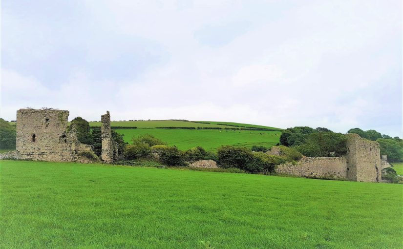
Gleaston Castle, listed Grade I and Scheduled under the Ancient Monuments and Archaeological Areas Act, is located on the Furness Peninsula, Cumbria in what appears to be a remote location and strange position for a fortified castle. It is an enclosure castle dating to the 14th century, now a ruin, and has been recorded as such since the mid-16th century. The location on the Furness Peninsula would have historically been less remote, as access was via boat or by crossing the sands of the Morecambe Bay estuary at low tide – a mere short walk.

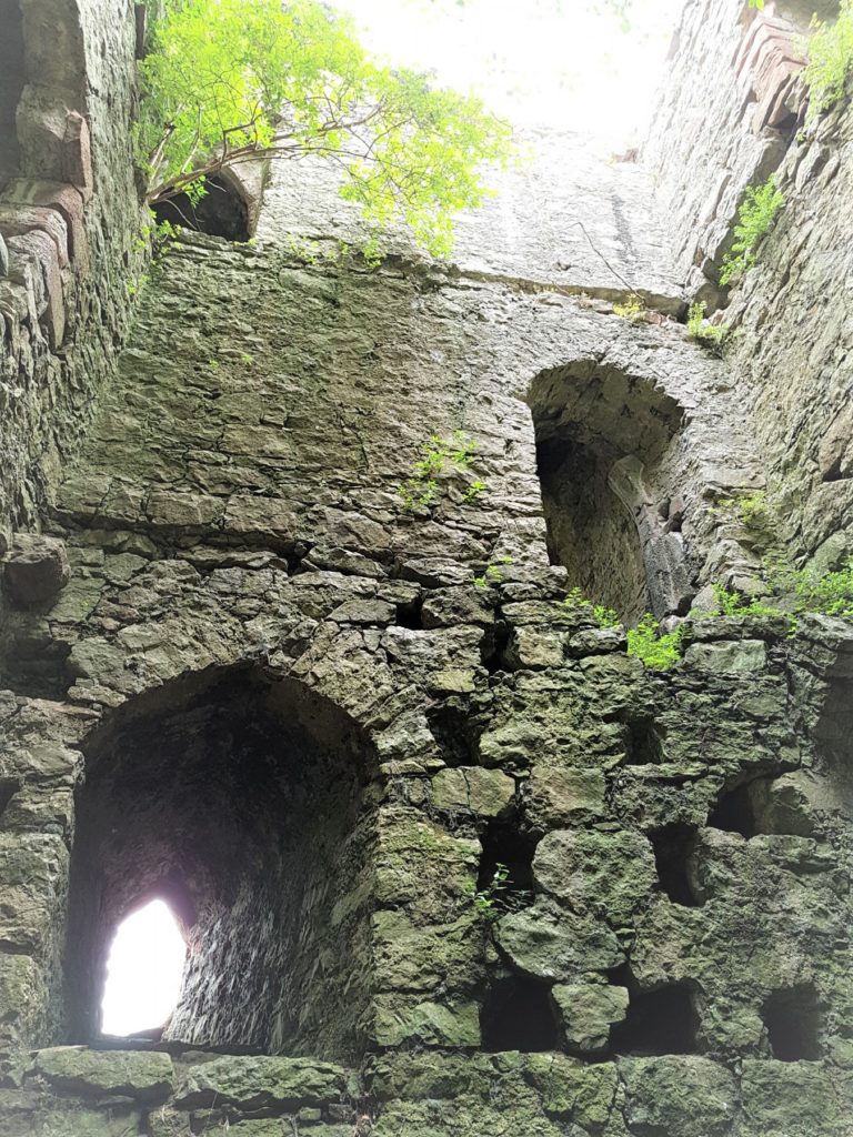
Gleaston Castle: south east tower interior. Copyright Chloe Granger

The exact date of construction of Gleaston Castle is not known; it was almost certainly built by John Harrington (knighted in 1306) and marked a move from the earlier coastal manorial residence at Aldingham, which had passed to the Harringtons in 1291, possibly in part prompted by early-14th century Scots raids. A date of c1325 is sometimes quoted although the earliest documentary reference is in the 1350s; several sources suggest that it was never finished. It appears to have been abandoned as a manorial residence after the death of Sir William Harrington in 1457 and c1540 it was recorded by Leland as lying in ruins, although some parts may have been re-occupied in the 17th century.

Gleaston is the probably nearest approach to a ‘quadrangular’ castle of a type more common in the North East, and typical of the earlier 14th century. It is not an exact rectangle in plan – the enclosure, 80 m in length north to south, narrows from 55 m at the north end to 45 m at the south. It has had corner towers, with the north-western, by far the largest, clearly containing the hall and subsidiary apartments.

Gleaston Castle: Great Hall from south east tower. Copyright Chloe Granger

The ruinous remains of the castle are in private ownership, incorporated into a working farm, which makes access difficult for the visitor. The structures are in a perilous condition, with falling masonry not an uncommon sight. General vegetation and rigorous ivy are the main culprits. The ivy on the south-east tower is known to Historic England as the largest, most substantial and ancient ivy known on a structure in the country. The scale of the issue is enormous. There is no management plan and no funding to enable a comprehensive strategy of repair to be carried out to safeguard the structures.

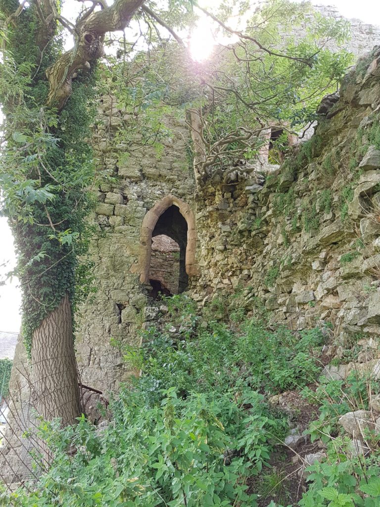
Gleaston Castle: entrance to sw tower. Copyright Chloe Granger

Through Chloe, the Society for the Protection of Ancient Buildings (SPAB) have become involved and are planning a working party to begin to make a start on rescuing the castle. It is a colossal task, but the aim of the working party will be to raise awareness and put Gleaston castle on the map, which the team hopes will generate support for the cause. The volunteer working party team is hoping to carry out some initial vegetation clearance and some consolidation, with professionals offering their time pro-bono; the first required are an ecologist and an arboriculturalist. The initial working party is planned for September,

If anyone is interested in either contributing time or funds, your support would be greatly appreciated! For more information contact Chloe Granger on chloe at crosbygrangerarchitects dot co dot uk 

Subscribe to our quarterly newsletter

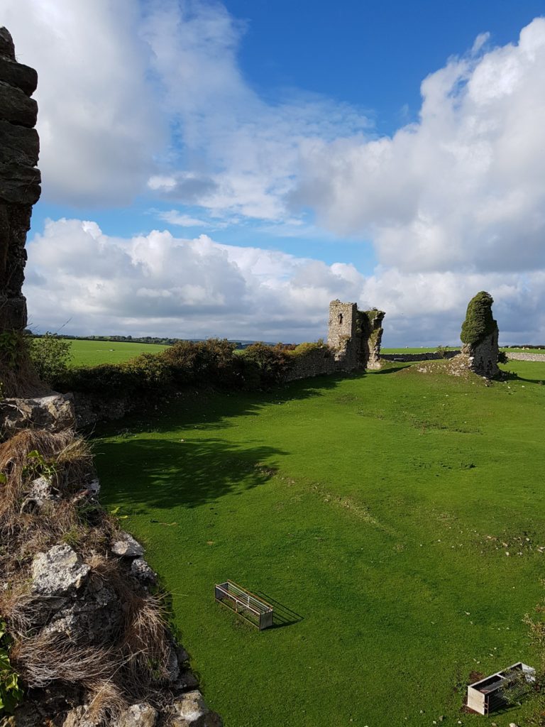
Featured image: Gleaston Castle from the West and where its main entrance was. Copyright Chloe Granger.