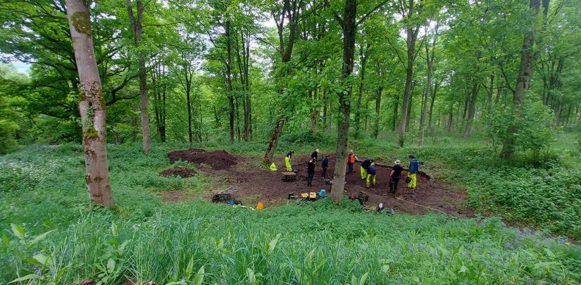
In Week Fourth and final week of the Lowther Medieval Castle and Village Project 2024, the team moved into the UCLan labs. This crucial phase allows us to draw together the evidence we’ve collected last year and this, from the recording of trenches to the analysis of soil samples.
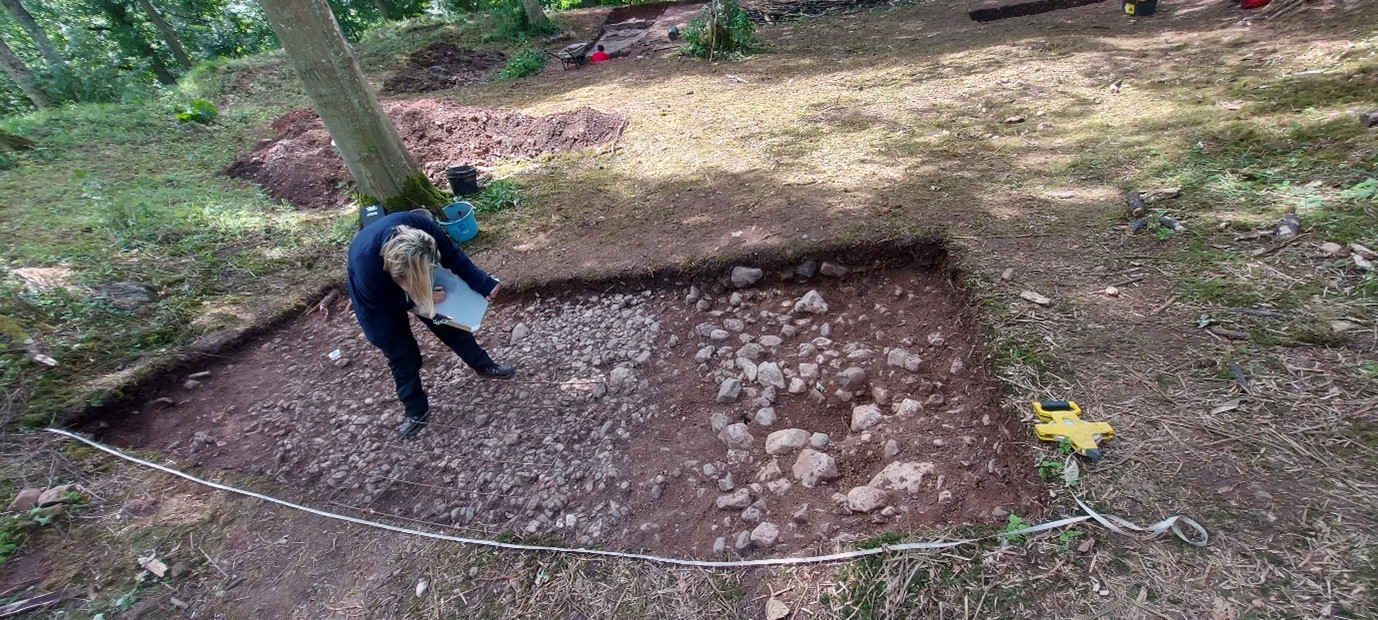
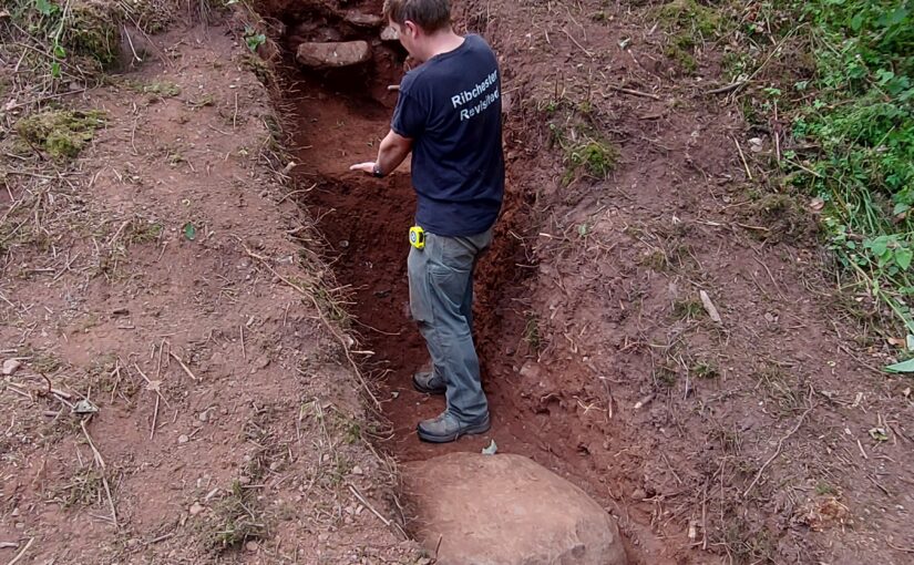
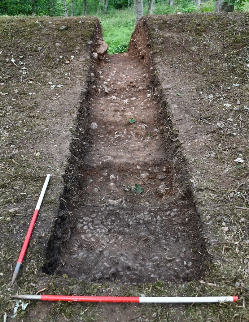
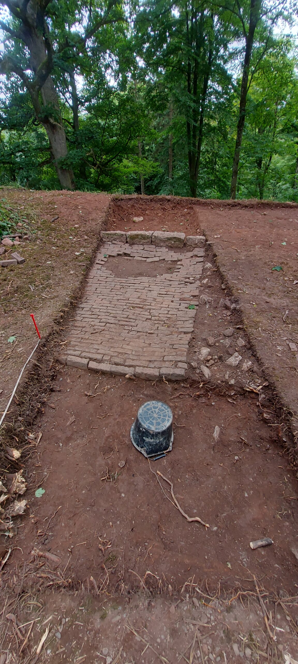
A major part of this process is the transfer of trench plans onto a Geographic Information System (GIS). During excavations, the dig team thoroughly recorded the contents of trenches in situ. This included the painstaking task of drawing the cobbled surfaces found inside the ringwork castle at 1:20 scale. Now, these hand drawings are transferred to the GIS and the outline of every cobblestone is traced digitally so that the archaeological contexts within the trenches be plotted with pinpoint accuracy.
Figure 1 Both last year and this, student archaeologists painstakingly recorded by hand the contents of all trenchesFigure 2 With hand drawings of trenches transferred to the project GIS, each component of the drawing needs to be traced digitally
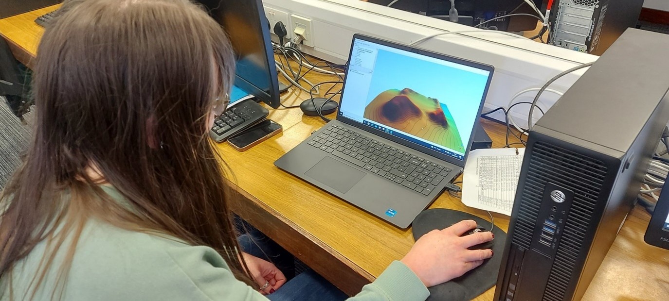
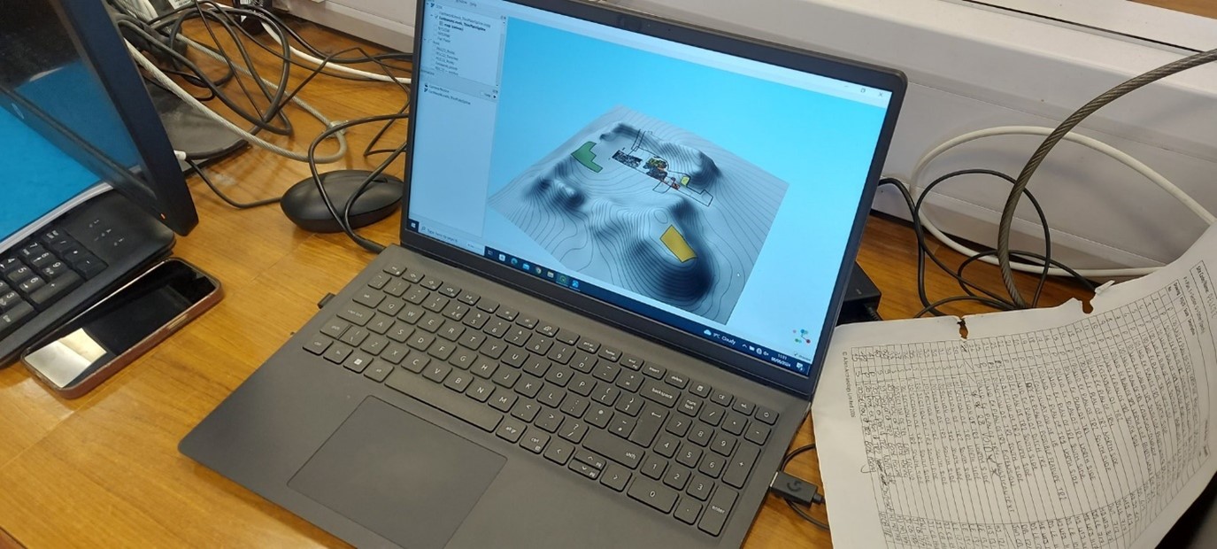
Meanwhile, the team is also plotting onto the GIS hundreds of data points from around the ringwork castle taken using a Global Positioning System (GPS). This allows us to create a three-dimensional digital model of the ringwork castle, in order to investigate its form and plot the positioning and contents of trenches from this year and last, building up our picture of the castle, its features and finds.
Figure 3 Taking hundreds of data points via the GPS enables the team to construct a 3D digital model of the ringwork castleFigure 4 Trenches from both phases of excavation can be plotted onto the 3D model of the ringwork castle using the GIS
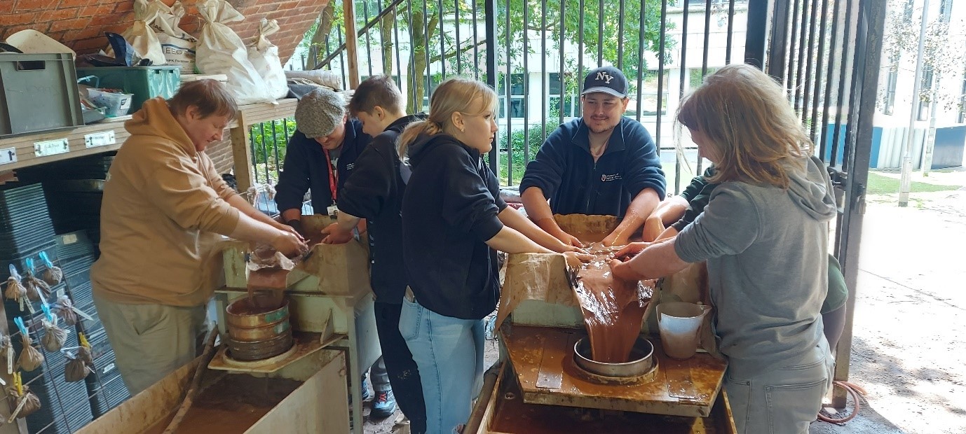
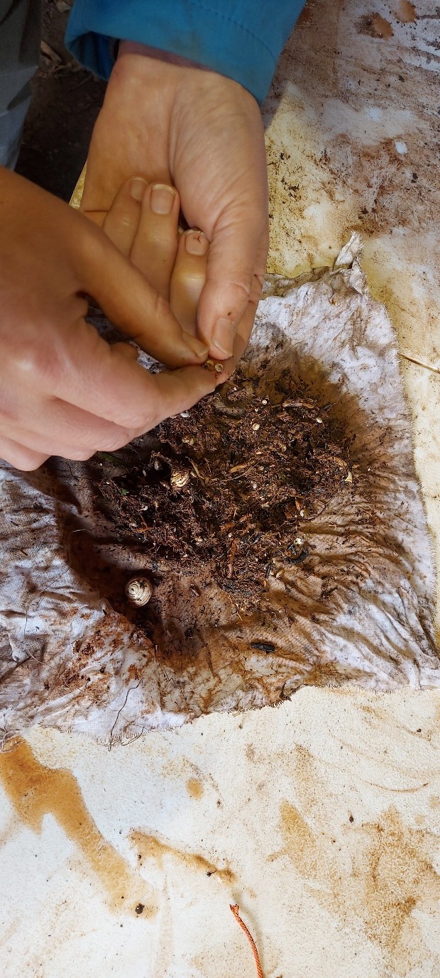
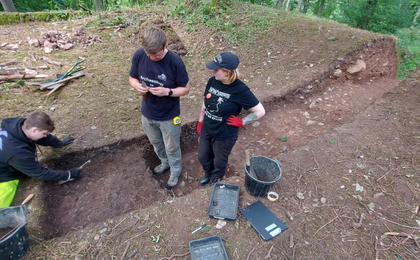
While one cohort of student archaeologists has been busy in the computer labs, another has been hard at work processing soil samples. Throughout the excavation, the team has been collecting bulk soil samples of 40 litres from all trenches. These samples have now been processed using water flotation, in order to recover charred plant remains, as well as small bones and artefacts. This has so far yielded environmental evidence such as tiny snail shells, which can be analysed to reconstruct the surrounding environment at the time the ringwork castle was built.
Figure 5 Dozens of soil samples have been processed using water flotationFigure 6 Soil sample processing yields environmental evidence, such as tiny snail shells
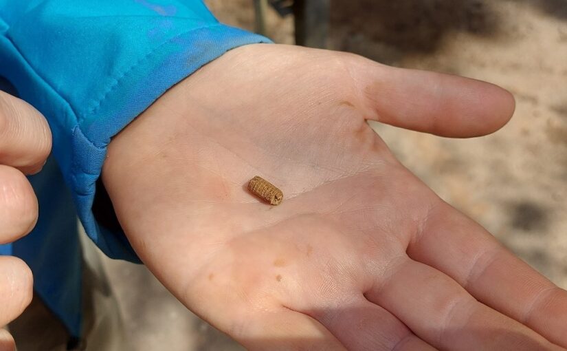
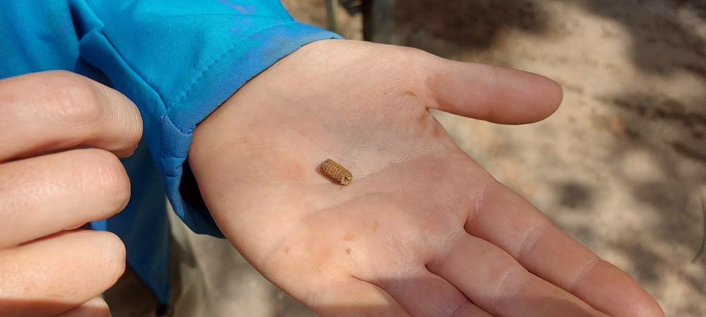
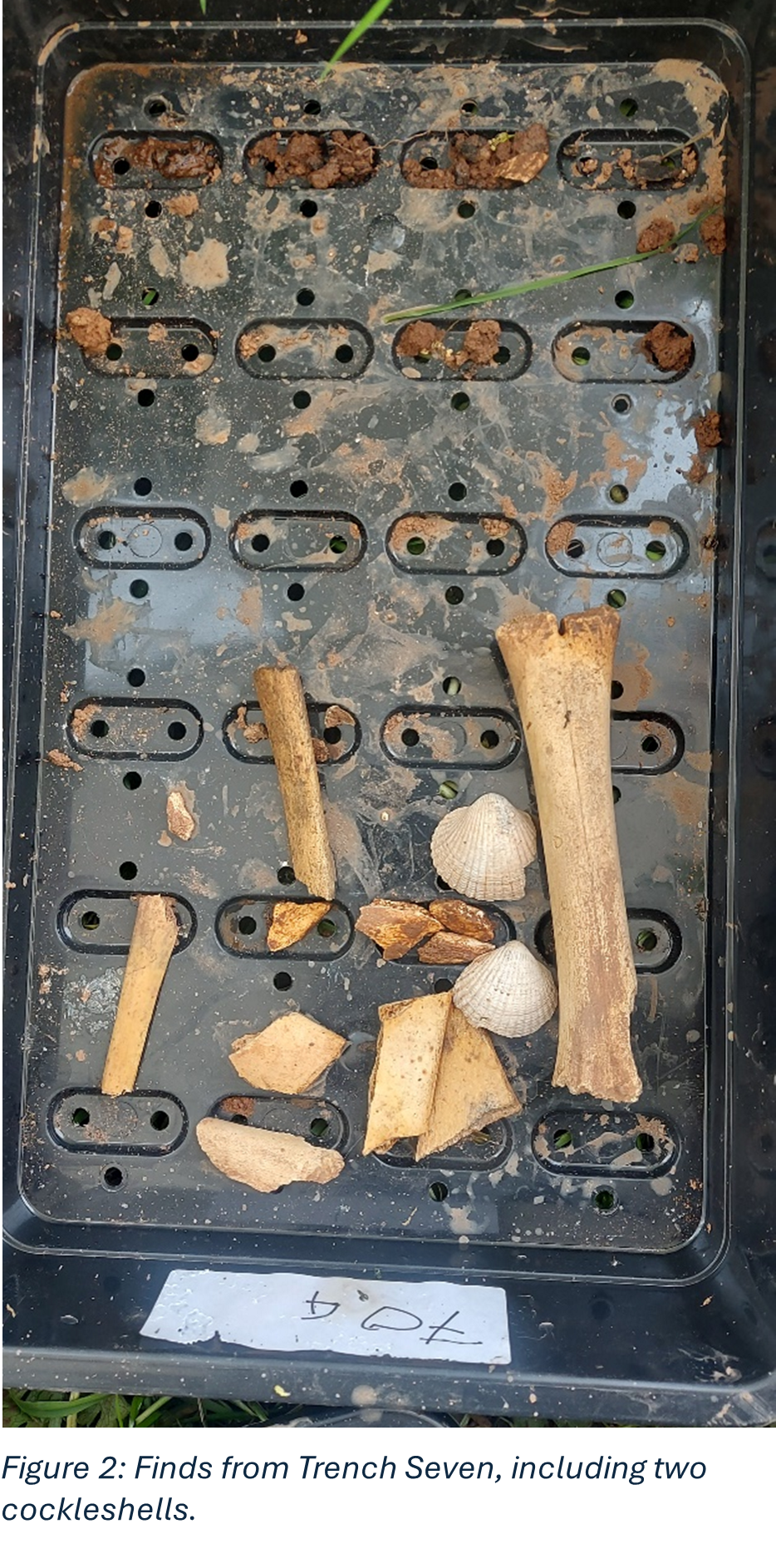
Now that Phase Two investigations are drawing to a close, the team has also been able to take stock of the small finds garnered this year. As discussed in our last Dig Diary, this year’s finds have included cockle shells and gritty ware pottery, both of which will help us to date the castle and trace activity at Lowther in the Middle Ages. This builds on intriguing earlier finds this year of animal bones, including an articulated fetlock (discussed in our first Dig Diary this year). We can now add to this a bone bead, small but delicately carved, which looks to be dateable to the Middle Ages.
Figure 7 A small carved bone bead found during this year’s excavation
Work on analysing these finds – and the broader phase of analysis – is ongoing, and will be compiled into the project’s second interim report in due course.
After a bit of a hiatus, co-project lead, Dr Sophie Ambler, gives an update of how the excavations at Lowther Castle went with some possible dating evidence.
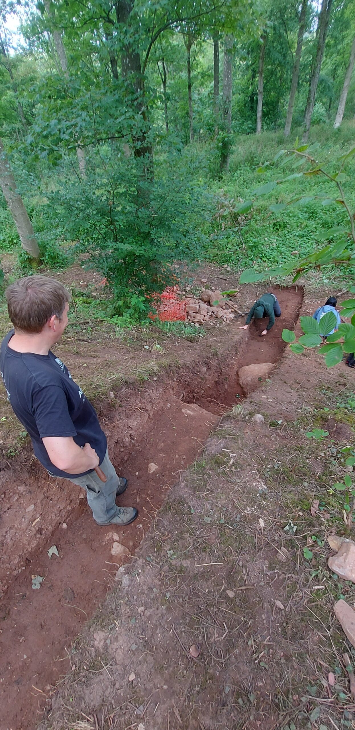
Weeks two and three of the Lowther Medieval Castle project brought significant progress, both in excavating a significant portion of the ringwork castle interior and ‘watchtower mound’, and in producing some long-hoped-for finds.
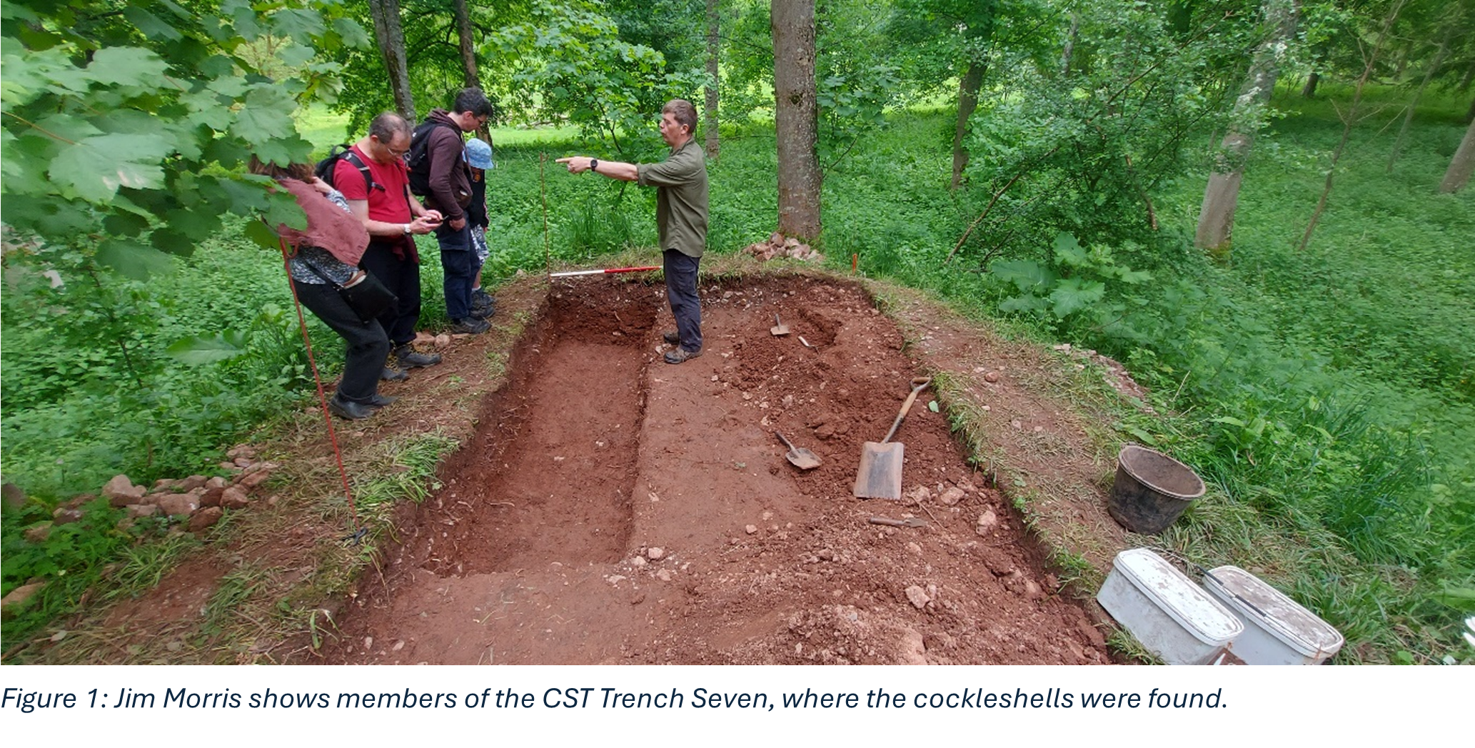
Trench Seven explored the so-called ‘watchtower mound’, the protrusion of the bank at the ringwork’s south-eastern corner, overlooking the attached settlement to the east, which may have afforded the castle’s occupants an elevated view over the settlement. The trench revealed a compacted stony surface that likely represents a foundation levelling layer. No evidence has been found of a structure having stood on this mound, although it may be that postholes or other evidence of a timber palisade may have been lost over the years to slippage. Soil samples were taken from across the trench and will be tested this week for environmental evidence. Meanwhile, as noted in the last dig diary, the trench had already yielded an equine fetlock joint, which can hopefully be radiocarbon dated.
The final stage of excavation in Trench Seven also revealed further intriguing evidence of activity: two cockleshells, again from a secure context. Cockles are abundant in the bays and estuaries of Cumbria’s coast. Although Lowther is thirty to forty miles from the coast, the presence of cockles is not as unlikely as it may first seem. Excavations at other inland castle sites have shown evidence of bivalve consumption. For instance, a significant assemblage of bivalve shells from across the medieval period has been found at Dudley Castle in Worcestershire, comprising mostly oysters but also cockles, mussels and whelks. Oysters formed the focus of a recent analysis, which revealed that these made up perhaps more than ten per cent of dietary intake at Dudley in the final quarter of the eleventh century (a much higher percentage in the fourteenth century). The challenge of transporting such produce quickly to inland sites made it something of a luxury foodstuff, but one that was clearly popular for castle-holding elites. (Thomas et al, 2018).
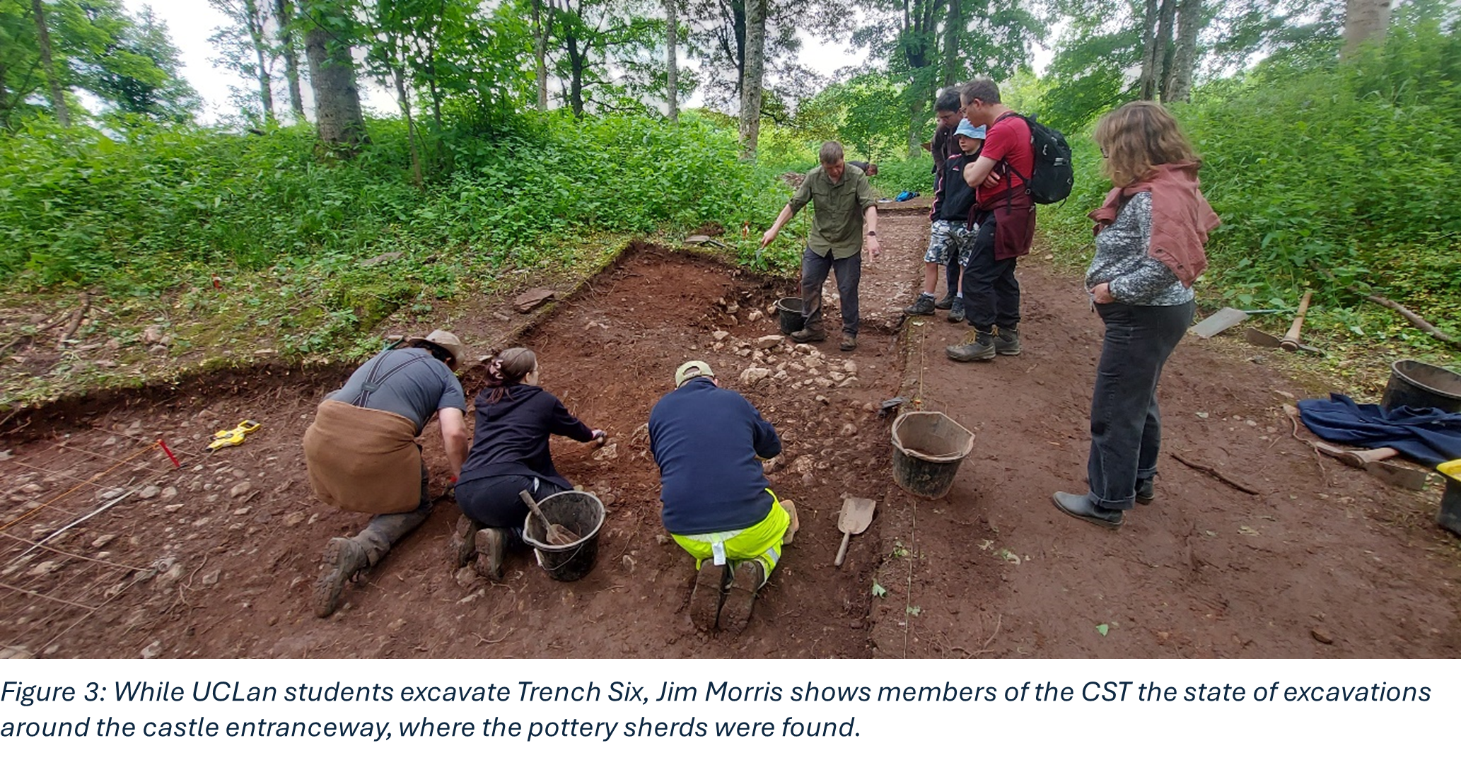
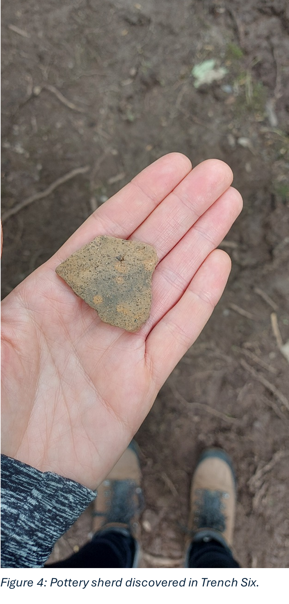
Meanwhile, Trench Six, which covers a significant portion of the ringwork castle interior, has yielded several pottery sherds. These were also found in a secure context, here the ringwork’s bank, by the entranceway. The study of medieval pottery in the North West is challenging due to the relative lack of securely datable evidence. This is especially true in Cumbria, which is generally finds-poor for the Middle Ages and where pottery from rural settlements (as opposed to Carlisle) has been less studied. Still, comparators can be found in the pottery assemblage at Cumwhinton, a rural medieval settlement about twenty miles north of Lowther that may have been home to pottery production. Lowther’s sherds appear to be ‘gritty ware’, a utilitarian fabric, most examples of which are from jars and jugs (and occasionally small dishes). This was the dominant fabric used across the north of England in the twelfth century and the earliest form of post-Conquest pottery in Cumbria. (Railton et al, 2014).
Although not definitive dating evidence yet, these finds are contributing significantly to our evidence base, which will help us to date our site and build its biography. We also hope that analysis now being undertaken in UCLan’s archaeology labs will continue to contribute to this evidence base. This includes analysis of soil samples, which may yield environmental evidence, and of finds, including animal bone and the pottery sherds. Watch this space for an ongoing report!
Thomas et al, 2018: Richard Thomas, Matt Law, Emma Browning, Alistair Hill and Rachel Small, ‘The Changing Exploitation of Oysters (Ostrea edulis L. 1758) in Late Medieval and Early Modern England: A Case Study from Dudley Castle, West Midlands’, Environmental Archaeology 25 (2020), 82-95
Railton et al, 2014: Martin Railton, Jeremy Bradley, Ian Millar, Meagan Stoakley, David Jackson, Don O’Meara and Alan Hall, ‘Peter Gate, Cumwhinton: Archaeological Investigation of a Medieval Rural Site’, Transactions of the Cumberland & Westmorland Antiquarian & Archaeological Society 14 (2014) 63-102.
Phase Two excavations at the putative partial ringwork castle at Lowther (Cumbria) will get underway on Sunday 12th May 2024. The project team leaders Drs Sophie Ambler and Jim Morris look at one they found in season one and look forward to what the want to will be examining in season two.
The Lowther Medieval Castle and Village Project unites History and Archaeology through Lancaster University, the University of Central Lancaster, and Allen Archaeology, with the support of Lowther Castle and Gardens Trust and the Lowther estate team. Phase One excavations in summer 2023, generously funded by the Castle Studies Trust (CST), saw a geophysical survey of Lowther’s north park and excavations of the ‘castlestead’ earthwork. Phase Two will see further excavations of the castle earthwork, funded by the CST, and a geophysical survey of the area to the north, funded by the Cumberland and Westmorland Antiquarian and Archaeological Society (CWAAS).
The site at Lowther is potentially of great significance for castle studies and the medieval history of Britain. We have good reason to think the site is associated with the second phase of the Norman Conquest: the annexation and plantation settlement of the Kingdom of Cumbria under William Rufus in 1092.
Thanks to the 2023 excavations and their interim report, we can begin to investigate how Lowther sits within ringwork castle typology. This is a partial ringwork, sited on the edge of a promontory, its banks built up on the landward sides. It thus took advantage of its landscape to be seen and to see. This conforms to a model for castle siting that aimed to produce (in the words of Oliver Creighton) ‘a conspicuous symbol of power with a panoptical viewshed over the surrounding territory’. At approximately 27m X 22m, Lowther sits at the smaller end of the ringwork spectrum. In that its central area is raised above external ground level, with landward circumferential banks elevated further, it bears comparison with ringworks of Norman Ireland.
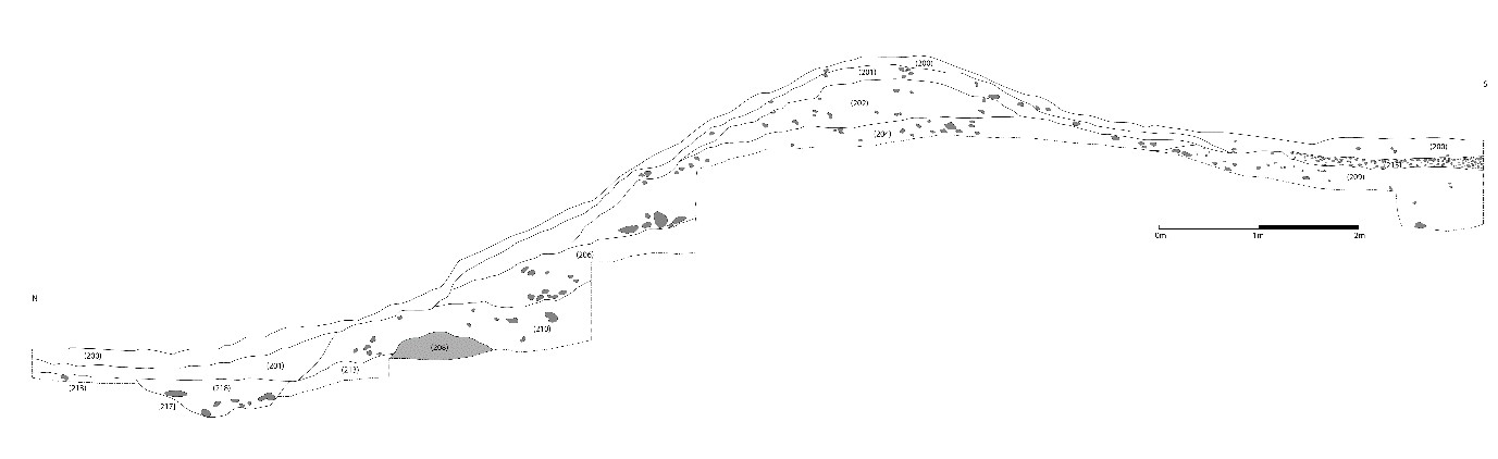
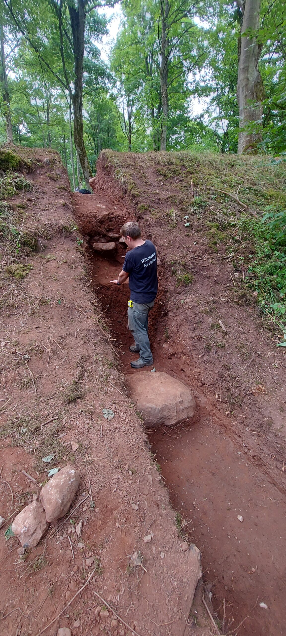
Trench Two investigated the construction of the castle’s north bank. This was one of our biggest undertakings in 2023: the trench measured 15m north-south, and 1m east-west, cutting through the northern bank, all excavated by hand. It was certainly worth the toil. A large block of limestone appears to represent the first layer of the castle’s construction; this is followed by at least four separate building deposits. Seemingly the bank was built up from a number of earthen layers with some smaller stone layers incorporated into the bank, perhaps for stability.
Lowther Castle excavation trench 2 looking north. Copyright Jim Morris
The trench’s southern part, within the castle interior, was also revealing. The stratigraphy, together with the clear level difference between the interior and northern exterior of the castle, suggest how the castle was constructed, first with a great mound, then with bank layers added around the northern, southern, and eastern banks to create the partial ringwork. No evidence has yet been found of a fosse associated with the castle, although Trench Two revealed a small feature at the far north of the trench, of a silty fill cut into the subsoil, running east-west (with a north-south width of 1.52m), possibly a drainage ditch the filled up gradually.
Lowther Castle: west facing section of trench 2. Copyright James Morris
Trench Four began to uncover the castle’s entranceway, in a break in the eastern bank. The removal of topsoil and subsoil revealed a metalled surface, comprising river stones ranging from 0.04 to 0.11m, between 0.20 and 0.15m deep. This seems to be the metalled interior surface of the castle, starting at the entranceway.
Lowther Castle: trench four under excavation. Copyright James Morris
Our 2023 excavation yielded little in the way of small finds, although this is not unusual for medieval Cumbria, and may also suggest that the castle was not long occupied. Meanwhile, in the hopes of finding good dating evidence, bulk soil samples of 40 litres (or 100% of a deposit if less was available) were taken from potentially datable features and layers for flotation for charred plant remains and for the recovery of small bones and artefacts. Bulk soil samples were processed using standard water flotation at the University of Central Lancashire. The results will be incorporated in the project’s final report.
Phase Two excavations will go further in investigating the castle’s construction – this time focusing on the interior. Can we identify a gatehouse structure? A potential comparator for Lowther is Castle Tower, Penmaen (Glamorgan), a partial ringwork sited on a promontory, of similar size and likewise with an entranceway gap: excavations here revealed a substantial Norman timber gatehouse, supported by six posts, and fosse. Phase Two will thus excavate an extended area over the entranceway and beyond. And can we identify interior structures (such as the small timber hall evidenced at Penmaen)? Phase Two will open a substantial area – a quadrant of the interior – to reveal the metalled surface, aimed at identifying postholes as well as maximising chances of recovering small finds.
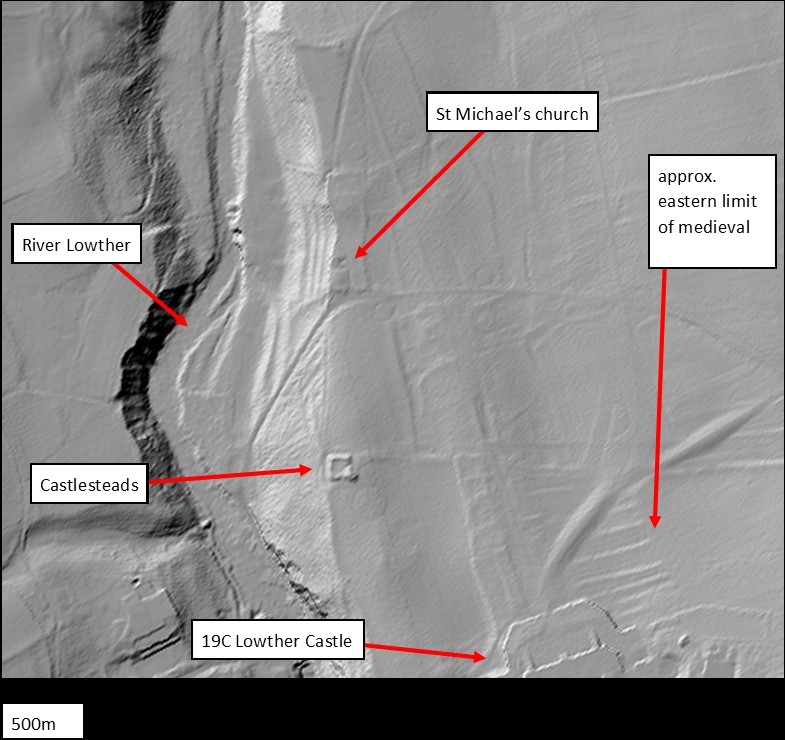
Meanwhile, a partner investigation will get underway in the area around St Michael’s church, just north of the partial ringwork. The castle, village, and Norman church of St Michael’s represent a typical configuration for a medieval manor. The presence of Hogback and other stone sculptures (c.700-1000) at St Michael’s hints at an earlier religious site: can this be established and, if so, what form did it take and how did the Norman settlement overwrite it? And how far did the medieval settlement, attached to the castle, extend northward? Building on our geophysical survey from Phase One, Phase Two’s geophysical survey, supported by CWAAS, takes in the surrounds of St Michael’s.
There is more information on the Lowther Medieval Castle and Village Project on the project website. The 2023 investigation was also featured on BBC2’s Digging for Britain (Series 11 Episode 1), available on BBC iPlayer. The May issue of BBC History Magazine also includes an article on the early medieval Kingdom of Cumbria, placing Lowther’s ringwork castle in its broader context.
Excavations will run on weekdays at Lowther Castle and Gardens from 13th to 31st May 2024. The north park, where our site lies, is free to access. Visitors are welcome! Entrance to the nineteenth-century castle and gardens offers further opportunities to explore the site’s history: the partial ringwork castle features in Lowther Castle’s new exhibition. Information on visits can be found on the Lowther Castle website.
At the end of week two of the #LowtherMedievalCastle dig and project lead Sophie Ambler gives us the latest update.
At the end of week two, we’re half way through our excavation of Lowther Medieval Castle and Village, and revealing some intriguing results.
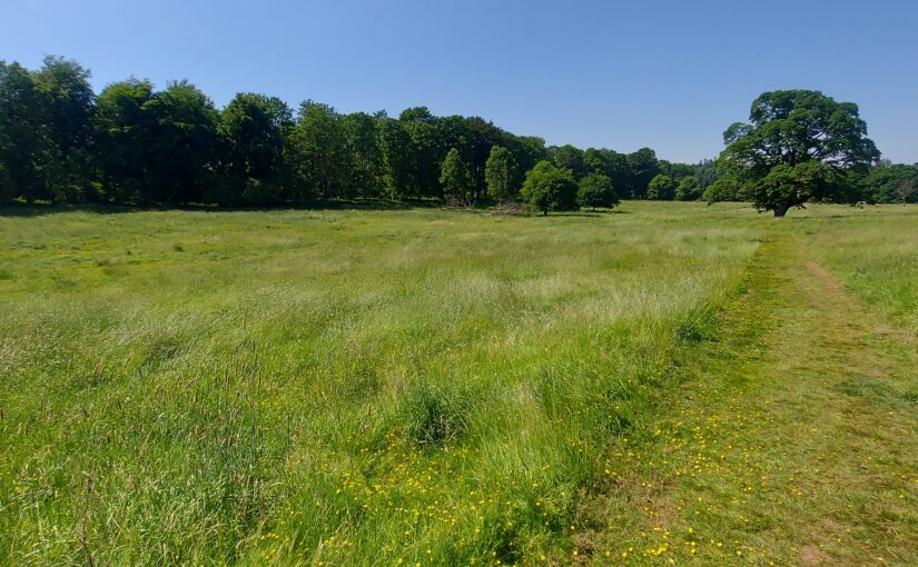
We now have four trenches open, three exploring the medieval castle earthwork and one across the routeway linking castle to village. There is still a great deal of work to be done, so much of what follows involves some speculation, and these findings are very much preliminary!
Trench One, on the western side of the castle earthwork, has revealed a small brick patio, bounded on the western edge with a course of cut stones. Miscellaneous finds, including a degraded iron doorhandle and pottery sherds, suggest that this might represent a phase of use concurrent with the nineteenth-century castle. Today’s Lowther Castle, the ruins of which overlook the site, was commissioned in 1806 by William, 1st Earl of Lonsdale. One theory is that the patio relates to the ‘Countess’s Stairs’, which once led up the steep slope from the River Lowther – perhaps towards the patio or a now-lost structure, which may have afforded a view across the river.
Trench Two: view down northward slope from top of northern bank
Trench Two, which cuts through the northern bank of the medieval castle earthwork, is starting to give us a real insight into how the fortification was constructed. We might expect with a ringwork castle for the bank to have been built using earth taken from an encircling ditch, but there is no evidence of a ditch at present. Instead, the bank appears to have been formed from material scoured from the immediate area: both the flat stretching north of the earthwork and the steep slope down to the River Lowther, a rich source of limestone. The bank appears to have been constructed in alternating layers of earth and stone. The team will continue working their way through the layers in this trench, in the hope of revealing more of the bank’s construction, and picking up any small finds that will provide us with dating evidence.
Trench Two northern bank of castle earthwork viewed from exterior showing layers of construction demonstrated by Jim Morris of UCLan
At the southern end of Trench Two, within the castle earthwork’s interior, is a metalled surface that may be the original medieval surface. This might tie into emerging discoveries in Trench Four.
Trench Four is our newest trench, opened over the entrance to the castle earthwork on its eastern side. Already this is beginning to yield evidence of what looks to be the same metalled surface evident in Trench Two. If so, this could suggest the original medieval metalled surface leading into the castle from the village and stretching across the floor of the ringwork. No evidence of this surface is evident so far in Trench One, either because it was destroyed by the intrusion of the nineteenth-century patio, or because the metalled surface did not cover the entirety of the castle interior. Within Trench Four, amidst a stone layer to the north of the metalled surface, is what might just be evidence of a post hole. Could this represent one side of the castle’s gateway? Watch this space!
Trench Three is another relatively recent trench taking in what is likely to be the routeway into the castle from the village, and what might be structures or plots lining the routeway. This has so far yielded two patches of disordered stone to the north of the routeway; one theory so far is that these represent demolition undertaken when the village was cleared in the seventeenth century.
All four trenches will hopefully have more to tell us as the team continues work over the second half of the project.
In part three of our dig diary, project lead Sophie Ambler talks about another type of digging, not of holes in the ground by through the archives to discover what if any historical evidence there is for Lowther.
Whilst the archaeologist are at work on site at Lowther, I’m attempting to piece together the site’s history from the documentary evidence.
Our biggest challenge is tracing the origins of Lowther’s medieval castle and village, which we think date to the late eleventh or early twelfth century. For most of England, historians have a phenomenal source for settlement in the eleventh century: Domesday Book. This was William the Conqueror’s enormous survey of landholding, compiled in 1086. It gives various details, settlement by settlement, such as landholders, land under cultivation, notable buildings and households (for an introduction to Domesday and the latest research, listen to this BBC History Extra podcast by Professor Stephen Baxter). Domesday thus helps historians to trace the process by which the Normans conquered England over the twenty years from 1066.
Frustratingly for us, the area of modern Co. Cumbria doesn’t appear in Domesday Book. Because this region wasn’t conquered by William I, it found no place in the Domesday survey. As discussed in our project’s first Dig Diary entry, the region was only conquered in 1092, by William the Conqueror’s son, William Rufus. The Anglo-Saxon chronicle states that William Rufus, following his campaign of conquest, ‘sent many peasant people with their wives and cattle to live there and cultivate the land’. This was, effectively, a process of Norman colonisation. We’re hypothesising that the ringwork castle earthwork and village at Lowther date to this era.
What was this region like when the Normans arrived in 1092? Here, historians have worked hard from patchy evidence for the Kingdom of Cumbria in the tenth and eleventh centuries. This was a Brittonic kingdom (distinct from the Anglo-Saxon kingdom of the south) but, as Professor Fiona Edmonds has described, parts of the kingdom were ‘multi-lingual and multi-cultural’ (including settlers we might think of as ‘Vikings’ and their descendants). These groups were encompassed by the term ‘Cymry’ (‘inhabitants of the same region’), from which the names Cumbria and Cumberland derive.
Who were the settlers dispatched in 1092 by William Rufus to colonise the Kingdom of Cumbria? There’s no hard evidence, but Dr Henry Summerson has suggested (in his book Medieval Carlisle) that they hailed from Lincolnshire. This theory has found some support from the late Professor Richard Sharpe, although he noted that evidence for a Lincolnshire connection dates to around 1100, so may represent a second wave of settlement.
Our first major evidence for Norman rule of the region comes in 1130, under King Henry I (William Rufus’ brother). This is found in a Pipe Roll – a record produced by England’s central government detailing the Exchequer’s annual audit, so-called because the parchment membranes were sewn together at the top and rolled up to look like a pipe (read more on the Pipe Roll Society website). The first surviving Pipe Roll dates to 1130. Professor Sharpe used this and other evidence to reconstruct the early Norman administration of the region. He concluded that the Normans formed the shires of Cumberland and Westmorland out of the old Kingdom of Cumbria by 1130, and were administering these shires under the aegis of central government. Even then, however, both counties were run ‘as a territorial unit’ rather than shires proper, overseen by an administrator rather than fully-fledged sheriffs. (You can read Professor Sharpe’s analysis in full here). This is perhaps not surprising, given that in southern England the Normans could co-opt the governmental systems of the Anglo-Saxon state, including shires and shire courts. Cumbria was a different beast.
Is this all to say that written evidence can’t tell us much about the Norman conquest of Cumbria in general, or about our site in particular? Yes and no. It does highlight the importance of archaeological investigation in filling the gaps in written evidence – and suggests how findings from the Lowther Castle and Village project could be significant to both historians and archaeologists in tracing the process of Norman conquest and colonisation and its realities on the ground. On the other hand, we do have written evidence for the Lowther site dating from the thirteenth century onwards, which we can use together with the archaeology to trace the site’s biography. More of this in a forthcoming post!
On Monday 26 June the excavation and geophysical survey of Lowther’s medieval castle and Village gets underway, finishing on Friday 21 July. Here, project lead Sophie Therese Ambler from the University of Lancaster explains what she hopes the team of students and academics from the university and University of Central Lancaster with the support of Allen Archaeology hope to find over the next three weeks.
Overlooking the Bampton Valley on the edge of the Lake District, the picturesque ruins of Lowther’s nineteenth-century castle are one of the region’s most popular attractions. Less well known are the earthworks immediately to the north, the remains of a medieval castle and village. Preliminary work suggests the site may date to the late eleventh or early twelfth century. If so, it could provide rare evidence of the conquest of Cumbria by King William Rufus and his brother, King Henry I – a generation after the Normans seized control of the rest of England. The site is potentially of national significance but has never been fully investigated.
Who built the castle and its settlement, when and why? The Lowther Medieval Castle and Village project brings together historians and archaeologists from the North West to uncover the site’s biography.
The Castle Studies Trust has generously funded a survey and excavation, which will take place from 26 June to 21 July 2023. The project team brings together History at Lancaster University, Allen Archaeology, the University of Central Lancaster (UCLan) and Lowther Castle and Gardens Trust.
In the 1990s, the Lowther Estate commissioned a landscape report and earthwork survey. The report suggested that the Castlesteads earthwork dates to the early Norman era (late eleventh or early twelfth century), and categorised it as a ringwork, a characteristic rural castle form of the early post-Conquest period. It noted that the castle is ‘of considerable archaeological importance, particularly as it was potentially the original fortified site at Lowther’.
The report also suggested the village was integrally linked to the ringwork and ‘likely to have been a planned settlement, established under close manorial control’. The settlement, the report noted, ‘is of considerable importance being a fossilised medieval settlement and it has the potential to significantly inform our understanding of medieval nucleated settlement in Cumbria.’ At the north of the site stands St Michael’s church, which is medieval in origin and potentially related to the castle and settlement.
Lidar image showing the extent of Lowther Castle and Village
The extent and form of the site as a whole can now also be seen in LiDAR imaging (see image above), noting that the circular features are intrusions brought by landscaping after the demolition of the settlement in the seventeenth century.
The working hypothesis is that the site dates to the Norman conquest of Cumbria. Unlike the rest of England, Co. Cumbria was not conquered by the Normans in 1066. The region was historically part of the Kingdom of Cumbria, which stretched from Strathclyde across the Solway. Then, while the Normans were conquering lowland England, the area from Lowther northwards was conquered by the Scottish king Máel Coluim III. Cumbria was only annexed by the Normans in 1092, when William the Conqueror’s son, William Rufus, led an expedition to the area. According to the Anglo-Saxon Chronicle, the king then ‘sent many peasant people with their wives and cattle to live there and cultivate the land’.
Could Lowther’s medieval castle and village date from this era? Beyond the estimations provided by the earthwork survey, it has been suggested from place name and field pattern evidence that many medieval villages in this area of Cumbria were planned or remodelled settlements established following the 1092 annexation of Cumbria and peopled largely by colonists. But written evidence for Cumbria in this era is extremely sparse, so it is up to archaeology to test this theory. Whatever the investigation finds, the archaeology at Lowther offers a fantastic opportunity to understand rural castle building and life in medieval Cumbria.
In the first few days of the project, the team will conduct a geophysical survey, before opening trenches across the Castlesteads and settlement earthworks. Visitors to Lowther Castle will be able to visit the dig site – if you are in the area, please do come and say hello.
The team will be posting regular updates on the project in a Dig Diary here on the Castle Studies Trust website. You can also follow the project on Twitter, via the hastag #LowtherMedievalCastle
Meanwhile, further information is available on the project website: