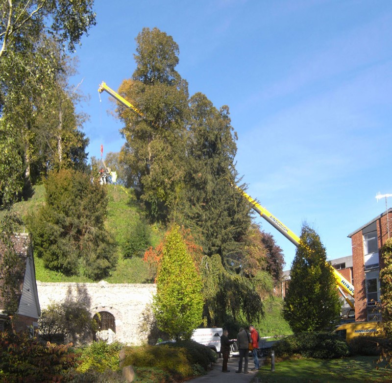
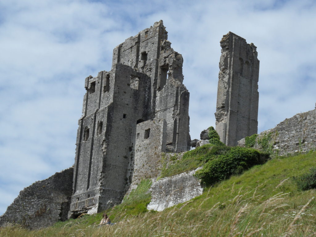
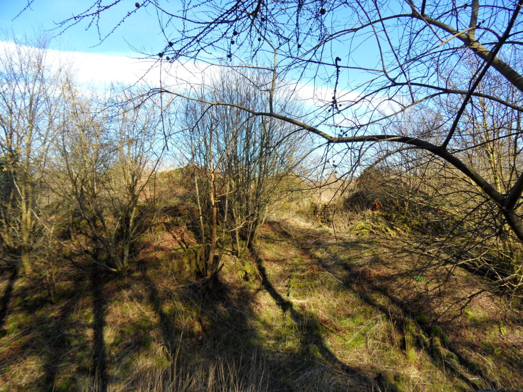
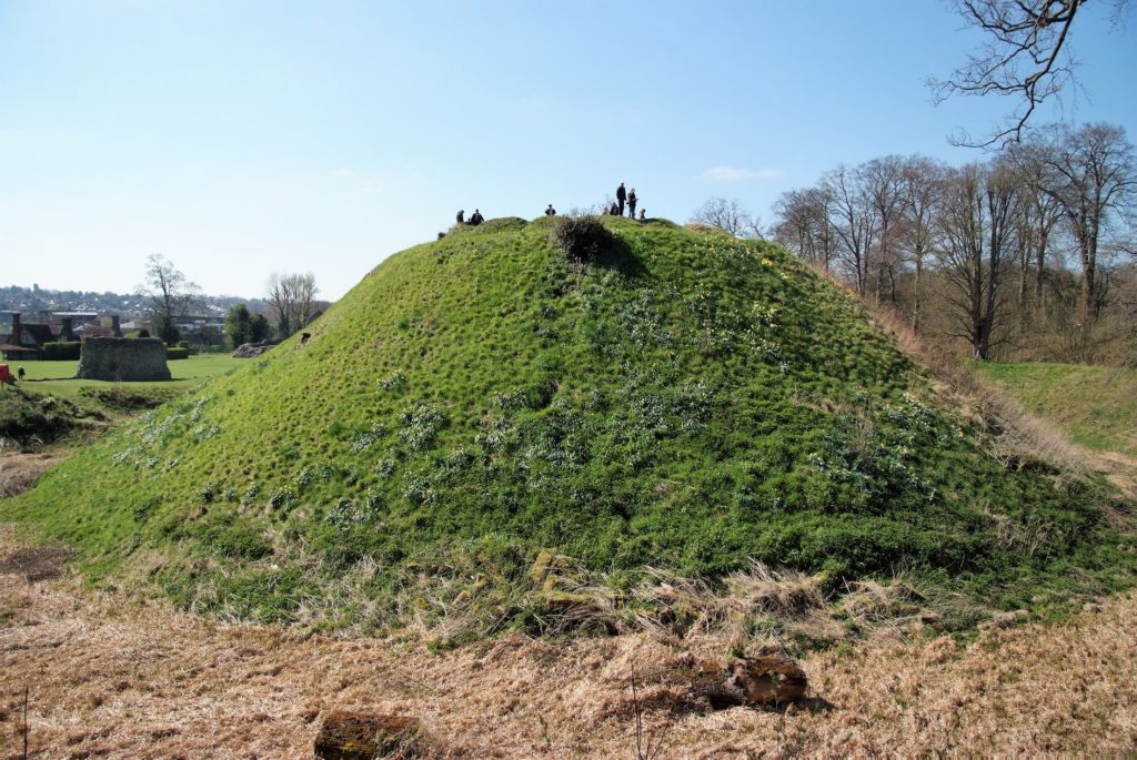
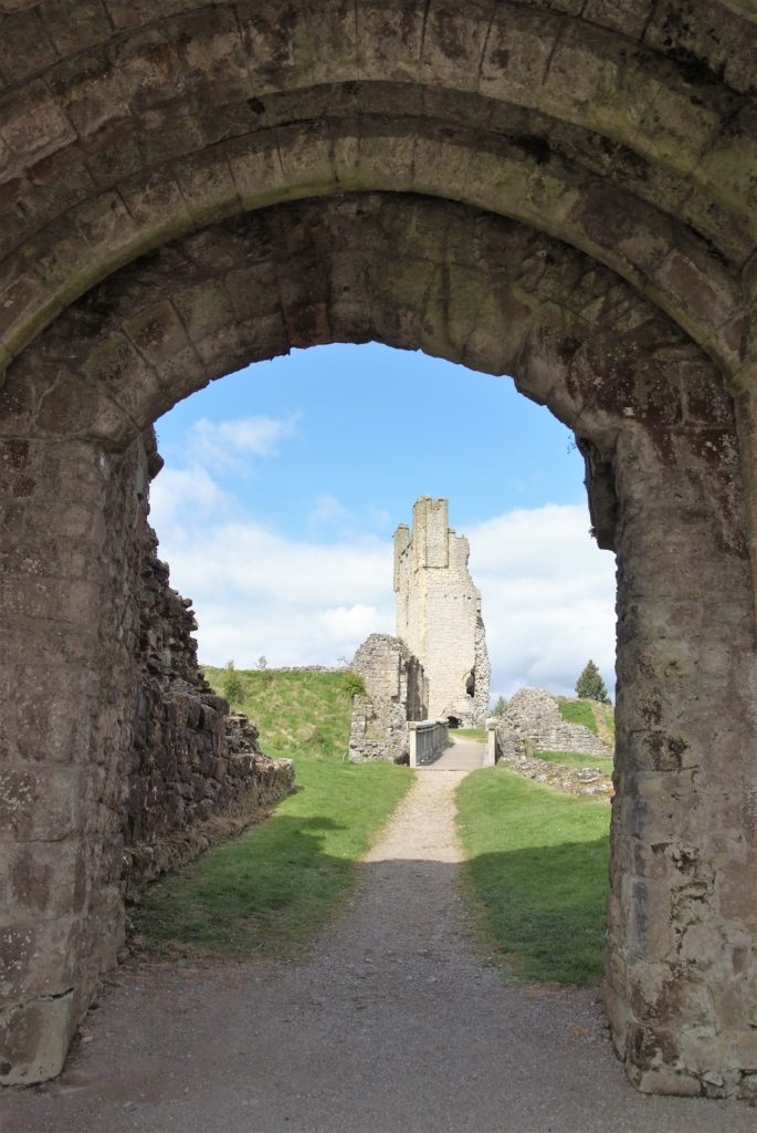
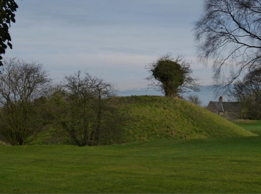
Over the last two decades, the Marlborough Mound Trust has carried out extensive conservation and investigations on the ‘mound’ in the grounds of Marlborough College. The origins of the mound were uncertain until recently. It was known to have been part of Marlborough Castle, but there had been persistent speculation, on the strength of its resemblance to neighbouring Silbury Hill and the discovery of antlers in the early twentieth century (now lost) that it was of prehistoric origin. In 2008, when Silbury Hill was being investigated, the opportunity of taking cores from the mound to obtain comparative dates presented itself. After a precarious operation involving a very large crane, the necessary drilling rig was hoisted to the top of the mound. The resulting cores, as a paper published the following year by Jim Leary and his colleagues showed, supported a date in the second half of the third millennium BC, broadly contemporary with Silbury Hill.
The drilling rig for the coring operation is hoisted into place (copyright Marlborough Mound Trust)
Jim Leary has subsequently carried out a survey of some fifty castle mottes, looking for other sites where prehistoric mounds could have been reused as the base for a castle, and has found only one other rather uncertain case. This means that Marlborough may be unique in being a prehistoric structure recycled into a medieval castle.
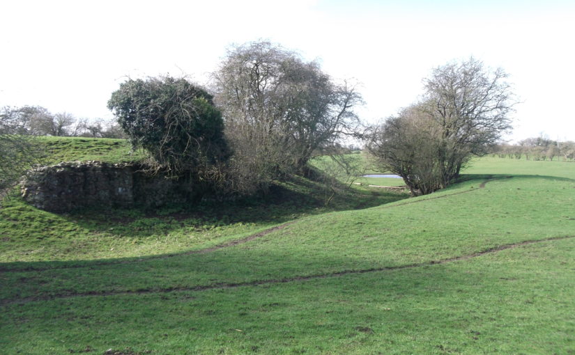
But we now know more about the prehistory of the mound than the supposed castle keep. The only possible sighting of masonry on the mound is uncertain in the extreme. H. C. Brentnall, a master at Marlborough College, in one of his many contributions to the Proceedings of the College’s Natural History Society on the the history of the castle, had this to say in 1936:
“Excavations necessitated by building operations at Marlborough College in the course of this summer have revealed several traces of the medieval castle which perished gradually between the fifteenth and seventeenth centuries. What little remains above ground (if the elevation justifies that expression) is to be seen on the summit of the motte, where a buttress of the keep was laid bare some years ago.“
The note implies that the buttress was visible in 1936, but recent geophysical surveys have not found it.
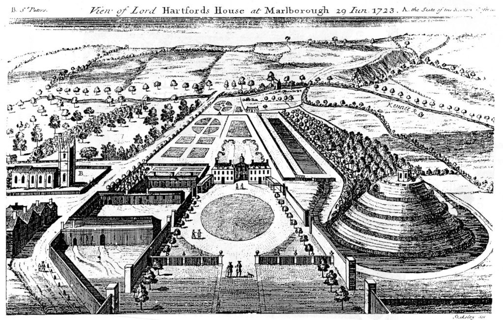
The problem is further compounded by the subsequent use of the mound. It became a garden feature in the seventeenth century, and a spiral was cut into the side of it to give access to a summerhouse at the top. Stukeley’s engraving of the countess of Hertford’s gardens in 1723 shows only the summerhouse, and no traces of masonry.
Stuckley’s engraving of countess of Hertford’s gardens.
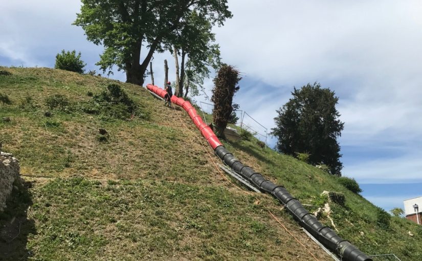
About the same time, a water tank was installed to supply the Hertfords’ newly built mansion. This was enlarged by the College after its establishment in 1843, and adapted over the years, until the top of the mound was graced by a large iron tank surrounded by a spoil bank, concrete steps, and substantial pipework. This meant that in effect most of the original top of the mound had been destroyed.
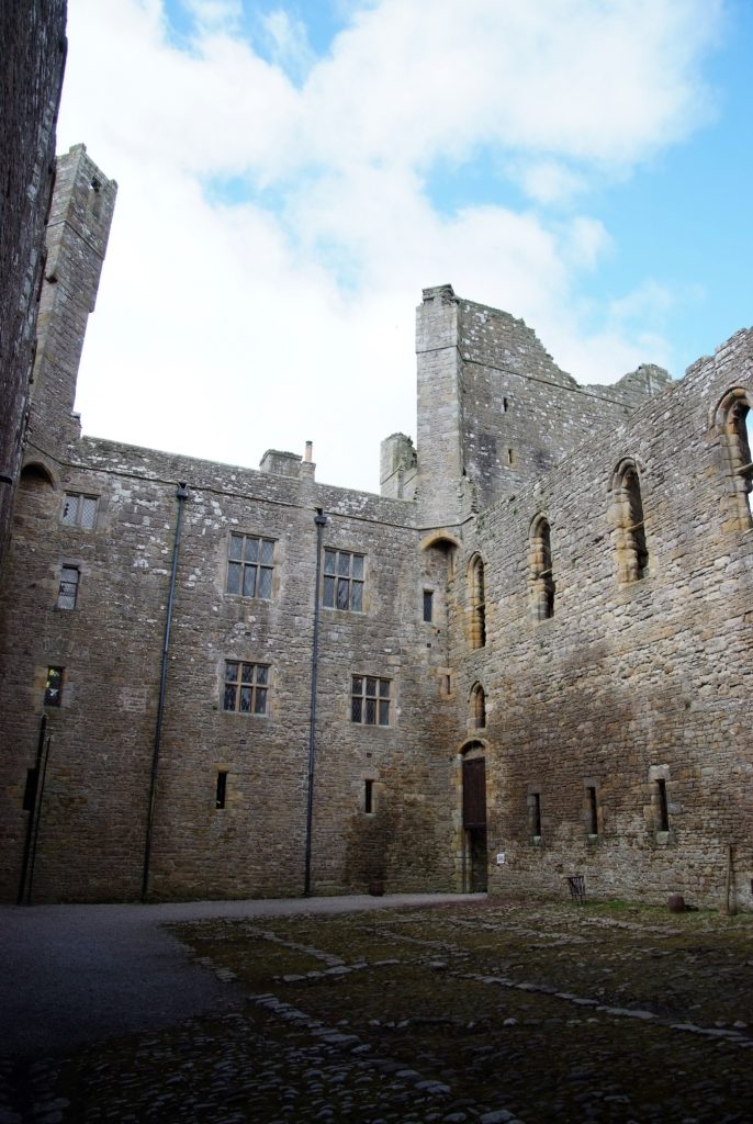
This raises the question of what we are looking for. The earliest mentions of the site, in 1070 and 1110, present the king’s establishment as a place of imprisonment and a site where a royal court was held. In the 1140s, Marlborough castle is first mentioned as such. It is described ‘very defensible’ in The Deeds of King Stephen. It was held by John Marshal, who used it to control the surrounding countryside, and there is no record of it ever being attacked.
The only entry in the plentiful records for the castle under Henry II and Henry III is in the context of payments in 1222 for work designed to create a substantial royal residence there. This is a single sum for the building of a lime kiln ‘for the Great Tower’, which must therefore have been of stone. There is no indication where this tower was sited, and it may well have been part of the lower bailey. It has simply been assumed that it was on the mound.
An inconclusive exploratory dig was carried out by Wessex Archaeology for the Mound Trust in 2019, and at the time of writing, it is still hoped that a follow up to this will be possible in 2020. The present assumption is that the mound was among the hastily erected timber forts from immediately after the Norman conquest, and that this was replaced by a stone keep after 1222. It would be good to be able to find some actual evidence as to the nature and even the existence of the keep at Marlborough.
Richard Barber is a trustee of the Marlborough Mound. He would welcome any comments, particularly on the replacement of timber with stone, and the nature of ‘great towers’: email rwbarberuk at yahoo.co.uk.
The earthwork site at Kirkby Fleetham just to the east of the A1 near Bedale in North Yorkshire is generally taken to be the hunting lodge given a licence to crenellate for Henry Le Scrope in 1308. However, recent finds in an adjacent domestic garden together with a reappraisal of the surviving documentary evidence give a more nuanced picture of life at the site.
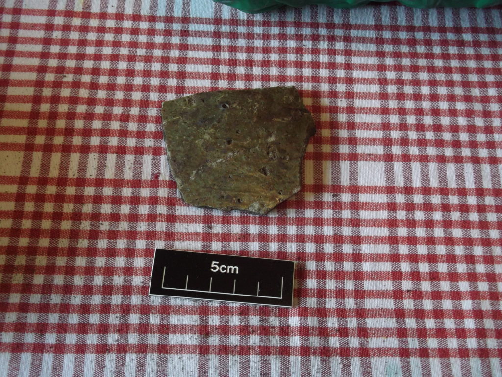
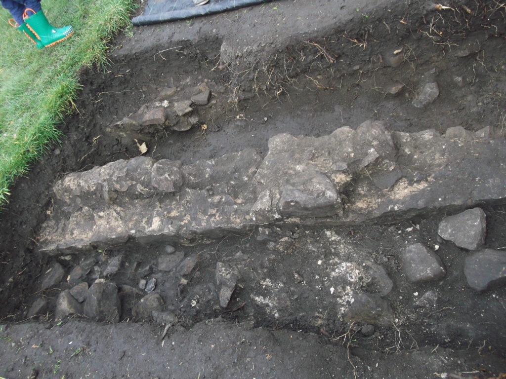
Work in the garden of a house directly to the north east in Spring 2019 has located the foundations of a coursed rubble stone wall approximately 1.3 metres wide with a series of looped windows, an internal mortar floor and traces of external white rendering. Traces of a cobbled yard have also been identified running between it and the castle earthworks to the south west. It has yielded a range of pottery including body sherds from Humberware jugs of the 14th Century along with several sherds of Cistercian ware from the early 16th Century. What is also significant is the volume of material dating to the Late 11th/12th Century including Coarse Sandy Gritty Wares from the York Area.
C14 Humberware Pottery
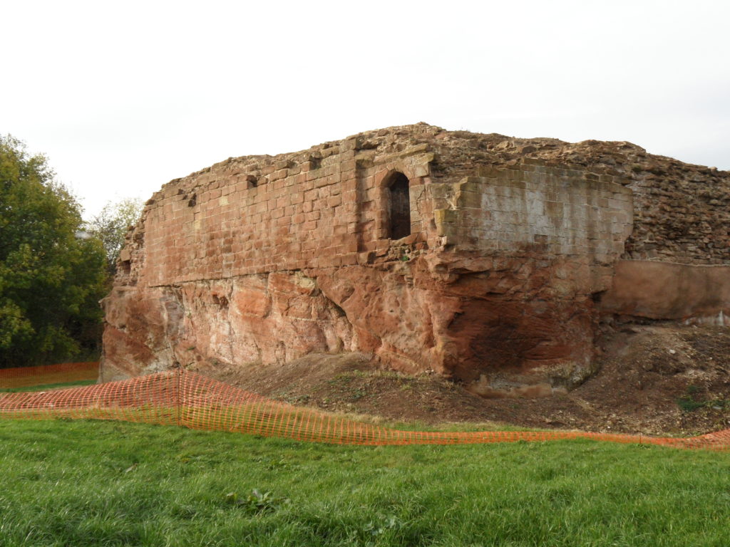
In terms of the castle remains two sections of stone revetment for a moat survive otherwise the site consists of two earthwork enclosures one slightly higher than the other surrounded by the drained site of two large artificial lakes running to the west and north west. The unseasonable dry weather in Spring 2020 allowed for a number of clear stone building platforms to appear marked in the vegetation. These suggest a peripheral curtain wall surrounding the inner mound with a series of buildings leading off it. Erosion by rabbits in the outer enclosure reveals a series of cobbled surfaces with sherds of pottery from further south in the Vale of York dating from the 12th through to the 14th Centuries. A series of building platforms clearly track off into neighbouring gardens including the one where the recent discoveries have been made.
Wall excavated in garden next to Kirby Fleetham castle
The documented history of the site together with the surviving pottery suggests a much longer period of occupation than has previously been suggested. The Domesday Book tenant is referred to as Odo the Chamberlain of the Duke of Brittany with references to his former holding throughout the documentary record in the 12th Century. In the mid to late 13th Century the owner is referred to as Sir Henry Fitz Conan who had a licence for a park awarded in 1271. The decline of the site is poorly documented although there is evidence of continued occupation into the early 16th Century and the documents show it held as a hunting lodge by Lord Grey of Codnor in 1417 when the estate was briefly forfeited by the Scropes.
In terms of the building in the adjacent garden, its design and location suggest a half-timbered superstructure above a stone basement and from its location a court house or similar use such as survives at Danby in the North York Moors can be hypothesised.
For more information about the excavation please contact Erik Matthews on rubyna dot matthews at btinternet dot com
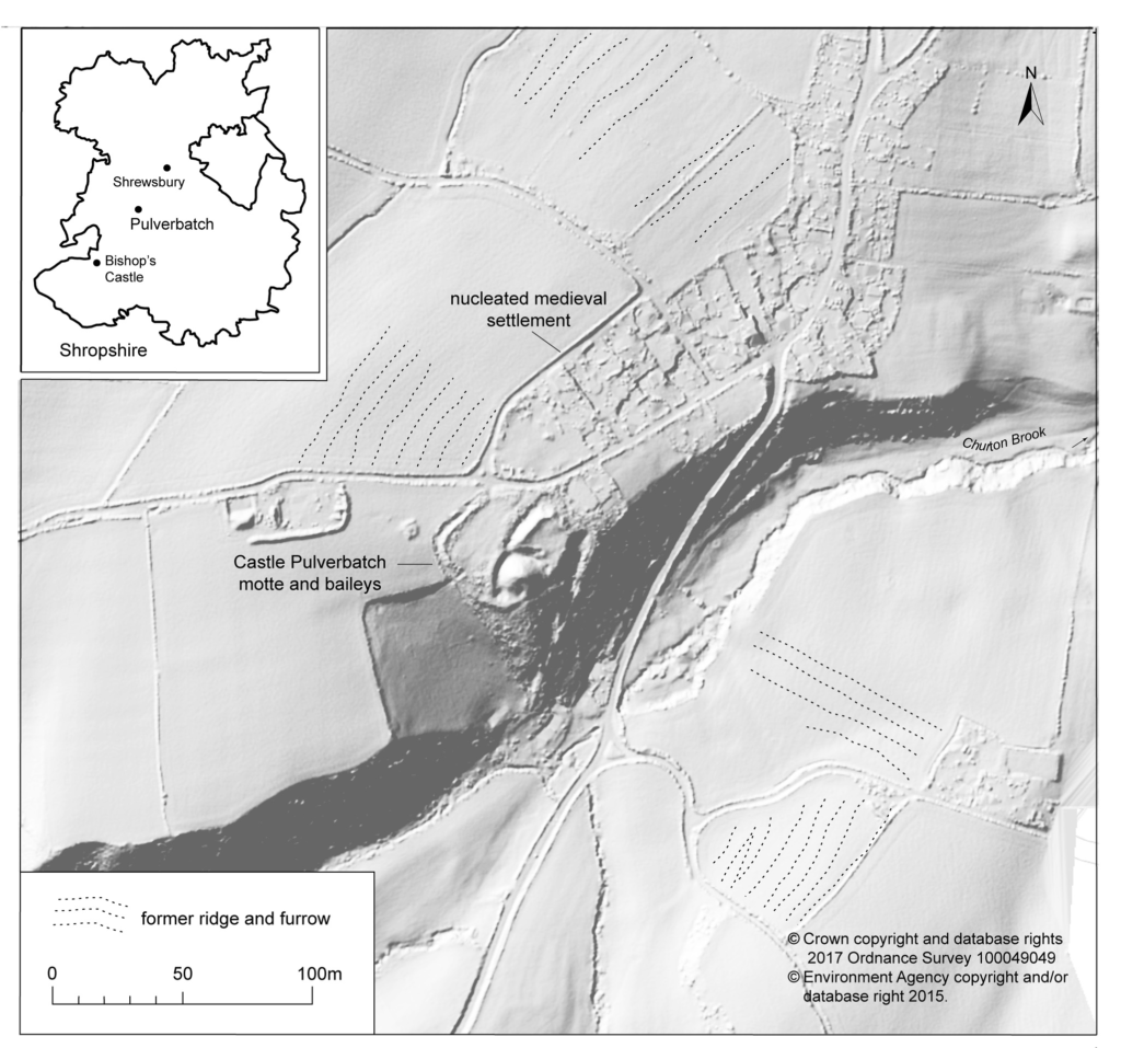
Giles Carey project lead for the Castle Pulverbatch survey, funded by the Castle Studies Trust, presents an overview of the wider settlement context for the motte and bailey at Castle Pulverbatch, central Shropshire.
“It is a truism that medieval castles ‘dominated’ their landscapes. But this apparently simple statement obscures, and indeed misrepresents the many and varied ways in which castles were both embedded in the medieval landscape and contributed to its evolution and character.” (Creighton and Higham, 2004: 5).
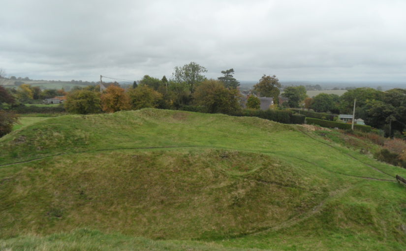
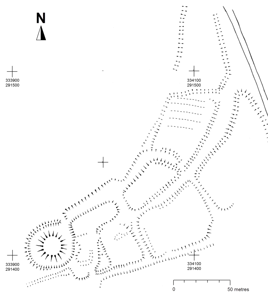
Pulverbatch is a village situated in central Shropshire, about 13km southwest of Shrewsbury on a minor road from Shrewsbury to Wentnor. The modern village is formed of two distinct centres, with a small nucleated settlement around the church (Church Pulverbatch, known as ‘Churcheton’, then Churton since at least the 13th century (Gaydon, 1968: 138)), and Castle Pulverbatch lying c.1km to the SW. One of Shropshire’s best-preserved motte and bailey castles is situated on the edge of a small steep-sided ridge at the southern end of the village (figure 1).
The castle comprises a roughly circular motte, with a base diameter of 35m standing up to 8m high, constructed on the edge of a ridge to make the best use of the natural topography. A substantial ditch 7m wide and 2.6m wide, with a counterscarp bank 4m wide and 0.8m high, separates the castle motte from the flat ground to the west. The inner bailey, situated to the north-east of the motte, is roughly rectangular in plan. It measures 28m north-east to south-west by 30m south-east to north-west. Around its north-west and north-east sides, the bailey is defended by a substantial bank up to 10m wide and 4.2m high on its outside, 1.5m high on its inside. The south-east side of the inner bailey is not defined by a bank but makes strategic use of the natural topography to provide a defendable location. The outer bailey, standing to the west, is, by contrast, defined by much slighter defences. This difference in construction has been suggested as indicating a two-phase construction for the site, with the outer bailey representing the enlargement of a compact and strongly defended initial structure (Stillman, 1980: 3). The outer bailey extends 80m north-south by 40m east-west. A defensive bank up to 6.5m wide and 1.4m high runs along its north-west side, defining a deep hollow-way which runs adjacent to the field boundary in this location.
Strategically, the castle occupies a dominant location on the edge of a spur extending south from the village of Castle Pulverbatch. From the top of the motte, views run along the valley of the Churton Brook, and cover the road network (figure 2). It has been suggested that the castle could have provided a control point over “the route from hill country to the Severn valley, perhaps levying a toll on traffic” (Stillman, 1980: 18).
Castle Pulverbatch is typical of rural earthwork castles in Shropshire and the wider Marches. It appears to form an outlier for a concentration of 12 similar motte and baileys in the Vale of Montgomery, from Montgomery in the south-west to Caus in the north-east (Cathcart King and Spurgeon, 1965). These small, rural castles have a number of key characteristics – mottes with a very restricted top, which would have been capable of carrying only a small structure – a ‘blockhouse or pill-box’ as Cathcart King and Spurgeon refer to them, overlooking strategic points on the road network. Pulverbatch certainly meets this criterion – it’s motte ‘dominates’ routeways at the northern approaches to the Long Mynd and the western flank of the entrance to the Stretton Valley.
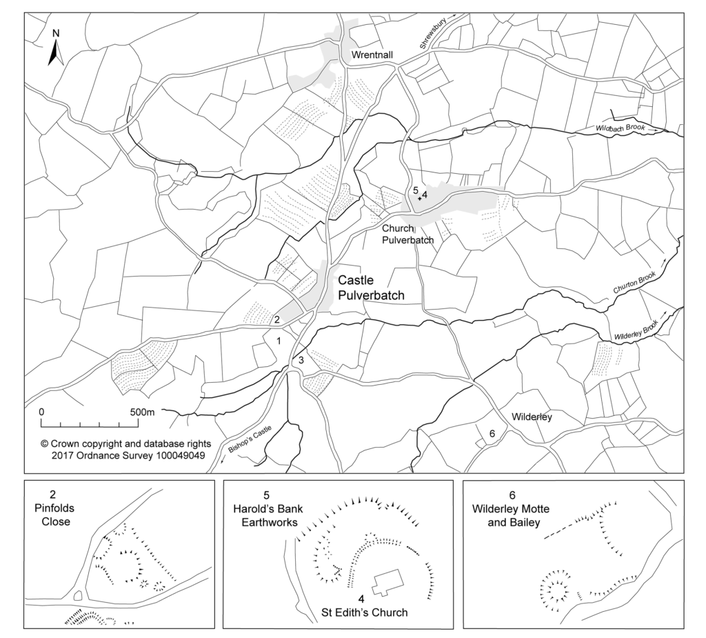
In 2017-2018, The Castle Studies Trust, and the Shropshire Archaeological and Historical Society provided grant-funding for geophysical surveys on the site, together with a level 2 earthwork survey using photogrammetry (Donaldson and Sabin, 2017; Stanford, 2017; Ashby, 2018). The results of this work were informative, and suggestive of a substantial building, measuring 22m by 18m in the inner bailey. Background research, however, drew attention to the wider landscape. It soon became clear that the story of the castle would only be ever half-complete if one focused on the earthworks and buildings of the inner and the outer bailey. The inter-relationship between the motte and bailey, its associated settlement and the parish church of St. Edith was evidently worthy of further exploration (figure 2).
Castle, settlement and church
Pulverbatch is first mentioned in the Domesday Survey of 1086 when it appears as ‘Polrebec’. The name derives from Old English, a combination of pulfre of unknown meaning and bǣce meaning stream valley (Gelling 1990, 245–7). At Domesday, the manor of Pulverbatch, combining both modern settlements of Church and Castle Pulverbatch, was held by Roger Venator [The Hunter]. Roger Venator was a tenant of Roger de Montgomery, Earl of Shrewsbury. Along with his brother Norman, he was a huntsman for the Earl and was consequently granted land in the Shropshire forests. He also held nearby Wrentnall.
Domesday records Pulverbatch as comprising two hides of land which paid tax, and there was land for five ploughs: two ploughs in the lordship with four slaves, while seven villagers had a further three ploughs between them. There were also two ‘radmans’ [riding men – the lord’s servants] in the manor. There was enough woodland for the fattening of 100 pigs. Before 1066, the manor had been worth £6 in tax; that had dropped to 20s in 1066, but by 1086its value had risen to 30s (Eyton 1854, 189).
The evidence suggests that the castle was built towards the end of the 11th century, either by Roger Venator or his son, also called Roger. Castle Pulverbatch is one of eighteen or more earthwork castles in south-west Shropshire that were built by the first Norman lords installed by Roger de Montgomery, himself one of three key lieutenants installed by William the Conqueror following rebellions in the Welsh Marches in the later 1060s. Documentary sources refer to the castle still being occupied in 1205, but there is no trace of a manor-house here in documents of 1292 (Gaydon 1968, 131).
Another motte and bailey lies 1.2km to the south-east, north of Wilderley Hall Farm (Figure 3, site 6), which at Domesday was held by another minor tenant of Roger of Montgomery, Hugh Fitz Turgis (Eyton 1854, 258). Probably, like Castle Pulverbatch, Wilderley was positioned strategically to command a route running northwards from the Long Mynd towards the Severn Valley (Gaydon 1968, 132). Little is known about the history of Wilderley so establishing any chronological link between the two castle sites remains challenging.
In 1254 Philip Marmion was granted the right to hold a weekly market at Pulverbatch on Mondays, and an annual three-day fair around the day [16th September]of St Edith the Virgin’, to whom the church in Church Pulverbatch was dedicated (Eyton 1858, 197).
At an inquest on the death of Philip Marmionon January 14 1292, his estate at Pulverbatch included a ‘capital messuage [house, yard, outbuildings and land], a carucate of arable land, and two acres of meadow. A Mill realised 30s…’ (Eyton 1858, 199). The latter was presumably on the site indicated by slight earthworks in a field identified on the tithe map as Upper Mill Meadow (Figure 3, site 3).
There is no clear dating evidence concerning settlement at Pulverbatch. The chronological picture is further complicated by the suggested early date for a church at Church Pulverbatch (Figure 3, site 4). The present building is medieval in origin, although it was largely rebuilt in 1853 (Newman and Pevsner 2006, 203–4). (A lovely watercolour of the pre-19th century form of the church is held by Shropshire Archives, and a small version can be accessed via their online catalogue: https://www.shropshirearchives.org.uk/collections/getrecord/CCA_X6001_19_372B_4)
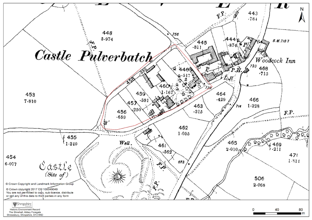
Figure 4 – 2nd edition 1:2500 Ordnance Survey map of 1903, showing suggested extent of settlement to immediate NE of the Castle site.
The church lies within a circular, embanked churchyard, which has been suggested as indicating an early, possibly pre-conquest origin, drawing upon other examples from the Marches (Rowley 1972, 81), although this hypothesis is untested in the county (see Ludlow 2009, 71-76 for discussion of examples from south-west Wales). A number of other circular churchyards are known in Shropshire (Cardeston, Stanton upon Hine Heath, Llanymynech, Loppington and Leighton, inter alia), but the importance of that at Pulverbatch is heightened by the presence of additional earthworks to the north of the churchyard, occupying a high point within the wider landscape (Figure 2, site 5).
A number of authors have speculated about the development of the medieval settlement sited immediately north and west of the castle (figure 4). Little earthwork evidence survives of this settlement, although a slight bank was recorded in the 1980s by Stillman on a triangle of land known as Pinfold’s Close, directly to the north of the castle’s outer bailey. This triangle was suggested as a possible plot division (see Figure 2, site 2) and subsequently recorded as a property/field boundary by Wendy Horton on a site visit in 1991 (Shropshire HER PRN 03703). Sadly, this area has been extensively disturbed since then, and little trace of any earthworks was found during the 2017-2018 survey work.
Higham and Barker see the village ‘growing up around a castle founded in previously open countryside’ (Higham and Barker 1992, 200) while Rowley suggests that its regularity indicates a deliberately planned settlement unit laid out by the lord of the manor in the 12th or 13th century (Rowley 1972, 86). Creighton goes further in identifying the development at Castle Pulverbatch as representing a nucleation point, “a regular settlement” growing up adjacent to the “new seigneurial centre” (Creighton 2002, 203). This would accord well with the manor of Pulverbatch becoming the caput baroniae, or principal manor of the baronry of Pulverbatch by the end of the 12th century (Gaydon 1968, 131). Stillman suggests that the settlement around the castle may have been a fairly speculative endeavour from the lord of the manor that was ultimately unsuccessful, with settlement shifting downhill to the modern settlement at Church Pulverbatch (Stillman 1980, 18). There is no evidence of the settlement at Castle Pulverbatch ever expanding into ‘anything more than a small farming community’ (Gaydon 1968, 132).
This relationship between the development of a settlement, and the development of a castle site has been little explored in the region. Whilst the extensive work at the motte-and-bailey site of Hen Domen in the 1970s revolutionised our understanding of the likely former structural complexity of timber castles in general (Higham and Barker, 1972), there has been little opportunity to further investigate the significant group of motte and bailey castles in the Vale of Montgomery and SW Shropshire, including inter-relations between settlements and castle.
Some of these complexities can be seen at the site of Caus Castle, was subject to a detailed programme of earthwork and geophysical survey in 2016, also funded by the Castle Studies Trust (Fradley and Carey, 2016). Although a castle of quite different status, size and setting to that at Pulverbatch, work here provided evidence of a castle, borough, market (and later fair) in states of flux, and indicated that the fortunes of the castle and the fortunes of the town were not always aligned.
A number of other small, earthwork castles in this part of the march would repay such further study. We might think the castle at More, for instance. A motte and bailey castle developed here from an earlier ringwork castle, with its associated earthwork remains of a deserted settlement, with the remains of house plots and toft boundaries (figure 5).
Non-intrusive landscape survey, as funded by the Castle Studies Trust, allows us to place these sites in some context, and allows a glimpse at the bigger seigneurial, tenurial and topographic picture of these earthwork castles.
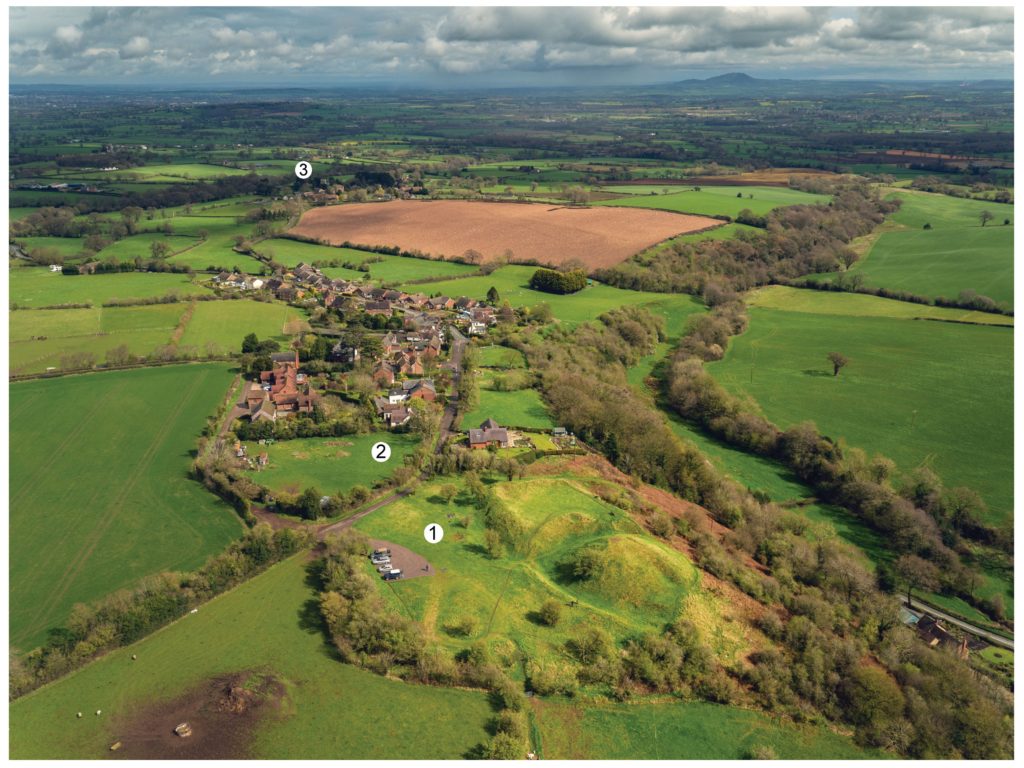
Featured image Castle Pulverbatch bailey from motte top.
Bilbliography
Ashby, D., 2018. ‘Castle Pulverbatch, Shropshire: Ground Penetrating Radar Report’, unpublished report, ARCA, University of Winchester.
Carey, G., 2018. Capturing the Castle: recent survey work at Castle Pulverbatch Motte and Bailey, Shropshire, Transactions of the Shropshire Archaeological and Historical Society93 pp.31-44
Cathcart King, D. and Spurgeon, C., 1965. ‘The Mottes in the Vale of Montgomery’, Archaeologia Cambrensis 114 pp.69–86.
Creighton, O. H., 2002. Castles and Landscapes. London: Continuum
Donaldson, K., and Sabin, D., 2017. ‘Castle Pulverbatch Motte and Bailey, Shropshire: earth resistance & magnetometer survey report’, unpublished report, Archaeological Surveys Ltd., report no. J708. Shropshire HER ESA 8253.
Eyton, R., 1854. Antiquities of Shropshire Volume 6. London. John Russell Smith.
Fradley, M. and Carey, G., 2016. ‘Archaeo-topographical survey: Caus Castle, Westbury — a preliminary report’, unpublished report. Shropshire HER ESA 8179.
Gaydon, A. (ed.), 1968. The Victoria History of Shropshire: Volume VIII. London. Oxford University Press.
Gelling, M., 1990. The Place Names of Shropshire. EPNS, Vols. LXII/LXIII (Part One).
Hannaford, H., and Silvester, R., 2015. ‘Desk-based studies of four castles in the Welsh Marches: Castle Pulverbatch, More Castle, Wilmington Castle & Hyssington Castle’, unpublished report, SCAS, report no. 371. Shropshire HER ESA 7514.
Highham, R. and Barker, P., 1992. Timber Castles. Exeter: University of Exeter Press
Ludlow, N., 2009. Identifying Early Medieval Ecclesiastical Sites in South-West Wales In: Edwards, N. (ed.) The Archaeology of the Early Medieval Celtic Churches London: Routledge, pp.61–84.
Pevsner, N. and Newman, J. 2006. Buildings of England: Shropshire. London: Yale.
Rowley, T. 1972. The Shropshire Landscape. London: Hodder and Stoughton.
Stanford, A., 2017. ‘Castle Pulverbatch Processing Report’, unpublished report, Aerial Cam, report no. C-P-01042017. Shropshire HER ESA 8254.
Stillman, N., 1980. ‘Castle Pulverbatch: a field survey of a motte and bailey earthwork in Shropshire’, unpublished report, University of Birmingham. Shropshire HER ESA 1137.
Thorn, F., and Thorn, C. (eds), 1986. Domesday Book: Shropshire. Chichester
In 2018 Historic England commissioned reports to be carried out on Gleaston Castle near Ulverston, where the Castle Studies Trust have previously funded a survey of the site. The reports commissioned by Historic England were led by Chloe Granger of Crosby Granger Architects, and included a condition survey and concept feasibility study. The feasibility study was aimed at reviewing any potential repair and/or development that could allow the site to become sustainable.
Formerly, in 2015 the Castle Studies Trust grant-funded preparatory works at Gleaston Castle that included a Conservation Statement, geophysical surveys and 3D imagery, to begin the process of understanding more about the castle and its development. From this initial research, the follow-up condition survey and feasibility study prepared by Chloe and her team sets the scene for future repair works and lays the foundations for a potential sustainable future.
Gleaston Castle, listed Grade I and Scheduled under the Ancient Monuments and Archaeological Areas Act, is located on the Furness Peninsula, Cumbria in what appears to be a remote location and strange position for a fortified castle. It is an enclosure castle dating to the 14th century, now a ruin, and has been recorded as such since the mid-16th century. The location on the Furness Peninsula would have historically been less remote, as access was via boat or by crossing the sands of the Morecambe Bay estuary at low tide – a mere short walk.
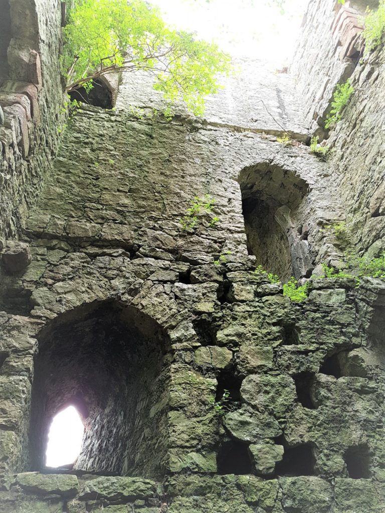
Gleaston Castle: south east tower interior. Copyright Chloe Granger
The exact date of construction of Gleaston Castle is not known; it was almost certainly built by John Harrington (knighted in 1306) and marked a move from the earlier coastal manorial residence at Aldingham, which had passed to the Harringtons in 1291, possibly in part prompted by early-14th century Scots raids. A date of c1325 is sometimes quoted although the earliest documentary reference is in the 1350s; several sources suggest that it was never finished. It appears to have been abandoned as a manorial residence after the death of Sir William Harrington in 1457 and c1540 it was recorded by Leland as lying in ruins, although some parts may have been re-occupied in the 17th century.
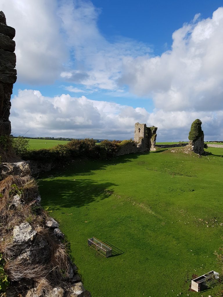
Gleaston is the probably nearest approach to a ‘quadrangular’ castle of a type more common in the North East, and typical of the earlier 14th century. It is not an exact rectangle in plan – the enclosure, 80 m in length north to south, narrows from 55 m at the north end to 45 m at the south. It has had corner towers, with the north-western, by far the largest, clearly containing the hall and subsidiary apartments.
Gleaston Castle: Great Hall from south east tower. Copyright Chloe Granger
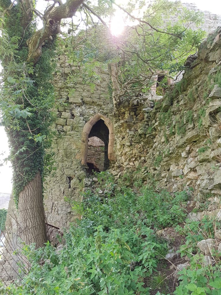
The ruinous remains of the castle are in private ownership, incorporated into a working farm, which makes access difficult for the visitor. The structures are in a perilous condition, with falling masonry not an uncommon sight. General vegetation and rigorous ivy are the main culprits. The ivy on the south-east tower is known to Historic England as the largest, most substantial and ancient ivy known on a structure in the country. The scale of the issue is enormous. There is no management plan and no funding to enable a comprehensive strategy of repair to be carried out to safeguard the structures.
Gleaston Castle: entrance to sw tower. Copyright Chloe Granger
Through Chloe, the Society for the Protection of Ancient Buildings (SPAB) have become involved and are planning a working party to begin to make a start on rescuing the castle. It is a colossal task, but the aim of the working party will be to raise awareness and put Gleaston castle on the map, which the team hopes will generate support for the cause. The volunteer working party team is hoping to carry out some initial vegetation clearance and some consolidation, with professionals offering their time pro-bono; the first required are an ecologist and an arboriculturalist. The initial working party is planned for September,
If anyone is interested in either contributing time or funds, your support would be greatly appreciated! For more information contact Chloe Granger on chloe at crosbygrangerarchitects dot co dot uk