Ellesmere Castle: geophysics points the way for future investigation

Local volunteers Gary Bick and Nick Cull along with Heneb archaeologist Chris Matthews look at the new survey work funded by the Castle Studies Trust that has helped clarify the buried archaeology of Ellesmere Castle, including the likely extent of its bailey.

Subscribe to our quarterly newsletter
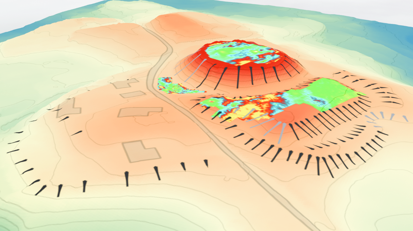
Figure 1: Aerial plan of Ellesmere Castle overlaid with the results of the geophysical survey results. Copyright Heneb

Local Beginnings

Ellesmere is a small market town in Northeast Shropshire, close to the England: Wales border, well known for its meres and the Llangollen Canal which passes by the town. Disappointingly, Ellesmere Castle does not figure significantly in any publicity or description of the town, not least because there are no physical remains other than a large motte, now used as a bowling green, and earthworks defining the bailey.

The Castle was probably built towards the end of the 11th Century and played a part in the Marcher disputes between England and Wales. Most notable among its “owners” was Llewelyn, Prince of Gwynedd who had been given the castle by King John as a wedding gift when he married John’s daughter Joan. The castle appears to have fallen into disuse by the late 15th Century , Leland recording that there “used to be a Castle” at Ellesmere, in the mid 16th Century.

Subscribe to our quarterly newsletter

The castle site presumably lay deserted for a couple of hundred years until the late 17th/early 18th Century when a bowling green was created on the motte. Crown bowls have been played there ever since, making it almost certainly unique as the oldest crown green bowls in the country played on a circular motte.
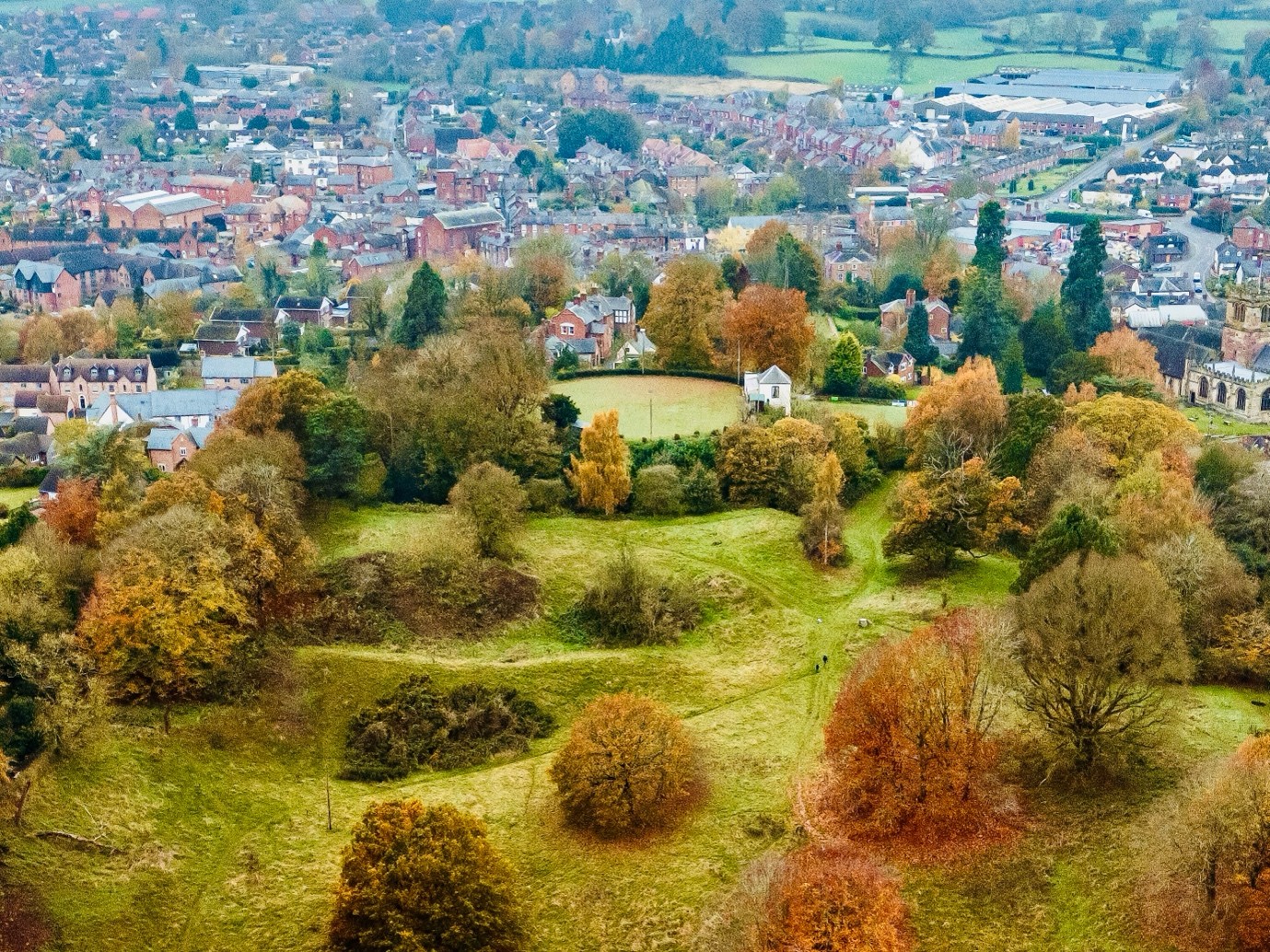
Figure 2: View of Ellesmere Castle from the east, showing motte, bailey and earthworks. Copyright Joe Bickerton Photographs

And so it was in the summer of 2023 that Gary Bick and Nick Cull, Ellesmere residents, were playing bowls at the castle site and started a conversation as to why no significant efforts had ever been made to look for evidence about  the configuration and construction of the castle. That led to the involvement of, and valuable advice from, Dr Nigel Baker via the Shropshire Archaeological and History Society, and Christopher Jobson, local historian. Wider conversations about funding and next steps then led to a stroke of huge good fortune with a ground penetrating radar survey of the motte donated by Adam Cook of Subsurface Measurement Technology in 2024.

The results of that survey which strongly suggested masonry remains under the motte only served to kindle a greater interest and led to an application for a grant from the Castle Studies Trust.

In May 2026, Heneb: The Trust for Welsh Archaeology carried out a programme of non-invasive geophysical investigation at Ellesmere Castle in Shropshire, led by Chris Matthews, Senior Project Archaeologist.  Funded by the Castle Studies Trust and undertaken on behalf of Ellesmere Bowling Club and Shropshire Council, the work aimed to improve understanding of a scheduled motte-and-bailey castle and build on Adam Cook’s ground penetrating radar survey of the motte.

Subscribe to our quarterly newsletter

The Expert View

Ellesmere Castle was once an important medieval stronghold within the shifting political landscape of the Welsh Marches. Very little is known of the earliest phases of the site; however, documentary sources indicate that at least parts of the castle had developed beyond an original earth-and-timber phase into a stone-built fortification, comparable with other nearby marcher sites such as Knockin, Whittington and Oswestry. Today, however, no masonry is visible above ground. This does not appear to have resulted from Civil War destruction, as is often the case elsewhere; instead, later accounts suggest that much of the castle had already been dismantled by the 16th century. The new surveys therefore offered an opportunity to assess whether buried remains of the castle still survive.

The investigation combined several complementary techniques. High-resolution magnetic gradiometry was used across the accessible parts of the motte, bailey and surrounding open ground, while targeted electrical resistivity survey helped test areas where stonework or rubble might survive. The new results were also considered alongside the earlier ground penetrating radar data, LiDAR modelling and historic aerial photography.

Each method responds to different buried conditions. Magnetic survey can pick up ditches, burning, ferrous material and disturbed deposits, while resistivity can be  useful for identifying concentrations of stone, with areas that retain moisture often producing contrasting low-resistance responses. Together, these techniques provide a broad picture of what may survive below the present ground surface, while also identifying the questions that only future targeted excavation can resolve.

Subscribe to our quarterly newsletter

Perhaps the clearest geophysical evidence came from the motte itself. Here, the combined survey results point to a substantial rectilinear feature beneath the bowling green visible in all three datasets, probably representing surviving masonry associated with the castle’s keep. The earlier ground penetrating radar data suggest remains beginning at around 1.1m below the surface, with internal voids and associated demolition deposits also indicated (Fig. 1). The GPR also appears to preserve evidence for the probable original outline of the motte summit, adding weight to the interpretation that the establishment of the bowling green significantly reworked the mound by enlarging its usable surface.

Another supporting aspect of this was noted in the GPR interpretation, which in an archaeological context would typically look to higher-frequency data for more detailed responses at shallower depths. At Ellesmere, however, it was the lower-frequency data that produced the most informative results. One possible explanation is that clay capping associated with the later reworking of the mound for the bowling green limited the effectiveness of the radar at shallower depths, meaning that the deeper-penetrating data provided the clearer picture.

Another strong anomaly may represent a well, shown as a consistent void in the GPR, while further responses on the south-eastern side of the motte could reflect shallower structural remains or spreads of rubble. Taken together, the evidence implies strong potential for significant buried archaeology despite the later landscaping, but point to logistical challenges in exposing the remains due to the deep overburden.
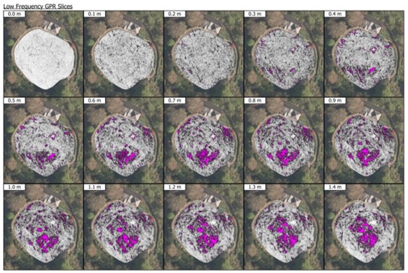
Figure 3: Low frequency time slices of Ellesmere’s motte from the GPR survey by Adam Cooke (2024). Copyright Adam Cook, Subsurface Measurement Technology Ltd

The resistivity survey also identified a substantial anomaly within the currently scheduled bailey, which may represent a buried structure or area of consolidated masonry. Its alignment appears broadly comparable with the principal feature identified on the motte, raising the possibility that it formed part of the castle’s wider built complex, perhaps associated with a forebuilding. This interpretation remains provisional, however, requiring further assessment before its character can be understood with confidence. Additional GPR survey of the scheduled bailey is planned in the near future and should help test whether the resistivity response reflects surviving archaeology, later disturbance or a combination of both.

Subscribe to our quarterly newsletter

One of the most significant results of the project has been to refine the likely extent of the castle bailey. Previous interpretations have noted that the scheduled bailey east and south-east of the motte appears relatively small for a castle of this scale. The new analysis of LiDAR and historic aerial photography now supports a stronger case for a more extensive outer bailey extending south across Sandy Lane.
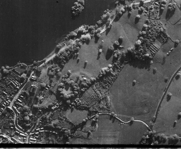
Figure 4: RAF Aerial photograph 1946, Historic England Archive

The possible southern bailey is visible as a raised triangular plateau in the LiDAR data, and its outline appears to correspond with earthworks visible on 1940s aerial photography before later housing development (Fig 3). Although parts of this area have since been affected by terracing, quarrying and modern construction, the alignment of the plateau with the existing earthworks suggests that elements of the larger bailey circuit may still survive. This would place the bailey in close relationship with Sandy Lane, a prominent historic routeway that once connected Ellesmere to the town of Shrewsbury.

This is an important shift in how the monument can be understood. Rather than treating the present scheduled bailey as the whole of the enclosure, the survey establishes a clearer working hypothesis that the medieval castle may have occupied a broader area, with the southern ground forming part of a more substantial bailey deliberately placed over a significant routeway. This gives future research a much firmer starting point.
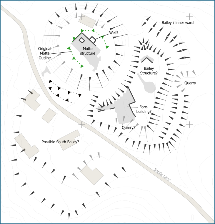
Figure 5: Provisional interpretation of anomalies from the geophysical survey copyright Heneb

What happens next?

The results represent the beginning of a new phase of investigation rather than the final word. Geophysics has shown where significant buried features are likely to survive and has helped refine the questions that now need to be tested. In particular, further work could investigate the substantial structural anomalies on the motte and within the bailey, examine the possible well, and test the proposed southern extension of the bailey.

Any future intrusive investigation would need to be carefully targeted and agreed with Historic England, given the site’s status as a scheduled monument, and the Ellesmere Bowling Club as the green is in regular use throughout the season and quality ground reinstatement would be crucial. The value of the present work is that such investigations can now be planned from a stronger evidence base, focusing on the features most likely to answer key questions about the castle’s form, development and survival.

The survey has demonstrated that Ellesmere Castle retains considerable archaeological potential. It provides a carefully evidenced starting point for the next stage of research into one of Shropshire’s lesser-known but historically significant medieval castles.

Subscribe to our quarterly newsletter

You can read the full report here: Geophysical Survey of Ellesmere Castle, Shropshire | Castle Studies Trust
Leybourne Castle gatehouse, Kent: patterns of baronial influence

Starting on 8 October 2024, Philip Poucher of Heneb – Dyfed Archaeology (formerly Dyfed Archaeological Trust) will carry out a laser-scan survey of the gatehouse at Leybourne Castle, near Maidstone in Kent. The survey will be supported by a full programme of research by Neil Ludlow who outlines the importance of such a survey.

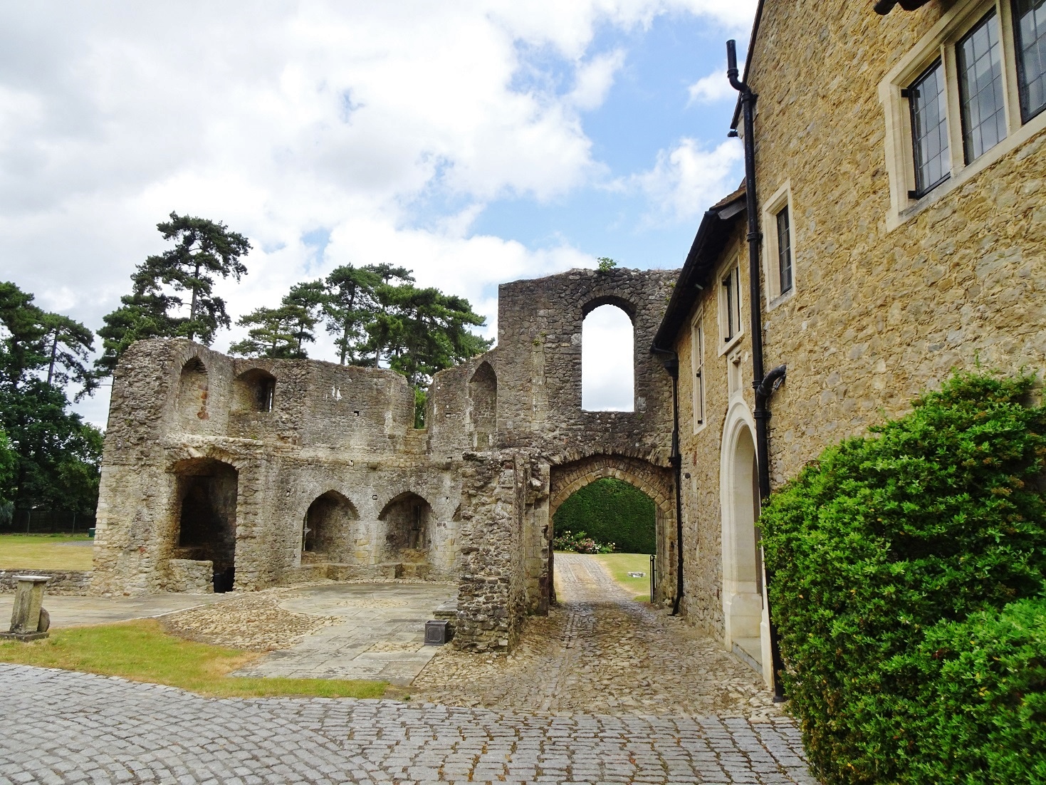
A small baronial castle, picturesquely sited on a low bluff above the village church, Leybourne has been occupied since it was built in the 11th or 12th century, and is still a private family home. It is not generally open to the public and no structured recording has so far taken place, while no accurate site drawings exist. The work, which is wholly-funded by the Castle Studies Trust, will fill this gap and greatly improve our understanding of this important site.

Subscribe to our quarterly newsletter

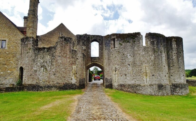
Fig. 1: Leybourne Castle – the gatehouse from the exterior. Present house to left,
latrine turret to right. Copyright Neil Ludlow

Beginning as a circular ringwork of around 0.12 hectares, Leybourne was later given stone defences, with a gatehouse that still dominates the castle. Centuries of alteration have masked much of the rest of the surviving stonework, but the present house – heavily restored during the 1930s in the Arts-and-Crafts manner – is built around the core of the medieval hall and chamber-block. A further building is thought to have been the chapel, while there are the remains of at least one other mural tower.

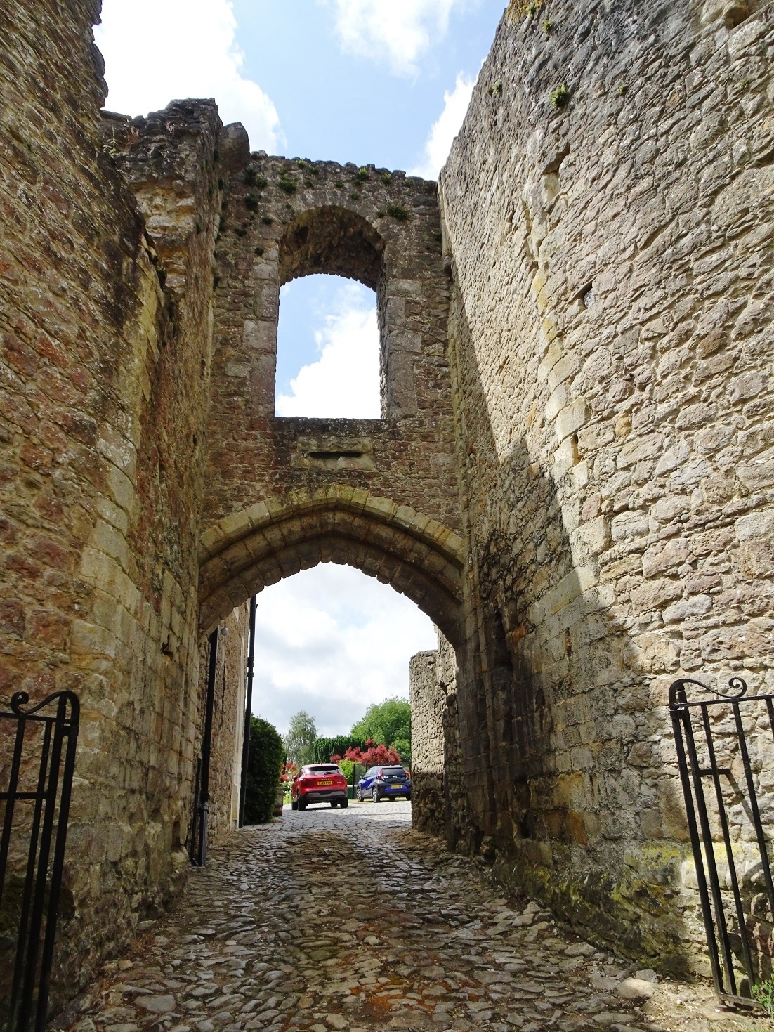
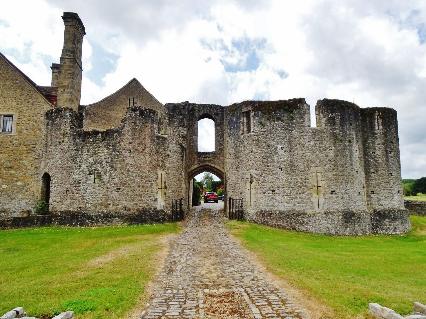
Fig. 2: Leybourne Castle – the gatehouse from the interior. Latrine turret to left,
present house to right. Copyright Neil Ludlow

The date of these works is still uncertain. Our only record is from 1266, when King Henry III granted 4000 freestones to Leybourne’s lord, Roger de Leybourne. They are normally thought to have gone towards the defences, but these are entirely of rubble construction suggesting that the freestone may instead relate to an upgrade of the domestic buildings. So the key to understanding the development of the defences is the gatehouse, which despite alterations through time, and the loss of its rear half, is substantially as built. Nevertheless, its precise form has never been properly established – published accounts are based on drawings produced by Sidney Toy, in 1927, which are somewhat misleading in many important details.

The gatehouse is of unusual design. It has been regarded as transitional between the simple twin-towered gatehouses of the early/mid-13th century and the more complex structures of the late 13th century onwards, but appears to be somewhat later. It is two storeys high, with D-shaped towers flanking a narrow gate-passage that was formerly rib-vaulted. The entry lies beneath a high outer arch and is deeply set back between the towers, characteristics that were both introduced, in Wales, during the 1280s. And the entrance arch lies beneath a horizontal chute outlet, somewhat like a letterbox in outline. This is a feature of debatable function, but which was notably employed at Caerphilly Castle by Gilbert de Clare in the 1270s. In addition, the gatehouse towers are of unequal size and projection, as in the Clare’s gatehouse at Llangibby Castle (Monmouthshire), probably built c.1307-14, while both gatehouses show a D-shaped flanking latrine turret. Incorrectly shown by Sidney Toy, it lies parallel to the towers at Leybourne, unlike Llangibby where it projects at right-angles. And while the arrowloops at Leybourne were restored as fully-oilletted ‘Clare-style’ cross-loops in Toy’s drawings, alteration during the 18th and 19th centuries has in fact masked their original form and the evidence for any original oillets is questionable.

Fig. 3: Leybourne Castle gatehouse – the ‘letterbox’ chute.

So the gatehouse has a highly individual design, which is of international significance. While it may largely be down to personal choice by its patron and master-mason, at least some influence from the Clares is unquestionable. This may have emanated directly from the Clares’ nearby centre at Tonbridge, but Welsh aspects of the Leybourne design may point towards additional input via an intermediate lord such as William de Valence, who also used ‘Clare’ motifs and was very powerful both in Wales and in this part of Kent. At any rate, the combination of features suggests a date long after 1266 and probably in the early 14th century – perhaps under Roger de Leybourne’s son William, or his grandson Thomas, between c.1300 and 1310. However, on current evidence much of this is speculative: these are the key questions the project will seek to answer, in addition to producing survey data.

Subscribe to our quarterly newsletter

Please note Leybourne is a privately owned house and is not accessible to the public.

Commemorating Bedford Castle on the 800th anniversary of the great siege of 1224

On Saturday, 24 August, the Higgins Museum in Bedford hosts an event to mark eight centuries since the town’s castle was subject to an 8-week long siege by the army of the teenage King Henry III (booking details at the end). Dr Peter Purton, FSA, outlines what happened in the siege.

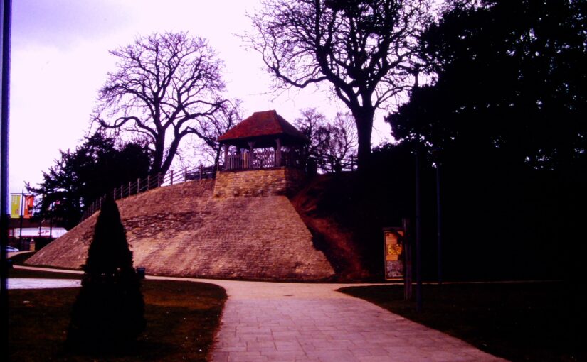
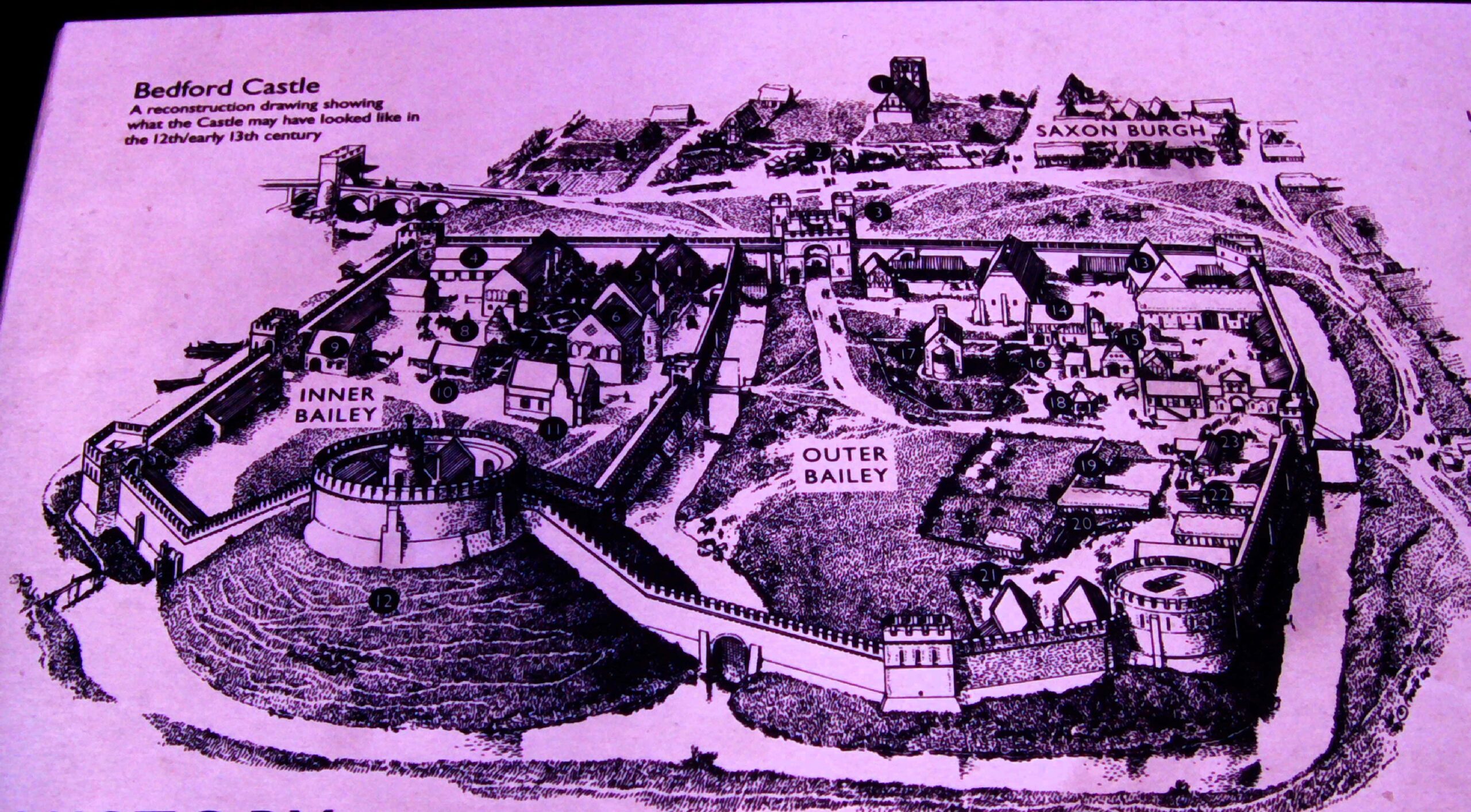
Not much remains now of Bedford Castle – just a degraded and much altered mound near the river Great Ouse in the town centre and a few excavated fragments of stone buildings, making it hard to visualise that it was once a large stone-built fortress with a moat, barbican, two wards and a stone tower on top of the motte which marked the original castle built after the Norman Conquest. A display board nearby reconstructs its possible appearance in 1224.

Subscribe to our quarterly newsletter

Image of display board showing how Bedford might have looked in 1224

 In that year, Henry III was assembling an army which was to be transported to France in an attempt to recover Poitou, part of the once extensive Angevin empire. This plan unravelled with the rebellion of Fawkes de Breauté. Fawkes had been one of the captains of King John, Henry’s father, and had become rich and powerful. He had been granted Bedford castle and we are told that he had strengthened the fortifications to make it “impregnable”. Rebelling against the crown, he prudently left the country while leaving Bedford in the hands of his brother, who in arresting the justices sent there by the king made it inevitable that he would face royal retribution: this was a direct insult to royal authority and following years of civil war and rebellion following John’s reign, there was no possibility that it could be ignored. The royal army, assembling conveniently nearby at Northampton, was diverted to Bedford. What happened next was recorded in several contemporary chronicles while royal expenditure was detailed in surviving accounts, a combination of evidence which is rare enough and which allows an unusually detailed reconstruction of the siege.

The royal army deployed seven stone-throwing engines (mangonels and petraries) and built two siege towers but the garrison resisted stoutly and inflicted heavy casualties on the attackers. Eventually the barbican and outer ward were breached and captured by royal soldiers then miners, summoned from the Forest of Dean, brought down the wall of the inner bailey and did the same with the tower on the motte, to which the defenders had withdrawn. The prisoners were set free and the entire garrison was hanged as punishment for their rebellion. The castle was then demolished.  A period of instability in England was thereby ended, but so too was English rule in Poitou, the French capturing La Rochelle at the same time as Bedford was being besieged.

These events were therefore of international as well as national significance, and through archaeology, it is possible to now know much more about Bedford castle. All these themes will be discussed at the conference on 24 August, the speakers are Professor David Carpenter, expert and author specialising in this period, Dr James Petre who has written about Bedford, Ben Murtagh who has been exploring Bedford Castle, Jeremy Oetgen (Albion Archaeology) who will update us on a long history of archaeology on the site, and the author of this blog who will place the siege in the context of contemporary siege warfare.

Anyone interested in attending can find all the details and book a ticket at the museum website: www.thehigginsbedford.org.uk. Tickets cost £15 and advance booking is encouraged.

Subscribe to our quarterly newsletter

Marlborough Castle: the missing keep

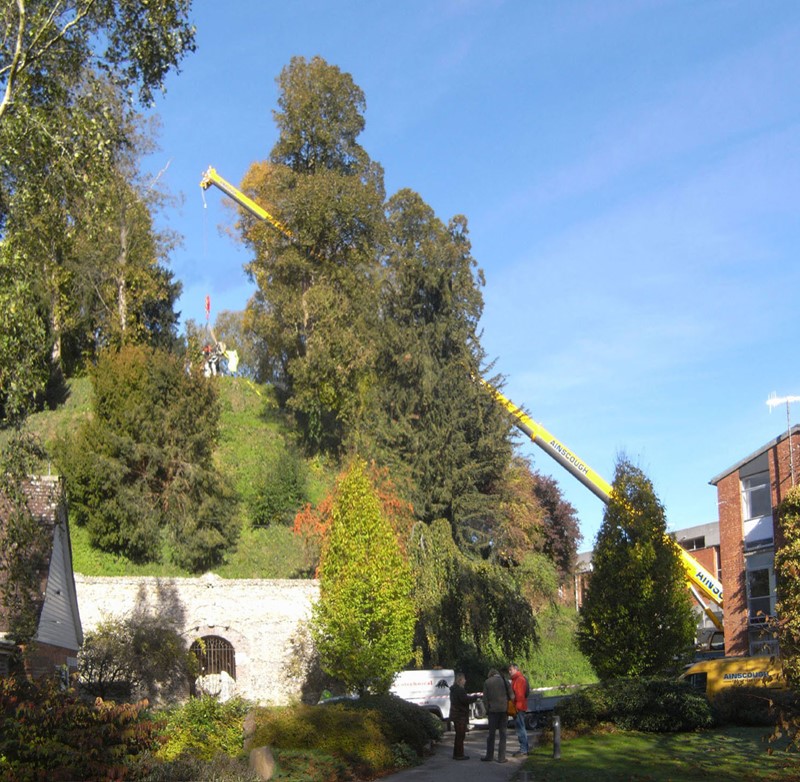
Over the last two decades, the Marlborough Mound Trust has carried out extensive conservation and investigations on the ‘mound’ in the grounds of Marlborough College. The origins of the mound were uncertain until recently. It was known to have been part of Marlborough Castle, but there had been persistent speculation, on the strength of its resemblance to neighbouring Silbury Hill and the discovery of antlers in the early twentieth century (now lost) that it was of prehistoric origin. In 2008, when Silbury Hill was being investigated, the opportunity of taking cores from the mound to obtain comparative dates presented itself. After a precarious operation involving a very large crane, the necessary drilling rig was hoisted to the top of the mound. The resulting cores, as a paper published the following year by Jim Leary and his colleagues showed, supported a date in the second half of the third millennium BC, broadly contemporary with Silbury Hill.

The drilling rig for the coring operation is hoisted into place (copyright Marlborough Mound Trust)

Jim Leary has subsequently carried out a survey of some fifty castle mottes, looking for other sites where prehistoric mounds could have been reused as the base for a castle, and has found only one other rather uncertain case. This means that Marlborough may be unique in being a prehistoric structure recycled into a medieval castle.

But we now know more about the prehistory of the mound than the supposed castle keep. The only possible sighting of masonry on the mound is uncertain in the extreme. H. C. Brentnall, a master at Marlborough College, in one of his many contributions to the Proceedings of the College’s Natural History Society on the the history of the castle, had this to say in 1936:

Excavations necessitated by building operations at Marlborough College in the course of this summer have revealed several traces of the medieval castle which perished gradually between the fifteenth and seventeenth centuries. What little remains above ground (if the elevation justifies that expression) is to be seen on the summit of the motte, where a buttress of the keep was laid bare some years ago.

The note implies that the buttress was visible in 1936, but recent geophysical surveys have not found it.

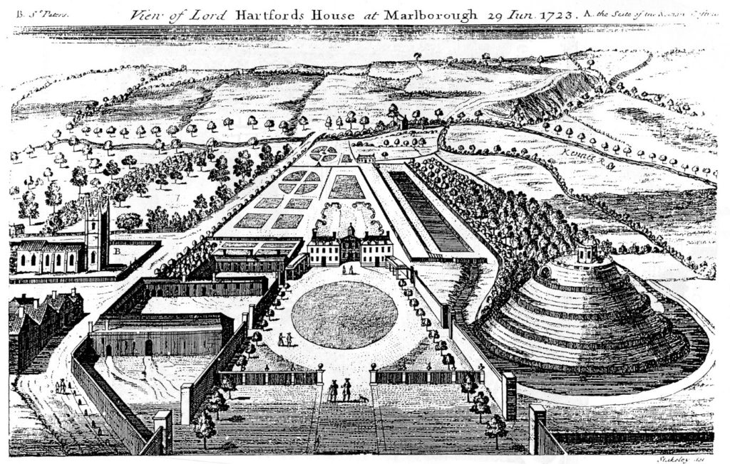
The problem is further compounded by the subsequent use of the mound. It became a garden feature in the seventeenth century, and a spiral was cut into the side of it to give access to a summerhouse at the top. Stukeley’s engraving of the countess of Hertford’s gardens in 1723 shows only the summerhouse, and no traces of masonry.

Stuckley’s engraving of countess of Hertford’s gardens.

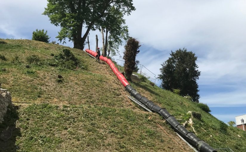
About the same time, a water tank was installed to supply the Hertfords’ newly built mansion. This was enlarged by the College after its establishment in 1843, and adapted over the years, until the top of the mound was graced by a large iron tank surrounded by a spoil bank, concrete steps, and substantial pipework. This meant that in effect most of the original top of the  mound had been destroyed.

This raises the question of what we are looking for. The earliest mentions of the site, in 1070 and 1110, present the king’s establishment as a place of imprisonment and a site where a royal court was held. In the 1140s, Marlborough castle is first mentioned as such. It is described ‘very defensible’ in The Deeds of King Stephen. It was held by John Marshal, who used it to control the surrounding countryside, and there is no record of it ever being attacked.

The only entry in the plentiful records for the castle under Henry II and Henry III is in the context of payments in 1222 for work designed to create a substantial royal residence there. This is a single sum for the building of a lime kiln ‘for the Great Tower’, which must therefore have been of stone. There is no indication where this tower was sited, and it may well have been part of the lower bailey. It has simply been assumed that it was on the mound.

An inconclusive exploratory dig was carried out by Wessex Archaeology for the Mound Trust in 2019, and at the time of writing, it is still hoped that a follow up to this will be possible in 2020. The present assumption is that the mound was among the hastily erected timber forts from immediately after the Norman conquest, and that this was replaced by a stone keep after 1222. It would be good to be able to find some actual evidence as to the nature and even the existence of the keep at Marlborough.

Richard Barber is a trustee of the Marlborough Mound. He would welcome any comments, particularly on the replacement of timber with stone, and the nature of ‘great towers’: email rwbarberuk at yahoo.co.uk.

Subscribe to our quarterly newsletter