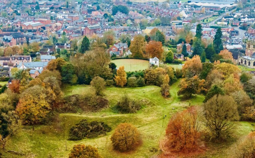
Local volunteers Gary Bick and Nick Cull along with Heneb archaeologist Chris Matthews look at the new survey work funded by the Castle Studies Trust that has helped clarify the buried archaeology of Ellesmere Castle, including the likely extent of its bailey.
Subscribe to our quarterly newsletter
Local Beginnings
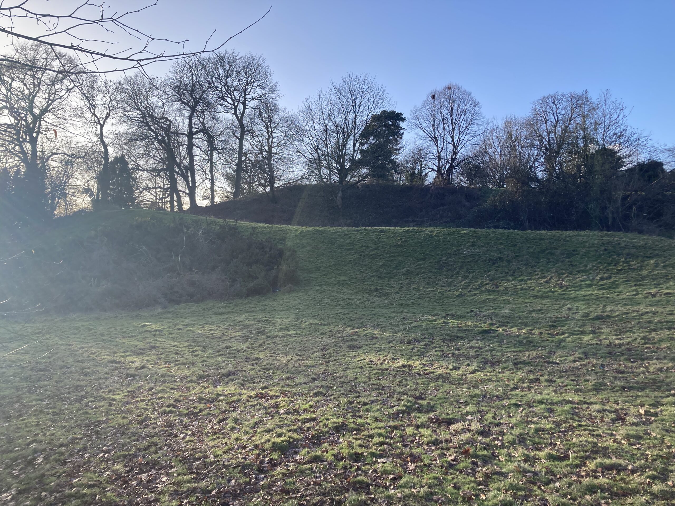
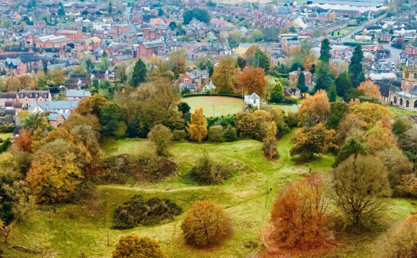
Ellesmere is a small market town in Northeast Shropshire, close to the England: Wales border, well known for its meres and the Llangollen Canal which passes by the town. Disappointingly, Ellesmere Castle does not figure significantly in any publicity or description of the town, not least because there are no physical remains other than a large motte, now used as a bowling green, and earthworks defining the bailey.
The Castle was probably built towards the end of the 11th Century and played a part in the Marcher disputes between England and Wales. Most notable among its “owners” was Llewelyn, Prince of Gwynedd who had been given the castle by King John as a wedding gift when he married John’s daughter Joan. The castle appears to have fallen into disuse by the late 15th Century , Leland recording that there “used to be a Castle” at Ellesmere, in the mid 16th Century.
Subscribe to our quarterly newsletter
The castle site presumably lay deserted for a couple of hundred years until the late 17th/early 18th Century when a bowling green was created on the motte. Crown bowls have been played there ever since, making it almost certainly unique as the oldest crown green bowls in the country played on a circular motte.
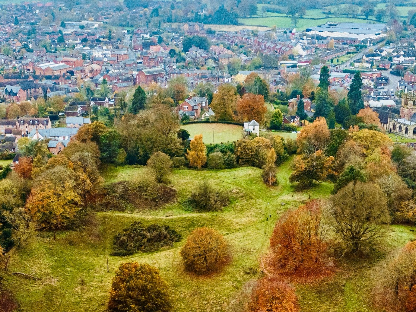
And so it was in the summer of 2023 that Gary Bick and Nick Cull, Ellesmere residents, were playing bowls at the castle site and started a conversation as to why no significant efforts had ever been made to look for evidence about the configuration and construction of the castle. That led to the involvement of, and valuable advice from, Dr Nigel Baker via the Shropshire Archaeological and History Society, and Christopher Jobson, local historian. Wider conversations about funding and next steps then led to a stroke of huge good fortune with a ground penetrating radar survey of the motte donated by Adam Cook of Subsurface Measurement Technology in 2024.
The results of that survey which strongly suggested masonry remains under the motte only served to kindle a greater interest and led to an application for a grant from the Castle Studies Trust.
In May 2026, Heneb: The Trust for Welsh Archaeology carried out a programme of non-invasive geophysical investigation at Ellesmere Castle in Shropshire, led by Chris Matthews, Senior Project Archaeologist. Funded by the Castle Studies Trust and undertaken on behalf of Ellesmere Bowling Club and Shropshire Council, the work aimed to improve understanding of a scheduled motte-and-bailey castle and build on Adam Cook’s ground penetrating radar survey of the motte.
Subscribe to our quarterly newsletter
The Expert View
Ellesmere Castle was once an important medieval stronghold within the shifting political landscape of the Welsh Marches. Very little is known of the earliest phases of the site; however, documentary sources indicate that at least parts of the castle had developed beyond an original earth-and-timber phase into a stone-built fortification, comparable with other nearby marcher sites such as Knockin, Whittington and Oswestry. Today, however, no masonry is visible above ground. This does not appear to have resulted from Civil War destruction, as is often the case elsewhere; instead, later accounts suggest that much of the castle had already been dismantled by the 16th century. The new surveys therefore offered an opportunity to assess whether buried remains of the castle still survive.
The investigation combined several complementary techniques. High-resolution magnetic gradiometry was used across the accessible parts of the motte, bailey and surrounding open ground, while targeted electrical resistivity survey helped test areas where stonework or rubble might survive. The new results were also considered alongside the earlier ground penetrating radar data, LiDAR modelling and historic aerial photography.
Each method responds to different buried conditions. Magnetic survey can pick up ditches, burning, ferrous material and disturbed deposits, while resistivity can be useful for identifying concentrations of stone, with areas that retain moisture often producing contrasting low-resistance responses. Together, these techniques provide a broad picture of what may survive below the present ground surface, while also identifying the questions that only future targeted excavation can resolve.
Subscribe to our quarterly newsletter
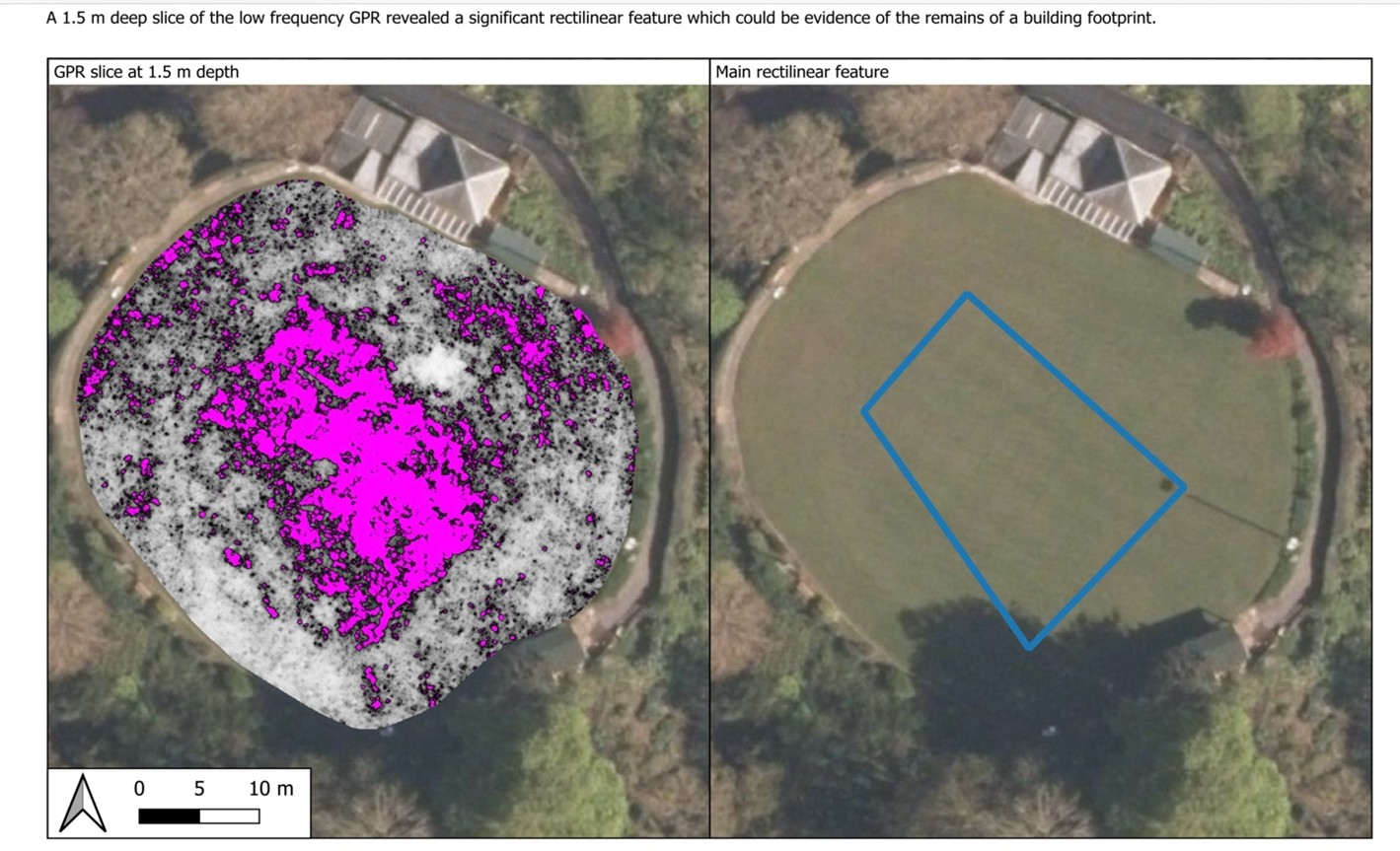
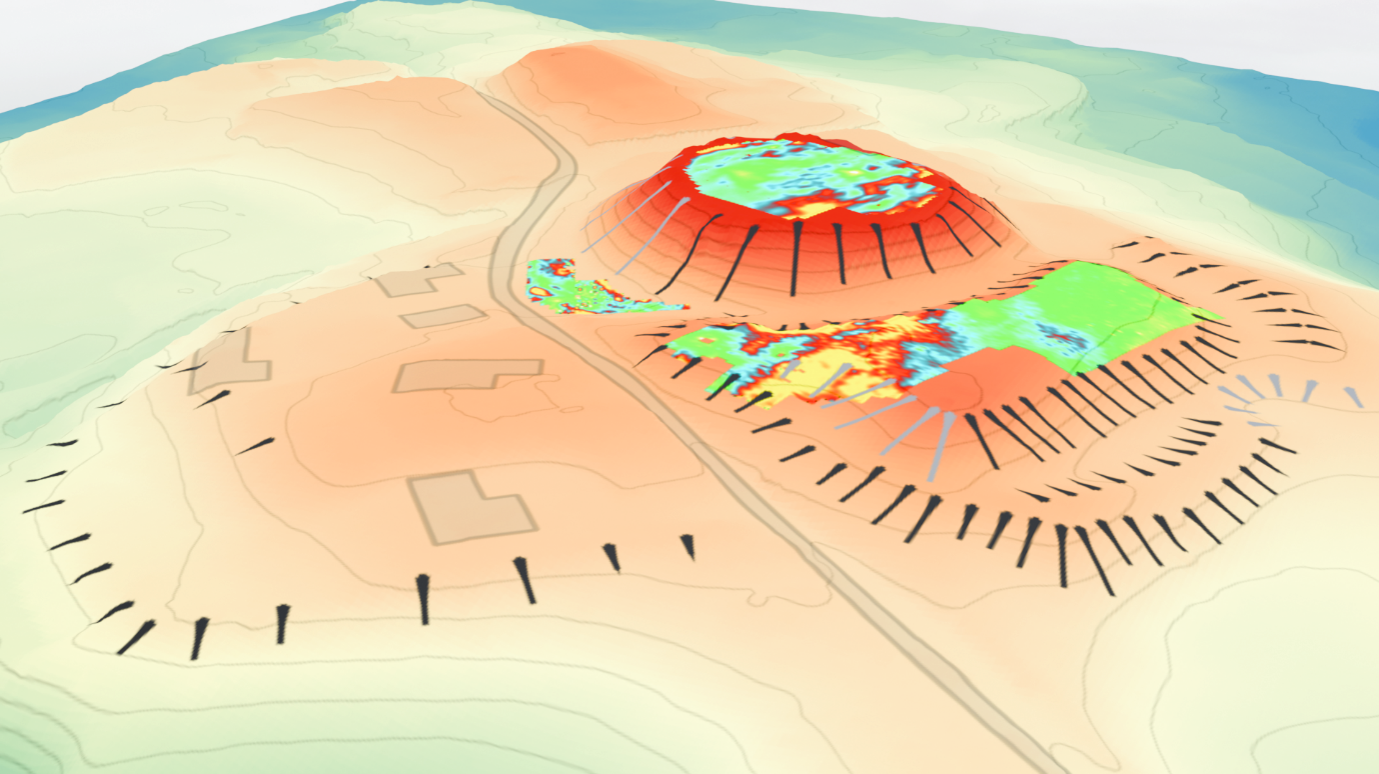
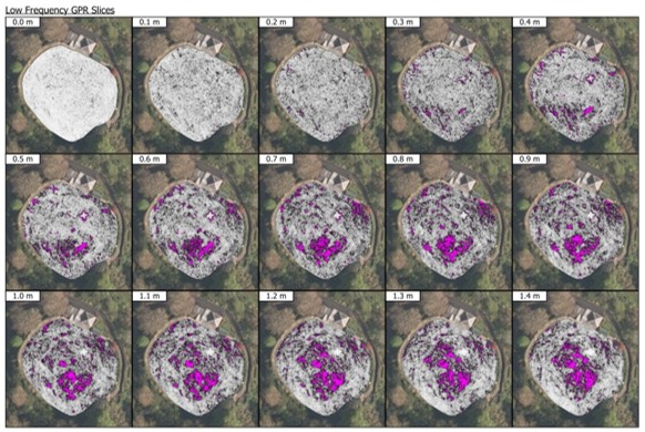
Perhaps the clearest geophysical evidence came from the motte itself. Here, the combined survey results point to a substantial rectilinear feature beneath the bowling green visible in all three datasets, probably representing surviving masonry associated with the castle’s keep. The earlier ground penetrating radar data suggest remains beginning at around 1.1m below the surface, with internal voids and associated demolition deposits also indicated (Fig. 1). The GPR also appears to preserve evidence for the probable original outline of the motte summit, adding weight to the interpretation that the establishment of the bowling green significantly reworked the mound by enlarging its usable surface.
Another supporting aspect of this was noted in the GPR interpretation, which in an archaeological context would typically look to higher-frequency data for more detailed responses at shallower depths. At Ellesmere, however, it was the lower-frequency data that produced the most informative results. One possible explanation is that clay capping associated with the later reworking of the mound for the bowling green limited the effectiveness of the radar at shallower depths, meaning that the deeper-penetrating data provided the clearer picture.
Another strong anomaly may represent a well, shown as a consistent void in the GPR, while further responses on the south-eastern side of the motte could reflect shallower structural remains or spreads of rubble. Taken together, the evidence implies strong potential for significant buried archaeology despite the later landscaping, but point to logistical challenges in exposing the remains due to the deep overburden.
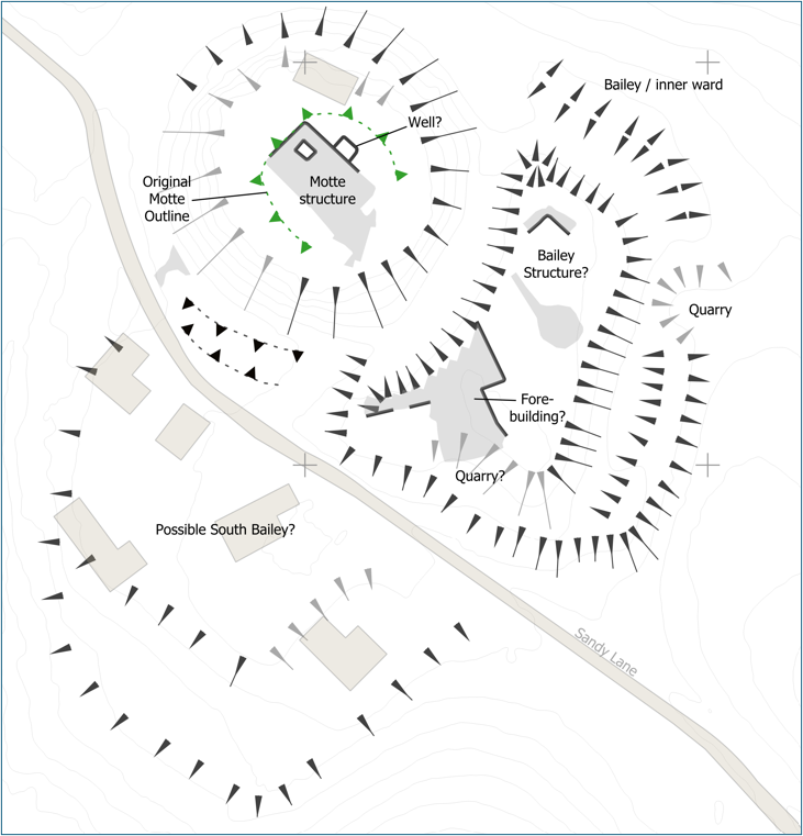
The resistivity survey also identified a substantial anomaly within the currently scheduled bailey, which may represent a buried structure or area of consolidated masonry. Its alignment appears broadly comparable with the principal feature identified on the motte, raising the possibility that it formed part of the castle’s wider built complex, perhaps associated with a forebuilding. This interpretation remains provisional, however, requiring further assessment before its character can be understood with confidence. Additional GPR survey of the scheduled bailey is planned in the near future and should help test whether the resistivity response reflects surviving archaeology, later disturbance or a combination of both.
Subscribe to our quarterly newsletter
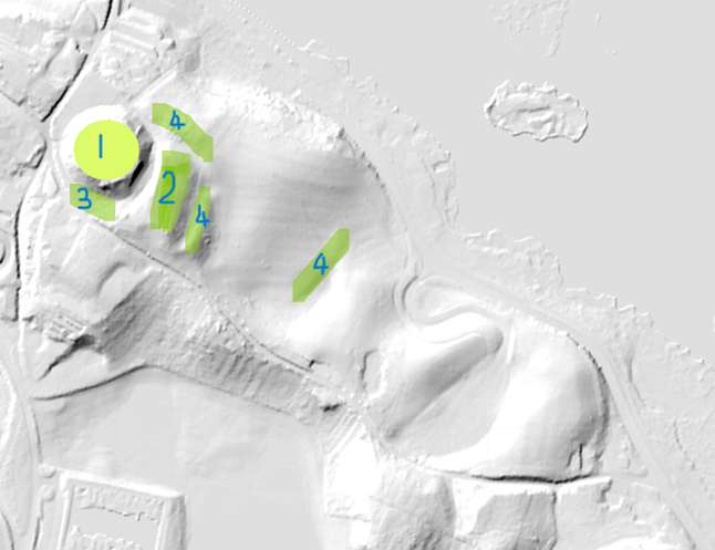
One of the most significant results of the project has been to refine the likely extent of the castle bailey. Previous interpretations have noted that the scheduled bailey east and south-east of the motte appears relatively small for a castle of this scale. The new analysis of LiDAR and historic aerial photography now supports a stronger case for a more extensive outer bailey extending south across Sandy Lane.
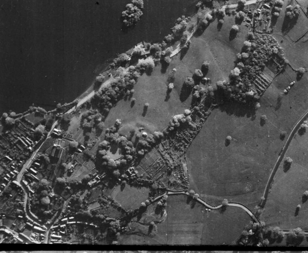
The possible southern bailey is visible as a raised triangular plateau in the LiDAR data, and its outline appears to correspond with earthworks visible on 1940s aerial photography before later housing development (Fig 3). Although parts of this area have since been affected by terracing, quarrying and modern construction, the alignment of the plateau with the existing earthworks suggests that elements of the larger bailey circuit may still survive. This would place the bailey in close relationship with Sandy Lane, a prominent historic routeway that once connected Ellesmere to the town of Shrewsbury.
This is an important shift in how the monument can be understood. Rather than treating the present scheduled bailey as the whole of the enclosure, the survey establishes a clearer working hypothesis that the medieval castle may have occupied a broader area, with the southern ground forming part of a more substantial bailey deliberately placed over a significant routeway. This gives future research a much firmer starting point.
What happens next?
The results represent the beginning of a new phase of investigation rather than the final word. Geophysics has shown where significant buried features are likely to survive and has helped refine the questions that now need to be tested. In particular, further work could investigate the substantial structural anomalies on the motte and within the bailey, examine the possible well, and test the proposed southern extension of the bailey.
Any future intrusive investigation would need to be carefully targeted and agreed with Historic England, given the site’s status as a scheduled monument, and the Ellesmere Bowling Club as the green is in regular use throughout the season and quality ground reinstatement would be crucial. The value of the present work is that such investigations can now be planned from a stronger evidence base, focusing on the features most likely to answer key questions about the castle’s form, development and survival.
The survey has demonstrated that Ellesmere Castle retains considerable archaeological potential. It provides a carefully evidenced starting point for the next stage of research into one of Shropshire’s lesser-known but historically significant medieval castles.
Subscribe to our quarterly newsletter
You can read the full report here: Geophysical Survey of Ellesmere Castle, Shropshire | Castle Studies Trust