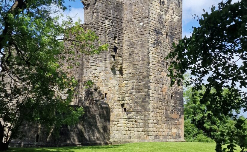
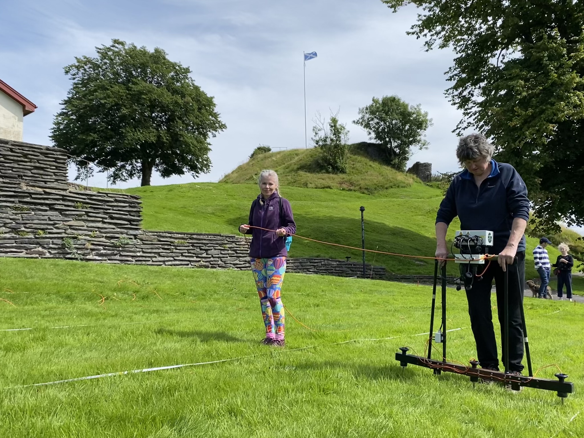
Dr Nick Hannon of Historic Environment Scotland, project lead and Head of Geophysical Survey, takes a look at the community geophysical survey of Crookston Castle.
Nestled just 15 miles southwest of Glasgow, Crookston Castle stands as a beacon of Scotland’s layered past. But in August, this historic site became more than a monument—it transformed into a hub of community-led archaeological discovery. Thanks to a collaboration between heritage professionals, local volunteers, and schoolchildren, the Crookston Castle Community Geophysics Project brought the castle’s history to life.
The project was led by Historic Environment Scotland (HES) Archaeological Survey staff—Dr Nick Hannon, Dr Hazel Blake, and Paul Bethune—in partnership with “The Friends of Crookston Castle,” a passionate local group dedicated to preserving and celebrating their heritage. With full funding from the Castle Studies Trust, the initiative aimed to explore what lay beneath the castle’s grounds and surrounding area using non-invasive geophysical survey techniques.
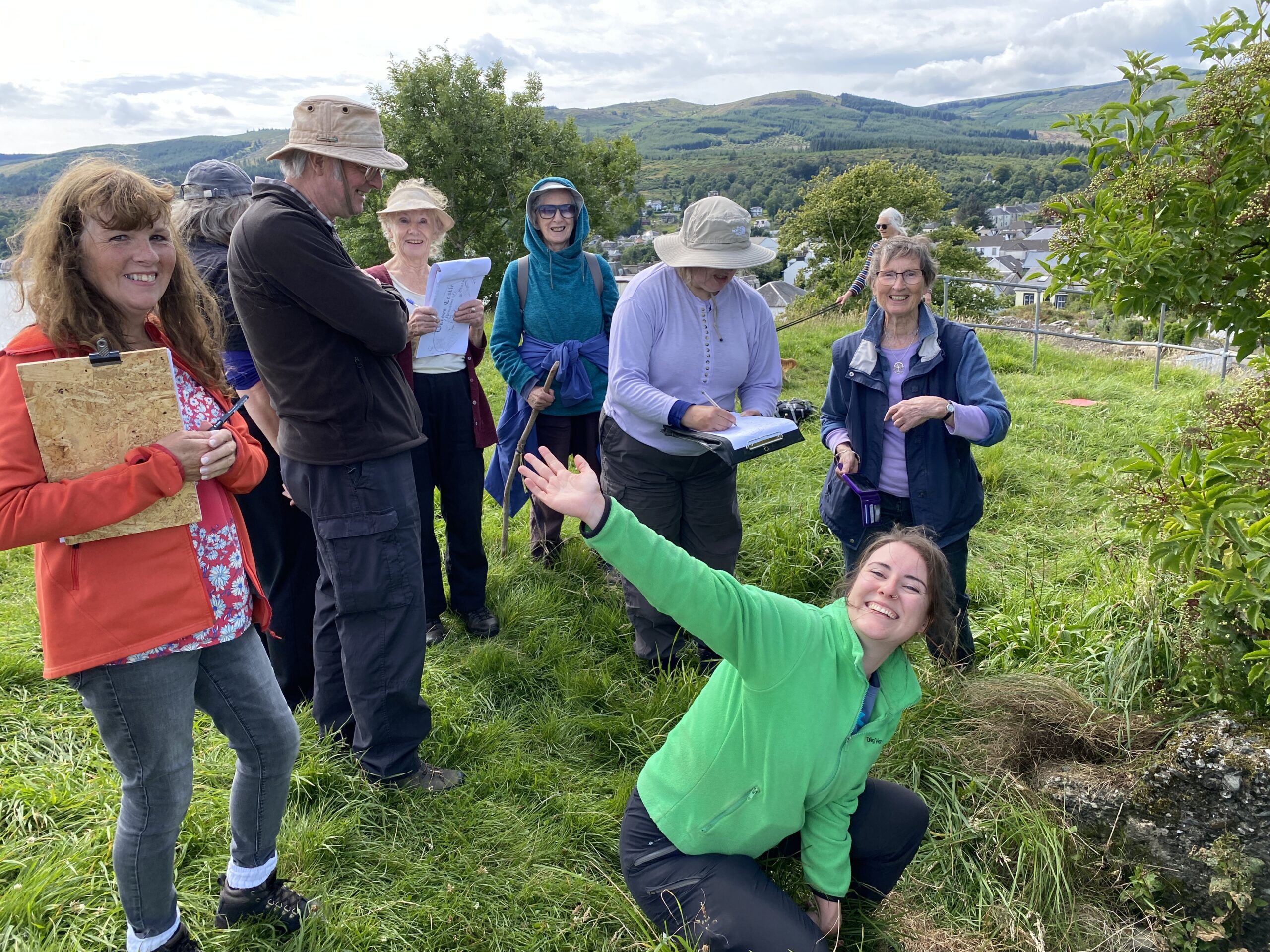
But this wasn’t just a technical exercise. It was a community-driven effort that welcomed volunteers from all walks of life. Students from the University of Glasgow, pupils from five local primary and secondary schools, and residents from the surrounding area all joined forces to uncover the hidden stories buried beneath their feet.
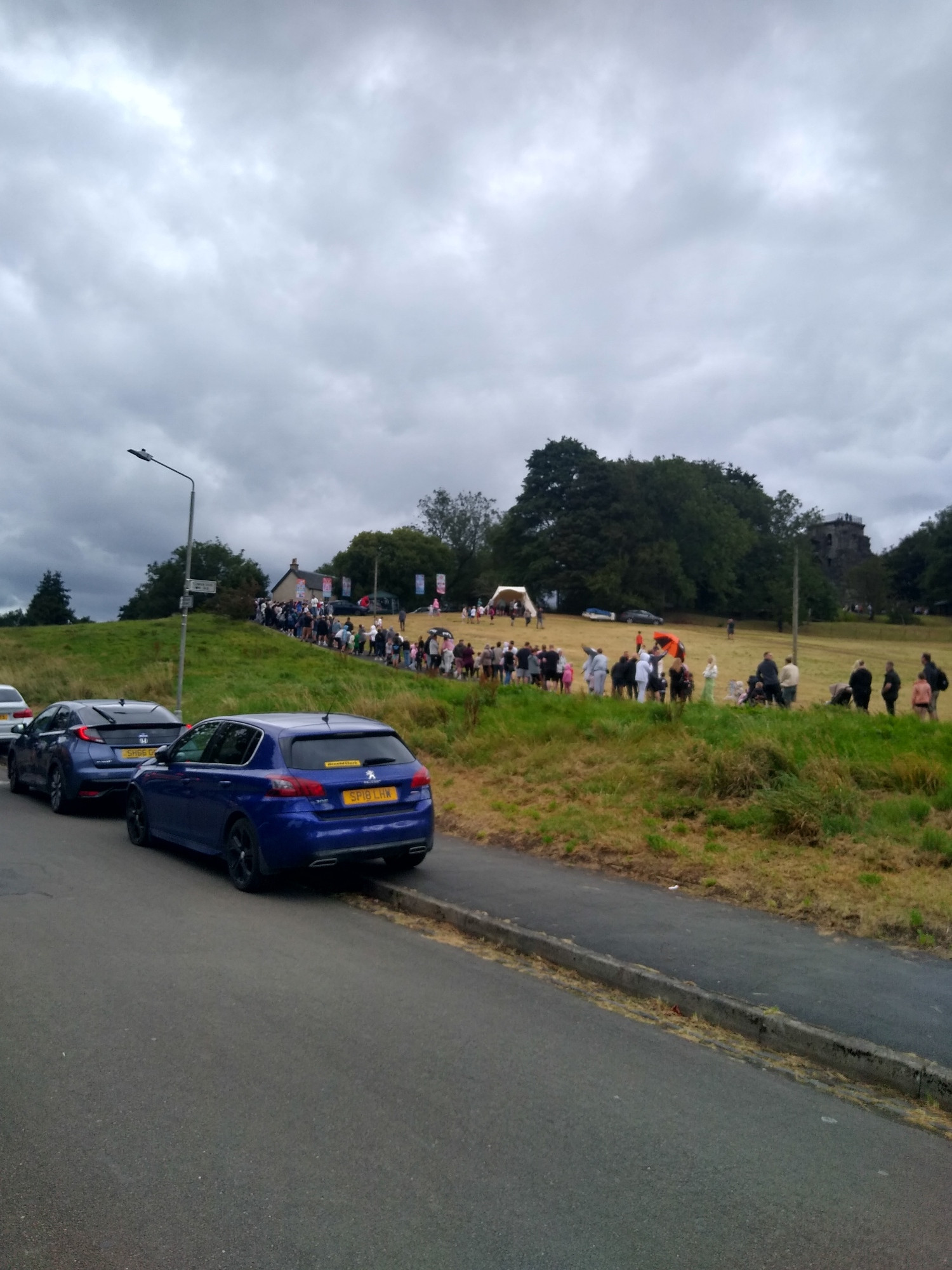
Queue to enter Friends of Crookston Castle Fun Day August 2025 copyright Castle Studies Trust
Science meets Storytelling
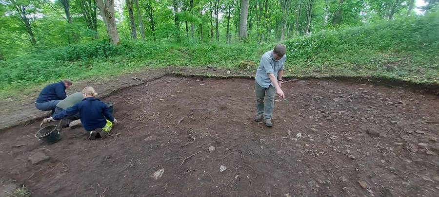
Geophysical surveys are a powerful tool in archaeology. They allow researchers to detect buried features without disturbing the ground—ideal for sites like Crookston Castle, where preservation is paramount. Under expert supervision, volunteers learned how to use these tools to scan the ground, searching for traces of ancient structures and activities.
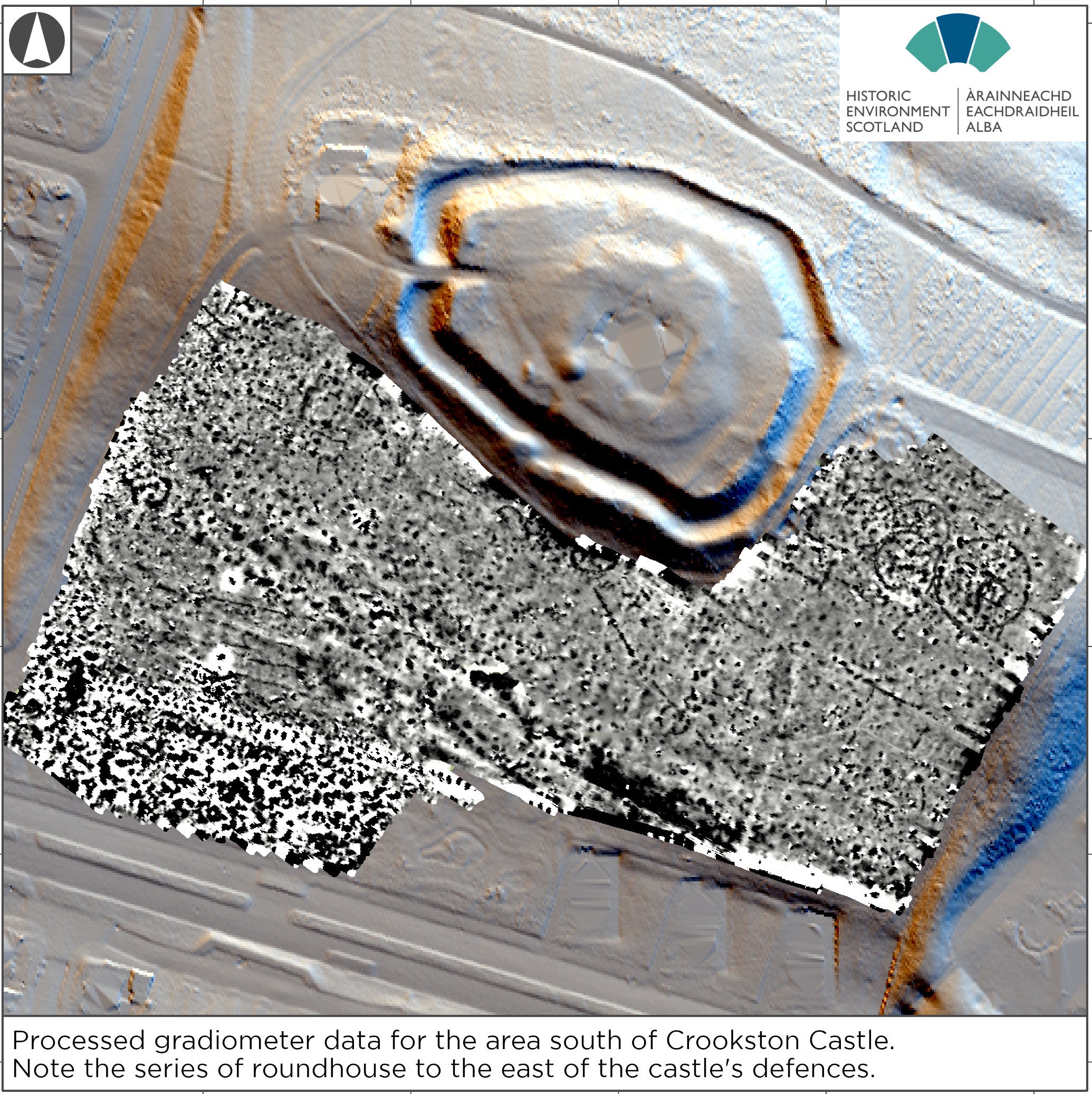
The results were great. The surveys revealed a range of previously unknown archaeological features, including later prehistoric roundhouses, a palisaded enclosure, medieval settlement remains contemporary with the castle’s occupation, and even signs of 17th-century coal mining. These discoveries added new chapters to Crookston’s story, enriching our understanding of the site’s long and varied history.
At the heart of this project was a belief that heritage can be a force for positive change. “The Friends of Crookston Castle” exemplify this philosophy. Their mission is to use local history as a way to bring people together, foster pride, and build bridges between communities.
Their dedication was evident not only in the fieldwork but also in the community open day they organised at the castle. Over 900 visitors attended, engaging with the archaeological team, exploring the site, learning about the discoveries, and more importantly having fun. It was a celebration of place, memory, and shared curiosity.
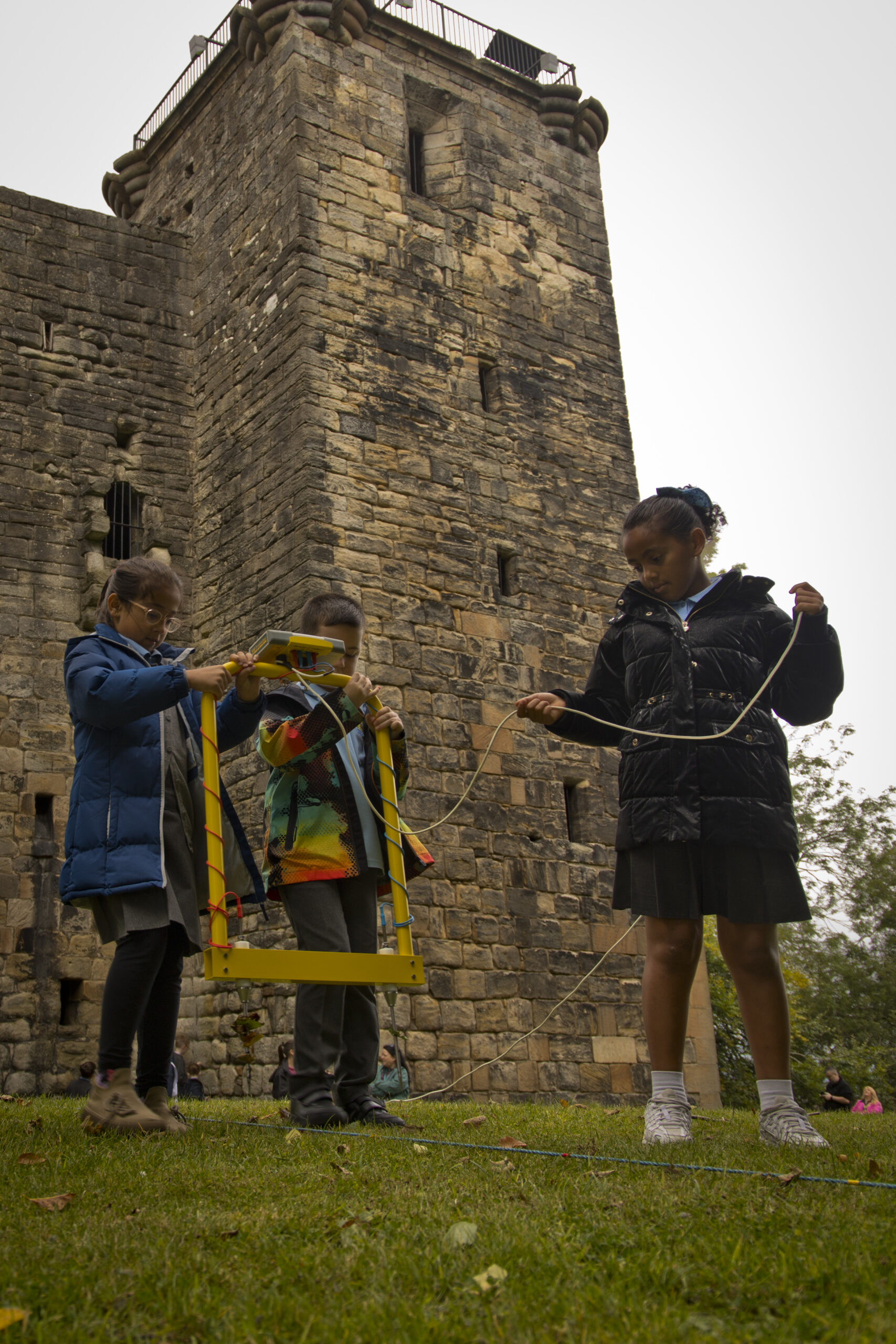
Crookston Castle Local school children carrying out the geophysical survey, copyright Friends of Crookston Castle
Learning by Doing
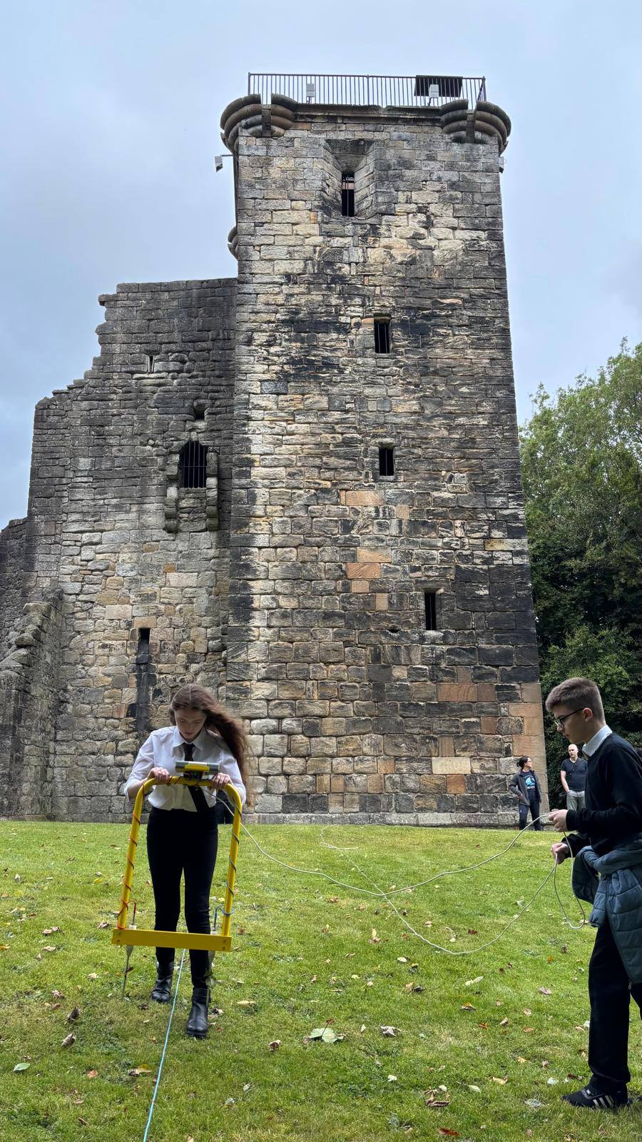
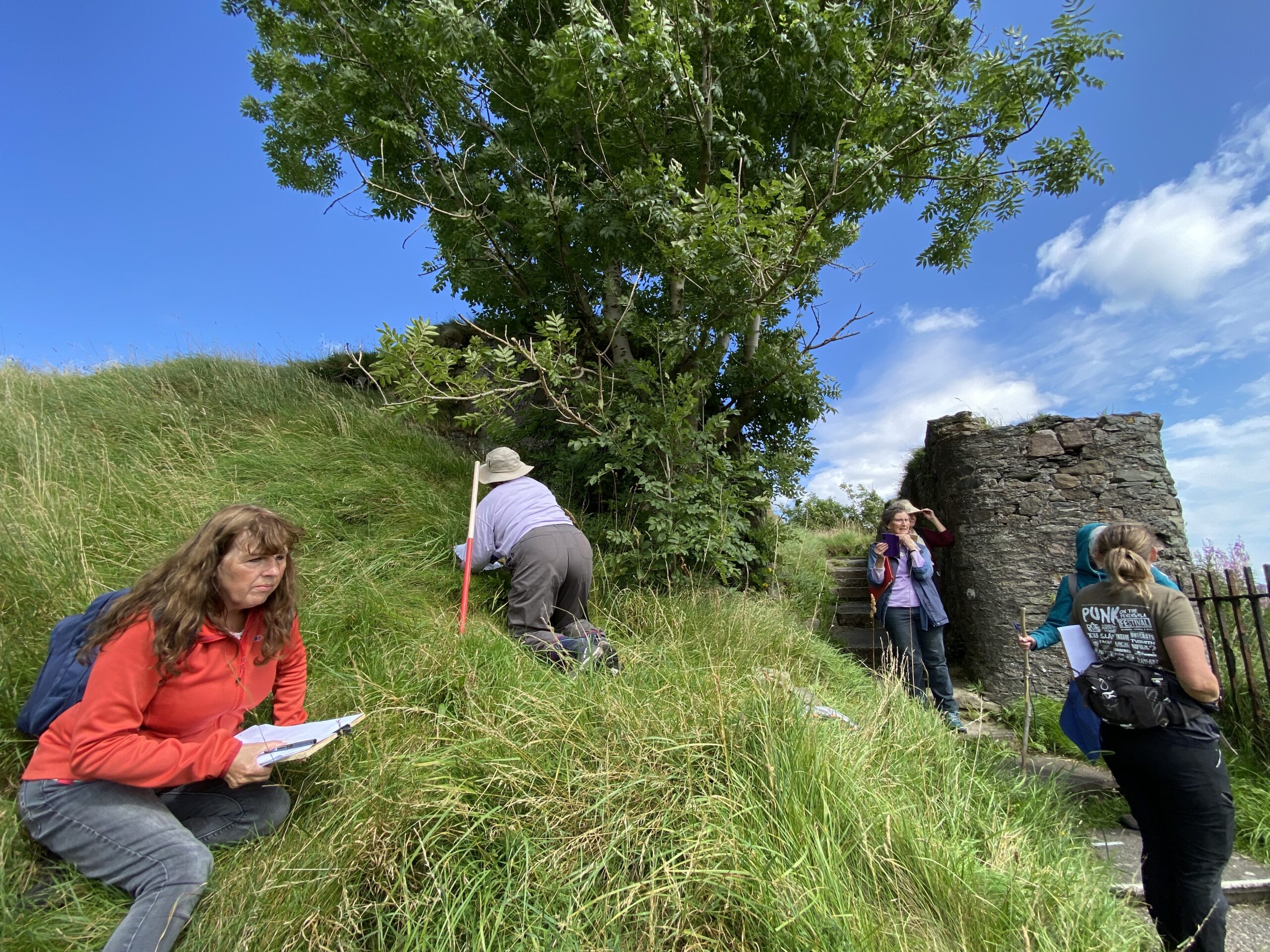
One of the most inspiring aspects of the project was its educational impact. For many of the school pupils involved, this was their first encounter with archaeology. They weren’t just passive observers—they were active participants, learning how to use equipment.
This hands-on experience helped make archaeology easier to understand, showing young people that history isn’t just something you read in books—it’s something you can touch, explore, and contribute to. It also planted seeds for future careers and lifelong interests, proving that heritage engagement can be both meaningful and transformative.
Crookston Castle: Local school children surveying in the castle grounds, copyright Friends of Crookston Castle
A Model for Community Archaeology
The Crookston Castle Community Geophysics Project stands as a model for how heritage organisations can collaborate with local groups to achieve something special. It wasn’t just about uncovering archaeological features—it was about empowering people to take ownership of their history, to tell their stories, and to connect with one another through a shared sense of place.
By combining scientific expertise with grassroots enthusiasm, the project demonstrated that archaeology can be inclusive, educational, and rewarding. It also highlighted the importance of funding bodies like the Castle Studies Trust, whose support makes such initiatives possible.
The Results: Large Potential for Future Archaeological Study
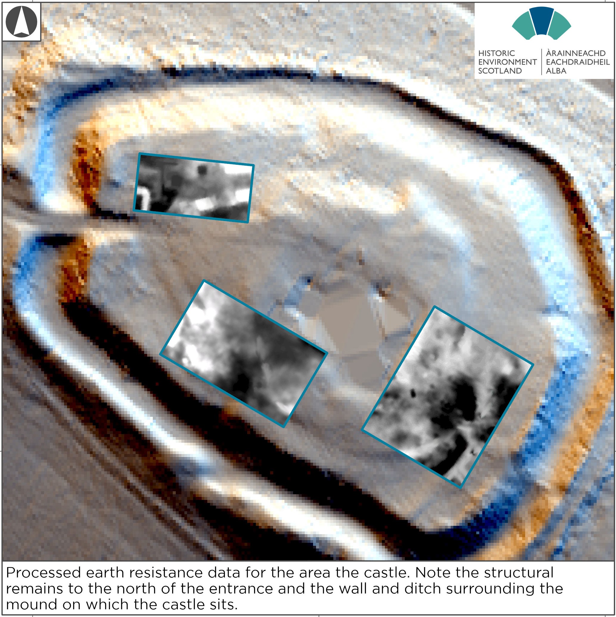
The survey has revealed a range of archaeological features that include structural elements of the castle, and a range of buildings and structures, including a stone enclosure surrounding the current standing remains and perhaps including a well within the castle keep. There is also possible evidence of another entrance with a gap in the stone enclosure aligning with a square enclosure south-east of the main castle Outside the castle moat an entirely unexpected cluster of later prehistoric roundhouses and a palisaded enclosure have been discovered, a significant addition to the history of this location. These represent a succession of large timber round houses.
The identification of ephemeral, possibly timber, building remains to the west south west of the castle moat highlights the potential for settlement of medieval and later date just outside the castle moat. Finally, coal mining of medieval or later date is identified in what look like bell pits, along with the signatures of demolished 19th and 20th century buildings and infrastructure.
Looking Ahead
Now that the fieldwork is over and the data is analysed, the legacy of the Crookston Castle project continues. The findings will inform future research, conservation efforts, and educational programmes. But perhaps more importantly, the relationships forged during the project—between professionals, volunteers, students, and community members—will endure.
Crookston Castle is no longer just a relic of the past. It’s a living symbol of what can happen when people come together to explore, learn, and celebrate their shared heritage. And thanks to the vision and hard work of “The Friends of Crookston Castle,” its story is richer than ever.
Ellesmere Castle in Shropshire is a substantial motte and bailey castle in the Welsh Marches that played an important role in the history of the area. However, very little is known about its form and structure with no standing remains above ground, or indeed when it was first constructed.
Starting on Monday 23 March, on behalf of the owners of the motte, Ellesmere Bowling Club, and with the support of owners of the rest of the castle Shropshire Council and funded by the Castle Studies Trust, archaeologists from the heritage organisation Heneb will be undertaking a programme of geophysical survey at the castle to assess the potential for surviving sub‑surface archaeological remains. The methods being used include magnetic gradiometry and electrical resistivity survey.
Ellesmere motte top, showing size as an shape of possible structure shown by GPR survey
The motte itself is substantial. It is approximately 80m in diameter at its base, 52m across the top and stands about 11m high. A steep-sided ditch, about 20m wide and 3m deep, separates the motte from the bailey to the south east. In 2024, a partial and informal Ground Penetrating Radar GPR survey was carried out, which suggested and indicated a substantial structure, probably indicating a stone structure with the dimensions of 23m x 14m.
Lidar image of Ellesmere Castle including areas of geophysical survey
This current survey builds on the work carried out in 2024. It will be covering four areas of this very large castle site. The LiDAR image below shows the four targeted areas for geophysical survey:
Motte: to pinpoint the position of the curtain wall along with any other buildings within.
Bailey: to determine the location and size of the buildings.
Area three, to establish where the outer defensive wall once stood that came down from the top of the motte, and to understand the width and depth of the defensive ditch, along with deciphering the extent of the bailey (No2), part of which had been quarried away sometime in the past.
Earthworks which are believed to be the outer defensive walls, showing what appears to be an entrance in the north east section, and to investigate the furthest easterly earthworks to determine whether there was both an inner and outer bailey.
The date of construction is unknown: it could have been built as early as the late eleventh century, by marcher lord Roger de Montgomery. The lands were confiscated by the crown following his son Robert de Bellesme’s rebellion. The castle was certainly in existence by 1138. In 1174 Henry II confirmed the manor to Dafydd ab Owain, a north Welsh prince, when he married Henry’s sister Emma in 1174. During the early to middle part of the 13th century the manor of Ellesmere passed in and out of royal control and throughout much of that century there are numerous accounts of building or repair works especially during the reign of Henry III.
Ellesmere Castle bailey with motte in the background, copyright Gary Bick
In 1241 John le Strange was paid forty pounds to build a castle also in the same year twenty one pounds was spent on building two bretasches. In 1256, the King’s house within castle was repaired at a cost of five pounds ten shillings and nine with a further one hundred and sixteen pounds being spent on castle repairs further emphasising the castle’s significance.
In historical terms, perhaps its most well-known claim to fame is that Joan, daughter of King John and wife of Llywelyn ap Iorwerth, was confined to the castle for about a year following her infidelity.
While the survey will not answer questions on its history, it will hopefully supply more details on the castle’s form, and potential targets for future excavation so we can learn more about its history.
In 2024, we awarded Stephen Parry in conjunction with MoLA a grant to carry out some geophysical surveys in the town of Higham Ferrers to find the lost royal castle once there. Stephen explains what happened next and what they found.
Over a ten-month period during 2024-25, a team of archaeologists used a combination of ground penetrating radar (GPR), magnetometry and earth resistance survey to reveal some of the mysteries of Higham Ferrers Castle, gaining new insights into what this royal castle might have looked like.
A generous grant from the Castle Studies Trust, supplemented by further grants from East Northamptonshire Council, Higham Ferrers Town Council and Tony & Jennifer Norman and with the support the Higham Ferrers Archaeology and Research Society (HiFARS), enabled archaeologists Stephen Parry (Finham Heritage), John Walford and Graham Arkley (Museum of London Archaeology) to undertake this project.
No remains of the castle survive above ground today so, before this project, our understanding was largely based on historical documentary evidence. This showed that the Castle was, at least from the early fourteenth century, a substantial medieval building with a hall, chapel, tower-house, King’s and Queen’s Chambers, as well as three gatehouses.
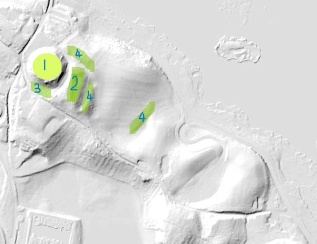
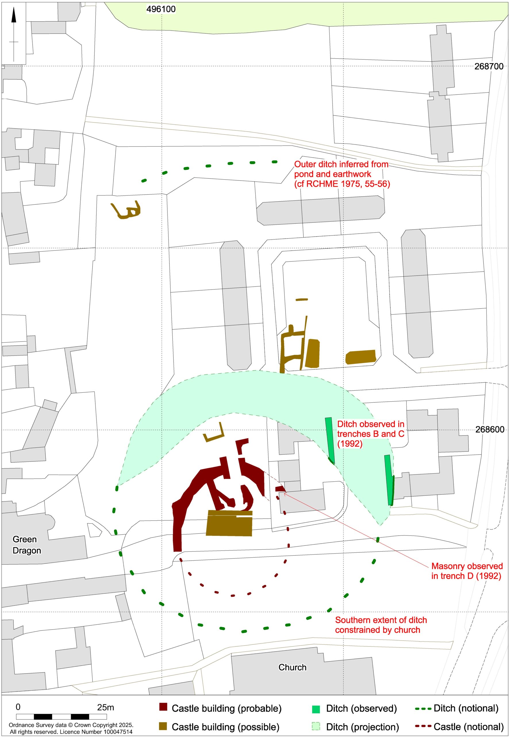
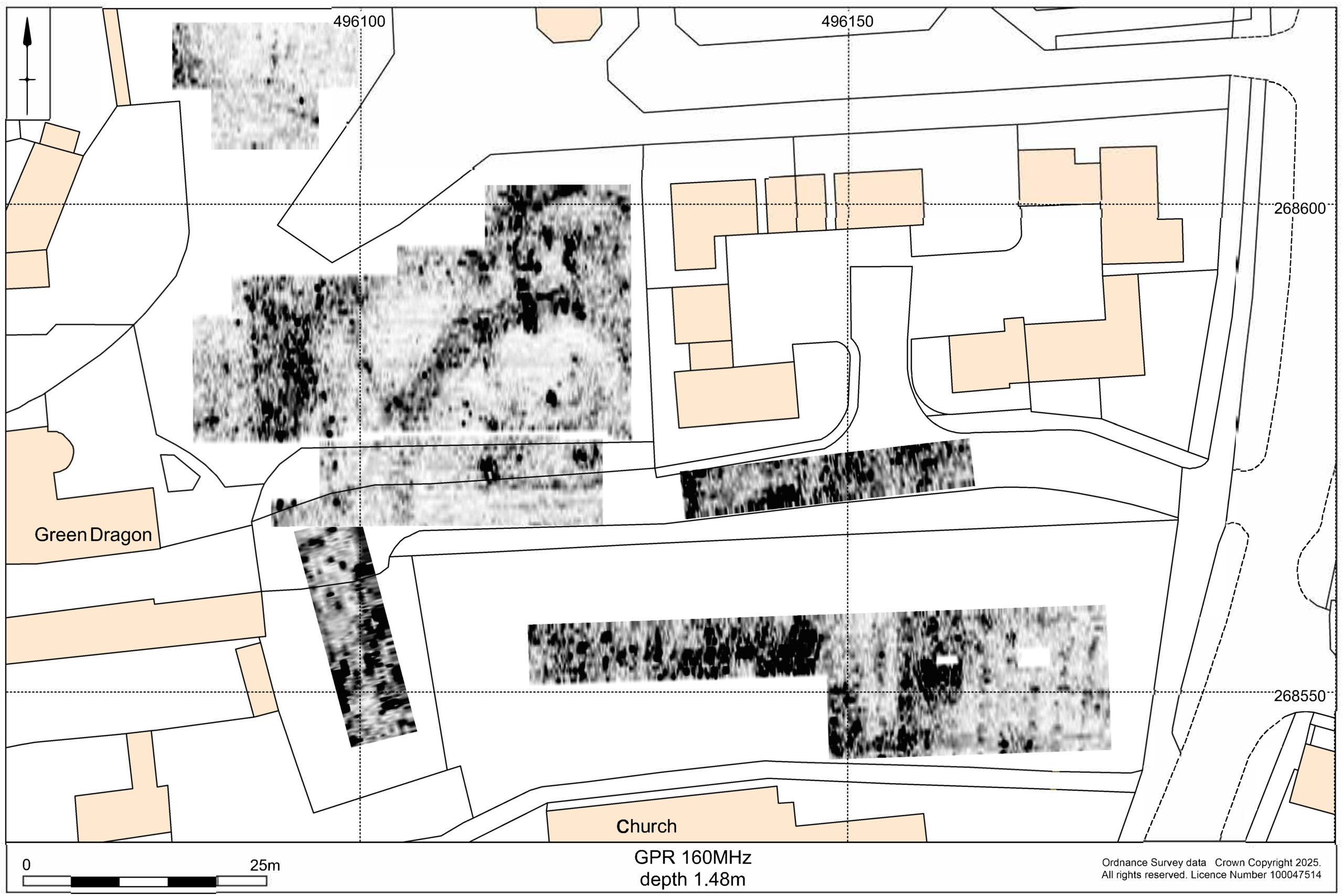
The GPR survey produced the most informative results, showing that the foundations of a curtain wall and other buildings of the inner bailey survive under the garden of the Green Dragon Hotel. Other building remains survive to the north, within the likely extent of the outer bailey.
Figure 1: GPR survey results copyright MoLA
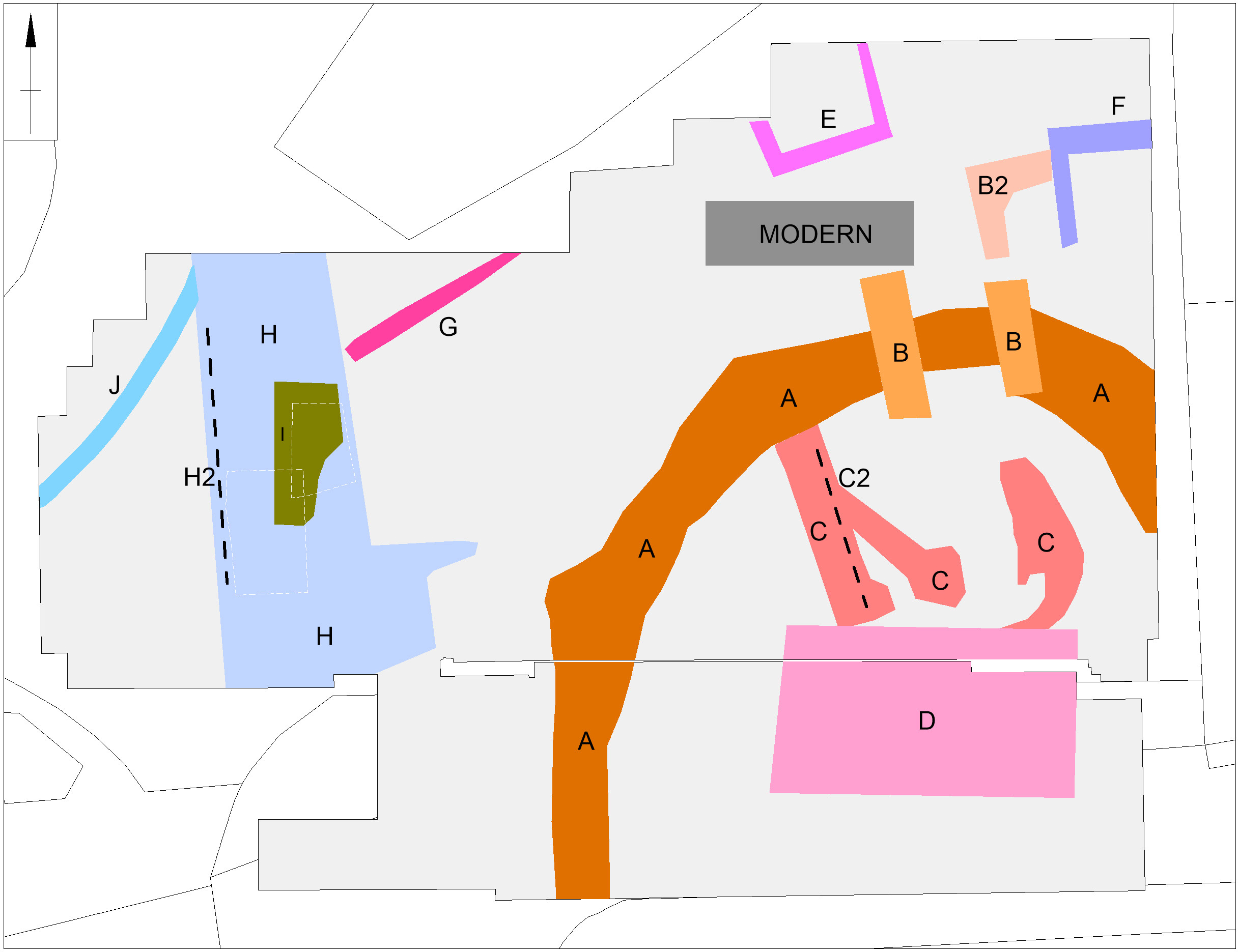
The broad foundation of the curtain wall (structure A in figure 3 appears to be made up of short straight lengths perhaps with slight projections at the angles. It probably enclosed an oval area measuring roughly 29m by 25m across. However, the southern part of its circuit, which must have lain under the churchyard, was not found by the survey and is likely to have been masked, or perhaps even destroyed, by Victorian grave digging.
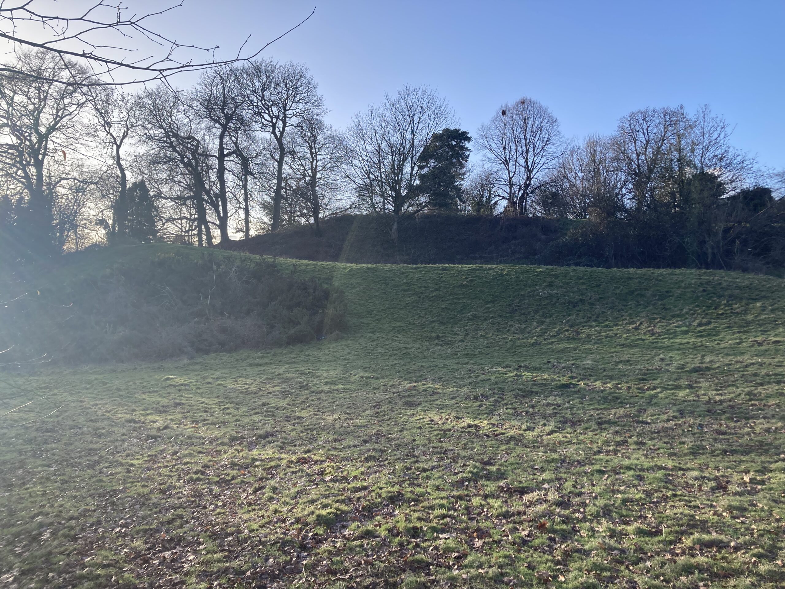
Surprisingly, there is a gap of 15m between the curtain wall and the inner bailey ditch, part of which was exposed in a nearby trial trench excavation in 1991. This might imply that the structure was placed on a low earthen bank or ringwork with its sloping sides taking up the intervening space. This earthwork cannot have been a high motte because, if so, the foundations of interior features would not have been dug to below the original ground level.
Figure 2 results / plots of Ground Penetrating Radar survey of inner bailey and motte Figure 3: interpretation of GPR results, both copyright MoLA
The foundations of a square gatehouse (structures B and B2), measuring 6m by 6m, were revealed across the line of the curtain wall and would have provided access from the outer bailey to the north. Inside the curtain wall, the foundations of a large rectangular building measuring 12m by 7m (structure D) may have been the great hall which the documentary sources indicate was rebuilt after a fire in 1409-1410. The narrowness of the foundations might imply that the hall was timber built. Other foundations within the curtain wall (structures C and C2) suggest the presence of other buildings that may have predated the fire. A further building (structure E) may also be part of the castle but other foundations (structures F to J) are more likely to belong to eighteenth and nineteenth century outbuildings of the Green Dragon Hotel.
While the construction date of the castle is uncertain, pottery excavated from the castle ditch in 1991 suggests a date after 1100. This evidence, albeit limited, suggests that the castle was not built by the elder William Peveril in the immediate wake of the Norman Conquest but either by his son, as a response to civil war during the reign of King Stephen (1135-1154), or else by the de Ferrers who held the manor from 1199 to 1266.
The results of this work, together with the limited trial trenching and documentary evidence, suggest that Higham Ferrers Castle may have looked similar to Tamworth Castle, Staffordshire, where the curtain wall is also an irregular polygon defining a slightly smaller area of 27.5m by 23m. Further similarities can be found in the central position of the fifteenth century great hall at Tamworth which was originally built of timber and has similar dimensions to the possible hall at Higham Ferrers, measuring at least 11m by 8m. To continue the analogy with Tamworth to its conclusion we should expect to see at Higham Ferrers a small courtyard between the gatehouse and hall, with the other castle main buildings including the King and Queen’s chambers, chapel and kitchen inside the line of the curtain wall (though as yet no structures have been identified at Higham Ferrers).
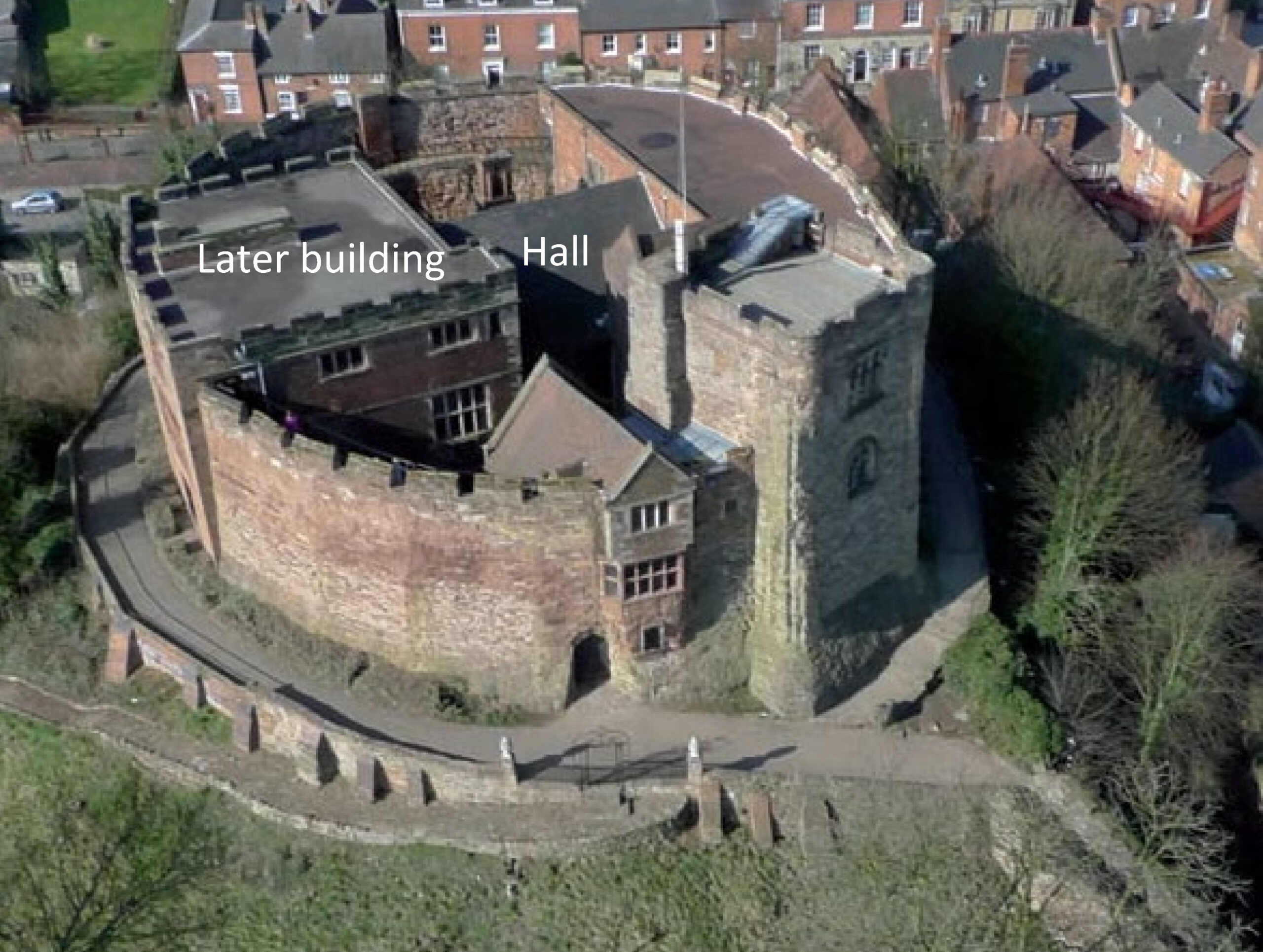
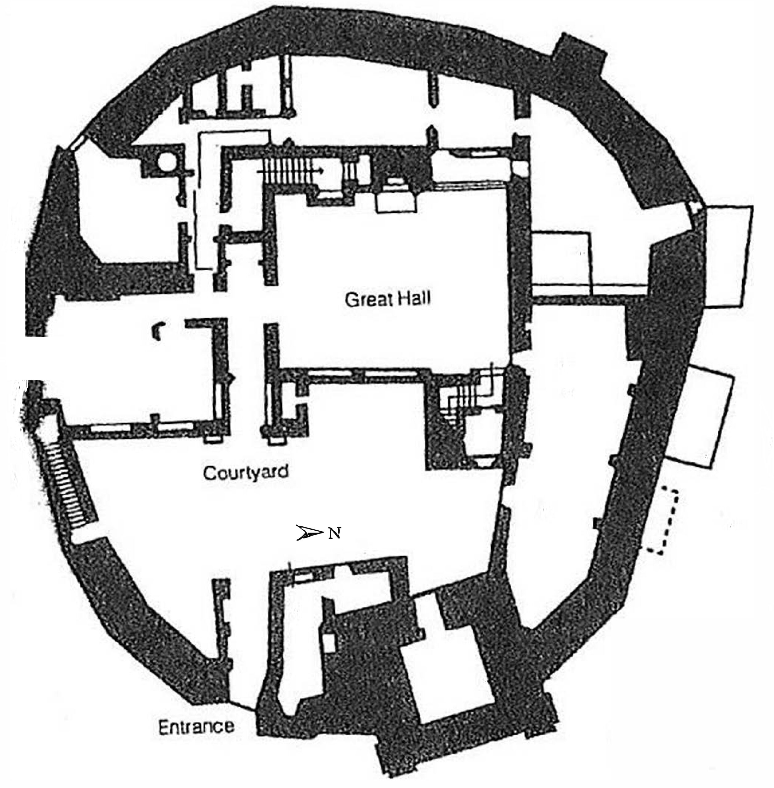
Tamworth Castle Shell Keep. Reproduced by kind permission of Tamworth Castle ArchivesOriginal lay out of Tamworth Castle shell keep.Reproduced by kind permission of Tamworth Castle Archives.
The purpose of the structures in the outer bailey and their date are uncertain, but they could represent service buildings including stables, barns, granaries or cowsheds.
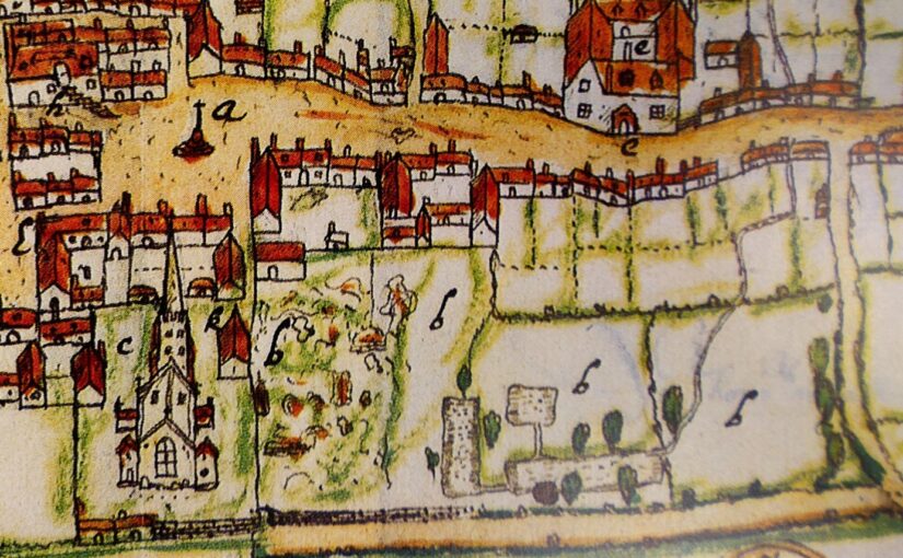
The survey project also investigated an area further to the north which is known locally as Castle Field and is often considered to have been the site of the castle. However, no credible evidence of castle buildings was found in this area. Instead, the main finding was a large rectangular feature, believed to be the remains of a fishpond that appears on a map of Higham Ferrers produced in 1591.
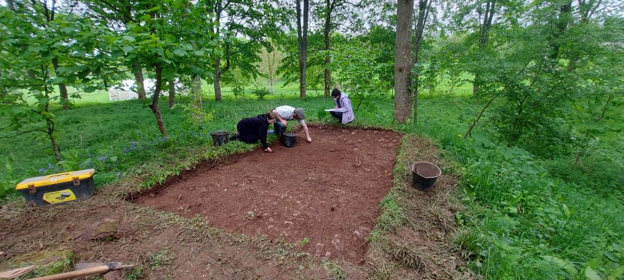
The first week of our 2024 excavations at Lowther (Cumbria) has brought excellent progress. This year we’re focusing our efforts on two trenches. (You can catch up with last year’s excavation on the CST blog).
Trench 7 is sited on the mound at the south-eastern corner of the ringwork. This juts out from the ringwork’s circumferential bank, overlooking the settlement to the east over which the castle presided. Could this mound have held a watchtower or any other structure? Trench 7, across the top of the mound, has so far revealed a stony context, which may be the surface of the ringwork’s built-up bank. A roundish, stone-free context within the trench might be evidence of a feature but might otherwise indicate where a tree has grown in the bank and been removed. There is no clear evidence so far of a structure, but the trench has yielded an intriguing find: horse bones, in the form of an articulated fetlock (ankle) joint. Because the joint is articulated, this means that the horse’s entire fetlock was deposited on the mound (i.e. skin, flesh and bone). Further examination of the bones, potentially including carbon dating, may reveal more.
Figure 1: Student archaeologists from UCLan excavating in Trench 7, on the south-eastern mound of the ringwork castle.Figure 2: Jim Morris (UCLan) demonstrates the articulated horse fetlock joint discovered in Trench 7.
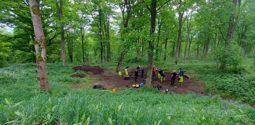
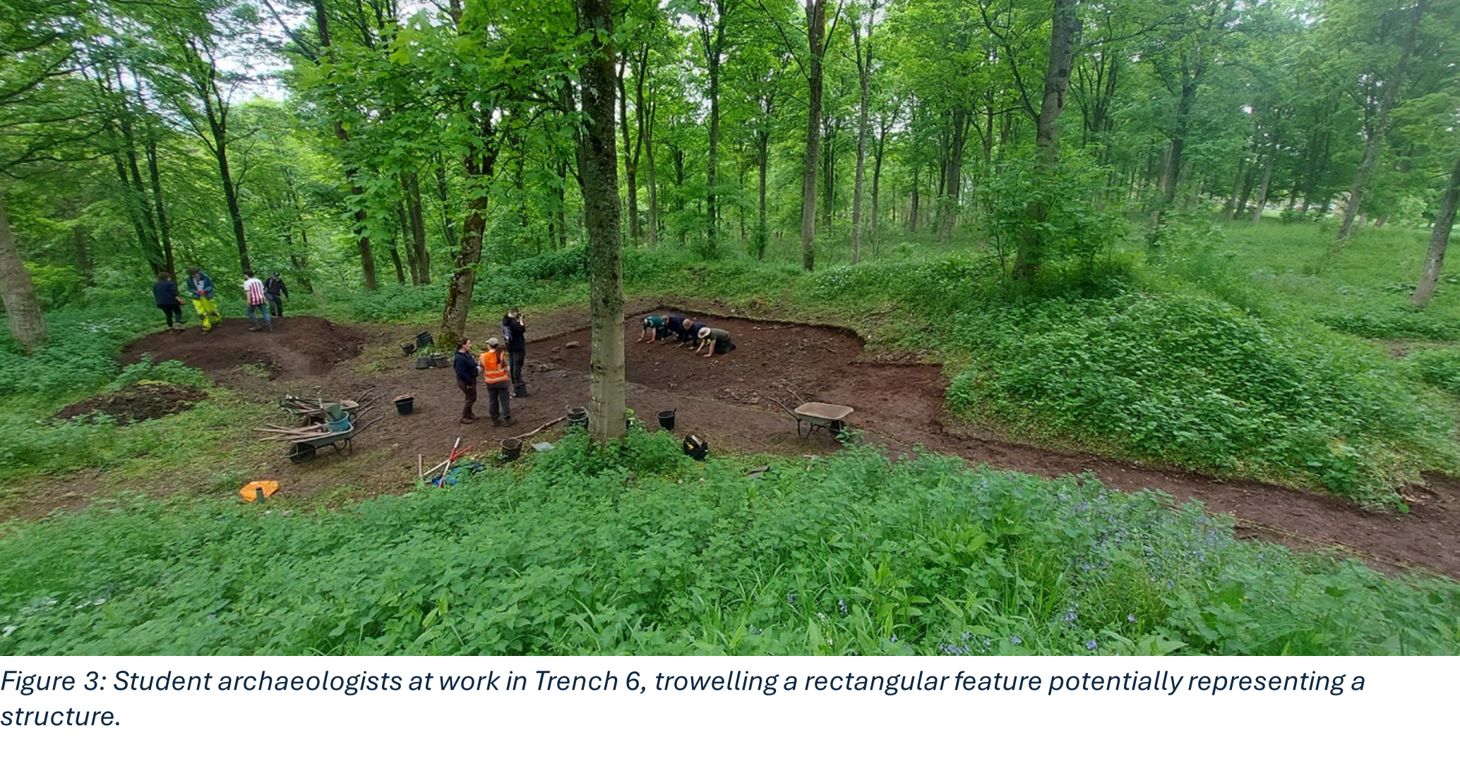
Meanwhile, Trench 6 has been opened over the north-eastern quarter of the ringwork castle interior. The trench also stretches eastward through the original entranceway to the castle, which is cut into the eastern bank. The goal here is to reveal much more of the original medieval cobbled floor surface discovered last year, looking for evidence of any structures. If we can find postholes around the entranceway, this might indicate a timber gatehouse (at Castle Tower, Penmaen in Glamorgan, excavations of a similar ringwork revealed evidence of a six-posted timber gatehouse). The castle’s interior may have also have held simple timber buildings, providing shelter for the castle’s guardian and their household.
Tantalizingly, by Day 5 of our dig, Trench 6 was beginning to yield potential evidence of a structure. A dark, rectangular feature is visible within the medieval cobbled surface of the castle interior. We don’t know yet whether it overlays the cobbled surface or is cut into it and, either way, whether it dates to the castle’s earliest phases. It may be that further excavations will reveal postholes, or it may be that that the structure was built simply across wooden beams, effectively floating on the cobbled surface. Hopefully, Week Two will reveal more!
Figure 4: While stuents continue trowelling in Trench 6, Jim Morris indicates the outline of a rectangular feature.
Meanwhile, to the north of the ringwork castle, in a partner investigation supported by the Cumberland and Westmorland Antiquarian and Archaeological Society, we are conducting a geophysical survey. Last year, in Phase One investigations supported by the CST, we surveyed a large area to the east of the ringwork castle, taking in what we think is the original Lowther village, built concurrently with the castle and linked to it by a trackway. Extending our geophysical survey allows us to investigate Lowther as a broader site, extending across the promontory overlooking the River Lowther. What was on this promontory before the ringwork castle was built? How far did the village extend across the promontory? This year, then, we’re surveying at the northern end of the promontory, in the area east of St Michael’s church.
The geophysical survey has run concurrently with excavations across Week One and will hopefully provide evidence of activity at Lowther across the centuries.
Figure 6: Rob Evershed from Allen Archaeology checks through ongoing results from the geophysical survey with UCLan students
For regular updates on our investigation, follow us on Twitter/X at #LowtherMedievalCastle. You can learn more of Lowther’s history and catch up with last year’s investigation on BBC2’s Digging for Britain, Series 11 Episode 1, available on BBC iPlayer.
Jo Kirton and Graeme Young, co-director of the Bamburgh Research Project (BRP) outlines what happened during their 2023 season and what the CST funded part of the research at this iconic castle revealed.
Throughout July 2023 BRP staff ran our annual field school at Bamburgh Castle, which is currently exploring the medieval outworks at the northern tip of the castle. We also welcomed several experts to site, funded by our CST grant, to undertake complementary survey alongside our excavation.
Historic Building Consultant Peter Ryder joined us to undertake a preliminary masonry survey of the extant outworks while Tony Liddel from Vindomora Solutions created several 3D models of the standing outworks and internal structures of Elmund’s Tower and our associated trenches. Dr Kristian Strutt and his team from the University of Southampton undertook a geophysical survey of the castle ditch and explored how this interacts with the outworks, as well as identifying related features and access ways to St Oswald’s Gate. BRP staff and students worked with the team, trying their hand at GPR, resistivity and magnetometry.
The reports from the masonry and geophysical survey, plus the associated3D models have now been completed and incorporated into the BRP’s Interim Report on Work on the Outworks Beyond St Oswald’s Gate. This is a summary.
Background
The Bamburgh Research Project (BRP) was set up in 1996-97 to undertake archaeological investigation of Bamburgh Castle and its environs. The area immediately within St Oswald’s Gate was investigated in an effort to identify early elements of the fortification and structures associated with the entrance; documentary evidence indicates that this gate was the principal, and perhaps only, entrance to the fortress in the 8th century AD and likely remained such until the main gate was relocated to its present position in the 12th century.
The rock outcrop on which Bamburgh Castle stands is comprised of volcanic dolerite that rises some 30m above the external ground surface. The surface of the plateau is c.3 hectares in area. It undulates in height, sloping downwards from the Inner Ward area at the south-east, which reaches 45m OD, to the north-west end of the West Ward where St Oswald’s Gate lies. Here a natural cleft in the bedrock on the landward side leads out and down the slope of the plateau. This has formed a natural route up to the summit from earliest times bridging, if awkwardly, the height difference between the West Ward at some 22m above sea level and the surrounding ground surface that lay at 13m OD. St Oswald’s Gate is written about as the entrance to the fortress of Bamburgh in the 8th century AD (Symeon HK, III. pg 37) and was very likely the earliest route up onto the rock plateau.
The present phase of work began in the summer of 2021. We are investigating the entrance, the access routes up to the entrance and the structures and outworks built to control this route over many generations. One area of focus was the recovery of the site of the Tower of Elmund’s Well, named in records from the 13th century (Colvin, H. M. 1973, 556) and onto which a cottage was constructed in the late 18th century.
The plan outline of the cottage/tower structure was quickly revealed during the first phase of investigation by the removal of foliage and a modest volume of aeolian sand. One of the first exciting discoveries during the 2022 excavation was the presence of two splayed lights (open window-like features) in two of the walls.
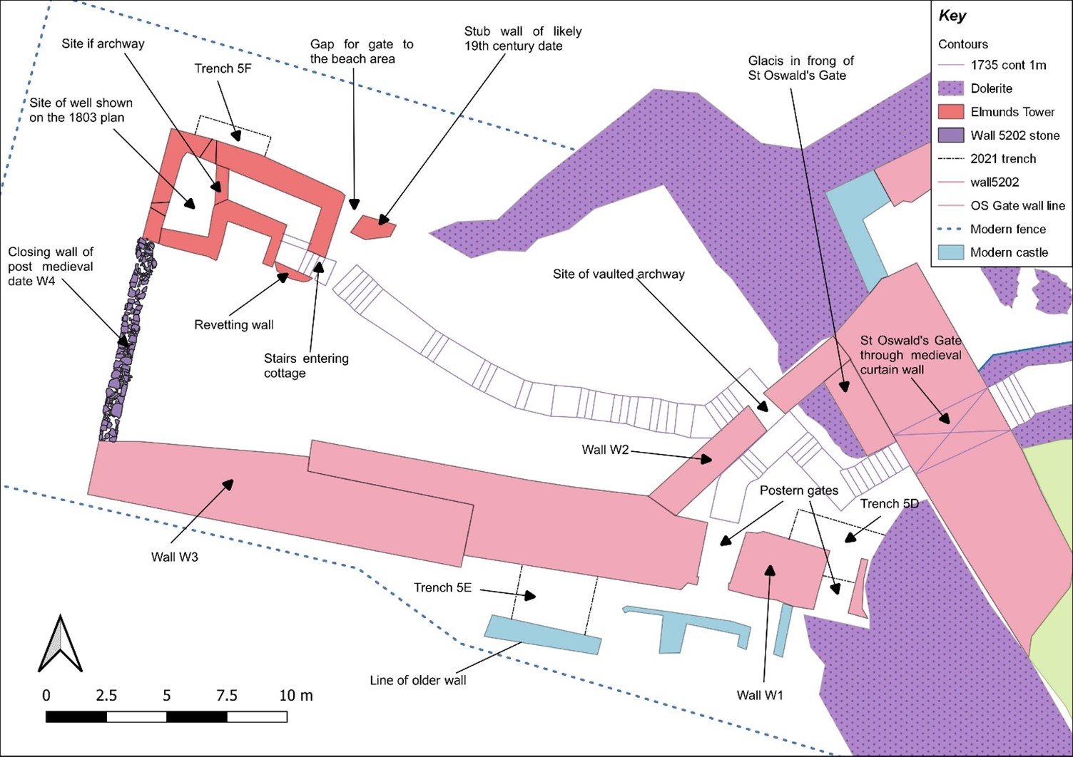
Figure 1: Aerial photo of the outworks with the cottage/tower seen in the top right corner. The steps that lead back to St Oswald’s Gate, through the Wing Wall, at the bottom of the photo. Facing west. Copyright Bamburgh Research Project
The elements of the cottage are now exposed fully in plan and when interpreted alongside the available cartographic evidence would suggest that the entrance was re-aligned due to the build-up of sand deposits in the area that have been slowly burying the standing structures during the post-medieval period. Two short flights of more recent stairs, each turning through a right angle, lead to a long straight set of stairs of older character and showing substantial wear, that extended down through the arch to the basement of the tower where we know from cartographic evidence the well was once present, in what is now a basement room. Here excavation must be getting close to the floor level and some four phases of build are seen in the exposed walls that now reach almost two storeys. The lower two of these phases are likely to be elements of the medieval tower and the upper, by default, phases of the cottage that was built on and into the tower from the 18th century.
There was further work on the postern gate that lies beyond St Oswald’s Gate that leads out to the village which had been subject to limited survey and excavation in previous seasons. Continued excavation immediately behind the wall that leads back to the castle rock has uncovered more of the structure. We intended to uncover more of the wall, recover some datable finds and identify the level from which it was constructed. The structure as uncovered is a single well-constructed feature of coursed squared masonry that ended abruptly and deliberately short of the rock. A further constructed face abutted the bedrock and the gap between the two faces is a little more than 1m wide, forming what must have been a second gate. The eastern of the two is likely the earlier of them and must have led to a timber stair as it is well above ground level. The western, that is currently still in use, may have replaced it as more practical as it is closer to ground level, though still reached by stairs, the current version of which appear to be late post-medieval. This wall extends well to the west where a form of it turns to the north towards the tower/cottage. All the elements that are currently exposed appear to be late in date and the medieval wall must lie beneath the current ground level.
In 2023 we opened Trench 5E, sited outside of the wall with the postern gate and the outworks. It was placed next to a short length of wall that we investigated last season to see if it had once extended further. It has revealed a stone alignment that extends parallel to the two standing walls. Those of the outworks and the short wall length. So far only the upper level has been uncovered, so it is possible that it could be either a wall top or a foundation or the surface of a narrow path.
Work supported by funding from the CST
CST funded BRP to undertake additional non-invasive survey work to offer additional context to the excavation outlined above. Initially, and to better frame the results of the geophysics and limited excavation a walk over study was undertaken by BRP and Peter Ryder. This aimed to provide a description of the standing structures in their historical context, as they are currently understood and was supported by selected areas of photogrammetry survey.
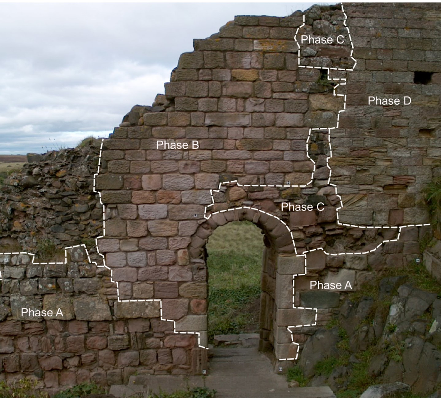
St Oswald’s Gate itself extends out through the curtain wall to the landward side at the northern end of the castle. It passes through a vaulted tunnel to the gate and appears to represent two phases of medieval build with a third – post-medieval – phase represented by internal and external refacing, likely of the late 18th century.
One of the most enigmatic features is the Wing Wall (W2 (see Figure 2) that forms a partial barrier to the route down from the gate. It appears to be one of the older elements of the defences with at least four phases of masonry (see Figure 3) and is relatively narrow compared to the later medieval defensive walls, such as the South Wall (W2) that cuts and post-dates it. It also contains an unusual arched doorway of early form that may be reused from elsewhere.
Figure 2: The northern extent of Bamburgh Castle showing the site of the outworks and the silted tidal port. Copyright Bamburgh Research ProjectFigure 3: The narrow ‘Wing Wall’ showing the narrow archway and multiple phases of construction, facing north-west Copyright Bamburgh Research Project
The south Wall (W1 and W3) comprised at least two build elements that joined with an overlapping joint. The wall as we now know through excavation had two postern gates that would have led to the village.
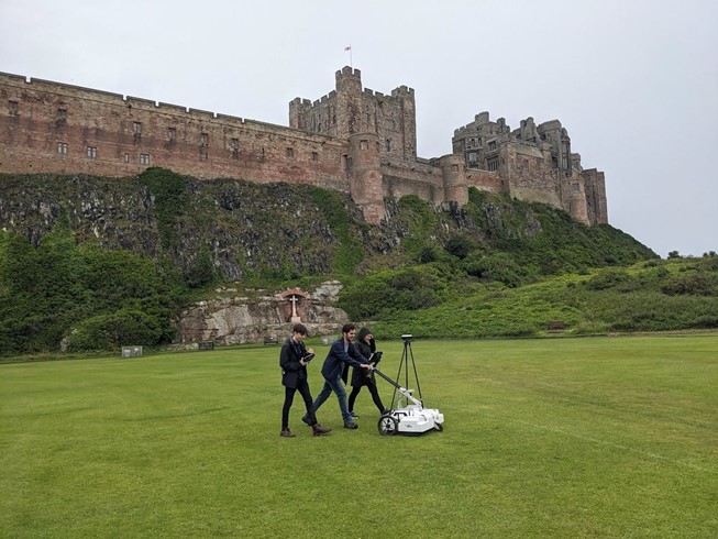
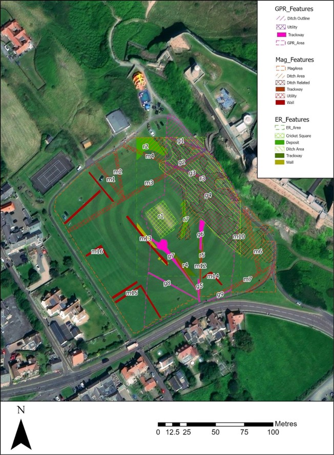
In addition to the masonry and photogrammetry survey, Dr Kristian Strutt undertook magnetometry, resistivity and Ground Penetrating Radar (GPR) survey of areas of the Cricket Ground to the west of Bamburgh Castle. The results indicate the possible presence of a large ditch, some 45m across, immediately to the west of the outcrop, in addition to trackways, walls and other features.
Figure 4: GPR survey under way across the Cricket Ground using an Impulse Raptor 8-channel system and GPS (photo: K. Strutt)
One of the principal questions we were hoping to address with the geophysics was if the castle ditch extended across the sports field at the base of the castle rock. A ditch cut through sandstone can been traced in the area of the modern entrance that is at the site of the 12th century gate. This feature extends across the front of the castle as far as the sandstone ridge. The results of the GPR seem to strongly indicate a large feature in the area where we would anticipate the castle ditch to be and the magnetometry and resistance surveys seem to support this. It is intended to conduct further fieldwork, starting with coring, to confirm this.
In addition, several features seen on the 1865 1st Edition Ordnance Survey (Accessed via National Library of Scotland online 23/04/2024) appear to be picked up on the surveys. Two trackways are evident, that lead to St Oswald’s Gate and to a cleft in the castle rock called the ‘Miller’s Nick’, which allowed people to scramble up to the West Ward in the 19th century. The second is an S-shaped path that meandered towards the area of St Oswald’s Gate, perhaps originally skirting around the edge of the ditch feature. One further route-way or path extends across the field parallel to the road in the village to the south, called the Wynding, that appears from records to have had a medieval origin. This path runs alongside a linear plot boundary and field boundaries and it will be interesting to see if more can be made from a number of anomalies within the enclosure areas to the south and west of the plot.
The resistivity and ground penetrating radar surveys so far cover a more limited area, due to time constraints and public access. There is an area of low resistance that lies just where the ditch would lie and matches up to the path towards the Miller’s Nick. The enclosure areas picked up in the magnetometry to the south-west also seems to be present on the resistivity. Notably, there is a high resistance feature that the S-shaped pathway may curve deliberately to avoid at the south part of the plot. A further T-shaped high resistance feature is present in the north-east extending from the area of the modern pavilion that will bear further study. The GPR further reinforces the presence of some of these features and indicates some depth to the anomaly that is interpreted as the ditch, though the signal attenuates before it could indicate a true depth.
Together, the on-going excavation and non-invasive survey work undertaken in 2023 are providing us with the opportunity to better understand the castle outworks, north of the castle, and the wider environs in which they were situated. That this area of the castle was its original entrance, and for a time gave access to a modest port, ensures that there is much yet to be discovered and understood.
Interim Report
If you would like to read more about the excavation, masonry survey & 3D models and/or the results of the geophysical survey with accompanying discussion, please take a look at
Ryder, P. 2024. Preliminary Assessment of the Standing Masonry Elements: St Oswald’s Gate, the Western Outwork and St Elmund’s Well Tower, Bamburgh Castle, Unpublished Report
Strutt, K and Barker, D. 2024. Report on the Geophysical Survey at Bamburgh, Northumberland, July 2023Department of Archaeology, University of Southampton: Unpublished Report
Symeon, H. K. Historia regum Anglorum et Dacorum (trans. J. Stevenson), 1858, Church Historians of England
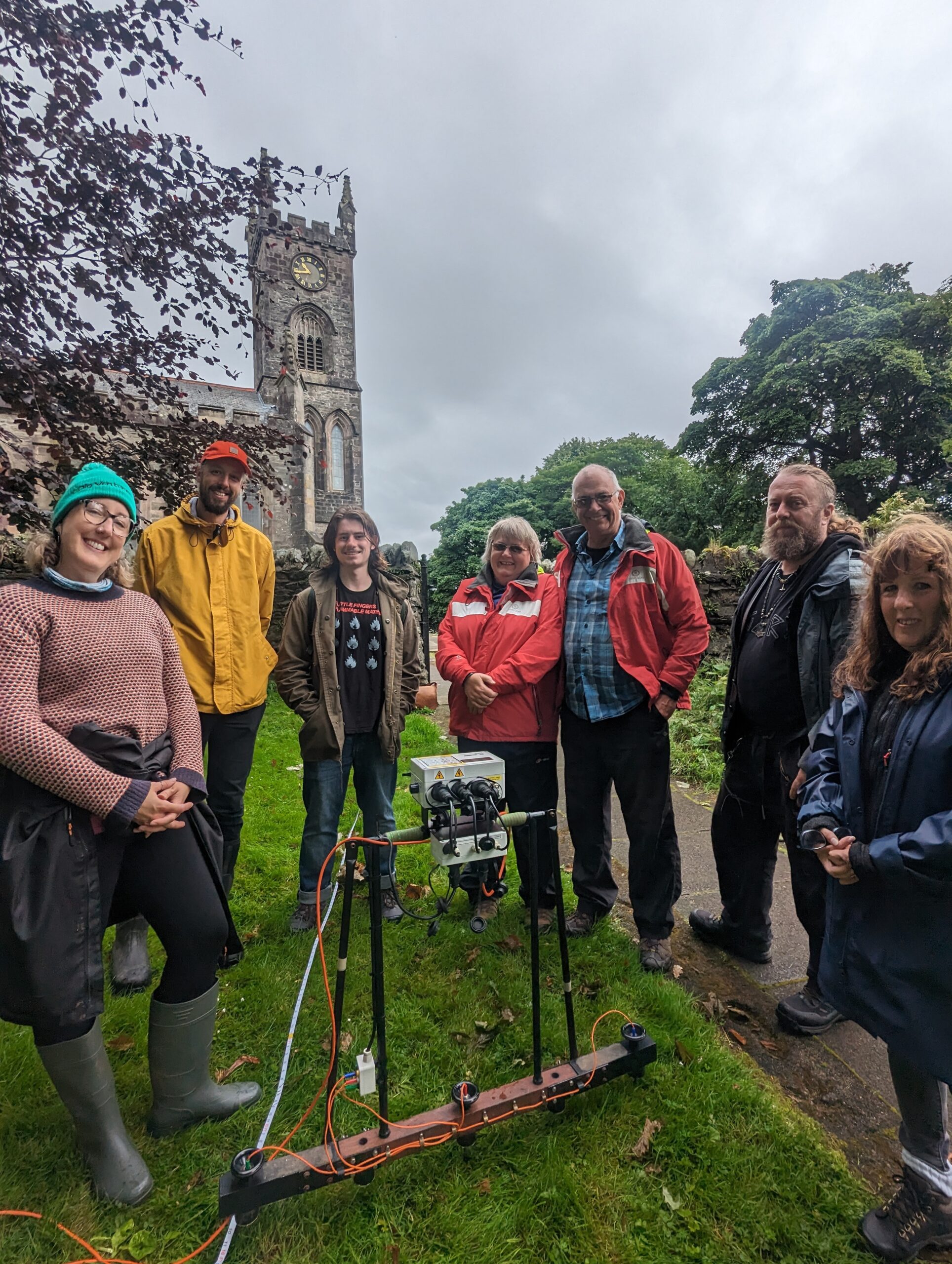
Harriet Tatton, Programme Coordinator, DigVentures looks at the community focused geophysical survey of Dunoon Castle in Scotland.
In summer 2023, a grant from the Castle Studies Trust facilitated an exciting collaborative venture to reveal some of the hidden mysteries of Dunoon Castle, Cowal. DigVentures, in partnership with Argyll and Bute Council, the Dunoon Area Alliance, and Castle House Museum, designed a community-orientated endeavour to learn more about the site of Dunoon Castle and raise awareness of the heritage of the Castle House Park and Gardens.
The medieval stronghold, a scheduled monument, has long been shrouded in the enigma of its past. Thanks to the support of the Castle Studies Trust, a comprehensive geophysical survey and community activity program were initiated, providing a fascinating glimpse into the castle’s rich history.
Professional archaeologists, building historians and amateur enthusiasts from the local community came together to conduct a non-invasive survey that aimed to unearth the secrets of Dunoon Castle and its surrounding parkland. The results not only contribute to the ongoing heritage management of the site but also enhance the narrative that can be shared by local heritage organisations such as the Castle House Museum. In total, just under 100 people were involved in the project, which included training workshops, a public talk and tours, and activities for children and young families.
Dunoon Castle has stood witness to centuries of history. Documentary evidence traces its roots back to the early 13th century AD, and today, it stands as a modified natural mound with a curtain wall, hinting at its medieval past. There is debate over the castle’s original purpose, with suggestions ranging from a motte-and-bailey castle to a ‘castle of enclosure.’ Recent interpretations lean toward the latter, aligning with a group of castles built during the 12th and 13th centuries by successive Scottish kings.
The castle’s complex history is evident in distinct phases. In the medieval and post-medieval era, Dunoon Castle played a pivotal role in Scottish history. From its Lamont origins, through conflicts and regencies, a visit from Mary Queen of Scots, to its eventual abandonment around AD1650, the castle witnessed tumultuous times. The 19th century marked a transformative phase as Dunoon Castle became a focal point for James Ewing’s architectural ambitions. His castellated mansion, set against landscaped gardens, turned Dunoon into a sought-after holiday destination.
As the 20th century unfolded, Dunoon Castle assumed new roles during both World Wars, serving as a strategic defence point with searchlights and coastal batteries. The aftermath of war saw the castle’s hill repurposed for military activities during the Cold War, reflecting the evolving strategic importance of the site.
During the weekend of activities, DigVentures’ small team of archaeologists and local people aimed to make sense of this historical jigsaw puzzle. The magnetometer survey, conducted in areas north and south of the tennis courts and south of the castle museum, uncovered intriguing details. Possible garden wall foundations around the museum, features related to landscaping of the castle gardens, and remnants of former garden plots and a fire station emerged from the data, making sense of the castle’s historical evolution.
Simultaneously, the earth resistance survey corroborated these findings across the same areas, providing a comprehensive dataset for analysis. The revelation of garden features, potential gateposts, and additional elements related to the castle’s history further enriched the understanding of Dunoon Castle’s past.
Over the weekend, Dr. Louise Turner spearheaded a rapid historic buildings assessment of the castle remains, and although not an exhaustive survey, the assessment hinted at the Victorian origins of much of the visible walling within the castle ruins. Surprisingly, limited evidence was found for the earlier phases of the castle and raises intriguing questions about its earlier configurations; documentary evidence suggests that a castle has been present at the site since at least the 13th century, but very little of this phase appeared to be visible.
Complementing these efforts, historic building and aerial 3D photogrammetric drone surveys were conducted. These surveys not only highlighted obscured walls and earthworks but also uncovered hidden features concealed by vegetation overgrowth. A resulting topographic survey, compared against historical maps and surveys, revealed that a substantial portion of the castle walls, previously recorded, is now obscured or even considered submerged beneath the current ground level.
The findings underscore the importance of ongoing conservation efforts, as vegetation threatens to permeate the fabric of the surviving castle walls, potentially causing damage, in particular to the earlier, less visible phases of the castle’s structure. This collaborative project aligns with best practices outlined by Historic England, the Chartered Institute for Archaeologists, and the Europae Archaeologiae Consilium, ensuring the responsible and insightful exploration of Dunoon Castle’s captivating history.
As the dust settles on this archaeological venture, Dunoon Castle stands as a testament to the power of collaboration, community engagement, and cutting-edge survey techniques in unravelling the mysteries of the town’s history. DigVentures hopes to do more work at Dunoon Castle in the near future.
Steven Spencer and Elena Faraoni of the Hoghton Tower Preservation Trust, look at the results of their work, funded by the Castle Studies Trust in 2019, in trying to find out more about Hoghton Tower in Lancashire.
Hoghton Tower sits 650 ft above sea-level in the heart of the Lancashire countryside. The stories of its visitors and family members are documented and shared whether it be in books, portraits, family albums or documents in the Lancashire archives. But there is one story which has always intrigued us and that is: what was the first tower of Hoghton Tower and where was it? It is clear when looking at the building today that this, like many other historic houses, is a ‘patchwork’ of different projects by different generations interlaced and blended…but where did Hoghton Tower start? Where was the original tower?
There are some clues: the ageing of the stone, the position of the well house, family stories passed down the generations, the shape of the windows and a mysterious mound of stones on the north side of the buildings. One of these stones has an intriguing mason’s mark… Spurred on by the interest of a group of our amazing volunteers who had just finished some research into historic graffiti and masons’ marks it was time to do some investigation under the guidance of Dr Mike Nevell and his team at Salford University. We designed a research project based on archaeological digs, building recording, geophysics and archives research based on the key exam question “where was the great keep of the Hoghton Tower hill?”
North side of Hoghton Tower (copyright Hoghton Preservation Trust)
Thanks to the grant from the Castle Studies Trust, work quickly got underway. Through a series of Salford-led workshops, the team surveyed, recorded and reviewed old photographs and pictures.
Then there was the wonderful five-day archaeological dig.
As they passed through the perimeter fencing on to the dig site, the usually mild-mannered volunteers underwent personality transformations as pairs of friends and even married couples were ‘pitted’ against one another. Was this the site of a 14th century Pele Tower, a 1643 victim of the First Civil War, who would make the crucial find?
Under the patient guidance and control of the Salford team, the test pits were marked out and the excavations began, to many this was the chance of a lifetime and was eagerly embraced. Each find was announced with enthusiastic shouting from the discoverer and muted derision from those yet to make a meaningful contribution.
Hoghton Tower Gatehouse from inside the courtyard (copyright Hoghton Tower Preservation Trust)
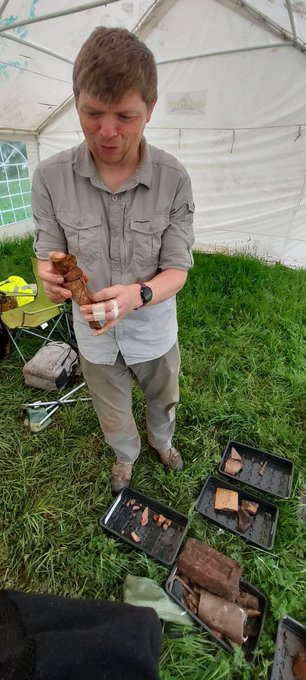
As the week progressed, 14th to 19th century finds were unearthed, thankfully shared out between the eight test pits. Clay pipe bowls (1640 to 1680), a musket ball, heat affected glass, sherds of medieval pottery and fragments of medieval roof tiles. Below a stone rubble layer, evidence of a stone-built structure was revealed in the form of large dressed stone blocks, together with walls and a stone flagged floor.
Spurred on by the whole experience, and encouraged by the de Hoghton family, the volunteers have produced and presented an ‘Outdoor History’ tour which aims to share the latest thoughts and discoveries.
Was this the site of the Hoghton Tower? Did we find anything categorical? Well yes and no. The archaeology revealed previously unrecorded stone structures. These together with the artefactual evidence were able to confirm that this part of the hilltop was occupied during the late medieval/early post-medieval periods. The geophysics also gave us other areas that warrant more digging and researching. So, some confirmation but also a lot more to understand and discover on this windswept hill!
Hello! A personal introduction before we get down to the geophysics. I’m Kayt Armstrong, and I am an advisor to the Castle Studies Trust as a specialist in the use of geophysics in archaeology. I am also a member of the board of the International Society for Archaeological Prospection, and I represent the UK on a European research network about soils and geophysics in archaeology. I obtained my PhD in Archaeological Geophysics from Bournemouth University in 2010. I have worked in the UK and Europe (Greece and Italy) since that time, conducting archaeological geophysics in a variety of research and developer-led contexts. I help the CST evaluate funding applications that have geophysical elements, and also comment on the reports from any resulting work.
If you were a Time Team enthusiast, you probably already know the answer to this one!
Geophysics is the study of the physical properties of the earth (or other planets – you can do astrogeophysics!). It is an extensive term that encompasses whole planets, right down to understanding the microstructures of stone. Archaeological geophysics falls into ‘near-surface geophysics’, which studies the first 30m or so of the ground. In fact, commonly, archaeological geophysics is only really concerned with the top 2m or so; material in the topsoil, rather than the bedrock.
Geophysicists use a variety of methods and instruments to get information about the physical properties of the ground, such as its ability to conduct electricity, or its magnetic properties. Small variations in those properties can then be mapped. Buried archaeological material causes variations in the properties in predictable ways. This means we can map buried archaeology using these methods, without having to dig everything up.
When it comes to Castles, there are three main geophysical methods: earth resistance (‘resistivity’), magnetometry, and ground-penetrating radar (GPR). All three techniques look at slightly different aspects of the sub-surface, and all three have benefits and weaknesses. It is really best to combine methods to get as complete a picture as possible, as they will all tell you slightly different things.
Magnetometry
Magnetometry is probably the most commonly used technique in archaeology. It uses sensors to look at small variations in the strength of the earth’s magnetic field, to look for changes caused by buried material. The soil on sites where humans live becomes more magnetic over time, due to things like fires for cooking and warmth and the fermentation of waste material. This material becomes the fills of cut features like pits and ditches. These end up more magnetic than the soil they are cut into.
Structures used for processes involving heating, such as kilns, furnaces and ovens, become even more strongly magnetised and have a very characteristic appearance in the data. Similarly, fired ceramic building materials like brick or tile have a distinctive signal, as do igneous or metamorphic rocks (those modified by heating during their formation).
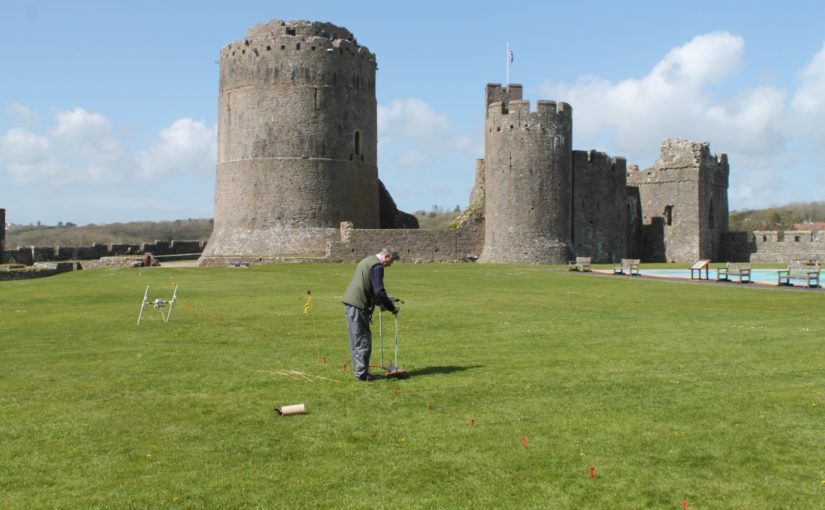
Magnetometry survey of Pembroke, funded by the CST in 2016
Magnetometry is very fast, covering upwards of 10ha a day if using the latest equipment. It is also relatively easy for community groups to employ. However, the pace will be somewhat slower using hand-carried single sensors. The plus-sides are the speed of survey and the wide variety of archaeological features that can be detected and mapped. The downsides are that this method is strongly disrupted by ferrous material in the survey environment, and has problems on igneous and metamorphic geologies as happened with the survey of Tibbers in 2014. It is also not very useful for mapping stone remains that are not strongly magnetic (such as some sandstones and most limestones). Modern infrastructure within or adjacent to the survey area has a far greater impact on the results than any buried archaeology (as happened in the Wressle survey of 2019), masking it from detection. It is practically not possible to use this method in urban areas. This method cannot detect smaller structures if they are buried more than about 2m below the ground surface. Features in the first 2m can usually be detected but the size of the anomalies that can be distinguished depends on the resolution of the readings taken. However, this method doesn’t let you understand the depths of the anomalies, and so isn’t as helpful on multi-period sites.
Earth Resistance
Earth resistance examines how easy it is to pass an electrical current through the ground. The resistivity of the subsurface varies in relation to several properties. Still, the most substantial effect is caused by variations in moisture content. The fills of cut features like pits and ditches (as witnessed in the 2018 survey at Laughton which showed a possible ditch, confirmed in the 2019 excavation and of Tibbers which lead to the discovery of a new inner bailey) tend to have a more open texture than natural soil. They usually also contain more organic matter. This means they are generally wetter than the ground they are dug into. Conversely, buried structures like walls and floors, are usually much drier than the material surrounding them, because they can’t absorb as much water.
Earth Resistence Survey at Tibbers, co-funded funded by the CST in 2016. Copyright HES
This technique can be applied in two ways. You can collect a grid of readings over a flat area to examine the first 2m or so, producing a plan view. You can also collect long lines of readings with increasingly wide measurement points. This is called ‘Electrical Resistance Tomography’ or ERT, and produces vertical pseudo-sections through the ground, and can reach greater depths, typically in archaeology 8-10m.
The plan-view method typically involves 2 probes on a mobile frame, and two remote probes connected by a cable. 2 of the probes inject a current, and two measure the resistance to it. It is especially useful for mapping buried stone structures. It is therefore handy on ‘Castle’ sites where multiple building phases can be expected. It is relatively slow, however, and relies on being able to insert probes into the ground to get the readings. This is fine on a lawn or field, and it can work on paths and gravel, but the results get very noisy, and it isn’t possible over flagstones or tarmac or concrete. You also need to be able to manoeuvre the cables and place the remote probes at an appropriate distance. This method also doesn’t let you understand the relative depths of various anomalies.
ERT is less commonly used in archaeology, but it has some specific applications in the study of large defended sites. Because it can resolve structures at a greater depth than the plan-mode, it can be used to examine the construction of large structures. This includes moats, earthen banks and buried fortification walls, and other such features. If multiple adjacent profiles are collected, the data can be combined into a 3D model of the subsurface, which can help resolve questions about the construction sequence of a site.
Twin-probe (plan-view) resistivity survey is relatively straightforward to carry out. It doesn’t require as much skill on behalf of the instrument operator as magnetometry does. It is however, slow and laborious. The equipment is relatively cheap, and data processing and visualisation are relatively simple. This method is rarely used in the commercial sector these days but is an ideal research tool. Community groups have produced excellent research using this technique. The ERT method requires specialised equipment and a trained collector. The background knowledge needed to correctly process and interpret the data is also high.
Ground Penetrating Radar
GPR only made the odd appearance on Time Team, but in the last decade or so advances in computing (mostly increasing miniaturisation of components, and improvements in battery life) have led to a new generation of GPR kit that is more flexible and affordable.
GPR works a lot like sonar or the sort of radar employed by aircraft. A transmitting antenna sends out radio waves focused into the ground. These propagate downwards and are reflected by abrupt changes in the material of the subsurface. For example, when the waves leave a stone ceiling and move into the vault, some of the waves will be reflected back up. Some will continue on, to encounter the floor of the vault, and anything below it. The reflected waves are collected by a receiving antenna (usually in the same ‘box’ as the transmitter, a fixed distance apart). The strength of the returned waves, along with the time (in nanoseconds!) it takes for them to return is logged and plotted. This is a single trace.
Ground Penetrating Radar Survey at Shrewsbury Castle 2019, funded by the CST
The antenna is dragged along a line, and a series of traces are collected at a small interval (usually every 5cm or 2cm), which are combined together to make a profile. This is effectively a vertical slice through the ground. These are a bit difficult to read because the radio waves emit in a curved shape, so they actually travel in front of and behind the antenna, not just directly under it. This creates distinctive hyperbolas in the data. The depth of signal penetration and the size of the objects you can detect varies with antenna frequency. Depending on the frequency of the antenna, you can look very shallowly and resolve things that are a centimetre (or less) across. Very high-frequency antennas are used to assess the structure of concrete in civil engineering or to image different layers in mosaics and floor coverings. Lower frequency antennas cannot resolve smaller anomalies but can penetrate 10m+ to resolve much larger objects, such as former river beds, large walls or banks and ditches.
Groups of profiles collected in parallel lines can be combined together to make a 3D block of data. This can be processed in a way that allows different horizontal depth slices to be examined (as done at Fotheringhays; see time slice). A new generation of GPR system uses lots of antennas in an array to collect very high- resolution datasets (8cm in all directions), or arrays of different frequencies to quickly collect data with good resolution at multiple depths.
GPR requires a skilled operator to plan the work, collect the data and the process and analyse the results, but it is arguably the best technique for investigating Castle sites. This is because it tends to be good at detecting the sorts of things we would expect to be looking for, for example, voids, buried walls, culverts and surfaces. It can also be deployed inside standing buildings, to look underneath floors or behind walls. It can be used over tarmac and concrete (providing the concrete is not re-inforced!) and does well on most geologies, except for certain kinds of clays, and saline environments like estuaries.
The other advantage of GPR is that the data is relatively fast to collect, compared to earth resistance, and a broader range of features can be detected with it. It is also an inherently 3D method and allows complicated below-ground sequences to be visualised and interpreted. I have seen examples of staircases being visible in the data from 3D GPR, for instance. This technique has made the headlines recently, with the publication of a study of an entire Roman city, Falerii Novi, just north of Rome, by colleagues of mine from Ghent University and Cambridge University.
Geophysics and the Castle Studies Trust
Geophysical approaches form an increasing component of research proposals put to the trust, which is excellent to see! Geophysics can help to answer both broad and specific questions about castle-sites, without the potentially destructive process of excavation. Geophysics also has applications for the conservation of sites and planning for their future management. For example, in mapping the integrity of standing walls using GPR, or understanding the soils and material within earthworks to protect them from erosion in extreme weather events. They can help site managers decide whether an intervention is necessary, and can inform the design of any needed work. Geophysics can also play an essential role in the continuing life of these sites as homes or places of historical interest by mapping areas where conservation or building work is planned to ensure nothing is damaged by the work.
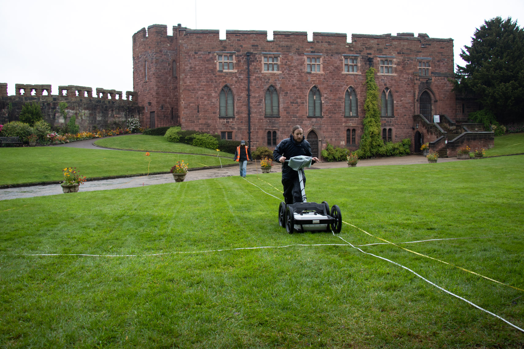
William Wyeth, Properties Historian at English Heritage Trust and project lead on the Castle Studies Trust funded project to geophysically survey Warkworth Castle explains what he hopes the survey will achieve.
In 2019 English Heritage, a charity which looks after over 400 historic properties and sites across England, began a project to change the way in which the stories of the people and buildings at Warkworth Castle in Northumberland were told. The castle is a popular destination in the county, and is both connected with notorious figures from the past as well as featuring an iconic piece of medieval architecture and design in its late 14th-century Great Tower.
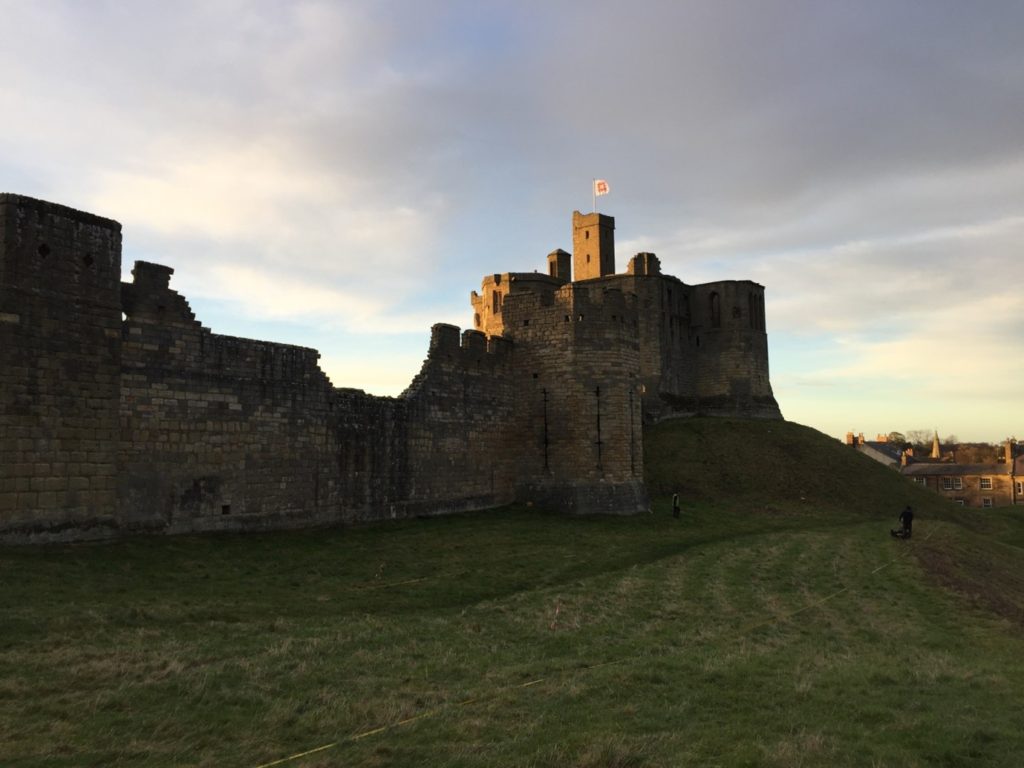
Figure 1. Warkworth Castle from the south-east. The Great Tower, in the background, sits atop a large motte. In the foreground, the curtain wall is punctuated by the Grey Mare’s Tail tower. Archaeologists from Archaeological Services – Durham University are surveying the unenclosed strip of bailey
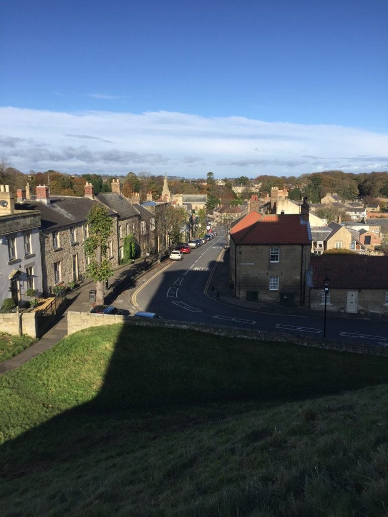
Warkworth is located at the foot of a narrow loop in the River Coquet, in coastal north-eastern Northumberland, about 25 miles north of Newcastle-Upon-Tyne and 30 miles south of Berwick-Upon-Tweed, themselves both significant fixtures of the late medieval history of this area. Just north of the castle proper and nestled on three sides within the river loop is the small village of Warkworth, arrayed in quite typical medieval layout. At the north end of the high street, sitting on a rough north-south axis, is the parish church of St Lawrence, probably an early medieval foundation, as well as a bridge with a toll-collecting tower built in the later 14th century. South of the church, numerous narrow parallel plots of land spread out at right angles from the high street. The southern trajectory of the street is abruptly broken by the enormous motte (earthen mound) of the castle, which acts to physically separate the village from the land south of the river.
Among the most famous historical figures connected to the castle was Henry Percy, eldest son of the 1st Earl of Northumberland, though he is more familiar to us today as Harry Hotspur. The origin of his martial nickname is not certain, but is accounted for in several traditions, all of which confirm that they drew from his short-tempered and violent character. One later 16th-century source rhythmically noted “For his sharp quickness and speediness at need / Henry Hotspur he was called in very deed.”
Though the early history of the Percy Northumberland earls and associated figures will form a key part of the story of the castle when the interpretation project is completed in 2022, other questions about the castle, and especially its earlier history, remain as yet unresolved. Among these is the relationship of the earthworks – the motte and bailey – with the stone structures atop them, the oldest of which date to the later 12th century. The Castle Studies Trust has graciously agreed to fund a geophysical survey of much of the castle earthworks to resolve three big questions.
The first touches upon the motte, which features the Great Tower of the 1370s, but was probably topped by an earlier structure. By assessing buried deposits around the tower, we aim to reveal traces of this earlier structure. But we also want to establish evidence for the means by which the Great Tower may have been provisioned, via a secure door to the motte-top outside the enclosing curtain wall which gave access to storage areas for beer and food in the tower’s north-west segment.
The second question relates to the bailey. In common with other castles of this type, the bailey was filled with buildings, often (as at Warkworth) in their earliest phases arrayed along the inner face of the enclosing wall. But were there buildings here before, or were there also buildings here from later periods, but for which above-ground evidence has been lost? Findings from the survey here will greatly influence how we understand the formal approach to the bailey’s principal buildings – its Gatehouse, Great Hall and Chapel – but also the late medieval Great Tower. The results may also shed light on the peculiar overhauling of spatial arrangements in the bailey occasioned by the construction of a 15th-century Collegiate Church which straddled the span of the bailey, arguably fundamentally changing how the castle was to be experienced.
The last question also relates to the bailey, but here to a strip of the bailey which sits outside the embrace of the late 12th-early 13th-century stone curtain wall, on the eastern side of the castle. The omission of this area from enclosure is unusual, though it is not without analogies from elsewhere, which suggest areas like this could contain gardens. It may be instructive that just within the bailey and adjacent to this strip was the location of late medieval stables – perhaps this area came to be used for the grazing of horses, though whether this was its original intended purpose remains to be seen. In addition to all of this, however, is the possibility that when the motte-and-bailey was built, perhaps well before the earliest stone parts of the castle were erected, the earliest enclosing wall of the bailey also embraced this eastern strip, thereby creating a larger bailey than the present one.
We hope that the survey will allow us to answer at least some of these questions. Whatever the outcome, it is certain that the results will help change how we understand the story of Warkworth Castle and its previous inhabitants.
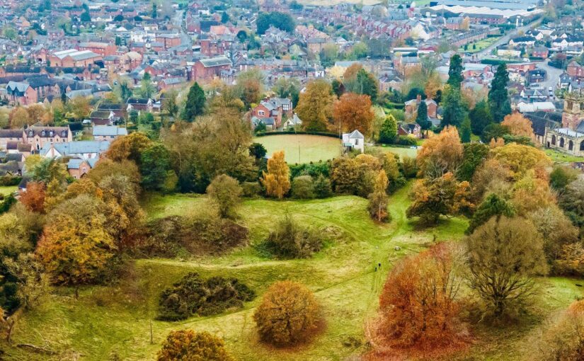
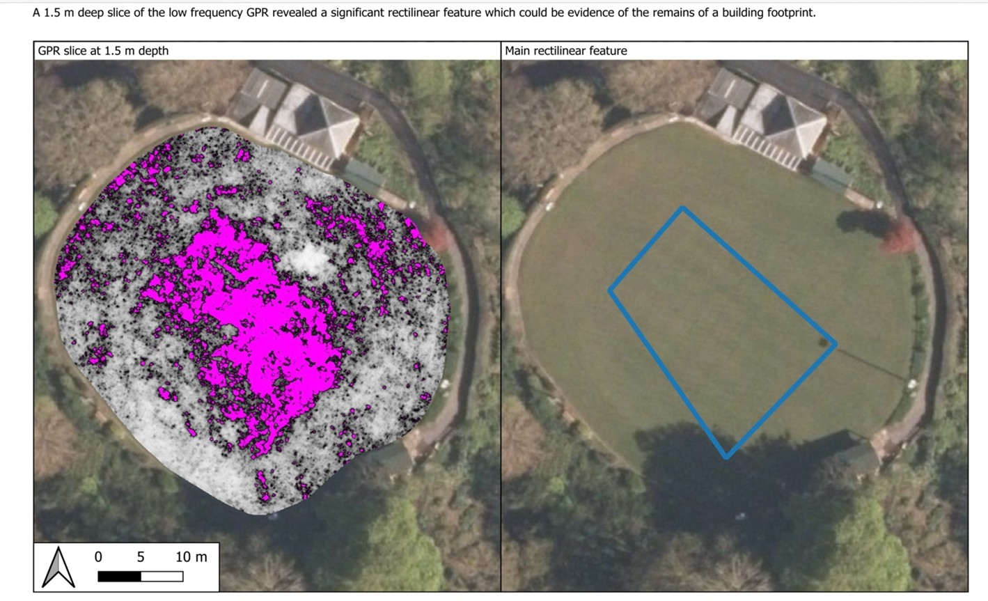
We have the results of the survey at Fotheringhay Castle. You can find out more about what we found in Steve Parry’s excellent blogpost, complete with the earliest depiction of the castle.
The castle is most famous as the place where Mary Queen of Scots was tried and executed. It was thoroughly dismantled in the first half of the 17th century, leaving the motte intact but little else above ground. Thanks to work by the Museum of London Archaeology and funded by the Castle Studies Trust, we now have a better idea of how the castle was arranged.