Dr Rowena Banerjea, University of Reading, UK, with funding from a British Academy/Leverhulme Small Research Grant talks about the research project she works on All Along the Watchtowers! https://research.reading.ac.uk/castle-geoarchaeology-heritage/
The buried or below-ground archaeology at castle sites can be exceptionally well preserved because of its burial under masonry. However, it is often overlooked in conservation and management plans in favour of protection and consolidation of standing remains and developments such as reconstruction and rebuilding projects. It provides an important lens through which we can examine important phases and hiatuses in the developmental history of these monuments.
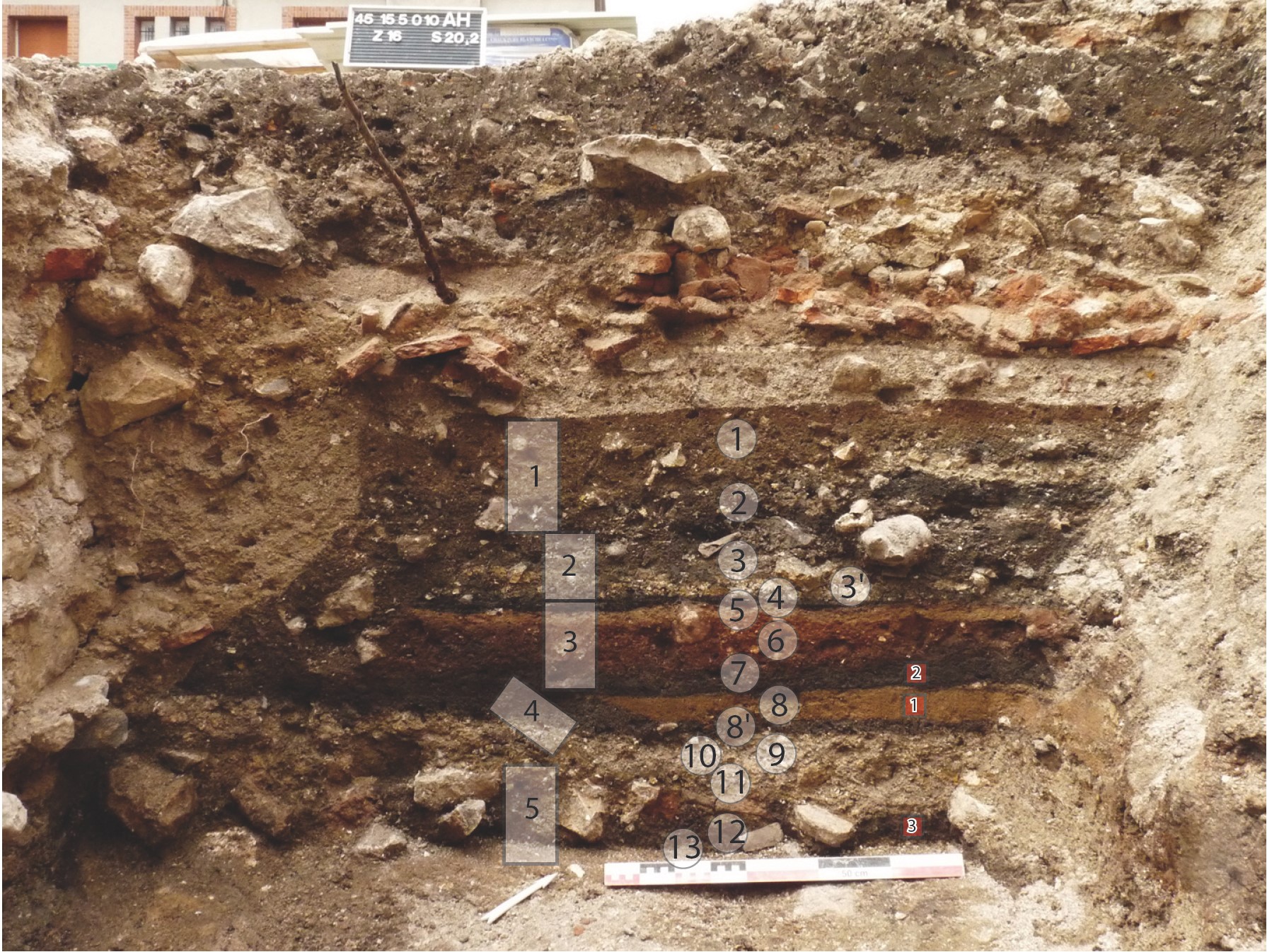
INSERT FIGURE 1. Well-preserved stratigraphy at Château de Gien, France, from c. 9th – 11th AD occupation, sealed below later masonry and collapse.The rectangles show where micromorphology samples were collected, and the circles mark the locations of spot samples for other scientific analyses. Photo credit Quentin Borderie.]
This project has been made possible due to its project partners and collaborations with several other research projects. The castle case studies represent a diverse range of cultural, environmental and heritage contexts across Europe, in which we could examine the preservation of stratigraphy, biological remains, artefacts and materials:
Castle Keverberg (Kessel), the Netherlands, which consisted of an original stone tower built in 1100 and covered by a motte-and-bailey castle;
Several French castles, which are Château de Caen, built in 1060, Château de Gien, which today hosts the National Museum of Hunting with the remains of an early (c. 9th – 11th AD) Carolingian castra below, Château de Loches and Château de Boves;
Two Italian case studies, Castelseprio, a UNESCO World Heritage site, and Montegrotto;
Dunyvaig Castle, Islay, Scotland, formerly the naval fortress of the Lords of the Isles, the chiefs of the Clan MacDonald.
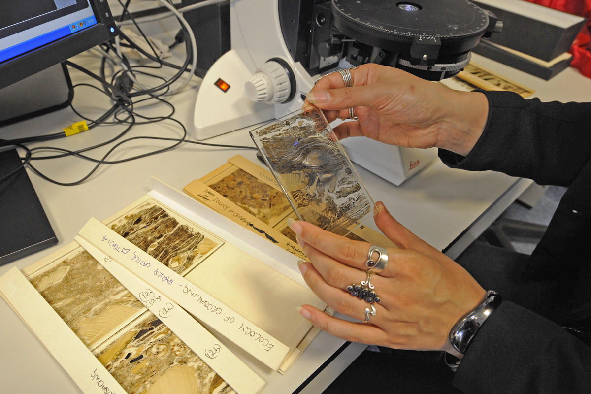
This project developed a framework for geoarchaeological research at European castles to target archaeologists, castle curators and heritage management policy-makers, so that our guidance can influence their future excavation strategies and conservation plans. Geoarchaeology applies environmental science techniques to archaeological research questions. Soil micromorphology is a geoarchaeological technique that enables us to conduct a micro-excavation by analysing a slide, or ‘thin section’, produced from an intact, small block collected from the archaeological stratigraphy, so the inclusions are still in situ. The slide is analysed using a geological polarising microscope. Under the microscope, we record the same soil properties as archaeologists do in the field and additional ones, to understand the processes by which materials were deposited, how they have decayed due to chemical weathering, and how later human and faunal disturbances have affected the stratigraphy.
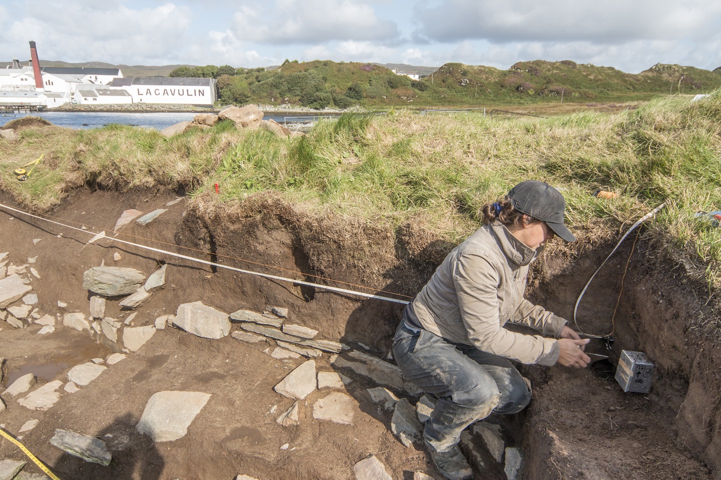
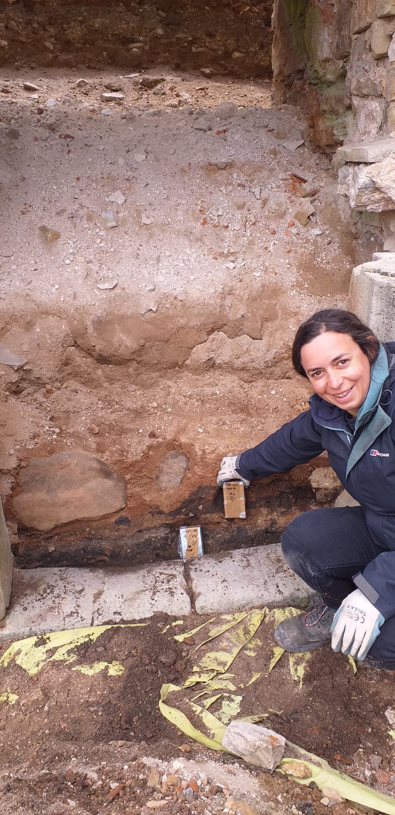
FIGURE 2. Micromorphology sampling of turf modifications to the curtain wall at Dunyvaig Castle, Islay, Scotland. Photo credit The Dunyvaig ProjectFIGURE 3. Micromorphology sampling of occupation deposits sealed below later masonry and collapse during excavations ahead of conservation work on the eastern range of Cēsis Castle, Latvia. Photo credit Alex BrownFIGURE 4. Micromorphologyor ‘thin sections’ from Elbląg (Poland) and Karksi (Estonia) castles. Photo credit Magnus Elandner
Soils and sediments are the backbone of the archaeological record. Our data revealed important stories within the soils about the early development of castle sites, the activities that took place inside different areas of the castle and how they may relate to the activities in a castle’s hinterland. We noticed that the preservation of the stratigraphy was exceptional owing to its burial under later masonry structures, masonry collapse and successive occupation layers; a phenomenon which is also observed on urban sites and Near Eastern tell sites.
Our results highlight the great potential and requirement for scientific analysis of these deposits when they are uncovered by excavation and/or building activities. These building activities include the conservation and renovation of the standing architecture and the removal of rubble, which can unseal buried archaeology affecting its preservation. Our analyses have revealed microscopic evidence for in situ animal husbandry and horse stabling, as well as the types of fodder that livestock were fed, crop processing activities, and periods of soil formation where areas of a castle have been abandoned or changed use. For example, at Castillo de Molina de Aragón, Spain, microstratigraphic data show the changing nature of the occupation the citadel, from the Islamic to Christian period which could possibly indicate a change in its role from a clean, well-maintained space to one where livestock roamed. The Islamic plaster floor surface was kept clean and very little domestic refuse accumulated ̶ a soil formed over it, followed by a substantial destruction horizon. In comparison, units of discarded material and trampled floor surfaces characterise the (Re)Conquest phase, c. 1154, and a series of plaster floor surfaces with associated occupation residues containing herbivore dung showing that livestock were present, which probably relate to modifications during the thirteenth and fourteenth centuries.
Castle Studies Trustee Charles Hollwey looks at the intriguing case of Humphrey de Bohun and the 10 licences to crenellate awarded to him on the eve of the Black Death and what happened to them.
In December 1347, Humphrey de Bohun, 6th earl of Hereford, 5th earl of Essex, was given a licence to crenellate, i.e. to fortify, 10 of his manors. These were:-
The number of licences is the most ever given, at one time, to a medieval noble or gentry. You can find them all on the Gatehouse castle gazetteer website[i]. However scrutiny here would indicate that there is little to see now or indeed was in the past. Most of the sites would appear to have been not much more than lightly fortified manor houses. Only at Saffron Walden is there what would be commonly described as a castle. However here and elsewhere there is little evidence that any building work was done by Humphrey.
A possible explanation could be the date. In 1348, the Black Death reached England. It was first recorded at Weymouth in June, reaching London by the autumn and was across all southern England by March 1349. It was only in December 1349 that some form of normality returned.
Map of the Progress of the Black Death
Like our current pandemic there were drastic consequences with an estimated 40 to 60% of the population dying, the greatest loss being amongst the working classes. There was a curtailment of much activity for instance major campaigns in the 100 Years’ War with France were halted until 1355. Post the pandemic there was a shortage of labour with an increase in wages, meaning building projects would have been more expensive.[ii]
Dance of Death (replica of 15th_century fresco; National Gallery of Slovenia)
In such a situation did Humphrey cease his building plans? Before jumping to this conclusion we need to probe into the impact on castle construction, the nature of licences to crenellate and the life of Humphrey.
Impact on castle building? The consensus view seems to be, certainly in the long term, this was not great. John Goodall, the eminent castle expert suggests it raised the financial threshold of construction and increased the relative importance of royal works. However it did not “deter the very richest—from embarking on splendid building projects”[iii]
Nature of licences to crenellate? It is not unusual to have licences without ensuing building work. The research of the late Charles Coulson and Phil Davies has highlighted that the true nature of such licences was not to control castle building but for the recipients to obtain the prestige, status and legitimacy of having such documents, whilst also generating revenue to the crown.[iv] Many were made after castle building or were given to buildings with minimal fortifications and many seemed to have led to no construction. The number given to Humphrey whilst high was similar to a few Bishops, for instance the bishop of Salisbury received licences for 10 sites in 1377 and the bishop of Chichester for 12 houses in 1448. Similarly to Humphrey, there was little consequently to see.
Life of Humphrey? Born in 1309 a younger son, inheriting in 1336, he served in the Breton campaigns of the Hundred Years’ War with involvement in the victories of Morlaix (1342) and La Roche-Derrien (1347).[v] However I am unaware of any subsequent campaigning and despite being the Lord High Constable of England he was never a favourite of Edward III. He died in 1361 at Pleshey Castle leaving his nephew as heir.
There is not a simple answer to this plethora of licences and missing castles. It is possible some were to underpin his legitimacy to manors where his inheritance might have been disputed, such as Seend and Upavon. Similarly at Saffron Walden, which had been slighted as a castle during the anarchy. Others might have been to emphasis his premier noble status.
Perhaps what was important pre-pandemic was not so afterwards? The impact on his psychological wellbeing is unknown but might be significant as can occur in our pandemic. In 1350 he commissioned the translation of the romance poem ‘Guillaume de Palerme’. He did not seem to have married or had children.
In my view the answer to this mystery is not simply the pandemic but it might have been a factor. I do think more understanding of his life might be the key.
Steven Spencer and Elena Faraoni of the Hoghton Tower Preservation Trust, look at the results of their work, funded by the Castle Studies Trust in 2019, in trying to find out more about Hoghton Tower in Lancashire.
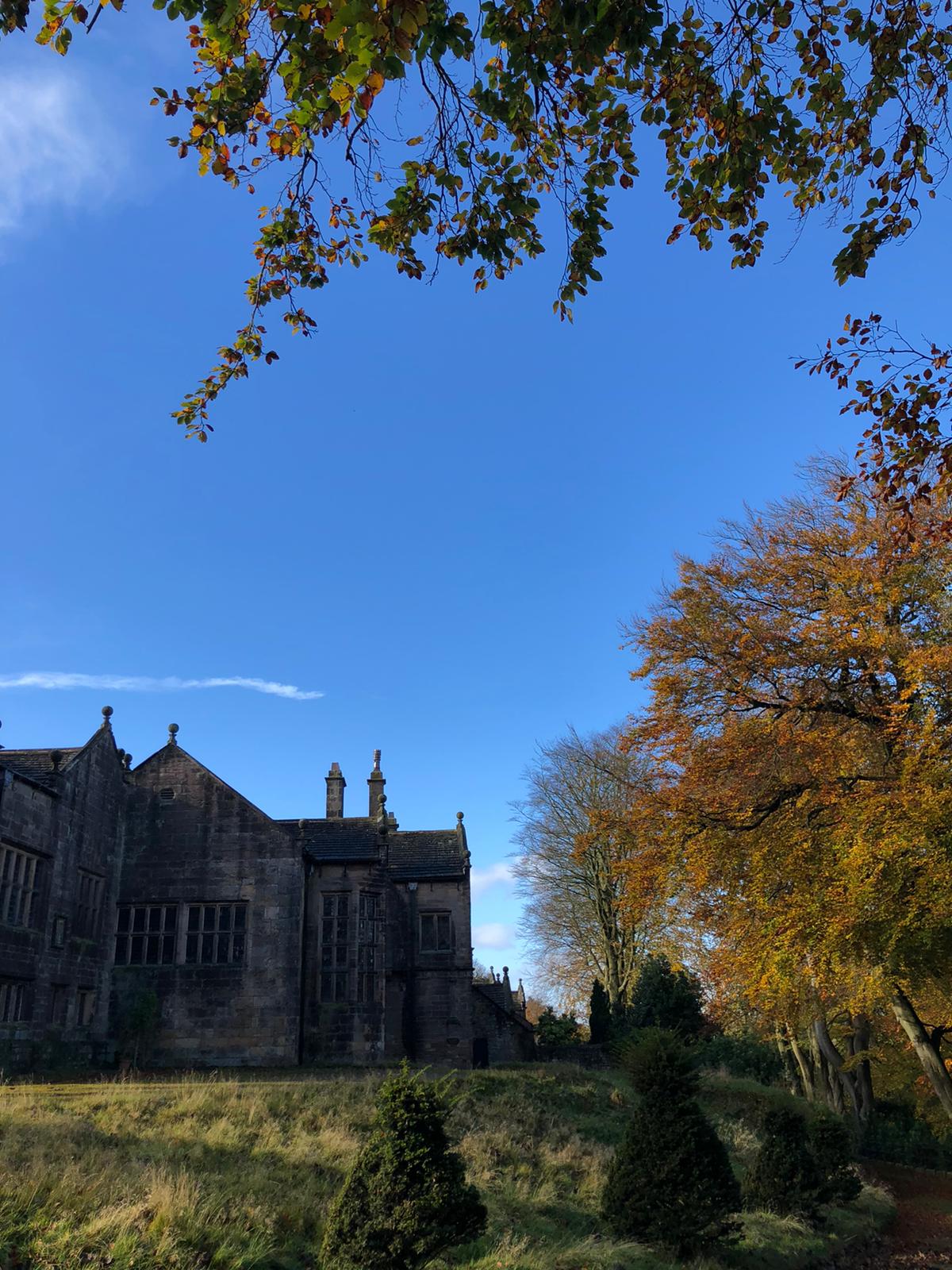
Hoghton Tower sits 650 ft above sea-level in the heart of the Lancashire countryside. The stories of its visitors and family members are documented and shared whether it be in books, portraits, family albums or documents in the Lancashire archives. But there is one story which has always intrigued us and that is: what was the first tower of Hoghton Tower and where was it? It is clear when looking at the building today that this, like many other historic houses, is a ‘patchwork’ of different projects by different generations interlaced and blended…but where did Hoghton Tower start? Where was the original tower?
There are some clues: the ageing of the stone, the position of the well house, family stories passed down the generations, the shape of the windows and a mysterious mound of stones on the north side of the buildings. One of these stones has an intriguing mason’s mark… Spurred on by the interest of a group of our amazing volunteers who had just finished some research into historic graffiti and masons’ marks it was time to do some investigation under the guidance of Dr Mike Nevell and his team at Salford University. We designed a research project based on archaeological digs, building recording, geophysics and archives research based on the key exam question “where was the great keep of the Hoghton Tower hill?”
North side of Hoghton Tower (copyright Hoghton Preservation Trust)
Thanks to the grant from the Castle Studies Trust, work quickly got underway. Through a series of Salford-led workshops, the team surveyed, recorded and reviewed old photographs and pictures.
Then there was the wonderful five-day archaeological dig.
As they passed through the perimeter fencing on to the dig site, the usually mild-mannered volunteers underwent personality transformations as pairs of friends and even married couples were ‘pitted’ against one another. Was this the site of a 14th century Pele Tower, a 1643 victim of the First Civil War, who would make the crucial find?
Under the patient guidance and control of the Salford team, the test pits were marked out and the excavations began, to many this was the chance of a lifetime and was eagerly embraced. Each find was announced with enthusiastic shouting from the discoverer and muted derision from those yet to make a meaningful contribution.
Hoghton Tower Gatehouse from inside the courtyard (copyright Hoghton Tower Preservation Trust)
As the week progressed, 14th to 19th century finds were unearthed, thankfully shared out between the eight test pits. Clay pipe bowls (1640 to 1680), a musket ball, heat affected glass, sherds of medieval pottery and fragments of medieval roof tiles. Below a stone rubble layer, evidence of a stone-built structure was revealed in the form of large dressed stone blocks, together with walls and a stone flagged floor.
Spurred on by the whole experience, and encouraged by the de Hoghton family, the volunteers have produced and presented an ‘Outdoor History’ tour which aims to share the latest thoughts and discoveries.
Was this the site of the Hoghton Tower? Did we find anything categorical? Well yes and no. The archaeology revealed previously unrecorded stone structures. These together with the artefactual evidence were able to confirm that this part of the hilltop was occupied during the late medieval/early post-medieval periods. The geophysics also gave us other areas that warrant more digging and researching. So, some confirmation but also a lot more to understand and discover on this windswept hill!
Hello! A personal introduction before we get down to the geophysics. I’m Kayt Armstrong, and I am an advisor to the Castle Studies Trust as a specialist in the use of geophysics in archaeology. I am also a member of the board of the International Society for Archaeological Prospection, and I represent the UK on a European research network about soils and geophysics in archaeology. I obtained my PhD in Archaeological Geophysics from Bournemouth University in 2010. I have worked in the UK and Europe (Greece and Italy) since that time, conducting archaeological geophysics in a variety of research and developer-led contexts. I help the CST evaluate funding applications that have geophysical elements, and also comment on the reports from any resulting work.
If you were a Time Team enthusiast, you probably already know the answer to this one!
Geophysics is the study of the physical properties of the earth (or other planets – you can do astrogeophysics!). It is an extensive term that encompasses whole planets, right down to understanding the microstructures of stone. Archaeological geophysics falls into ‘near-surface geophysics’, which studies the first 30m or so of the ground. In fact, commonly, archaeological geophysics is only really concerned with the top 2m or so; material in the topsoil, rather than the bedrock.
Geophysicists use a variety of methods and instruments to get information about the physical properties of the ground, such as its ability to conduct electricity, or its magnetic properties. Small variations in those properties can then be mapped. Buried archaeological material causes variations in the properties in predictable ways. This means we can map buried archaeology using these methods, without having to dig everything up.
When it comes to Castles, there are three main geophysical methods: earth resistance (‘resistivity’), magnetometry, and ground-penetrating radar (GPR). All three techniques look at slightly different aspects of the sub-surface, and all three have benefits and weaknesses. It is really best to combine methods to get as complete a picture as possible, as they will all tell you slightly different things.
Magnetometry
Magnetometry is probably the most commonly used technique in archaeology. It uses sensors to look at small variations in the strength of the earth’s magnetic field, to look for changes caused by buried material. The soil on sites where humans live becomes more magnetic over time, due to things like fires for cooking and warmth and the fermentation of waste material. This material becomes the fills of cut features like pits and ditches. These end up more magnetic than the soil they are cut into.
Structures used for processes involving heating, such as kilns, furnaces and ovens, become even more strongly magnetised and have a very characteristic appearance in the data. Similarly, fired ceramic building materials like brick or tile have a distinctive signal, as do igneous or metamorphic rocks (those modified by heating during their formation).
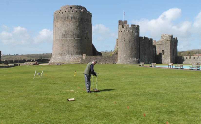
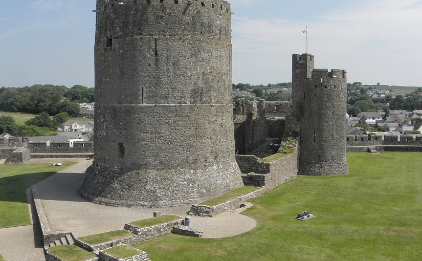
Magnetometry survey of Pembroke, funded by the CST in 2016
Magnetometry is very fast, covering upwards of 10ha a day if using the latest equipment. It is also relatively easy for community groups to employ. However, the pace will be somewhat slower using hand-carried single sensors. The plus-sides are the speed of survey and the wide variety of archaeological features that can be detected and mapped. The downsides are that this method is strongly disrupted by ferrous material in the survey environment, and has problems on igneous and metamorphic geologies as happened with the survey of Tibbers in 2014. It is also not very useful for mapping stone remains that are not strongly magnetic (such as some sandstones and most limestones). Modern infrastructure within or adjacent to the survey area has a far greater impact on the results than any buried archaeology (as happened in the Wressle survey of 2019), masking it from detection. It is practically not possible to use this method in urban areas. This method cannot detect smaller structures if they are buried more than about 2m below the ground surface. Features in the first 2m can usually be detected but the size of the anomalies that can be distinguished depends on the resolution of the readings taken. However, this method doesn’t let you understand the depths of the anomalies, and so isn’t as helpful on multi-period sites.
Earth Resistance
Earth resistance examines how easy it is to pass an electrical current through the ground. The resistivity of the subsurface varies in relation to several properties. Still, the most substantial effect is caused by variations in moisture content. The fills of cut features like pits and ditches (as witnessed in the 2018 survey at Laughton which showed a possible ditch, confirmed in the 2019 excavation and of Tibbers which lead to the discovery of a new inner bailey) tend to have a more open texture than natural soil. They usually also contain more organic matter. This means they are generally wetter than the ground they are dug into. Conversely, buried structures like walls and floors, are usually much drier than the material surrounding them, because they can’t absorb as much water.
Earth Resistence Survey at Tibbers, co-funded funded by the CST in 2016. Copyright HES
This technique can be applied in two ways. You can collect a grid of readings over a flat area to examine the first 2m or so, producing a plan view. You can also collect long lines of readings with increasingly wide measurement points. This is called ‘Electrical Resistance Tomography’ or ERT, and produces vertical pseudo-sections through the ground, and can reach greater depths, typically in archaeology 8-10m.
The plan-view method typically involves 2 probes on a mobile frame, and two remote probes connected by a cable. 2 of the probes inject a current, and two measure the resistance to it. It is especially useful for mapping buried stone structures. It is therefore handy on ‘Castle’ sites where multiple building phases can be expected. It is relatively slow, however, and relies on being able to insert probes into the ground to get the readings. This is fine on a lawn or field, and it can work on paths and gravel, but the results get very noisy, and it isn’t possible over flagstones or tarmac or concrete. You also need to be able to manoeuvre the cables and place the remote probes at an appropriate distance. This method also doesn’t let you understand the relative depths of various anomalies.
ERT is less commonly used in archaeology, but it has some specific applications in the study of large defended sites. Because it can resolve structures at a greater depth than the plan-mode, it can be used to examine the construction of large structures. This includes moats, earthen banks and buried fortification walls, and other such features. If multiple adjacent profiles are collected, the data can be combined into a 3D model of the subsurface, which can help resolve questions about the construction sequence of a site.
Twin-probe (plan-view) resistivity survey is relatively straightforward to carry out. It doesn’t require as much skill on behalf of the instrument operator as magnetometry does. It is however, slow and laborious. The equipment is relatively cheap, and data processing and visualisation are relatively simple. This method is rarely used in the commercial sector these days but is an ideal research tool. Community groups have produced excellent research using this technique. The ERT method requires specialised equipment and a trained collector. The background knowledge needed to correctly process and interpret the data is also high.
Ground Penetrating Radar
GPR only made the odd appearance on Time Team, but in the last decade or so advances in computing (mostly increasing miniaturisation of components, and improvements in battery life) have led to a new generation of GPR kit that is more flexible and affordable.
GPR works a lot like sonar or the sort of radar employed by aircraft. A transmitting antenna sends out radio waves focused into the ground. These propagate downwards and are reflected by abrupt changes in the material of the subsurface. For example, when the waves leave a stone ceiling and move into the vault, some of the waves will be reflected back up. Some will continue on, to encounter the floor of the vault, and anything below it. The reflected waves are collected by a receiving antenna (usually in the same ‘box’ as the transmitter, a fixed distance apart). The strength of the returned waves, along with the time (in nanoseconds!) it takes for them to return is logged and plotted. This is a single trace.
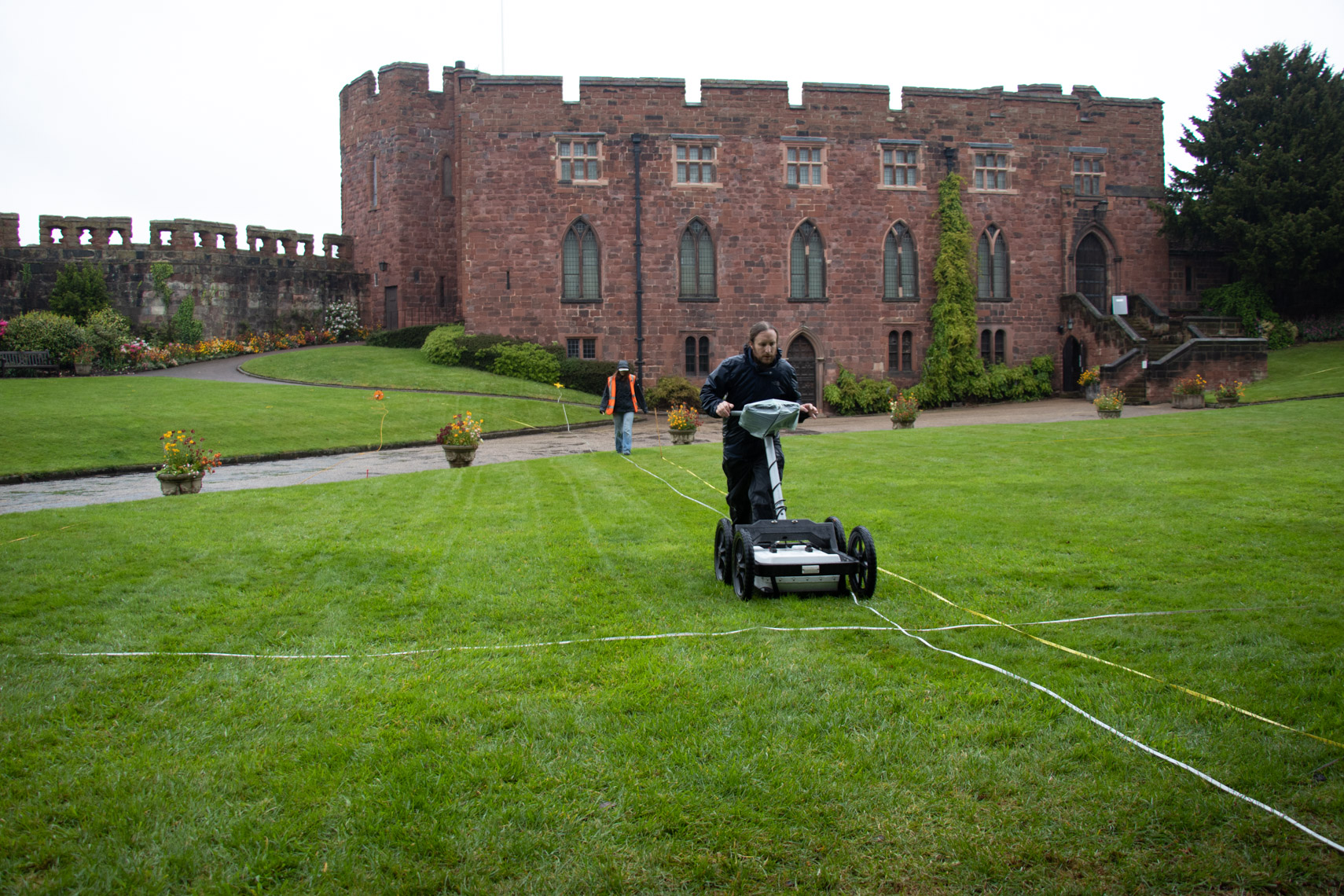
Ground Penetrating Radar Survey at Shrewsbury Castle 2019, funded by the CST
The antenna is dragged along a line, and a series of traces are collected at a small interval (usually every 5cm or 2cm), which are combined together to make a profile. This is effectively a vertical slice through the ground. These are a bit difficult to read because the radio waves emit in a curved shape, so they actually travel in front of and behind the antenna, not just directly under it. This creates distinctive hyperbolas in the data. The depth of signal penetration and the size of the objects you can detect varies with antenna frequency. Depending on the frequency of the antenna, you can look very shallowly and resolve things that are a centimetre (or less) across. Very high-frequency antennas are used to assess the structure of concrete in civil engineering or to image different layers in mosaics and floor coverings. Lower frequency antennas cannot resolve smaller anomalies but can penetrate 10m+ to resolve much larger objects, such as former river beds, large walls or banks and ditches.
Groups of profiles collected in parallel lines can be combined together to make a 3D block of data. This can be processed in a way that allows different horizontal depth slices to be examined (as done at Fotheringhays; see time slice). A new generation of GPR system uses lots of antennas in an array to collect very high- resolution datasets (8cm in all directions), or arrays of different frequencies to quickly collect data with good resolution at multiple depths.
GPR requires a skilled operator to plan the work, collect the data and the process and analyse the results, but it is arguably the best technique for investigating Castle sites. This is because it tends to be good at detecting the sorts of things we would expect to be looking for, for example, voids, buried walls, culverts and surfaces. It can also be deployed inside standing buildings, to look underneath floors or behind walls. It can be used over tarmac and concrete (providing the concrete is not re-inforced!) and does well on most geologies, except for certain kinds of clays, and saline environments like estuaries.
The other advantage of GPR is that the data is relatively fast to collect, compared to earth resistance, and a broader range of features can be detected with it. It is also an inherently 3D method and allows complicated below-ground sequences to be visualised and interpreted. I have seen examples of staircases being visible in the data from 3D GPR, for instance. This technique has made the headlines recently, with the publication of a study of an entire Roman city, Falerii Novi, just north of Rome, by colleagues of mine from Ghent University and Cambridge University.
Geophysics and the Castle Studies Trust
Geophysical approaches form an increasing component of research proposals put to the trust, which is excellent to see! Geophysics can help to answer both broad and specific questions about castle-sites, without the potentially destructive process of excavation. Geophysics also has applications for the conservation of sites and planning for their future management. For example, in mapping the integrity of standing walls using GPR, or understanding the soils and material within earthworks to protect them from erosion in extreme weather events. They can help site managers decide whether an intervention is necessary, and can inform the design of any needed work. Geophysics can also play an essential role in the continuing life of these sites as homes or places of historical interest by mapping areas where conservation or building work is planned to ensure nothing is damaged by the work.


