Project lead Dr Andy Moir (Chairman of the Gloucestershire Building Recording Group) takes a look at the project to see if we need to re-evaluate our existing understanding of the building history of Sudeley Castle.
Sudeley Castle is a grade I listed building (Historic England List No: 1154791). Although the castle has origins as a Saxon house, its history really began with Ralph Boteler who in 1441 became the Lord Admiral, and then Baron Sudeley and Lord Chamberlin of the Kings Household. Ralph Boteler set about buildings a castle to reflect his new found status and is reputed to have built the Portmare Tower, the Dungeon Tower, the banqueting Hall, and the Tithe barn. In 1547 Thomas Seymour married King Henry VIII widow Katherin Parr (who’s tomb is at the castle) and set about the refurbishment of the estate. Historical documents record that stonemasons and carpenters built a complete new suite of apartments. Queen Mary granted the castle to Sir John Brydges in 1554 creating him Lord Chandos and later the third Lord Chandos entertained Queen Elizabeth I three times at Sudeley.
The castle was bombarded by cannon in 1644 during the Civil War and ordered ‘slighted’ (which is stated to have included the removal of the roofs) in 1649. After this the castle was left in ruins for the next 180 years and then extensively restored in the 19th century.
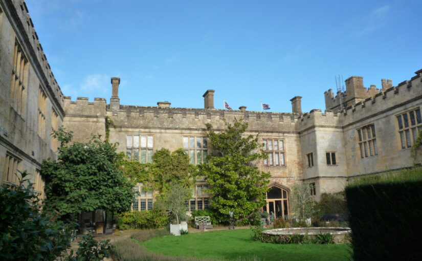
Figure 1: Outer Courtyard Ranges of Sudeley Castle, copyright Dr Andy Moir
Due to the slighting previously little of the earlier builds at Sudeley were thought to survive. However, in November 2025 the Outer Courtyard of Sudeley Castle was visited by the Gloucestershire Building Recording Group (GBRG) and a brief visual survey of the west, north and east range roofs undertaken (Figure 1).Some of stylistic features of timbers that survive in the roofs are useful to estimating their date of contraction, because date ranges of similar features have been identified in through the GBRG’s previous tree-ring dated projects on buildings in Gloucestershire. For instance, the use of queen struts (Figure 2) in the castle roofs are rarely used before the 1440s, and the use of clasped purlins are generally restricted to between the 1380s and 1500s. Diminished principal are present and these are rarely used before the 1440s and to date no examples have been found after the 1550s. Similarly the use of curved wind braces are typically restricted to before the 1570s, after which straight wind braces become more common used. Also in terms of carpentry, 80º saw marks are usually a reliable indicator that the timbers were pit-sawn, which generally comes into use from the 1540s. Overall, the stylistic features recorded suggest that the West and North Range roofs were likely constructed in the first half of the 16th century, some time between the 1500s and 1550s. This evidence suggests that the West and North ranges may be part of the new suite of apartments built by Thomas Seymour around 1547. However, precise dating of the timbers would be required to resolve this issue.
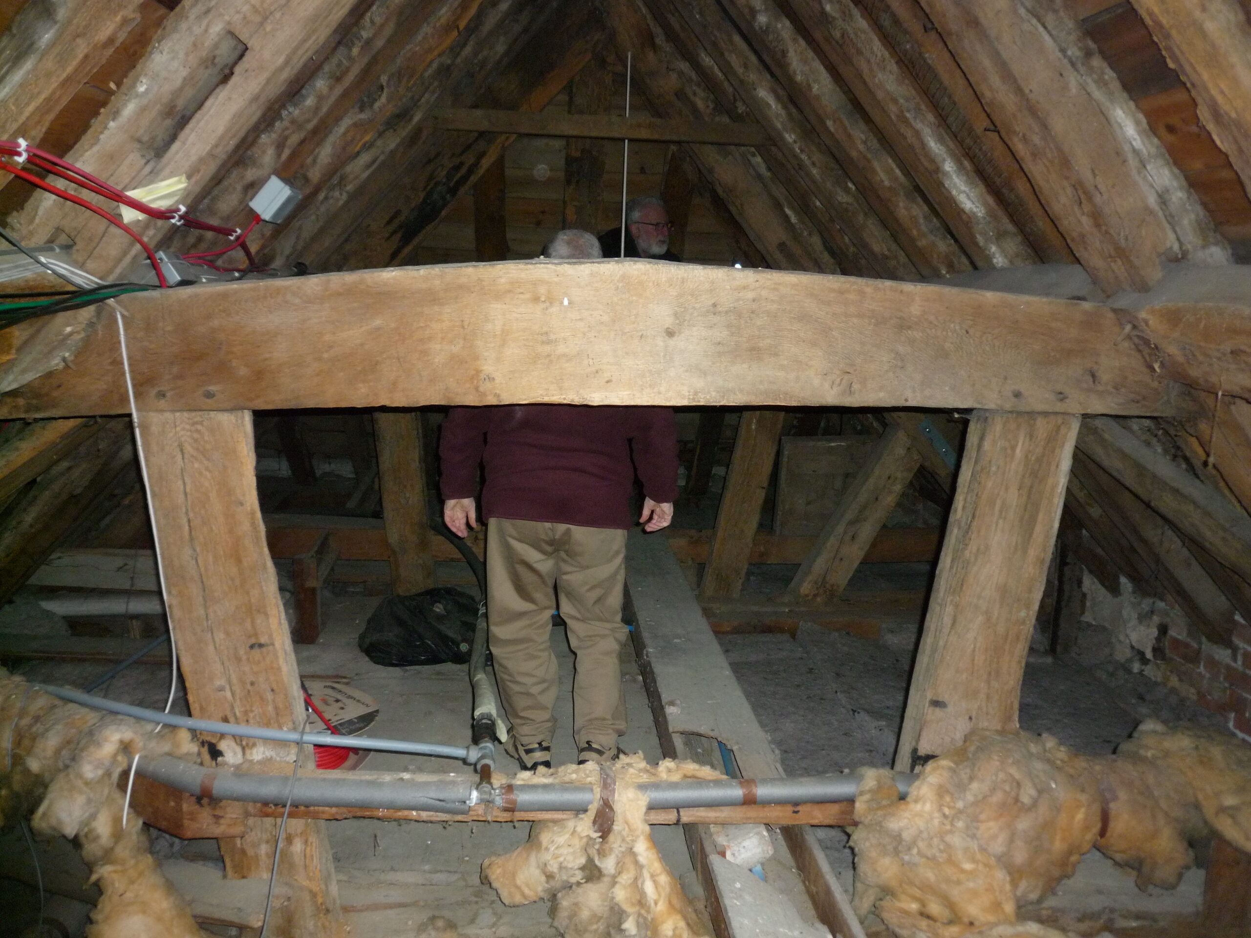
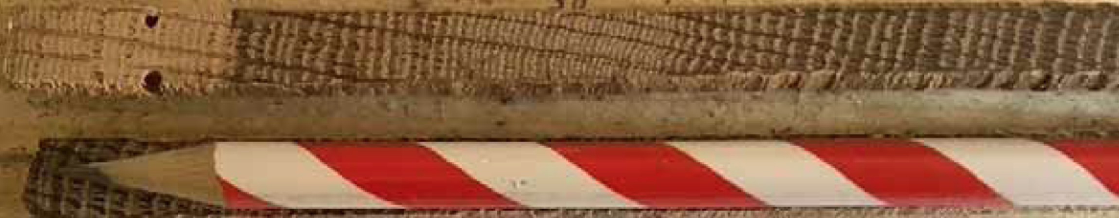
Figure 2: East range raking queen strut truss constructed using oak timbers, copyright Dr Andy MoirFigure 3: A core taken for tree-ring dating (top) and a pencil (bottom), copyright Dr Andy Moir
Through the taking of small pencil like cores from timbers (Figure 3), tree-ring analysis can often identify an exact year of felling of the timbers used in construction of a building. Most medieval woodworkers use green wood (as seasoned wood is much more difficult to work with) and so a year of felling is generally accepted to identify the year of construction. During the recording of the roof at Sudeley Castle the timbers were also assessed for their potential use in tree-ring dating. Oak timbers with more than 50 rings, traces of sapwood or bark, and accessibility were the main considerations. The oak timbers in the roofs of all three ranges contain sufficient rings and bark to indicate tree-ring dating would likely produced precise felling dates and so significantly advance the understanding of the development of Sudeley Castle. Thanks to funding from the Castle Studies Trust the roof will be recorded and samples for tree-ring dating taken near the end of February 2026 and the results of this project available near the end of March 2026. The GBRG would like to express their thanks to Lady Ashcombe for kindly granting access to Sudeley Castle for this project.
The Castle Studies Trust is delighted to announce the award of eight grants, totalling a record £44,500, to a wide range of projects involving a wide variety of research methods. This total means that, since our foundation, we will have given nearly £350,000 to castle research projects – a landmark to celebrate.
Cockermouth Kitchen Tower and Great Hall Range from river, copyright Richard Oram
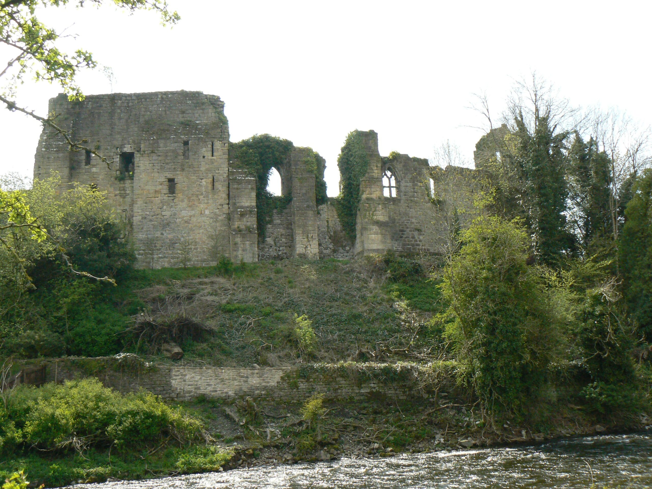
Cockermouth, Cumbria: Cockermouth Castle is an extensively surviving major multi-phase northern fortress whose evolutionary history has never been subject to systematic or formal assessment. The building survey will focus upon developing a detailed understanding of the physical fabric of the castle’s inner ward structures with a view to mapping their evolution, and to provide contextualization by relating the major building periods to the site’s known history and occupancy, and in terms of the broader evolution of castle architecture. The survey will be carried out by Tom Addyman with the support of Edward Impey and Richard Oram.
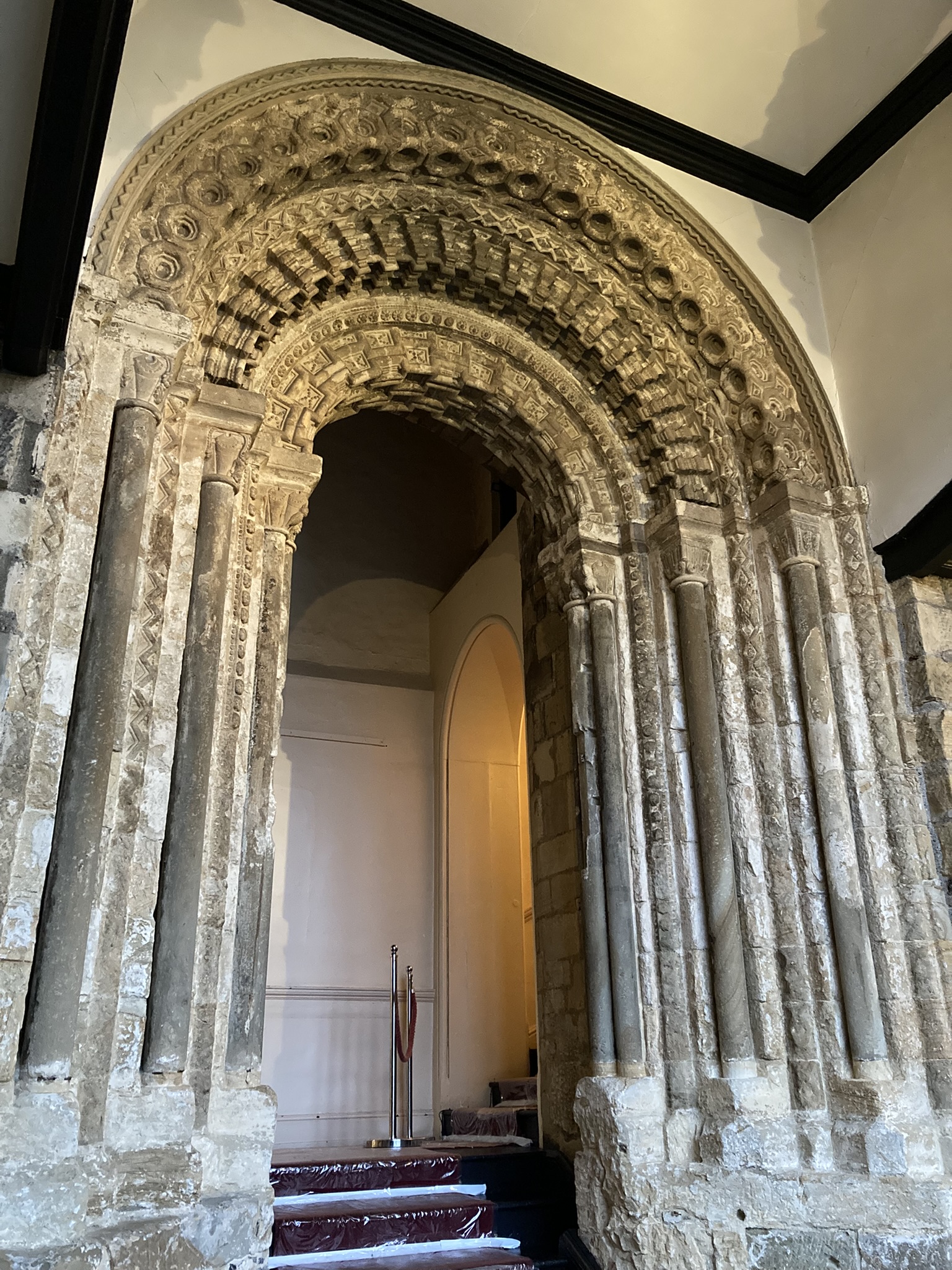
Durham Castle’s twelfth century entrance way, copyright Dr Andrew Ferrara
Durham Castle, County Durham: Investigating the Twelfth-Century Entranceway of Durham Castle. The aim of the project is to utilise digital archaeological techniques to create high-resolution images and models of the twelfth-century archway into Durham Castle’s North Range, enabling detailed investigation of the architectural features. The Durham University team carrying out the work will be led by Andrew Ferrara and Giles Gasper.
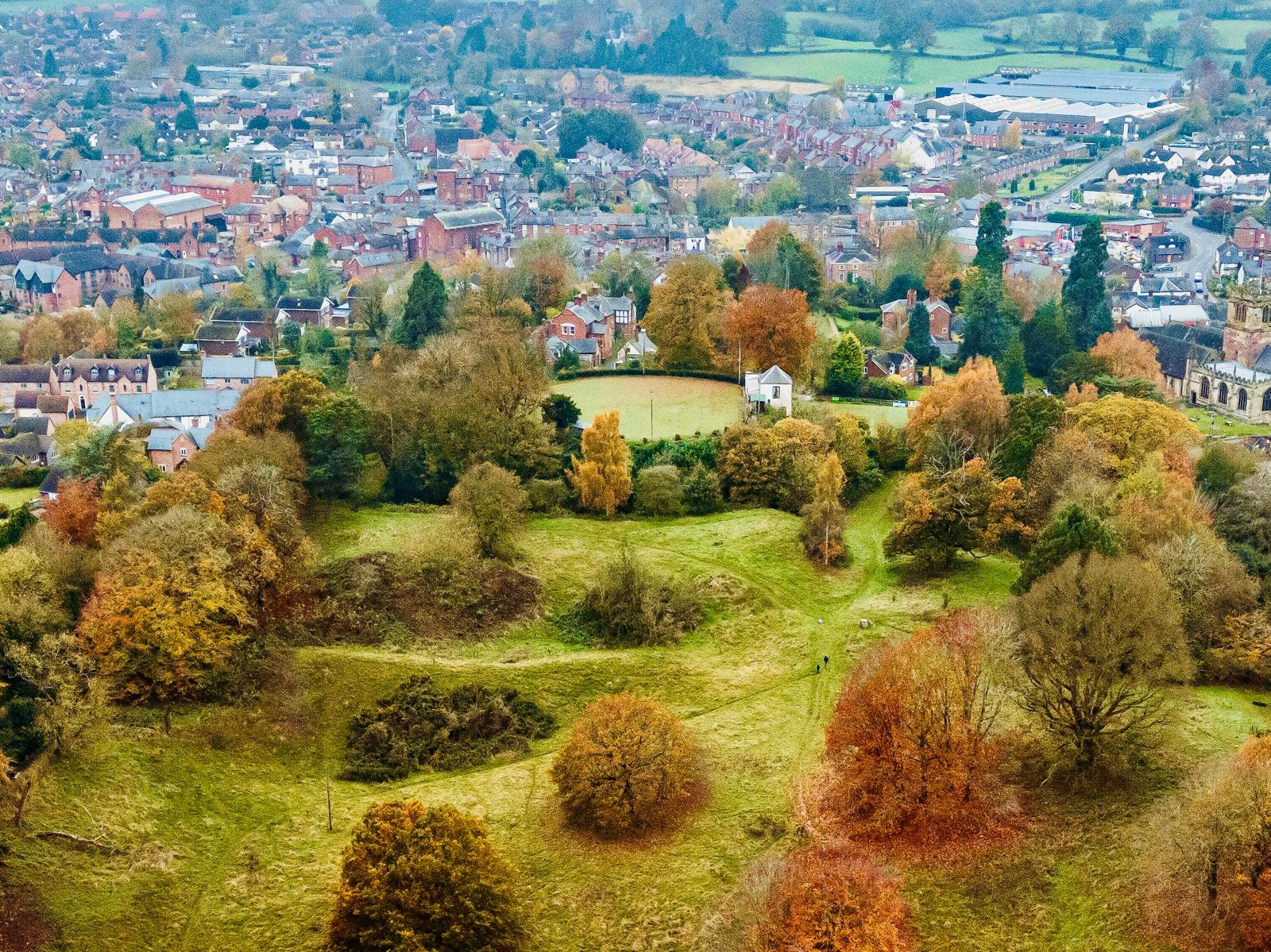
Ellesmere Castle from the air, copyright Joe Bickerton
Ellesmere, Shropshire: Geophysical survey of the large motte and bailey castle in Shropshire which, prior to June 2024, had never been surveyed before when the large motte was surveyed by GPR which revealed possible buildings. The resistivity and magnetometry surveys would confirm that, as well as extend the survey to the rest of the site which played an active part in the Marcher disputes in the reign of Henry III. The survey, carried out by Heneb, will take place in the week starting 9 March, with the results ready in the early summer.
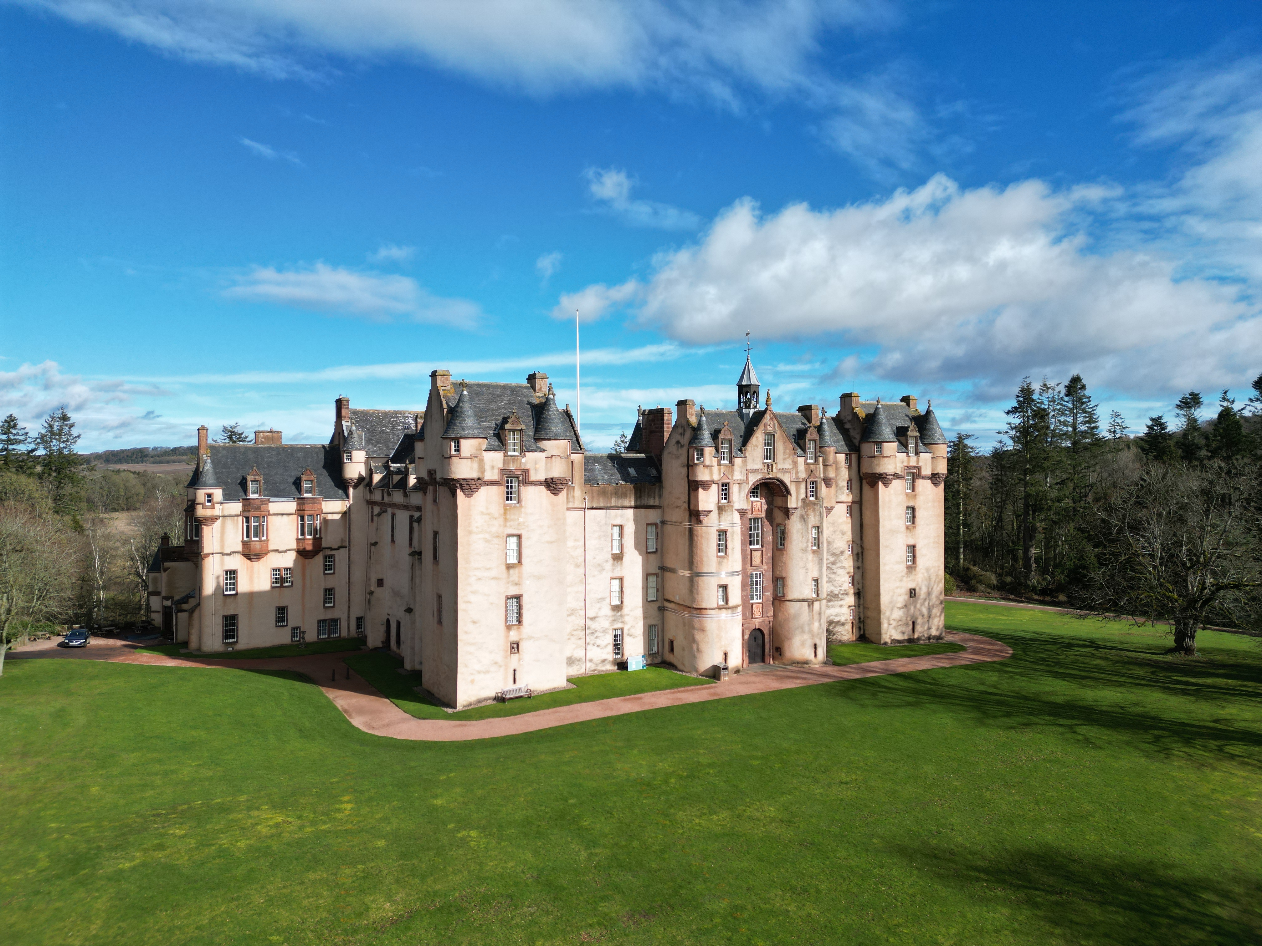
Fyvie Castle, copyright National Trust of Scotland
Fyvie, Aberdeenshire: The project aims to create new interpretation drawings to showcase key stages in the architectural development of the castle, which dates to the thirteenth century, and share these as part of outreach and engagement. The drawings by Jan Dunbar will be commissioned by Annie Robertson of the National Trust and are expected to start in April.
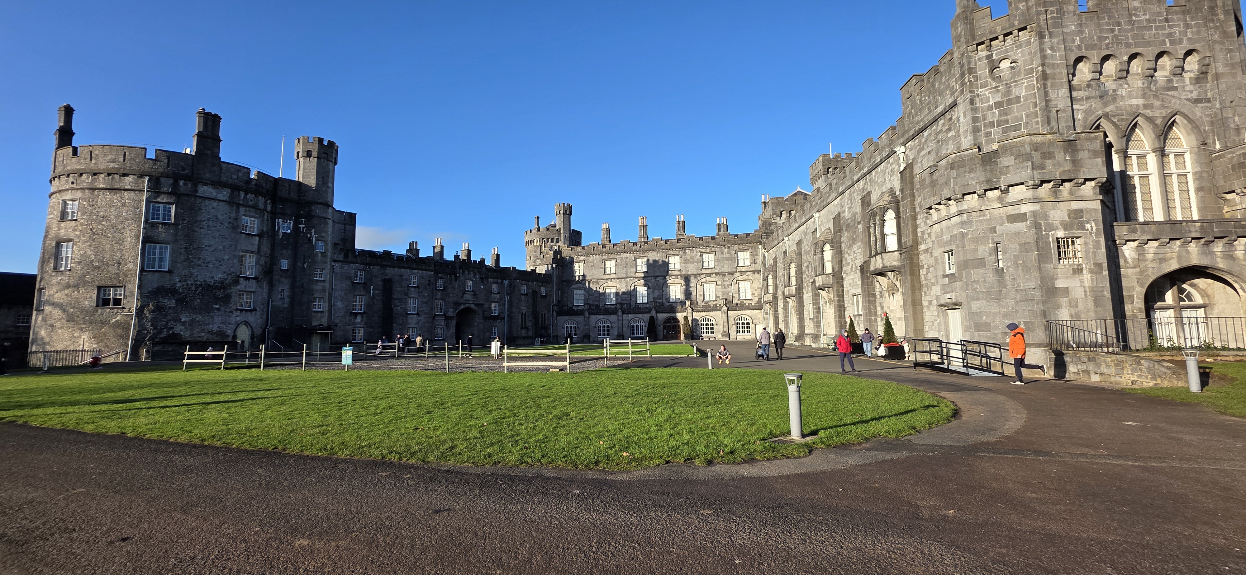
Kilkenny Castle, copyright of the Discovery Programme
Kilkenny, Leinster, Republic of Ireland: This project proposes the use of geophysical survey to locate and map the lost Flemingstown of Kilkenny Castle – a unique example of a purpose-built Flemish colonial suburb. While some of the outer ward has already been investigated, the one area missing has been around the site of the township’s tower. The geophysical survey will be carried out by The Discovery Programme and will take place in early to mid March, led by David Stone with the support of Susan Currant and Coilin O Drisceoil.
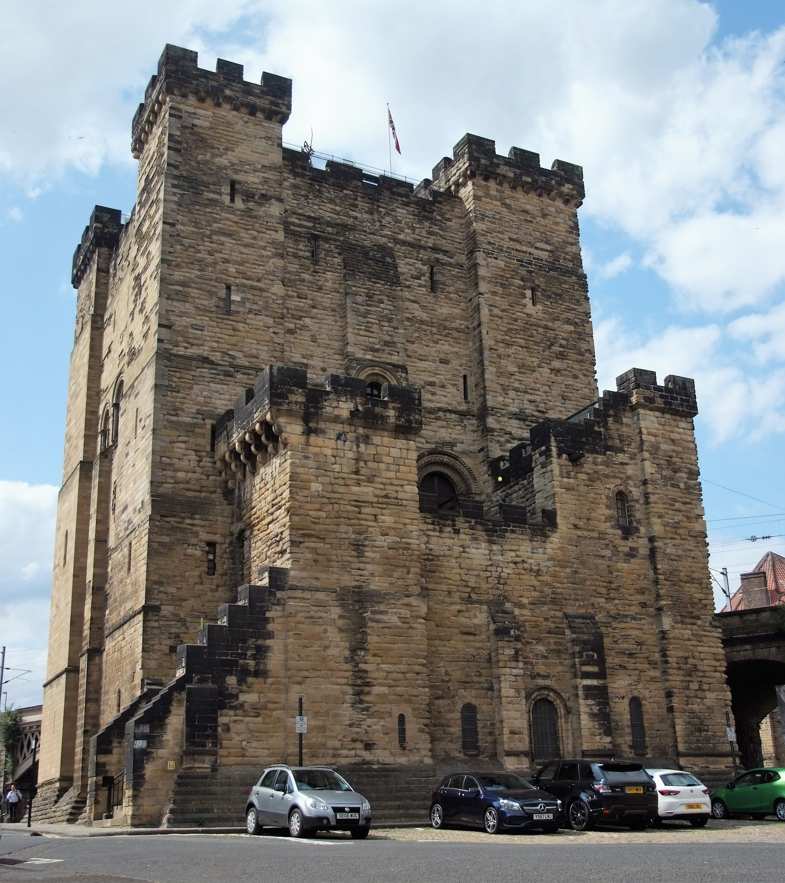
Newcastle Keep, copyright Peter Purton
Newcastle, Northumberland: To co-fund the publication of the report of the excavations of Newcastle Castle, one of the major royal castles in the North East of England, which took place over 20 years between 1974-95. The funds will be for synthesising all the different excavations, updating specialist reports and preparing relevant reports. We are only part funding £2,000 of the £8,000 asked for, as we lacked the means to fund any more. . The grant from the CST will allow him to commission the illustration work for the building interpretation and the excavation illustrations. The part funding has also spurred on other funders to cover the remaining part of the grant. The project will be led by Don O’Meara of the Society of Antiquaries of Newcastle with the support of John Nolan and Richard Pears.
Ruthin Castle great gatehouse, copyright Ruthin Castle Preservation Trust
Ruthin, Denbighshire: Co-funding a structural survey and analysis of the great gatehouse of this formidable thirteenth century baronial castle that was a key part of Edward I’s strategy to secure the conquest of Wales. The project is led by Fiona Gale, chair of the Ruthin Castle Preservation Trust who will commission Mann Williams to do the survey with add context provided by Will Davies from Cadw.
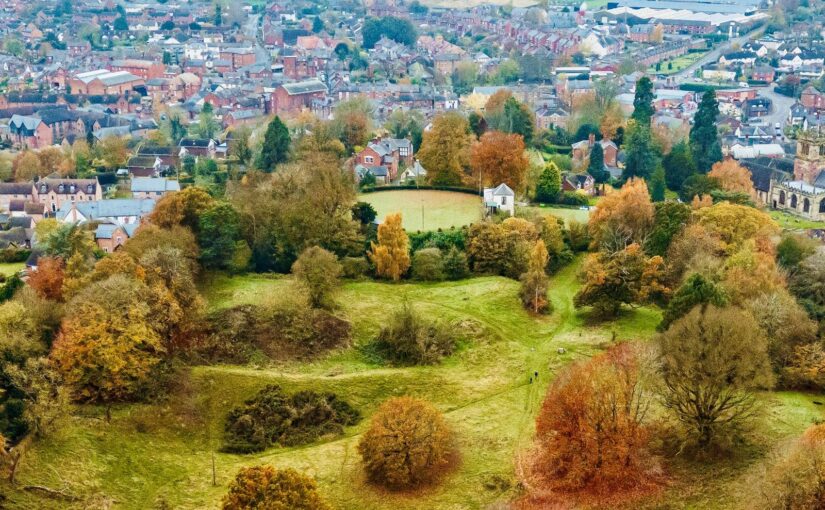
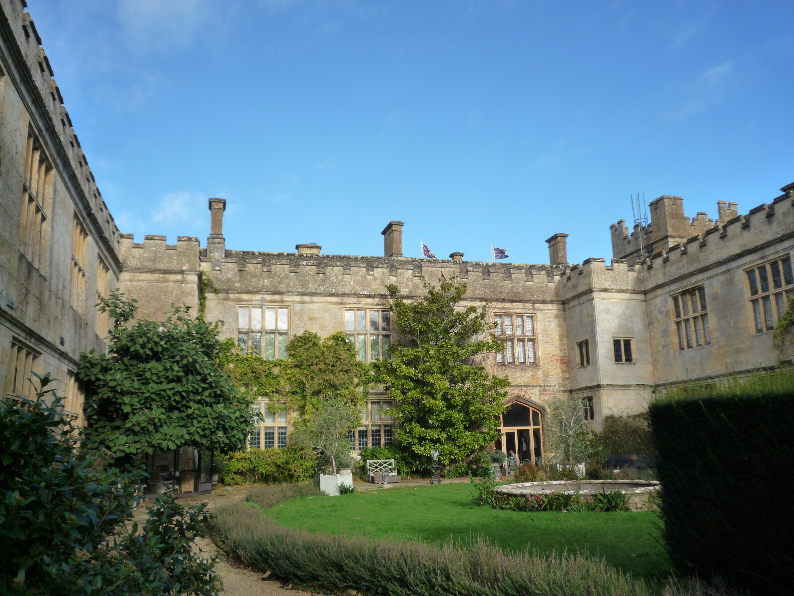
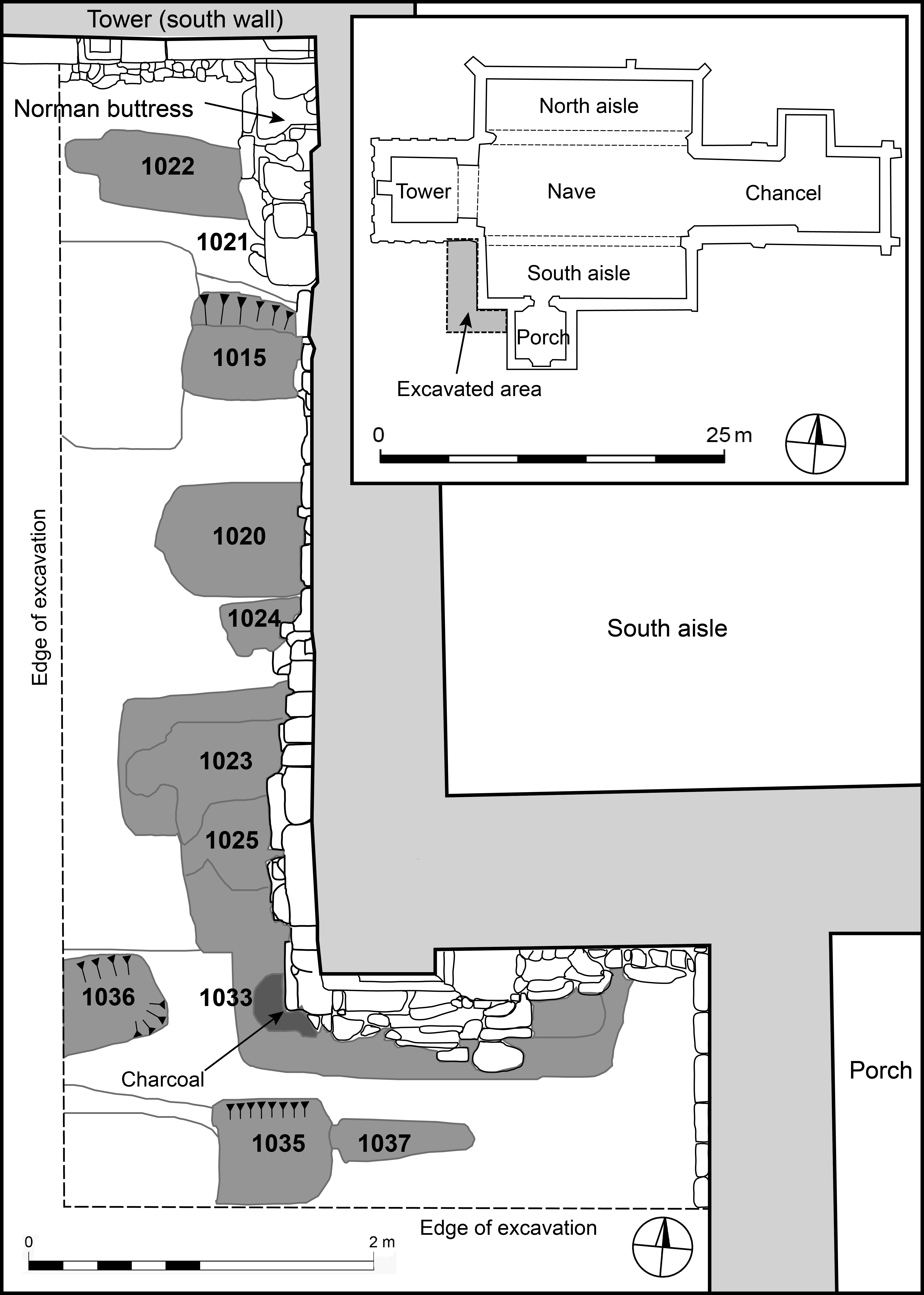
Sudeley Castle outer courtyard, copyright Andy Moir
Sudeley Castle, Gloucestershire: Tree-ring dating and recording with 3D imaging the original roofs of Sudeley Castles Outer Courtyard Ranges. The castle site dates to the anarchy but the castle was rebuilt in the fifteenth century by Lord Sudeley. The sampling and photography will take place on 25 and 26 February. The project will be led by Andy Moir of the Gloucestershire Building Recording Group.
Between November 2022 and March 2025 the research project Where Power Lies explored the archaeological evidence for the origins and early development of England’s medieval lordly centres. Funded by the Arts and Humanities Research Council, the project characterised material expressions of elite authority across c.800-1200. This blog summarises some of the project’s key findings and outputs, and provides updates on continuing work.
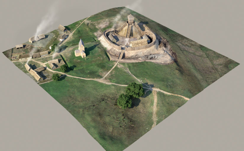
For a little over two years the research project Where Power Lies investigated the archaeological evidence for the emergence of England’s medieval ‘lordly centres’: places in the landscape that elite families developed primarily for their own self-aggrandisement. The programme was keen to conceptualise early castles (c.1066-1200) as a manifestation of these elite enclaves, albeit ones that were in many ways distinctive from other sites. Where Power Lies examined the material at a number of scales, firstly with national datasets integrated into a GIS in order to identify possible regional distinctions. It was quickly realised, however, that a more detailed approach was required to interrogate data more meaningfully, so the project team examined two ‘macro regions’ more closely. One region covered counties in southern and western England, the other incorporated the historic counties of Yorkshire and Lincolnshire. Information was extracted from the Historic Environment Record of each county, and interrogated to assess the validity of a site identified as a lordly centre and an assessment made as to its character and date.
Figure 1: Plans of some early lordly centres, showing enclosures, earthworks, and major watercourses. The integration of large streams and rivers into these sites hints at the fundamental importance of watermills in their economy. Credit: David Gould.
Although the ‘cleaned’ dataset for the two macro regions still presented challenges for interpretation, some meaningful patterns could be identified. Firstly, it was clear that lordly centres featuring a closely paired church and residence occurred more frequently in areas of dispersed settlement. This finding is supported by analysis of the nationwide dataset of early castles, with significant numbers located in areas of very low to low settlement density. These patterns highlight that lordly foci were were at the very least embedded within a diversity of settlement landscapes and were not a peculiarity of nucleated villages in ‘champion’ countryside, as has sometimes been assumed. Secondly, it was evident that major watercourses were of great importance in the establishment of lordly centres; while significant quantities of water would have been needed for domestic and agricultural purposes, substantial rivers and streams also seem to have been exploited from an early date to power watermills (Figure 1). Such mills were a fundamental foundation of lordly authority, representing a centralisation of a key economic resource and symbolic of the primacy of particular families over others.
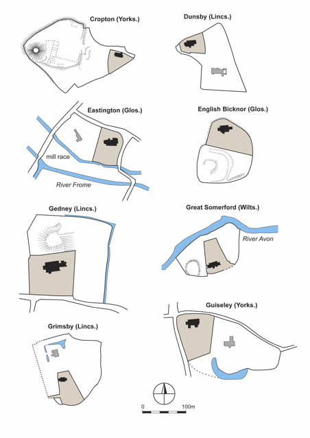
Figure 2: Plan of the key features at Great Somerford, Wiltshire. The location and form of the early aristocratic building, most feasibly interpreted as a chamber, was achieved through ground penetrating radar. Credit: Scott Chaussée/David Gould.
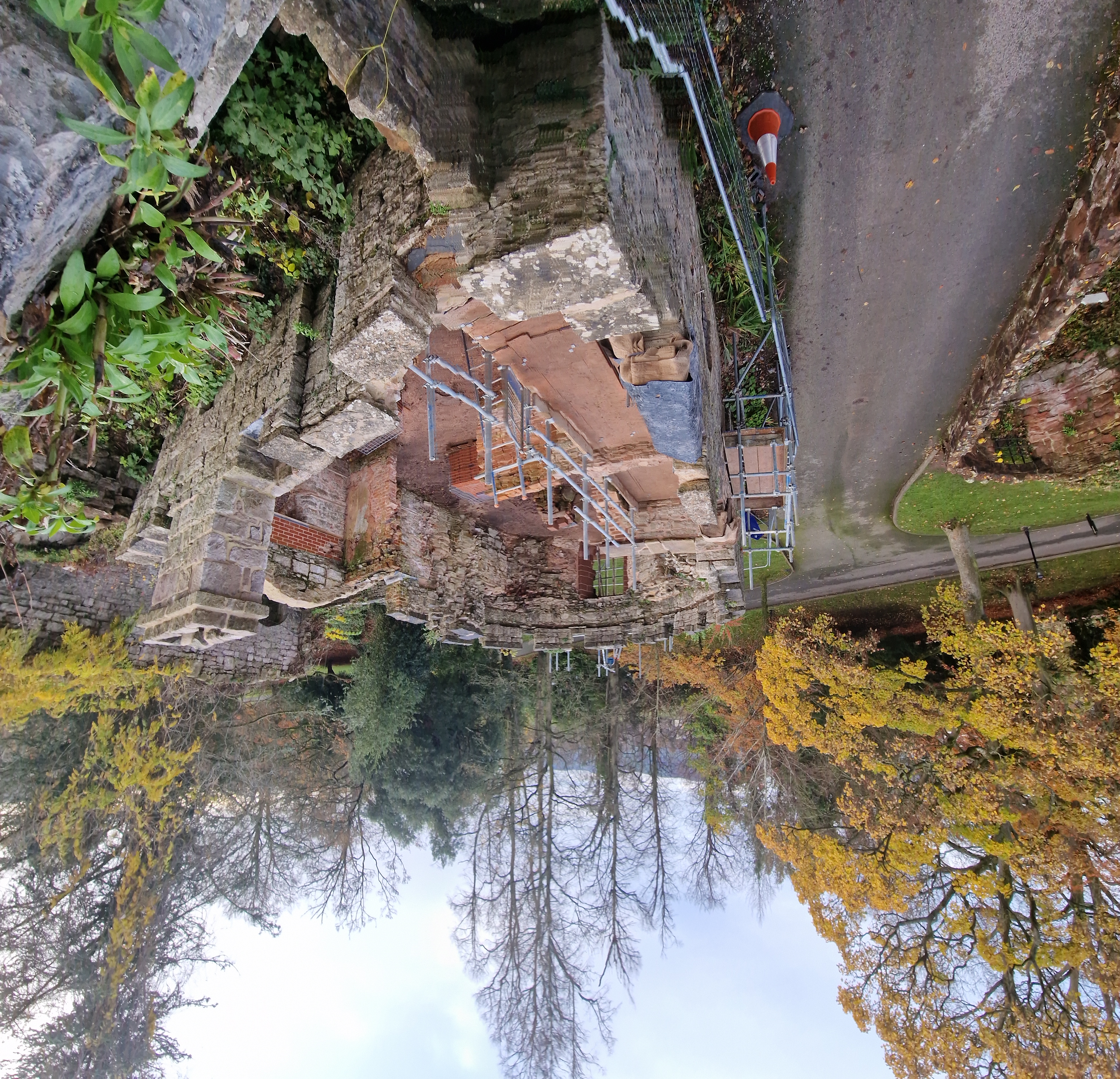
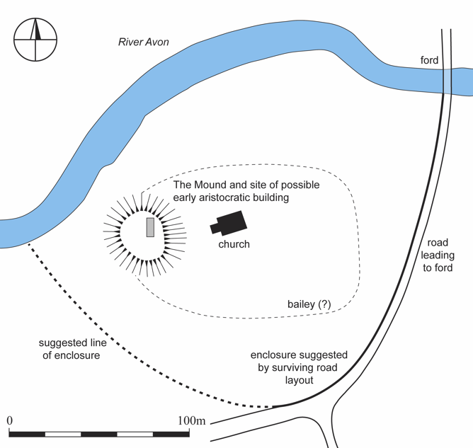
Eight locations offering especially high potential were chosen as case studies warranting further investigation, with a combination of approaches deployed to understand them more thoroughly; these included detailed desk-based research, geophysical and topographic survey, standing building assessment, and targeted excavation to facilitate optically-stimulated luminescence profiling and dating of earthworks. Among the case studies was the motte at Great Somerford (Wiltshire), surveyed using a ground-penetrating radar which found a stone-built structure located within the earthwork. This feature had previously been excavated in the 1950s and although ‘windows with Norman features’ were recovered, the exact character of the structure remained uncertain. Our survey demonstrated that the rectilinear building is orientated broadly north-south, apparently discounting its identification as an early church (Figure 2). Situated at some depth within the north-east part of the motte, this feature is perhaps best understood as a chamber and one that apparently preceded construction of the castle. A similar situation is apparent at Earls Barton, Northamptonshire, where a comparable stone-built rectilinear building seems to have been followed by construction of Berry Mount (Figure 3). Our survey here also located a second church, less than 5 metres from the celebrated tower-nave. At both of these sites, then, mottes seem to have been raised over earlier stone-built chambers; while further work is required to phase site sequences more closely, the possibility is that these castles were raised after a period of elite Norman occupation, perhaps in the twelfth century, rather than in the immediate aftermath of the Conquest.
Figure 3: Timeslice of the ground penetrating radar survey at Earls Barton, Northamptonshire. Feature ‘A’ is a probable stone-built chamber. Credit: Scott Chaussée.
Our work continues at Earls Barton, with two generous grants from the National Environment Isotope Facility supporting investigation of ten rock-cut burials from the churchyard, excavated in the 1970s (Figure 4). The majority of the radiocarbon work has already taken place, and our tentative interpretation phases these graves to the eleventh and early twelfth centuries. Results of isotope analyses are expected soon, which will hopefully clarify the migration and dietary histories of what is apparently Earls Barton’s earliest medieval burial population. A final site in which a castle was investigated was at Saintbury, Gloucestershire, which was reported on in a previous blog-post. The project team are aiming to obtain radiocarbon dates for human remains recovered from animal burrowing at Saintbury’s motte and bailey, in order to ascertain whether the monument was erected on a prehistoric burial mound.
Figure 4: Location of the rock-cut graves at All Saints’ Church, Earls Barton, excavated in the 1970s. Credit: Redrawn by Oliver Creighton from the original by M Audouy.
Where Power Lies has generated several outputs, all of which are free to access. Our project database, which includes all geophysical survey and GIS data as well as individual site reports, is hosted by the Archaeology Data Service and we have published papers in The Antiquaries Journal, Early Medieval Europe and Medieval Settlement Research. Duncan Wright and Oliver Creighton are also writing a monograph, which will be published in 2028 with Bloomsbury. The project team would like to thank once again the Castle Studies Trust for supporting the project throughout, and for funding the pilot phase of work at Laughton en le Morthen, South Yorkshire. We hope that our work has in some way advanced understanding of lordly centres, and that the study of early castles as a phenomenon has been invigorated and enriched by our findings.
Gould D., Creighton O., Chaussée S., Shapland M., Wright D.W. 2025: ‘Where Power Lies: Lordly centres in the English Landscape c.800-1200, The Antiquaries Journal 104, 72-106. https://doi.org/10.1017/S0003581524000350
Gould D, Creighton O, Chausée S, Shapland M, Wright D.W. 2024: ‘Where Power Lies: The Archaeology of Transforming Elite Centres in the Landscape of Medieval England c.AD 800-1200’, Medieval Settlement Research 39, 80-92. https://archaeopresspublishing.com/ojs/index.php/msr/article/view/2715
Wright, D.W., Creighton, O., Gould, D. 2024: ‘Data from ‘Where power Lies: The Archaeology of Transforming Elite Centres in the Landscape of Medieval England c. AD 800-1200’, 2022-2024 [data-set]. York: Archaeology Data Service [distributor] https://doi.org/10.5284/1122293
Wright, D.W. Creighton, O.H., Gould, D., Chaussée, S., Kinnaird, T., Shapland, M., Srivastava, A. and Turner, S. 2025: ‘The power of the past: materialising collective memory at early medieval lordly centres’, Early Medieval Europe, https://doi.org/10.1111/emed.70004
Wright D.W., Bromage S, Shapland S, Everson P, Stocker D. 2022: ‘Laughton en le Morthen, South Yorkshire: Evolution of a Medieval Magnate Core’, Landscapes 23(2), 140-165. https://doi.org/10.1080/14662035.2023.2219082