Dr Will Wyeth, Property Historian at English Heritage, previews the geophysical survey, funded by the Castle Studies Trust, in order to learn more about the landscapte around Warkworth castle.
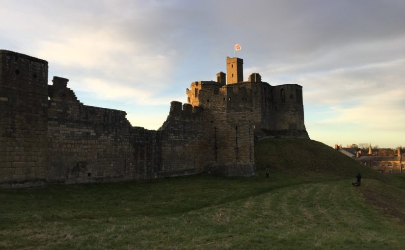
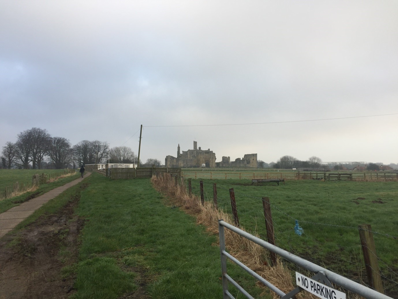
Following the success of a survey of Warkworth Castle’s earthworks in late 2020 as part of a scheme of reinterpreting this most palatial castle (report forthcoming), we on the English Heritage Warkworth project team have sought to expand upon our understanding of the medieval complex by turning towards its immediate landscape. Although much of the medieval landscape is not in the care of the charity, which looks after over 400 historic properties and sites across England, the landscape has tangible and nuanced connections which the project wants to explore. The castle is among the most prominent features in this area (Figure 1); its location adjacent to the lowest crossing point of the River Coquet means that low, somewhat boggy ground extends across the area south-east of the castle as the river widens to its mouth by the coastal village of Amble.
Subscribe to our quarterly newsletter

The plan of Warkworth Castle comprises a fairly typical motte and bailey, with stone superstructures of varying date and scale, and whose earliest iterations date from the late 12th century. While the antiquity of the settlement of Warkworth – laid out upon the north-south ridge of raised ground within this loop of the Coquet – is not known for sure, what is apparent is that the castle respects and influences the configuration of burgage plots and the coastal road ultimately linking Newcastle-Upon-Tyne and Berwick-Upon-Tweed. A walk around Warkworth village proper shows there are several important places and features which both relate to and indeed enrich the castle story.
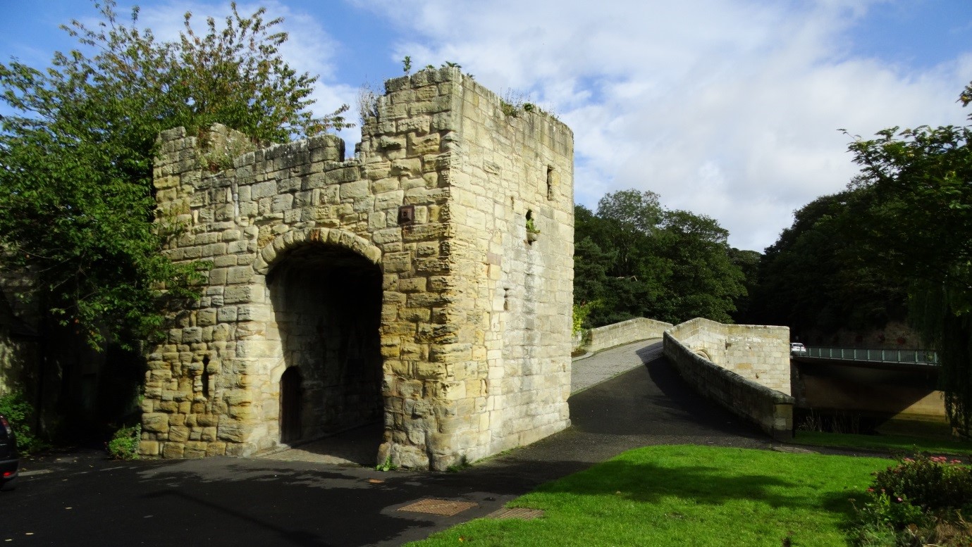
The church of St Lawrence, itself probably constructed on the site of an earlier medieval church, is located mere metres away from the late 14th-century fortified bridge (Figure 2) which spans the northern extent of the river’s loop. The identification as a ‘fortified bridge’ is perhaps misleading. Thought to have been completed around the time the Great Tower at Warkworth Castle was finished, the bridge may be better understood as a toll collection station, though its administrative and security characteristics are not necessarily contradictory.
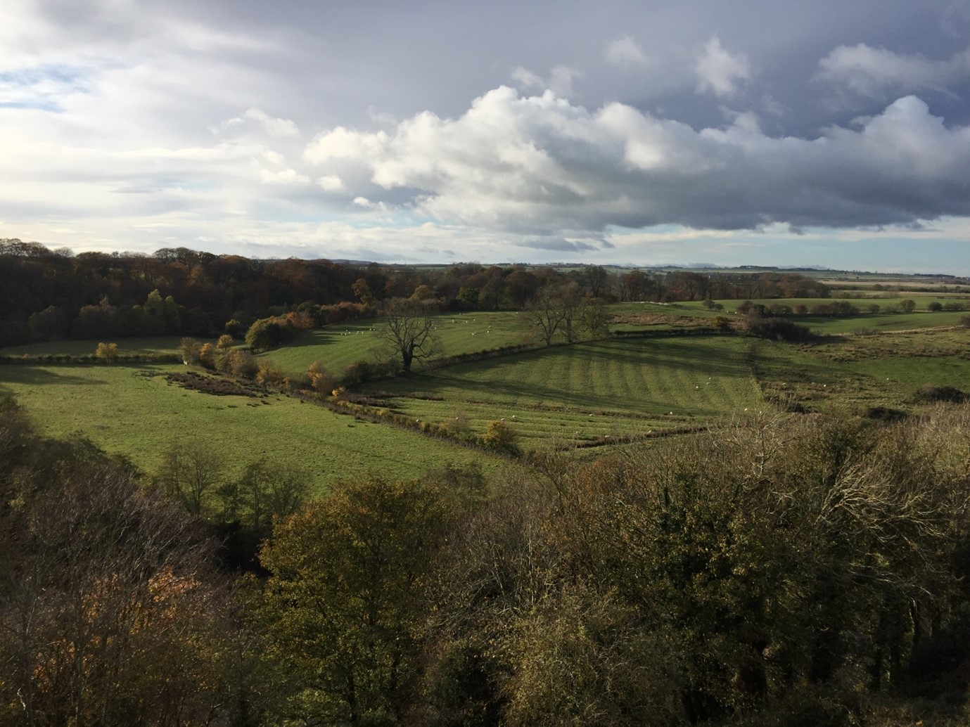
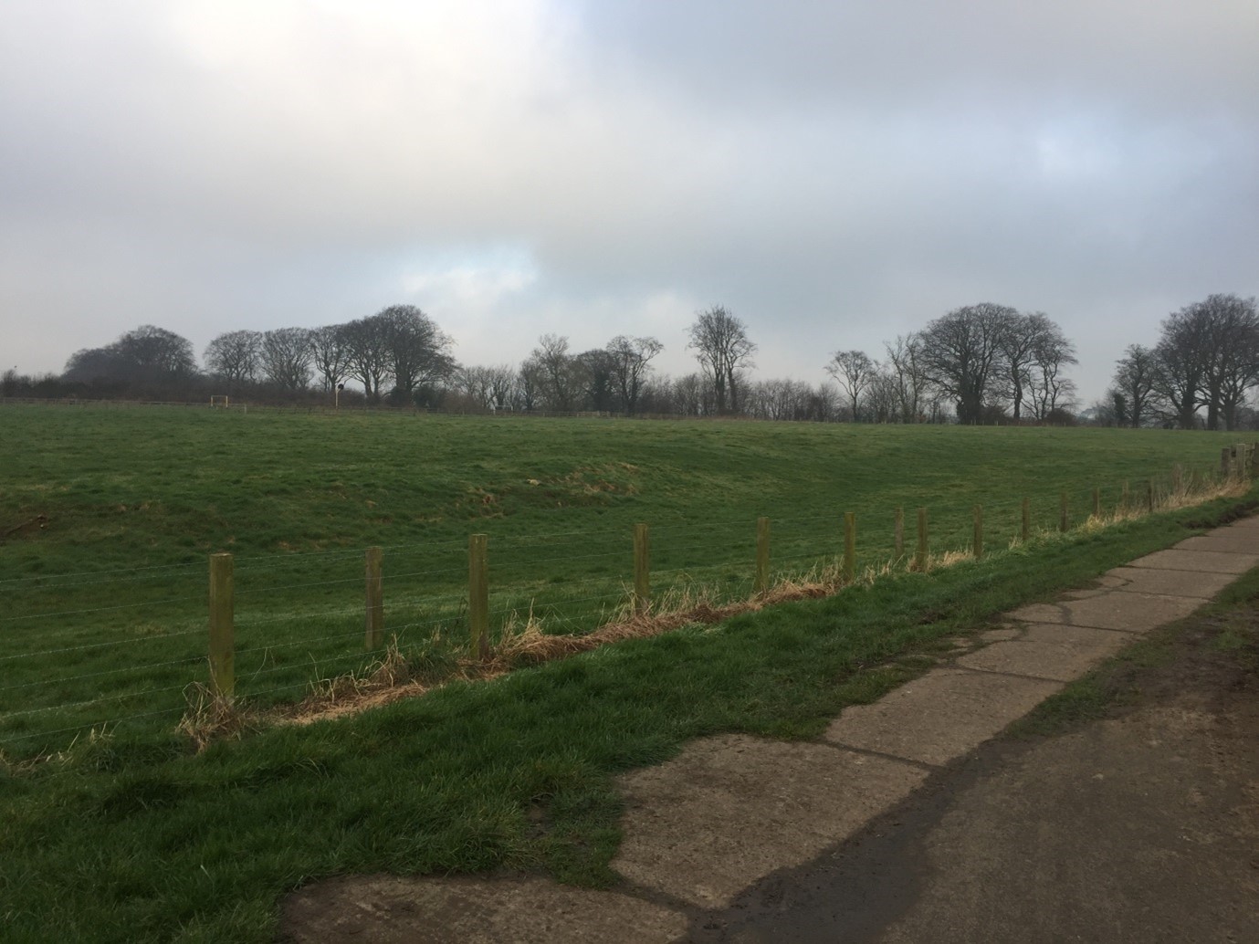
To the north, the coastal road carries on towards Alnmouth and onto Alnwick. It is in relation the immediate south and west of the castle, however, to which the Castle Studies Trust generously agreed to fund a further season of geophysical survey. Fields here testify to a legacy of cultivation which may be medieval in origin; traces of ridge-and-furrow are apparent immediately south and south-west of the castle (Figure 3), as well as in an area of ground rising gently from the river terrace, west of the Great Tower, across the river proper (Figure 4).
This new geophysical survey targets a cluster of fields adjacent to a modern pedestrian route to the castle which may fossilise a medieval antecedent (Figure 5), which would substantiate theories about the architectural orientation of major elements of the southern curtain wall of the castle towards the south-west. It also looks to locate with confidence the position of a suspected medieval hunting park boundary and access gate, which are sporadically referred to in manorial documents associated with Warkworth Castle in the late medieval period, but whose origins may lie in the 12th-13th-century, or (when considering place-name evidence) earlier still. Currently the park boundary is probably represented by a linear bank (Figure 6) with a southern return going westwards.
One of the fields in question bears the name St John’s Close, which had previously been thought to indicate the presence of a chapel here. In fact, the name likely references the field’s ownership by the Knights Hospitallers in the late medieval period, of uncertain origin but attested in a 16th-century return. The field is depicted in an estate map (which for copyright purposes cannot be displayed here) at the corner of a hunting park.
It is hoped that by firmly establishing the location of the medieval park boundary, any trace of a parallel routeway to the castle from the south-west, as well as the located of a gate into the park, English Heritage will be able to better draw the connections between castle and landscape which are now acknowledged as central components of castle culture. In turn, this will allow the charity to tell a more informed and more nuanced story about Warkworth Castle and the people who lived, worked and died here and hereabouts in its long history.