Lowther Castle excavation: season one results and what to look forward to in season two

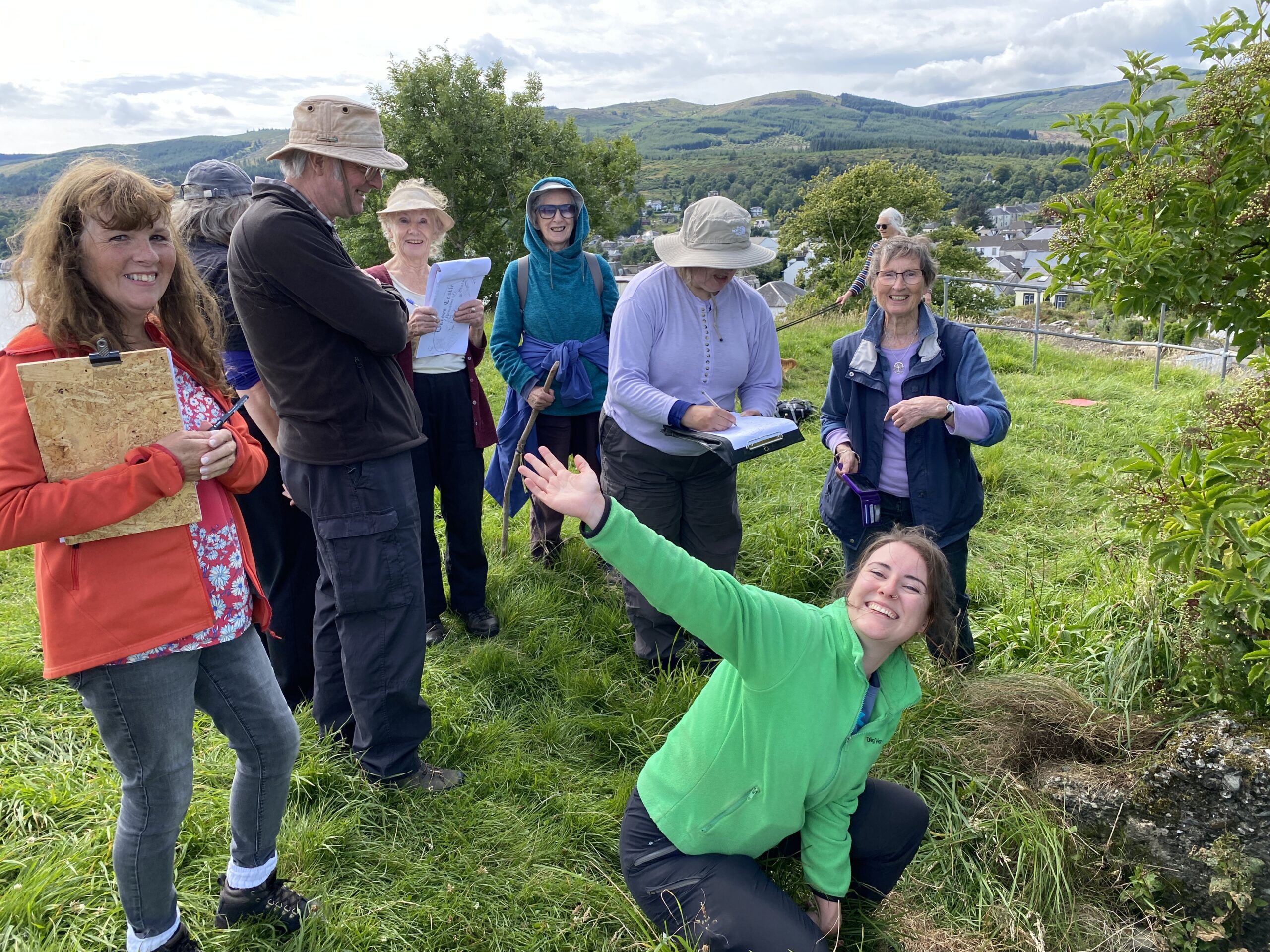
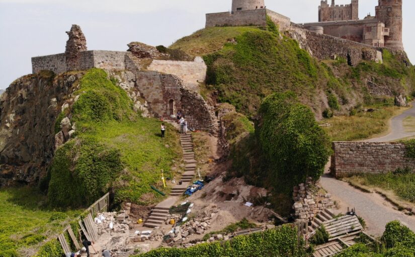
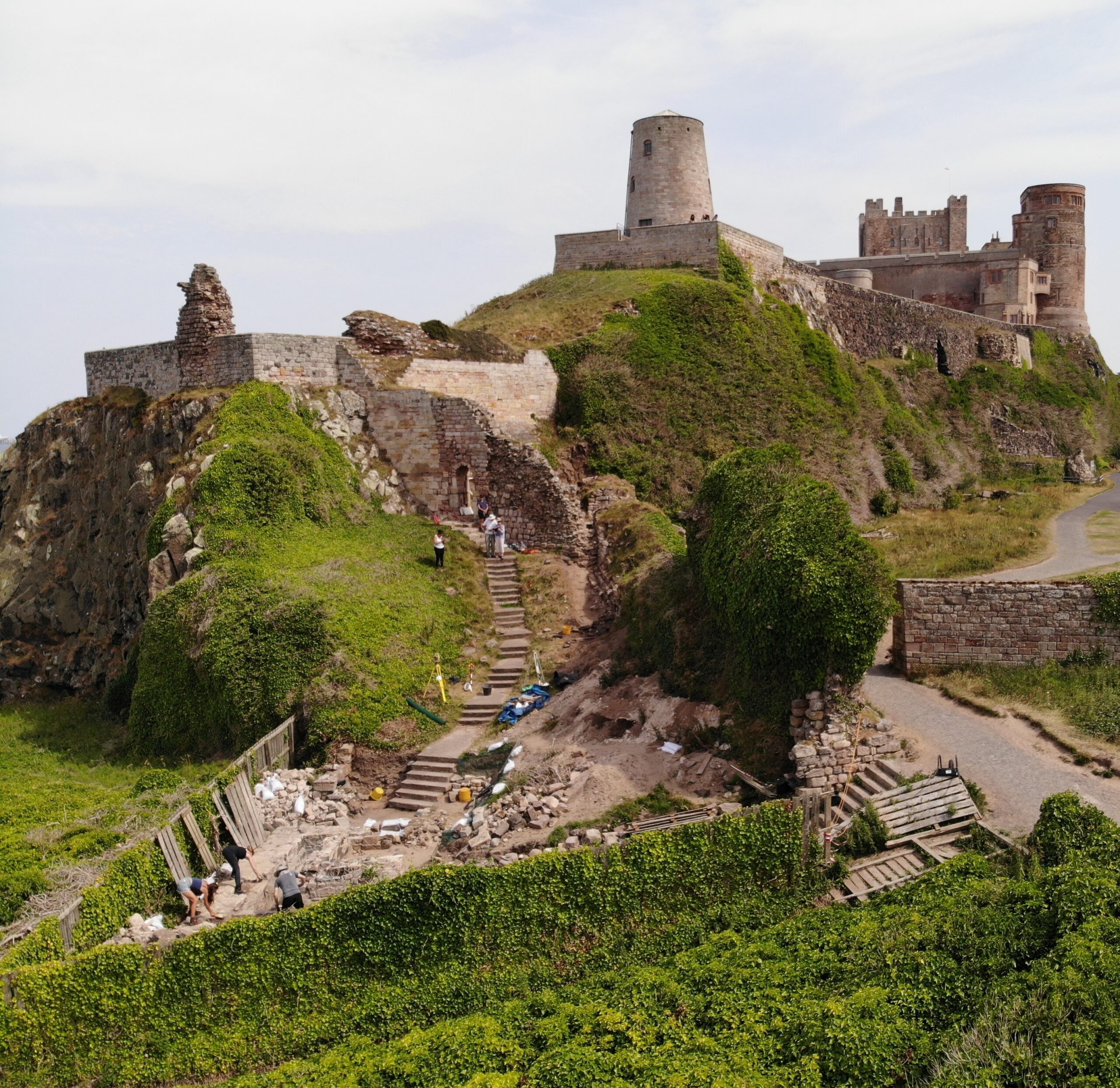
Phase Two excavations at the putative partial ringwork castle at Lowther (Cumbria) will get underway on Sunday 12th May 2024. The project team leaders Drs Sophie Ambler and Jim Morris look at one they found in season one and look forward to what the want to will be examining in season two.

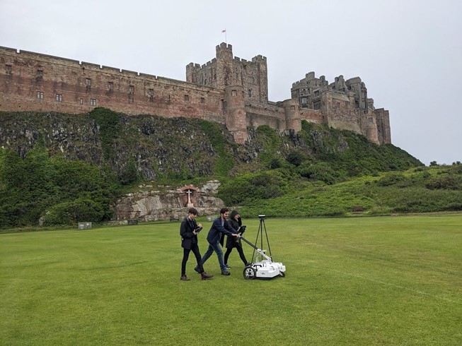
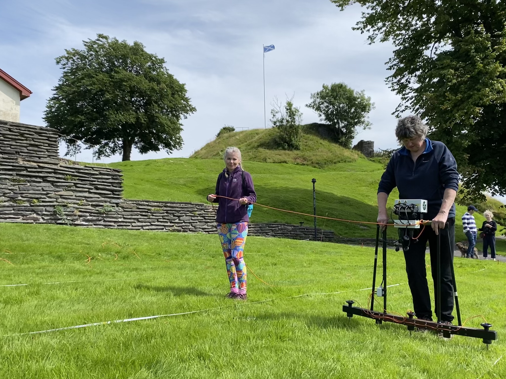
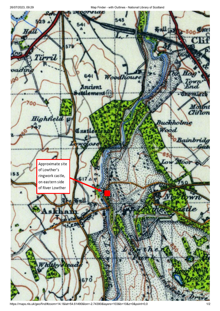
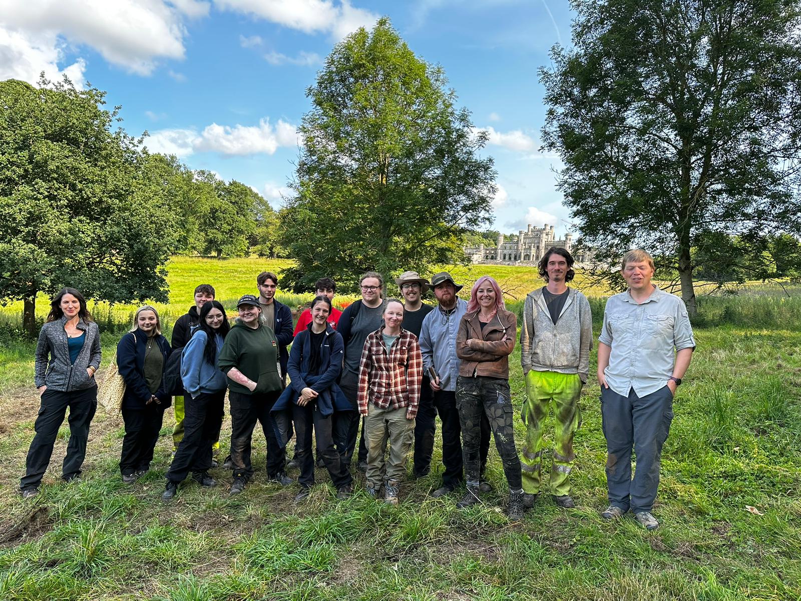
The Lowther Medieval Castle and Village Project unites History and Archaeology through Lancaster University, the University of Central Lancaster, and Allen Archaeology, with the support of Lowther Castle and Gardens Trust and the Lowther estate team.  Phase One excavations in summer 2023, generously funded by the Castle Studies Trust (CST), saw a geophysical survey of Lowther’s north park and excavations of the ‘castlestead’ earthwork. Phase Two will see further excavations of the castle earthwork, funded by the CST, and a geophysical survey of the area to the north, funded by the Cumberland and Westmorland Antiquarian and Archaeological Society (CWAAS).

Subscribe to our quarterly newsletter

The site at Lowther is potentially of great significance for castle studies and the medieval history of Britain. We have good reason to think the site is associated with the second phase of the Norman Conquest: the annexation and plantation settlement of the Kingdom of Cumbria under William Rufus in 1092.

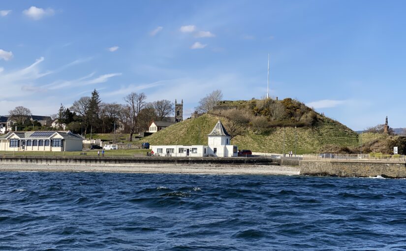
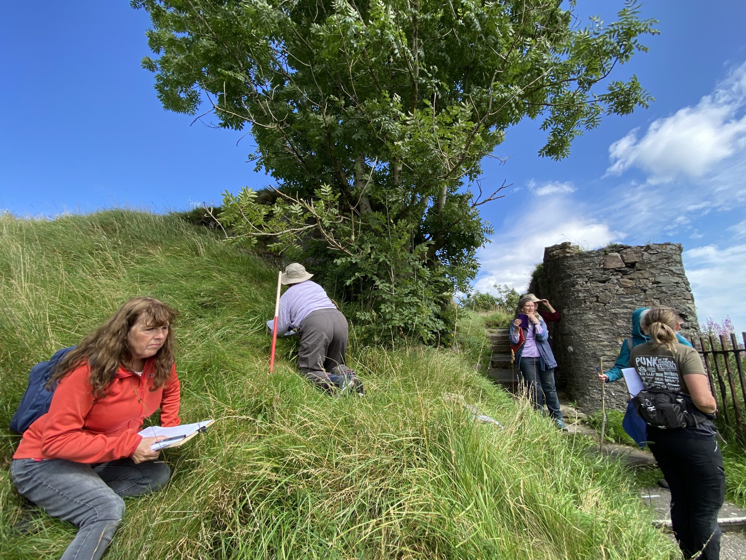
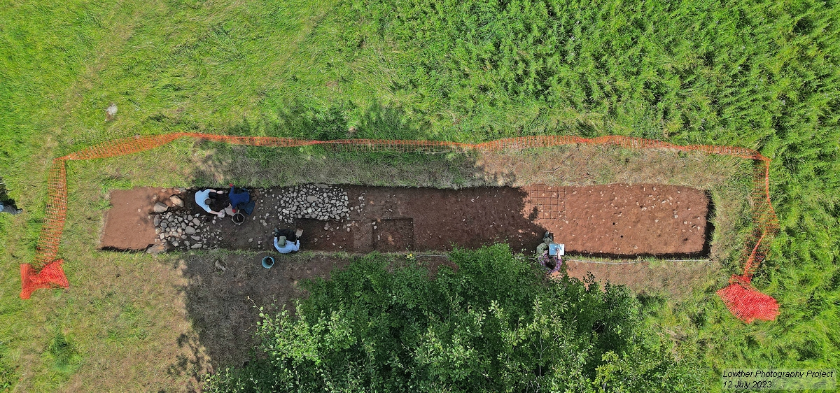
Thanks to the 2023 excavations and their interim report, we can begin to investigate how Lowther sits within ringwork castle typology. This is a partial ringwork, sited on the edge of a promontory, its banks built up on the landward sides. It thus took advantage of its landscape to be seen and to see. This conforms to a model for castle siting that aimed to produce (in the words of Oliver Creighton) ‘a conspicuous symbol of power with a panoptical viewshed over the surrounding territory’. At approximately 27m X 22m, Lowther sits at the smaller end of the ringwork spectrum. In that its central area is raised above external ground level, with landward circumferential banks elevated further, it bears comparison with ringworks of Norman Ireland.

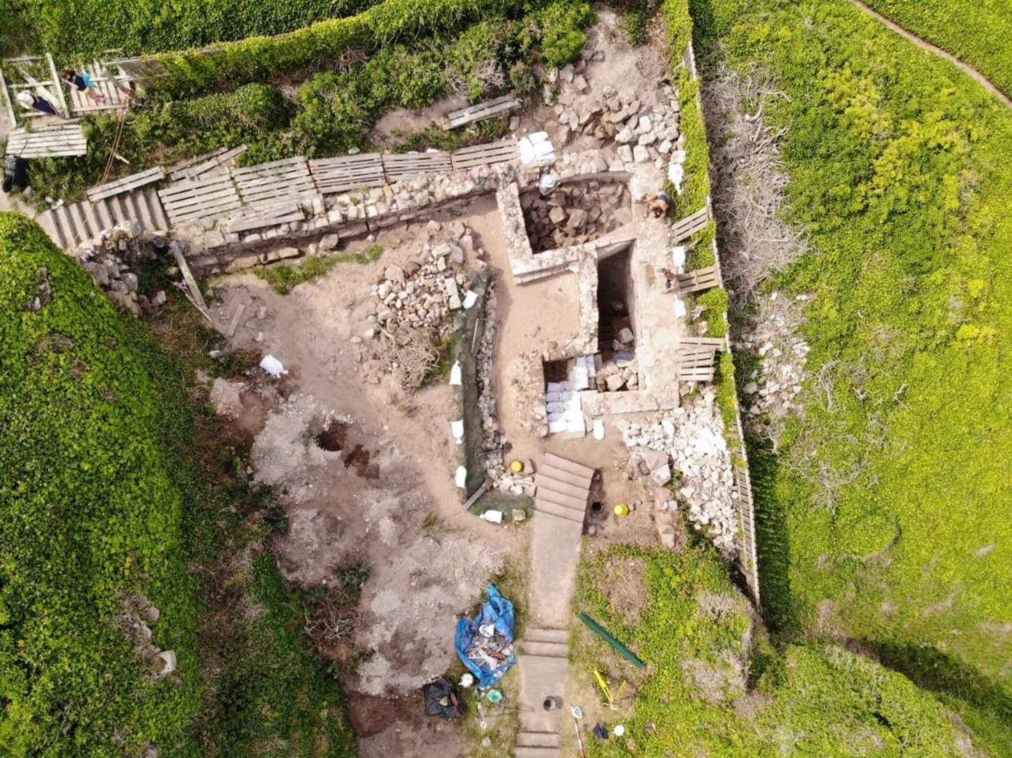
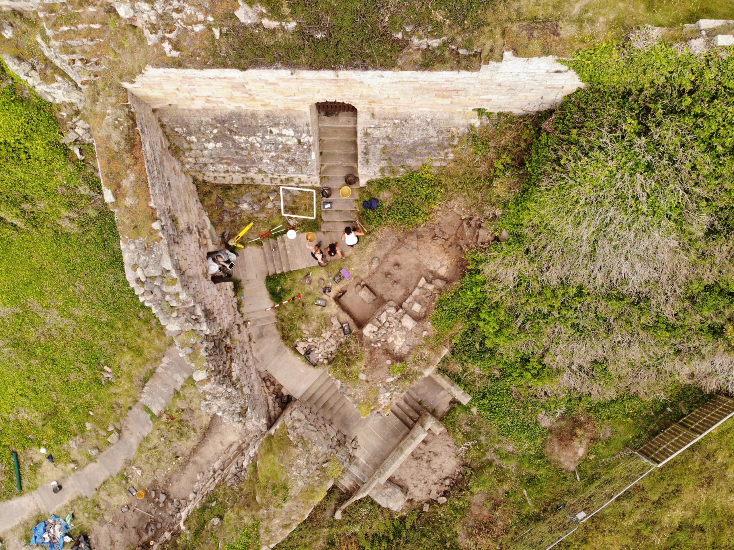
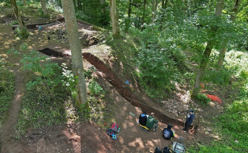
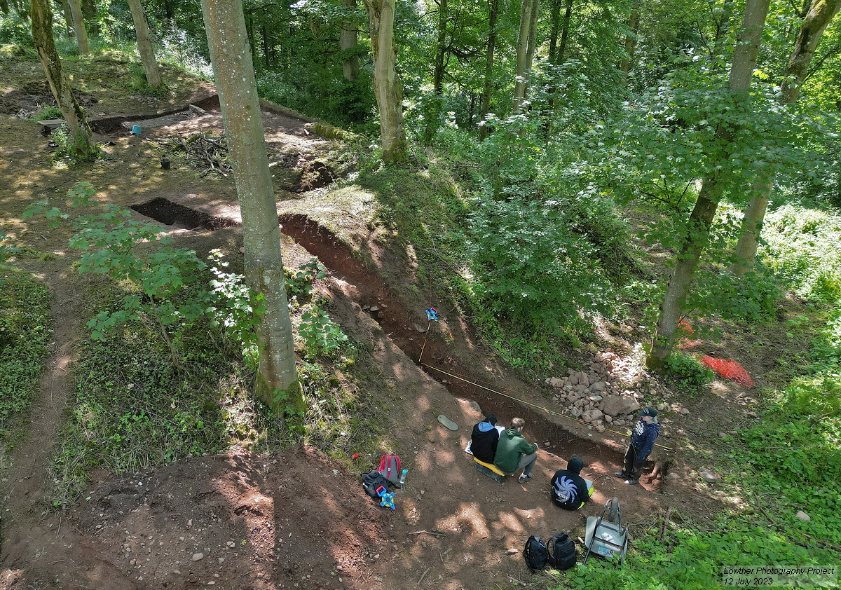
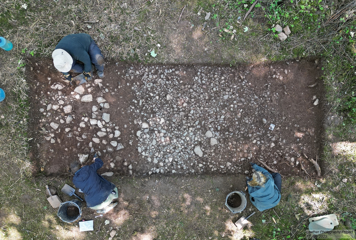
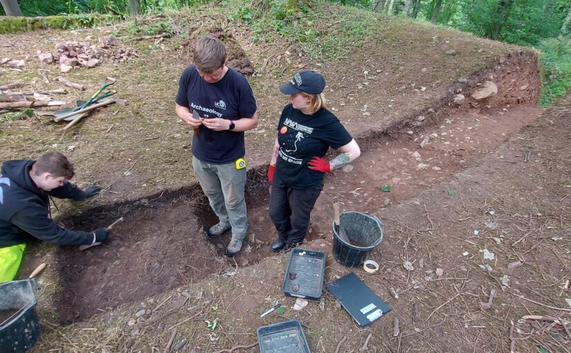
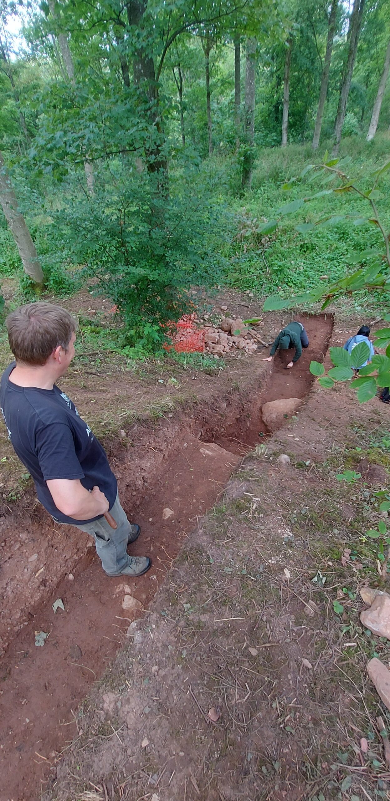
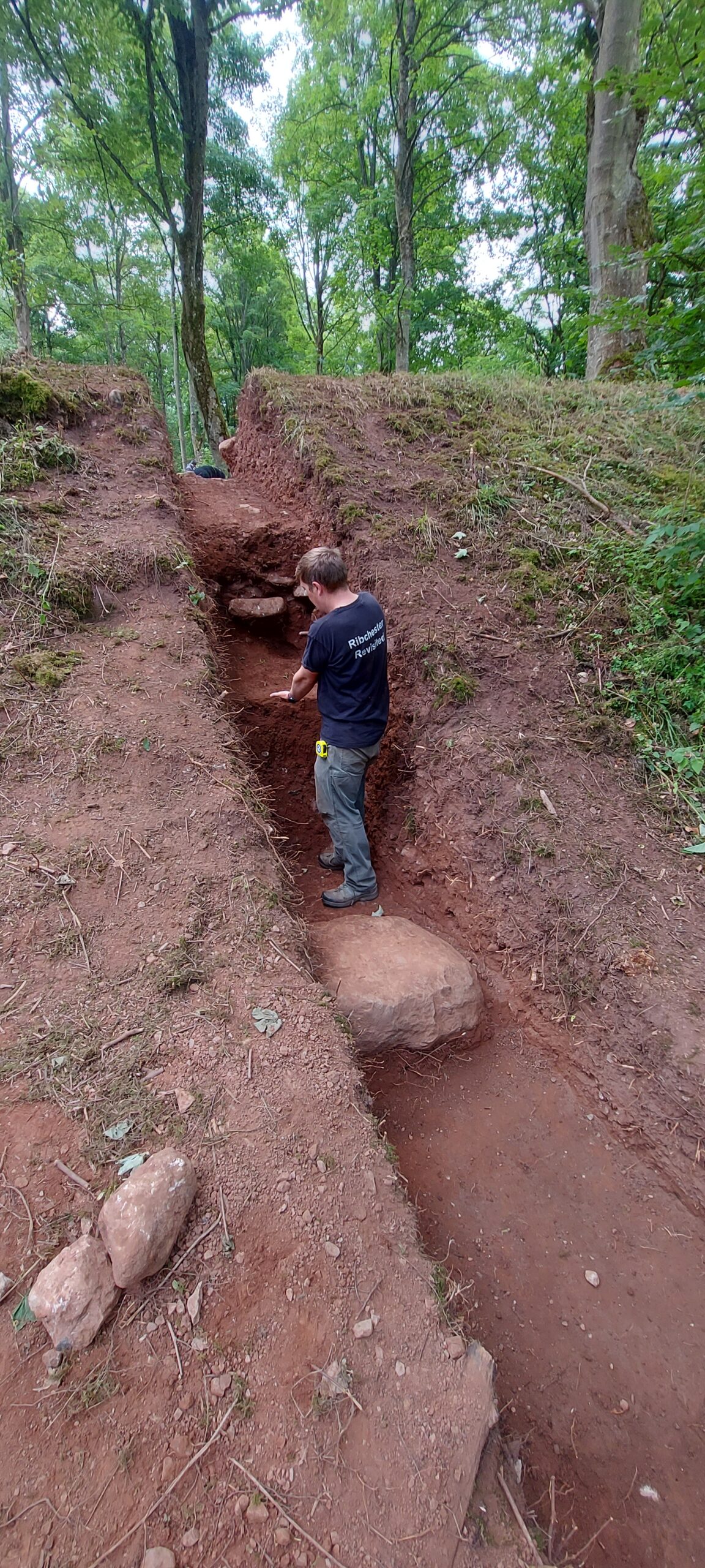
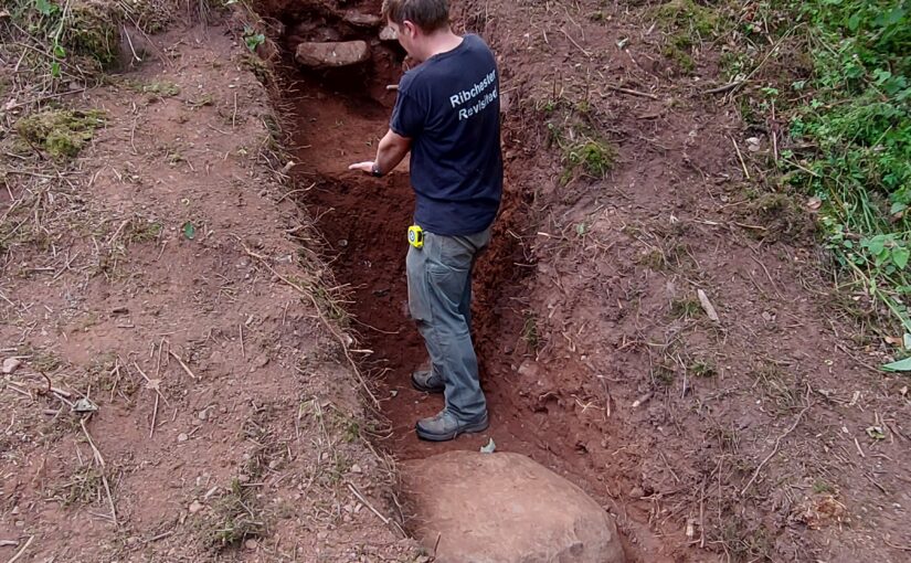
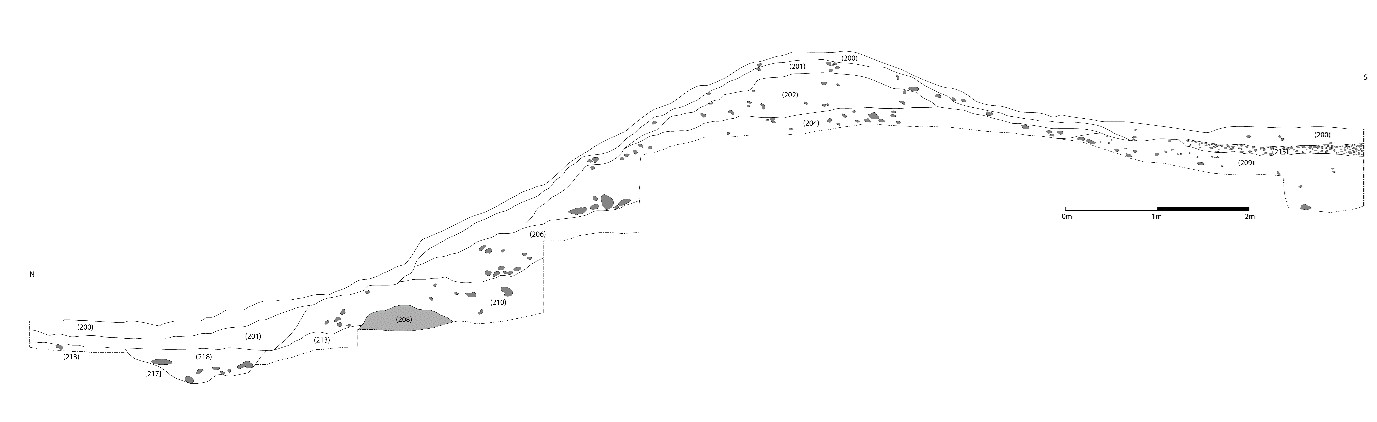
Trench Two investigated the construction of the castle’s north bank. This was one of our biggest undertakings in 2023: the trench measured 15m north-south, and 1m east-west, cutting through the northern bank, all excavated by hand. It was certainly worth the toil. A large block of limestone appears to represent the first layer of the castle’s construction; this is followed by at least four separate building deposits. Seemingly the bank was built up from a number of earthen layers with some smaller stone layers incorporated into the bank, perhaps for stability.

Lowther Castle excavation trench 2 looking north. Copyright Jim Morris

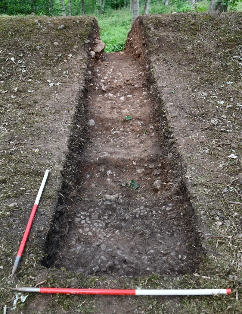
The trench’s southern part, within the castle interior, was also revealing. The stratigraphy, together with the clear level difference between the interior and northern exterior of the castle, suggest how the castle was constructed, first with a great mound, then with bank layers added around the northern, southern, and eastern banks to create the partial ringwork. No evidence has yet been found of a fosse associated with the castle, although Trench Two revealed a small feature at the far north of the trench, of a silty fill cut into the subsoil, running east-west (with a north-south width of 1.52m), possibly a drainage ditch the filled up gradually.

Lowther Castle: west facing section of trench 2. Copyright James Morris

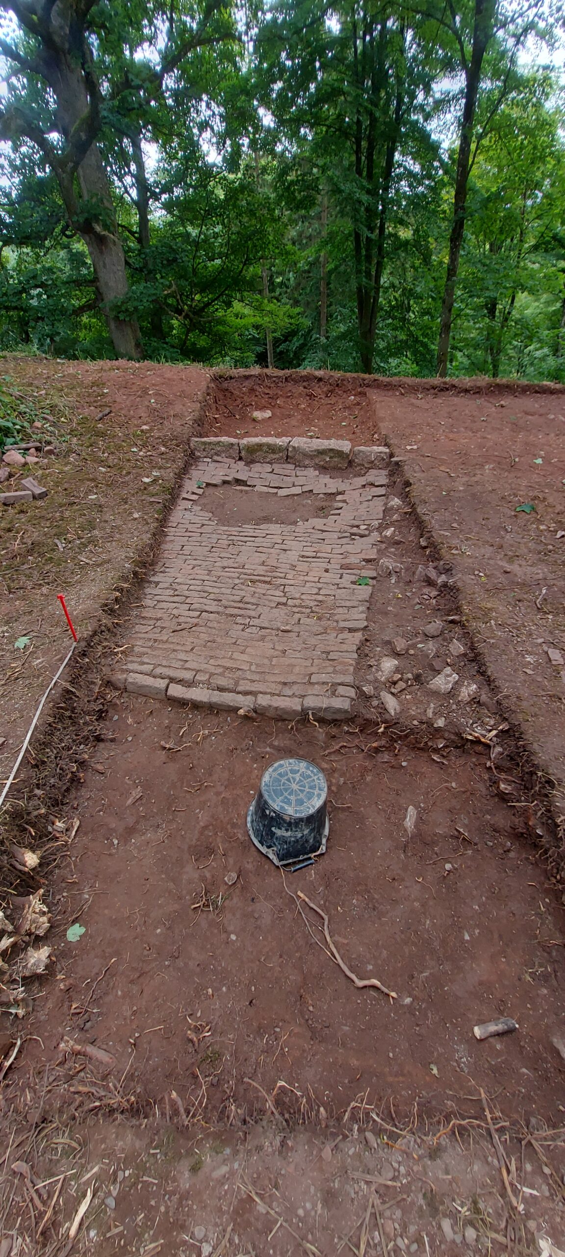
Trench Four began to uncover the castle’s entranceway, in a break in the eastern bank. The removal of topsoil and subsoil revealed a metalled surface, comprising river stones ranging from 0.04 to 0.11m, between 0.20 and 0.15m deep. This seems to be the metalled interior surface of the castle, starting at the entranceway.

Lowther Castle: trench four under excavation. Copyright James Morris

Our 2023 excavation yielded little in the way of small finds, although this is not unusual for medieval Cumbria, and may also suggest that the castle was not long occupied. Meanwhile, in the hopes of finding good dating evidence, bulk soil samples of 40 litres (or 100% of a deposit if less was available) were taken from potentially datable features and layers for flotation for charred plant remains and for the recovery of small bones and artefacts. Bulk soil samples were processed using standard water flotation at the University of Central Lancashire. The results will be incorporated in the project’s final report.

Phase Two excavations will go further in investigating the castle’s construction – this time focusing on the interior. Can we identify a gatehouse structure? A potential comparator for Lowther is Castle Tower, Penmaen (Glamorgan), a partial ringwork sited on a promontory, of similar size and likewise with an entranceway gap: excavations here revealed a substantial Norman timber gatehouse, supported by six posts, and fosse. Phase Two will thus excavate an extended area over the entranceway and beyond. And can we identify interior structures (such as the small timber hall evidenced at Penmaen)? Phase Two will open a substantial area – a quadrant of the interior – to reveal the metalled surface, aimed at identifying postholes as well as maximising chances of recovering small finds.

Subscribe to our quarterly newsletter

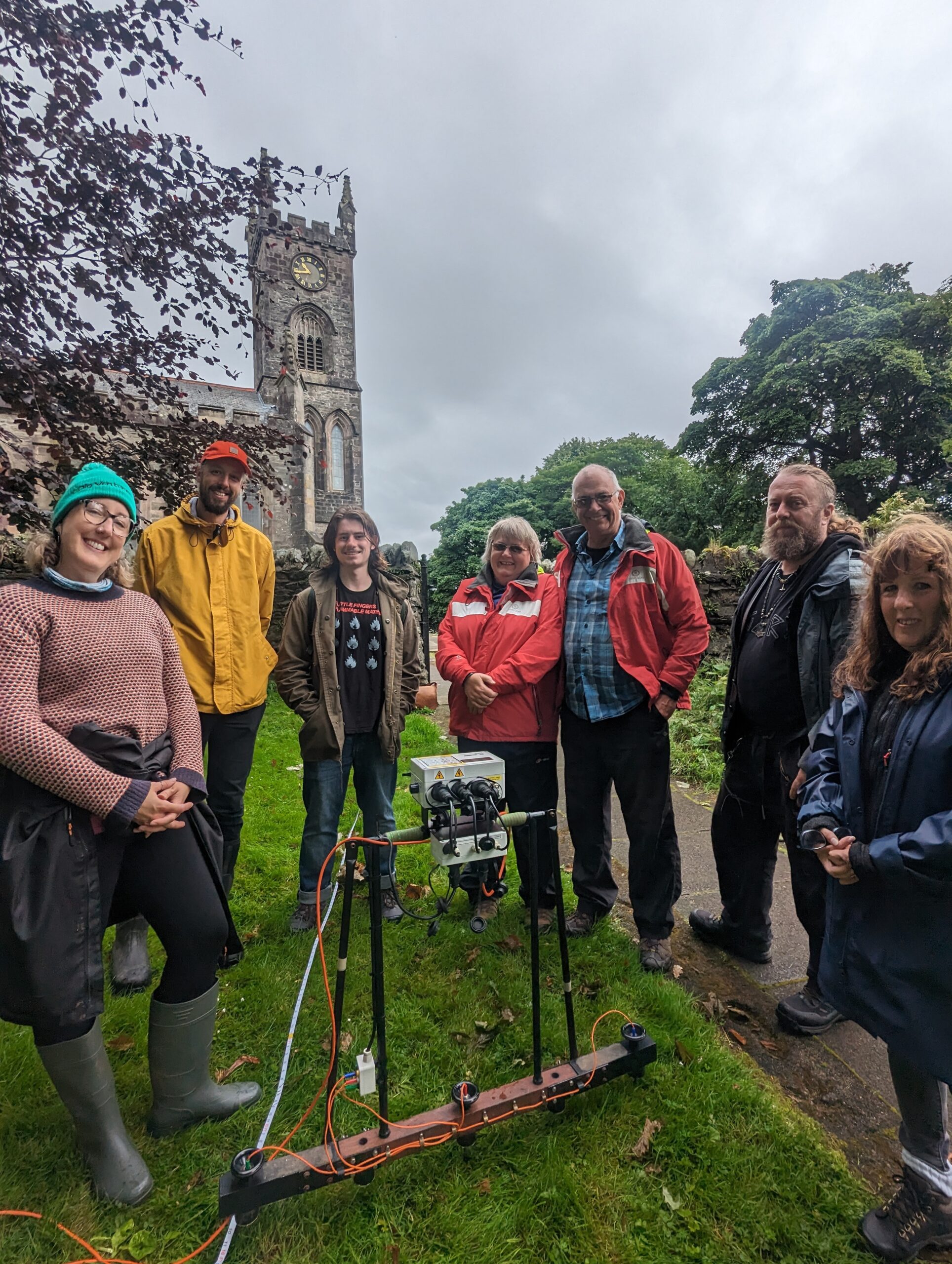
Meanwhile, a partner investigation will get underway in the area around St Michael’s church, just north of the partial ringwork. The castle, village, and Norman church of St Michael’s represent a typical configuration for a medieval manor. The presence of Hogback and other stone sculptures (c.700-1000) at St Michael’s hints at an earlier religious site: can this be established and, if so, what form did it take and how did the Norman settlement overwrite it? And how far did the medieval settlement, attached to the castle, extend northward? Building on our geophysical survey from Phase One, Phase Two’s geophysical survey, supported by CWAAS, takes in the surrounds of St Michael’s.

There is more information on the Lowther Medieval Castle and Village Project on the project website. The 2023 investigation was also featured on BBC2’s Digging for Britain (Series 11 Episode 1), available on BBC iPlayer. The May issue of BBC History Magazine also includes an article on the early medieval Kingdom of Cumbria, placing Lowther’s ringwork castle in its broader context.

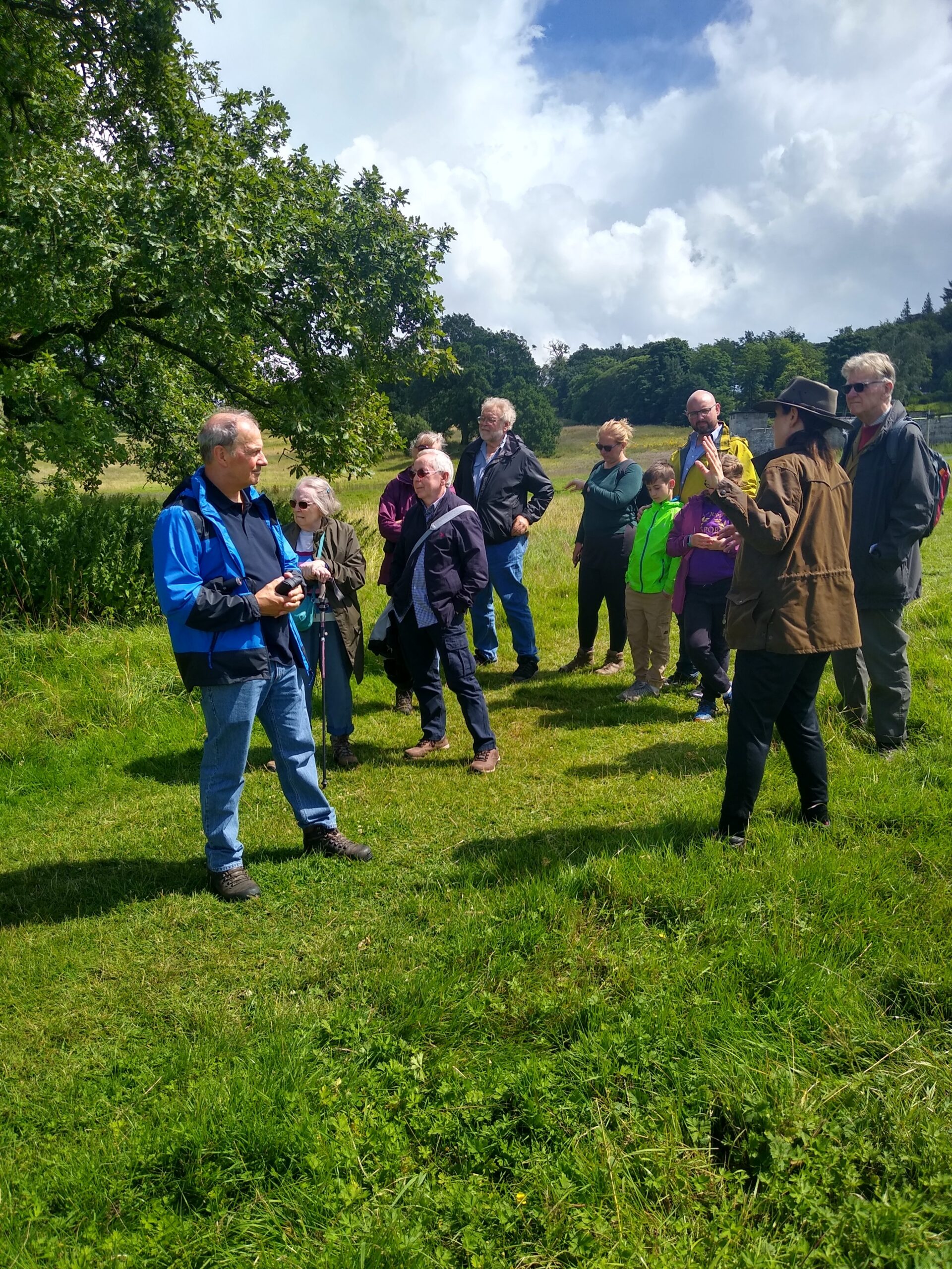
Excavations will run on weekdays at Lowther Castle and Gardens from 13th to 31st May 2024. The north park, where our site lies, is free to access. Visitors are welcome! Entrance to the nineteenth-century castle and gardens offers further opportunities to explore the site’s history: the partial ringwork castle features in Lowther Castle’s new exhibition. Information on visits can be found on the Lowther Castle website.

Subscribe to our quarterly newsletter

You can find the interim report of last year’s excavation here: Grants and Results 2023 | Castle Studies Trust

What did the Castle Studies Trust funded research at Bamburgh find?

Jo Kirton and Graeme Young, co-director of the Bamburgh Research Project (BRP) outlines what happened during their 2023 season and what the CST funded part of the research at this iconic castle revealed.

Throughout July 2023 BRP staff ran our annual field school at Bamburgh Castle, which is currently exploring the medieval outworks at the northern tip of the castle. We also welcomed several experts to site, funded by our CST grant, to undertake complementary survey alongside our excavation.

Subscribe to our quarterly newsletter

Historic Building Consultant Peter Ryder joined us to undertake a preliminary masonry survey of the extant outworks while Tony Liddel from Vindomora Solutions created several 3D models of the standing outworks and internal structures of Elmund’s Tower and our associated trenches. Dr Kristian Strutt and his team from the University of Southampton undertook a geophysical survey of the castle ditch and explored how this interacts with the outworks, as well as identifying related features and access ways to St Oswald’s Gate. BRP staff and students worked with the team, trying their hand at GPR, resistivity and magnetometry.

The reports from the masonry and geophysical survey, plus the associated3D models have now been completed and incorporated into the BRP’s Interim Report on Work on the Outworks Beyond St Oswald’s Gate. This is a summary.

Background

The Bamburgh Research Project (BRP) was set up in 1996-97 to undertake archaeological investigation of Bamburgh Castle and its environs. The area immediately within St Oswald’s Gate was investigated in an effort to identify early elements of the fortification and structures associated with the entrance; documentary evidence indicates that this gate was the principal, and perhaps only, entrance to the fortress in the 8th century AD and likely remained such until the main gate was relocated to its present position in the 12th century.

The rock outcrop on which Bamburgh Castle stands is comprised of volcanic dolerite that rises some 30m above the external ground surface. The surface of the plateau is c.3 hectares in area. It undulates in height, sloping downwards from the Inner Ward area at the south-east, which reaches 45m OD, to the north-west end of the West Ward where St Oswald’s Gate lies. Here a natural cleft in the bedrock on the landward side leads out and down the slope of the plateau. This has formed a natural route up to the summit from earliest times bridging, if awkwardly, the height difference between the West Ward at some 22m above sea level and the surrounding ground surface that lay at 13m OD. St Oswald’s Gate is written about as the entrance to the fortress of Bamburgh in the 8th century AD (Symeon HK, III. pg 37) and was very likely the earliest route up onto the rock plateau.

Subscribe to our quarterly newsletter

Current work

The present phase of work began in the summer of 2021. We are investigating the entrance, the access routes up to the entrance and the structures and outworks built to control this route over many generations. One area of focus was the recovery of the site of the Tower of Elmund’s Well, named in records from the 13th century (Colvin, H. M. 1973, 556) and onto which a cottage was constructed in the late 18th century.

The plan outline of the cottage/tower structure was quickly revealed during the first phase of investigation by the removal of foliage and a modest volume of aeolian sand. One of the first exciting discoveries during the 2022 excavation was the presence of two splayed lights (open window-like features) in two of the walls.

Figure 1: Aerial photo of the outworks with the cottage/tower seen in the top right corner. The steps that lead back to St Oswald’s Gate, through the Wing Wall, at the bottom of the photo. Facing west. Copyright Bamburgh Research Project

The elements of the cottage are now exposed fully in plan and when interpreted alongside the available cartographic evidence would suggest that the entrance was re-aligned due to the build-up of sand deposits in the area that have been slowly burying the standing structures during the post-medieval period. Two short flights of more recent stairs, each turning through a right angle, lead to a long straight set of stairs of older character and showing substantial wear, that extended down through the arch to the basement of the tower where we know from cartographic evidence the well was once present, in what is now a basement room. Here excavation must be getting close to the floor level and some four phases of build are seen in the exposed walls that now reach almost two storeys. The lower two of these phases are likely to be elements of the medieval tower and the upper, by default, phases of the cottage that was built on and into the tower from the 18th century.

There was further work on the postern gate that lies beyond St Oswald’s Gate that leads out to the village which had been subject to limited survey and excavation in previous seasons. Continued excavation immediately behind the wall that leads back to the castle rock has uncovered more of the structure. We intended to uncover more of the wall, recover some datable finds and identify the level from which it was constructed. The structure as uncovered is a single well-constructed feature of coursed squared masonry that ended abruptly and deliberately short of the rock. A further constructed face abutted the bedrock and the gap between the two faces is a little more than 1m wide, forming what must have been a second gate. The eastern of the two is likely the earlier of them and must have led to a timber stair as it is well above ground level. The western, that is currently still in use, may have replaced it as more practical as it is closer to ground level, though still reached by stairs, the current version of which appear to be late post-medieval. This wall extends well to the west where a form of it turns to the north towards the tower/cottage. All the elements that are currently exposed appear to be late in date and the medieval wall must lie beneath the current ground level.

In 2023 we opened Trench 5E, sited outside of the wall with the postern gate and the outworks. It was placed next to a short length of wall that we investigated last season to see if it had once extended further. It has revealed a stone alignment that extends parallel to the two standing walls. Those of the outworks and the short wall length. So far only the upper level has been uncovered, so it is possible that it could be either a wall top or a foundation or the surface of a narrow path.

Work supported by funding from the CST

CST funded BRP to undertake additional non-invasive survey work to offer additional context to the excavation outlined above. Initially, and to better frame the results of the geophysics and limited excavation a walk over study was undertaken by BRP and Peter Ryder. This aimed to provide a description of the standing structures in their historical context, as they are currently understood and was supported by selected areas of photogrammetry survey.

Subscribe to our quarterly newsletter

St Oswald’s Gate itself extends out through the curtain wall to the landward side at the northern end of the castle. It passes through a vaulted tunnel to the gate and appears to represent two phases of medieval build with a third – post-medieval – phase represented by internal and external refacing, likely of the late 18th century.

One of the most enigmatic features is the Wing Wall (W2 (see Figure 2) that forms a partial barrier to the route down from the gate. It appears to be one of the older elements of the defences with at least four phases of masonry (see Figure 3) and is relatively narrow compared to the later medieval defensive walls, such as the South Wall (W2) that cuts and post-dates it. It also contains an unusual arched doorway of early form that may be reused from elsewhere.

Figure 2: The northern extent of Bamburgh Castle showing the site of the outworks and the silted tidal port. Copyright Bamburgh Research Project
Figure 3: The narrow ‘Wing Wall’ showing the narrow archway and multiple phases of construction, facing north-west Copyright Bamburgh Research Project

The south Wall (W1 and W3) comprised at least two build elements that joined with an overlapping joint. The wall as we now know through excavation had two postern gates that would have led to the village.

In addition to the masonry and photogrammetry survey, Dr Kristian Strutt undertook magnetometry, resistivity and Ground Penetrating Radar (GPR) survey of areas of the Cricket Ground to the west of Bamburgh Castle. The results indicate the possible presence of a large ditch, some 45m across, immediately to the west of the outcrop, in addition to trackways, walls and other features.

Figure 4: GPR survey under way across the Cricket Ground using an Impulse Raptor 8-channel system and GPS (photo: K. Strutt)

One of the principal questions we were hoping to address with the geophysics was if the castle ditch extended across the sports field at the base of the castle rock. A ditch cut through sandstone can been traced in the area of the modern entrance that is at the site of the 12th century gate. This feature extends across the front of the castle as far as the sandstone ridge. The results of the GPR seem to strongly indicate a large feature in the area where we would anticipate the castle ditch to be and the magnetometry and resistance surveys seem to support this. It is intended to conduct further fieldwork, starting with coring, to confirm this.

Subscribe to our quarterly newsletter

In addition, several features seen on the 1865 1st Edition Ordnance Survey (Accessed via National Library of Scotland online 23/04/2024) appear to be picked up on the surveys. Two trackways are evident, that lead to St Oswald’s Gate and to a cleft in the castle rock called the ‘Miller’s Nick’, which allowed people to scramble up to the West Ward in the 19th century. The second is an S-shaped path that meandered towards the area of St Oswald’s Gate, perhaps originally skirting around the edge of the ditch feature. One further route-way or path extends across the field parallel to the road in the village to the south, called the Wynding, that appears from records to have had a medieval origin. This path runs alongside a linear plot boundary and field boundaries and it will be interesting to see if more can be made from a number of anomalies within the enclosure areas to the south and west of the plot.

Figure 5: Interpretation plot of all three surveys, labels link to the text in the Interim Report and Geophysical Survey Report. Map Data: Google ©2023, Airbus 11/05/23

The resistivity and ground penetrating radar surveys so far cover a more limited area, due to time constraints and public access. There is an area of low resistance that lies just where the ditch would lie and matches up to the path towards the Miller’s Nick. The enclosure areas picked up in the magnetometry to the south-west also seems to be present on the resistivity. Notably, there is a high resistance feature that the S-shaped pathway may curve deliberately to avoid at the south part of the plot. A further T-shaped high resistance feature is present in the north-east extending from the area of the modern pavilion that will bear further study. The GPR further reinforces the presence of some of these features and indicates some depth to the anomaly that is interpreted as the ditch, though the signal attenuates before it could indicate a true depth.

Together, the on-going excavation and non-invasive survey work undertaken in 2023 are providing us with the opportunity to better understand the castle outworks, north of the castle, and the wider environs in which they were situated. That this area of the castle was its original entrance, and for a time gave access to a modest port, ensures that there is much yet to be discovered and understood.

Interim Report

If you would like to read more about the excavation, masonry survey & 3D models and/or the results of the geophysical survey with accompanying discussion, please take a look at

Surveying Bamburgh Castle’s Elmund’s Tower | Castle Studies Trust

We are incredibly grateful to the Castle Studies Trust for their generous support.

Subscribe to our quarterly newsletter

References

  • Colvin, H. M. 1973. The History of the King’s Works, London: HMSO
  • Map Data: Google ©2023, Airbus 11/05/23
  • Ordnance Survey Sheet XVII 1865 (Accessed via National Library of Scotland online 23/04/2024: https://maps.nls.uk/view/102346251)
  • Ryder, P. 2024. Preliminary Assessment of the Standing Masonry Elements: St Oswald’s Gate, the Western Outwork and St Elmund’s Well Tower, Bamburgh Castle, Unpublished Report
  • Strutt, K and Barker, D. 2024. Report on the Geophysical Survey at Bamburgh, Northumberland, July 2023Department of Archaeology, University of Southampton: Unpublished Report
  • Symeon, H. K. Historia regum Anglorum et Dacorum (trans. J. Stevenson), 1858, Church Historians of England

Picton Castle: baronial innovation in southwest Wales

In September 2023, author, Neil Ludlow, with Phil Poucher of Heneb – Dyfed Archaeology (formerly Dyfed Archaeological Trust) carried out the first modern detailed survey of Picton Castle, Pembrokeshire, funded by the Castle Studies Trust. Neil Ludlow looks at what they found in this unique and enigmatic building.

Picton Castle in Pembrokeshire has long been something of an enigma. It has a unique layout – there’s no other castle quite like it – which has been much discussed, resulting in rather more questions than answers. And it’s been continually occupied since it was built, so it’s seen a lot of alteration. While outwardly it retains much of its medieval flavour, the interiors were extensively made over during the eighteenth century so that it now presents itself first and foremost as a Georgian country seat. But beneath this veneer, much medieval work still survives – though a lot of it is tucked away behind stud-walls, in cupboards, or is otherwise obscured. Yet no structured archaeological survey of the castle had been undertaken, while the documentary record for its medieval development is more or less non-existent. We don’t even know its precise date – it’s long been attributed to Sir John Wogan, an important official in Crown service and Justiciar of Ireland 1295-1313, but being baronial work it’s unlike Crown work where accounts usually survive. 

Subscribe to our quarterly newsletter

To try and resolve some of its many mysteries, the Castle Studies Trust generously funded survey, recording and research at the castle during 2023, which was carried out by the author, Neil Ludlow, with Phil Poucher of Heneb – Dyfed Archaeology (formerly Dyfed Archaeological Trust). A full photographic record was made, along with a full 3-D survey using a Leica RTC360 laser scanner. This was not without its challenges. The castle is still occupied, as the administrative hub for the Picton Castle Trust, which means that many areas are busy, working spaces, while others are used for storage – and nearly all of it is furnished.

Longitudinal section through Picton Castle, facing north (roughly along midline) – conjectured medieval, copyright Heneb – Dyfed Archaeology
Longitudinal section through Picton Castle, facing north (roughly along midline) – as today, copyright Heneb – Dyfed Archaeology

Picton’s unique layout makes it a castle of great importance. Most castles have at least some close parallels, but Picton is effectively one of a kind. In essence, it is a towered hall-block, inviting comparisons with castles like Nunney in Somerset, and the ‘towered keeps’ of thirteenth-century Ireland, for example at Carlow and Ferns. However, close study shows that it resolves as a central first-floor hall, flanked by services and a chamber-block to form a very early example of the three-unit ‘H-plan’ house. Here, though, the end units are processed out as D-shaped towers, two on each side wall. A terminal twin-towered gatehouse lies opposite a D-shaped tower formerly lying at the western apex – seven towers in all. The hall is open to the roof; the towers have polygonal interiors (two of them disguised beneath later fittings), and contain three storeys. The ground floor is mostly rib-vaulted. The gatehouse – unusual in buildings of this kind – led onto an equally unusual ‘grand stairway’ to the hall; a second ground-floor entry probably led to an external kitchen and bakehouse. Though very forward-looking in its layout, the castle belongs stylistically to the first two decades of the fourteenth century, and analysis of the sources suggests that it was most likely built by John Wogan between around 1315 and 1320.

Picton Castle serving hatches, copyright Neil Ludlow

The castle’s spatial disposition, access and circulation are meticulously planned, while the domestic appointments show a remarkable level of sophistication for the period, including what appear to be vertical serving-hatches between the ground floor and the service rooms above. At second-floor level, the east towers and gatehouse form two integrated suites of residential apartments either side of a chapel, in a manner firmly rooted within royal planning. The opposite pair of towers, at the west end, seem to have been united internally to form a residential chamber-block, for Wogan’s officials and guests, possibly served by latrines in the former west tower; the present partition walls are later.  

Some aspects of the layout may show influence from northern Britain, or perhaps even Plantagenet Gascony. Detail shows influence from the castles of Gilbert de Clare, including the form of the spur-buttresses, the rib-vaulting and the arrow-loops. Execution of the design is however largely regional, showing great ‘plasticity’ of form and extensive squinching. There is surviving evidence for neither a defensive ditch, nor a surrounding wall until the seventeenth century, though an accompanying enclosure – containing the kitchen and other ancillary buildings – is likely from the first.

Picton Castle Great Hall area today from eastern / gatehouse end of the castle, including Georgian features

Beginning in around 1700, and spanning over 50 years, extensive works transformed the castle into an elegant country house, with magnificent and well-preserved Georgian interiors that include what seems to be only the second circular library to be built in Britain. Later campaigns included the addition of further wings and ranges. Work continued into the later twentieth century, with an extensive refurbishment in the 1960s. But the earlier work has largely survived, making the castle – along with its gardens – a popular visitor attraction.

Subscribe to our quarterly newsletter

Uncovering the Secrets of Dunoon Castle: A Collaborative Archaeological Endeavour

Harriet Tatton, Programme Coordinator, DigVentures looks at the community focused geophysical survey of Dunoon Castle in Scotland.

In summer 2023, a grant from the Castle Studies Trust facilitated an exciting collaborative venture to reveal some of the hidden mysteries of Dunoon Castle, Cowal. DigVentures, in partnership with Argyll and Bute Council, the Dunoon Area Alliance, and Castle House Museum, designed a community-orientated endeavour to learn more about the site of Dunoon Castle and raise awareness of the heritage of the Castle House Park and Gardens.

Subscribe to our quarterly newsletter

The medieval stronghold, a scheduled monument, has long been shrouded in the enigma of its past. Thanks to the support of the Castle Studies Trust, a comprehensive geophysical survey and community activity program were initiated, providing a fascinating glimpse into the castle’s rich history.

Community participants getting to grips with geophysics in front of the Castle mound © DigVentures

Professional archaeologists, building historians and amateur enthusiasts from the local community came together to conduct a non-invasive survey that aimed to unearth the secrets of Dunoon Castle and its surrounding parkland. The results not only contribute to the ongoing heritage management of the site but also enhance the narrative that can be shared by local heritage organisations such as the Castle House Museum. In total, just under 100 people were involved in the project, which included training workshops, a public talk and tours, and activities for children and young families.

Looking for overgrown walling on the top of the mound © DigVentures

Dunoon Castle has stood witness to centuries of history. Documentary evidence traces its roots back to the early 13th century AD, and today, it stands as a modified natural mound with a curtain wall, hinting at its medieval past. There is debate over the castle’s original purpose, with suggestions ranging from a motte-and-bailey castle to a ‘castle of enclosure.’ Recent interpretations lean toward the latter, aligning with a group of castles built during the 12th and 13th centuries by successive Scottish kings.

Volunteers exploring the Castle mound © DigVentures

The castle’s complex history is evident in distinct phases. In the medieval and post-medieval era, Dunoon Castle played a pivotal role in Scottish history. From its Lamont origins, through conflicts and regencies, a visit from Mary Queen of Scots, to its eventual abandonment around AD1650, the castle witnessed tumultuous times. The 19th century marked a transformative phase as Dunoon Castle became a focal point for James Ewing’s architectural ambitions. His castellated mansion, set against landscaped gardens, turned Dunoon into a sought-after holiday destination.

As the 20th century unfolded, Dunoon Castle assumed new roles during both World Wars, serving as a strategic defence point with searchlights and coastal batteries. The aftermath of war saw the castle’s hill repurposed for military activities during the Cold War, reflecting the evolving strategic importance of the site.

Geophysicist Kimberley Teale with the project’s team of community participants © DigVentures

During the weekend of activities, DigVentures’ small team of archaeologists and local people aimed to make sense of this historical jigsaw puzzle. The magnetometer survey, conducted in areas north and south of the tennis courts and south of the castle museum, uncovered intriguing details. Possible garden wall foundations around the museum, features related to landscaping of the castle gardens, and remnants of former garden plots and a fire station emerged from the data, making sense of the castle’s historical evolution.

Simultaneously, the earth resistance survey corroborated these findings across the same areas, providing a comprehensive dataset for analysis. The revelation of garden features, potential gateposts, and additional elements related to the castle’s history further enriched the understanding of Dunoon Castle’s past.

The team review the results at the end of a day of geophysical survey © DigVentures

Over the weekend, Dr. Louise Turner spearheaded a rapid historic buildings assessment of the castle remains, and although not an exhaustive survey, the assessment hinted at the Victorian origins of much of the visible walling within the castle ruins. Surprisingly, limited evidence was found for the earlier phases of the castle and raises intriguing questions about its earlier configurations; documentary evidence suggests that a castle has been present at the site since at least the 13th century, but very little of this phase appeared to be visible.

Subscribe to our quarterly newsletter

Complementing these efforts, historic building and aerial 3D photogrammetric drone surveys were conducted. These surveys not only highlighted obscured walls and earthworks but also uncovered hidden features concealed by vegetation overgrowth. A resulting topographic survey, compared against historical maps and surveys, revealed that a substantial portion of the castle walls, previously recorded, is now obscured or even considered submerged beneath the current ground level.

The findings underscore the importance of ongoing conservation efforts, as vegetation threatens to permeate the fabric of the surviving castle walls, potentially causing damage, in particular to the earlier, less visible phases of the castle’s structure. This collaborative project aligns with best practices outlined by Historic England, the Chartered Institute for Archaeologists, and the Europae Archaeologiae Consilium, ensuring the responsible and insightful exploration of Dunoon Castle’s captivating history.

As the dust settles on this archaeological venture, Dunoon Castle stands as a testament to the power of collaboration, community engagement, and cutting-edge survey techniques in unravelling the mysteries of the town’s history. DigVentures hopes to do more work at Dunoon Castle in the near future.

Subscribe to our quarterly newsletter

To look at the geophysical survey report you can go here: Geophysical surveys at Dunoon Castle | Castle Studies Trust

Picton Castle – form, function and affinities – new work at an enigmatic Pembrokeshire castle

Starting on September 11 2023, Dyfed Archaeological Trust, with Neil Ludlow, will undertake survey and recording at Picton Castle, near Haverfordwest in Pembrokeshire. This work, wholly funded by the Castle Studies Trust, will be fully analytical: it will provide a comprehensive record, underpinned by new research, in an attempt to unravel some of the mysteries of one of Wales’s – and indeed Britain’s – most enigmatic castles. Here Neil Ludlow and Phil Poucher from DAT explain more about the project.

Subscribe to our quarterly newsletter

Picton Castle has been continuously occupied since it was built, and was substantially modified over the centuries, now wearing the veneer of an eighteenth-/nineteenth-century country house. Underneath, however, is a baronial castle from around 1300-20, of a highly unusual plan without close parallels in Britain and Ireland. A small, compact building, it comprised a hall-and-chamber block flanked for D-shaped towers, one near each corner, with a twin-towered gatehouse at one end – possibly unique – and a D-shaped tower, now lost, at the other. Variations on this basic ‘towered hall-block’ layout are seen in castles of similar date – and somewhat earlier – in the West Midlands, Scotland and the border, Ireland and even southwest France. But none fully mirror Picton’s plan-form – which might conceivably have been at least partly modelled on the large ‘keep-gatehouses’ of the late thirteenth century.

In addition, Picton shows strongly regional attributes including a first-floor hall, corbelled parapets and an abundance of squinched features in the external angles. The towers rise from pyramidal spur-buttresses with an unusual octagonal footprint, otherwise seen only in the gatehouses at St Briavels Castle (Gloucs.) and Tonbridge Castle (Kent). So a variety of influences – regional, national, international and purely personal – may lie behind design at Picton.

Picton Castle Ground Floor (incl ribbed vaulting)

No structured survey and analysis of the castle has yet been undertaken, and it is fundamental questions like this that the present study will address. In addition, little is known of how the castle actually functioned. The service end of the hall is currently assumed to have lain towards the gatehouse, where blocked doorways possibly led to a buttery and pantry; at the opposite end, it’s possible that the two western towers were united to form a storeyed chamber-block, to which the lost D-shaped tower was a bedchamber. But medieval access arrangements are still a mystery, as are the use and relative status of many internal spaces. For instance, it’s speculated that a broad flight of steps might have led from the gatehouse, through a ‘processional’ archway, to the hall. But the ground floor is, unusually for the region, rib-vaulted throughout – can it really have been ‘cellarage’, or did it provide access (and an anteroom) to the hall and chamber? Two spiral stairs connect ground- and first-floor level, one of them with very broad treads – were the distinguished by the status of their users? Or did the vaulted ground-floor corridor lead to a stair accessing the high end of the hall?

Not all internal walls have been dated – some, at least, may be post-medieval. Similarly, it is clear that not all medieval features such as openings, entries, stairs, latrines, fireplaces, ovens and hearths have yet been identified. Their correct identification and dating will tell us a lot more about status and usage of interior spaces, and about circulation between them. The location of the kitchen and bakehouse – and method of water-supply – are also still unknown: were they separate from the main building? A chapel was in existence by the seventeenth century, and is assumed to have a medieval predecessor, but it is yet to be shown whether it lay over the gate-passage like its successor.

The 2023 work aims to resolve such questions, and to achieve a full understanding of the form, functions and affinities of the medieval building. A combination of total-station theodolite survey, drone photography, drawn elevations, a high-resolution photographic record and, where possible, 3D modelling will be used to obtain a comprehensive record, supported by new research. All evidence for medieval features, openings and architectural detail will be recorded, along with former levels and access between them, and any indication of different building campaigns. The report, with all survey drawings and photos, will be posted on the Castle Studies Trust website. 3D models will be accessible via Sketchfab.

Subscribe to our quarterly newsletter

Contextualising Bamburgh Castle: wells, towers, mounds and more!

Dr Jo Kirton co-director of the Bamburgh Research Project takes a look at the work they are doing at Bamburgh Castle, funded by the Trust.

Throughout 2023 and early 2024 the Bamburgh Research Project will be utilising funding from the Castle Studies Trust to further explore Bamburgh Castle’s medieval outworks, particularly the area outside St Oswald’s Gate where our current excavation is underway as part of our annual field school. Our project is titled ‘Contextualising Bamburgh Castle: wells, towers, mounds and more!

Subscribe to our quarterly newsletter

crForeground shows the area currently under excavation by the BRP with St Oswald’s Gate visible at the top of the steps and West Ward of Bamburgh Castle present in the background.eated by dji camera

Bamburgh Castle

Bamburgh Castle rises from the North Sea coast of north Northumberland. It lies on an undulating, 3.2-hectare, outcrop of dolerite bedrock that stands up to 30m above the surrounding countryside. Bede describes it as a palace site of the Anglo-Saxon kings of Northumbria from the later 6th century and it remained a royal castle until its semi-abandonment after a great siege in 1464. Rebuilt by the Lord Crewe Trust in the 18th century and again by the 1st Lord Armstrong at the end of the 19th, the fortress has long held a special place in the history and culture of the region.

The majority of the archaeological work at Bamburgh has concentrated in the low-lying West Ward at the north of the castle. A complex deeply stratified, finds-rich, site has been revealed archaeologically. By contrast, the Inner Ward of the castle, at the very top of the hill, remains a built-up area. Modest scale excavation of the accessible areas has provided an important balance, giving insight into the heart of the citadel to contrast with the occupation and industrial activities we see in the West Ward.

Aerial shot of St Oswald’s Gate with steps leading down to current excavation area.

St Oswald’s Gate

St Oswald’s Gate and the outworks beyond lie in the area of the original entrance to the castle. It is very likely that the siege castle (named Mal Voisin in the Anglo-Saxon Chronicle) was built close to this gate in AD 1095. When the main access was re-sited, the entrance here remained as an important postern, perhaps serving a small adjacent harbour immediately to the north of the site. This area now forms the BRP’s main investigative focus. The outworks consist of strong walls enclosing a trapezoidal area with the Tower of Elmund’s Well, with a more recent wall and postern to the west.

Map depicting current area of excavation (Base map Crown Copyright/database right 2022. An Ordnance Survey/Edina supplied service).

The outworks at St Oswald’s Gate are a rare case at Bamburgh as they have not been subject to extensive rebuilding in the post medieval period. Other than the reconstruction of the tower as a cottage, the outworks represent an astonishing window into mostly unaltered medieval fabric still standing at Bamburgh.

Aerial shot of Elmund’s Tower and suspected medieval well location.

Work to Date

Recent investigation by the BRP has revealed that a substantial structure still survives below ground. This is in the form of an L-shaped corridor and steps down into the room that is thought to be the tower basement that contained the well. The presence of two splayed narrow windows appears to further indicate that this is part of the medieval Elmund’s Tower. Our primary aim this year is to continue to reveal the full extent of the tower and identify any remains of the well depicted on the 19th century survey. 

Steps down into the room that is thought to be the tower basement that contained the well.
Arch into the well room of the tower

What will the Castle Studies Trust (CST) Funding be used for?

There are two primary aims for the CST funding:

  • The first is to contextualise our recent excavations at Elmund’s Tower through geophysical survey (GPR and Magnetometry) and to undertake a masonry survey of the castle’s associated extant outworks. This will include using photogrammetry to create a 3D model of the standing outworks and internal structures of Elmund’s Tower. The survey will be undertaken in conjunction with a metric survey of the structures outlines. This work is currently underway and we look forward to sharing the results with the CST. You can follow our progress on our blog: https://wordpress.com/post/bamburghresearchproject.wordpress.com
  • The second focus for the funding will be on disseminating our discoveries to the wider public. We will install signage for visitors, who cannot currently visit this area of the castle with a QR code for the 3D model, granting online access to Elmund’s Tower and the wider outworks over the winter period. This information will also be replicated and enhanced with the creation of a new webpage on the Bamburgh Castle website. Alongside these permanent additions we will continue to share our work through our blog and social media.

Subscribe to our quarterly newsletter

Dig Diary Six: Lowther Castle and Village Project Highlights

In her final blog piece (for now) Project Lead, Sophie Ambler, looks back at the three excavation at Lowther

The on-site investigation of the medieval castle and village at Lowther (Cumbria) has now drawn to a close. Over the past month, a team from Allen Archaeology, UCLan, and Lancaster University has been exploring the site through geophysical surveying, excavation and archival research. We now have a geophysical survey of the village to analyse alongside LiDAR and the original earthworks survey. Over the coming months, our small finds will be analysed, together with soil samples, in the hopes that they yield dating evidence, and a report will be prepared drawing together the results from our trenches.

Subscribe to our quarterly newsletter

Meanwhile, we have the chance to reflect on what’s been a thrilling month of investigation.

Uncovering the construction of the ringwork castle and assessing its situation has helped us to get a sense of the site’s place in the broader landscape. Since the area in which the castle stands is now wooded, this takes some imagination.

1. Lowther medieval castle OS map with label

The ringwork castle is sited on the edge of Lowther’s western escarpment, which runs down to the River Lowther. The ringwork’s positioning is clearer in OS maps (image 1), where its proximity to the river and the steepness of the escarpment are evident. Today, one can get some sense of the impact of this positioning by heading eight hundred metres or so south to take the view over the escarpment from the Jubilee Summer House, in the grounds of the nineteenth-century castle (image 2, and view the panorama on Google Maps.), although the escarpment is far less steep here. Originally, the castle would have commanded wide-ranging views to the west, across the river to Askham Fell, and would have been a highly visible – perhaps dominant – landmark for miles around.

View of western escarpment down to River Lowther from south of 19C castle

The scale and the construction of the ringwork castle has also become clearer. Again, given the tree coverage and overgrowth, it’s long been hard to perceive the earthwork’s size and form. It’s been hard also to capture the earthwork in photographs – but throughout the project Lowther’s resident photographer, Tony Rumsey, has been busy. His drone footage gives a much clearer sense of the site (image 3). To the top of the picture, the western escarpment drops steeply down from the earthwork to the river. In the foreground, Trench Two cuts into the earthwork’s northern bank.

Drone Trench 2 bank of ringwork castle in woods_Tony Rumsey

The image also shows how the floor level of the earthwork’s interior is significantly higher than the exterior ground level. As Trench Two revealed, the ringwork was constructed as a large, roughly square mound with layers of earth and stone, with its banks built up further to gird the mound. Meanwhile, the interior was topped with a metalled surface. We expect that the banks would have been surmounted by a simple fence or palisade (Trench Two did not reveal any postholes to indicate this palisade, but this is not surprising given that the top of the bank has almost certainly been lost to slippage).

Drone Trench 4 metalled surface entrance to ringwork castle Tony Rumsey

The metalled surface covering the interior of the ringwork is also clear in Trench Four (image 4). This trench takes in the approximate area of the ringwork castle’s entranceway, which cuts through the eastern bank. The entranceway may have included a wooden gateway, although we haven’t found firm evidence of one in Trench Four, and perhaps would need to open a larger area to be sure. Trench Three picked up a trackway (image 5), noted in the earthworks and geophysical surveys, which linked village to castle and brought visitors to the entranceway.

5. Drone Trench 3 trackway into castle_Tony Rumsey_

One of the highlights throughout the project has been welcoming visitors to the site. The project’s archaeology students from UCLan have been giving tours to those who’ve ventured down to the site during the course of the dig, keen to know more about what we’ve been uncovering. On Saturday 15 July, we were delighted to welcome representatives of the Castle Studies Trust and share with them our ongoing work (image 6), as well as members of several regional history and archaeology societies. We also had a visit from Professor Alice Roberts and the team from BBC2’s Digging for Britain (image 7), who plan to feature the project in their next series.

6. Visit of CST
7.Digging for Britain with project team

We still have further to go in analysing our findings and expanding our investigation of Lowther’s medieval castle and village, but are very pleased with how the on-site phase of our project has gone – not only in exploring the remains of an important medieval castle site, but also in training a new generation in castle archaeology, and encouraging public appreciation of castle studies. The project team is extremely grateful to the Castle Studies Trust for funding the project and for its support throughout, and would also like to thank the Lowther Castle and Gardens team for their help and hospitality over the past month. I’d also like to say a huge thank you to the indomitable Jim Morris, who has led the UCLan archaeology contingent, the hardworking and dedicated cohort of UCLan archaeology students, and the excellent Allen Archaeology team (Jonny Milton, Rob Evershed and Tobin Rayner).

Subscribe to our quarterly newsletter

Investigating Dunoon Castle

Dr Manda Forster of DigVentures and independent historical researcher Dr Louise Turner set the scene for our next project getting under way – the geophysical survey of Dunoon Castle, Argyll.

On Friday 21 July, members of the public will be joining archaeologists from DigVentures to investigate the remains of Dunoon Castle (NGR: NS 1796 7868; Canmore ID: 40729). The medieval castle site occupies a prominent, partly-modified hill within landscaped gardens which overlook the seafront in the coastal town of Dunoon, Argyll. The town itself is located towards the south end of the Cowal Peninsula at the narrowest point of the Firth of Clyde. This part of the peninsula forms the western shore of a distinct body of water – the north to south oriented sea loch named ‘Holy Loch’ – which adjoins the lower reaches of the Clyde that continue onwards following a more east to west course past Toward Point in the south.

Subscribe to our quarterly newsletter

This community-based investigation, supported by a grant from the Castle Studies Trust, aims to raise awareness of the significant archaeology which sits in the town. Working with local people, the team will explore the archaeology of the site to add detail to the few visible earthworks at the top of the mound with geophysical and topographic survey, including photographic building recording and a drone survey. To get families involved, we’re hosting tours and a character trail around the site, as well as running activities with the Castle House Museum inspired by postcards of the castle and a nod to the town’s history as a visitor destination for those heading on a trip ‘doon the watter’. The project is a collaborative venture by DigVentures with Dunoon Area Alliance, Dunoon CARS and the Castle House Museum which aims to raise awareness of the significant history of the site and find out more about the buried archaeology through a programme of geophysics.

The remains of Dunoon Castle, and the hillock on which it stands, are a designated Scheduled Monument (HES ID: SM5450). The site has a long and complex history linked inextricably with its prominent strategic location in the Firth of Clyde – and with the success of the town itself. The castle hill played a crucial role in the military history of the Clyde Coast during both world wars, and in the town’s success as a holiday destination during the later nineteenth and early twentieth centuries. As a result, the archaeology of the hill extends beyond the medieval castle itself to encompass built elements associated with the nineteenth century landscaped park and gardens.

Dunoon Castle looking north copyright Manda Forster

Little is known or evidenced for early occupation at the site, although ‘seven or eight’ cist burials were discovered in the grounds of Castle House in 1822, during its construction. The description of the burials is comparable with nearby examples of medieval long cists from Innellan (just south of Dunoon), which have been radiocarbon dated to the late tenth century. Early ecclesiastical activity would not be unexpected, and could focus around the site of the modern Dunoon High Kirk. Historically, the earliest documentary mention of the castle was made in 1257 in reference to ‘John of Dunown,’ who was steward to the Earl of Lennox in 1253. From then on, the castle and its associated people, which includes two successive bishops (mid-fifteenth century) and a visit from Mary Queen of Scots in 1563, take a prominent role in the region. The Campbells acquired Dunoon Castle in the 14th century when Sir Colin Campbell, 3rd Lord of Lochow, was granted title of ‘Hereditary Keeper of Dunoon Castle’. The Campbells then retained Dunoon Castle throughout the remainder of the medieval period, and beyond. A document dated 15th January 1472 outlines their responsibility for the upkeep of the castle and the maintenance of its fabric, as well as the power to appoint constables, porters, jailors, watermen and other officers. By the end of the medieval period, Campbell influence was growing ever greater in this SW corner of the Cowal peninsula but, following the grisly Dunoon Massacre* in 1646, the castle seems to have been deserted. After its abandonment, stone from Dunoon Castle was probably used locally for housing, including for the construction of Castle House and associated structures (now the location of the museum).

Postcards of Dunoon through the ages

The site itself retains its nineteenth century character, having been retained within a larger area of landscaped gardens. The planned investigations have the potential to explore whether there are undiscovered features relating to earlier occupation of the castle mound (Phase 1) and provide an updated record of the extant remains which relate directly to the medieval castle (Phase 2). In delivering the survey, we also hope to further refine our understanding of how the configuration of the gardens and landscaped grounds may have changed from the early nineteenth century to the present (Phase 3) and to record any extant evidence for the twentieth century coastal defences (Phase 4).

Subscribe to our quarterly newsletter

*The 17th century was brutal for the clans in the area as it was across Scotland, with a backdrop of war and switching allegiances. Within this context, the Lamonts and Campbells found themselves on opposing sides, and the Lamonts invaded Campbell lands killing 33 men, women and children. In 1646, the Campbells struck back, attacking the Lamont castles of Ascog and Toward (just down the coast) and capturing around 100 Lamonts who were sentence to death and executed. Thirty-six of the highest ranking were hanged from a tree in the graveyard. A memorial now stands to Clan Lamont at Tom A’Mhoid road.

Dig Diary Five: Digging in to the archives part two

In the fifth of our Dig Diaries Sophie Ambler discusses the work she is doing investigating the Lowther archives and seeing how the written record helps with the archaeology.

In the third Dig Diary for the Lowther Castle and Village project, I introduced the (patchy) written evidence for the Norman conquest and colonisation of Cumbria – potentially when our site was established. Here, I’ll introduce some of the earliest written evidence for our site, dating from the thirteenth century.

Our evidence comes from the archive of the Lowther family, held in the Cumbria Archive Centre in Carlisle. This archive is largely uncatalogued, held in boxes arranged by manor (administrative units within the larger estate). There are six boxes pertaining to the Lowther manor, containing several centuries’ worth of documents. Sifting through them is a long but exciting task.

Subscribe to our quarterly newsletter

Readers might have spotted that ‘Lowther’ – the name of the family that has held the estate for centuries, as well as the name of our manor and village – is not a Norman name. In fact, ‘Lowther’ is the name of the river running below our site. The name’s origins are uncertain but might derive from the Old Norse for ‘foaming water’. The Lowther manor and its principal settlement (our village site) took their names from the river, and the family took its name from the manor and/or village. This practice was common in the thirteenth century. People didn’t generally have surnames (sometimes occupational names, e.g. John le Carpenter), and were often referred to either by their parentage (e.g. John fitz/son of Agnes) or their home (e.g. John of Hackthorpe).

Our central character is Hugh fitz Geoffrey of Lowther – or, as he was more commonly known, simply Hugh of Lowther. In the 1280s, Hugh was one of several men known as so-and-so ‘of Lowther’. He was one of the manor’s four leading landholders, who held their lands in Lowther from a tenant-in-chief of the king. But it was Hugh who would make his fortune, so that in the fourteenth century his descendant could be described as ‘Hugh of Lowther, lord of Lowther’.

Hugh made his money as a sergeant (an early form of barrister) in the central courts of King Edward I. His career has been traced by Professor Paul Brand, who has researched the emergence of a new class of professional lawyers in the late thirteenth century. Hugh, together with his wife Ivette, used the money earned practising law to build a property portfolio in Lowther manor and village. By c.1292, Hugh had become a knight. (He also went on to take part in Edward I’s conquest of Scotland, but that’s another story!)

Charter of Alice daughter of Peter of Thrimby for Hugh de Lowther_Carlisle DLONS-L-5-1-26 LO35. Alice-castle

It’s the documents drawn up for Hugh and others of the manorial community to record grants, sales and exchanges of land that provide our evidence for the site. These give the names of the women and men granting or receiving property, the names of the men who stood witness to a grant, and the parcels of property conveyed – sometimes described with highly localised placenames, and landmarks.

Using this material as evidence for the landscape and use of our site, together with archaeological findings, will be a long and fiddly process, but here’s a taster.

This is a charter, dating probably to the 1280s, recording two points. First, a grant of two acres of land in Lowther by Alice daughter of Peter of Thrimby to Hugh of Lowther (comprising various small parcels, each described by local names). Second, Alice’s quitclaim to Hugh of rights in three acres and half a rood of land (there were four roods in an acre) in the vill of Lowther, which she and her late husband, William fitz Richard of Hackthorpe, had demised to Matthew of Rosgill, chaplain. Again this land is broken into parcels, each described. One of these is half a rood (an eighth of an acre) ‘above the castle’. You can see ‘castellum’ along the lateral fold of the charter. 

Could this refer to the ringwork castle we’re investigating? This would be a good bet, as there is no evidence of another castle on the site at this date. In which case, this reference gives us a glimpse of how people in the village were using the castle as a marker in their landscape.

Subscribe to our quarterly newsletter

Follow the project on Twitter via the hashtag #LowtherMedievalCastle

Charter archive reference: Carlisle Archive Centre, Carlisle, DLONS/L/5/1/26 LO35, Copyright Lowther Estates.

Lowther Dig Diary Four: Lots of questions not many answers…yet

At the end of week two of the #LowtherMedievalCastle dig and project lead Sophie Ambler gives us the latest update.

At the end of week two, we’re half way through our excavation of Lowther Medieval Castle and Village, and revealing some intriguing results.

We now have four trenches open, three exploring the medieval castle earthwork and one across the routeway linking castle to village. There is still a great deal of work to be done, so much of what follows involves some speculation, and these findings are very much preliminary!

Subscribe to our quarterly newsletter

Trench One: Brick Patio

Trench One, on the western side of the castle earthwork, has revealed a small brick patio, bounded on the western edge with a course of cut stones. Miscellaneous finds, including a degraded iron doorhandle and pottery sherds, suggest that this might represent a phase of use concurrent with the nineteenth-century castle. Today’s Lowther Castle, the ruins of which overlook the site, was commissioned in 1806 by William, 1st Earl of Lonsdale. One theory is that the patio relates to the ‘Countess’s Stairs’, which once led up the steep slope from the River Lowther – perhaps towards the patio or a now-lost structure, which may have afforded a view across the river.

Trench Two: view down northward slope from top of northern bank

Trench Two, which cuts through the northern bank of the medieval castle earthwork, is starting to give us a real insight into how the fortification was constructed. We might expect with a ringwork castle for the bank to have been built using earth taken from an encircling ditch, but there is no evidence of a ditch at present. Instead, the bank appears to have been formed from material scoured from the immediate area: both the flat stretching north of the earthwork and the steep slope down to the River Lowther, a rich source of limestone. The bank appears to have been constructed in alternating layers of earth and stone. The team will continue working their way through the layers in this trench, in the hope of revealing more of the bank’s construction, and picking up any small finds that will provide us with dating evidence.

Trench Two northern bank of castle earthwork viewed from exterior showing layers of construction demonstrated by Jim Morris of UCLan

At the southern end of Trench Two, within the castle earthwork’s interior, is a metalled surface that may be the original medieval surface. This might tie into emerging discoveries in Trench Four.

Trench Four is our newest trench, opened over the entrance to the castle earthwork on its eastern side. Already this is beginning to yield evidence of what looks to be the same metalled surface evident in Trench Two. If so, this could suggest the original medieval metalled surface leading into the castle from the village and stretching across the floor of the ringwork. No evidence of this surface is evident so far in Trench One, either because it was destroyed by the intrusion of the nineteenth-century patio, or because the metalled surface did not cover the entirety of the castle interior. Within Trench Four, amidst a stone layer to the north of the metalled surface, is what might just be evidence of a post hole. Could this represent one side of the castle’s gateway? Watch this space!

Trench Three is another relatively recent trench taking in what is likely to be the routeway into the castle from the village, and what might be structures or plots lining the routeway. This has so far yielded two patches of disordered stone to the north of the routeway; one theory so far is that these represent demolition undertaken when the village was cleared in the seventeenth century.

All four trenches will hopefully have more to tell us as the team continues work over the second half of the project.

Subscribe to our quarterly newsletter

You can follow the project’s discoveries on Twitter via the hashtag #LowtherMedievalCastle