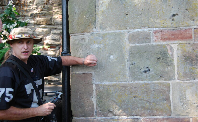
Jason Hurst from the University of Leicester’s School of Ancient History and Archaeology and expert on civil war damage to castles looks at the damage at Shrewsbury Castle.
In June this year I went with Dr Nigel Baker, and Dr Morn Capper of University Centre Shrewsbury, to examine suspected musket/weapon projectile damage inflicted on the Castle, possibly during the Parliamentarian assault of February 1645.
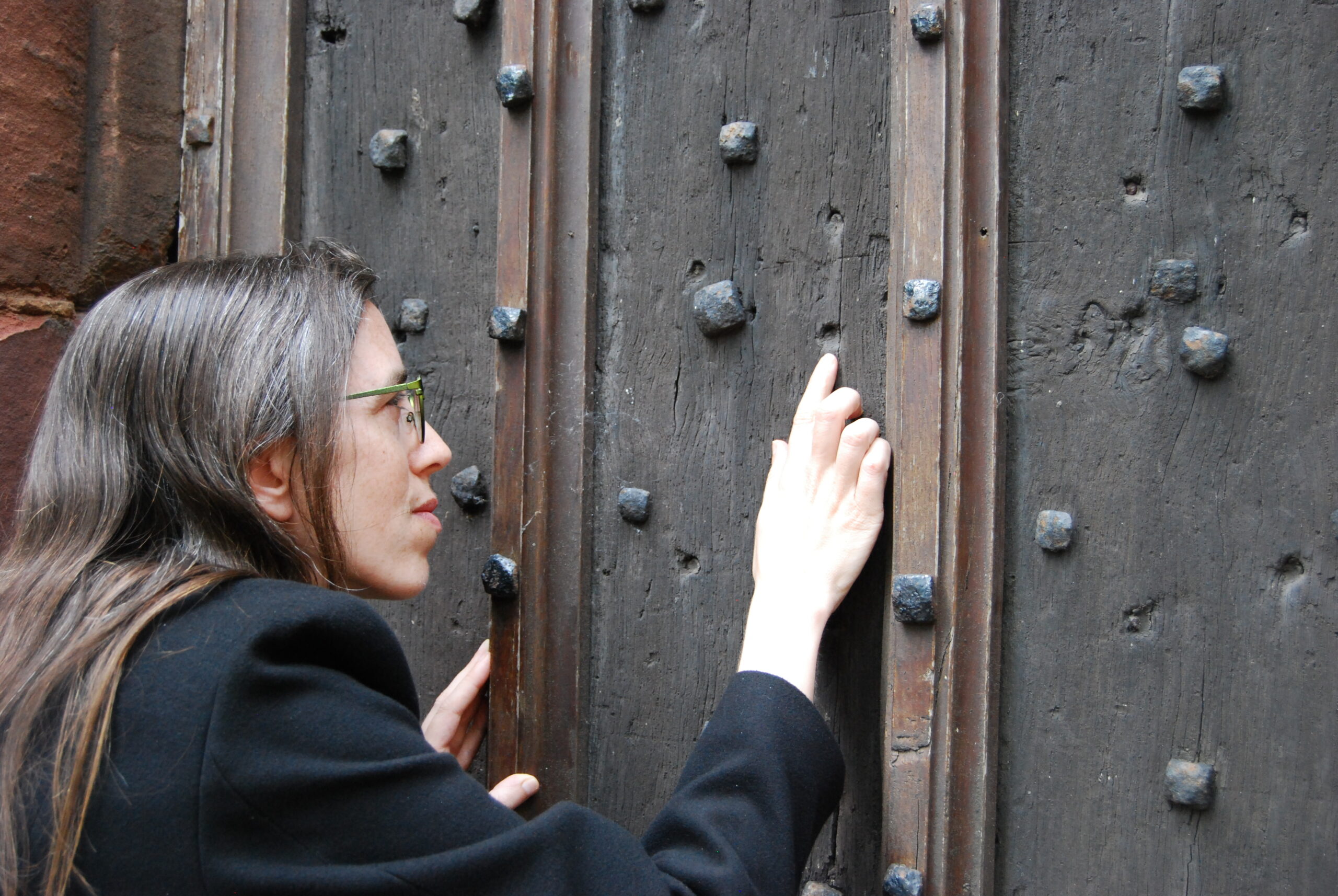
Dr Morn Capper showing the damage to Shrewsbury Castle’s main gate
When inspecting the marks on the main castle gate I concluded that these were from musket/pistol ball strikes with some indication of possible fragments of these projectiles still embedded in the woodwork, along with possible residues.
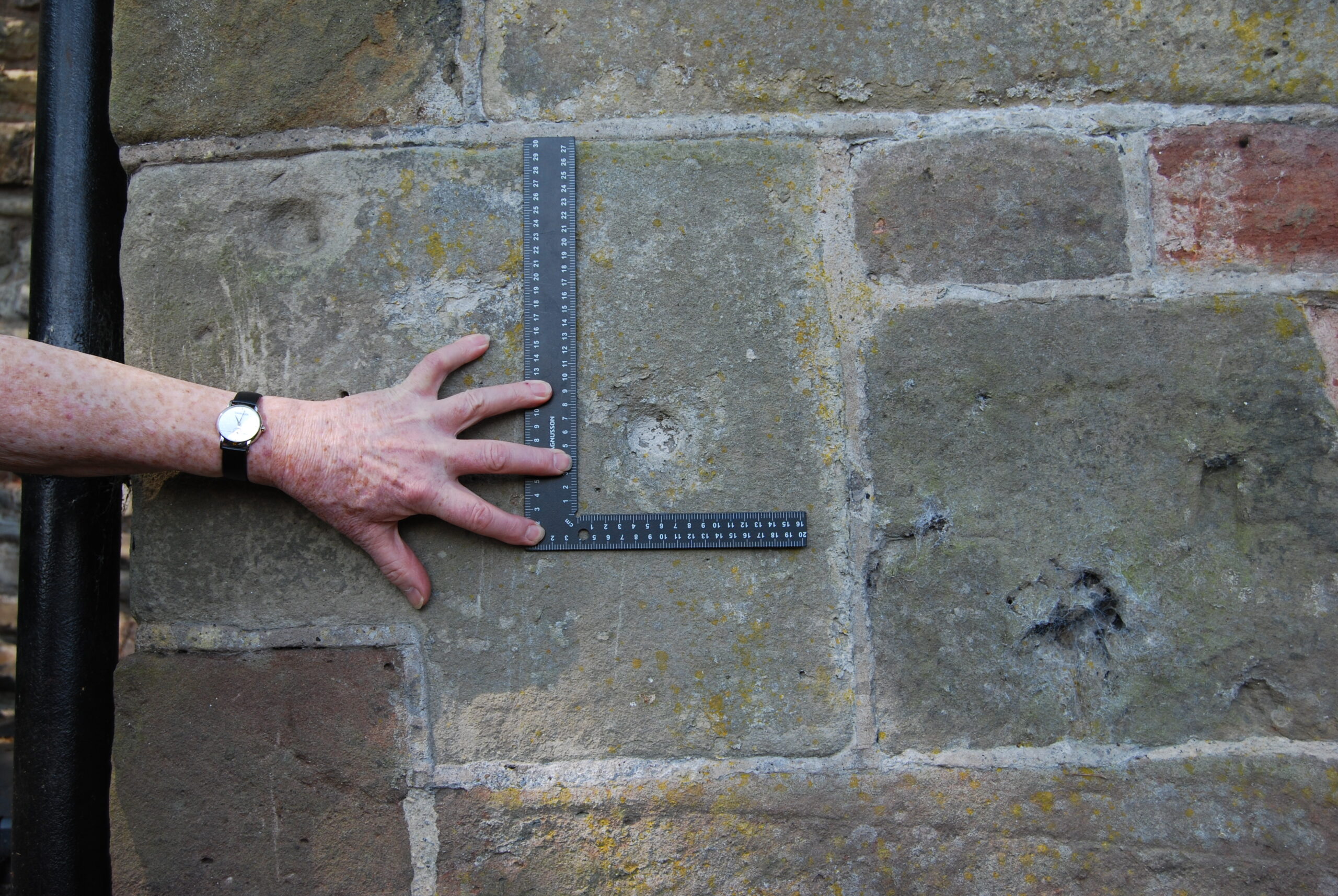
Shrewsbury Castle Postern Gate Gun Shot Damage
On the outside of the Postern Gate the identification of some of the marks could not be positively made because of weathering, but intriguing larger impact marks seem to be from a small calibre artillery piece, possible a Robinet or similar sized calibre gun.
At the north end of the hall, facing the railway station, are marks that look like weapon projectile strikes but their trajectory is problematic. Some appear to have come in at a level trajectory towards the wall and some from a downward trajectory, so these need to be looked at in more detail to determine what has caused them.
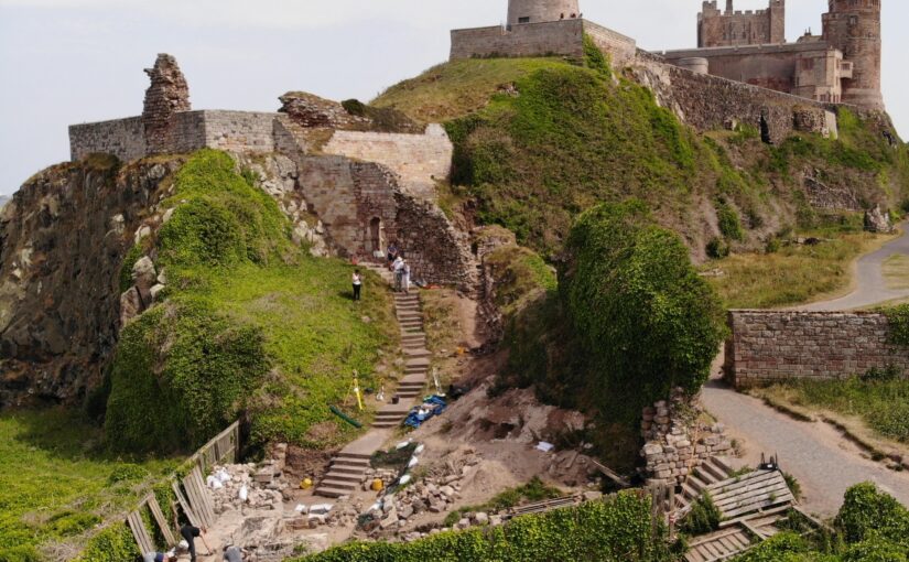
Dr Jo Kirton co-director of the Bamburgh Research Project takes a look at the work they are doing at Bamburgh Castle, funded by the Trust.
Throughout 2023 and early 2024 the Bamburgh Research Project will be utilising funding from the Castle Studies Trust to further explore Bamburgh Castle’s medieval outworks, particularly the area outside St Oswald’s Gate where our current excavation is underway as part of our annual field school. Our project is titled ‘Contextualising Bamburgh Castle: wells, towers, mounds and more!’
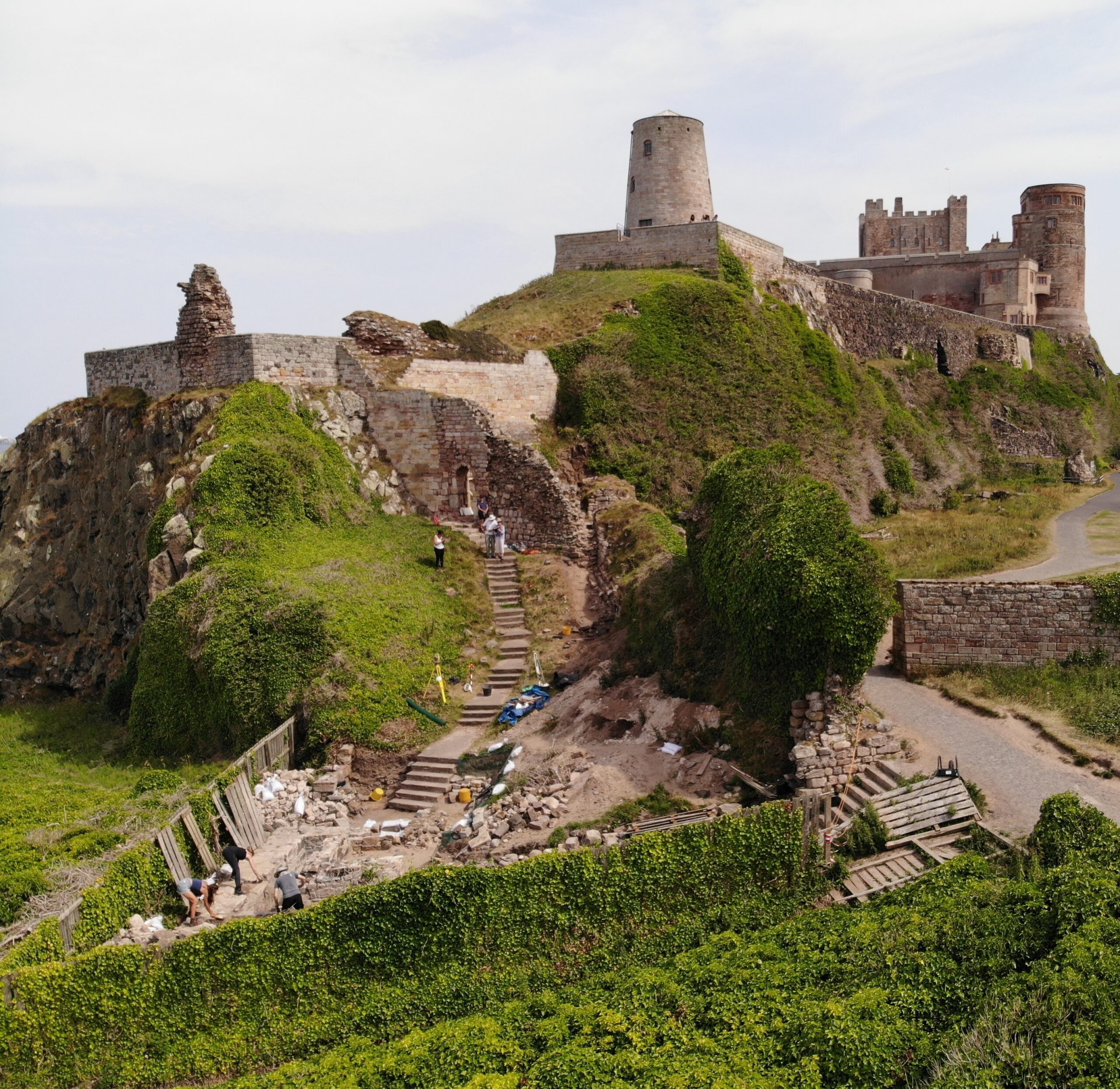
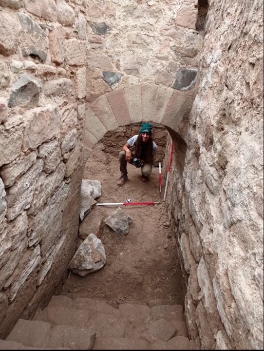
crForeground shows the area currently under excavation by the BRP with St Oswald’s Gate visible at the top of the steps and West Ward of Bamburgh Castle present in the background.eated by dji camera
Bamburgh Castle
Bamburgh Castle rises from the North Sea coast of north Northumberland. It lies on an undulating, 3.2-hectare, outcrop of dolerite bedrock that stands up to 30m above the surrounding countryside. Bede describes it as a palace site of the Anglo-Saxon kings of Northumbria from the later 6th century and it remained a royal castle until its semi-abandonment after a great siege in 1464. Rebuilt by the Lord Crewe Trust in the 18th century and again by the 1st Lord Armstrong at the end of the 19th, the fortress has long held a special place in the history and culture of the region.
The majority of the archaeological work at Bamburgh has concentrated in the low-lying West Ward at the north of the castle. A complex deeply stratified, finds-rich, site has been revealed archaeologically. By contrast, the Inner Ward of the castle, at the very top of the hill, remains a built-up area. Modest scale excavation of the accessible areas has provided an important balance, giving insight into the heart of the citadel to contrast with the occupation and industrial activities we see in the West Ward.
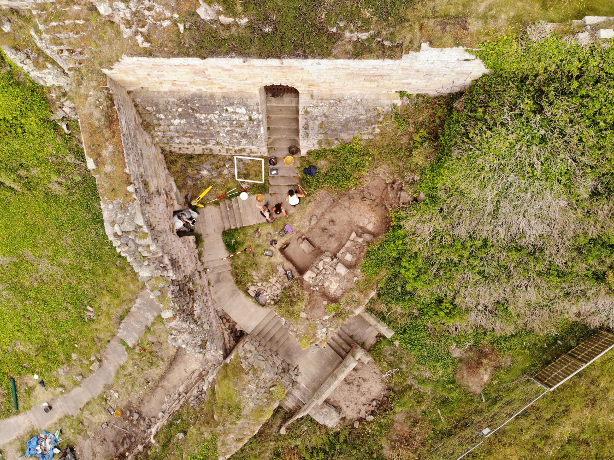
Aerial shot of St Oswald’s Gate with steps leading down to current excavation area.
St Oswald’s Gate
St Oswald’s Gate and the outworks beyond lie in the area of the original entrance to the castle. It is very likely that the siege castle (named Mal Voisin in the Anglo-Saxon Chronicle) was built close to this gate in AD 1095. When the main access was re-sited, the entrance here remained as an important postern, perhaps serving a small adjacent harbour immediately to the north of the site. This area now forms the BRP’s main investigative focus. The outworks consist of strong walls enclosing a trapezoidal area with the Tower of Elmund’s Well, with a more recent wall and postern to the west.
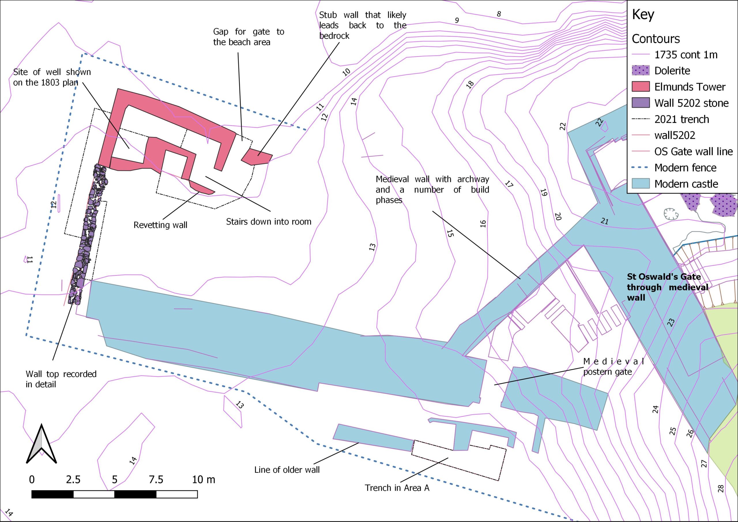
Map depicting current area of excavation (Base map Crown Copyright/database right 2022. An Ordnance Survey/Edina supplied service).
The outworks at St Oswald’s Gate are a rare case at Bamburgh as they have not been subject to extensive rebuilding in the post medieval period. Other than the reconstruction of the tower as a cottage, the outworks represent an astonishing window into mostly unaltered medieval fabric still standing at Bamburgh.
Aerial shot of Elmund’s Tower and suspected medieval well location.
Work to Date
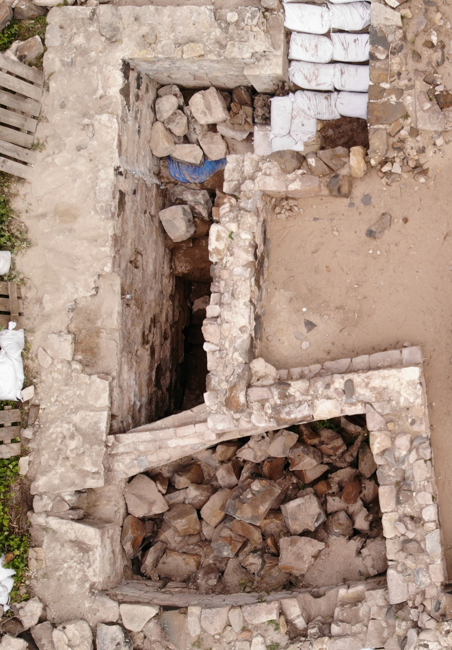
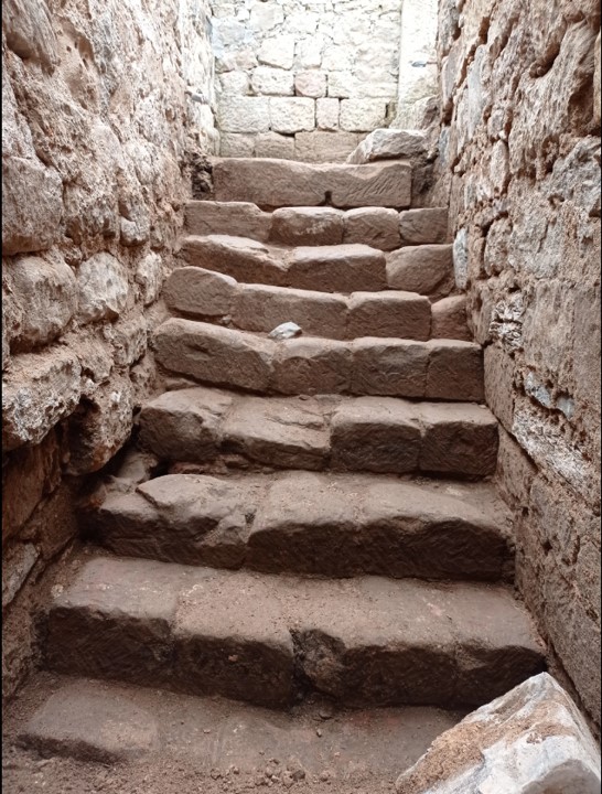
Recent investigation by the BRP has revealed that a substantial structure still survives below ground. This is in the form of an L-shaped corridor and steps down into the room that is thought to be the tower basement that contained the well. The presence of two splayed narrow windows appears to further indicate that this is part of the medieval Elmund’s Tower. Our primary aim this year is to continue to reveal the full extent of the tower and identify any remains of the well depicted on the 19th century survey.
Steps down into the room that is thought to be the tower basement that contained the well.Arch into the well room of the tower
What will the Castle Studies Trust (CST) Funding be used for?
There are two primary aims for the CST funding:
The first is to contextualise our recent excavations at Elmund’s Tower through geophysical survey (GPR and Magnetometry) and to undertake a masonry survey of the castle’s associated extant outworks. This will include using photogrammetry to create a 3D model of the standing outworks and internal structures of Elmund’s Tower. The survey will be undertaken in conjunction with a metric survey of the structures outlines. This work is currently underway and we look forward to sharing the results with the CST. You can follow our progress on our blog: https://wordpress.com/post/bamburghresearchproject.wordpress.com
The second focus for the funding will be on disseminating our discoveries to the wider public. We will install signage for visitors, who cannot currently visit this area of the castle with a QR code for the 3D model, granting online access to Elmund’s Tower and the wider outworks over the winter period. This information will also be replicated and enhanced with the creation of a new webpage on the Bamburgh Castle website. Alongside these permanent additions we will continue to share our work through our blog and social media.