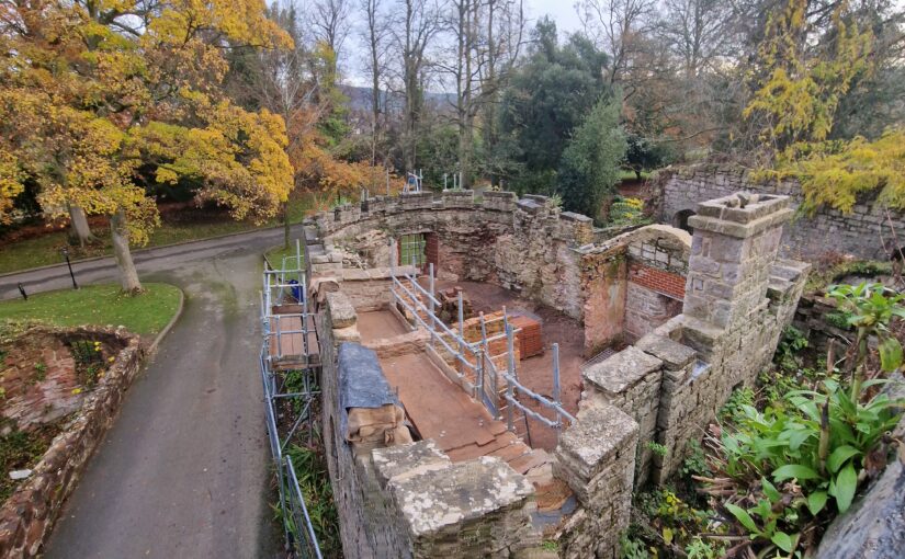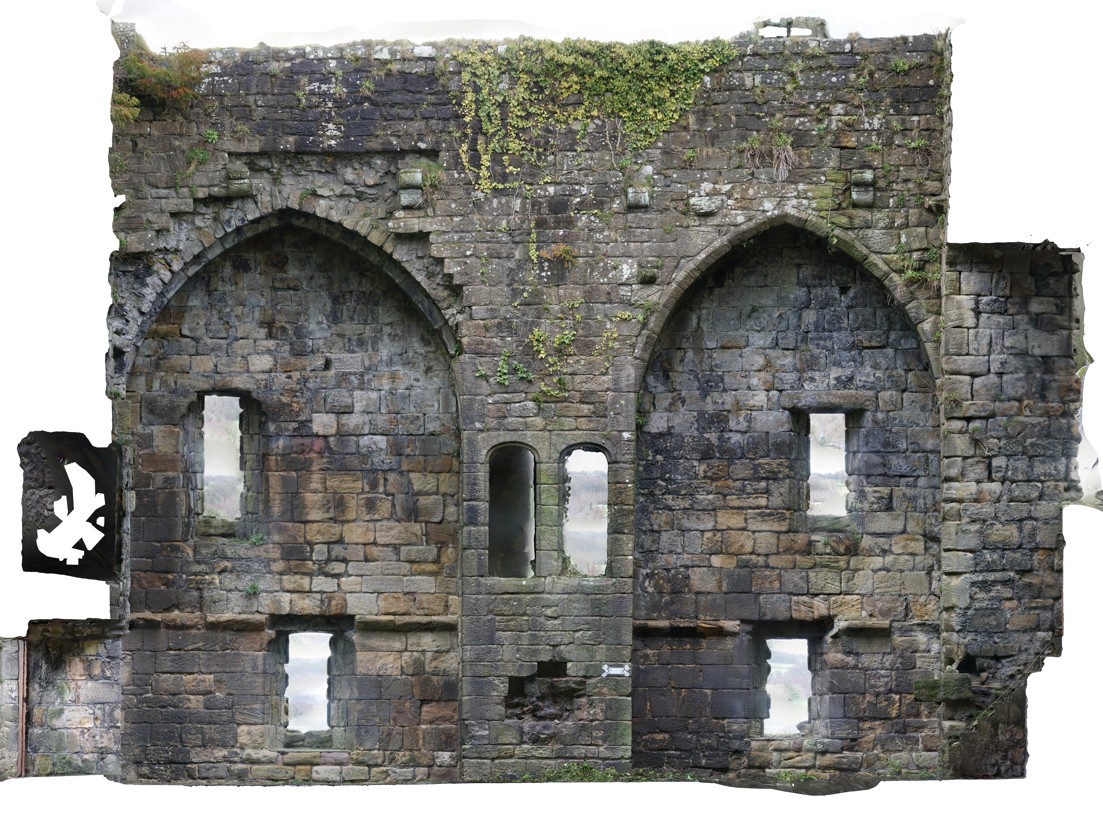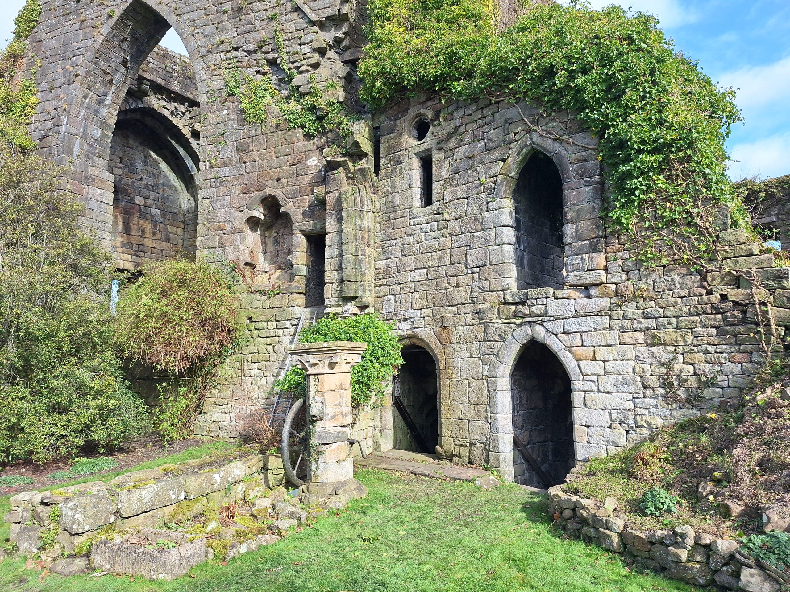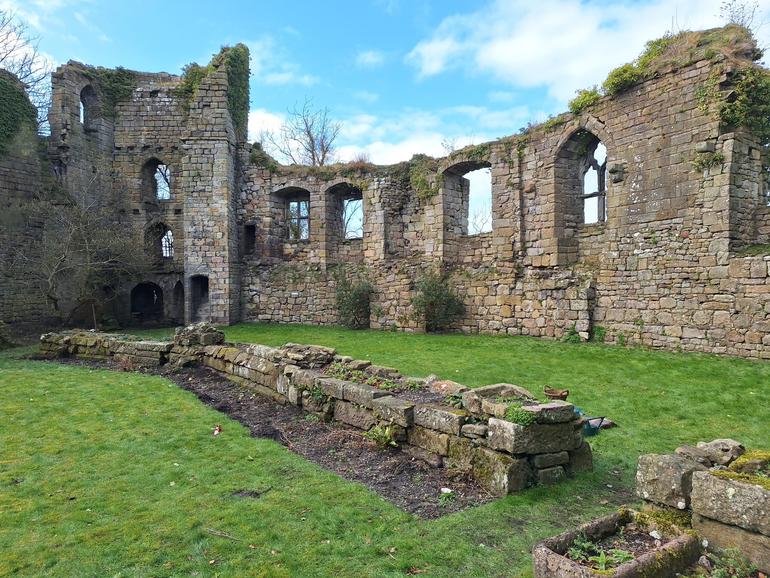
Rediscovering Newcastle Castle: publishing 30 years of historic excavations

Don O’Meara, President of the Society of Antiquaries of Newcastle upon Tyne John Nolan, archaeologist Richard Pears, buildings historian, project leads for the publication of the decades of excavations that took place around the major urban fortress of Newcastle.

Many towns and cities in England derive their name from fortified positions. However, perhaps none so prominently as when the pre-Conquest settlement of Monkchester was fortified with a royal castle, and became thereafter Novum Castrum super Tynam. Newcastle is fortunate in the survival of its 12th century stone keep against the forces of siege, neglect and demolition, which denuded so many other castles and fortifications across the country, including that which befell our homonymous distant relative under-Lyme.

Subscribe to our quarterly newsletter
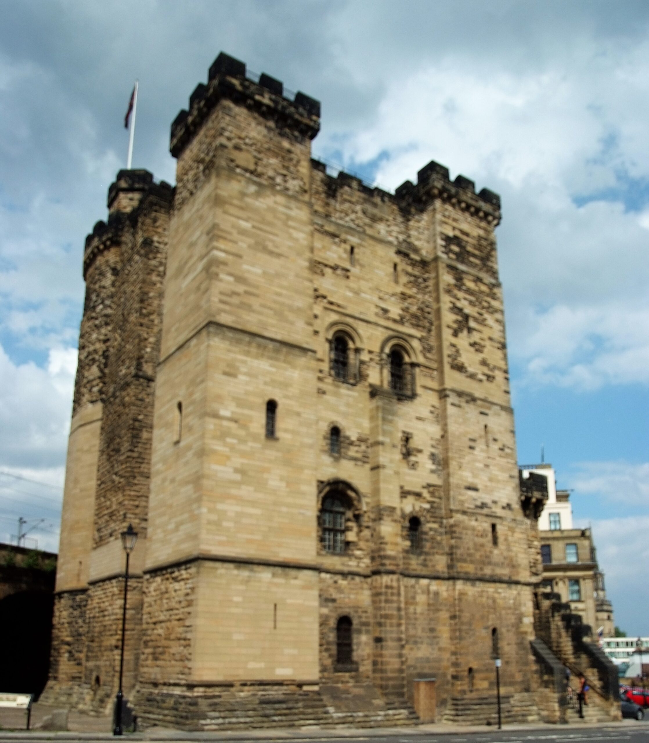
Newcastle Keep, copyright Don O’Meara

The keep at Newcastle also has a special place in the history of the Society of Antiquaries of Newcastle upon Tyne, the oldest such provincial society. For over 200 years the image of the keep has appeared on the book plate of our journal (Archaeologia Aeliana), reminding members of our role in preserving it from destruction at the hands of 19th century development (particularly railway construction), as well as our role renovating and managing the building until 2013.

Subscribe to our quarterly newsletter

The royal castle from which Newcastle derives its name was founded by Robert Curthose, son of William the Conqueror, in 1080 as a statement of Norman control in a region coveted by the kings of Scotland and with a history of independent-minded local rulers. In the late 1160s and early 1170’s the earth and timber castle was refortified in stone, which included the keep which stands today and which, in the eyes of many Novocastrians, is ‘The Castle’.

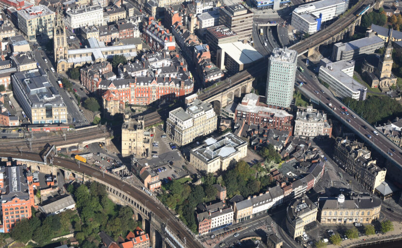
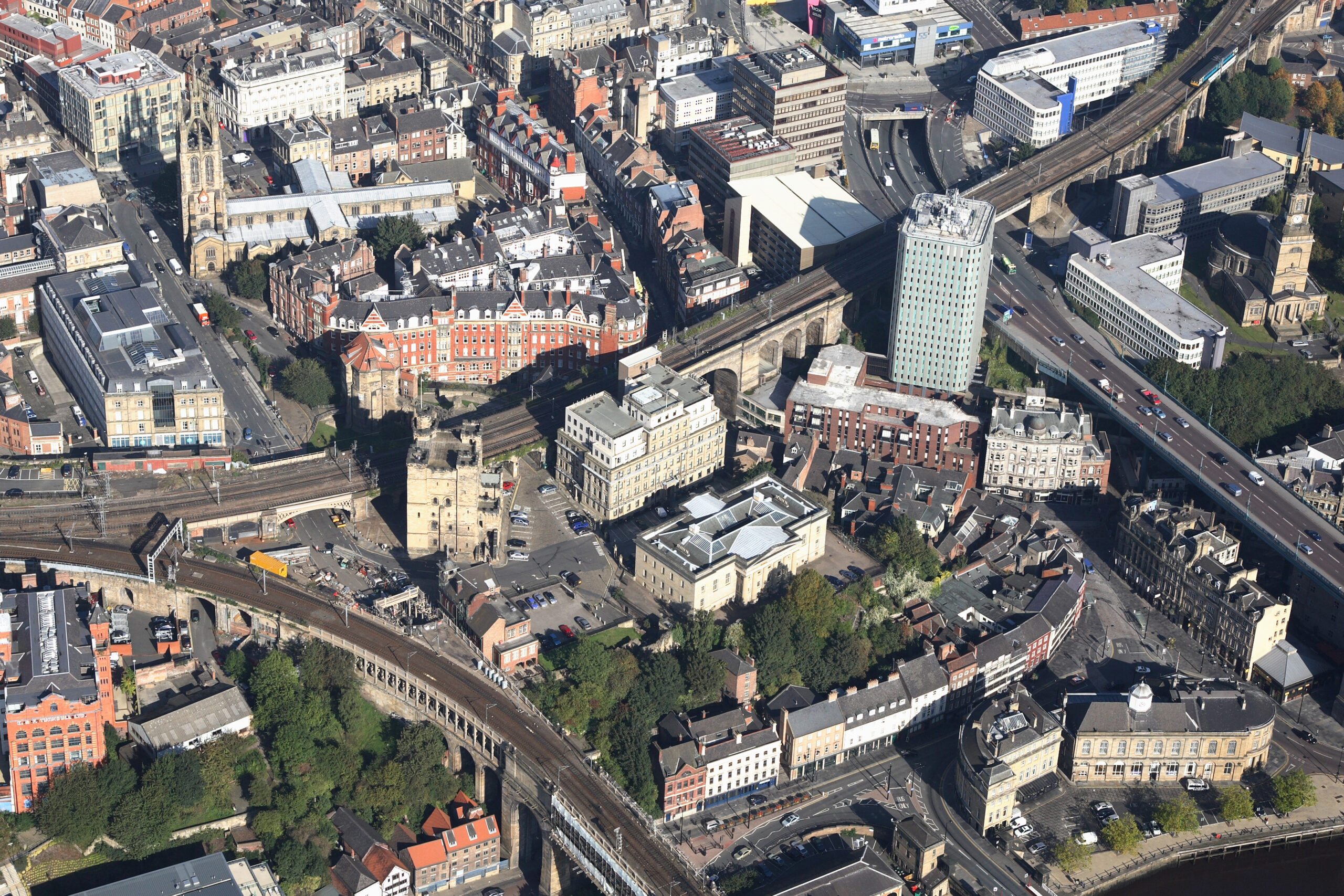
Newcastle Castle from the air, copyright Newcastle City Council

The site is the most archaeologically investigated ‘urban’ castle in North East England, albeit excavations, begun in 1960 and for many years led by Barbara Harbottle, have principally focused on the defensive circuit. Excavations showed how an apparently linear development model can be an oversimplification, highlighted gaps in the understanding of the castle as a whole and revealed problems of correlating archaeological evidence with medieval documentary records. The excavations were also significant in charting the evolution of archaeological practice from essentially amateur archaeological techniques in the 1960s to more modern, scientific investigation. Analysis of the finds offers to reveal new insights into the material culture of the castle’s occupants. Despite the importance of investigations at this site, there has been no published report on the medieval excavations since 1981. This project aims to complete this.

Subscribe to our quarterly newsletter

Between 1981 and 1992 further excavations on the castle site revealed more evidence for the evolution of the castle and aspects of its associated infrastructure. It has been a long running ambition of this Society to see these works brought to publication and to wider academic attention.  In 2024 the principal excavator of the site in the 1990s John Nolan, buildings archaeologist and historian Richard Pears, and I in my capacity as editor of Archaeologia Aeliana sought to rectify this situation.

This project involves a synthesis of 30 years of excavations and a reassessment of their results, a new building analysis and interpretation of the site, and the compilation and editing of these results into a single text. With gratefully received funds from Newcastle City Council, the Castle Studies Trust, and the Castle Studies Group we are now progressing with the preparation of a special edition of Archaeologia Aeliana which will achieve the aim of disseminating these important results.

Though there are still funds required that would allow for a full open-access publication, we aim to publish this special edition monograph in early 2027.

Subscribe to our quarterly newsletter

Reimagining Fyvie Castle

Alice Connelly of the National Trust for Scotland takes a look at The Re-imagining of Fyvie Castle project.

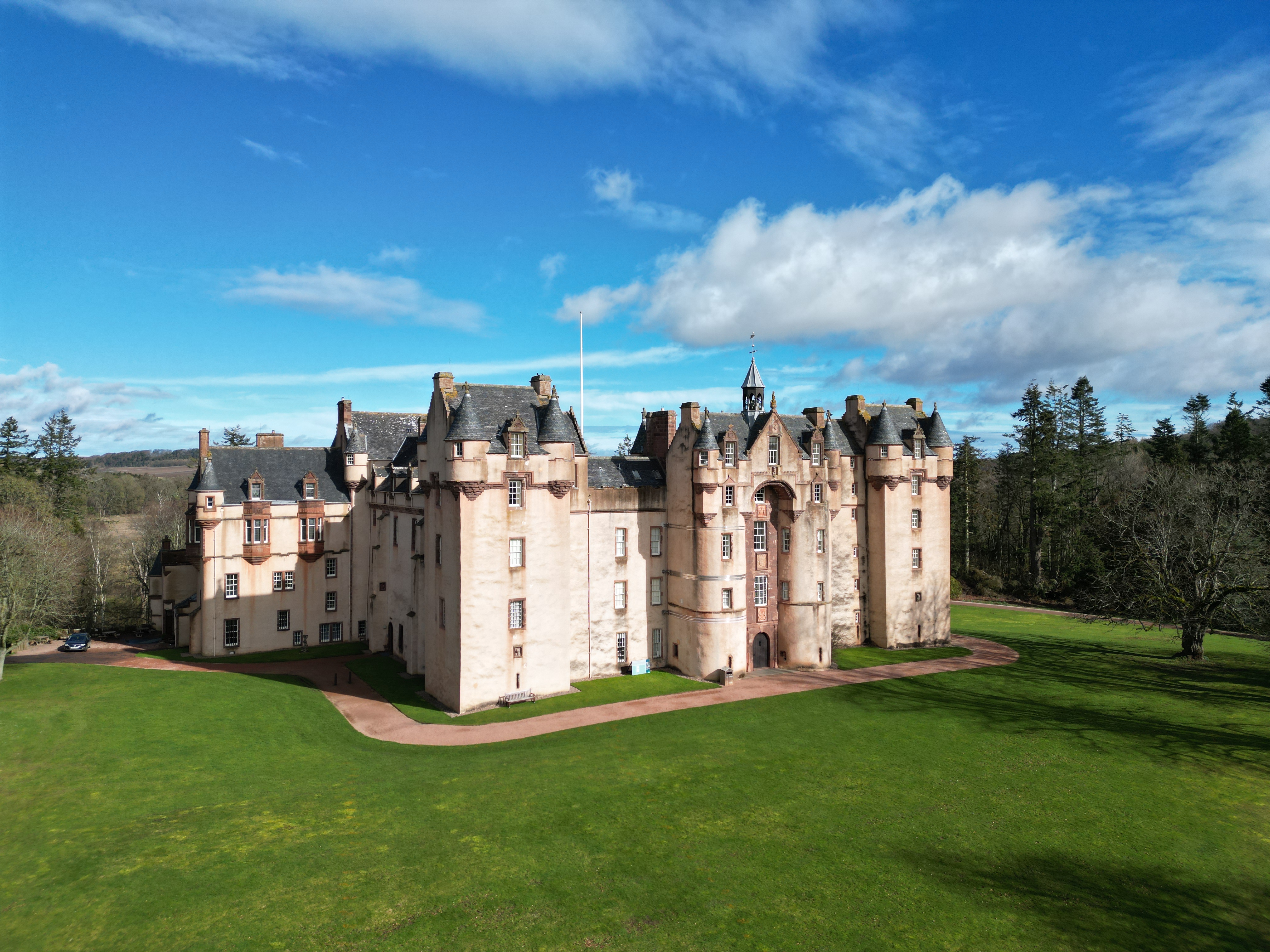
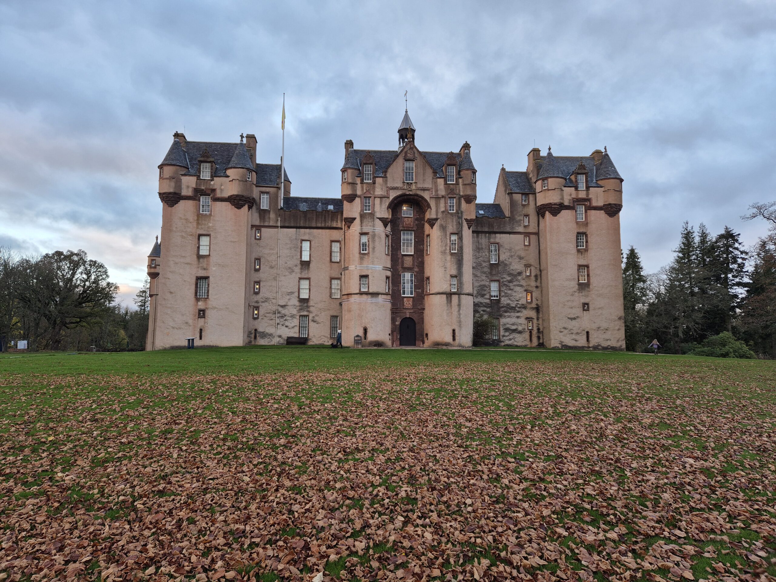
Rising above the rolling landscape of Aberdeenshire, Fyvie Castle is the quintessential Scottish fairytale castle. Its pink harled walls, ornate towers and landscaped grounds draw thousands of visitors from the nearby A96 each year, inviting them to explore centuries of Scottish history hidden behind its striking exterior.

Subscribe to our quarterly newsletter

Inside, visitors are guided through the castle’s richly furnished rooms by a dedicated team of volunteers, hearing stories of royal visits, political intrigue, battles, folklore and ghostly legends. Yet the magnificent castle we know today emerged from much humbler beginnings.

Fyvie Castle today, copyright National Trust for Scotland

Fyvie began as a timber stronghold built on a natural defensive platform, protected by the River Ythan and surrounding bogland. Over time, the site evolved dramatically: timber was replaced with stone and successive generations expanded and remodelled the building. What began as a laird’s fortified residence gradually transformed into a royal stronghold and, eventually, the lavish country estate seen today.

Fyvie also occupies an important place within the cultural traditions of north-east Scotland. The castle and village are woven into Scots song and folklore through tunes such as The Bonnie Lass o’ Fyvie and Mill o’ Tifty’s Annie. The latter tells the tragic story of Bonnie Annie and Andrew Lammie, the trumpeter to Lord Fyvie. The grave of Annie Smith, the woman thought to be Bonnie Annie, can still be visited in Fyvie cemetery today, while a carved stone trumpeter stands among the twenty-four decorative figures that crown the castle roofline, a reminder of how deeply history, music and storytelling are embedded within the site.

Fyvie Castle today, copyright National Trust for Scotland

Recently, Fyvie featured in the National Lottery Heritage Fund supported television programme Great British Castle Rescue, presented by Rick Edwards. The programme explored both the architectural significance of the castle and the challenges involved in conserving such a complex historic building for future generations.

Subscribe to our quarterly newsletter

At the heart of this work is the Fyvie Reimagined project. The project aims not only to conserve and repair the fabric of the castle, but also to deepen public understanding of how Fyvie developed over time. Fyvie remains a focal point for the local community and an Aberdeenshire landmark; cherished by regular visitors who walk the grounds throughout the seasons, as well as those travelling from much further afield to experience one of Scotland’s great historic houses.

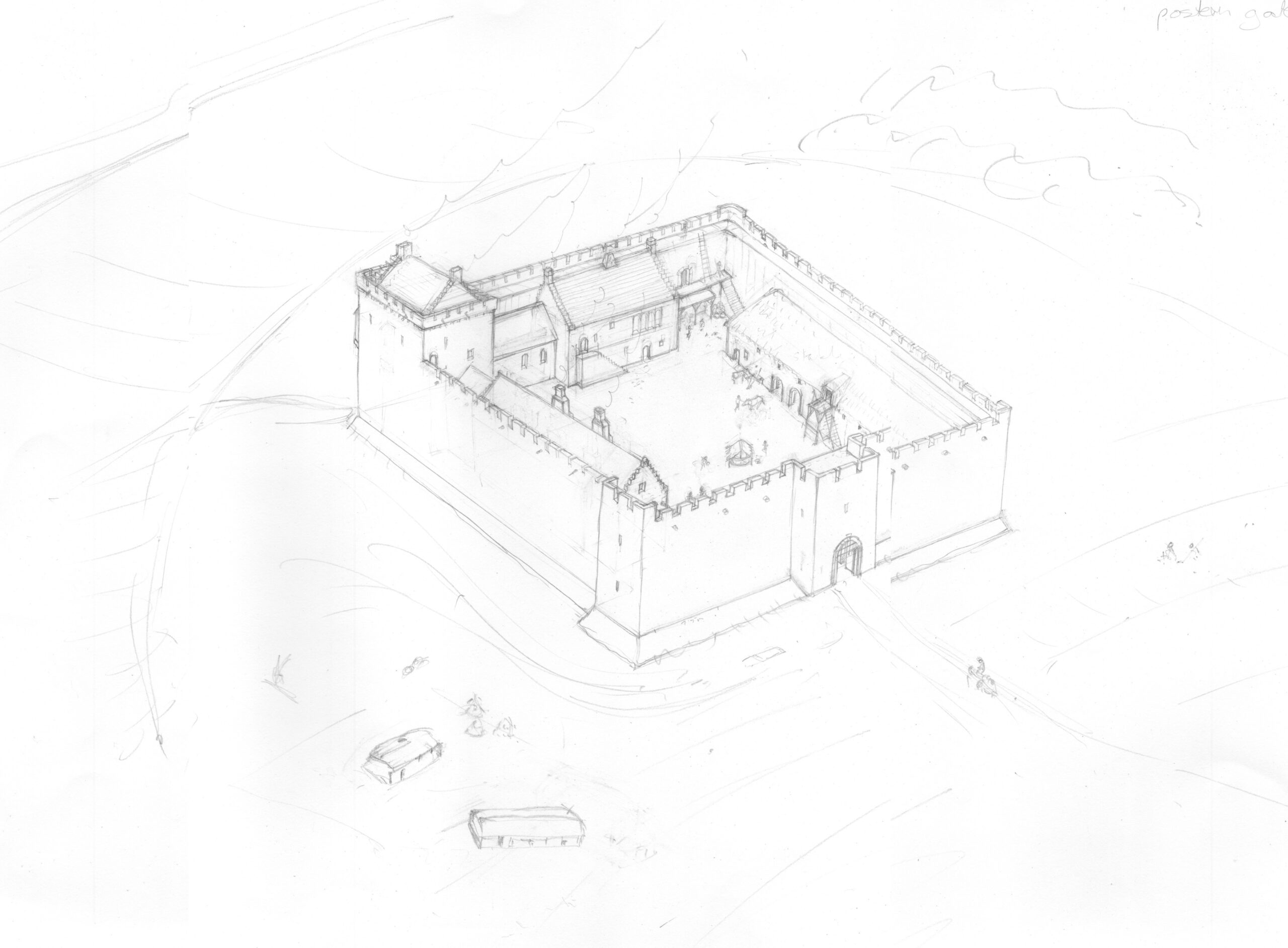
As part of this wider effort, the Castles Studies Trust has funded a new series of interpretation drawings designed to help visitors visualise key moments in the castle’s development. While the standing building tells a remarkable story, understanding how Fyvie changed across seven centuries can be difficult when viewing the castle only in its present form. The illustrations aim to bridge that gap, allowing visitors to imagine Fyvie at different stages in its history and better understand how architecture, landscape and daily life evolved together over time.

Initial image of Fyvie as an enclosure castle in 1398 by Jan Dunbar, copyright Jan Dunbar

Several key periods in the castle’s development were selected for reconstruction, charting Fyvie’s transformation.

  1. The early palisaded, motte and bailey type structure, 1211
  2. Enclosure castle in stone, 1398
  3. Full courtyard palace, 1596
  4. North and East wings, with formal gardens in ruins and general dilapidation of main blocks, 1734
  5. South and West Ranges restored, altered roofline with new tower and formal parkland setting, 1784
  6. Castle as we know it today, with Leith Tower as fresh addition, connection of Butlers apartment by new kitchens, 1980

Each drawing will capture not simply the appearance of the castle, but also something of the activity and atmosphere surrounding it.

Importance was also placed on depicting construction work and scaffolding within one of the earlier scenes. Too often, castles are presented as finished monuments rather than places shaped by generations of labour, craftsmanship and continual rebuilding. Showing the physical process of construction helps highlight the immense skill and effort required to create buildings like Fyvie, while also drawing attention to the ongoing conservation work needed to preserve them today.

The illustrations therefore serve several purposes at once. They help visitors engage more deeply with the castle’s long history, provide an accessible way of communicating archaeological and architectural research, and reinforce the importance of protecting Scotland’s built heritage for future generations. By visualising change over time, the drawings encourage people to see Fyvie not as a static monument, but as a living site that has continually evolved across centuries of Scottish history.

Subscribe to our quarterly newsletter

Tree-ring dating of previously unidentified Elizabethan roofs at Sudeley Castle

Dr Andy Moir of Gloucestershire Historic Buildings Group takes a look at the results from their attempts to date the outer ward of Sudeley Castle

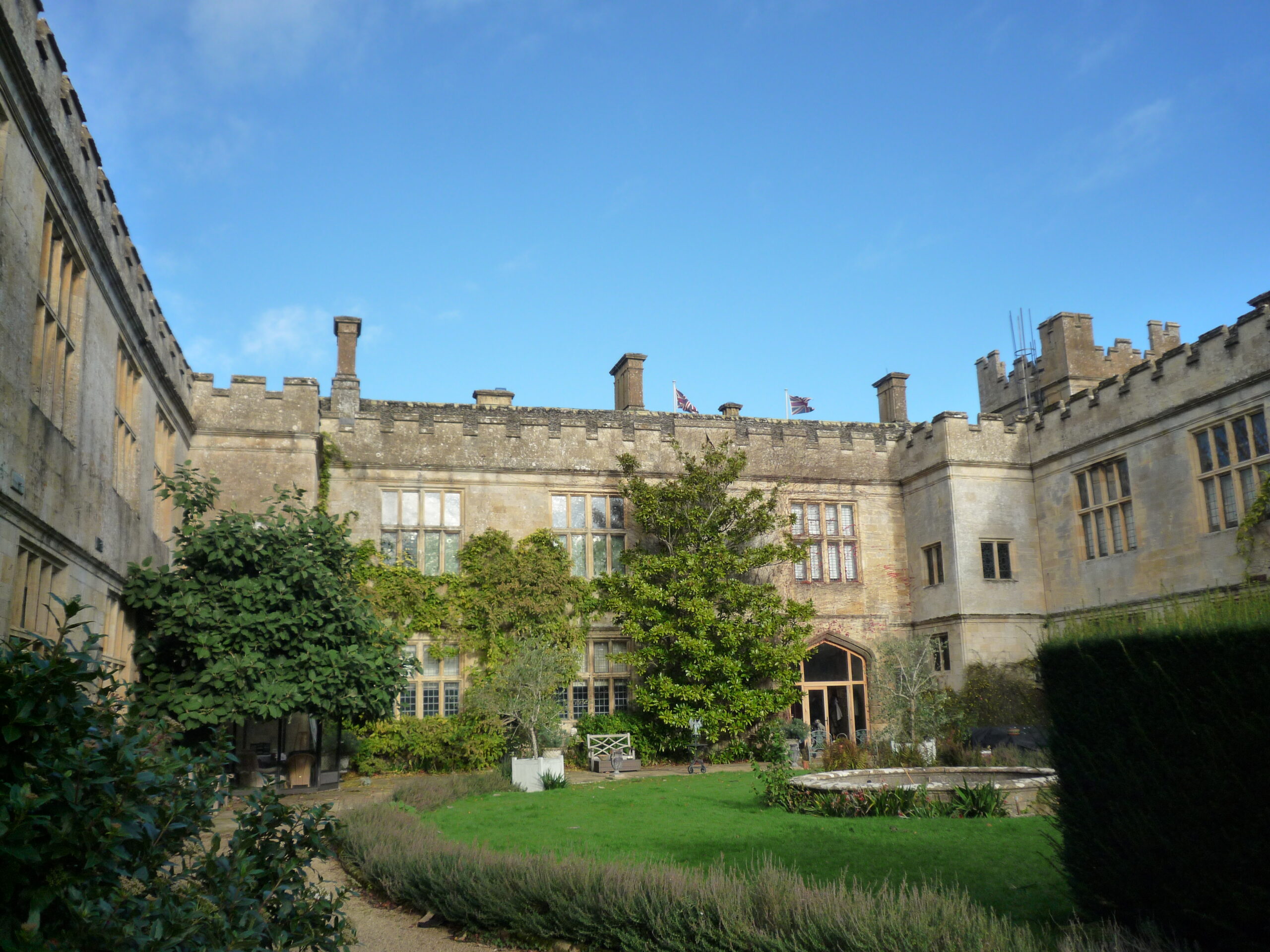
Tree-ring dating at Sudeley Castle has established that the outer courtyard roofs were constructed over three years between 1569 and 1572. This result overturns the previous history which indicated that the castle roofs were destroyed during the Civil war and identifies that the roofs were likely built by Edmund Brydges (the 2nd Lord Chandos).

Subscribe to our quarterly newsletter

Sudeley Castle Outer Courtyard looking north, copyright Dr Andy Moir

Sudeley Castle has Saxon origins, but its history really developed from 1441 with Ralph Boteler (Baron Sudeley and Lord Chamberlain of the King’s Household) who set about developing a castle to reflect his new-found status. In later Tudor times, Thomas Seymour was granted the castle by Henry VIII and after marrying the king’s widow, Katherine Parr he set about refurbishment of the Sudeley Estate. Katherine became pregnant at a relatively late age and unfortunately died a few days after childbirth. Following her death and Seymour’s arrest for treason following his desperate attempt to grab power at the expense of his brother Edward Seymour, the castle was then gifted to John Brydges, the Constable of the Tower of London. This gift by Queen Mary I was followed with the title of Lord Chandos being granted to the family.  John’s successor, Edmund Brydges seems to have been further developing the castle, enhancing the work of Boteler and Seymour and the family contributed to Winchcombe with the building of Almshouses by Edmund’s wife Dorothy. The Brydges family maintained the castle throughout the rest of the Tudor times and supported the Royalist cause following the start of the Civil War.

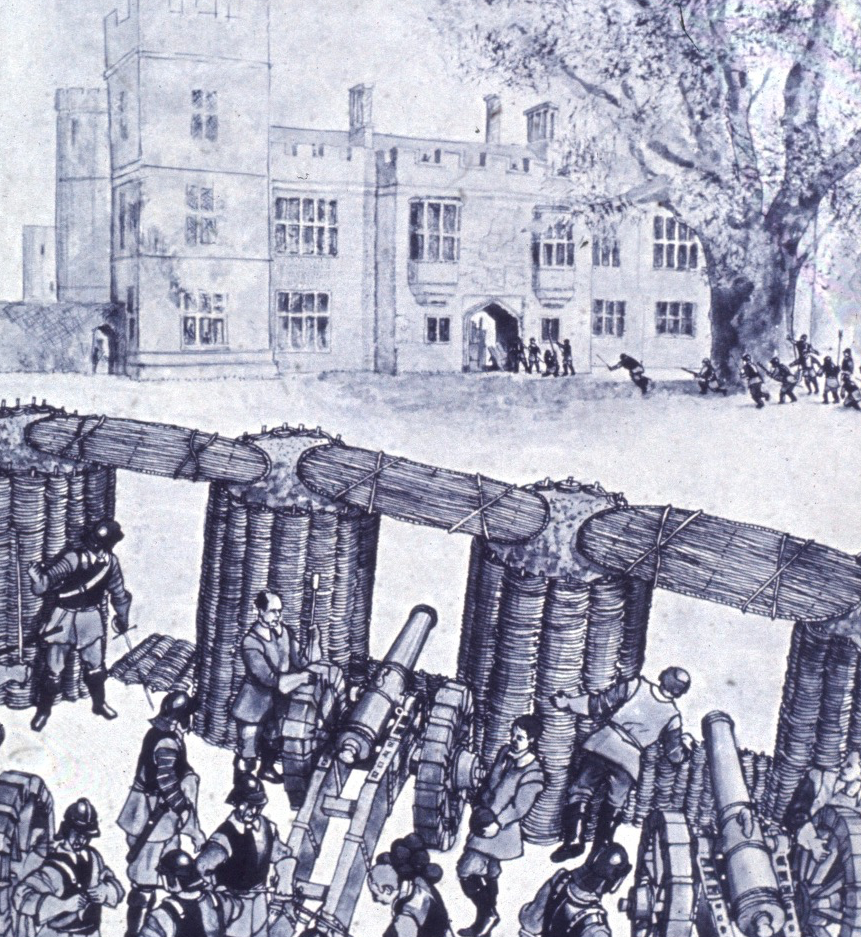
Besieging Sudeley Castle in 1643, during the Civil War

Sudeley had been used as the base by both Prince Rupert and Charles I from where they had launched attacks on Cirencester and preparations had been made to attack Gloucester. Following these failed attempts, Parliamentary troops had successfully besieged the castle on two occasions, bombarding the castle with cannon and after the second siege, the order was given for a systematic slighting (made un-inhabitable). Roofs were taken off and many walls were razed to the ground. Details of the destruction became clear when Lady Jane Brydges widow of George Chandos tried to sue for recompense. This was shown by depositions in the archives taken from five craftsmen stating that the castle had been fully destroyed and this had been signed off by two judges from Gloucester, Edward Slaughter and Robert Megge, but as the dendrochronology report went onto show, the slighting was not as comprehensive as claimed and roofs to the East, West and part of the North range of the outer courtyard were still intact.

Subscribe to our quarterly newsletter

 It had previously been thought that the castle had been left in ruins for the next 180 years, and few of the original structures at Sudeley Castle were thought to have survived before extensive restoration in the 19th century funded by the Dent brothers and their heir John Coucher Dent and his wife Emma.

In 2025 castle archivist Derek Maddock invited the Gloucestershire Building Recording Group (GBRG) to survey the outer courtyard roofs. Unexpectedly, the survey identified that east, west and north range roofs of the outer courtyard contained mainly oak timbers that were likely to be Elizabethan. As this finding completely changed understanding of the castle’s history, a project to precisely tree-ring date the roofs was conceived. This project was supported by the Castle’s owner, Lady Ashcombe, and funded by the Castle Studies Trust (www.castlestudistrust.org).
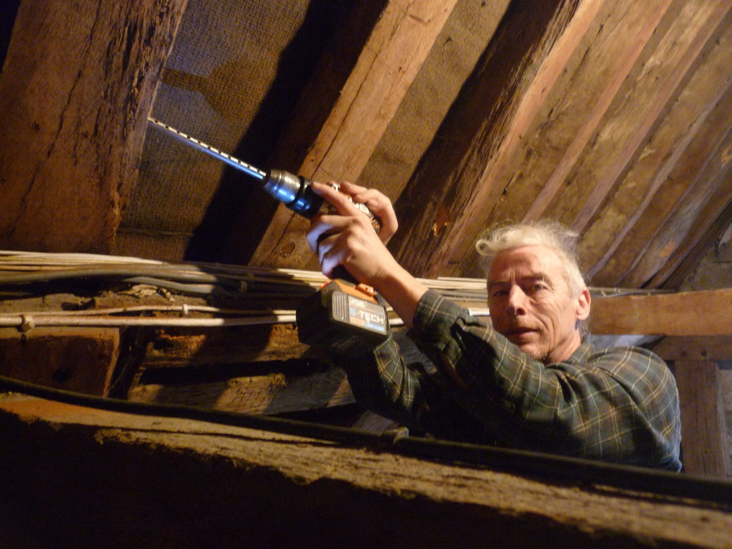
Dr Andy Moir of GHBG taking one of the 30 core samples from the roof.

The 2026 project saw 30 pencil-like core samples drilled from the castle roofs. Tree-ring series from twenty of these timbers matched together to form a 159-year mean chronology that was dated to span 1413 to 1571. The oldest tree used in construction of the roof started growing in 1413 and the trees were all felled between the spring of 1569 and the winter of 1571/2.  As it was common medieval practice to convert the tree into timbers before they seasoned, construction of the east, north and west range roofs of the outer courtyard likely occurred between 1569 and 1572. To give some idea of the scale of the construction, the west, north and east range roofs are around 36m, 38m and 46m in length, respectively. Yet still the carpenters of the day likely managed to complete this huge construction over just three years. This result therefore overturns the previous history which indicated that the castle roofs were destroyed during the Civil war and identifies that the roofs were likely built by Edmund Brydges (the 2nd Lord Chandos). A fantastic development in the history of Sudeley Castle.

Subscribe to our quarterly newsletter

Cockermouth Castle Building Survey Diary – Update 2

Project Lead Tom Addyman gives an update on how the survey of Cockermouth Castle’s inner ward is progressing following the team’s second visit in April

The survey team returned to Cockermouth in mid-April to carry out the follow-on stage of the analytical survey of the inner ward.  The processed base photogrammetric data from the first survey visit was marked up with analytical data such as construction breaks and other interpretative information.  The opportunity was taken to extend survey coverage to other areas such as the mural chambers within the gatehouse and to re-survey parts of the exterior that had been better revealed following continuing trimming of obscuring ivy.

Subscribe to our quarterly newsletter

A general review was made of the complexities of the fabric, paying particular attention to structural discontinuities and changes in masonry coursing, character, stone type and alignment.  The site assessment particularly benefited from the expert insights of Dr Edward Impey and Prof Richard Oram.  Significant progress was made on understanding the evolutionary history of the inner ward buildings:

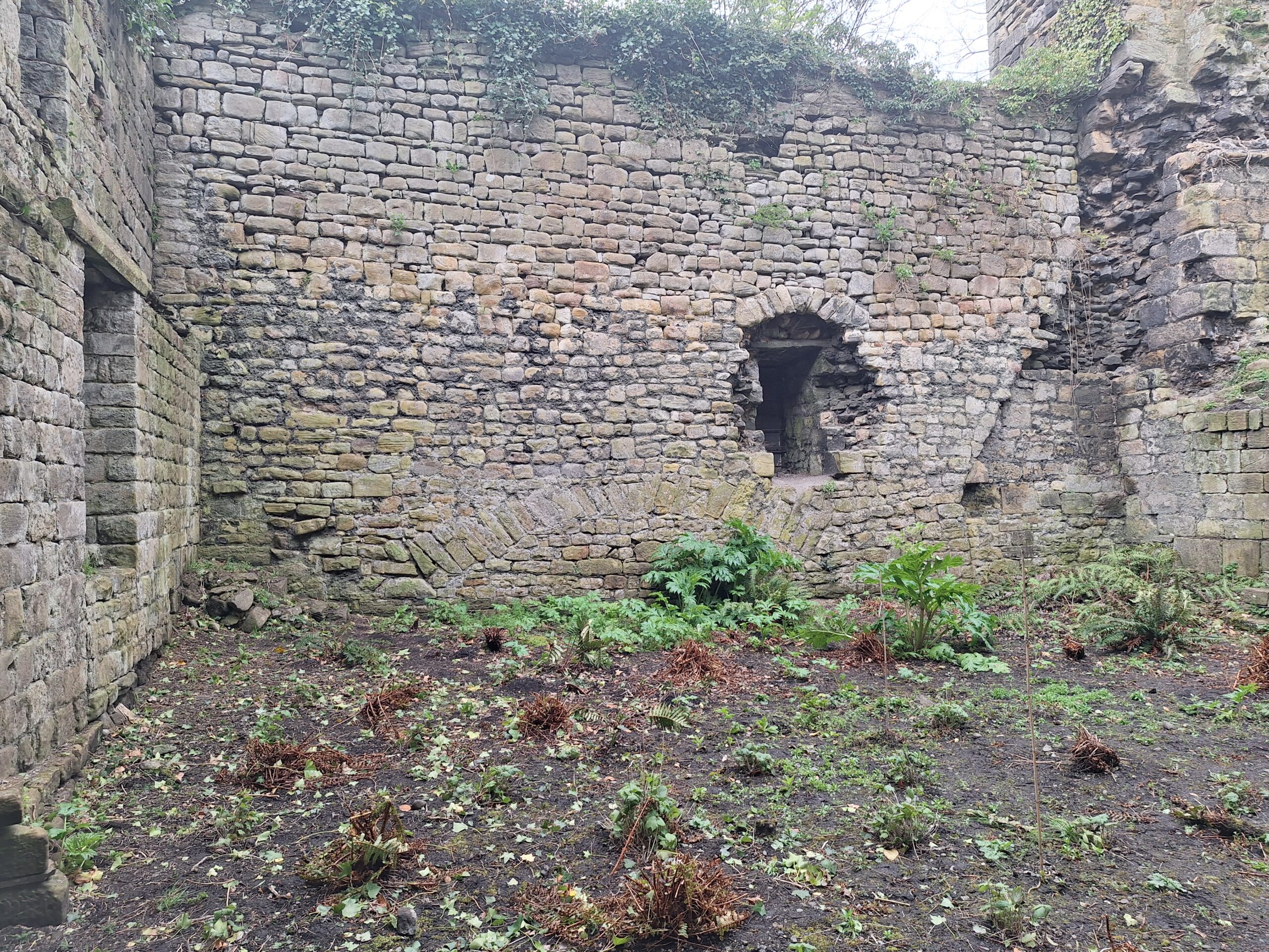
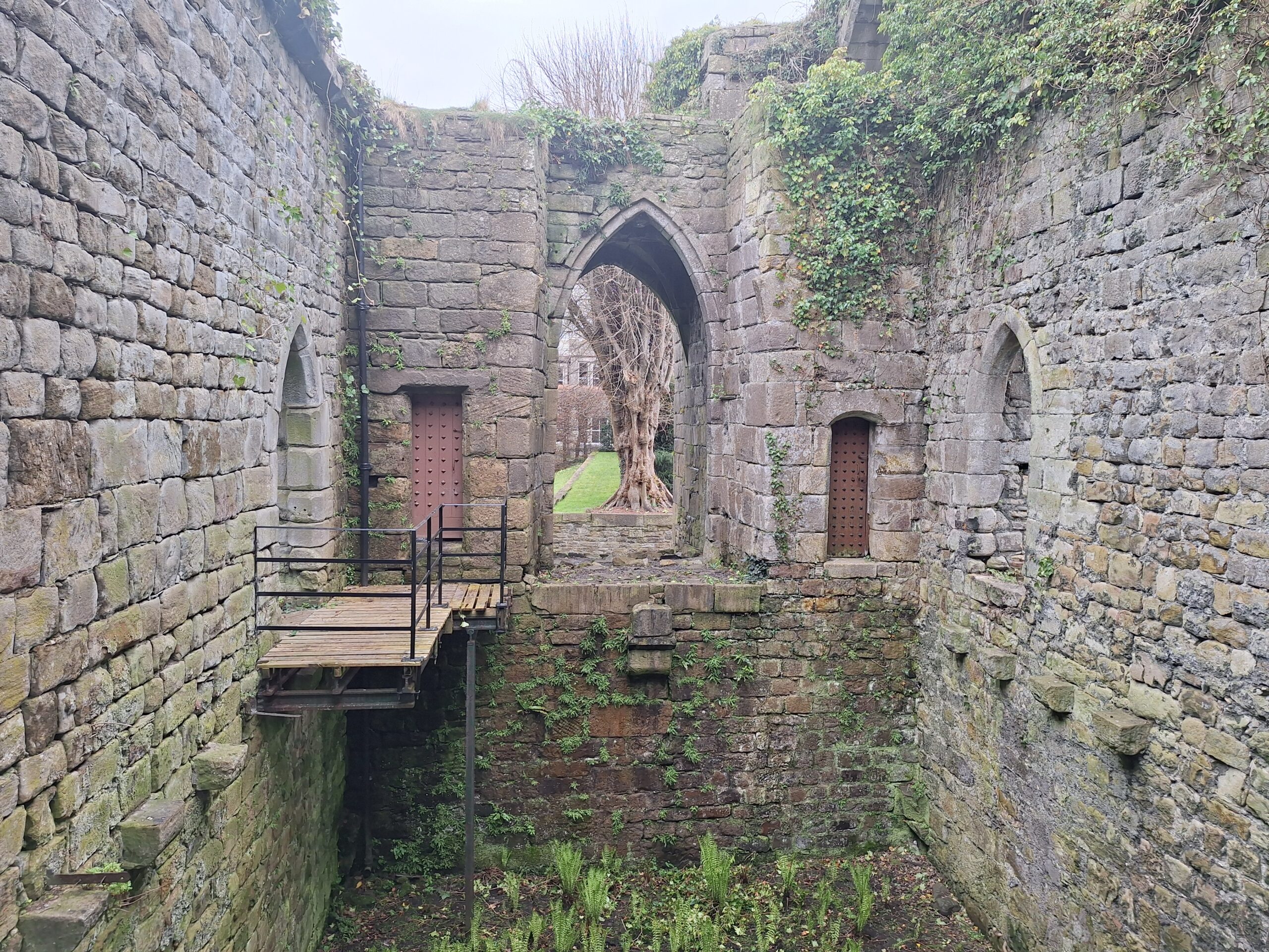
Interior of the south curtain wall showing relieving arch – possibly bridging unstable ground relating to a pre-existing defensive ditch Copyright Tom Addyman
  • Evidence supporting the idea that the gatehouse range occupied the site of a pre-existing ditch in the form of a broad structural relieving arch within the south curtain
  • Confirmation that the eastern gatehouse range incorporated the part-built remains of a predecessor of likely mid-late 14th century date that featured evidence for an intended 3-chamber rib-vaulted lower storey.  Construction resumed to a somewhat modified design within a decade or two.
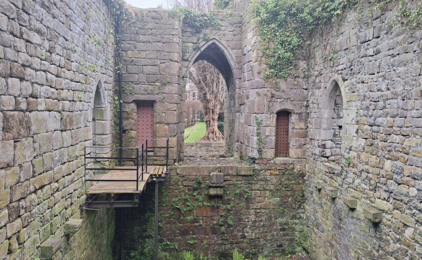
Interior of the gatehouse looking east to the pend copyright Tom Addyman
  • The architectural peculiarities of the gatehouse itself were better understood, including the possibility of a draw-bridge pit within the pend, details of the pend’s octopartite vault that was found to feature decorative collars and bosses at its main junctions, and the relationship of the large vestibule chamber within to the lodging ranges to either side to which direct access was provided.
  • The narrow Bell Tower, located at the south-east angle of the inner ward, was concluded to be of early date, possibly of the early 13th century
  • The south curtain was found to incorporate many finely-worked, diagonally-tooled blocks of a predecessor building, with a number of examples displaying a narrow sunken roll of keeled profile, perhaps c.1200.  These provide the earliest date for the construction of the curtain – perhaps in the early-mid 13th century.
  • The south curtain also provided evidence for a former range of two stories with lean-to roof built against it – joist sockets and corbels, an inserted fireplace at first floor level, and indications of cross–walls.  The structure had likely been narrow and at the upper level may have provided gallery-like access between the private apartments of the hall range and the lodging block.
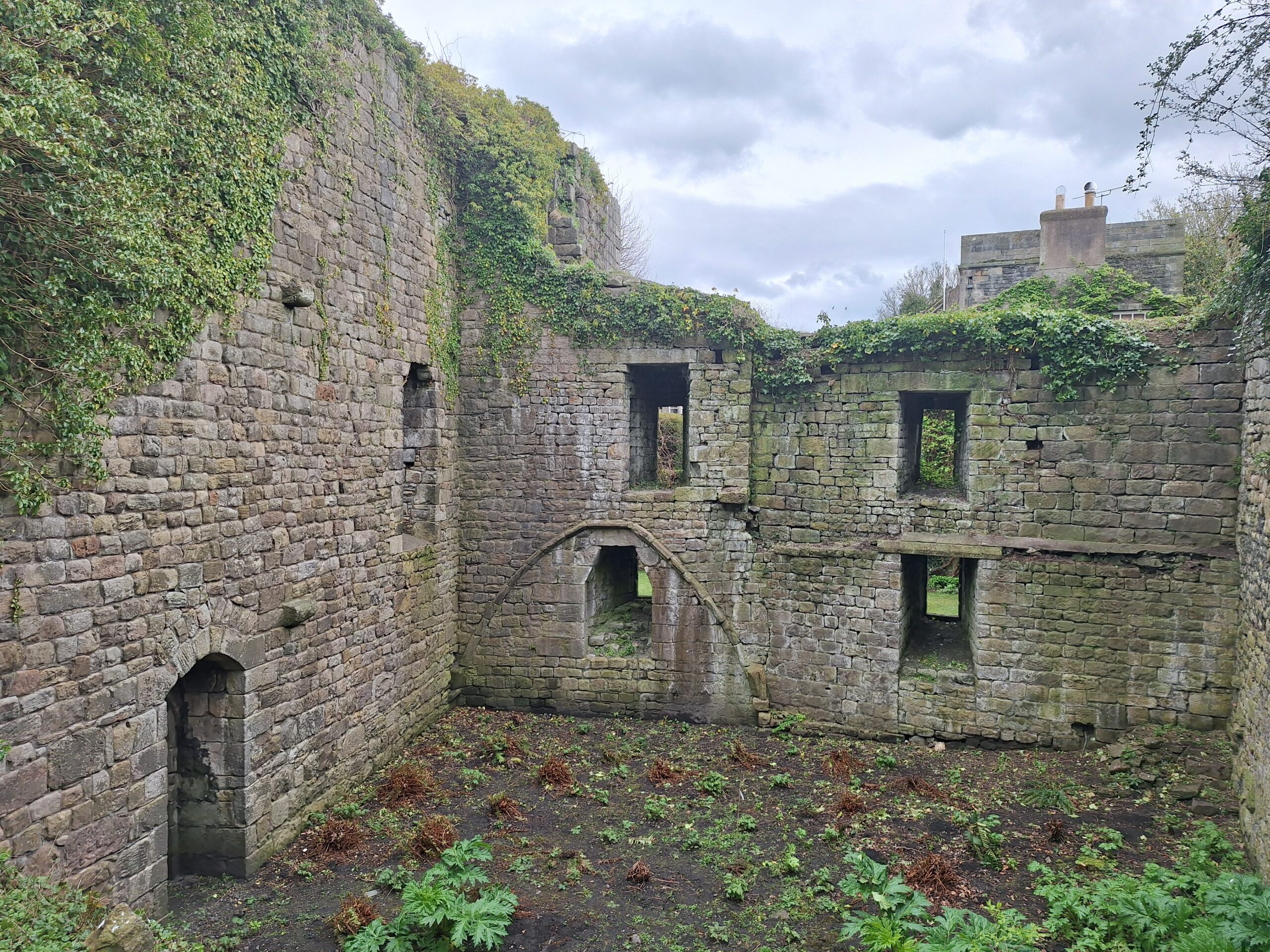
Interior of the lodging block to the south side of the gatehouse, looking east – showing the outline of the intended vaulted cellar. Copyright Tom Addyman

Subscribe to our quarterly newsletter

The work was coordinated with the Cockermouth Castle volunteer archive group, overseen by Alison McCann, Consultant Archivist to the Leconfield Estates.  Review of archival materials relating to the castle identified a number of significant items such as estate drawings for the various castle buildings, inventories relating to the later 17th century occupation of the site, and a number of early views including some depicting the excavation of the infilled cellarage of the inner ward in the mid-19th century.  Tom Addyman presented the ongoing work of the CST-funded survey to the archive group who were very positive in their response.

In May, the upgraded photogrammetric record is being digitised to form a line drawing set that will then be enhanced with analytical and phasing data.

Subscribe to our quarterly newsletter

You can read the first update here: Cockermouth Castle – Building Survey Diary Stage 1 – Update – Castle Studies Trust Blog
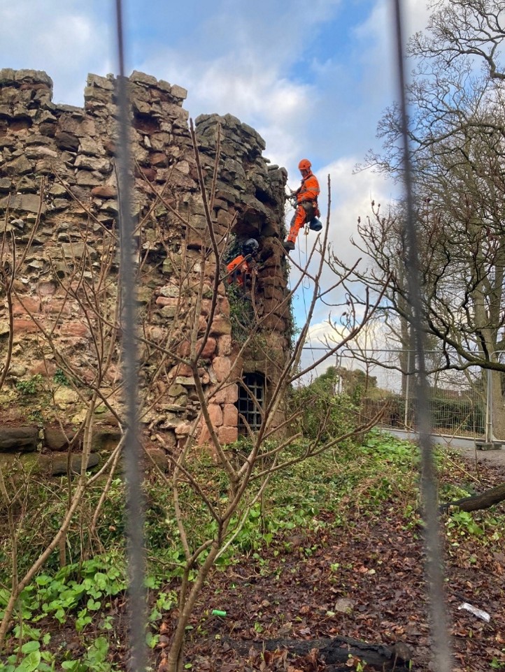
Investigating the Twelfth-Century Entranceway of Durham Castle

Dr Andrew Ferrara of Durham University, and project co-lead for investigating the Romanesque entrance looks at what they are doing and also hoping to learn from this detailed study of this spectacular doorway.

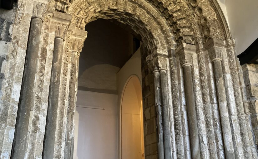
Durham Castle is one of the most prominent and renowned twelfth-century episcopal castles in Britain, sitting in the wider Durham UNESCO World Heritage site along with the cathedral. Construction is recorded as beginning in 1072, and the site has been in continuous occupation ever since. It operated as one of the bishop’s principal residences, right up until the nineteenth century when it was given to Durham University. As such, the complex has undergone multiple changes and alterations through the centuries, including significant interior and exterior works in the seventeenth and eighteenth centuries, with many of the medieval structures enclosed or adjusted by later development. Amongst the most significant building phases was the work undertaken during the episcopate of Bishop Hugh de Le Puiset (1153-95) and one of the most dynamic features from that period is the grand archway entrance inserted into the south façade of the castle’s North Range. Despite its longevity and pedigree, the castle has received surprisingly limited investigation or scholarly attention over the past century.

Subscribe to our quarterly newsletter

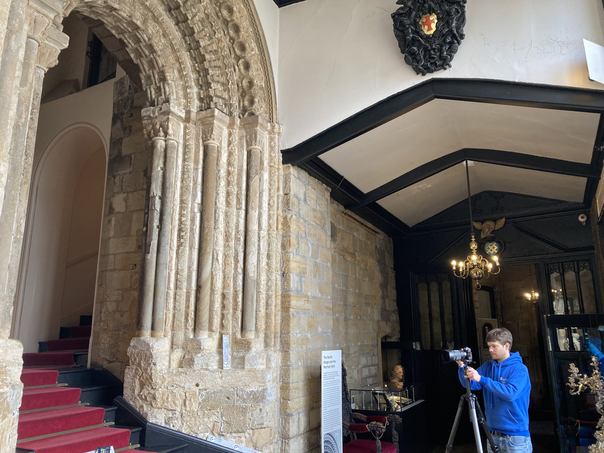
The current project, made possible through generous funding by the Castle Studies Trust, and led by Dr Andrew Ferrara and Professor Giles Gasper, is undertaking non-destructive photogrammetry of the Le Puiset archway. This methodology will result in a highly-detailed 3D model of the structure, ideal for detailed remote study. The same 3D data can then be used to generate orthographic projections, functioning as highly accurate blueprints of the arch. In addition, targeted high-resolution photography of details and additional 3D laser scans of the capitals will be undertaken. These combined methods will result in the most detailed and state-of-the-art records of this part of the castle for wider research and dissemination.

Durham Castle: Door scanning in action, copyright Dr Andrew Ferrara

This research focus has emerged from a renewed interest in the castle complex, catalysed by recent conservation and refurbishment works around the site which have revealed previously unknown architectural features. While the archway is exceptionally elaborate, it has never been subject to in-depth examination and set within the wider context of both Romanesque sculpture and the understanding of Durham Castle. The detailed modelling will allow for a thorough inspection of the features to be undertaken, in particular of diagnostic sculpture elements, enabling thorough comparison with other contemporary architectural outputs across the region and country. It is hoped that this will help tighten the chronology of the archway and set it in the context of other building projects undertaken by Bishop Le Puiset and other elite patrons. This will then further help inform understanding of the movement and concurrent projects of different master masons, and the sharing of architectural templates between secular and ecclesiastical sites and patrons in that milieu.

The project will also examine how the archway would have operated with the wider complex, to enable or restrict access and movement between the courtyard and internal spaces. This is crucial for better understanding the layout of the castle site in the late twelfth century, and how it would have looked and operated as the bishop’s See seat and one of the core centres of his palatine administration.  The project will also explore the Durham archway within the context of ceremonial and embellished entranceways at contemporary castle structures like Newcastle, helping to understand where Le Puiset’s sponsored work sits within the wider corpus of elite buildings across the region.

All of this should result in a better comprehension of the layout and operation of the Durham castle in the late-twelfth century, and also of how this archway feature compares with other contemporary and preceding royal and local castle sites.

Subscribe to our quarterly newsletter

Ruthin Castle: conserving and learning more about an Edwardian Castle

Fiona Gale of the Ruthin Castle Conservation Trust looks at what they are hoping to find out with the engineering survey being co-funded by the Castle Studies Trust about the Great Gatehouse of Ruthin Castle, North Wales.
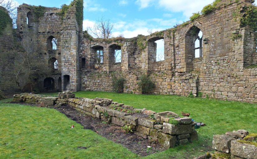
Ruthin Castle is situated in North East Wales, it relates to the English conquest of the Welsh carried out by Edward I. In 1277, after conquering Wales and building an iron ring of castles around the north coast, Edward 1 gave the area in which Ruthin Castle now sits to Dafydd ap Gruffydd, brother of Llewelyn the Last. He may have begun some building in Ruthin, but the castle building really took off when the area was given to Reginald de Grey in 1282 following the defeat of Dafydd’s uprising. It is recorded that Edward visited the site of the castle with his ‘architect’ Master James of St George in the autumn of 1282 and there was some limited expenditure recorded by the Crown.

Subscribe to our quarterly newsletter

The curtain walls of Ruthin Castle have the shape of a large pentagon, with upper and lower wards separated by a deep ditch which lies immediately behind the postern gate. The de Greys remained in control of the site throughout the medieval period, despite an attack from Owain Glyndwr in 1400. Little documentary evidence survives but there is a plan and bird’s eye view from the very early 17th century, by Randle Holme, which shows a number of internal buildings including a great hall, well and chapel. By the early 17th century, however, the castle was in crown hands and recorded as being in a ruinous state ‘except for the Great Gatehouse’ and at this stage it was bought by the Middletons of Chirk Castle. It played its last military role in the Civil war period when it was held by the Royalists but taken by the Parliamentarians following a siege.

Ruthin Castle in the 1970s

Subscribe to our quarterly newsletter

Nothing was done to the site until the early 19th century and until  then it most probably acted as a good source of building stone for the town of Ruthin. However, in the 1820s the site was inherited by Harriet Middleton, and she built a large mansion house within one corner of the medieval remains. Thirty years later her nephew extended the mansion house and developed a grand garden. The remains of the medieval castle became part of the picturesque grounds of the house and much of the vegetation, particularly ivy and some trees, most probably relate to this time when the romantic picturesque ruins fitted with how a garden should be. The mansion house is now a private hotel with the building listed as Grade 2*, the medieval castle remains are a scheduled ancient monument and the gardens and grounds are on the Gardens Register.

Ruthin Great Gatehouse south tower copyright Fiona Gale

Despite this neglect of the medieval remains over many centuries, there is a large amount of the fabric surviving, although there have been some alterations and additions as part of the garden development.  Levels within the interior of the curtain walls have been raised by as much as three metres. Around three quarters of the curtain wall survives, with both the postern gate and Great Gatehouse still recognizable. The Great Gatehouse, a key feature of the castle, still acts as the main entranceway into the castle gardens. It was partly rebuilt in the Victorian period, but understanding the extent of this and the extent of medieval remains is extremely important. Ruthin Castle, although one of the important castles build as part of Edward I’s campaign to quell the Welsh, has had very little antiquarian study and little research undertaken. It is hoped that a programme of work, of which this structural examination of the lower areas of the Great Gatehouse funded by the Castle Studies Trust is a part, will begin to add knowledge. A review of the Conservation Management Plan (CMP) in 2021 identified the Great Gatehouse, and particularly features within it, as in imminent danger of collapse.
Ruthin Castle Conservation Trust was established  in 2016 and members comprise  former Cadw inspector, local historians, construction and planning specialists, and representatives of local organisations. Representatives of the owners also sit on the Trust, demonstrating their support.

In 2021, the Trust was successful in an application to Cadw for funding to undertake conservation work on the Great Gatehouse of the castle, to address serious issues which had been identified within the CMP. Despite extra funding from Cadw the funds available were only enough to conserve the upper levels of the Gatehouse. The structure proved much more complicated than expected with surviving medieval masonry at ground level, which was completely unexpected, Victorian rebuild of external walls and a subsequent brick ‘house’ inserted into the structure. The area which was not reconsolidated with funding from Cadw was the lower, predominantly medieval area of the Great Gatehouse.

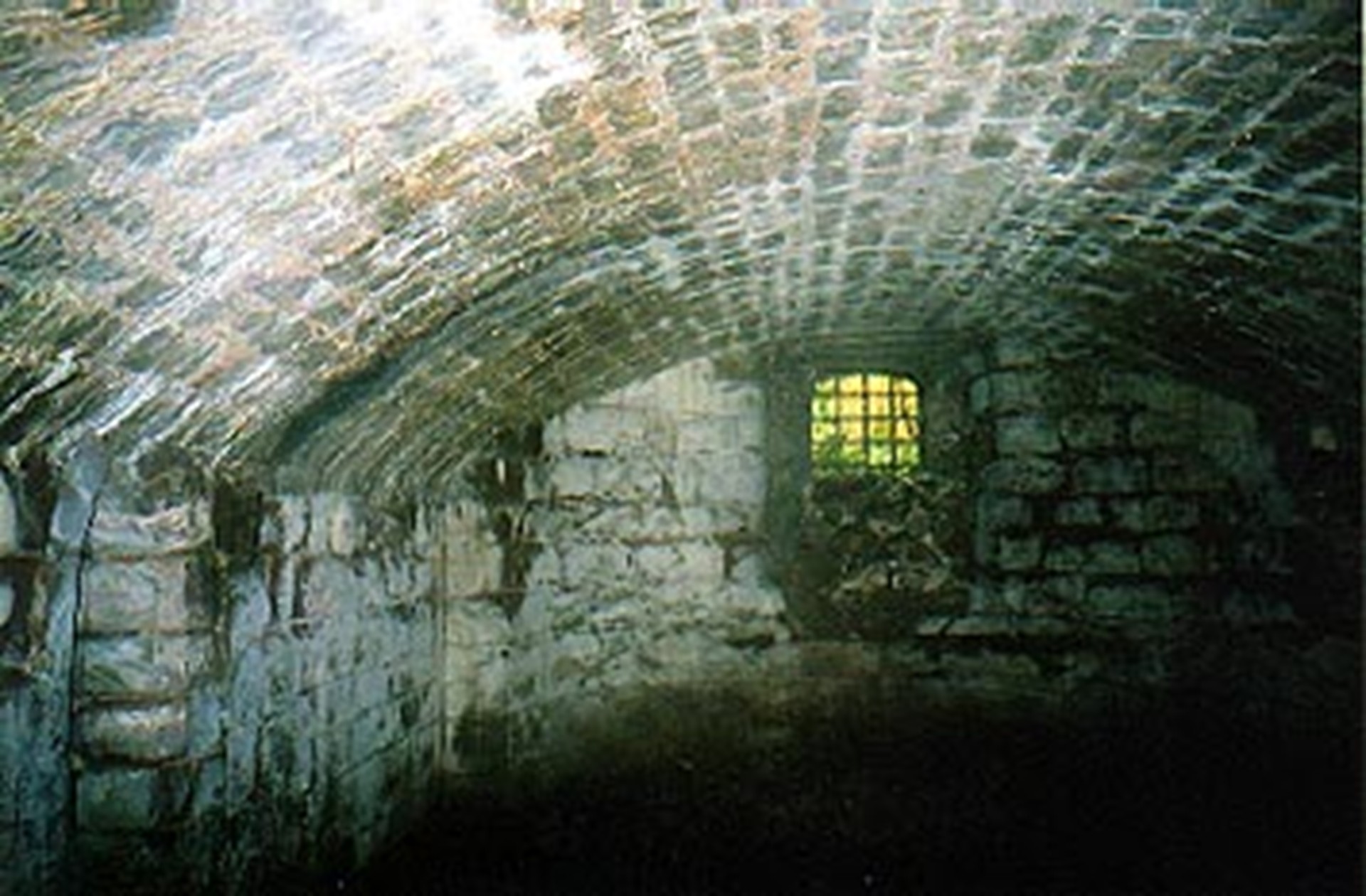
Ruthin Castle Great Gatehouse lower level interior, copyright Fiona Gale

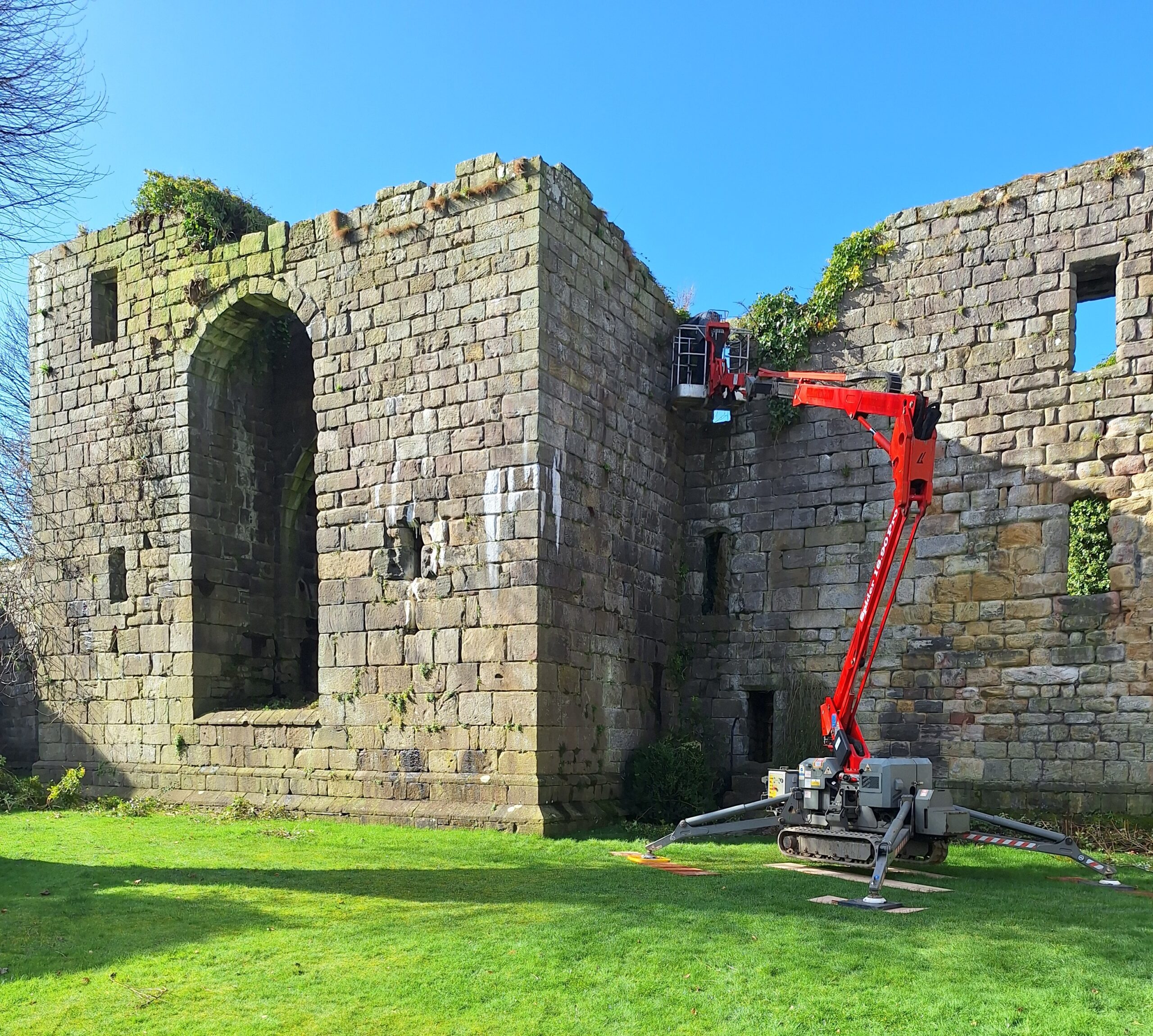
Thanks to grant aid from the Castle Studies Trust, which is matching a contribution from the Cambrian Archaeological Association, the Trust will employ an expert structural engineer to look at the underground, medieval, areas of the Great Gatehouse, and develop a plan of work to address issues of collapse and water ingress.  This work is scheduled to take place in mid-April 2026.

Subscribe to our quarterly newsletter

Armed with this information, the aim is to apply for further funding to address the serious conservation issues remaining. Concurrently the Trust is seeking funds to work with an experienced legal firm to develop a formal, legally binding, agreement between the Trust and the private owners which we hope will open up the possibility to apply for larger sums from the likes of Cadw and National Lottery Heritage Fund to then undertake the pressing conservation issues in the Gatehouse and throughout the extensive medieval remains. The information the structural engineer will provide will be key in moving towards this stage.

The funding from the Castle Studies Trust will help the Trust both gain further information about the condition of a part of Ruthin Castle and will act as a catalyst for funding in the future. The medieval ruins of Ruthin Castle form part of the gardens of the private hotel but are open to the public to explore, and the Trust would be keen to offer a tour of the remains to members of the Castle Studies Group.
Subscribe to our quarterly newsletter

Cockermouth Castle – Building Survey Diary Stage 1 – Update

Following his and his team’s first visit to survey the inner ward of Cockermouth Castle Tom Addyman looks at what they have found so far.

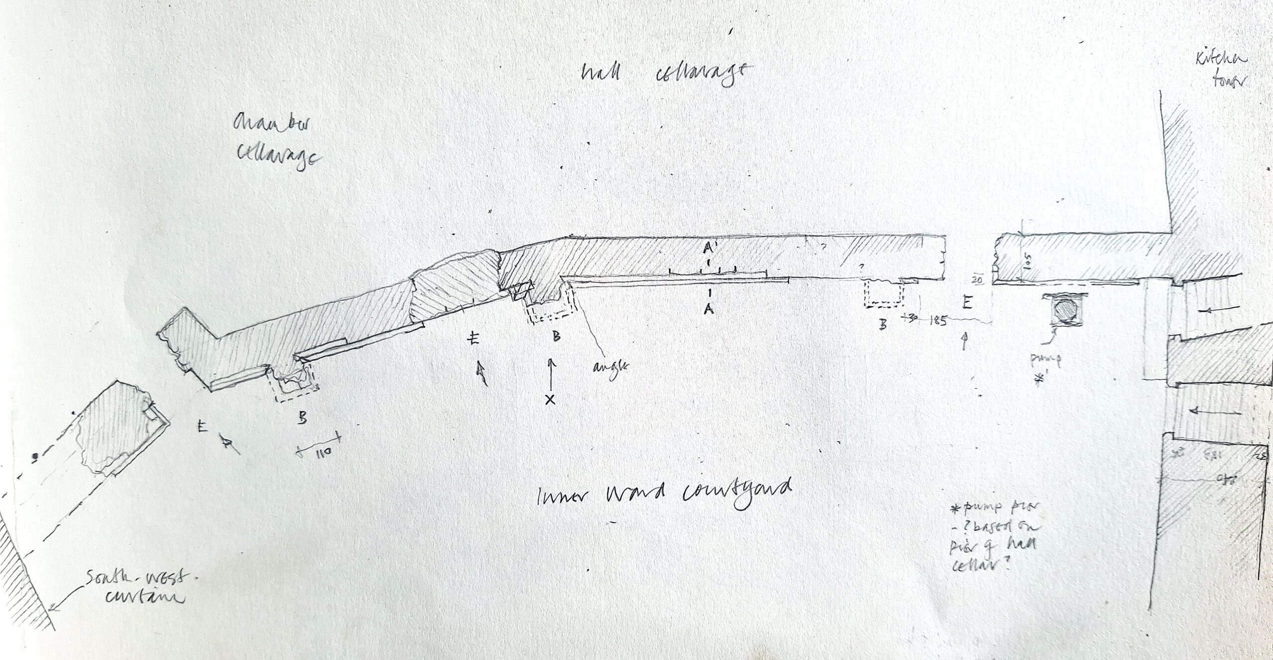
The initial stages of survey were carried out at Cockermouth Castle, within the inner ward area.  Adverse weather held off until gales forced an early retreat on the third day.  In spite of that excellent survey coverage was achieved, principally establishing a survey control and data capture for photogrammetry.  Great assistance was given by the estate in reduction of obscuring vegetation that revealing a number of areas that were long-obscured, and through the provision of high-level access.  The initial survey stage also included a general photographic record and preliminary fabric analysis such as the image below of the hall range frontage – sketch plan.

Subscribe to our quarterly newsletter

Cockermouth Castle high level access, inner ward gatehouse, copyright Addyman Archaeology
Cockermouth Castle hall range frontage – sketch plan, copyright Addyman Archaeology

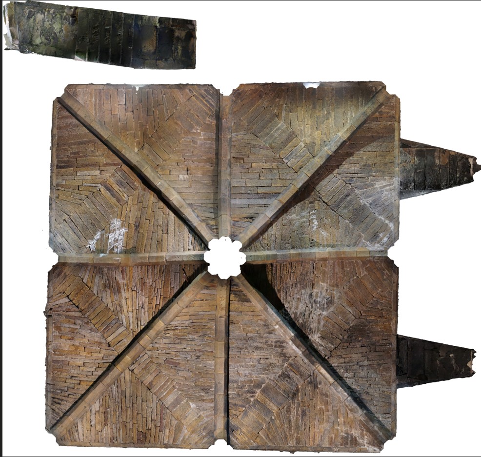
Initial processing of the imagery worked well leading, as intended, to the generation of dimensionally accurate projections to be used as a basis for a survey drawing set.  In purely visual terms some striking individual images emerged, such as a vertical projection of the vaulted ceiling structure of the cellarage beneath the kitchen tower and elevation views within the kitchen interior.    

Subscribe to our quarterly newsletter

Cockermouth Castle vertical projection showing vaulting configuration of lower level of the kitchen tower, copyright Addyman Archaeology
Cockermouth Castle north interior of the kitchen tower showing remains of former gallery arrangements, copyright Addyman Archaeology

Better access to the fabric allowed better understanding of the evidence for the evolving hall range arrangements (hall entrance and junction with the kitchen range and general view of hall range, north wall.  Examination of the surviving footings of the hall range’s courtyard frontage led to a preliminary reconstruction of its former appearance (image – preliminary sketch reconstruction of hall range frontage).

Cockermouth Castle great hall entrance and junction with the kitchen range, copyright Addyman Archaeology
Cockermouth Castle general view of hall range, north wall, copyright Addyman Archaeology
Cockermouth Castle preliminary sketch reconstruction of hall range frontage, copyright Addyman Archaeology

Once image processing is complete a follow on survey trip will involve detailed marking up of the imagery with phasing data and other analytical information.  There will also be a review of early records of the castle with the estate archivist and volunteer team.

Subscribe to our quarterly newsletter

Finding Flemingstown Kilkenny

Project lead Dr David Stone of the Discovery Programme Centre in Ireland explains their plans for geophysical survey at Kilkenny.

Archaeologists from the Discovery Programme Centre for Archaeology and Innovation Ireland, Dr David Stone, Dr Susan Curran and Cian Hogan, together with Cóilín Ó Drisceoil of the National Monuments Service, are beginning a new project to explore the grounds of Kilkenny Castle in search of the lost Flemingstown. This is one of the most intriguing missing parts of the castle’s medieval history, a former settlement associated with the castle, documented in historical sources, but whose location has since been lost as no traces of it remain visible on the ground. With the generous support of the Castle Studies Trust, work will begin in the last week of March on a new survey of the parkland east of Kilkenny Castle known as the Dukesmeadow.

Subscribe to our quarterly newsletter

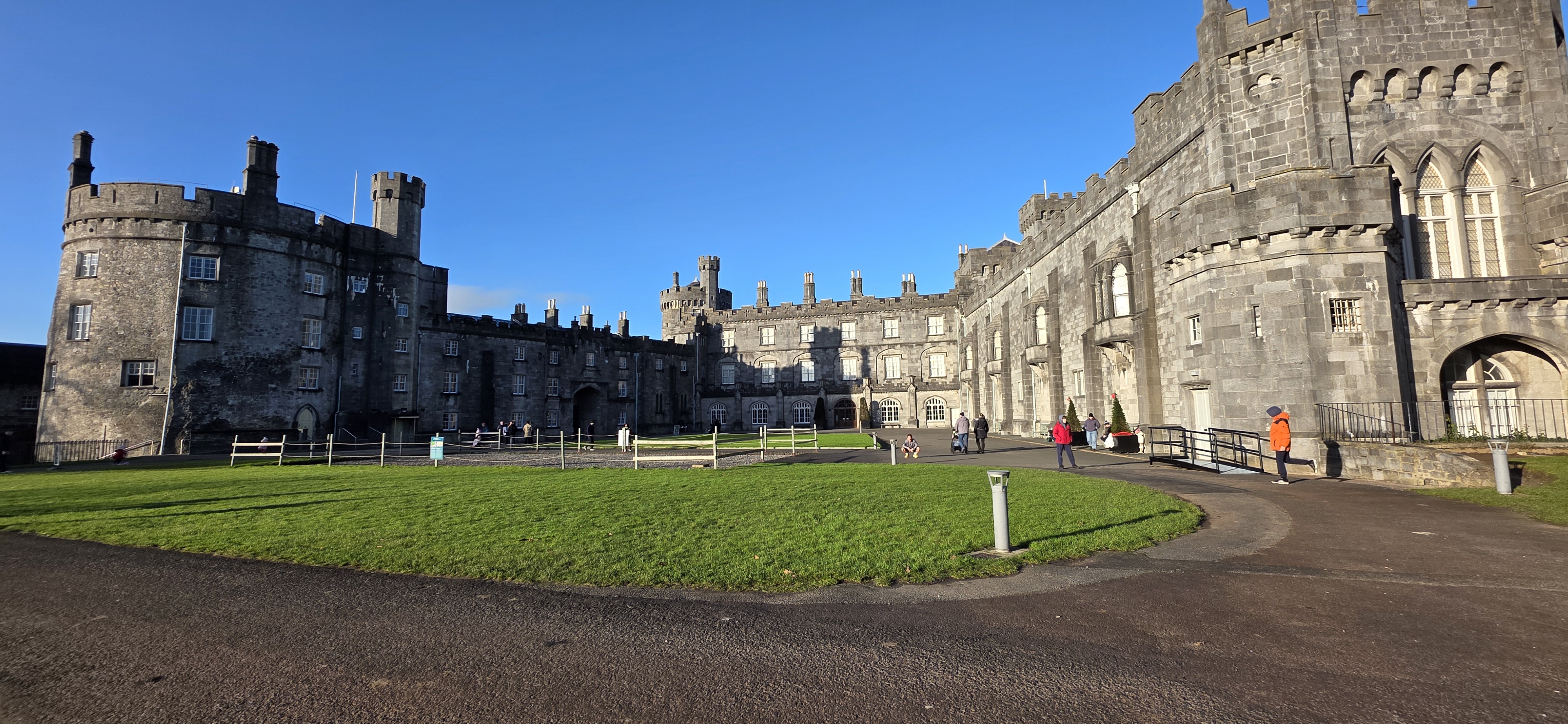
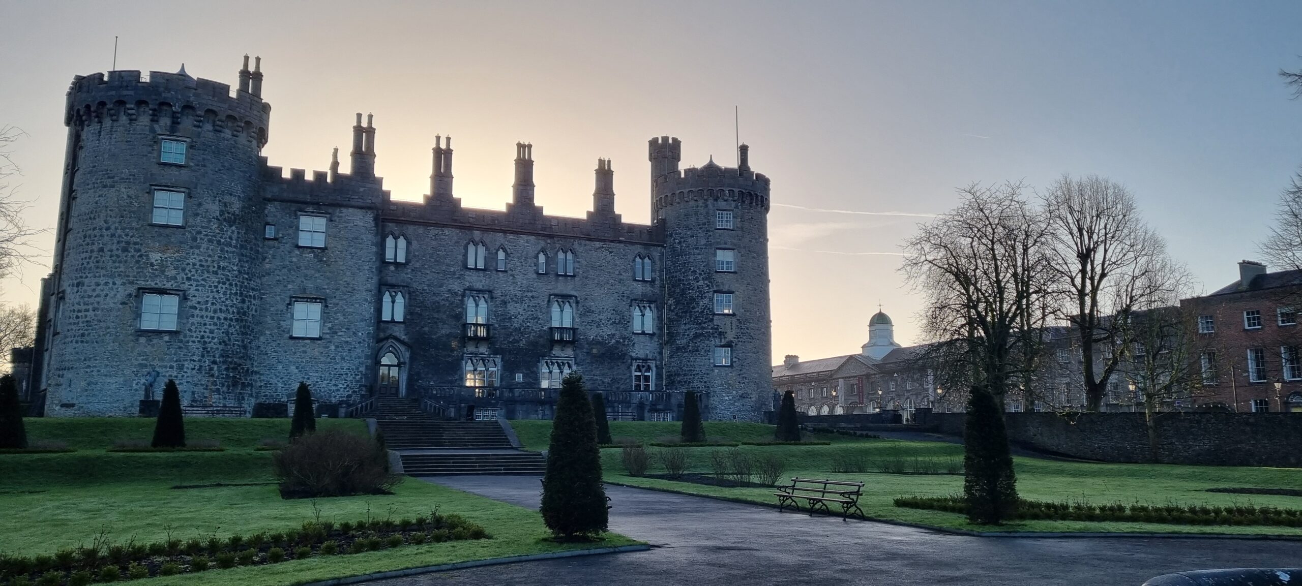
Kilkenny Castle, copyright The Discovery Programme Centre for Archaeology and Innovation Ireland

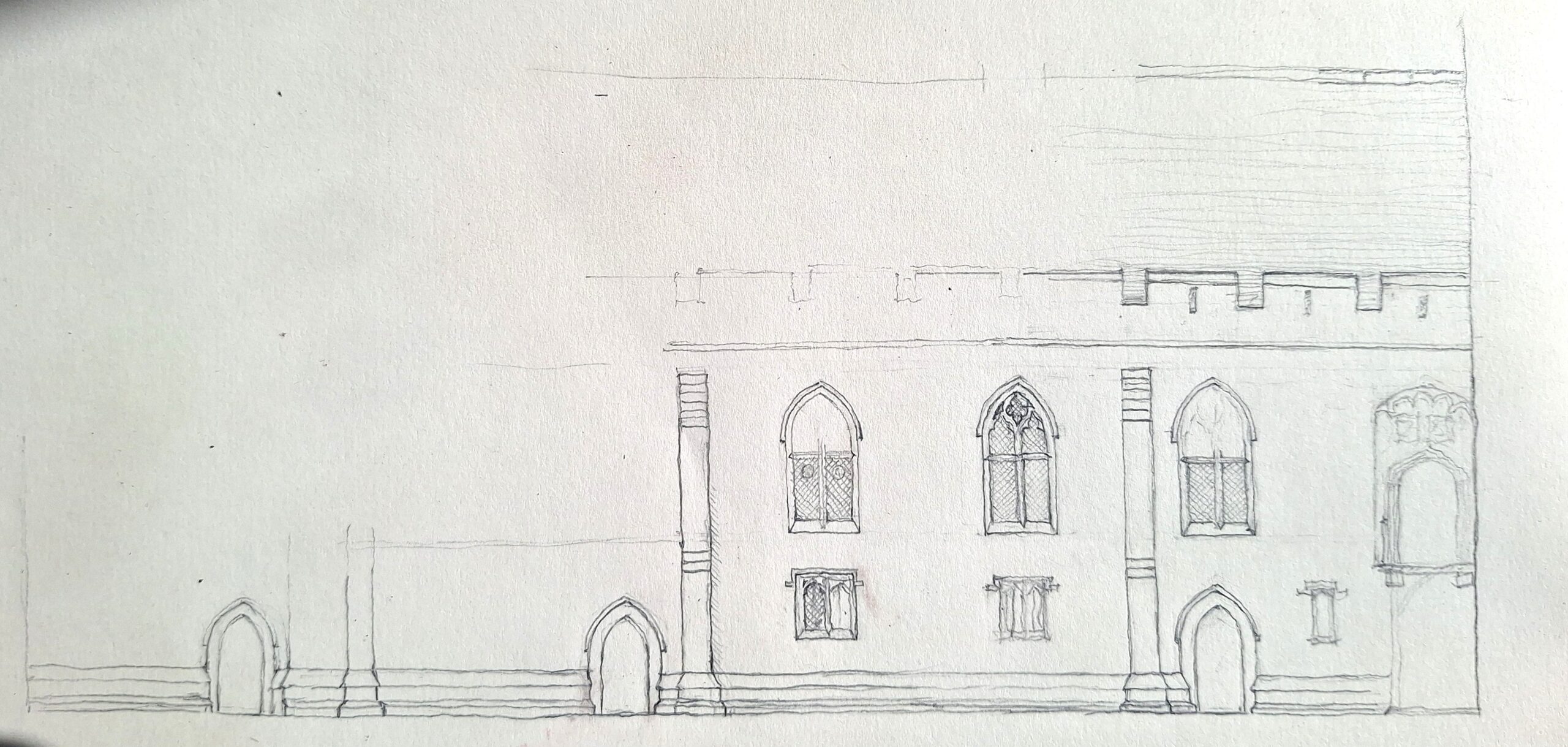
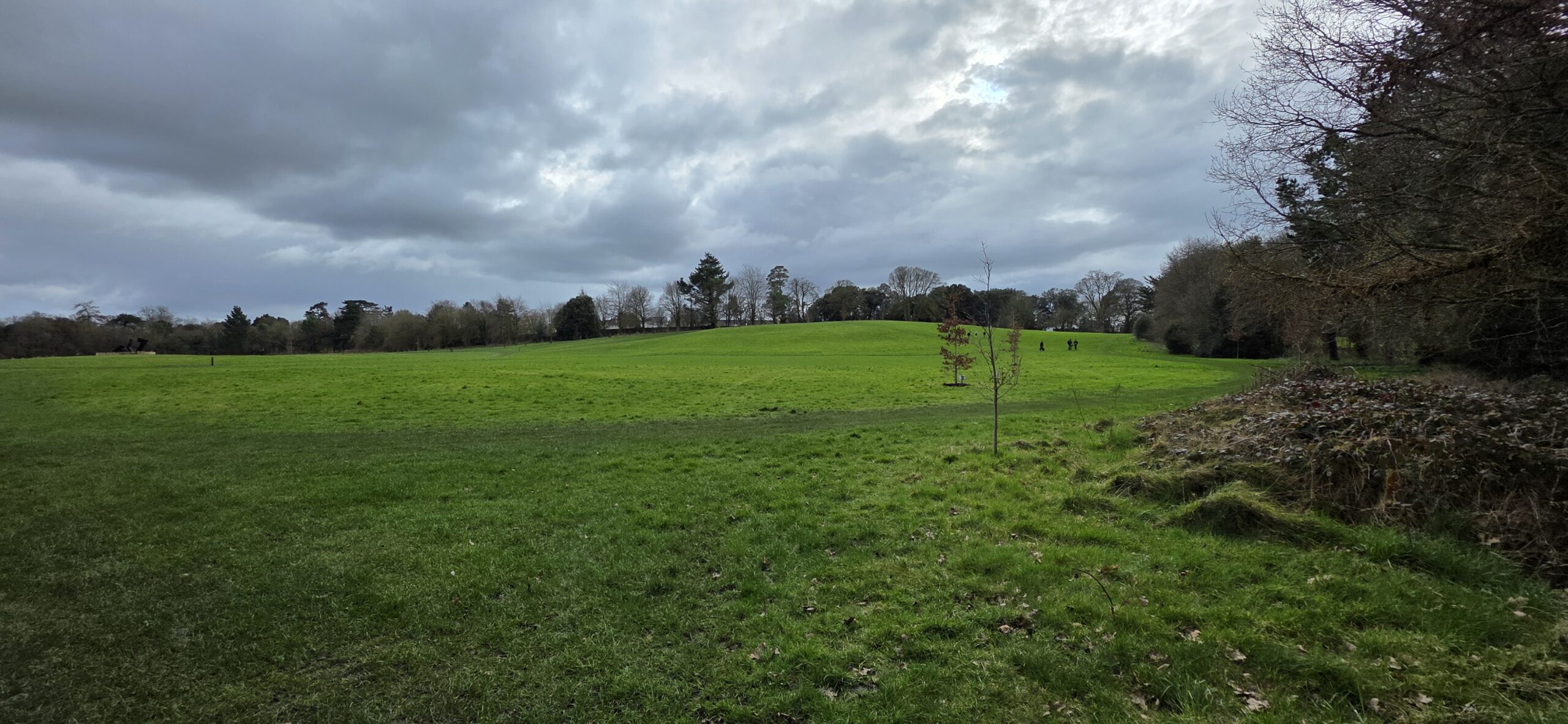
Kilkenny Castle (Figure 1) is one of the great fortresses of medieval Ireland. Built by William Marshal between approximately 1207 and 1213, it still dominates the modern city’s skyline and remains one of the county’s best known historic sites. The standing remains at Kilkenny Castle, however, tell only part of the story. Research over the last decade has shown that the medieval castle complex once extended far beyond the surviving Inner Ward into what is now open public parkland. A geophysical survey in 2010, followed by excavation in 2019, confirmed the position of the great gatehouse and revealed that the castle’s original layout was far more complex than had long been assumed. That earlier work also identified a dense area of subsurface archaeology, including defensive features, routeways and elements of a designed landscape in the outer park. The new project will target the one major area of the castle landscape that remains unexplored, the Dukesmeadow (Figure 2 & 3), which is also the most likely location of Flemingstown.

Figure 2: Dukesmeadow, Kilkenny, copyright The Discovery Programme Centre for Archaeology and Innovation Ireland

Flemingstown appears to have been a purpose-built settlement connected to the castle and associated with Flemish settlers. It was probably established in the early thirteenth century to house Flemish weavers, millers and other artisans, either drawn from Pembrokeshire or from Flanders itself. The settlement is first recorded in 1339 as Villa Flemang. By 1413 it seems to have been largely deserted after its inhabitants were moved to Danesfort by the earl of Ormond. Even so, later writers still described traces of an extensive former settlement surviving near the castle, including the mid seventeenth century Bishop of Ossory, David Rothe. LiDAR evidence also suggests that traces of this settlement may survive in the lower parkland in the form of earthworks, possible plot boundaries, enclosures and a hollow way.

Figure 3: Dukesmeadow, Kilkenny, copyright The Discovery Programme Centre for Archaeology and Innovation Ireland

This makes the project significant not only for Kilkenny, but for castle studies more generally. Castles were not simply defensive structures or elite residences. They were also centres of economic activity, planning, movement and display. Flemingstown offers a chance to examine Kilkenny Castle as the centre of a broader lived-in landscape, and to investigate the role of an immigrant artisan community within that setting. It may be the only attested example in Ireland of a purpose-built colonial castle settlement established specifically for an immigrant artisan community. If that can be demonstrated more clearly on the ground, it will give the site importance well beyond Kilkenny itself.

Subscribe to our quarterly newsletter

The team will use magnetic gradiometry across the Dukesmeadow, supported by targeted earth resistance survey on selected features. The aim is to detect buried boundaries, routeways, possible plot divisions, structures, pits or industrial features, and perhaps elements of an enclosing circuit. In practical terms, success would mean producing the first clear interpretative map of Flemingstown’s extent and internal organisation, while also clarifying how it related to the Outer Ward, surrounding meadows and approach routes into the castle complex. Just as importantly, the survey should identify the best targets for future research.

This project is therefore about recovering a missing part of Kilkenny Castle’s story. By identifying what survives beneath the parkland, the survey will provide the foundation for future research. It will also help bring back into view a forgotten community that once stood at the edge of one of medieval Ireland’s most important centres of power. For visitors to Kilkenny Castle, that promises a richer and more complete picture of the monument, not just the great fortress that still stands, but the wider lived in landscape that made it work.

The project team would like to thank the donors and patrons of the Castle Studies Trust for their generous award, which has made this project possible. We would also like to thank The Discovery Programme’s CEO Dr John O’Keeffe, Projects Manager Clare Lancaster, the National Monuments Service, and the Office of Public Works, especially Albert Jordon and Colm Mangan, for their assistance with this project.
Go raibh míle maith agaibh go léir.

Subscribe to our quarterly newsletter

Ellesmere Castle – Revealing the Secrets of a Major Castle of the Welsh Marches

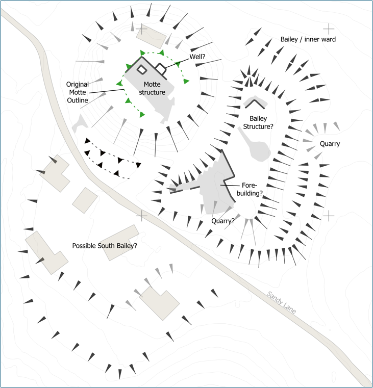
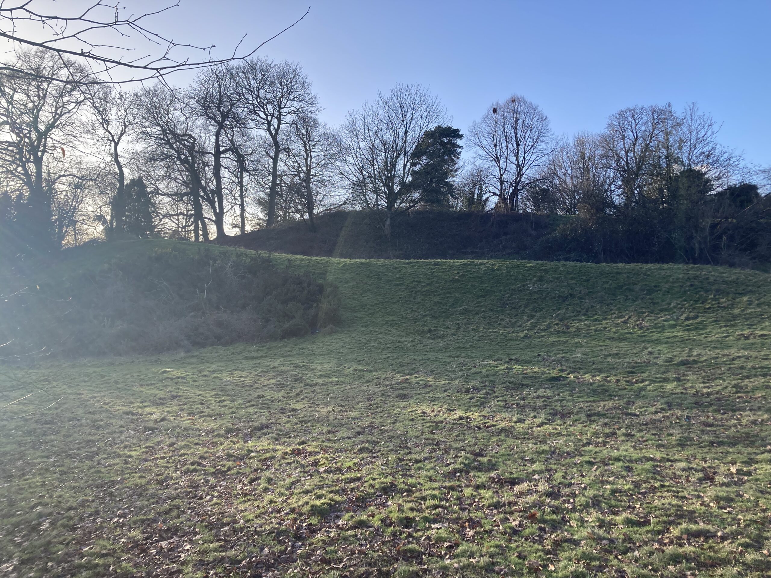
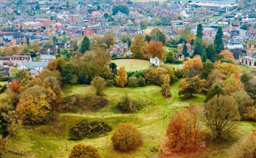
Ellesmere Castle in Shropshire is a substantial motte and bailey castle in the Welsh Marches that played an important role in the history of the area. However, very little is known about its form and structure with no standing remains above ground, or indeed when it was first constructed.

Starting on Monday 23 March, on behalf of the owners of the motte, Ellesmere Bowling Club, and with the support of owners of the rest of the castle Shropshire Council and funded by the Castle Studies Trust, archaeologists from the heritage organisation Heneb will be undertaking a programme of geophysical survey at the castle to assess the potential for surviving sub‑surface archaeological remains. The methods being used include magnetic gradiometry and electrical resistivity survey.

Subscribe to our quarterly newsletter

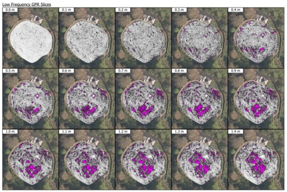
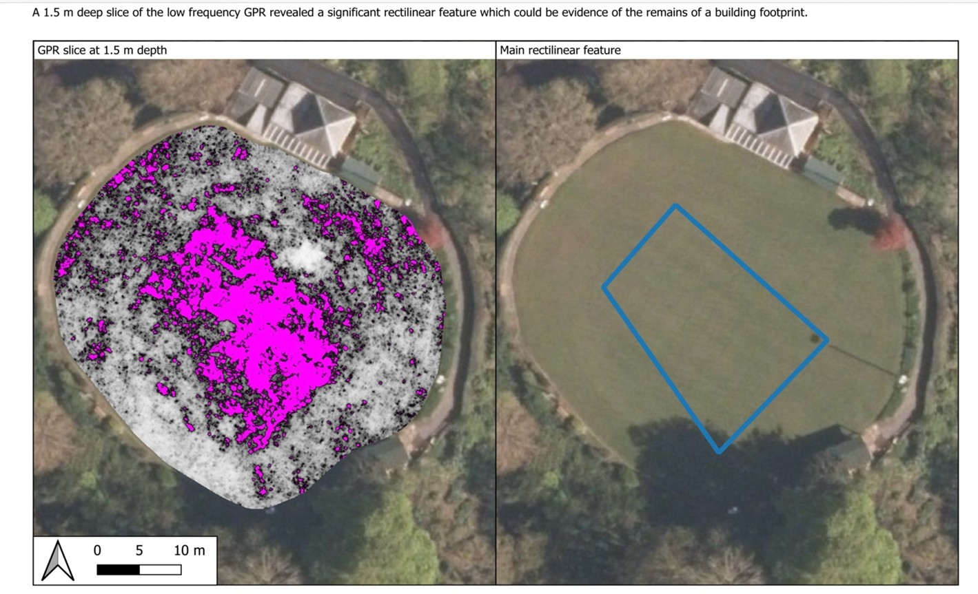
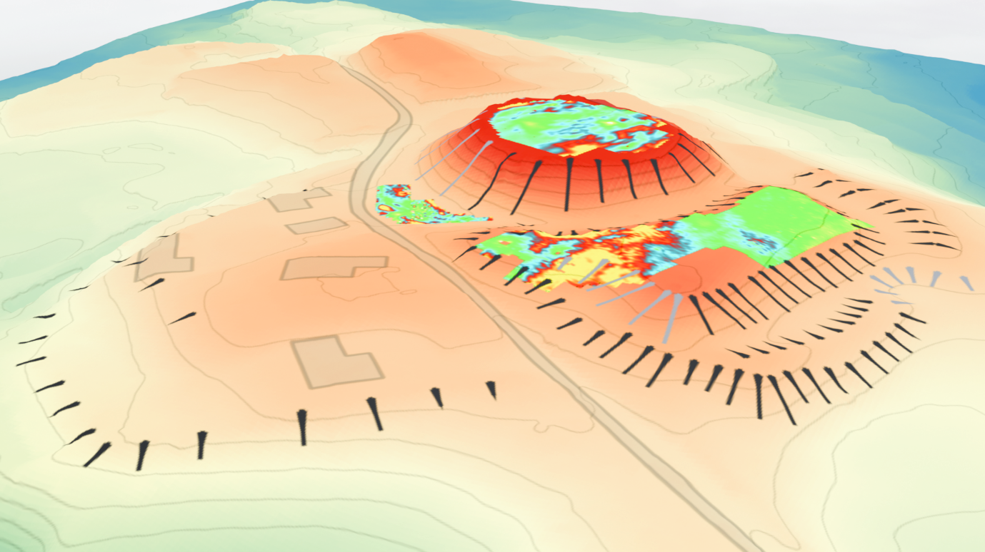
Ellesmere motte top, showing size as an shape of possible structure shown by GPR survey

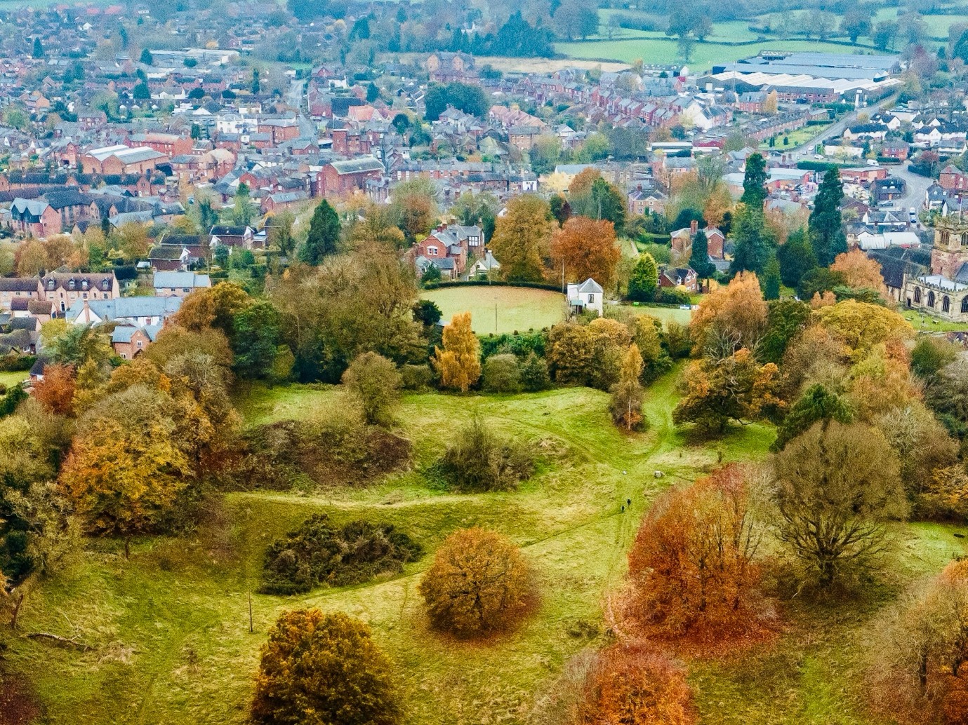
The motte itself is substantial. It is approximately 80m in diameter at its base, 52m across the top and stands about 11m high. A steep-sided ditch, about 20m wide and 3m deep, separates the motte from the bailey to the south east. In 2024, a partial and informal Ground Penetrating Radar GPR survey was carried out, which suggested and indicated a substantial structure, probably indicating a stone structure with the dimensions of 23m x 14m.

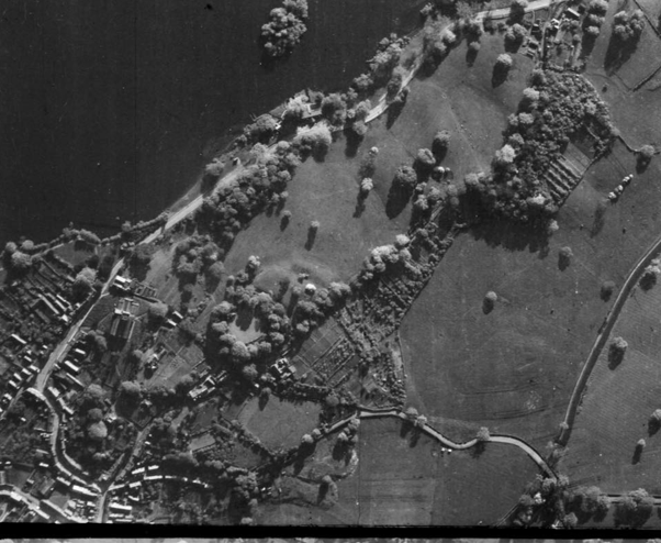
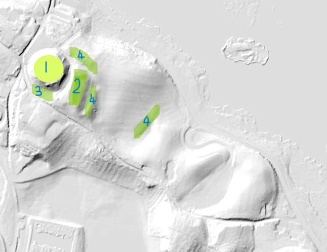
Lidar image of Ellesmere Castle including areas of geophysical survey

This current survey builds on the work carried out in 2024. It will be covering four areas of this very large castle site. The LiDAR image below shows the four targeted areas for geophysical survey:

  1. Motte: to pinpoint the position of the curtain wall along with any other buildings within.
  2. Bailey: to determine the location and size of the buildings.
  3. Area three, to establish where the outer defensive wall once stood that came down from the top of the motte, and to understand the width and depth of the defensive ditch, along with deciphering the extent of the bailey (No2), part of which had been quarried away sometime in the past.
  4. Earthworks which are believed to be the outer defensive walls, showing what appears to be an entrance in the north east section, and to investigate the furthest easterly earthworks to determine whether there was both an inner and outer bailey.

Subscribe to our quarterly newsletter

The date of construction is unknown: it could have been built as early as the late eleventh century, by marcher lord Roger de Montgomery. The lands were confiscated by the crown following his son Robert de Bellesme’s rebellion. The castle was certainly in existence by 1138. In 1174 Henry II confirmed the manor to Dafydd ab Owain, a north Welsh prince, when he married Henry’s sister Emma in 1174. During the early to middle part of the 13th century the manor of Ellesmere passed in and out of royal control and throughout much of that century there are numerous accounts of building or repair works especially during the reign of Henry III.

Ellesmere Castle bailey with motte in the background, copyright Gary Bick

In 1241 John le Strange was paid forty pounds to build a castle also in the same year twenty one pounds was spent on building two bretasches. In 1256, the King’s house within castle was repaired at a cost of five pounds ten shillings and nine with a further one hundred and sixteen pounds being spent on castle repairs further emphasising the castle’s significance.

In historical terms, perhaps its most well-known claim to fame is that Joan, daughter of King John and wife of Llywelyn ap Iorwerth, was confined to the castle for about a year following her infidelity.

While the survey will not answer questions on its history, it will hopefully supply more details on the castle’s form, and potential targets for future excavation so we can learn more about its history.

Subscribe to our quarterly newsletter

Cockermouth Castle: a major baronial fortress of which we know little

Tom Addyman of Addyman Archaeology looks ahead to the first modern detailed study of Cockermouth Castle, a major baronial castle near the Scottish border which is starting this week.

With the generous support awarded by the Castle Studies Trust new survey work is to commence this week at Cockermouth Castle.  Located in the extreme west of the historic county of Cumberland, Cockermouth is the caput of a major early landholding, the barony of Allerdale and Honour of Cockermouth.  The castle is an extensively surviving baronial fortress that occupies a strong defensive site, a high spur of land at the confluence of the Rivers Derwent to the north and Cocker to the south and overlooking the medieval town extending to the south-east. 
Subscribe to our quarterly newsletter

Outer Gatehouse of Cockermouth Castle looking North West, copyright Addyman Archaeology

Roughly triangular in plan, the complex’s major walls and defensive towers essentially survive intact, comprising a small inner ward at the point of the promontory and a larger outer ward facing level ground to the east, defended by a ditch, now infilled.  The outer ward is accessed by a massively constructed gatehouse at the north angle of the east side.  The gatehouse and later ranges built against the north, east and south perimeter walls of the enclosure are still in occupation.  The now-ruinous inner ward, containing the principal domestic apartments, had been accessed by means of a second major gatehouse to the centre of its east side.

Cockermouth Castle gatehouse to the inner ward facing south west, copyright Addyman Archaeology

Subscribe to our quarterly newsletter

Following recent appraisal during the 2024 Chateau Gaillard conference there was considerable consensus as to both the importance of the site and its surviving architecture and in recognizing that its fabric has seen little study and was very notably lacking a reliable evidence-based analysis.  It seems the most up-to-date published plan of the site is that of 1910 by John Curwen who also provided an account of the castle’s evolution.  The only subsequent in-depth study that relates the detailed analysis of the physical development of the site to its ownership history is that of JB Bradbury (Bradbury’s History of Cockermouth, 1996); however this now requires comprehensive revision through scholarly review of the physical evidence.  Other accounts, by Lord Leconfield (1959) and Pevsner, as revised by Hyde (2010), are more summary in nature.  The understanding of the castle and its history has most recently been assessed by Dr Edward Impey in a draft paper (July 2024) that provides a firm basis upon which the more detailed assessment of the site will be built and its interpretation re-considered.

Cockermouth Castle inner ward with all and chamber block and the kitchen tower on the far left. copyright Addyman Archaeology

Led by a team from Addyman Archaeology, the project will focus upon developing a detailed understanding of the physical fabric of the structurally complex inner ward area.  The major building periods will be defined and related to the site’s known history and occupancy, to early illustrative material, and in terms of the broader evolution of castle architecture.  Particular focus will be the massive redevelopment of the site in the 14th century under the de Lucy and Percy families.  Incorporating parts of a pre-existing masonry curtain, these works included the creation of chamber, hall and service arrangements, the magnificent kitchen tower (reminiscent of the work of Master John Lewyn), and the inner ward’s idiosyncratic gatehouse, a structure of defensive appearance though of limited capability and without close parallel.  Together the gatehouse and the domestic ranges to either side occupy the site of an earlier defensive ditch; these structures present a specific interpretative challenge in that they incorporate the remains of vaulted cellarage of a predecessor range that may never have been completed.  

Cockermouth Castle Kitchen Tower looking North West, copyright Addyman Archaeology

The present project prioritises the establishment of new base-line survey information.  As far as existing vegetation and safe access permits the structures of the inner ward will be subject to a close and systematic visual assessment and non-invasive survey to be carried out primarily through photogrammetry.  The latter will lead to the development of a record drawing set that will be overlain with comprehensive analytical and phasing data.    The study will include a detailed component-by-component analysis and description, and a narrative account of the visible stratigraphic evidence.  Working with the estate archivist and a local historical group the project will also involve scoping of historical materials relevant to the understanding of the castle fabric.  The project will lead to the development of research questions and a possible scope of works for ongoing study of the site.

Subscribe to our quarterly newsletter