In the latest in is “Defending…” series looking at the fortifications in particular counties, Mike Osborne looks at Bedfordshire.
When I wrote Defending Lincolnshire: a military history from the Conquest to the Cold War (The History Press, 2010), I had no idea that ten years on, the series would have grown to cover ten counties with an eleventh almost completed. What I have discovered along the way is that while there exist clear cultural similarities, counties are patently different in so many regards. Some of these differences are obvious: the landscape factors which affect settlement patterns; the geology which dictates building materials and factors such as moated sites; the county’s relationship to important routes and its density of urban or rural settlements; its central or remote position within the nation; its relative vulnerability to invasion; and, above all, its recorded history. Other differences are more subtle and may be governed by local conditions and circumstances: the dominance of particular families or factions; the power struggles of kings, nobles or bishops; the economic effects of trade or farming; fashion and technology; continuity and re-use of defensive locations and the impact of localised, country-wide or international conflict. Taking the wider context of these studies which embrace all forms of fortification and military activity from Iron Age forts to nuclear bunkers, then such differences will only be magnified.
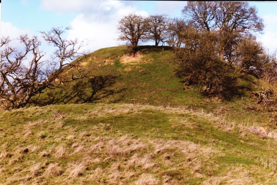
The motte at Cainhoe (copyright Mike Osborne
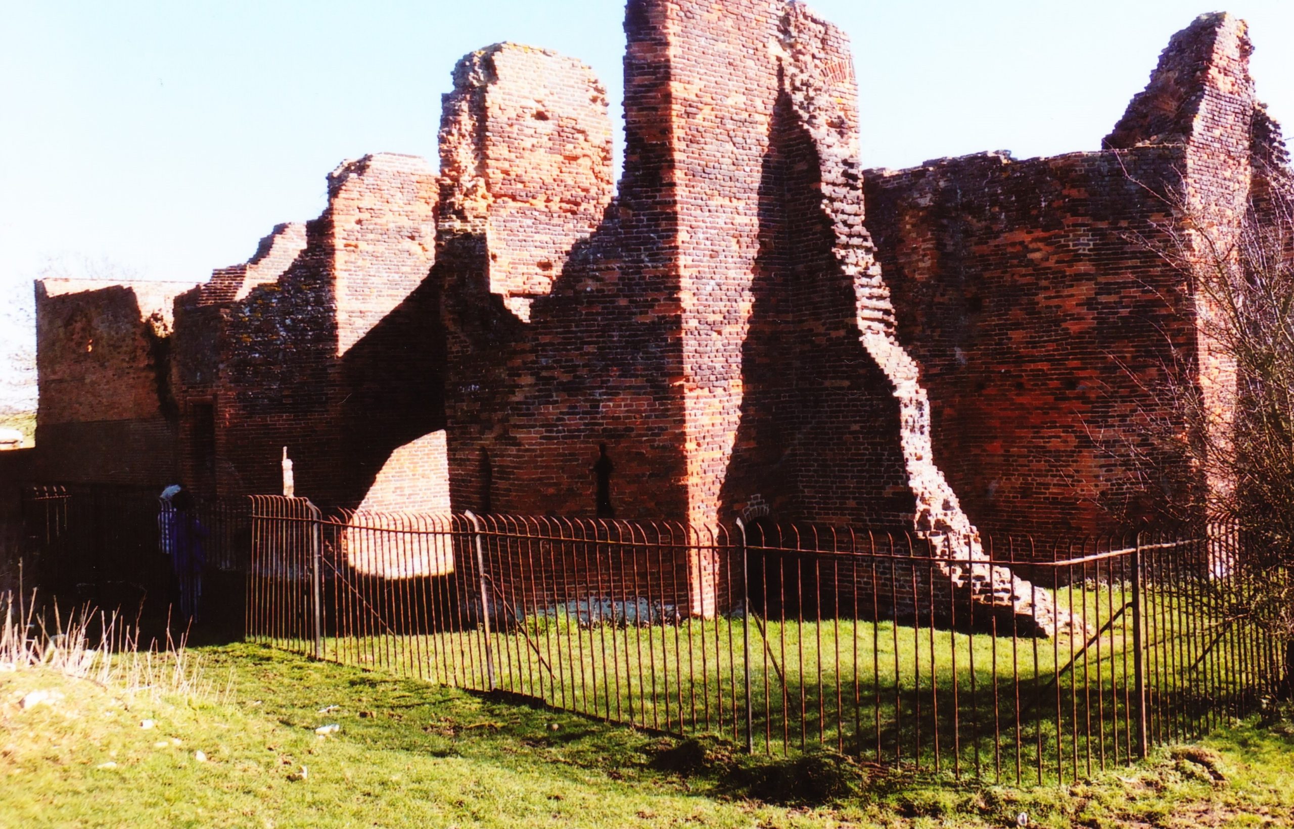
Bedfordshire is unusual in that whilst there were Romano-British settlements and an established network of Roman roads: Watling Street, Ermine Street and the Icknield Way, there were, apparently, no Roman forts. Bedford became established only in Saxon/Danish times, owing to its strategic position astride the Great Ouse, and Clapham’s church-tower, on the border of Wessex and the Danelaw may well have served a defensive function. Sadly, despite the public promotion of Danes Camp at Willington and Tempsford as Viking river-side fortresses, they have both been found to be medieval moated sites. Luton only developed after the Norman Conquest becoming the location for two earthwork castles. A ‘royal’ castle was established at Bedford, soon to evolve into a masonry fortress, but the county’s numerous motte castles, notably Cainhoe, Yielden, Risinghoe and Totternhoe, and its fewer ringworks, whilst remaining as structures of earth and timber throughout, nevertheless often occupied dominant sites. Historical factors around conflict saw Bedford erased as a fortification early in its career having undergone two sieges, and most of the other castles would be superseded by more comfortable accommodation. The county was split into an unusually large number of small manors which may account for the over twenty earthwork castles and the 300+ homestead moats- the greatest density of any English county- benefiting from the underlying clay. Bedfordshire’s later medieval castles, Wrest Park, Bletsoe and Ampthill, have disappeared, but remnants of Someries survive to the background sound, in normal times, of Easyjet. Whilst largely insulated against external threats, the county still experienced the effects of conflict during the civil war between Stephen and the Empress and the Wars of the Roses, whilst suffering its share of the universal effects of famine, plague and social disorder. Probably the best-known castle-related event was the siege of Bedford by Henry III in 1224 which resulted in the destruction of the castle but not, in all likelihood, the draconian penalties reputedly enacted against the garrison.
Someries Castle: the gate-house/chapel range of the mid-fifteenth-century brick strong-house of Sir John Wenlock (copyright Mike Osborne)
Were anyone to ask me which of these counties had been the most interesting, given their differences, I should be pushed to answer. From the perspective of fortification, some will share similarities: Essex, Norfolk, and Hampshire as targets for invasion; the Midland counties of Nottinghamshire, Northamptonshire and Leicestershire/Rutland controlling lines of communication from urban centres; Bedfordshire, Lincolnshire and Cambridgeshire sharing elements of landscape; whilst London has a bit of everything as, I am currently discovering, has Gloucestershire and Bristol. All of them have interesting facets either shared or individual, common or unique. Rob Liddiard, amongst others, has confirmed to me the value of the local focus alongside other approaches, and it is certainly something I will continue to explore.
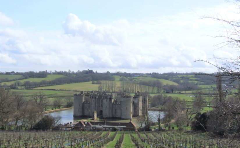
Professor Matthew Johnson of Northwestern University takes a look the iconic Bodiam Castle.
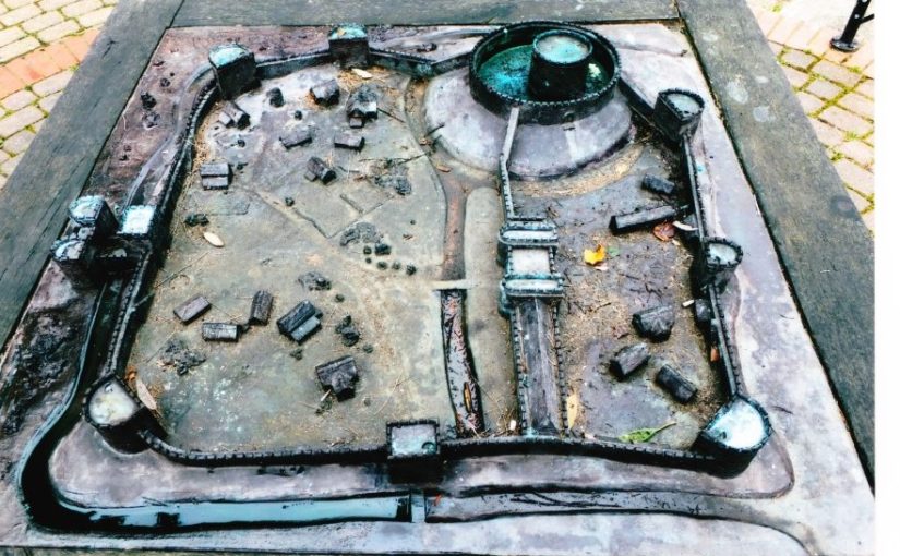
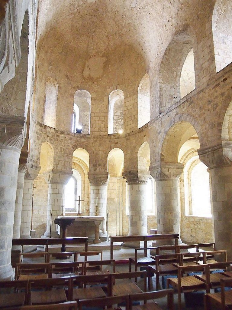
Many readers of the Castle Studies Trust blog will be only too familiar with Bodiam Castle. It is the most-discussed late medieval castle in England, and probably in Europe. Over the last ten years I have worked with a team of researchers from Northwestern University and the University of Southampton, in partnership with the National Trust. We carried out a new survey of the building, a topographical and geophysical survey of the surrounding landscape, and a synthesis of the extensive ‘grey literature’ on the site. Our work was published in the 2017 volume Lived Experience in the Later Middle Ages; digital copies are freely available here. We deliberately avoided older debates, and instead stressed a landscape of work and the variety of lived experiences of different people as they worked and moved around the castle and local landscape.
In this short blog post, I want to highlight one point: Bodiam needs to be understood as a multi-period site and landscape. One of the mistakes of the old ‘defence vs status’ debates was to see Bodiam simply as a creation of the 1380s and of one man, Sir Edward Dallingridge. Our work suggests rather that the building and its surroundings form a distinctive place with its own cultural biography that should be understood over the very long term, from the Palaeolithic to the WWII pillbox. It is a place that has seen reworking and recasting by different social groups over the centuries and even over the millennia.
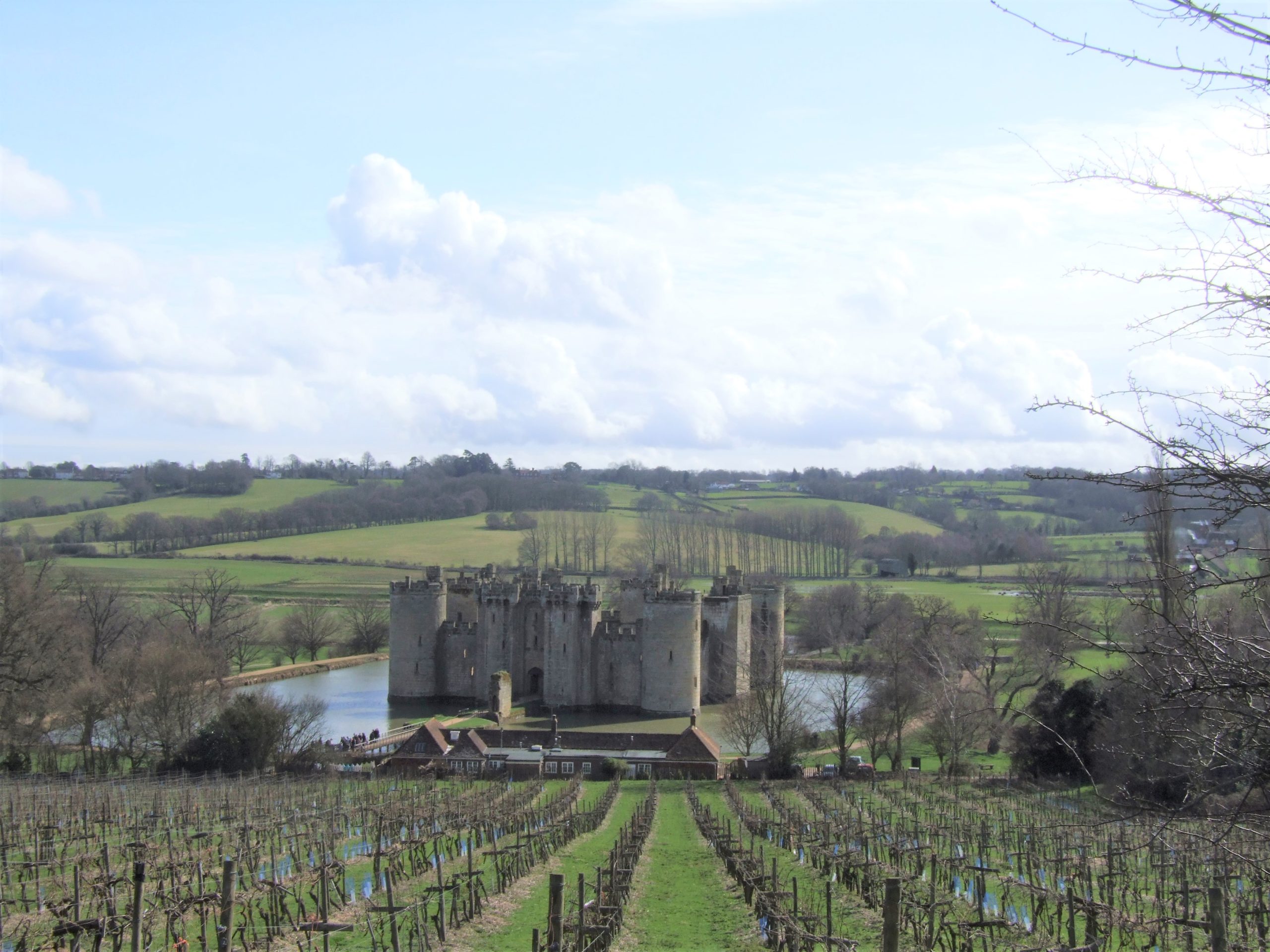
The castle viewed from the N, photo taken from the older manorial site, also known as the ‘Gun Garden’ or ‘viewing platform’. The floodplain of the Rother can be seen behind the castle, with the Weald rising up beyond and the linear village of Ewhurst Green strung out along the horizon.
The stone fabric of the castle does, indeed, date largely to the 1380s, and the use-life of the stone structure was relatively short; it was probably derelict and rarely used by the end of the 15th century. However, its story is not just that of one man. Bodiam was a manor of the Wardedieu family, which Edward inherited through his marriage to Elizabeth Wardedieu. Alice Beauchamp, a wealthy widow and subsequently warden of the infant king Henry VI, married John Dallingridge, son and heir of Edward; John died soon after his father, and Alice became chatelaine of the castle for 35 years until her death in 1443 (Johnson 2020, 321). Usually presented as the creation of a single powerful man, Bodiam then was one of the residences of a powerful woman for much of its active use. The elaborate stacked, double suite of ‘private’ chambers at the upper end of the hall needs to be understood in this gendered context.
Much of the internal fabric, and most of the barbican, was ‘robbed’ of building stone in succeeding centuries; many visitors stopped to leave their mark in the form of graffiti. In the 1830s, ‘Mad Jack’ Fuller bought and restored the site and landscape. Fuller’s wealth came in part from his ownership of enslaved people on plantations in Jamaica, as the recent National Trust report describes. In the 1920s, the castle was restored again by ex-Viceroy of India Lord Curzon; Curzon of course was also responsible for the restoration of the Taj Mahal. His activities at Bodiam included the failed construction of a cricket pitch (the selected site, which he named ‘the tiltyard’ but which was in fact the basin of the old millpond, was not an ideal choice). The later cultural biography of Bodiam, then, is part of a story of colonialism and postcolonialism.
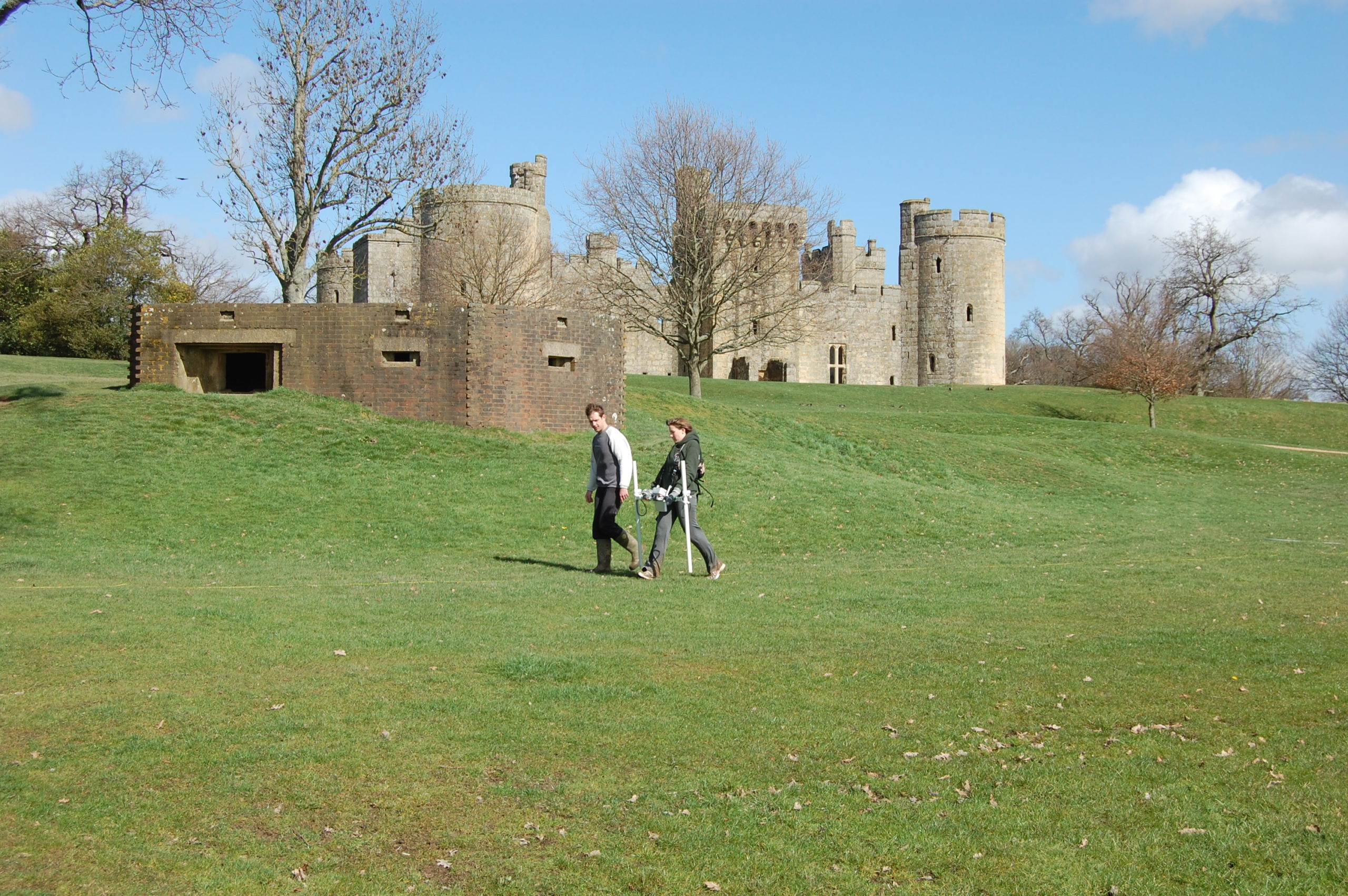
University of Southampton students surveying what Curzon termed the ‘tiltyard’, in reality the former millpond, in April 2010. The castle and WWII pillbox are in the background.
However, it is the prehistory of the site – its enduring importance as a critical place in the landscape – before the 1380s that most fascinates me. The castle itself was ‘fitted in’ to an earlier framework of manorial site, village tenements, river crossing and wharf. The whole assemblage sits at the junction of the Weald and the Rother Valley. The Kent and Sussex Weald, with its rolling hills, heavy clay soil and extensive woodland, contrasts with the floodplains below, running out to Romney Marsh. Climatic variation and the troubled history of land reclamation has meant that at different times, the valley has been shallow estuary, marshland, or fertile fields (it will return to shallow estuary in 100 years if climate change continues). Bodiam sits at the lowest crossing point on the river Rother, on a N/S Roman road, at a point which was a ford but which had a bridge from the 12th century onwards.
When I lecture on Bodiam, I like to suggest to audiences primed for discussion of knights, gunports and the Hundred Years War that the critical moment in the biography of the Bodiam landscape is not the 1380s, but rather the Early Bronze Age, when the complex interaction between human and environment meant that peat accumulation in the valley stopped and was replaced by alluvium. And I like to go back still further, to a time in the deep past when the valley was some metres deeper and the surrounding hills some metres higher, giving a less comfortable and more rugged feel to the landscape.
Jacquetta Hawkes (1967) famously said that ‘every generation gets the Stonehenge it deserves – or desires’; the same, arguably, is true of Bodiam. The Bodiam for our generation is, in part, a place of cultural biography and long-term climatic change, where humans have worked with and through the landscape to create, maintain and transform a place that has had an enduring importance over the millennia.
Hawkes, J., 1967. God in the machine. Antiquity 41, 174-80.
Johnson, M.H. (ed.) 2017. Lived Experience in the Later Middle Ages: Studies of Bodiam and Other High Status Sites in South East England. St Andrews, Highfield Press.
Dr Lorna-Jane Richardson, University of East Anglia/Bungay Museum, looks at the 1930s excavations of Bungay carried out by Hugh Braun and also the possibility of future work at the site.
Bungay is a small market town on the border of Norfolk and Suffolk, and sits on a meander in the River Waveney at the very edge of the Norfolk Broads National Park. The town is in a good defensive position, sat on a sand and gravel river terrace, some 10 metres above OD, with wide views across the valley and surrounded by marshland. This ‘natural fortress’ (Braun 1934) had seen earlier, perhaps early Medieval, defensive structures built, suggestive of a burh. This site was chosen for the construction of a castle firstly by one of William the Conqueror’s stewards, William de Noyers, who constructed a motte and bailey structure. The castle was bestowed on Roger Bigod, a Norman knight who was awarded estates in East Anglia and given Bungay in 1103 by King Henry I. Roger’s son, Hugh, known as Bigod the Restless, was made Earl of Norfolk in 1154, and he ordered the construction of the stone keep. The Bigods were the most powerful family in East Anglia for much of the 12th and 13th centuries. After nearly two centuries in the hands of the Bigod family, who also owned Framlingham Castle further south in Suffolk, Bungay Castle reverted to the Crown and fell into disuse. In 1312, Edward II gave the Castle to his brother, Thomas Plantagenet, and it eventually passed to the Dukes of Norfolk in 1483. However, it was recorded as being ‘ruinous’ by 1362, and over the subsequent centuries, the site was used as a source for building materials, the gatehouse was converted into a residence for an eighteenth-century novelist, and the keep was also used as a beer garden by the King’s Head Inn at least until the early 1930s.
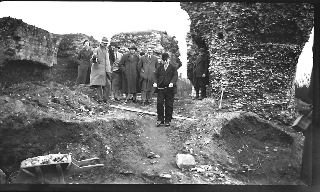
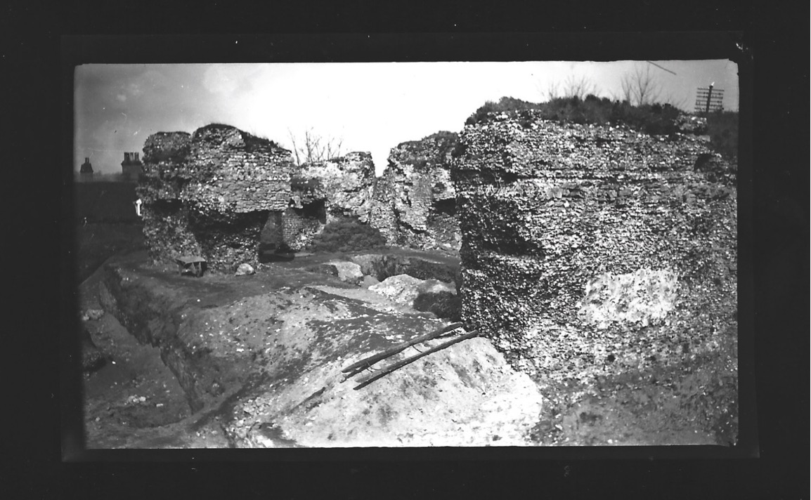
Dr Leonard Cane directing excavations at Bungay Castle in 1934
A group of Bungay dignitaries, led by the Town Reeve and local doctor Leonard Cane, leased the site from the Duke of Norfolk, and on 19th November 1934, the excavation of the site commenced. This excavation took place under the leadership of Dr Cane and Hugh Braun, an architect from London who had worked in Iraq with the Chicago University Expedition at the site of Nineveh. The excavation provided work for unemployed war veterans and interestingly, engaged the services of a local water diviner, one Mr John Davey who can be seen in Fig 2, to locate water and gold during the excavations. Further research is underway in an attempt to discover more about these veterans, and the role played by Mr Davey and his water-magic.
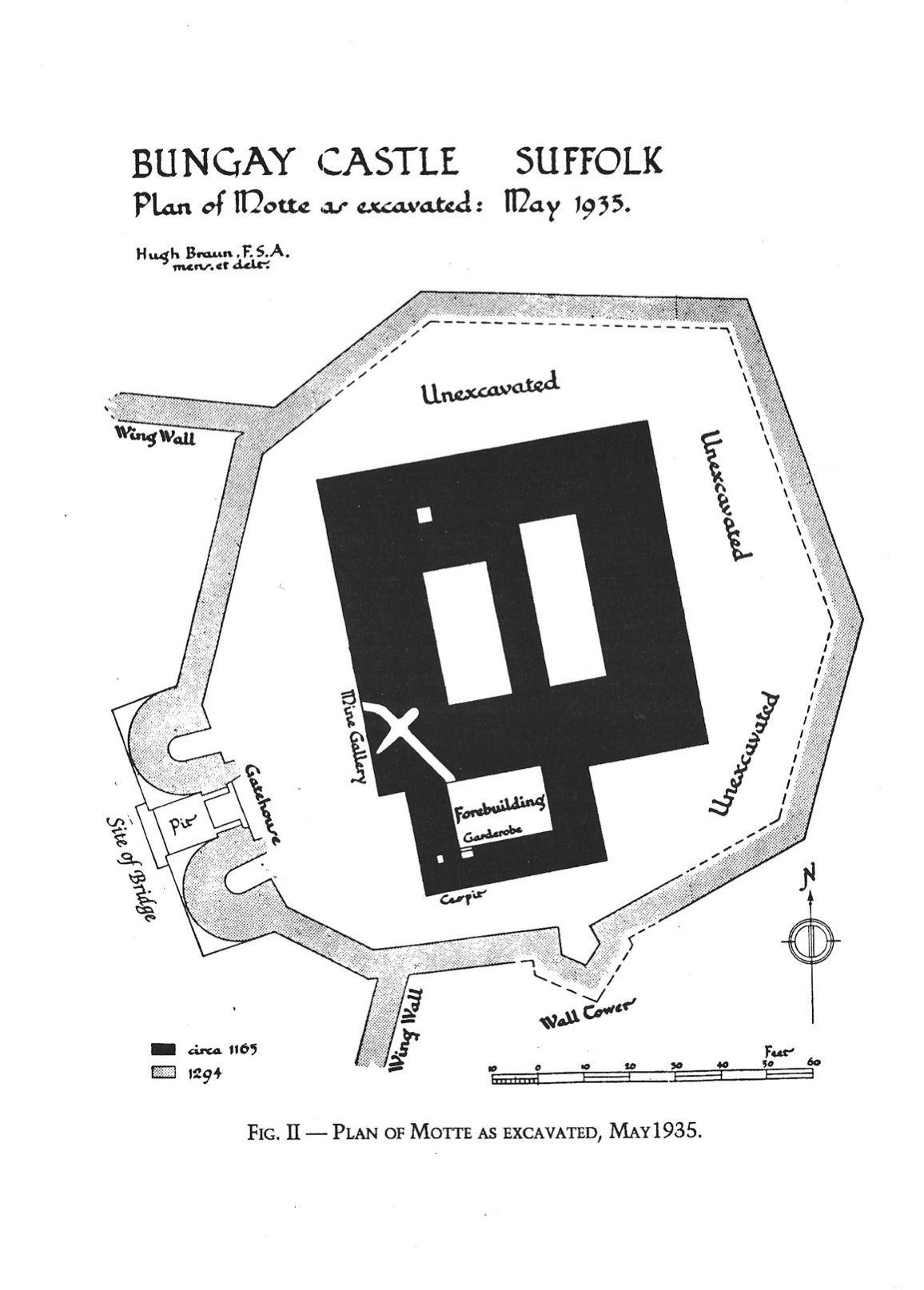
The excavations initially concentrated on the area between the keep ruins and the gatehouse, and around the keep itself, revealing buried walls which “would show the castle rising some twenty feet higher than before the excavation commenced” (Braun 1991, 23). The drawbridge pit was excavated, and the west wall of the keep was exposed, but other areas of the gatehouse and keep were left intact, after the excavation ran out of funds. Some of these areas were, according to Braun’s report, tidied and returfed ready for further exploration at a later date. These areas remain untouched, and no further excavations in the area of the gatehouse or keep have taken place since 1934. The excavations were subsequently published in the Proceedings of the Suffolk Institute of Archaeology and History in 1934, 1935 and 1936. There have been no further major archaeological excavations, although some unpublished monitoring work took place in 2001, 2006 and 2008 according to the HER, and geophysical work took place at the Castle in 1990 (Gaffney & Gater) and 2017 (Schofield). In 2017, what is now Cotswold Archaeology Suffolk undertook a detailed geophysical survey of the area of the inner bailey, which demonstrated very high potential for archaeological material and structural remains. These include evidence for buildings, a potential well, and a variety of pits some of which feature ferrous debris. Bungay Castle holds much potential for further archaeological work.
Map of the Castle Motte (Braun)
These photographs are from the Braun/ Cane excavations at Bungay Castle and are dated to 1935. They are part of the Bungay Museum collection, and there are around 40 images which feature the excavations, the people involved, and a variety local dignitaries and visitors to the site. In January 2021, I became curator of Bungay Museum, which was originally established in 1968 by Dr Leonard Cane’s son, Dr Hugh Cane. As part of this role, I plan to undertake further research into the contents of the museum collection, local contemporary news articles about the excavations, as well as Ministry of Works documents held at Kew, in order to develop new displays about the site and Bungay’s very own version of ‘The Dig’. Basil Brown himself would have certainly visited the excavations, as he lists the site in his notebooks, and he lived relatively locally. I hope my research will reveal more information about the names and lives of the veterans who dug the site, how the excavation was managed and run, more about the archaeological finds, and the mysterious role of water divination in the process. There are many interesting stories waiting to be told about the original excavations at Bungay Castle, and many more are waiting in the wealth of archaeology that remains in the ground.
Feature image: Bungay Castle copyright Andrew Atterwill
References
Braun, H. (1934). “Some notes on Bungay Castle”. Proceedings of the Suffolk Institute of Archaeology and Natural History XXII.1, pp. 109–119.
— (1935). “Bungay Castle, report on the excavations”. Proceedings of the Suffolk Institute of Archaeology and Natural History XXII.2, pp. 201–223.
Braun, H. and G. Dunning (1936). “Bungay Castle: Notes on 1936 excavations and on pot- tery from the mortar layer”. Proceedings of the Suffolk Institute of Archaeology and Natural History XXII.3, pp. 334–338.
Gaffney, C., and Gater, J. (1990). Report on Geophysical Survey, Bungay Castle. Geophysical Surveys Bradford, Report 90/60.
Schofield, T. (2017) Bungay Castle, Bungay, Suffolk BUN 004 Geophysical Survey Report. Suffolk Archaeology Community Interest Company Report No. 2017/078.
Castles were more than military sites, being political, judicial and economic centres too. Duncan Berryman of Queen’s University Belfast looks at one of those aspects, the important but little studied area of agricultural buildings in castles.
The domestic considerations of castles were as important to daily life as their defensive functions. Castles were also the centres of estates; Clare Castle (Suffolk) is a good example of an estate centre with manors in the surrounding region and further afield while Caister Castle (Norfolk) was the centre of a much more compact estate. Manorial centres were generally undefended courtyards of domestic and agricultural buildings. However, many of these were moated sites and their lack of defensibility might be debated. Sites such as Chalgrove (Oxfordshire) and Coolamurry (Wexford) had substantial moats and may have had complex bridges (Page et al. 2005; Fegan 2009). These complexes saw high-status accommodation sitting alongside the barns and animal housing that served as the manorial farmyard. Many smaller castles would have been the centres of smaller estates and would have also functioned as manorial centres. Agricultural buildings were vital to this operation and would have been found within baileys or associated enclosures. To investigate these buildings, it is essential to take a multidisciplinary approach by combining archaeology with documentary and pictorial evidence. The agricultural buildings have often been left unexcavated as they are seen as less important, and less interesting, than the domestic complexes.
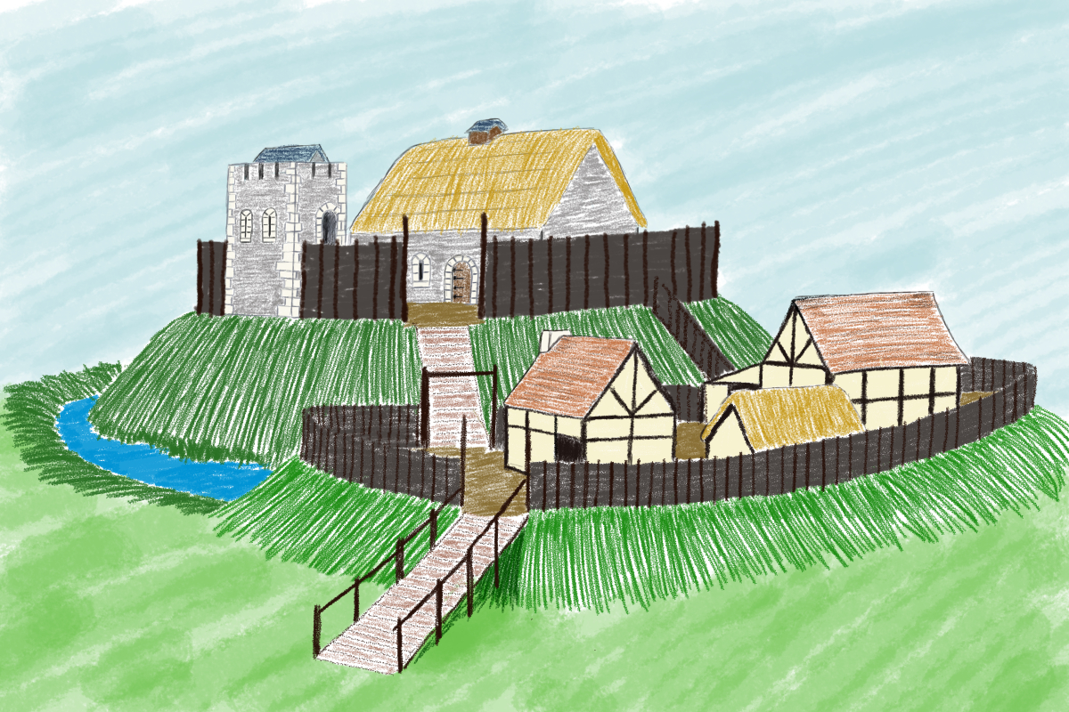
Artistic reconstruction of Clough Castle (Down). Many motte and baileys would have had a similar appearance, often with timber structures on the motte instead of the masonry buildings presented here.
Documentary sources related to Ireland indicate that many smaller castle sites had agricultural buildings within the surrounding area. This is clearly illustrated at Cloncurry (Kildare), where an extent records that beside the motte was “an old haggard close [farmyard] in which there are two small granges [barns] each of eight forks … [t]here is also there, beside the gate an ox-house … [and t]here is a dovecote” (Murphy & Potterton 2010, 175). There is also a record of a barn of ten forks at Castlemore (Carlow), as well as a mill and other timber and masonry buildings (O’Conor 1998, 32). The forks referred to in these accounts are probably the cruck blades of the barn, thus ten forks produce a nine-bay barn that could be the equivalent size of a barn like Bredon (Worcestershire). At Lough Merans (Kilkenny), the motte sat on a promontory in the lake and had an associated bailey containing a granary, stables, and a sheepcote (O’Conor 1998, 30). The motte of Inch (Tippararery) also had a granary and sheepcote, additional buildings were stables, a fish-house, a dovecote, and a malt kiln (O’Conor 998, 29). These examples suggest that, in Ireland, castles were playing important roles as the centres of manorial farms and wider estates. The perceived need for a defensive motte may have been carried over from an earlier period, but it continued with the construction of tower houses in the fifteenth and sixteenth centuries (McAlister 2019, 28-35).
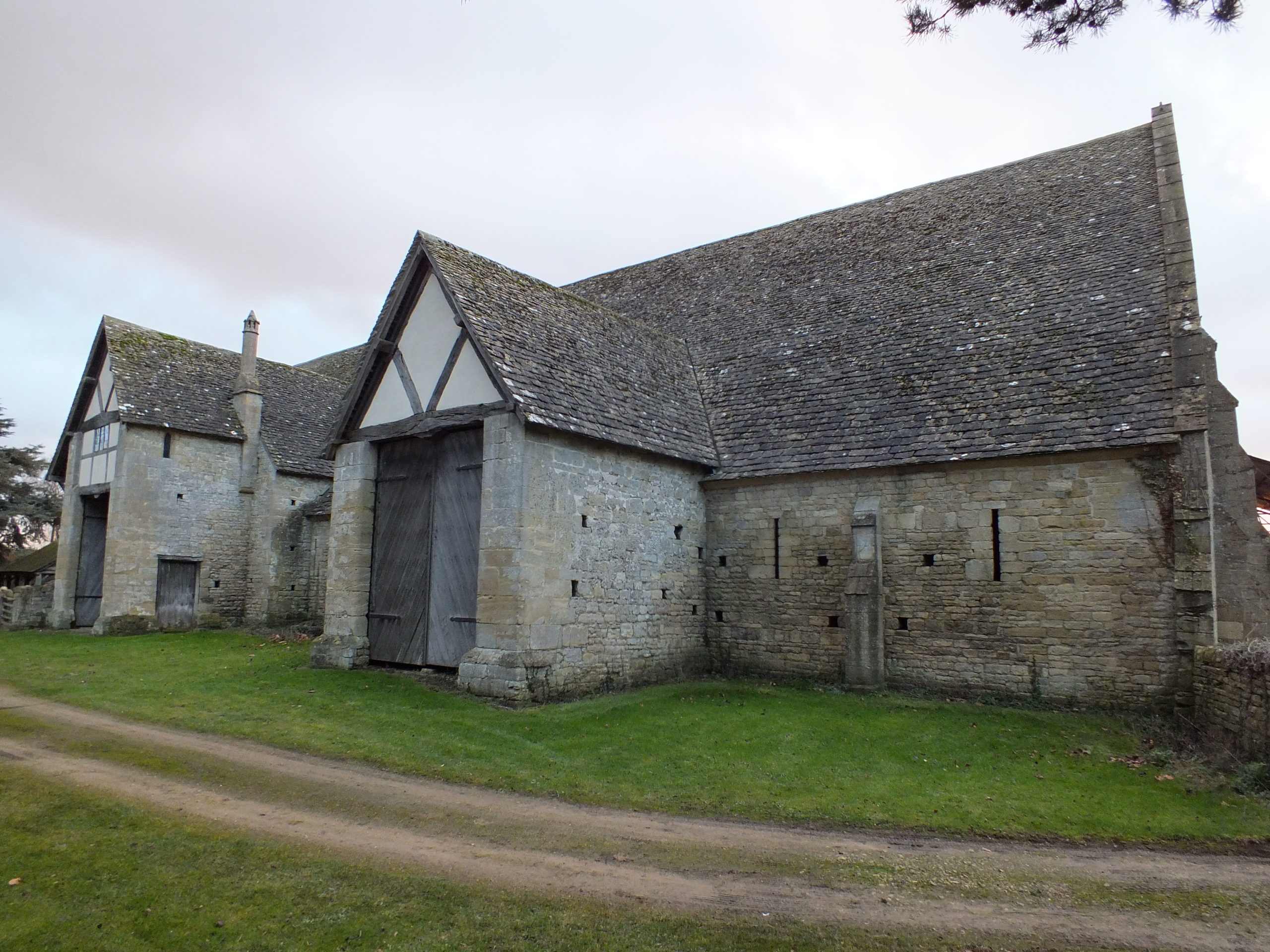
Bredon Barn (Worcestershire). Barns of a similar size were found within castle baileys. They would have been constructed from masonry or timber
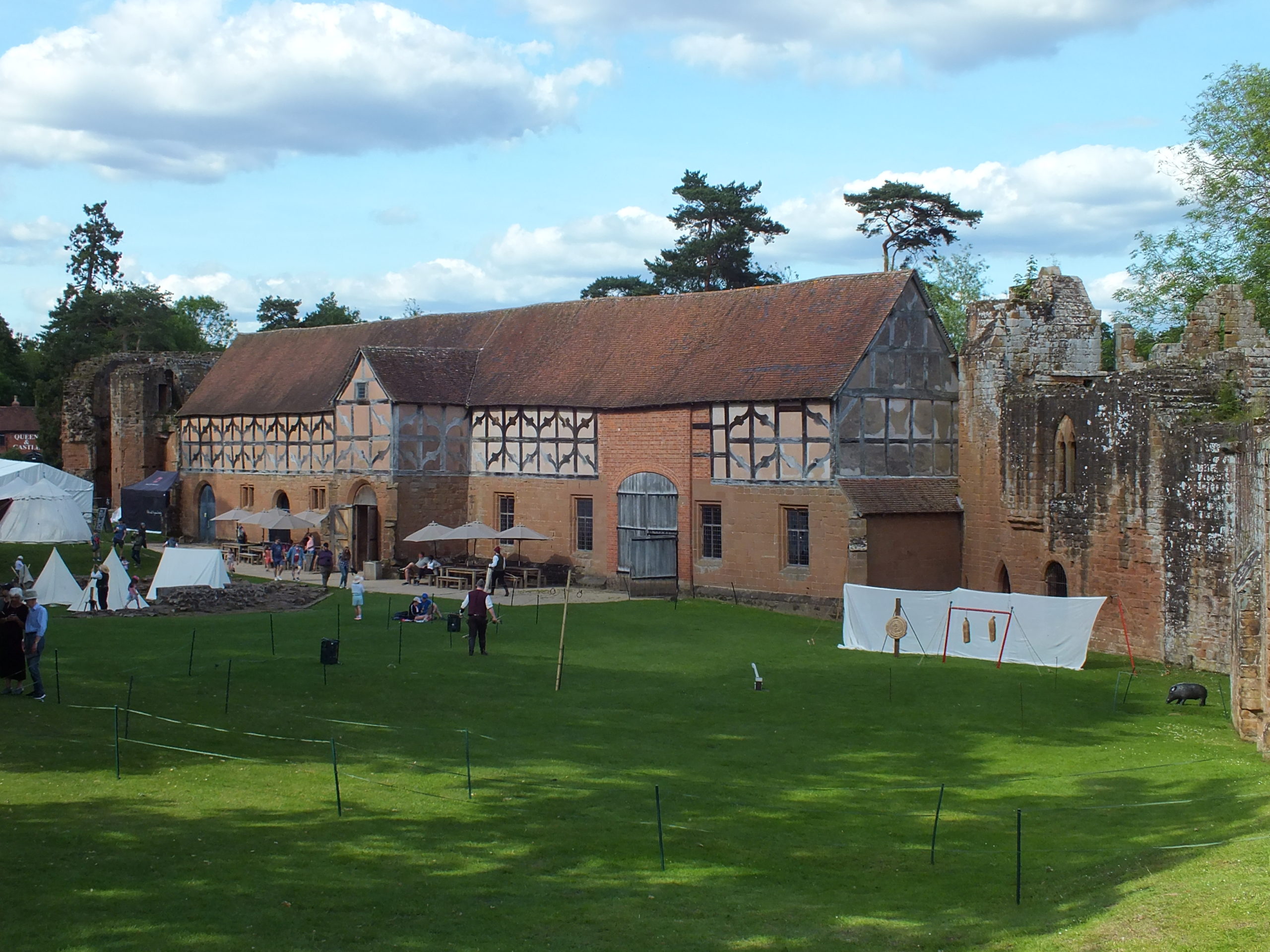
A brief survey of larger castles in England does show that these castles had a small number of agricultural buildings. The main buildings identified were stables, dovecotes, barns, and granaries. These buildings are unlikely to have functioned in the same way as they did in rural manorial centres, but they are a reminder that some agricultural processes occurred within the castle. Stables were obviously for housing the riding horses of the lord or king and their entourage, but they probably also housed the cart horses used by the castle staff to bring goods in from the market. There are records of stables at Hereford, Leeds (Kent), Leicester, Lincoln, Nottingham, and the stables of Kenilworth (Warwickshire) are still extant (Colvin 1963). The dovecote was an important source of food in the form of squabs (young pigeons). A dovecote was recorded at Dorchester (Dorset) and one has been identified in the south-west tower of Bodiam (Sussex) (Colvin 1963; Thackray 2003). The existence of barns might suggest that sheaves of wheat or barley were being brought into the castle and threshed there, providing grain for flour and straw for the stables and other floors around the castle. There is evidence for barns at Acton Burnell (Shropshire), Bamburgh (Northumbria), Hadleigh (Essex), Weoley (Warwickshire), and Pontefract (Yorkshire) (Colvin 1963; Emery 2000; Roberts 2002).
The stables of Kenilworth castle (Warwickshire). This was a particularly grand building, but stables were vital for the lordly lifestyle.
The c.1610 plan of Castle Hedingham (Essex) indicates that there may have been an agricultural complex beside the main castle enclosure (Emery 2000, 113). To the top of the map are buildings labelled stable and barn and an area marked barnyard, in manorial sites this would indicate a complex of crop storage buildings including several barns and a granary. Returning to Clare Castle, the 1325 accounts of the constable indicate that there were a pigsty and poultry house within the castle compound (Ward 2014, 64).
Agricultural buildings are found in areas away from the main domestic complex of the castle, and these areas are often left unexcavated. They were most often made of timber, and thus leave little trace in the archaeology compared to the stone-built structures elsewhere. It is possible that there were more agricultural buildings within castles, or close to them, and they have not yet been identified. This research highlights the importance of using documentary and pictorial sources alongside archaeology and reminds us that lesser castle complexes may have been surrounded by a significant range of buildings.
Colvin, H.M. (ed.) 1963, The History of the King’s Works Vol I & II (London: Her Majesty’s Stationary Office).
Emery, A. 2000, Greater Medieval Houses of England and Wales II (Cambridge: Cambridge University Press).
Fegan, G. 2009, ‘Discovery and excavation of a medieval moated site at Coolamurry, C. Wexford’, in C. Corlett & M. Potterton (eds), Rural Settlement in Medieval Ireland in the Light of Recent Archaeological Excavations (Dublin: Wordwell Books).
McAlister, V. 2019, The Irish Tower House: Society, Economy and Environment c.1300–1650 (Manchester: Manchester University Press).
Murphy, M. & Potterton, M. 2010, The Dublin Region in the Middle Ages: Settlement, Land-Use and Economy (Dublin: Four Courts Press).
O’Conor, K.D. 1998, The Archaeology of Medieval Rural Settlement in Ireland (Dublin: The Discovery Programme).
Page, P., Atherton, K. & Hardy, A. 2005, Barentin’s Manor: Excavations of the moated manor at Harding’s Field, Chalgrove, Oxfordshire 1976–9 (Oxford: Oxford Archaeology Unit).
Roberts, I. 2002, Pontefract Castle: Archaeological Excavations 1982–86 (York: West Yorkshire Archaeology Service).
Thackray, D. 2003, Bodiam Castle (Swindon: The National Trust).
Amidst the tower blocks and industrial landscape of Kirkaldy in Fife is an unexpected sight. Perched on a triangular promontory overlooking the Firth of Forth stands the crumbling ruin of a fifteenth-century fortress. Now fiercely guarded by an abundance of resident seabirds, Ravenscraig is one of Scotland’s lesser-known medieval castles, yet it deserves a closer look, not least because it is a rare surviving example of a castle commissioned by a woman, in this case Mary of Guelders, queen of Scotland (d.1463).
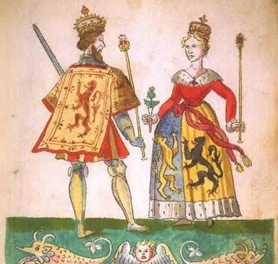
Mary of Guelders and James II
Mary of Guelders first arrived in Scotland on the 18th June 1449 when she stepped onto the shores of Leith ahead of her marriage to James II at Holyrood Palace. Born in Guelders (today the province of Gelderland in Holland) and raised at the Burgundian court, Mary brought illustrious connections to her new home. The match, it seems, was met with approval on both sides: in 1457, Mary’s uncle the Duke of Burgundy sent James the gift of Mons Meg, the famous cannon which can still be seen at Edinburgh Castle today. James’ love of artillery, however, was to also be his downfall. Three years later at the Siege of Roxburgh the 29-year-old king met an untimely end when another of his cannons exploded and killed him. Mary, as this previous blog post has shown, was present at the siege, and following her husband’s tragic death, the newly widowed queen ordered for Roxburgh to be razed to the ground. From 1460 until her own death three years later, Mary acted as regent of Scotland, ruling on behalf of her young son, James III. It is also from this point that she becomes visible to us in the historical record as a prolific patron of architecture.
Mons Meg, Edinburgh Castle. Photo by Lee Sie, licensed CC-BY-SA 2.0.
The nature of the evidence means that we don’t know too much about Mary’s actions during her marriage, but the few glimpses we can glean suggest that she played a relatively active role as consort, including at her husband’s first parliament in 1450. She was also present at the siege of Blackness Castle in 1454 (which James afterwards gave her as a gift to celebrate the Scots’ victory), and she appears to have been the driving force behind the couple’s foundation of a hospital at Fale near Glasgow. It is during her brief stint as regent, however, that Mary’s enthusiasm for building projects really becomes apparent: she not only commissioned Ravenscraig, but also Trinity College Kirk in Edinburgh, as well as improvements to Falkland Palace, which included the first recorded instance of a gallery in Scotland. Recent dendrochronology carried out by Dr Coralie Mills and Hamish Darrah on the tower of St Giles’ Cathedral in Edinburgh on behalf of Historic Environment Scotland has also revealed Mary’s likely involvement in the fifteenth-century alterations there. Ravenscraig was therefore one of a number of works which Mary undertook during her regency.
Shortly before his death, James II had gifted the estate of Dysart to Mary, after which she funded her major works at Ravenscraig entirely from her own revenues. We know from the Exchequer Rolls that she spent 600 pounds Scots on the castle, but it could have been considerably more, as the accounts of the queen’s lands for the first term after the king’s death are missing. Building began in the east, but Mary died before she could see the castle finished, at which point the regular flurry of works ceased altogether. Part of the castle was inhabitable before her death, however, as in 1461, the queen’s steward was able to stay there for 25 days along with several of her servants.
From the outset, Ravenscraig appears to have been intended to have a strong military appearance and is believed to be the first castle in Scotland designed to withstand cannon fire. For this reason, it has been treated as something of an enigma by historians and heritage professionals, who often regard the military design as being at odds with its supposedly intended use by Mary as a dower or “retirement’’ house. Yet the two are not necessarily incompatible. Mary’s decision to fortify the castle and to protect a vulnerable piece of coastline made perfect sense given the changeable nature of relations with the English at this point.
It was also not unusual for women elsewhere in Europe to be involved in military endeavours at this time. Mary’s contemporaries in Renaissance Italy, for example, frequently acted as military managers, fortifying towns and cities and supplying provisions and resources. Closer to home, Margaret of Anjou, with whom Mary negotiated terms in 1460, was also commissioning works on several English castles around this time, including the refurbishment of the keep of Pleshey Castle in brick. Equally, Mary’s aunt, Isabella of Portugal, in whose court the queen of Scots had been raised, was a politically active and energetic architectural patron. Mary therefore came from a tradition whereby architecture was commonly adopted as a language of female power. It is also possible, particularly given the circumstances of James’ death, that Mary intended for Ravenscraig to be part of a larger commemoration project for her husband, which also included her mausoleum at Trinity College Kirk in Edinburgh.
The termination of the works at Ravenscraig upon Mary’s death in 1463 suggests that she was very much the driving force behind them. James III showed little interest in his mother’s project, instead granting the castle to the Sinclair family, who completed the building. Nevertheless, the remains stand as a testament to the ways in which Mary chose to materially express her authority as regent. They also pose a challenge to the overwhelmingly male narrative that has long dominated castle studies, reminding us that women could, and did, play active and sometimes innovative roles in shaping the physical and social life of late medieval castles.
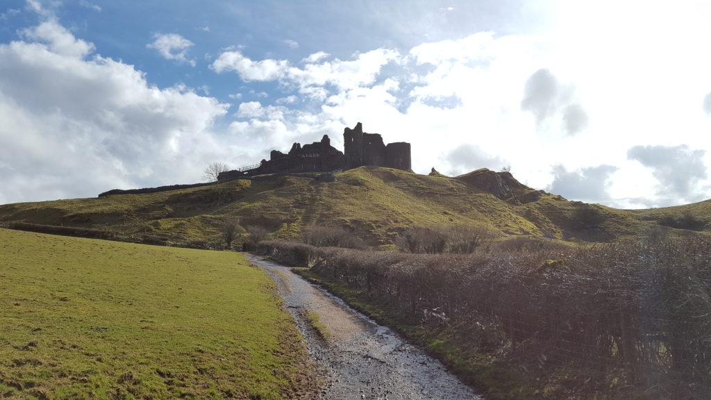
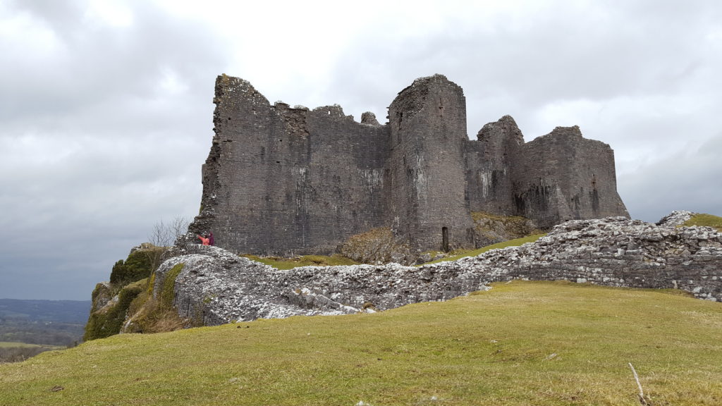
The striking ruins of Carreg Cennen Castle in south Wales have a rich history, bound up in power struggles between the Welsh and English and the Wars of the Roses. Dr. Dan Spencer takes us on a journey through its past.
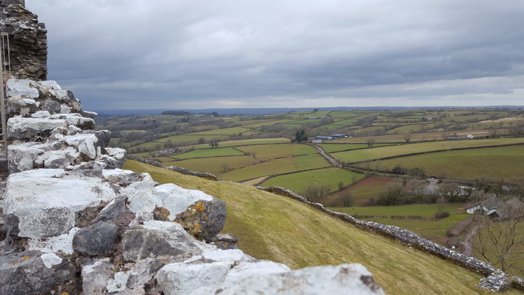
Carreg Cennen was most probably founded by the Welsh prince of Deheubarth, Rhys ap Gruffydd, in the late twelfth century. It is situated in a prominent position on a high limestone crag overlooking the River Cennen. Carreg Cennen was later captured by the English during the conquest of north Wales in the late thirteenth century. Edward I granted the castle to John Giffard, Lord Giffard of Brimpsfield, who extensively rebuilt the castle. Carreg Cennen was acquired by Henry, duke of Lancaster, in 1340, and thereafter by marriage to his son-in-law, John of Gaunt, duke of Lancaster, son of Edward III. The duchy of Lancaster subsequently passed into royal ownership, upon the accession of Henry IV, Gaunt’s eldest son, to the throne in 1399. Carreg Cennen was captured by the rebels of Owain Glyn Dŵr in the early fifteenth century, with repairs carried out during the reign of Henry V.1
In 1455, Welsh landowner Gruffydd ap Nicolas seized the castle, taking advantage of a power vacuum in south Wales, where many of the principal royal offices were held by absentee officials. This move was not welcomed by the government of Henry VI. Gruffydd subsequently came into conflict with Edmund Tudor, earl of Richmond, a half-brother of the king, in the following year. Richmond eventually emerged victorious from the struggle in the late summer of 1456, at which time it appears that Gruffydd relinquished control of Carreg Cennen.2 The earl died of the plague later that year, with the task of maintaining royal authority in southern Wales thereafter entrusted to his brother, Jasper Tudor, earl of Pembroke.
In 1459, civil war broke out when the Yorkist lords, Richard, duke of York, Richard Neville, earl of Salisbury, and his son Richard Neville, earl of Warwick, attempted to seize power. This development prompted Jasper to install a garrison in the castle, which remained in place until at least the following year.3 It is not known how large the garrison was, and Carreg Cennen appears not to have seen any military action at this time. This is not surprising, as potential attackers would have been deterred by its strong defences. It was also in a relatively isolated location, far removed from the main areas of conflict.
Instead the fate of Carreg Cennen was decided by events elsewhere. The decisive clash of the conflict took place at the Battle of the Towton on 29 March 1461, the largest engagement of the Wars of the Roses. The Yorkists led by Edward IV were victorious, with Henry VI and his remaining supporters forced to take refuge in Scotland. Later that summer, Edward delegated the task of subduing Wales to some of his trusted supporters, who included William, Lord Herbert.4
By the end of 1461, the Yorkist commanders had succeeded in conquering almost all of Wales (with the main exception of Harlech in the north-west), and Jasper Tudor fled overseas. This left Carreg Cennen as the last remaining Lancastrian fortress in the south. In the spring of 1462, Lord Herbert instructed his half-brother, Sir Richard Herbert, and another member of the gentry, Sir Roger Vaughan, to take control of the castle. They set off from Raglan Castle, Herbert’s ancestral seat, with a force of 200 gentlemen and yeomen and soon reached Carreg Cennen. The defence of the latter was led by Thomas and Owen ap Gruffydd, sons of the recently deceased Gruffydd ap Nicolas. It is unclear whether they had been given this responsibility by Jasper Tudor, or if they had exploited the situation to take control of the castle. Either way, the brothers were said to have a large force under their command and had a strong defensive position. Nevertheless, the futility of the Lancastrian cause prompted them to surrender under terms. They were pardoned in return for pledging allegiance to Edward IV.5
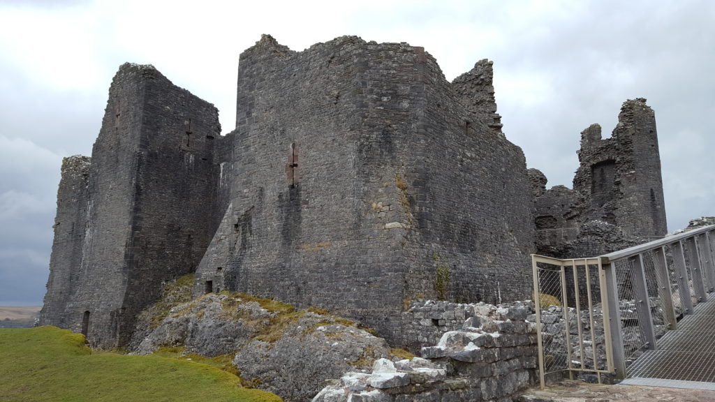
On Lord Herbert’s instructions, the castle was provisioned, and a garrison was installed for its safeguard. This consisted of a small force of nine men, who served there from the beginning of May until mid-August. These men each received 4d. per day in wages, the standard rate for footmen or archers at this time, as well as 1s. 10d each per week to pay for their expenses.6 The garrison was required, as is explained in a surviving letter from Edward IV, because ‘the said castle was of such strength that all the misgoverned men of that country there intended to have inhabited the same castle and to have lived by robbery and spoiling our people of the country’. However, as the letter went on to explain ‘we soon after were advised that the said castle should be thrown down and destroyed’ to avoid the inconvenience of expending money on maintaining its defence. The source of this advice is unspecified, but it could have been from Lord Herbert, who, as chamberlain of south Wales, was acutely aware of the financial burden of paying for its garrison. This was an extraordinary decision, as no other castle was slighted by royal command at this time, which may have reflected Yorkist concerns about its potential as a formidable fortress in an area with Lancastrian sympathies. It could also have stemmed from more general unease about law and order in the region. The king therefore issued orders to Herbert to oversee its destruction. A labour force of 500 men was recruited who used a variety of tools to ‘break and throw down’ the castle.7 The extent of the destruction is unclear, but at the very least the labourers made the place uninhabitable, with Carreg Cennen thereafter falling into ruin.
[1] J. M. Lewis, Carreg Cennen (Cardiff: Cadw, 2016), p 1; H. M. Colvin, The History of the King’s Works, volume 2 (London: H.M.S.O, 1963), p. 602.
[2] For Gruffydd’s seizure of the castle and conflict with Edmund Tudor see, William Rees, ed., Calendar of Ancient Petitions relating to Wales (Cardiff: University of Wales Press, 1975), pp. 184-6; PL, I, pp. 392-3.
[3] For the garrisoning of Carreg Cennen by Jasper see, TNA, DL 29/584/9249; DL 29/596/9558.
[4] For an overview of these events see, Anthony Goodman, The Wars of the Roses (London: Routledge & Kegan Paul, 1991).
[5]. For the occupation of the castle by the sons of Gruffydd ap Nicolas and its surrender see, TNA, SC 6/1224/6; SC 6/1224/7.
[6] TNA, SC 6/1224/6.
[7] Quoted from TNA, SC 6/1224/7, whose Middle English text has been modernised.
Bethany Watrous of Experience Heritage examines how her digital reconstruction of the Jacobean manor house at Slingsby Castle sheds light on its original form when first built in the C13.
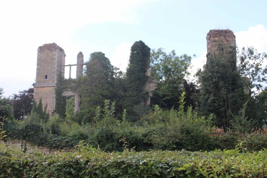
The ruins of Slingsby Castle, Yorkshire
The mysterious Slingsby Castle in Slingsby Village, North Yorkshire, is a ruin of a 17th century manor built on the site of a 13th century moated castle which survived, at least in part, into the early 17th century. The manor was built for Sir Charles Cavendish II, grandson of infamous Bess of Hardwick, by John Smithson. An earlier design for a manor on the same location was created for Sir Charles Cavendish I by Robert Smythson, father to John (who changed the spelling of the family name). Original architectural sketches for both versions of the manor still exist in the Royal Institute of British Architects’ Smythson Collection.
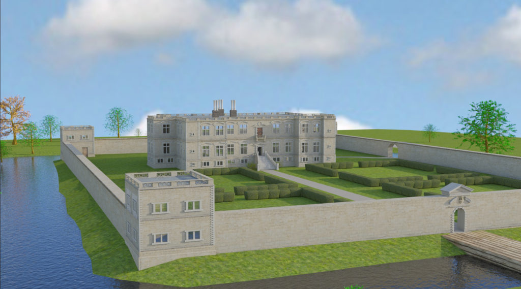
It was with this evidence, as well as further historical record, that I set about reconstructing both versions of the manor in digital 3D. The intention of this project was multifaceted. The ruins of Slingsby Castle have long been left to decay and the local community was in discussion about whether to put funding into refurbishing the site or allowing it to continue to be reclaimed by nature. Interactive digital models would help to engage the public in the conversation. However, the digital reconstruction would also provide further research about a site with a greatly confused historical record. It would help to tell a story about a significant phase of British architecture and give better insight into the original medieval castle.
The little we know about the original medieval castle comes from historical writings and archival material. A royal license was granted in 1216 for a manor or castle on a site owned by the Wyvilles. It was sold to Ralph de Hastings in 1344 and in the same year, a license was sought to crenellate a structure there1. In 1475 William Lord Hastings was granted permission to “build, enclose, crenellate, embattle and machiociolate”2 and it’s believed that this was the time of the creation of the moat. In 1619, the historian Dodsworth visited the site and described seeing the Hastings’ crest over the gates and a “church within the castle walls”3. The Jacobean manor was likely built on the site soon after Dodsworth’s visit.
There are many theories as to whether the Jacobean manor reused original parts of the castle. The site has not been inspected by modern archaeologists and we were not able to gain access for the purpose of this study. Modern historians disagree on the topic. Some believe no part (including the moat) of the Jacobean manor is medieval, while others have found evidence suggesting otherwise.
3D model of Jacobean manor, by Experience Heritage
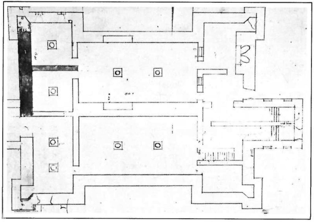
19th century historians described what then still remained of the 17th century manor including a wall running along the inside of the moat and “turrets at each angle”4 which some believed to be remains of the medieval bailey walls3 or following the original footprint. Another theory suggests that the original structure was either incorporated in or influenced the development of the basement vaults. On multiple floor plans, attention has been drawn to the irregular nature of the northwest room’s west wall.
The earlier, Elizabethan floor plan may give us insight into another piece of the medieval castle. The plan contains all the symmetrical balance of a typical Elizabethan design except for the off-center placement of its gatehouse. During the digital recreation and movement through the 3D model of this plan, the sharp curve of the path from gatehouse to main house was too jarring to ignore. Furthermore, when studying the plan, it became apparent that the manor’s only gatehouse was not meant to be the main entrance. On the opposite side, the main entrance leads over a stepped bridge to a raised terrace, whereas the door into the manor from the garden is hidden to the side of the portico. This suggests that the gate’s real purpose was as a reused medieval ornament for exhibition during progression around the estate. Therefore, Smythson’s floor plan may capture the outline of one part of the original castle.
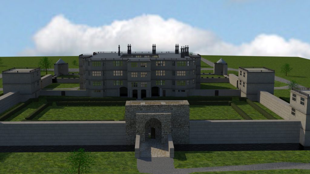
View of the off-centre gatehouse as part of the 3D model of the Elizabethan design, by Experience Heritage
Bethany Watrous is the director of Experience Heritage which combines her archaeological and digital backgrounds to create engaging, authentic and interactive digital displays, 3D models, film and mobile apps for the heritage sector. Learn more at www.experience-heritage.com.
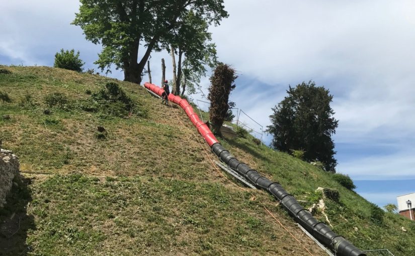
Over the last two decades, the Marlborough Mound Trust has carried out extensive conservation and investigations on the ‘mound’ in the grounds of Marlborough College. The origins of the mound were uncertain until recently. It was known to have been part of Marlborough Castle, but there had been persistent speculation, on the strength of its resemblance to neighbouring Silbury Hill and the discovery of antlers in the early twentieth century (now lost) that it was of prehistoric origin. In 2008, when Silbury Hill was being investigated, the opportunity of taking cores from the mound to obtain comparative dates presented itself. After a precarious operation involving a very large crane, the necessary drilling rig was hoisted to the top of the mound. The resulting cores, as a paper published the following year by Jim Leary and his colleagues showed, supported a date in the second half of the third millennium BC, broadly contemporary with Silbury Hill.
The drilling rig for the coring operation is hoisted into place (copyright Marlborough Mound Trust)
Jim Leary has subsequently carried out a survey of some fifty castle mottes, looking for other sites where prehistoric mounds could have been reused as the base for a castle, and has found only one other rather uncertain case. This means that Marlborough may be unique in being a prehistoric structure recycled into a medieval castle.
But we now know more about the prehistory of the mound than the supposed castle keep. The only possible sighting of masonry on the mound is uncertain in the extreme. H. C. Brentnall, a master at Marlborough College, in one of his many contributions to the Proceedings of the College’s Natural History Society on the the history of the castle, had this to say in 1936:
“Excavations necessitated by building operations at Marlborough College in the course of this summer have revealed several traces of the medieval castle which perished gradually between the fifteenth and seventeenth centuries. What little remains above ground (if the elevation justifies that expression) is to be seen on the summit of the motte, where a buttress of the keep was laid bare some years ago.“
The note implies that the buttress was visible in 1936, but recent geophysical surveys have not found it.
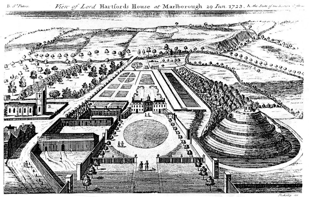
The problem is further compounded by the subsequent use of the mound. It became a garden feature in the seventeenth century, and a spiral was cut into the side of it to give access to a summerhouse at the top. Stukeley’s engraving of the countess of Hertford’s gardens in 1723 shows only the summerhouse, and no traces of masonry.
Stuckley’s engraving of countess of Hertford’s gardens.
About the same time, a water tank was installed to supply the Hertfords’ newly built mansion. This was enlarged by the College after its establishment in 1843, and adapted over the years, until the top of the mound was graced by a large iron tank surrounded by a spoil bank, concrete steps, and substantial pipework. This meant that in effect most of the original top of the mound had been destroyed.
This raises the question of what we are looking for. The earliest mentions of the site, in 1070 and 1110, present the king’s establishment as a place of imprisonment and a site where a royal court was held. In the 1140s, Marlborough castle is first mentioned as such. It is described ‘very defensible’ in The Deeds of King Stephen. It was held by John Marshal, who used it to control the surrounding countryside, and there is no record of it ever being attacked.
The only entry in the plentiful records for the castle under Henry II and Henry III is in the context of payments in 1222 for work designed to create a substantial royal residence there. This is a single sum for the building of a lime kiln ‘for the Great Tower’, which must therefore have been of stone. There is no indication where this tower was sited, and it may well have been part of the lower bailey. It has simply been assumed that it was on the mound.
An inconclusive exploratory dig was carried out by Wessex Archaeology for the Mound Trust in 2019, and at the time of writing, it is still hoped that a follow up to this will be possible in 2020. The present assumption is that the mound was among the hastily erected timber forts from immediately after the Norman conquest, and that this was replaced by a stone keep after 1222. It would be good to be able to find some actual evidence as to the nature and even the existence of the keep at Marlborough.
Richard Barber is a trustee of the Marlborough Mound. He would welcome any comments, particularly on the replacement of timber with stone, and the nature of ‘great towers’: email rwbarberuk at yahoo.co.uk.
Sara Cockerill, author of the recently published biography of Eleanor of Aquitaine, looks at her role in English castle development.
One of the areas which has stayed slightly “off-camera” as I have written about Eleanor is the question of her relationships with the castles of her era. The headlining castles built under Henry’s aegis show no signs of Eleanor’s input. More intriguing however, is her relationship with those castles which pre-dated Henry’s reign and which found themselves in need of a bit of TLC – not necessarily from a military point of view, but in order to function as homes as well as defences. Where this sort of work is concerned there seems to be some ground for tracing a link between Eleanor’s regencies and the initiation of refurbishment programmes.
To start with the most obvious example – the Tower. On Eleanor’s first arrival in London the Tower was uninhabitable, and the royal couple had to stay instead at Bermondsey Abbey. While it is clear that Henry II put Thomas Becket in charge of refurbishing the equally run down Palace of Westminster, money does not commence to be spent on the Tower until 1166 – during Eleanor’s regency, suggesting that she had some hand in the decisions as to its refurbishment. Quite what these were is of course a matter of some debate, but they included as well as defensive works, quasi domestic features, such as work to the chapel and living accommodation.
Another castle which came under Eleanor’s review is Berkhamsted – initially given to, and refurbished by Becket, it was transferred to Eleanor, who held the barony as part of her dower assignment, during the course of Henry’s quarrel with Becket, with the royal family spending Christmas of 1163 there; an event which involved numerous items of plate being sent from Westminster to dress the rooms to best advantage. In the years which follow, again during Eleanor’s regency, there is regular work noted in the accounts, on the “Kings houses” there, at the granary, the bridges – and the lodgings. Her interest in the property is further evidenced by her travelling to stay there as soon as she gained a greater measure of freedom in 1184, with the advent of her daughter Matilda, then in exile from Saxony. Eleanor and Matilda’s family seem to have spent the whole summer there. And finally – work stops on the castle just at the period when Eleanor departs to her retirement in Poitou. However even in retirement her steward for the Berkhamsted estate would travel to visit her at Fontevraud….
Berkhamsted Castle bailey from the motte including remains of buildings built in Eleanor’s regency
Other places where Eleanor was particularly at home and where her interest can be traced are Old Sarum (Salisbury) and Winchester – her main locations during her captivity. But everything suggests that she was sent there not because she disliked them, but rather the reverse. Both are places she positively chose to visit on more than one occasion as regent in the 1150s and 1160s. Winchester, of course, was Henry I’s main residence, and had benefitted from a constant programme of renewals ever since. Interestingly however its domestic architecture was thoroughly overhauled from the year after Eleanor arrived in England. In 1155–6 £14 10s. 8d. was paid for making the king’s house and the next year another £14 10s. was spent for work on just one chamber in the castle. In 1170 £36 6s. was paid, and in 1173 £56 13s. 1d. was paid for work on the king’s houses at Winchester and £48 5s. for work on the castle and provisioning it. Large sums of money were, interestingly paid for the King’s chapel, in the years when Eleanor was a frequent resident there in confinement. To this period too can be traced the first indications of development of the gardens. Old Sarum for its part had a residential area which was modern, having been built as recently as 1130 under the aegis of the then bishop. During Eleanor’s residence at Salisbury in the 1170s and early 1180s, there was consistent expenditure including £47 on the houses in the year Eleanor came to live there. That Eleanor positively liked Salisbury is shown by the fact that after her release she chose to organise the wedding of André de Chauvigny to the heiress Denise of Déols there; and Winchester too was a voluntary stop for her more then once in her later years.
Old Sarum from the west in C12, (Model: John B. Thorp. Photo: Kurt Kastner)
In a similar category is Windsor castle. Though predominantly a project of Henry’s – the defensive remodelling smacks of his planning – Eleanor spent considerable periods of time here – bearing Matilda here when the castle must have been a building site, and visiting repeatedly both as regent when she may well have had a hand in the development of the domestic buildings, which were to form a family base for her descendant Henry III’s family. Again it is a castle she seems to have positively chosen to visit with Matilda on Matilda’s return, and again following her release.
Although of course Berkhamsted has fallen into disrepair, one can perhaps therefore trace Eleanor’s hand in creating a core of castles which could double as homes, which was to influence the lives of generations to come.
Featured image: Aerial photograph of Old Sarum site, on departure from Old Sarum airfield by Mark Edwards.
This is an edited version a talk given by Béla Zsolt Szakács gave at the Leeds International Medieval Congress in July 2018 and published in the Castle Studies Group bulletin.
Since the political changes of 1989/90, the countries of East Central Europe have been trying to overcome the century-long lagging behind Western European regions. An important element of the rebuilding of national identities in these territories is the ‘glorious’ medieval past. Understandably the visual expression of this medieval past is a focus of political and cultural interest. Castles are primary objects – so to say, victims – of this interest.
The year 2000 was celebrated in Hungary with a special pomp since it was not only the second millennium of Christianity, but also the 1000- year anniversary of the Hungarian kingdom was established by King Saint Stephen (c.1000–38). As a result of this, there was a great need of memorial sites, however, practically all important royal monuments and residences had been destroyed during the Ottoman wars and the Baroque period.
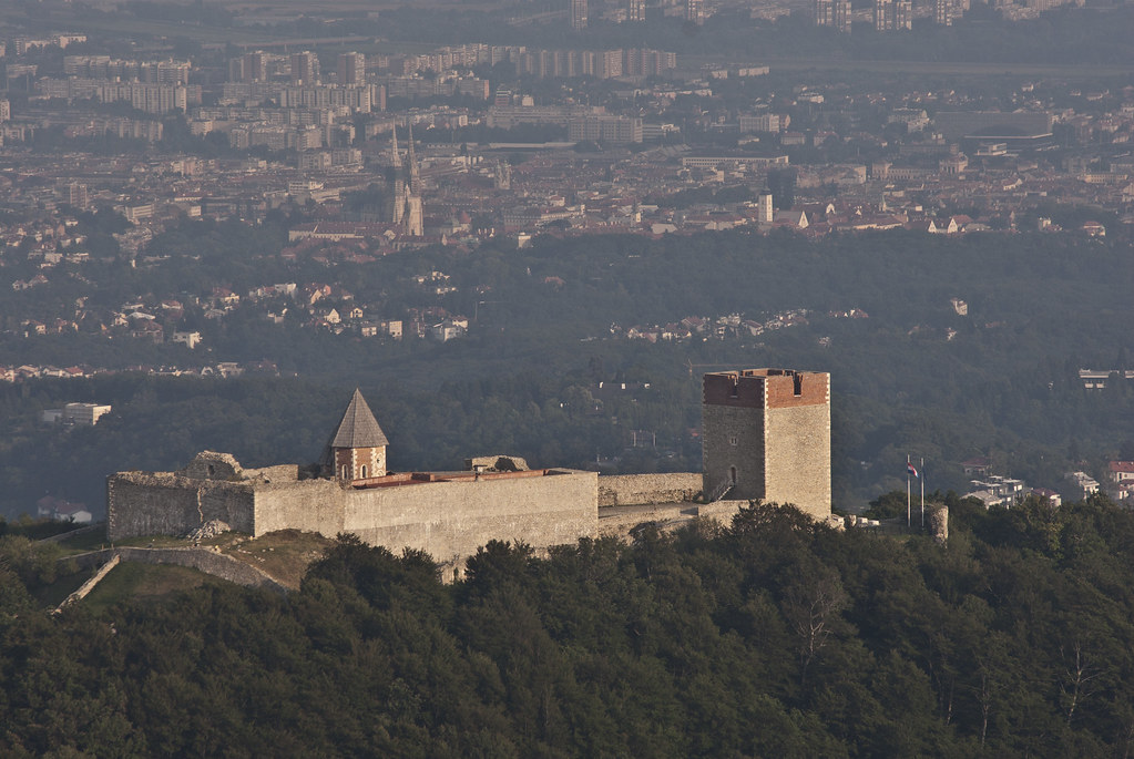
One of them is the royal castle of Esztergom, the former capital of the Hungarian kingdom and centre of the Catholic Church. Excavations of the surprisingly well-preserved Romanesque castle started in 1934 and the first phase was finished by 1938. By 2000, further elements of the royal (later archiepiscopal) castle had been identified.
Castle Hill in Esztergom in 1955. It was the site of the medieval castle and now the basilica. Photo from Wikimedia Commons, licensed CC-BY-SA 3.0.
Following the plans of Tibor Gál, a renowned Hungarian architect, a postmodern reconstruction was carried out at the site. The new building complex incorporated the Romanesque and Gothic remains of the palace with additions designed in a style that recalls, but does not imitate, the medieval past of the site. The courtyard was closed with a gate that never existed in the Middle Ages. Around the courtyard, remains of the Romanesque palace and a Gothic audience hall are standing. Although some of the windows were partially preserved, they were fully reconstructed, in other cases they were imitated by modern steel constructions. The results of the whole work were harshly criticised for being confusing and totally alien to the medieval original.
Esztergom Castle in 2013. Photo by Krystian Cieślik, licensed CC-BY-SA 3.0.
Another historic monument extensively rebuilt in 2000 is the Royal Palace of Visegrád. This romantic site – near to Esztergom and Buda, capitals of the kingdom – was a royal residence in the 14th century and an important hunting lodge of King Matthias (1458–90). It was destroyed during the Ottoman wars, and excavation of the remains began in 1934 and are still continuing. The most spectacular part is the north-eastern palace with its courtyard. The corridors around the courtyard were vaulted, the imprint of which were discovered during the excavations. With the help of the in-situ corbels and the excavated ribs a reconstruction of the east wing was carried out in 1952. This was continued with smaller additions in 1970, resulting in a complicated architectural complex of terraces, ruins and reconstructed building parts. In 2000 the palace was extensively rebuilt incorporating all the previously discovered and reconstructed elements. This was not a full reconstruction as the additions stopped where no information was available.
The Royal Palace of Visegrád in 2013. Photo by Allexkoch, licensed CC-BY-SA 3.0.
Nevertheless, this resulted in a still ruinous palace with many unverifiable details. The whole concept was based on the studies of Gergely Buzás, archaeologist and art historian (later director) of the local museum. His pioneering monograph published in 1990 contained a possible reconstruction. However, while the drawing is a scholarly attempt of a theoretical reconstruction, the building work in 2000 made permanent the understanding of the castle at a particular point in time. The vaulting reconstruction of 1952 has already proved to be erroneous, but has been never corrected. The present, much bigger volume of the reconstructed loggiaa (a covered gallery) is still debated.
The reconstructed loggia. Photo by EtelkaCsilla, licensed CC-BY-SA 3.0.
These actions, in 2000, were strongly connected to the memorial year and were supported generously by the government which needed representative sites for political purposes. They represented different methodologies: the postmodern reconstruction which did not imitate medieval forms but was inspired by them and a scientific reconstruction which claimed to be authentic. Visegrád was the most extensive but was followed by many other examples in the next decades.
One them was the castle of Diósgyőr in Northern Hungary, now part of the modern city of Miskolc. This important site was a royal castle built by King Louis the Great of Hungary (1326–1382) in the second half of the 14th century. Later it became the property of the Hungarian queens who made some modifications during the 15th and 16th centuries. Beside its political significance, this castle is regarded as an outstanding monument of Hungarian secular Gothic architecture.
Since the 18th century the building has been in a ruinous state: only the four towers standing on the four corners have been preserved more-or-less intact (but without the uppermost floors and the roofs), all the palace wings have been destroyed. The state of preservation of the ruins deteriorated during the last decades of the twentieth century.
Shortly after 2000, plans were drawn up by architects in order to preserve the existing walls by new additions, which led to the idea of a radical reconstruction. The reconstruction was partial, keeping one of the towers in its ruinous state, and leaving the western wing unfinished However, many details were totally reconstructed which provoked heated debates.
The castle in 2016. Photo by CivertanS, licensed CC-BY-SA 4.0.
One of the reconstructed rooms is the knights’ hall. The vaulting system is authentic, but the form of supporting piers is not known. The present room has two windows and two portals on the south façade, although according to an 18th-century drawing, there was only one window and one portal. The additional portal is based on a stone-carving, but its shapes were not followed precisely and it fits better to the chapel rather than the knights’ hall. The windows’ shape follows its presumed 14th-century form, consequently the original late-medieval additions were removed. The reconstruction resulted in the destruction of one of the latest original elements of the medieval building in order to return to an earlier phase; unfortunately, the original form of this earlier window is not known: the present form is purely hypothetical.
The Knights’ Hall in 2018. Photo by ArBePa, licensed CC-BY-SA 4.0.
All the other wings were rebuilt with Renaissance windows, again without any archaeological evidence. In other cases original elements were destroyed because in their survived form they were not strong enough to support the modern reconstruction. Modern functions were also destructive, e.g. the royal apartment was replaced by an elevator. The amateurish furnishing of the interiors needs no further criticism.
So far we have seen some example of the recent castle reconstruction from Hungary. Nevertheless, such reconstructions can be found easily all over East Central Europe. I will limit myself to three well-known examples.
The first is from Croatia. The castle of Medvedgrad is situated above Zagreb and is a popular destination. It was probably built by the bishop of Zagreb in the mid-13th century. One of the most spectacular elements of this reconstruction is the chapel. This was totally reconstructed using the original carved stones of the supporting and vaulting system, the rose window and the portal. The lower castle ended in a keepwhich unfortunately collapsed in 1954. Thus the present building is a total reconstruction.
Medvedgrad’s reconstructed chapel (left) and keep (background). Photo by August Dominus, licensed CC-BY-SA 4.0.
The reconstruction works intensified after 1993, in a period when Croatia was fighting for its independence. The castle of Medvedgrad became a national monument, and a memorial was built there for the victims of the war of 1991–95. Although the castle itself never played an important historical or military role, its position above the country’s capital and the national ideology connected to it, predestined it to be the subject of an intensive and controversial reconstruction.
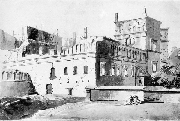
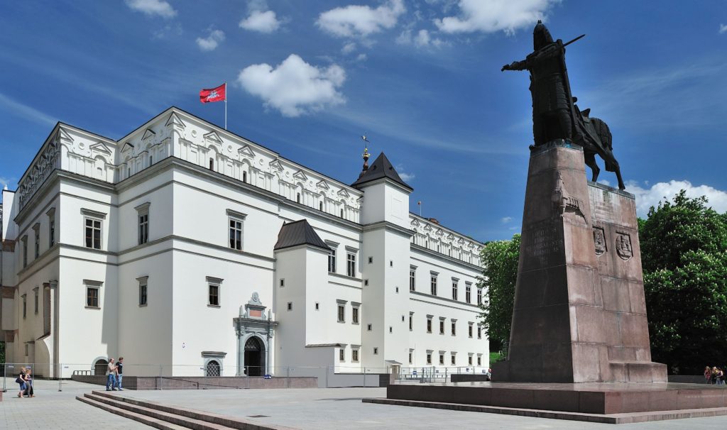
Similar national feelings inspired the reconstruction of the grand ducal palace in Vilnius. It was constructed in the 15th century and rebuilt during the subsequent centuries. During the Russian wars of the 17th century, the castle was heavily damaged and then stood abandoned for more than a century. After Vilnius was incorporated into the Russian Empire, the palace was destroyed in 1801. After long debates, the parliament decided in 2000 to reconstruct the palace as it was before 1801, although precise information was lacking and practically no original part was standing. Parallel to the building campaign, excavations continued which resulted in modifications of the palace project. By 2009 significant parts were ready and the whole complex was finished by 2013. Since then the palace is often used as the site of representative political venues.
The ducal palace of Vilnius in the 18th century, from Wikimedia Commons.
The palace being rebuilt in 2010. Photo by Redaktoriuspsl, licensed CC-BY-SA 4.0.
A third example can be taken from Poznan, Poland. The castle was situated in the north-west corner of the town. Its medieval shape is practically unknown. The earliest depiction of the town is from 1617 and though it shows the town walls and some palaces, but the donjon is not represented. The whole complex was destroyed in 1945. During the years of 1959–64, the post-medieval buildings were partially reconstructed. The idea of reconstructing the medieval part emerged around 2000. Remains of a medieval tower were discovered which served as a basis for the rebuilding which process started in 2010 with the building complex being finished in 2013. During these works a tower was erected which dominates the façade and is connected to wings imitating medieval houses. As the medieval form of the palace is practically unknown, the entire reconstruction is extremely hypothetical. While the rebuilding lacks scientific basis, it evidently inspired political motivation, creating a new visual highlight in contrast to the towers of the cathedral and the town hall.
The reconstruction of Poznan Castle in 2012, close to completion. Photo by Kapsuglan, licensed CC-BY-SA 3.0.
The presented importance of the reconstruction in what is presently one of the most prosperous modern towns of Poland, is far from historical reality. Although Posnan was the early capital of Poland, it never played such a role after 1300. Rebuilding medieval castles is more popular today in East Central Europe than ever, however, motivation and methodology may differ considerably. In some cases the scientific background is more solid, although in all cases scholars needed to accept compromises. In other examples pure fantasy dominates the reconstruction, sometimes combined with modernist or post-modern architectural solutions.
Some of the reconstructors argue that the idea of the medieval castle is more important that its material originality. However, the medieval ideas are usually lost and when modern architects, archaeologists, or art historians try to recreate them, these will be certainly not authentically medieval. What they sell to the visitors is the memory of the medieval past; but this memory is a falsification. Whilst reconstructors usually admit that some parts of their work is uncertain, this is rarely manifested at sites, where visitors will believe that what they see is the real (or at least authentic) Middle Ages. That’s how present day reconstructions falsify our memory creating castles that are more medieval than ever.


.jpg)