This guest post was written by Erik Matthews, Fieldwork Officer for the Architectural and Archaeological Society of Durham and Northumberland.
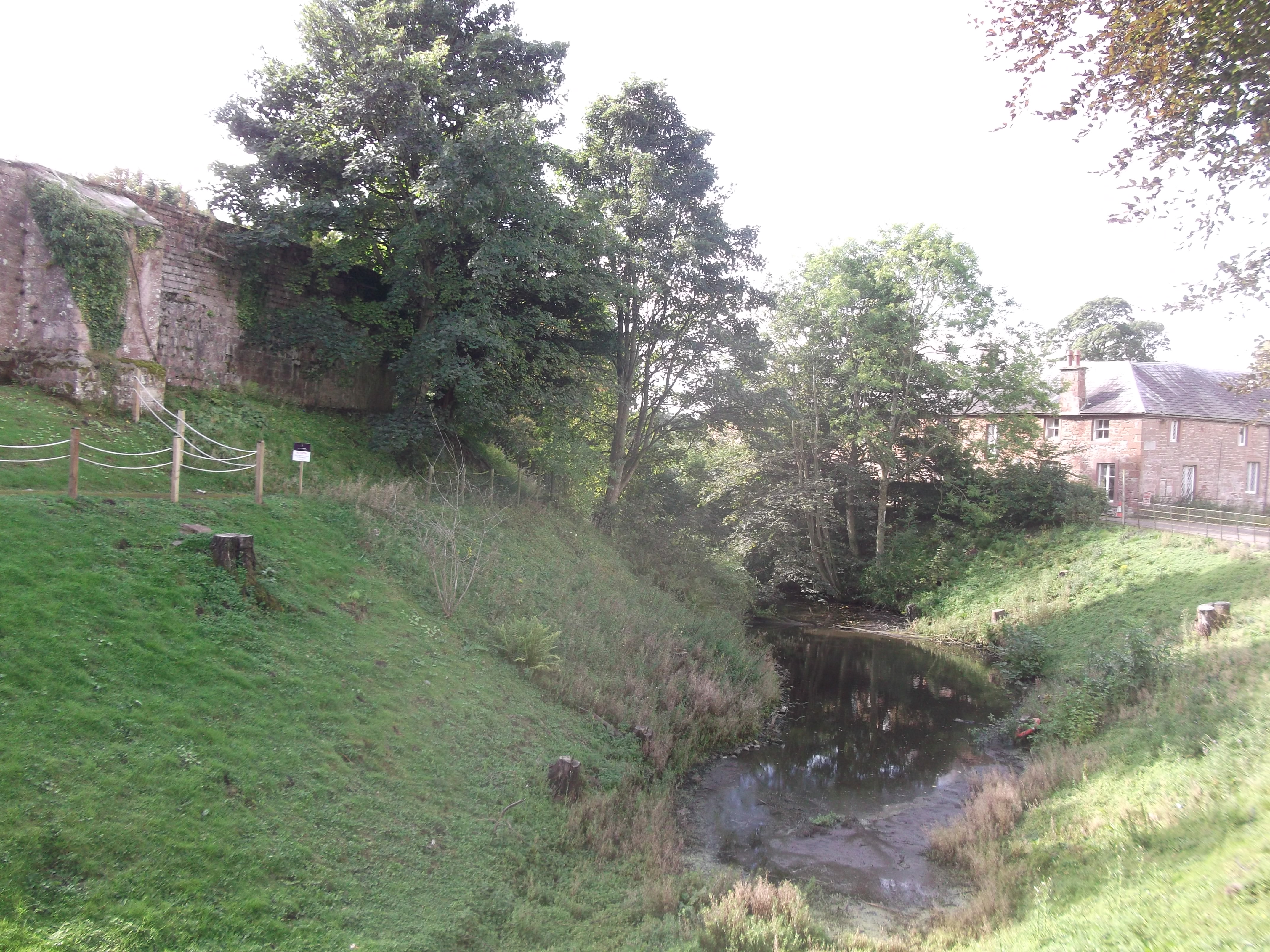
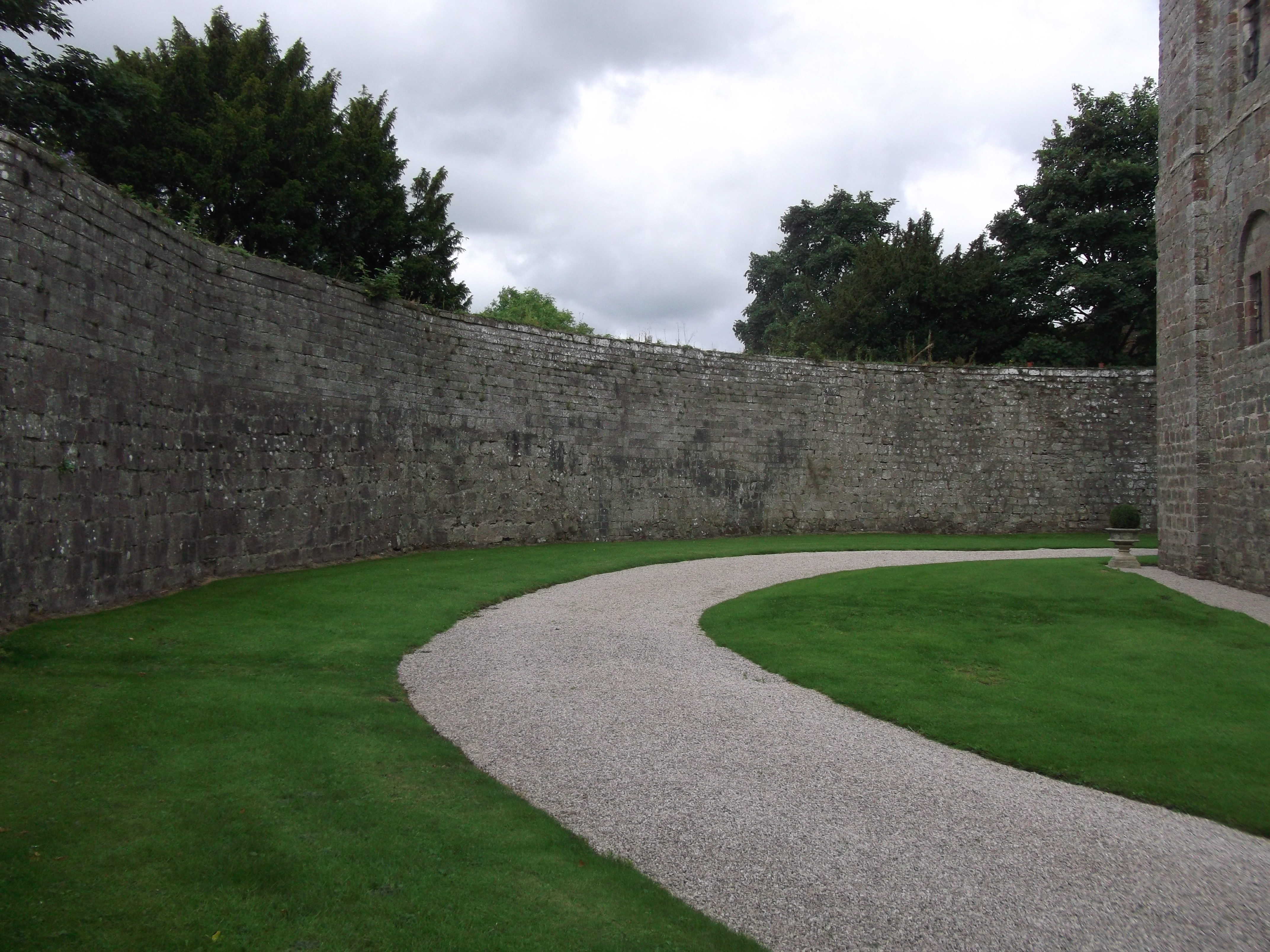
Appleby Castle in Cumbria (formerly Westmoreland) is much less well known and certainly much less studied than its neighbours at Brougham, Brough or Carlisle. Yet it is substantially intact with masonry elements from at least three periods (12th, 13th and late 15th centuries) together with an extensive area of possibly earlier earthworks.
The castle’s early history is tied to the kings of England: it is mentioned in the Pipe Roll of King Henry I in 1129-1130 and then it was seized by King Henry II as part of his re-occupation of the area from the Scots in 1157. Later the castle was held by the Viponts in the 13th century and then by the Clifford’s in the 14th and 15th centuries.
Along with Skipton, Pendragon, Brough and Brougham it formed a major element of the former Clifford landholding in the North West in the later medieval and early post-medieval periods. As such there are clear parallels between the 12th-century keep “Caesar’s Tower” and the great tower at Brough as well as between the late 15th-century hall range and the work of the Henry Clifford the 1st Earl of Cumberland at Skipton.
The site has recently re-opened after a protracted period of closure since the 1990s and is the centrepiece of a Heritage Action Zone recently designated by Historic England as a means of attracting investment into the area following on from the devastating floods of winter 2015. This gives a welcome opportunity to undertake a fresh study of the site which was last seriously examined by the Royal Commission on the Historical Monuments of England back in the 1930s. Further study of “Caesar’s Tower” is particularly over-due as recent research into similar structures in the UK, Ireland and France have changed our understanding of them.[1]
Historic England are funding consolidation works on “Caesar’s Tower” and the associated curtain wall. It is hoped this will include a photogrammetric survey of and a geophysical survey of the area between the curtain wall, the tower, and the later 15th-century hall range. Further detailed building recording surveys may be possible in the long term to disentangle the later 15th-century and mid 17th-century work associated with Lady Anne Clifford from earlier work within the Hall. The presence of what appears to be the remains of a postern gate with portcullis groove within the north wall and a curious bottle shaped tower at the western end give a hint of what might readily be identified.
The curtain wall is of a characteristic early form with a low un-crennelated wall walk without towers. Rather than curving, it has angular changes of alignment and may have been built at the same time as the keep. It is unclear how the keep was arranged inside when it was built, but a drain from a sink or laver at third floor indicates there may have been a chapel or oratory. We also are uncertain where the original entrance was. The two earthwork baileys run roughly north to south and north-west to south-east and cover a large area. Investigation may reveal evidence of earlier structures from amongst the ephemeral remains of more recent activity.
The project if successful holds out the prospect of answering a whole range of interesting questions about this fascinating and presently poorly understood site.
[1] “Some thoughts on the use of the Anglo Norman Donjon” Pamela Marshall. Pgs 159-176. Castles and the Anglo Norman World. John Davies, Angela Riley, JM Leveque, Charlotte Lepiche eds. Oxbow 2016.
For many people not fortunate enough to grow up with a castle in their proverbial backyard (like me), books, video games, films and television shows are the first places they will encounter castles. Such images often stay with people for life and inform their view of what the medieval world would have looked like. I see this as an asset for historians and heritage professionals rather than a hindrance – sure, pop culture doesn’t have a great track record with getting the historical details right, but if it sparks an interest in castles where one might never have arisen that, to me, can only be a good thing.
I’m using the world of fantasy and fictional castles as way to discuss the real deal in a talk for Previously…Scotland’s History Festival on Nov.19th in Edinburgh. My aim is to put the defences of famous fictional castles to the test – would, for instance, Mickey be able to withstand a siege if he holed up in the Disney castle? Do the fortresses of Game of Thrones actually make sense or are they all show? How hard would it be to rescue a princess from the Super Mario castles?
To find out, I’m applying several criteria to each that can just as easily be used to assess the battle-readiness of real castles. For instance, are their turrets, crenels and wall-walks actually capable of bolstering their defence, or are they in fact just for aesthetic flair? Is their architecture specifically tailored to the demands of their environments? Are there multiple layers of defence, or do all hopes rest on a single strongpoint?
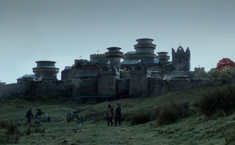
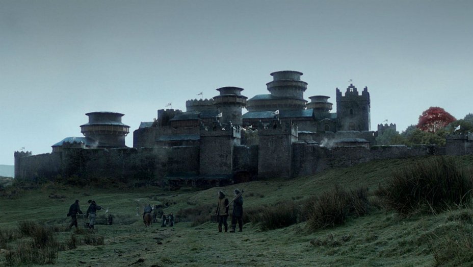
Let’s take Game of Thrones’ Winterfell as an example. I hate to challenge the might of a castle that has famously been untaken for ‘thousands of years’, but for that to be the case they can’t have had a single decent winter in millennia. Take a look at many of the tower roofs in the image below. Notice anything peculiar about their design?
That’s right – a castle specifically designed to resists winter employs flat roofs on many of its towers. Why is this a problem? Because those roofs need to bear weight, and accumulated snow is immensely heavy. So, unless the towers are upheld by some ancient magic, their roofs will come crashing down with the first heavy snowfall. Perhaps the name ‘Winterfell’ is actually an architect’s very reasonable warning about the weather!
The first castles I probably saw outside of Alan Lee’s illustrated version of The Lord of the Rings were the castles in the original Super Mario. Now, I know they weren’t designed to be overly scrutinised by nitpickers like me and the graphical limitations of early 1990s video games meant simplicity was key. But let’s take a look.
Credit where credit is due for having functional wall walks with crenellations and merlons that are actually high enough to fully shelter an archer. But we really need to talk about those windows. As a general rule of thumb, more windows means less defensive capability, and the larger the window the further that defence is compromised. The windows on Super Mario’s castles are clearly exaggerated, but it’s not hard to find real-life parallels. Take one of Scotland’s most famous castles, Kilchurn on the banks of Loch Awe.
Often thought of by visitors as an impregnable fortress, its western face leaves much to be desired. Kilchurn was never, in fact, a true fighting fortress but more of a domestic seat with castellated features. No stronghold hoping to stand against a determined foe would dare give them so many openings through which to fire and breach.
These are just a few examples of what I’ll be discussing, and there will be some surprising winners as well as losers out of it. It is my hope that talks like this will get people who have already been exposed to castles through pop culture to think more critically about them, all while having a bit of fun.
David is a writer, presenter, and castle hunter, and you can find more from him on Twitter, Instagram, and his website.
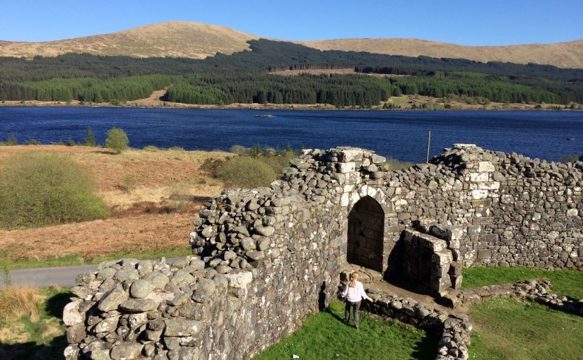
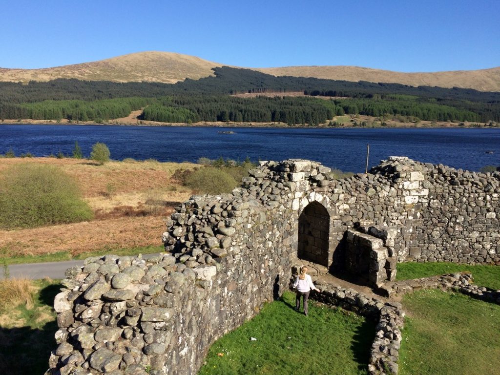
Research on castles has outgrown the walls of architecture, sprung from the rubbly tangle of archaeology and taken flight from the pages of law texts, charters and literary exposition. In the hands of an adept writer, these are small bumps on the road to timely completion. Presently, however, I find myself in the camp of the almost-complete thesis writers (PhD fourth-yearers: here is fellowship!). It is a credit to castle studies that there is so much to think and write about and, perhaps, get lost in. This post shares some of the most interesting conclusions from my work looking at early stone castles in two polities in medieval Scotland, the Earldom of Orkney and the Lordship of Galloway. Among the themes I examined was the transition from timber to stone architecture, the relationship of castle to landscape and the political context for castle construction in these areas.
Why Orkney and Galloway? To begin with, we cannot be certain why castles appeared in non-‘feudal’ Orkney in the first place. Secondly, one of Orkney’s early castle sites, according to accepted wisdom, is the prototype for a larger group of early castle sites in the earldom – and has influenced larger debates on castles in Scotland more generally. Cubbie Roo’s Castle, this foremost plank of Orcadian castellar wisdom is, I believe, a little younger than widely believed. Nevertheless, the evidence suggests Orkney was probably home to a stone castle founded around the middle of the 12th century, decidedly early for this part of the world.
If the castle site (but not the surviving architecture) is genuine, then the attendant landscape must be examined too, for Cubbie Roo’s and other Orcadian castles. Following a conventional model of castle as the centre of lordship, one would expect to find churches and important farm sites close to suspected or documented castle sites. This was simply not the case in Orkney. Cubbie Roo’s and the other castle sites I examined were, on present (chiefly place-name) evidence, sited on marginal lands of indifferent quality. Some preserved evidence of associated chapel sites, which fits with the conventional model of early castellar lordship.
The disconnect between terrestrial wealth and castle location opened three possibilities about the origin and siting of castles: firstly, were these defensive sites? If defence included a consistent grasp of the surrounding area, including major seaways through the Earldom, then the answer is no. Secondly, were these sites connected to maritime wealth? It is entirely plausible: recent research has demonstrated the wealth of the earldom derived massive fisheries exploitation. Thirdly, were these sites connected to ‘new’ arrivals to the Earldom? The political upheavals in the Kingdom of Norway (to which Orkney belonged) saw magnates appear in the Earldom with no obvious familial connection. The lack of obvious relationship with good farming land may be taken to suggest the castles were built on land acquired more for the purposes of castle building (and architectural showmanship) and maritime exploitation than the inherent wealth of the soil. The new men’s power derived from proximity to the Earl, not a direct ancestral claim to a portion of Orkney’s economic output. Orkney’s earliest castles, whatever their form, were the product and reflection of a shift in how comital wealth and power operated.
Galloway’s castles present a different challenge; though as a group they are more numerous than their Orcadian counterparts, the evidence for them is drastically more erratic. The exquisite (and displaced) Loch Doon Castle is more clearly understood than the hummocky mound of Castledykes outside Kirkcudbright, for example. On a cursory examination of both sites’ landscapes shows that Castledykes is much easier to understand. Kirkcudbright was the centre of the powerful Lordship of Galloway. Its hinterlands feature no fewer than three monastic foundations by the Lords, and the probable extent of demesne estate concentration in the area around Kirkcudbright is one of the highest in the Lordship.
What of Loch Doon Castle? Any modern visitor will appreciate the eponymous loch is remote and difficult to access from the big towns of Scotland’s south-west. However, it was originally built on an island in the Loch and later dismantled and reconstructed on the shore. It initially sat on a substantial route-way between the Glenken in Galloway – another demesne area of the Lords – and the Scottish coastal royal burgh and castle of Ayr. Another route south of Loch Doon offered access to the southern area of Carrick and, via the River Cree, the Wigtownshire portion of the Lordship of Galloway, with its probable administrative centre at Cruggleton Castle. Though its landscape is presently dominated by fishing holiday cottages and forestry, place-name evidence suggests in the medieval period the area was exploited for its pastoral suitability, and analogous documentary evidence from monastic sources hint at mineral wealth too. Doubtless Loch Doon Castle also formed an upland centre in Carrick in counterpart to the lowland, maritime-oriented centre at Turnberry Castle (also surveyed during this project).
Lastly, an overview for all of Scotland. A small, prefacing section of my thesis examined the monuments record for all possible castle sites in Scotland, including the sites above and less conventional secular power centres in the 12th-14th centuries – palaces, enclosures, crannogs (artificial islands in lochs), duns and brochs. A growing body of evidence in Scotland suggests many sites typically understood as prehistoric (chiefly the last three aforementioned categories of sites) were re-occupied during the broad medieval period. One conclusion from this country-level study suggested that there were more medieval power centres (e.g. bearing evidence for occupation) per square kilometre in the western counties of Scotland than the east. This likely reflects the underlying patterns of early medieval lordship in Scotland over which the culture of castles was overlain. This may act as another, belated, nail in the coffin of the military-architecture thesis of castle studies in Scotland.
The framework of understanding castles through landscape as much as architecture and archaeology is one I hope to apply more widely to Scotland and, as I engage more fully with English castle studies in my new job, in the wider medieval world.
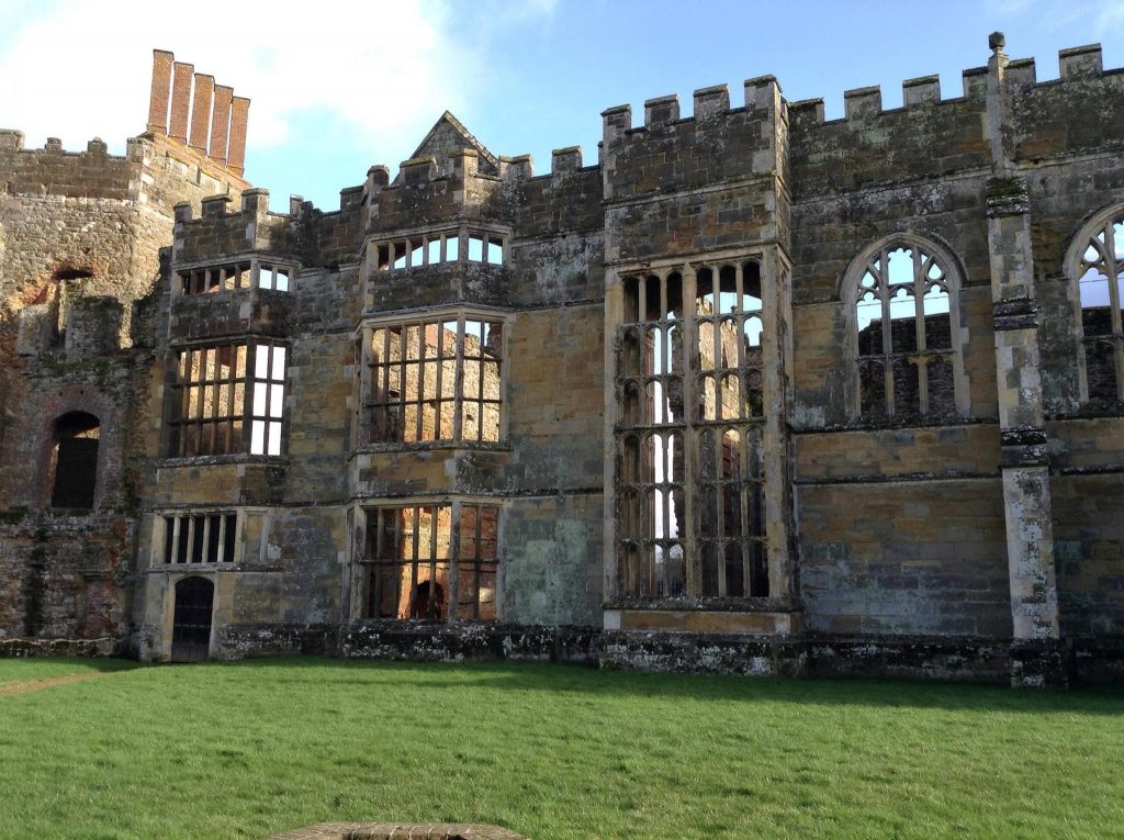
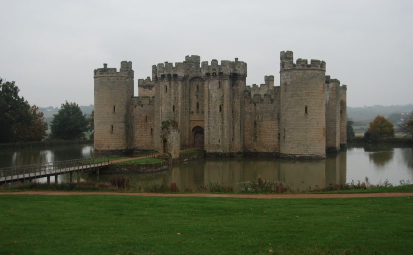
Bodiam Castle is well known in castle studies; whether it was a fortified structure or built to display the status of the owner. This debate has been explored elsewhere, particularly by Professor Matthew Johnson[1]. Traditionally the building has been considered from the exterior, with a few notable exceptions[2], further until recently only ground floor plans of the building have existed. As part of the Lived Experience in the Later Middle Ages project we undertook a survey of the building and created plans of each floor level and some elevation drawings[3]. To undertake the survey we used a Leica reflectorless Total Station linked to download in real time straight into AutoCAD using the software TheoLT. This allowed us to view the survey data as work progressed and to record the building in three dimensions (3D).
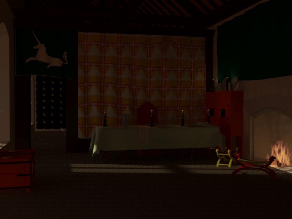
Having the results of the building recorded in 3D allowed us to start thinking about the space beyond the traditional drawings, we had generated and we could think about the building in a number of new ways. The 3D data was used as a basis for creating models of the building in the medieval period; rebuilding the fallen walls, reroofing the apartments, and furnishing the rooms. These models can be used to create beautiful illustrations of the spaces, but they can also be used to tell us about living in those spaces.
A visualisation of part of the private apartments at Bodiam Castle
This can be seen when considering the private apartments on the eastern elevation. Previous interpretations[4] see them described as comparable; they lie one above the other and appear to consist of a similar layout of rooms; an unheated outer chamber, an inner chamber with fireplace and window seat, and a further inner chamber with fireplace. However, in 3D they begin to look very different; the roof converts the upper apartment; making the space much more open and the slightly different arragements of windows on the curtain wall combined with the position of the Great Hall will affect the outer chambers.
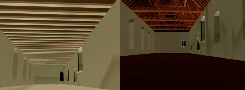
Comparison between the upper and lower apartments when considered in three dimensions
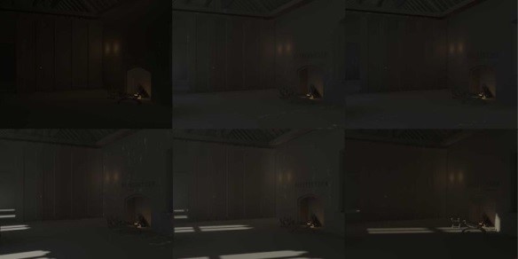
We can also use the models to consider the lighting of the spaces over the course of a day. A lighting analysis demonstrates how dark these rooms are and how they change over the course of the day.
A lighting analysis of Bodiam Castle showing the changing conditions in the upper apartments over the course of the day
Finally, in furnishing the rooms we can consider movement through the spaces. Floor plan can allow us to see how spaces connect and their size. But in furnishing the rooms the movement through that space can be considered within the frame of reference of an inhabited building.
A visualisation showing a fully furnished room, a different space to negotiate than the empty spaces depicted in floor plans
These examples show just some of the ways to consider how we are thinking about the use of space; in this case at Bodiam Castle and how it is beginning to raise new thoughts on the experience of living within the building.
[1] These drawings and the results of the project have recently been published Johnson 2017 available http://www.oxbowbooks.com/oxbow/lived-experience-in-the-later-middle-ages.html [2] Faulkner, P. A. (1963). Castle Planning in the fourteenth century. The Archaeological Journal, 120, 215–35. DOI: 10.1080/00665983.1963.10854241.
Simpson, W. D. (1931). The Moated Homestead, Church and Castle of Bodiam. The Sussex Archaeological Collections, 72, 69–99. [3] Johnson, M. H. (2017). Lived Experience in the Later Middle Ages. (M. H. Johnson, Ed.). St Andrews: Highfield Press. [4] Faulkner, P. A. (1975). Domestic planning from the twelfth to the fourteenth centuries. In J. T. Smith, P. A. Faulkner, & A. Emery (Eds.), Medieval Domestic Architecture (Vol. 115, pp. 84–117). Leeds: The Royal Archaeological Institute.
Goodall, J. (2011). The English Castle. London: Yale University Press.
Nairn, I., & Pevsner, N. (1965). The Buildings of England: Sussex. London: Penguin Books.
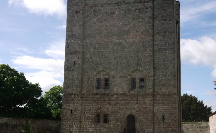
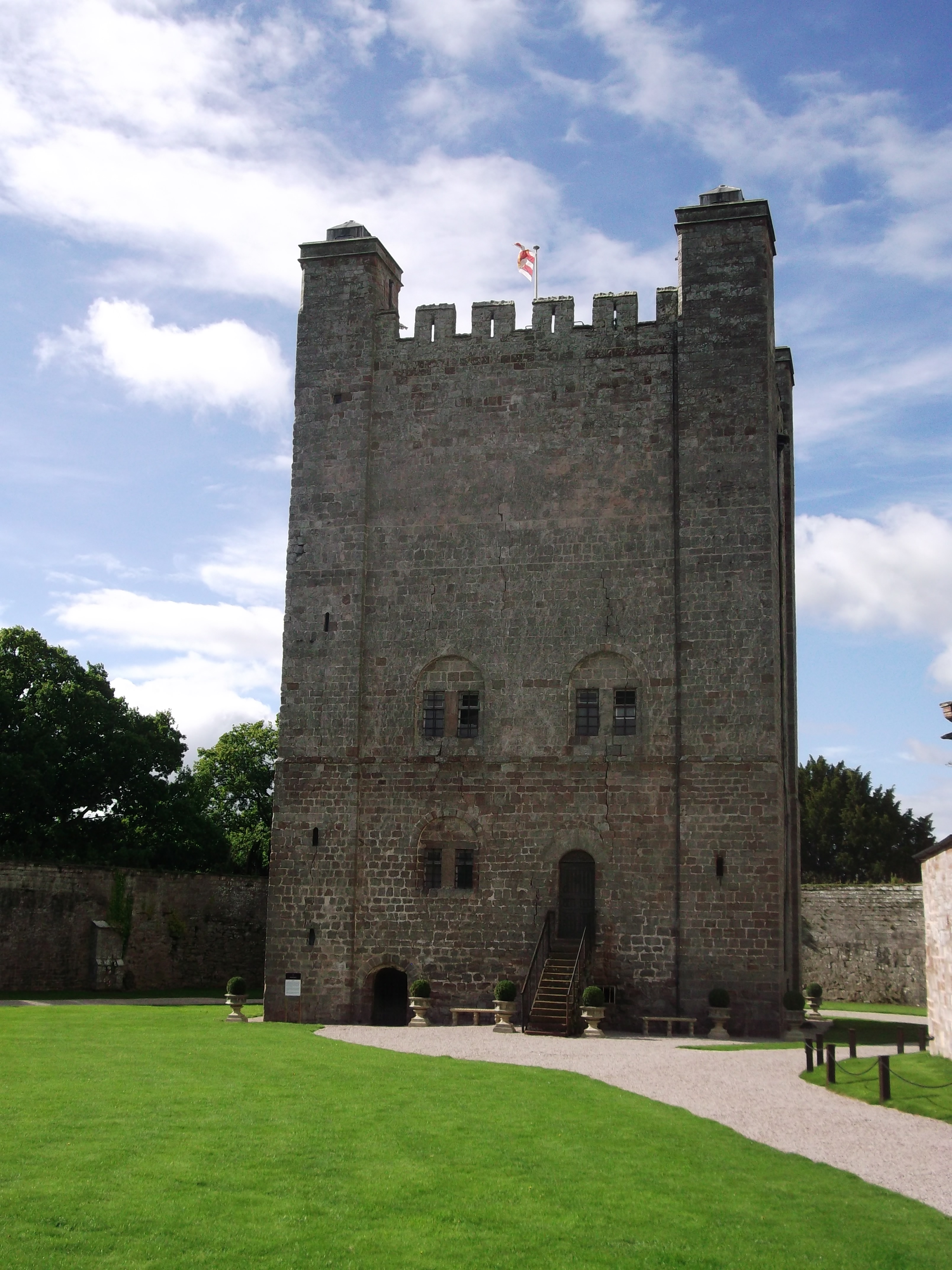
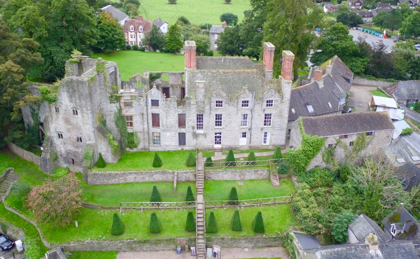
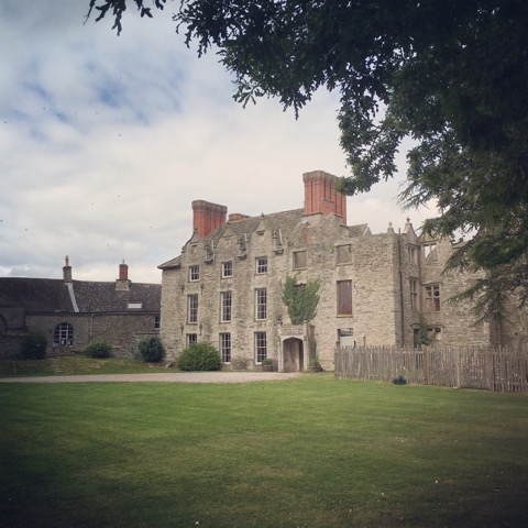
Hay Castle, in Hay-on-Wye, is undergoing a major restoration which will result in an exciting visitor destination and a centre for culture and arts. The Heritage Lottery Fund granted nearly £5 million toward the project. So far, a substantial amount of archaeology has been undertaken to help inform planning applications, conservation management plans and structural engineering solutions.
The site, a Scheduled Ancient Monument, embodies an astonishing array of architecture, including a Norman keep, an important medieval gateway, a Grade I listed Jacobean mansion and later Victorian and Edwardian additions. The keep was probably incorporated into a late medieval domestic building and then this was retained within the double-pile mansion built in the first half of the 17th century. The mansion was itself subjected to alterations in the 18th and 19th centuries and twice partly gutted by fire in the 20th century. The gate and curtain wall were retained and appear to have been repaired as garden features.
Fifteen archaeological test pits have enhanced our knowledge of the site in a variety of ways. Digs were undertaken within the derelict mansion to establish where the new lift could be situated. Just below the surface runs a medieval stone structure, at least 3.5 metres wide running along the north face of the mansion. The angle and relationship with the keep suggests that this is the 13th century curtain wall. A glimpse of the underground stonework will remain visible in the restored mansion.
Investigations also revealed that much of the site comprises about two meters of infill. Two boreholes were drilled giving results of approximately 2–3 metres of made up ground, 2–3 metres of sub soil and then at 7 metres the Raglan mudstone bedrock. It is thought that this infill was brought in when the Jacobean mansion was constructed, thus heightening it from the lower medieval ground level.
On the north face of the keep, facing town, a test pit revealed a wall of tufa. Large regular well-cut blocks measuring around 40cm long by 20cm high appeared to extend below the level of excavation. In his report, lead archaeologist Peter Dorling stated: “This finding appears to support the interpretation of the tower as the original castle gateway. The west side of the tufa forms a straight edge, which at this level was perhaps associated with a seating for a bridge/drawbridge”. This is an exciting find as freshly quarried tufa around a gateway arch would have been very striking and certainly would have had a strong visual impact.
Volunteers from the community have helped on a dozen or so of the digs. The Hay History Group and the Young Archaeologists Club have taken part. Further archaeological exploration will be undertaken, mainly in the derelict mansion to establish locations of new footings. In addition, it is hoped that ongoing archaeology will help determine the existence of the earlier gateway within the keep.
Construction is expected to begin in October and will take two years, when Hay Castle will be fully open to the public for the first time in many centuries.
This post was written by Dr Audrey Thorstad, Lecturer in Early Modern History at Bangor University.
As castle scholars and enthusiasts, we enjoy learning about history, exploring how the remains of the past can teach us about the lives of people who came before us, and perhaps what we might learn about ourselves through their experiences. Did those in the past feel the same way? How did they view their own history? How did they embrace or even manipulate the history of the landscape in which they lived?
The physical and material remains tell us a story of a layered history. Any given castle can have centuries of history layered and intertwined with one another. For Tudor castle owners, builders, and renovators, the past played an important role in how they used and interpreted the building and the landscape.
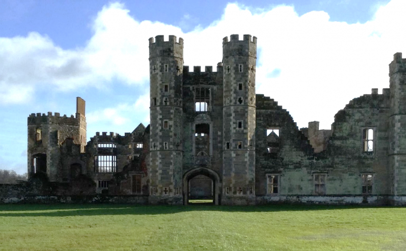
An interesting example, though just one of many, is Cowdray House or Castle in West Sussex. The building that survives today had two main phases of construction during the late 15th and early 16th centuries. The first phase started by Sir David Owen from around 1492 and saw the completion of the eastern and northern ranges. The second phase began when Sir William Fitzwilliam, later earl of Southampton bought the estate in the late 1520s and completed the southern and western ranges. Although it appears that the surviving physical remains depict a completely new build, thirteenth-century floor tiles indicate there may have been an earlier residence on the site.
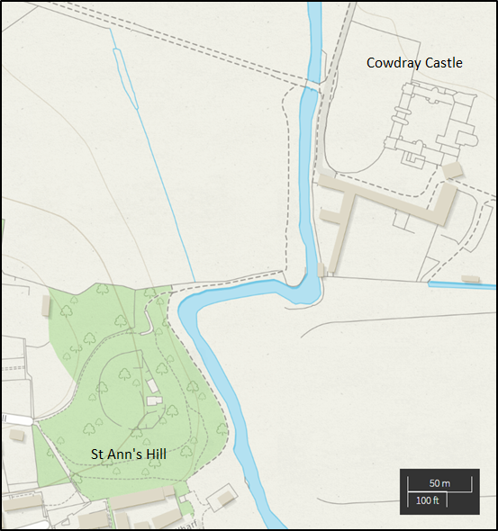
The placement and building of Cowdray was no mistake. To the west, the residence looks out onto the town of Midhurst; to the north and east the castle looks out onto parkland. Fitzwilliam received a licence to impark and crenellate in 1533 from Henry VIII. The licence allowed him to impark 600 acres of land, meadow, pasture and wood.[1] To the south of Cowdray is St Ann’s Hill, the location of a Saxon cemetery dating from the fifth and sixth centuries as well as a Norman castle owned by the Bohun family until the 15th century.[2] These views were meant for those in the castle as well as those approaching the castle. The town and parkland scenery evoked lordly privilege and status, while the closeness of the newly built Cowdray and the old Norman castle gave the observer a sense of historical significance.
By rebuilding the castle not on the original site of St Ann’s Hill, but approximately 400 meters away, the Tudor builders were using the past in very interesting ways. The new build broke away from the Norman past and the Bohun family tradition, yet kept the site as a physical memory of that history. Cowdray does not have a completely new history starting in 1492 when Owen started building the castle, but an intertwining and connected history to the town and historical sites around it.
Owen and Fitzwilliam were not alone in their endeavour to create their own legacy by shaping the past. John de Vere, thirteenth earl of Oxford renovated his familial stronghold at Hedingham Castle making the Norman great tower the central building of the inner bailey with his late-fifteenth-century brick towers surrounding the twelfth-century great tower like a monument to his ancestors. It was not just castle building that allowed the Tudor nobility and gentry to use the past. Sir Rhys ap Thomas, for example, used the coat of arms of Urien of Rheged as his own, claiming descent from the sixth-century king of Gower. The use, and arguably manipulation, of history by the sixteenth century elite was nothing new. The nobility and gentry throughout the Middle Ages were interpreting and adopting the past. What sets castles apart is the constant, and at times, unbridled incorporation of structures, materials, landscapes, and histories that came before.
As the days get shorter and the number of times you have to defrost the car in the morning rises substantially, the chance of large gatherings and feasting also increases. People try to figure out how to fit large numbers of guests in their homes, share their news and hopes for the upcoming year and, sometimes, settle business. Thinking about castles as warm and lively places is not necessarily the easiest when they present a cold, wet, bare-stoned backdrop to our lives today but the gathering of people and feasting would have warmed the halls of lords as well.
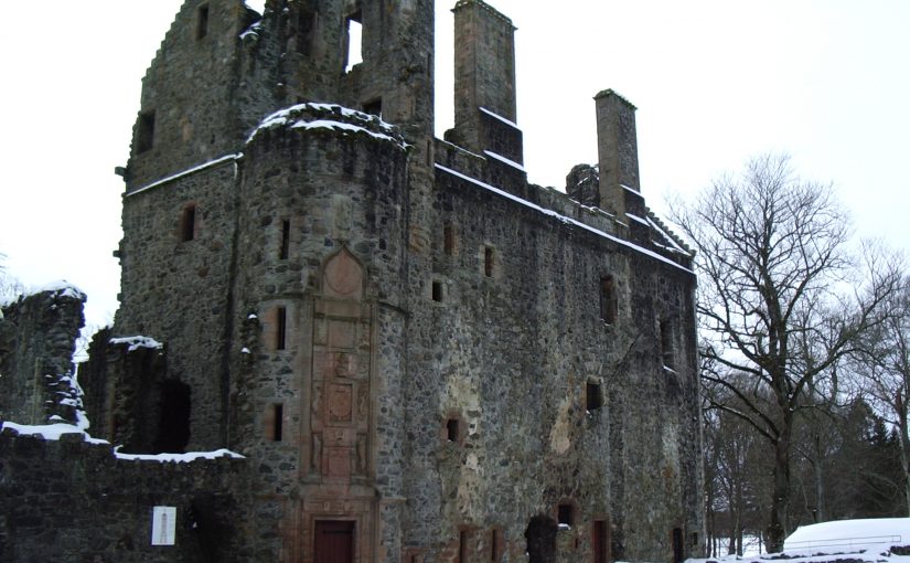
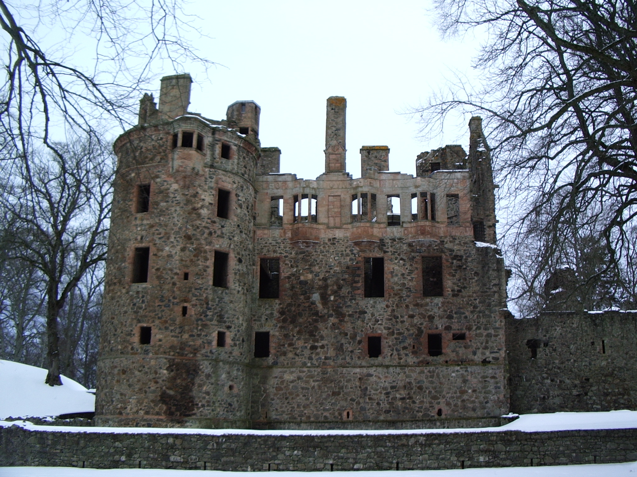
While huddled over a steaming cup of tea or mulled wine and eating mince pies, I invite you to take a moment to consider a winter gathering that took place at Huntly Castle (Aberdeenshire), the seat of the Gordon family. Huntly is well known for its magnificent inscription commemorating the marriage of George, the Sixth earl of Huntly, to Lady Henrietta Stewart in 1588 and the surviving heraldry within the 16th century palace block, but it has a long architectural history.
There have been three major stages of building at the site of Huntly Castle. First, there was a 12th century timber motte and bailey castle known as the Peel of Strathbogie. Second was an early 15th century L-plan tower. Third was a mid-15th century palace, built in partial conjunction with the establishment of the property as an earldom. Although the palace has been remodelled in the 16th and 17th centuries to what we see in ruins today, the basement largely consists of the first stage of this palace block.
A small gathering of people took place during the first stage of the palace block and the life of the Second Earl of Gordon, George (earl from 1470-1501). On 12 January 1492, George, Earl of Huntly and Lord of Badenoch, passed the lands of Auchannochquhy in the forest of Boyne in the county of Banff to Walter Ogilvy of Boyne and his heritors. This charter was witnessed by Richard Strathquhayne, Prior of Monymusk, Patrick Berclay, lord of Grantuly, James Abirnethy, son and heir apparent of George Abirnethy of Uggistoune, Andrew Hay, D. Patrick Grantuly, rector of the church of Glas, and D. John Andrew, vicar of the church of Bocarne in diocese of Moray.[1] This charter was later confirmed by James IV on 3 December 1495 at Perth (RMS, Vol II, 2289).
Judging from the locations identified with the names of the witnesses, most came from a relatively short distance (under 10 miles) from Huntly Castle. The prior of Monymusk seems to have travelled the furthest, at approximately 24 miles, and is likely to have been seeking accommodation. These six witnesses were likely accompanied in their travel to Huntly Castle but there is no reason to suspect a large retinue. Although it is not necessarily a gathering that suggests a feast of celebration, it was not uncommon for this kind of business to take place at such a gathering. The Christmas celebrations had finished and it may have just been a gathering of neighbours.
The record of this gathering clearly reflects business but is also a gathering of neighbours and acquaintances in witness of this transaction, whether as an aside to an already gathered feast or specifically for this occasion. Against the darkness of a Scottish January, this gathering is a small remnant of the warmth of gathering neighbours, likely drinking warm drinks around a fire, while discussing business among other things.
[1] All spelling of names and places has been taken from the document as printed in Scotorum, Registrum Magni Sigilli Regum. “The Register of the Great Seal of Scotland.” (1886).
This post was written by Louise Martin, Cultural Heritage Officer for Morecambe Bay Partnership
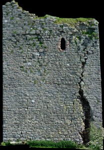
Gleaston Castle is a gem of a site; a little known and poorly understood courtyard or enclosure castle, located in the beautiful Furness Peninsula. The history of the site is scant and whilst it has been the subject of antiquarian and more recent documentary research, its origins and reason for construction still remain unclear. Some writers have proposed that the castle was constructed in the early 14th century as a response to the Scottish raids, although the site is not mentioned in documentary sources until some 30 years after these raids and may simply be a reflection of the wealth and status of the Lord of the Manor.
Today the site survives as the ruins of three towers with an associated curtain wall. As a Grade I listed building and Scheduled Monument this unique site is protected from development or destruction, however, this site is currently on the Heritage at Risk register with many conservation concerns.
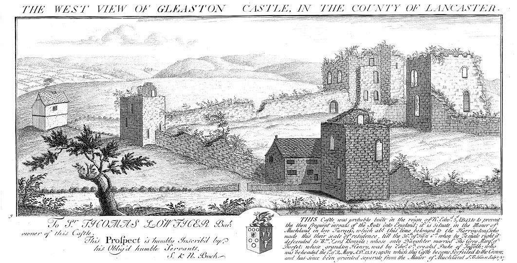
Its crumbling stature is not new, the site is believed to have been dismantled after it ceased to be a manorial residence. It was described as a ruin in the mid-16th century and is depicted as such in engravings from the early 18th century.
Engraving of Gleaston Castle by Samuel and Nathaniel Buck, 1727 showing the site in a ruinous state
Whilst the site was subject to antiquarian attention, with plans and descriptions produced in the early 19th century, I was surprised to discover that the site had never been fully recorded, in particular the elevations of the structures which survive from its original layout.
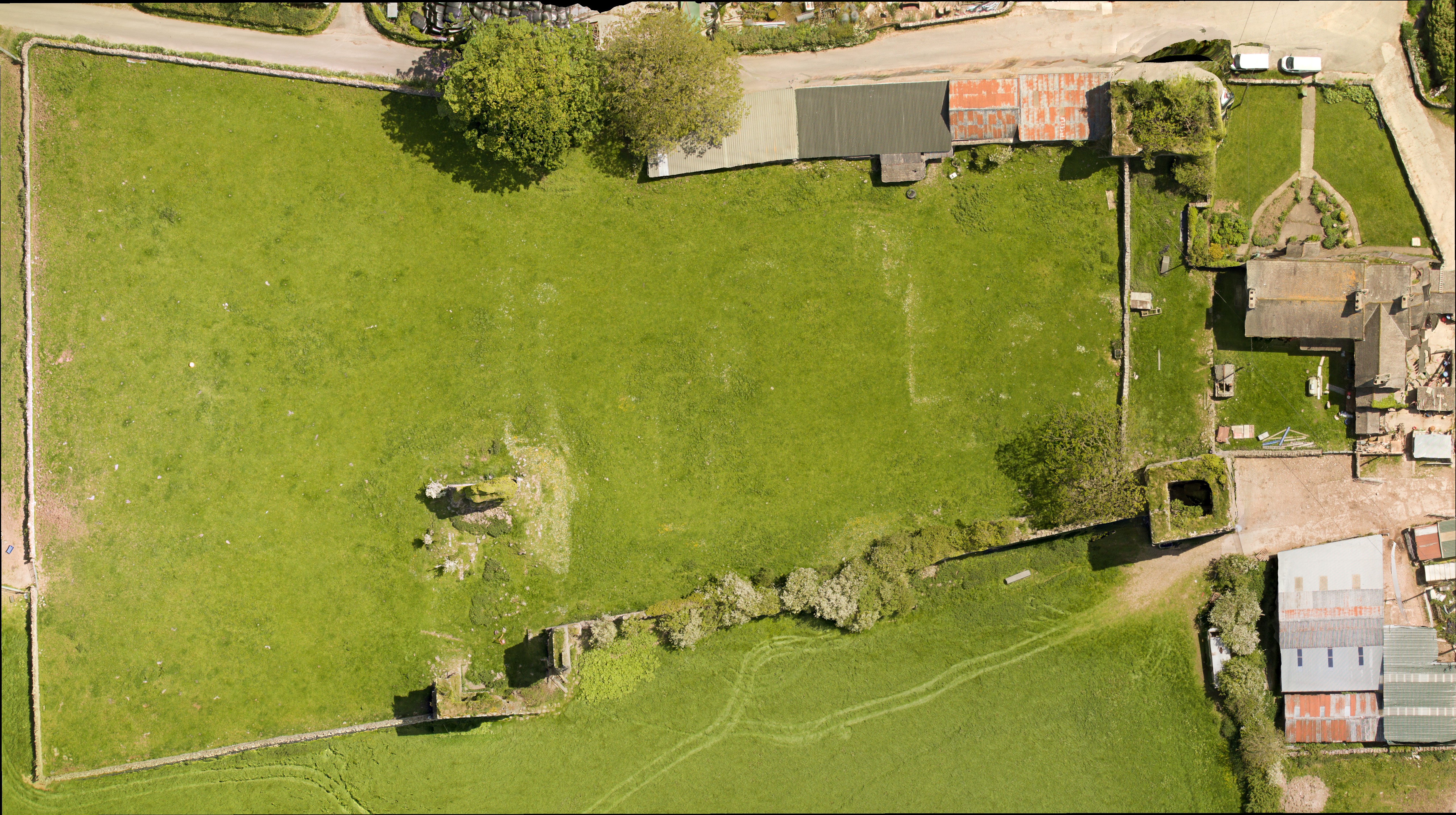
To bridge this gap in the archaeological record and gain a better understanding of the site, Morecambe Bay Partnership applied to the Castle Studies Trust for a grant in late 2014. I was thrilled and delighted to hear the news that our application had been accepted and a generous £5,000 grant had been awarded to enable an aerial photographic survey and 3D model of the site to be produced. In addition, the grant would fund the production of a conservation assessment, outlining the historical background and current issues for the site.
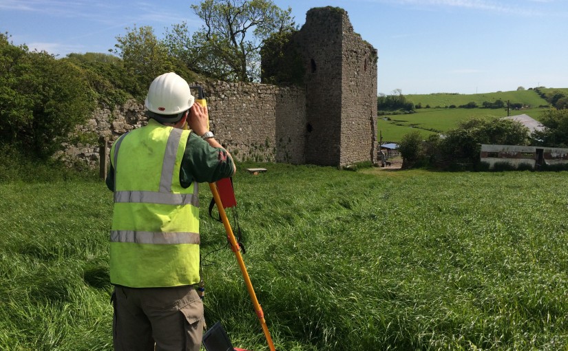
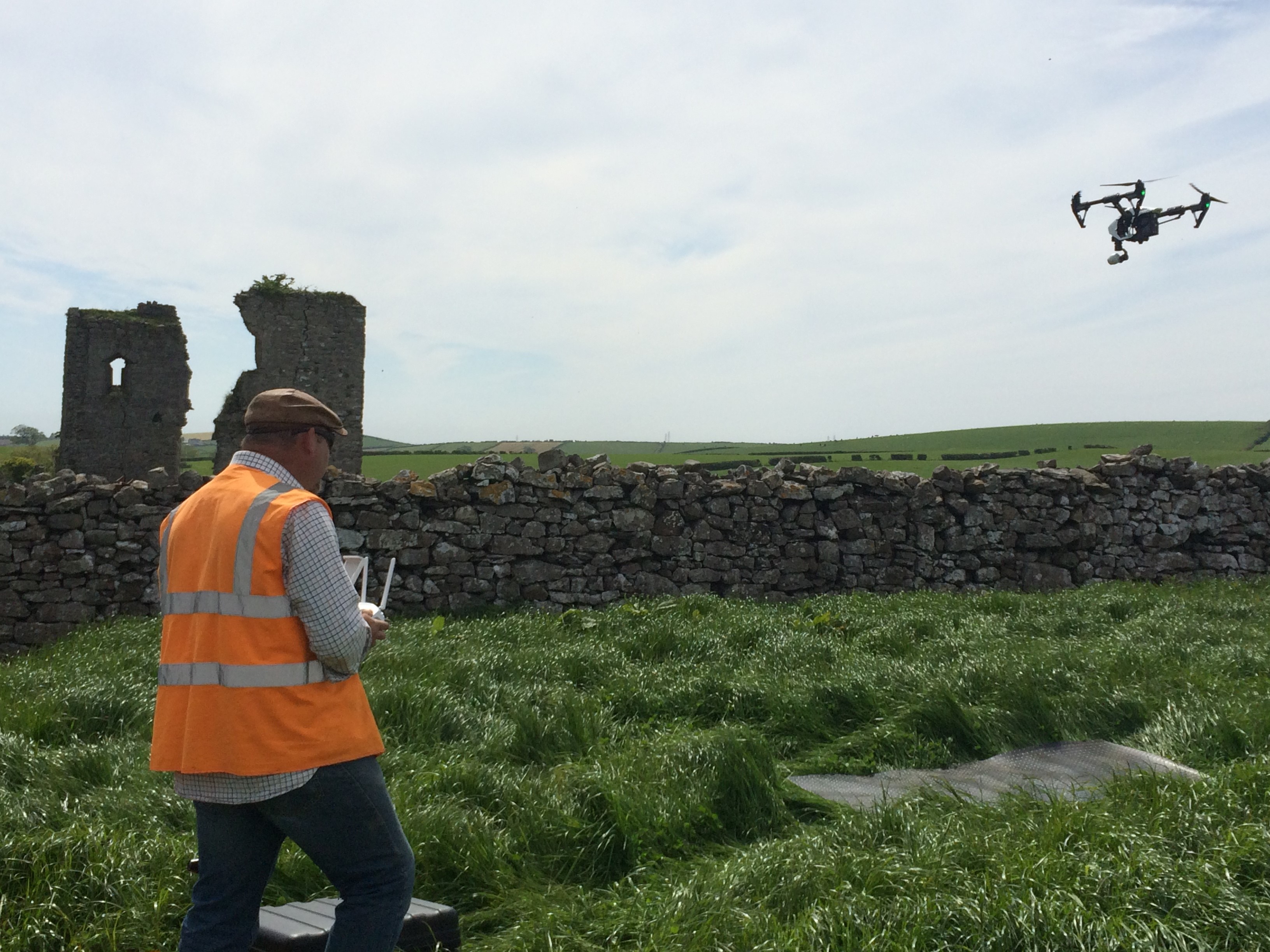
Greenlane Archaeology Ltd. was commissioned to run the project, bringing in professional archaeological photographer Adam Stanford from Aerial-Cam to undertake the survey work. During the summer of 2015 Adam flew over the site with Remotely Piloted Aircraft (RPA)-a DJI Inspire 1 quadracopter fitted with an X3 gimballed camera producing still images at 12 megapixels. Professional photographers, such as Adam, have to follow strict guidance and regulations as part of their licence to undertake such work.
Many precautions had to be put in place before the RPA survey was undertaken by Adam a CAA licenced pilotAdam from Aerial-Cam operating the quadracopter RPA
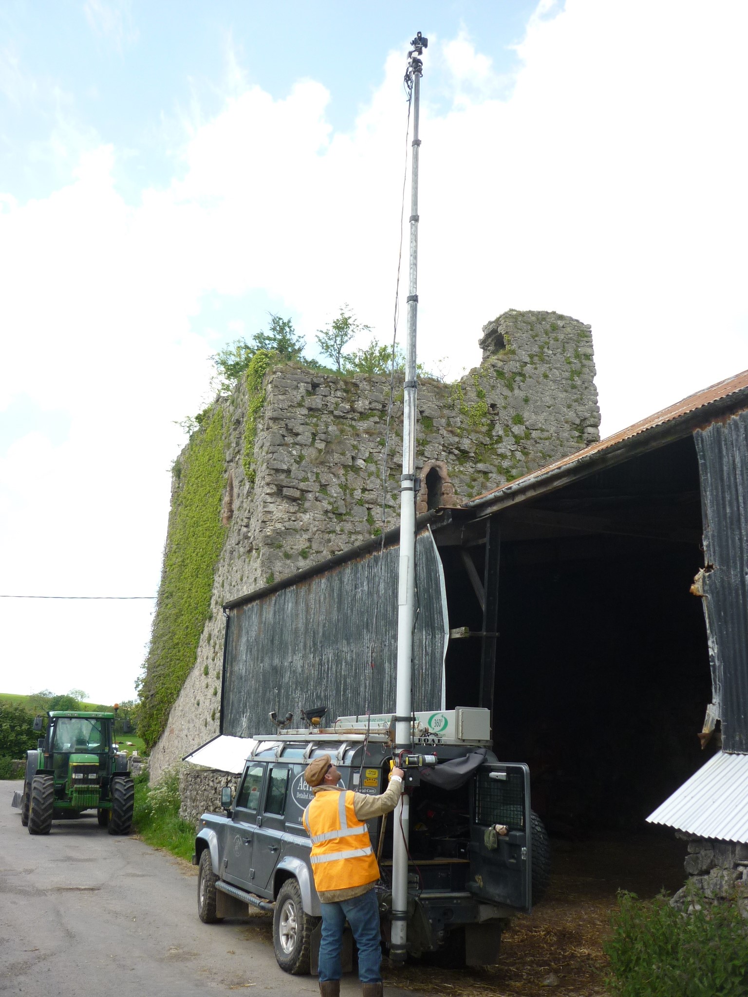
The photographic record from the air was supplemented by high-resolution (24 megapixel) images captured with a high-level telescopic pole and more traditional ground-based photography to obtain close up images of the structure.
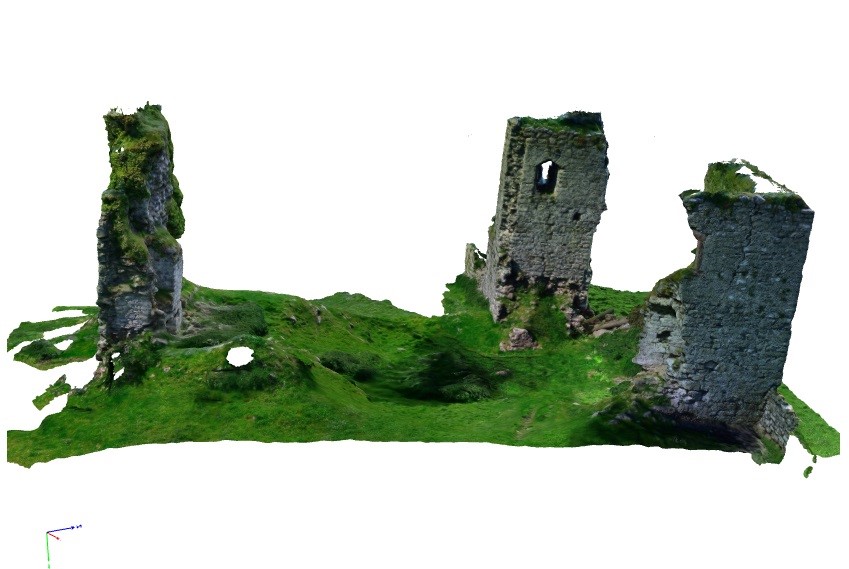
Over 600 overlapping photographic images were taken to capture a detailed record of the site. Back in the office Adam used Agisoft Photoscan to process the data collected. The results were stunning, including aerial images and the creation of a 3D model, which enables the site to be ‘explored’ from the safety and comfort of a PC or tablet through Sketchfab.
Adam capturing some of the elevated images that would be used alongside the RPA images to produce an accurate and detailed 3D record of the site
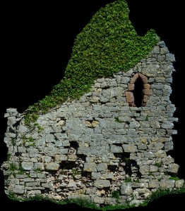
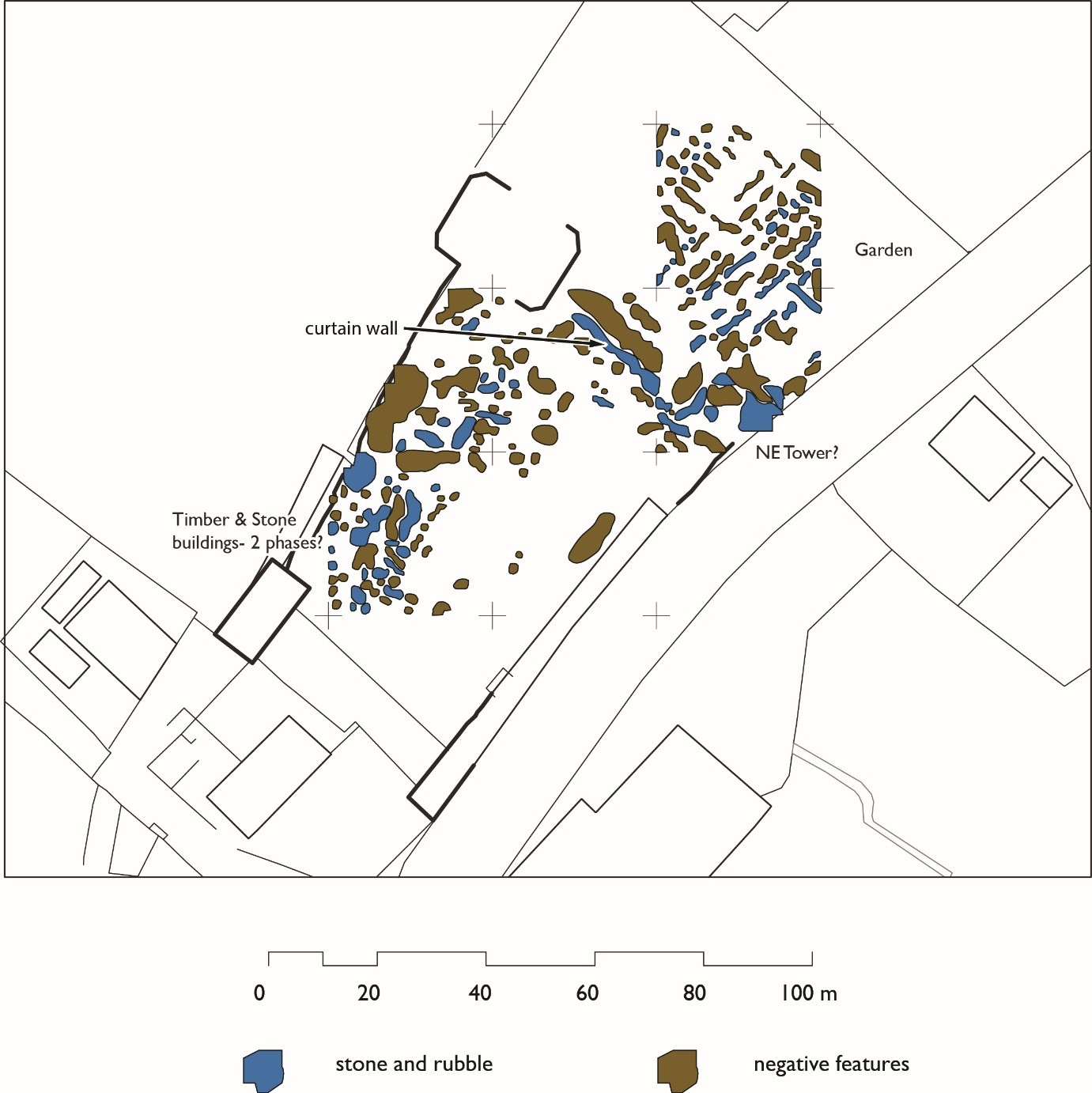
One of the most important outcomes of this project was the detailed orthophotos that were captured of the elevations of the castle’s ruins. We have been using these images to inspect the construction and conservation issues for the site, but primarily they form a permanent record of the castle that was lacking until this survey in 2015.
The aerial image and subsequent grey scale shading was particularly informative revealing furrows and a possible track way to the north-east of the castle. The track appears to lead to the north-western tower, the largest structure at the site and probably once the manorial residence. Within the curtain walls, areas of terracing and possible building platforms could be identified – but what could they be?
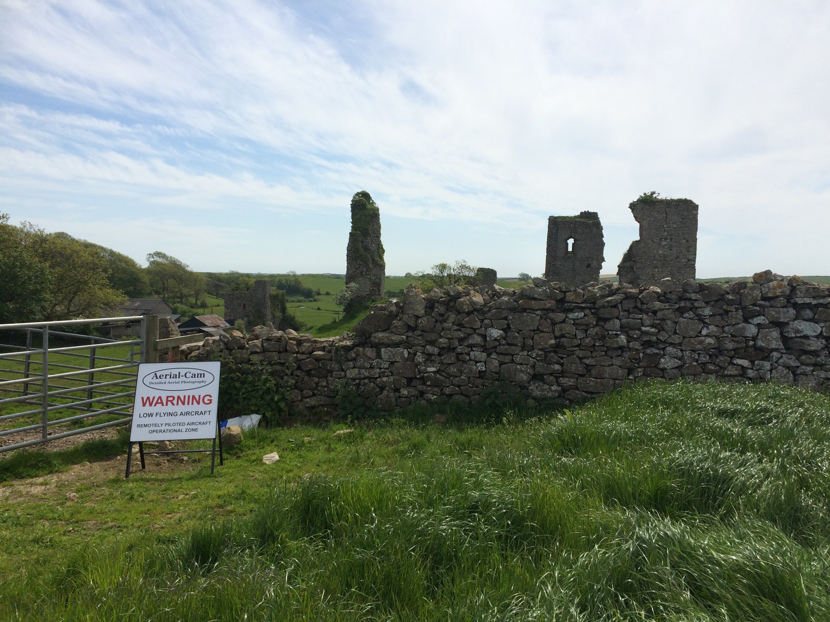
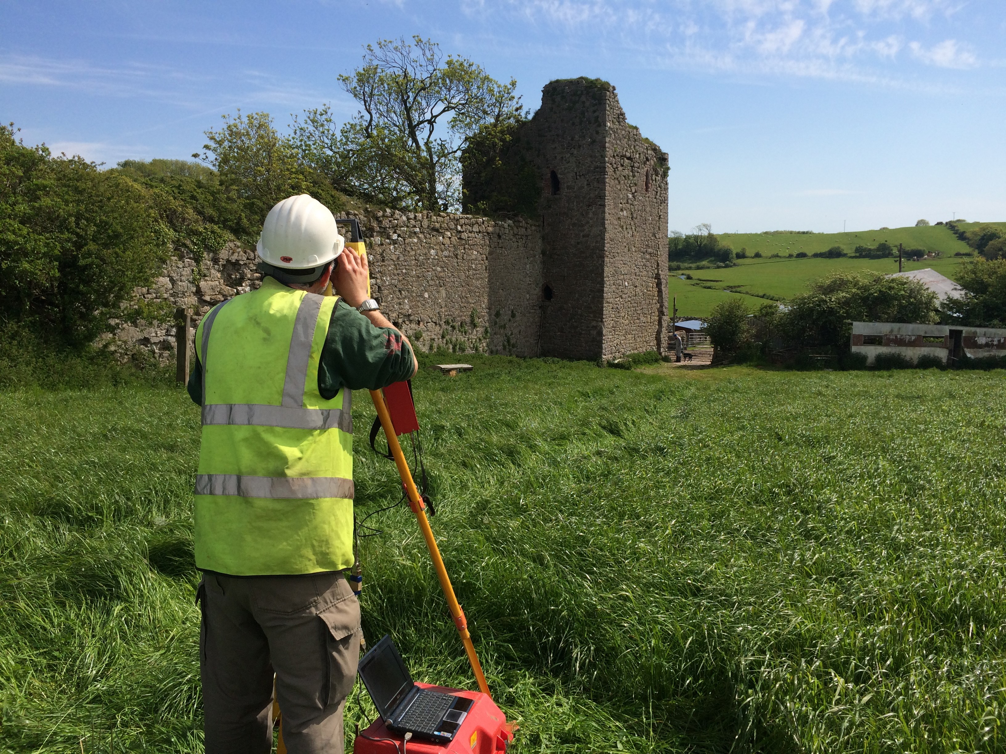
Supplementing the photographic work Greenlane Archaeology also undertook a topographic survey of the site to complement and enhance the results obtained.
Daniel Elsworth from Greenlane Archaeology undertaking the topographic survey of the south-east tower
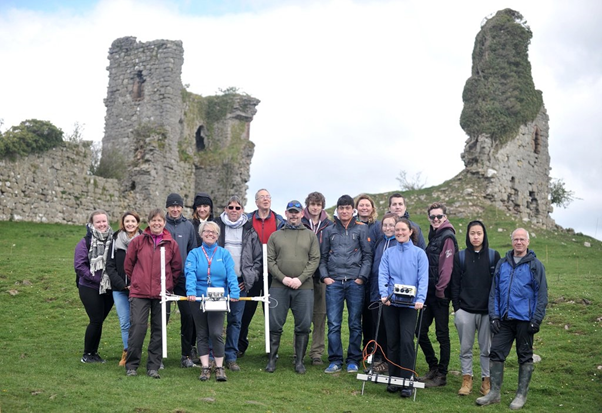
In August 2015 we were delighted to host some of the trustee’s from the Castle Studies Trust (CST) along with supporters of the CST charity, who travelled to the Furness Peninsula to see the survey work in action. We were joined by the Historic England Heritage at Risk Officer, the Lead Archaeologist from Cumbria County Council, and Helen Evans who had compiled the Conservation Statement. Adam from Aerial-Cam gave a detailed demonstration on how the RPA captures the photographic images and how these are enhanced and combined to form the incredible 3D records of the site.
Adam from Aerial-cam demonstrating to Trustee’s and supporters of the Castle Studies Trust how the RPA captures the images from the air
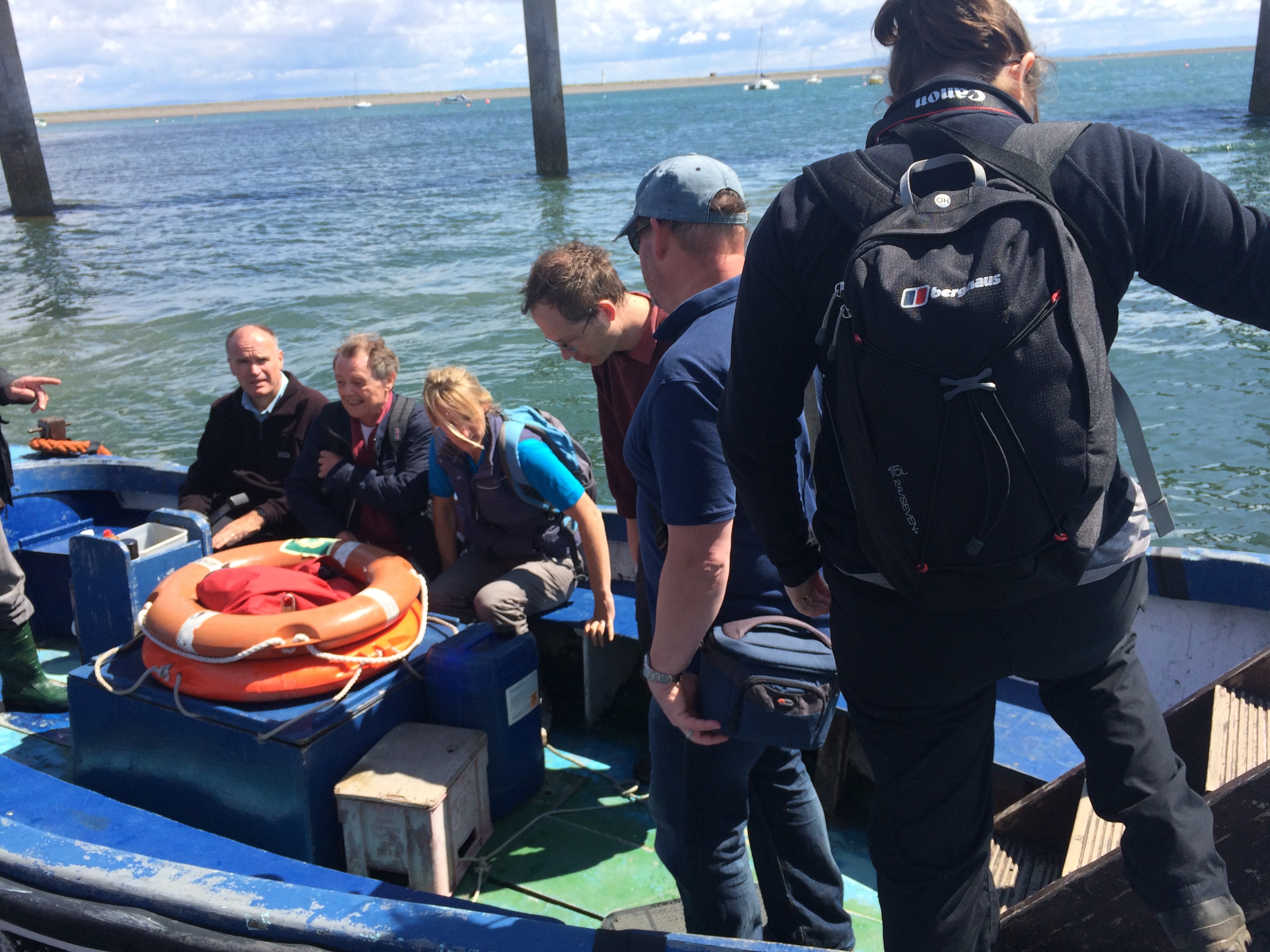
To put the site of Gleaston into context, the visitors were also taken on a tour of Piel Castle, which can be seen from the elevated position of the north-west tower at Gleaston. Piel Castle is positioned on a tidal island and we had to use the local ferry service to reach the site.
Boarding the ferry to Piel Island and castle
It was some months later, during discussions with Dr Richard Peterson and Dr James Morris of University of Central Lancashire (UCLan) Archaeology and Anthropology Department that the next piece of fieldwork was being determined. Each year UCLan host a field school for their first year archaeology students and the team were looking for a site to use to teach the concepts and theories of geophysical survey and laser scanning. We had some interesting research questions to answer, which had been formulated following the photographic survey – do any buildings survive within the courtyard formed by curtain wall and what are the features shown to the north of the castle? Together we thought that Gleason was the ideal site for this year’s field school.
Before any plans to be laid out we had to get permission from the landowners to allow this work to go ahead. Once this had been secured, we had to apply to Historic England for a Section 42 licence, as the site is Scheduled and such work is strictly monitored by Historic England inspectors.
Permission was granted for the work and the fieldwork was scheduled for the end of April 2016. In addition to UCLan students, the survey training was opened up to the community, with fifteen places available per day through the Heritage Lottery Funded Headlands to Headspace (H2H) Landscape Partnership Scheme, which I am currently running part of for Morecambe Bay Partnership.
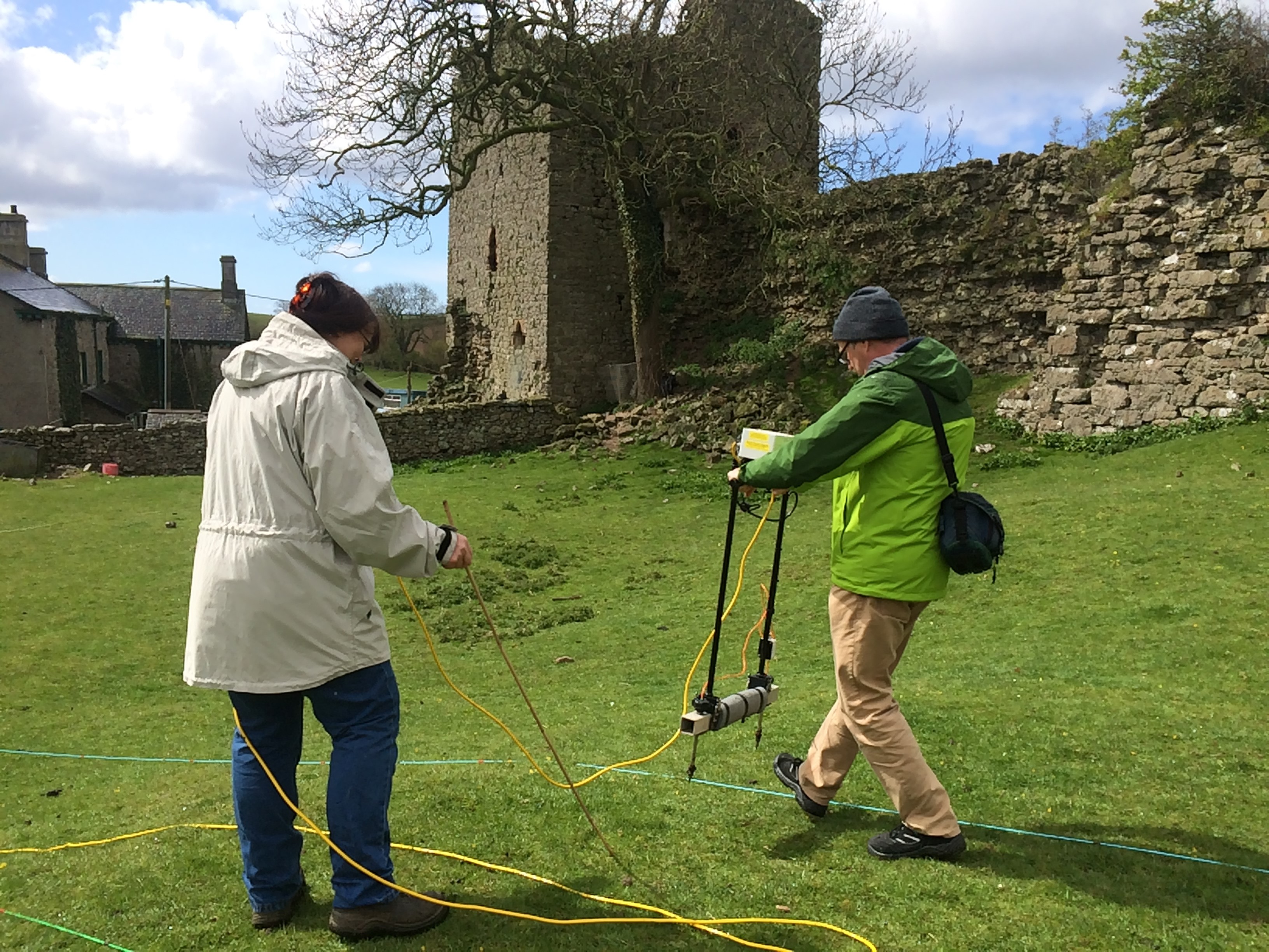
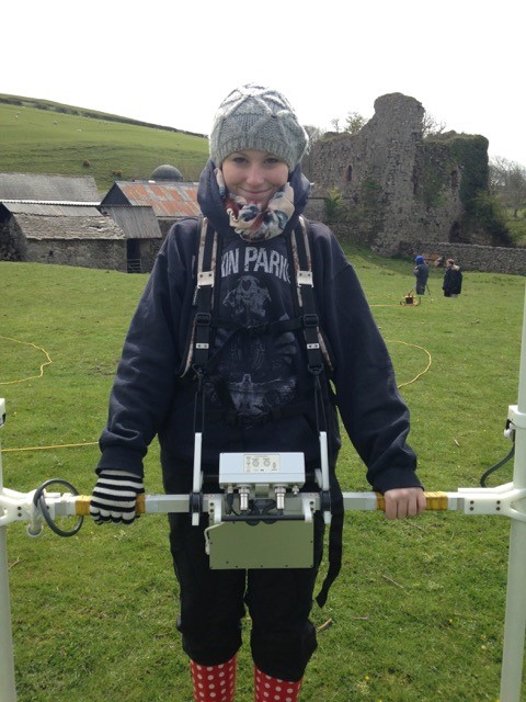
On 25th April we started the work at the site, using earth resistance and magnetometry to survey areas within the curtain wall and to the north of the castle, where we had identified ridge and furrow and the track way. The training attracted participants from as far afield as Liverpool and Carlisle as well as some local residents to Gleaston Village. The north-west tower was also subject to detailed laser scanning, which will supplement the photographic record produced by Aerial-Cam. The weather was, well, challenging especially for the end of April with heavy downpours and even snow hampering our progress on site!
H2H volunteers undertaking an earth resistance survey at the siteOne of the first year students from UCLan undertaking a magnetometry survey. Still smiling despite the cold!
The team of students, together with volunteers and the fabulous UCLan staff persevered and we completed a significant amount of survey across the site. The results of the survey work are currently being processed by the team at UCLan, however, initial interpretation of the data is highlighting garden features to the north of the site and possible post-built structures to the south-west of the courtyard.
All this recent work is enabling professionals to gain a better understanding of the site. For the first time we have an accurate photographic record of all the standing remains and have started investigating what below-ground remains may survive beneath the soil.
Morecambe Bay Partnership would like to thank the Castle Studies Trust and all their supporters for enabling the survey work to take place and highlight the importance of this site and the conservation issues the site currently faces.
We would also like to thank the landowners who have provided us with special permission to undertake this survey work and the team from Historic England and Cumbria County Councils Lead Archaeological Advisor who have provided advice and guidance along the way.
It is hoped that the work undertaken so far will be built on in future years with additional survey and assessment, finding positive solutions to protect this rare and fascinating site.
Some of the Castle Studies Trust’s projects have made innovative use of cutting edge technology. Nick Tarr explains how a new survey technique was used this year at Pembroke Castle.
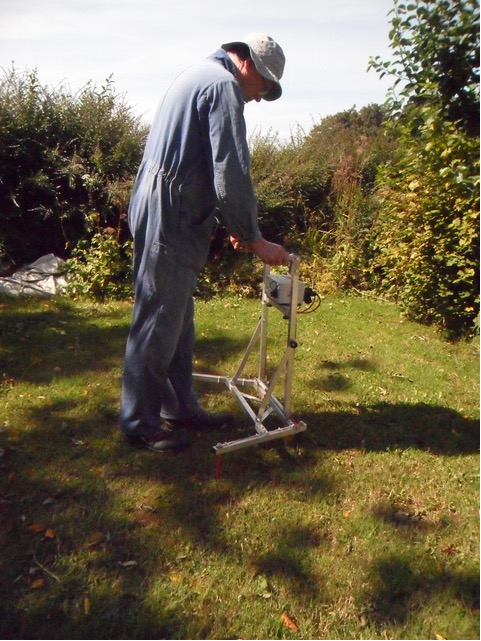
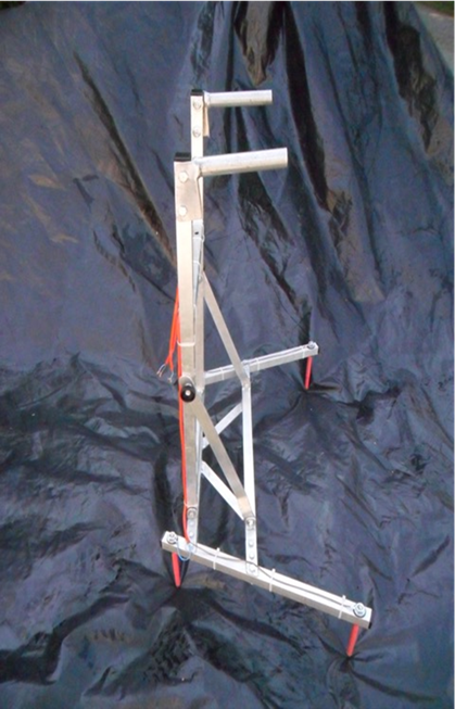
Geophysical Survey Technologies (GST) was formed to improve survey equipment for archaeologists to use in all environments including equipment suitable for use in woodlands. The equipment, ideally, should be within the financial reach of amateur groups.
The prototype survey frame resulted from research into voltage surveys (commonly called resistance surveys) where geology or other conditions are unfavourable for conventional methodology. The frame uses a commercially available data logger and power supply but has all four electrodes on a compact mobile frame which is collapsible to fit in boot of a car.
The version used at Pembroke Castle was aimed at keeping the energy from the power supply within the archaeological layers so maximising any opportunity of detecting any archaeology present. A comparison with the conventional twin array in both parallel and zig-zag walking modes was made over a single grid which contained part of a building and a track. The existing twin array frame gave no clear signal for the building, the track was the only major feature seen.
The prototype frame gave much better results. A further test across a monastic site in west Wales has also shown improved results over the conventional twin array methodology. Development work continues.
Gleaston Castle, April 2016. Written by Matthew Emmott.
Throughout the week of the 25th to the 29th of April, the Morecambe Bay Partnership and the University of Central Lancashire’s archaeological department teamed up to give a lucky few a golden opportunity to take part in a further survey of Gleaston Castle in Cumbria.
Following on from the aerial survey undertaken at the end of July last year using a grant from the Castle Studies Trust, it was hoped that any buried structures beneath the courtyard would be identified and mapped out. Adam Stanford’s 2015 survey (Aerial-Cam) used the latest in drone technology, utilising high definition photography\photogrammetry to capture the full character of Gleaston’s ruins, and in the process produced some intriguing survey results pointing towards the possible remains of buildings and platforms beneath the courtyard.
Tools on offer to assist in the survey, and provided by the University of Central Lancashire’s Archaeological department, were ground penetrating radar, a magnetometer, an electrical resistivity meter, high definition cameras and laser scanners.
Aided and abetted by Louise from the Morecambe Bay Partnership, volunteers and students were taken through the process of mapping out grids and the use of the equipment. And then the real work was done. By the end of the week it looked as if the whole of the courtyard had been scanned using all the available techniques…..all we have to do now is wait for the results and hope that Gleaston has at last given up some more of her secrets.


 Fifteen archaeological test pits have enhanced our knowledge of the site in a variety of ways. Digs were undertaken within the derelict mansion to establish where the new lift could be situated. Just below the surface runs a medieval stone structure, at least 3.5 metres wide running along the north face of the mansion. The angle and relationship with the keep suggests that this is the 13th century curtain wall. A glimpse of the underground stonework will remain visible in the restored mansion.
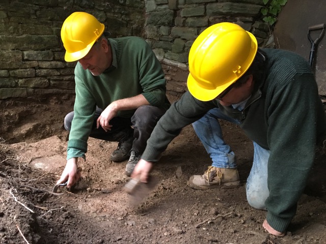 Volunteers from the community have helped on a dozen or so of the digs. The