Men on the Watch: The Motte d’Olivet, Grimbosq, Normandy

In her new book Authority, Gender and Space in the Anglo-Norman World, 900-1200, Dr Katherine Weikert, Senior Lecturer in Early Medieval European History at the University of Winchester looks at how medieval manors reflected and shaped – and were shaped by – their occupants to express social authority. In this article she looks at the facinating if little known Motte d’Olivet.

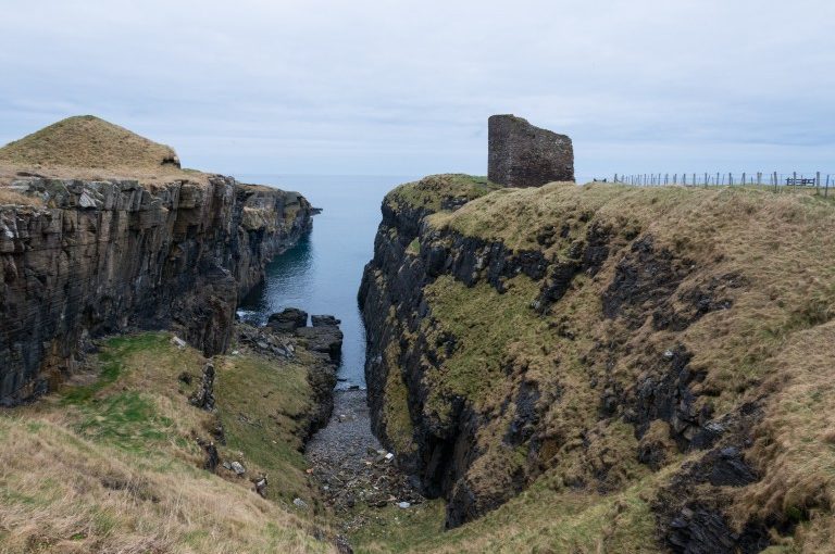
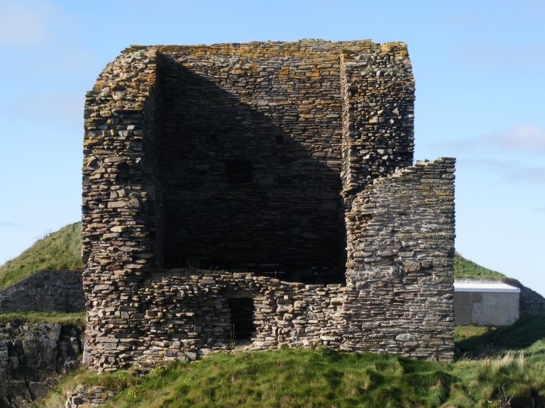
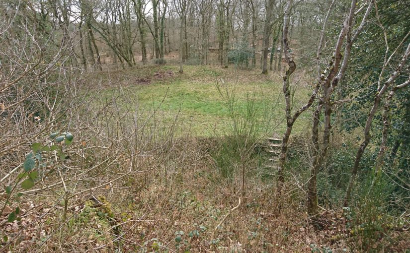
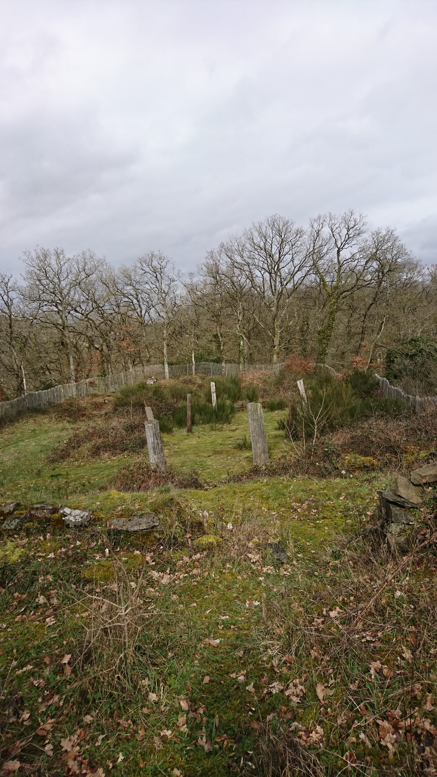
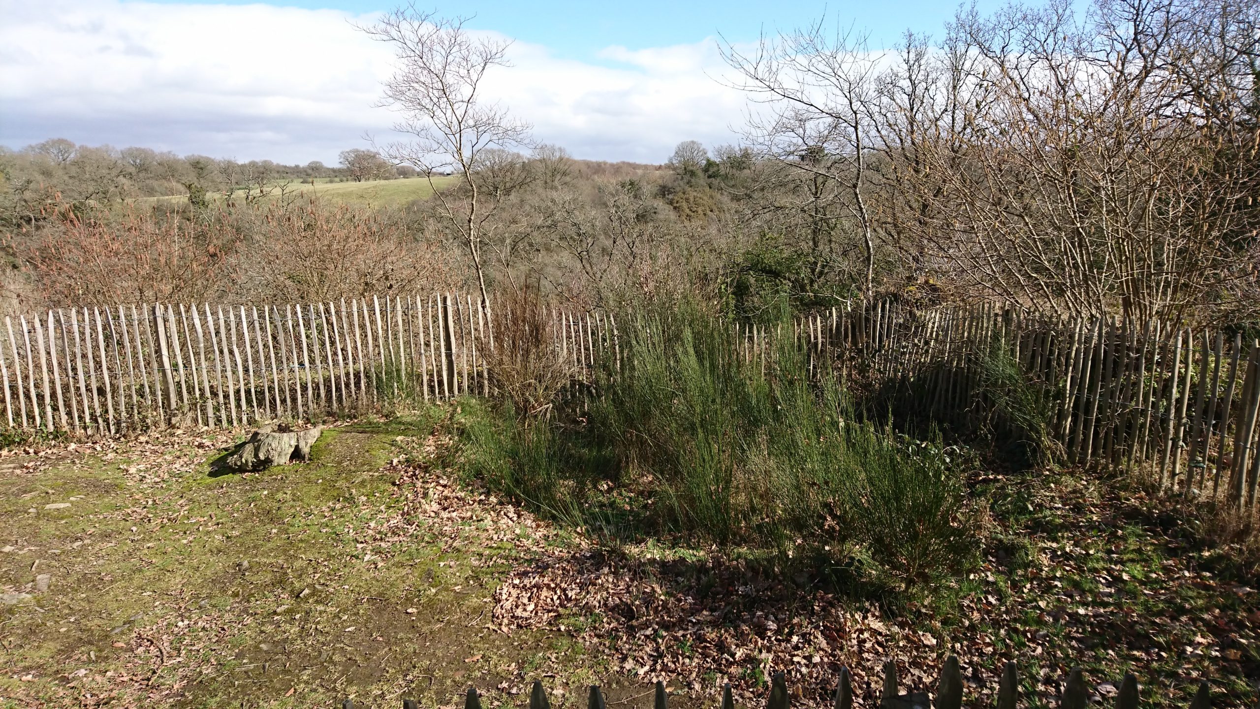
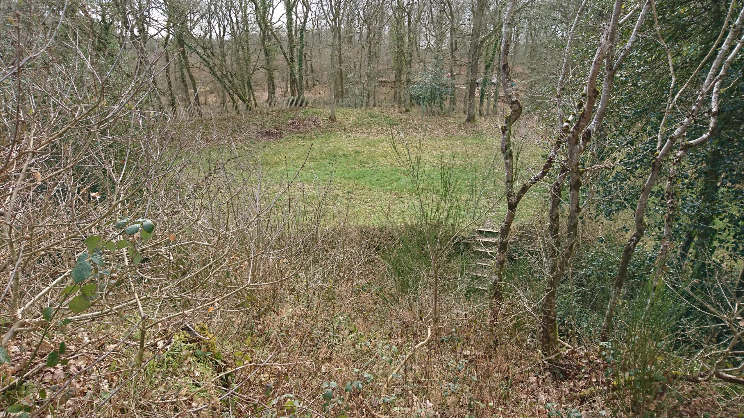
High in the lush forest of Grimbosq, Normandy, the remains of the Motte d’Olivet sit atop a lofty spur overlooking the Orne River valley. About twenty-two kilometres to the south of Caen, it’s a site that would be familiar to many castle-lovers: a man-made earthen mound, atop which formerly stood a wooden tower, with baileys on either side of it. A deep ditch around the motte kept it spatially and physically separated from both baileys. The motte-and-baileys take up the cramped, flat space on the point of the v-shaped spur surrounded by steep drops and small rivers on both sides (one charmingly called Ruisseau de Coupe-Gorge: essentially, cut-throat creek). The tower on the motte overlooked the whole area, and when the brush and forest was cut down around it, as it was in the eleventh century, the viewshed would have been spectacular. The Motte d’Olivet has long been considered a seigneurial residence, but its location, and the history of the man who built it, suggest a far less lofty purpose.

Subscribe to our quarterly newsletter


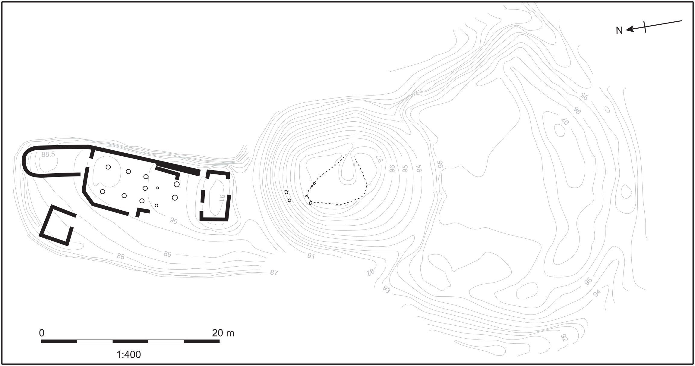
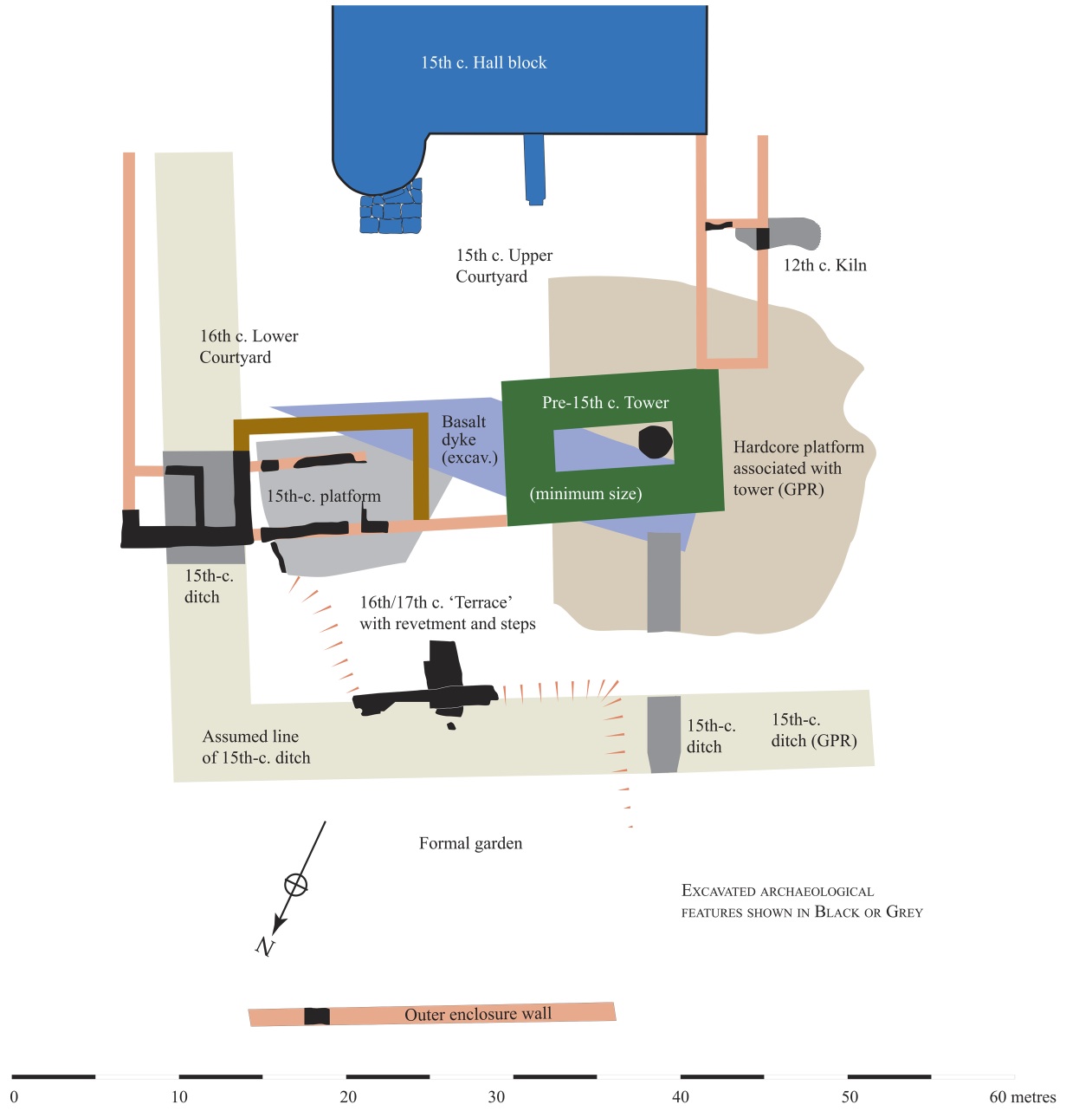
Image 1: Plan of the site of the Motte d’Olivet. Pighill Archaeological Illustrations redrawn from Decaëns 1981, published in Weikert 2020.
Image 2: View north from the motte towards the River Orne. The stone remains in the foreground are suggested to be part of a gatehouse to access the motte, and the modern posts are placed at the location of the posts of an aisled building. Photo by the author.

The site was excavated by Joseph Decaëns and published in 1981, though lingering questions remain about the castle and its builder. The elusive Erneis Taissan built the motte in the 1040s-50s during a period of conflict with his older brother Raoul. The Taissons come to greater prominence in Normandy in the twelfth and thirteenth centuries along Raoul’s line; Ralph Taisson, for example, was King John’s seneschal in Normandy at the turn of the thirteenth century. But in this earlier period, the family is more difficult to uncover, and the remains of the Motte d’Olivet are some of the only physical presence we have of them from this time. Decaëns even described Raoul as ‘un personnage très important mais assez énigmatique’ (a very important, but very enigmatic person)!

Seeking evidence of the brothers and their history is an exercise of charters, patience and this castle. Decaëns ascribed the tension between the brothers to each receiving portions of their father’s lands after his death, and Norman charters indicate some expression of this frustration through the brothers’ conflicting patronage of local monasteries. For example, the elder Raoul founded the abbey at Fontenay (St-Étienne de Fontenay, on the Orne north of Grimbosq) in 1050, and its foundation charter, confirmed by William the Conqueror, lists properties Raoul gave to the abbey, all to the east of the Orne. Erneis – who patronised Fontenay but may have preferred the abbey at Fontenelle – held estates mostly to the west of Raoul’s. Grimbosq and Cesny(-Bois-Halbout) are but two of these, with his descendants’ title even named for them. The lines drawn between the properties of these two brothers run straight through the forest where Erneis built his Motte.

Image 3: The remains of St-Étienne de Fontenay, outside of St André-sur-Orne, Normandy, founded by Raoul Taisson c. 1050. Photo by the author.

Regardless of the cause of the tension, the Motte is the most obvious indication of the brothers’ strife, which visibly plays out the Norman landscape. The Motte directly overlooks the boundaries and roads between Grimbosq – Erneis’ land – and Mutrécy – Raoul’s land – with a clear sightline to the valley to the north, and a ridge to its east leading to Mutrécy. With this in mind, alongside the size of the castle and particularly its distance and isolation from any settlement, the Motte looks less like a seigneurial castle and more like an outpost, a short-lived watchtower to keep an eye on one’s pesky brother. It’s deeply unlikely this motte was Erneis’ main residence, but instead a place for his men to watch the boundaries of his land.

Image 4: The top of the motte, Mutrécy over the horizon. Photo by the author.

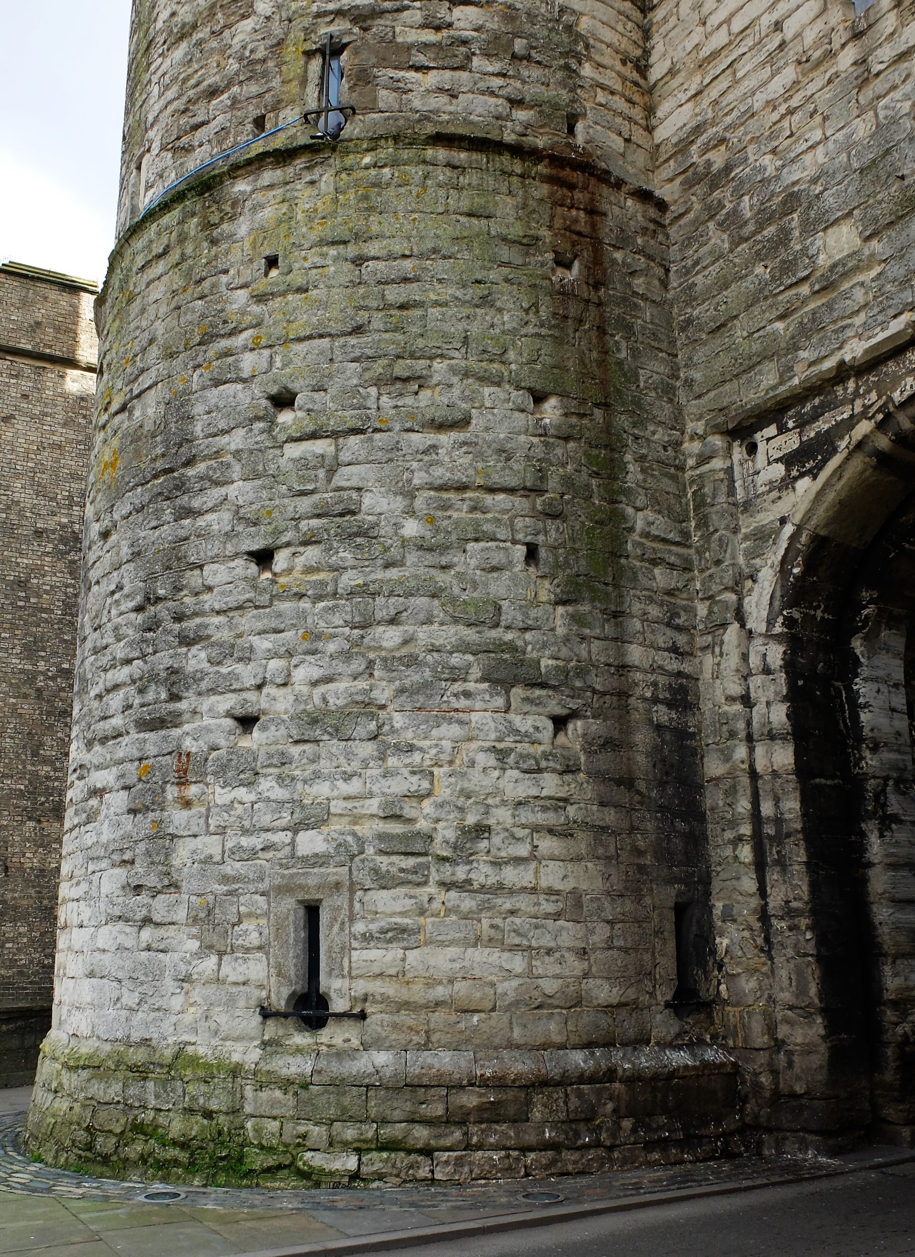
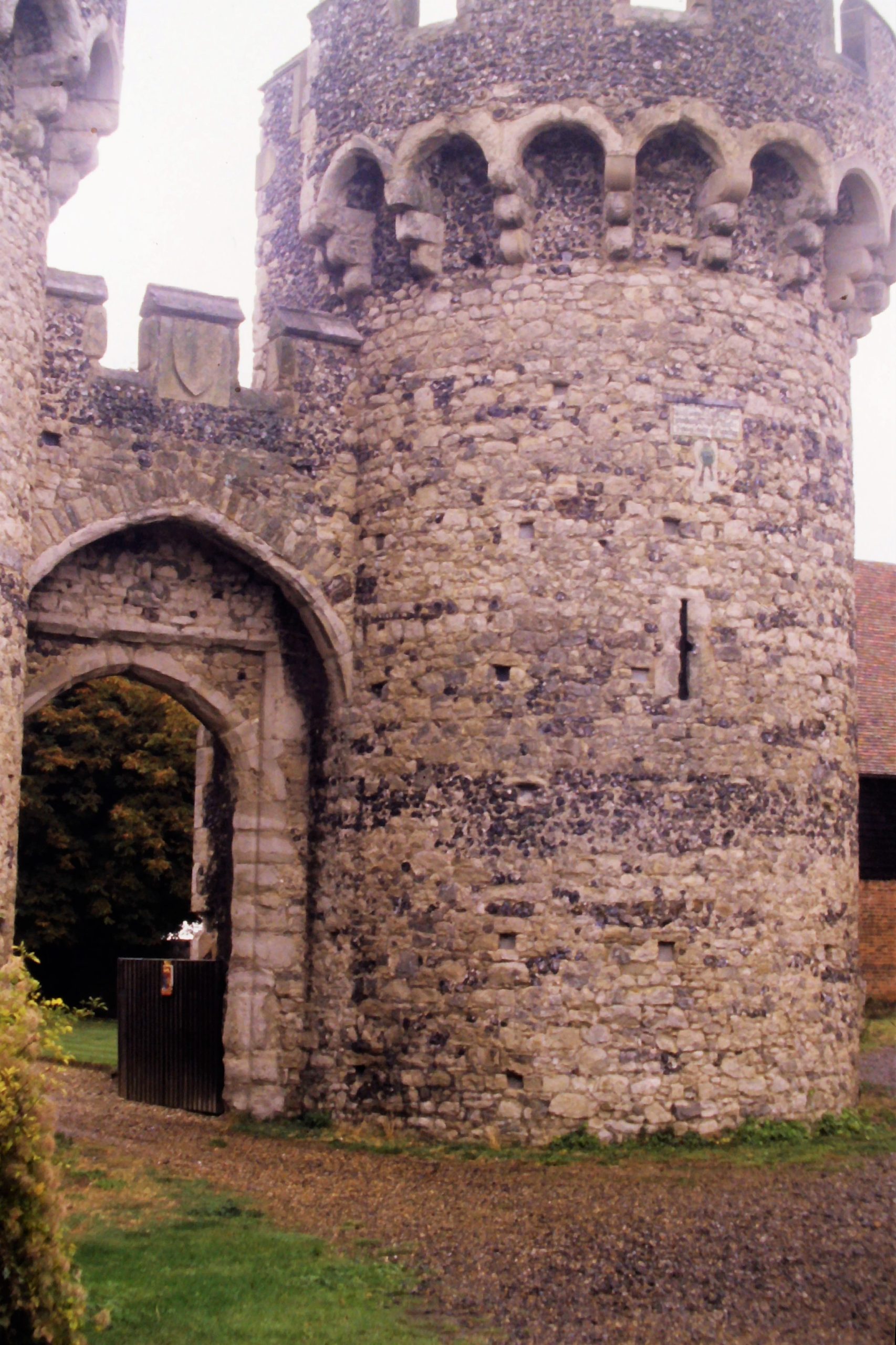
The northern enclosure holds a large aisled building, possibly two-storeyed, and additional stone rooms or buildings which have been interpreted as a sort of a gatehouse providing access to the motte, and a small separate kitchen. The apsidal room was previously interpreted as a chapel but this has recently been rejected by me on varying grounds (including location, orientation and charter evidence), which further indicates this place as less an elite residence and more an outpost. However, the state of the physical remains makes it unclear how to interpret not only the décor but quite simply the form and use of these buildings. The north bailey would probably have housed Erneis when he was there. But if that was this bailey’s primary intention, it would have only occasionally seen habitation, and more frequently seen the men on the watch accessing the motte via the gatehouse. The intention of this castle wasn’t in residency, but in the duties it performed for Erneis, in the watching and waiting done by his men.

Image 5: Remains of the ‘kitchen’ in stone, the modern post-holes marking the location of the large aisled building in the north bailey, with the motte (covered in scrub) in the background. Image by the author.

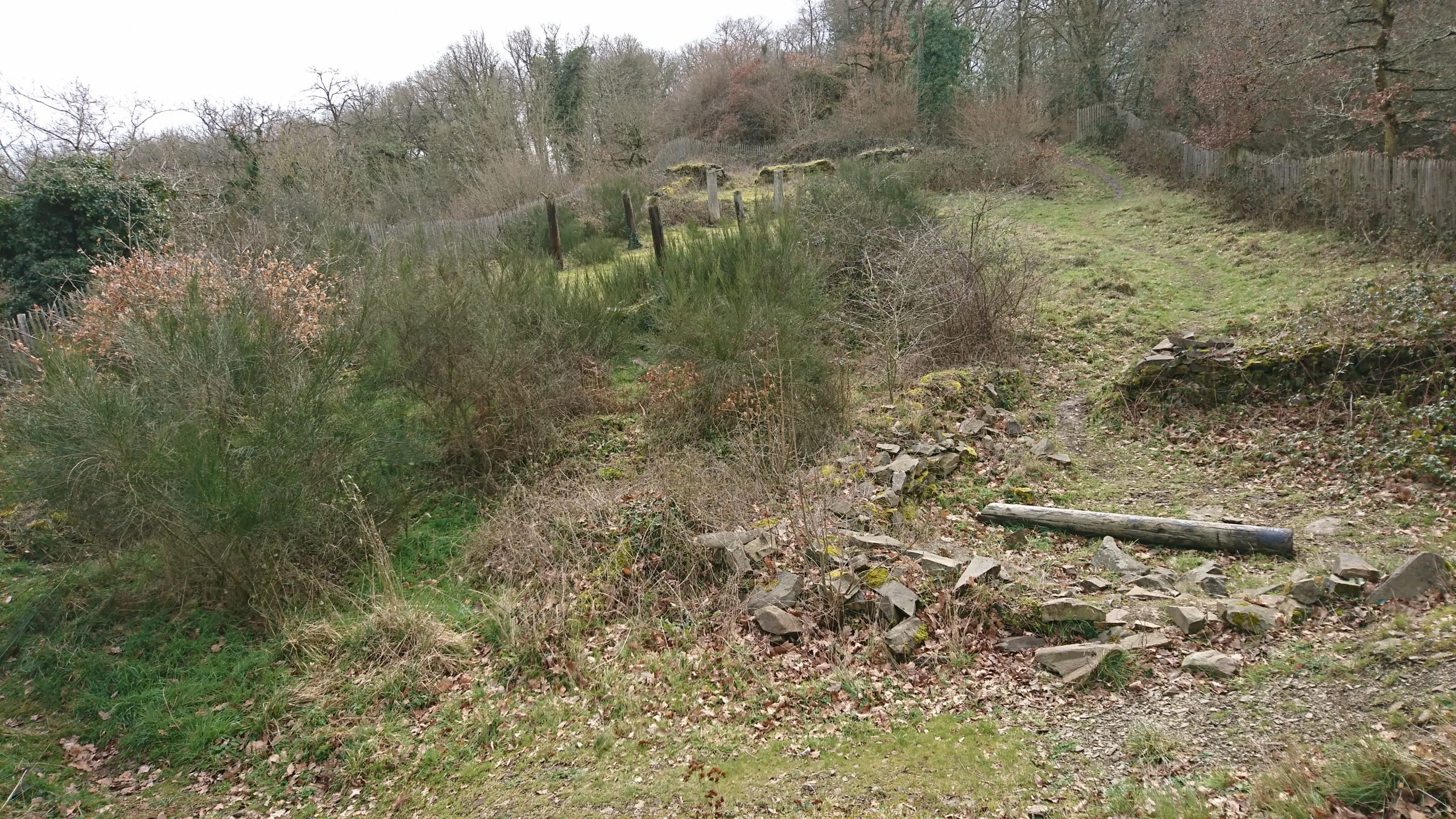
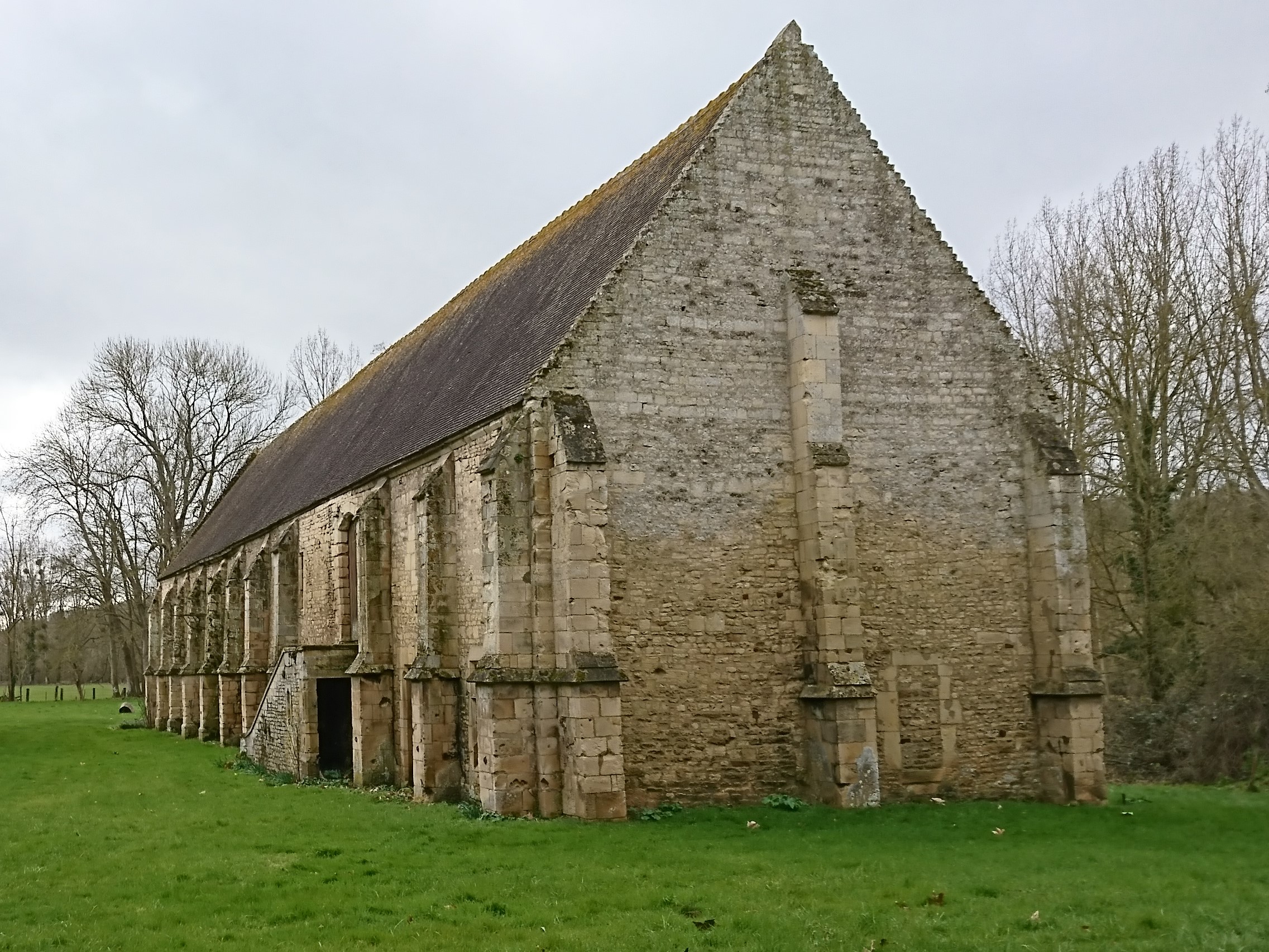
The castle’s activity would have been focused in the south bailey. The south enclosure, which held a stable and forge, would have hosted a number of people and animals, and alive with the sights, sounds and smells of a working yard – hot iron and manure, the hammer singing against the anvil. It would have been a site of activity at the castle, a place for the retinue who staffed this border outpost. Game pieces found in excavation mean men entertaining themselves, or perhaps simply passing the time, the way you’d play cards in an airport. As Susan Reynolds and many others have pointed out across the middle ages, military men of a sort gathered together to wait and watch would have probably had some training or practice to attend to themselves: we can envision the south enclosure for this.

Image 6: The south bailey from the top of the motte. Note the deep ditch surrounding the motte. Image by the author.

Wace tells us that the sons of the two men, Robert fitzErneis and Raoul (II) Taisson, both died at Hastings fighting with Duke William, and the rift between their two families was only repaired at this point. Erneis and Raoul (I) were probably already deceased and, to wit, the Motte was no longer in use by the FitzErneis line. Neither the Motte d’Olivet nor the warring brothers have been further investigated since the site’s excavation in 1981, and new questions about the place and its people can bring different views about what was once considered an elite house. What’s left of the brothers’ rift is just the landscape of this ruined castle, a lonely enclosure in an isolated place, high above the flourishing green forest, a lesson reminding us that castles have much to say about all the people who were once there.

Subscribe to our quarterly newsletter

Katherine Weikert’s new book, Authority, Gender and Space in the Anglo-Norman World, 900-1200, is available from Boydell & Brewer at http://boybrew.co/2YyHx2m. Use the special discount code BB870 for 40% off and free international shipping!

Grimbosq Forest is a part of the city of Caen. It is open to the public and filled with walking and mountain cycling routes, and sites such as an arboretum, a pet cemetery, and the Motte d’Olivet. The Motte is on the yellow walking route, and is unstaffed thought signage gives information about the site. There is free parking, and the forest is also on bus route 34 from Caen. More information can be found at https://caen.fr/annuaire-equipement/foret-de-grimbosq (French) or https://www.calvados-tourisme.co.uk/offer/la-motte-castrale-dolivet/ (English).

Castle Studies Trust 2021 Grant Awards

The Castle Studies Trust is delighted to announce the award of six grants, totalling a record £31,000 not only covering a wide geographic area but also a wide range of different types of research:

Subscribe to our quarterly newsletter

Caerlaverock new castle with old behind it and the coastline Crown Copyright Historic Environment Scotland

Caerlaverock, Dumfriesshire

The aim is to understand the chronology and geography of extreme weather events in the high medieval period, and the effects they wrought on archaeological features that led to the abandonment of the old castle built in c.1229 in favour of the new built 200m away in c.1277. The latest thinking is that it was a series of extraordinary storm surge events which pushed a series of storm driven gravel ridges across the River Nith.

The methodology to find this out is interdisciplinary, using scientific methods to enhance understanding of archaeological fieldwork. The fieldwork will involve the establishment of a series of transects across the site and surrounding landscape from which cores and samples will be extracted for sediment description, stratigraphic analysis, and Carbon 14 dating.

Depending on Covid restrictions, the aim is to start doing the work in May this year with the receipt of the final data in the autumn.

Greasley_Castle from air copyright Neil Gabriel

Greasley, Nottinghamshire

The production of an interpretative phased floor plan for Greasley Castle in Nottinghamshire.  The castle, built in the 1340s, has an obscure history and the understanding of its architectural phasing is at best very cloudy. The site is now a working farm and a number of post-mediaeval structures have been conglomerated around the remains of what is suspected to be a fourteenth century courtyard house with projecting corner towers.

The survey will act as baseline research data for a site which has not previously received serious fieldwork or publication and provide a basis for further research but also for any future conservation needs.

Work on the project will start in the early summer when covid restrictions ease.   

Laughton-en-le-Morthen motte and bailey castle and church

Laughton-en-le-Morthen, South Yorkshire

To provide professional illustration and reconstruction which will also be integrated into a co-authored academic article based on the two previous research projects carried out on the site by Dr Duncan Wright and funded by the Trust. A geophysical survey and then small-scale excavation which give a strong indication that the Normans had built a motte on the site of a high-status Saxon dwelling.

Part of the monies will be used to produce phase plans of Laughton during key stages of its development, and a small percentage will pay for a line drawing of the 11th century grave cover incorporated into the fabric of the nearby church. The aim will be to start the work as soon as possible.

Old Wick Tower copyright Historic Environment Scotland

Old Wick, Caithness

Dendrochronological assessment of timber at the Castle of Old Wick, Caithness thought to be one of the earliest stone castles in Scotland dating from the12th century and the period of Scandinavian ascendency. Current thinking though ascribes the date to the 14th century. Analysing these samples will hopefully provide an answer.

With no architectural features or physical “independent” evidence analysing the remains of a timber joist-end (in poor condition) in one of the joist ends remains the best chance of being able to find an answer. 

The taking of the samples is likely to take place in September when conditions are still going to be favourable as the castle is situated next to the North Sea and the sample can only be found 8 metres above ground level. 

Richmond Castle copyright English Heritage

Richmond, North Yorkshire

Co-funding a three-week excavation of Richmond Castle, one of the best preserved and least understood Norman castles in the UK. The aim is to understand better the remains of buildings and structures primarily along the eastern side of the bailey including near the 11th century Robin Hood tower and near Scolland’s Hall.

Subject to the scheduled monument consent being granted the excavation will take place in late July.

Warkworth Castle, copyright William Wyeth

Warkworth, Northumberland

Geophysical survey to explore evidence for subsurface features in and around the field called St John’s Close in a field adjacent to the castle with the aim to establish the location and eastern extent of the castle’s deer park in the 16th century as well as its entrance way. It also hoped to find evidence of a routeway running parallel to the possible park boundary which could represent an early route to the castle’s gatehouse from the south-west.

The plan is to do complete the geophysical survey by the end of March.

To keep up to date with how these projects progress over the coming months you can:

Subscribe to our quarterly newsletter

And if you donate at least £50 here and be invited to our exclusive visits to these projects: https://donate.kindlink.com/castle-studies-trust/2245 

Featured image: Old Wick Castle, Caithness, copyright Historic Environment Scotland

What lies beneath: what a ground penetrating radar survey reveals of Druminnor Castle

Lead Archaeologist on the Druminnor Castle excavation, Dr Colin Shepherd, looks at the results of the ground penetrating radar (GPR) survey of the castle in funded by the Castle Studies Trust in 2019 and what that means for future work at the site.

As a consequence of the GPR geophysics, that were generously funded by the Castle Studies Trust, we have a number of new and potentially interesting anomalies to be investigated. Furthermore, the GPR research has also been instrumental in clarifying other aspects of previously excavated evidence. This has been made possible as, contrary to most instances, the geophysics at Druminnor have been incorporated into the ongoing investigation rather than simply as a precursor to excavation.

Subscribe to our quarterly newsletter

The GPR generated 286 ‘radargrams’ or sections across the site and much time and effort has gone into analyzing these. The radargrams were compared to actual excavated sections. This permitted the creation of a ‘key’ that has allowed us to extrapolate from the excavated sections to unexcavated parts of the site. As a result, we can, fairly comfortably, suggest a developmental plan of Druminnor spanning the 13th to 18th centuries (Figure 1).

Suggested phasing of Druminnor Castle by Colin Shepherd

The GPR has suggested the extent of a hardcore platform that appears to have supported the ‘Old Tower’. This was thought to have been the earliest part of the castle but without hard evidence. We hope to test the presumed limit of this platform as we extend our trench southwards from the well that sat within the tower. (As you will recall, the GPR alerted us to that remarkable feature that became a focus for our 2019 season.) The GPR suggests that there may be a revetment supporting the platform at that point. Also, any relationship between this platform and the mid 12th-century kiln will be important in attempting to date that platform and, by extension, the Old Tower itself.

Well found in tower as a result of the GPR survey

The radargrams have also demonstrated the probable line of a terrace and sunken formal garden (red hachures on plan) and permits the excavated section of revetment and steps (shown in black) to be placed in its proper context. This garden probably dates to the 16th or 17th century, though exactly when is still debatable. The construction of the terrace removed all trace of the earlier (early to mid 15th century) ditch and so must post-date that. A late 17th-century Dutch pipe bowl found in the fill of a post hole associated with the steps suggests its removal at around that time or shortly thereafter. No trace of the terrace appears on the estate plans of c.1770.

The line of the defensive ditch has been shown by the radargrams to extend westwards from the excavated portion in Trench 11. This gives us an accurate alignment permitting its course to be drawn, even though the middle section was removed by the terrace. Where its return is at the western end of the site is still a mystery. The eastern arm was excavated in Trench 2 lying beneath the later (early 16th-century) lower courtyard. The 15th-century upper courtyard incorporated the tower with the surviving hall block (shown in blue). The courtyard’s west range can be estimated from remains found during the kiln excavation, but its eastern boundary was removed when the lower courtyard was added.

Finally, the GPR revealed the line of the outer enclosure wall as depicted on the estate plans. This was sampled in 2019 and the base of the wall found. The date of this feature is presently unknown and further work needs to be done to try to clarify that matter.

Evidence of landscaping material in outer enclosure copyright Iain Ralston

Sadly, work planned for 2020 included the extension of the ‘well trench’ in the car park to look for the possible revetment suggested by the GPR as well as opening a much bigger area across the outer enclosure wall, as located by GPR. This sits beneath a good metre and a half of later landscaping material (see picture, courtesy of Iain Ralston) and, for safety and archaeological reasons, demands a much larger trench. The keyhole sample trench indicates good survival and, it is hoped, evidence will be found to date the feature and to help explain when this became the northern boundary of the castle enclosure.

The excavated evidence together with the GPR results permit this developmental plan to be made and rough dates affixed. It is worth noting that, prior to our investigations, Druminnor was believed to have consisted solely of the surviving hall block with an attached tower at its western end. Everything not in blue on the plan, therefore, was formerly completely unknown.

Access in 2021 is still, sadly, in the laps of the Gods owing to Covid, but it is hoped that we will be able to get back on track later this year to look for more goodies!

Subscribe to our quarterly newsletter

Fragile symbols: gunpowder and castle walls

Dr Peter Purton, FSA, Castle Studies Trust trustee and author of recent works on medieval sieges and medieval military engineers looks at his latest area of research, later medieval fortifications and the impact of the introduction of gunpowder.

Castle studies were once ruled (in England at least) by wealthy amateurs, mostly male (Ella Armitage a stand-out exception) and many with military backgrounds. Every aspect of a castle, for them, was determined by military thinking. The late twentieth century counter-attack turned this on its head, stressing the symbolic role of castle-building as expressions of status and power. Some people challenged any suggestion that changes were driven by the need to upgrade defensive capability; and the same argument has been applied when guns arrived on the scene.

Subscribe to our quarterly newsletter

Those keen to argue the superiority of the English can always point to the first adoption (in Europe – the Chinese were centuries ahead) of gunpowder, and its first use for war. It’s also true that the English were the first to adapt fortifications to use guns, from the mid-fourteenth century, a little ahead of the Low Countries followed by the French, all places affected by the devastating impact of the struggles we bundle up in the title of the Hundred Years war (1337-1453).

Gun loop at the west gate of Canterbury, Kent

Were loops created for guns also symbolic? If you take account of the historical reality of the time, this argument surely evaporates in a puff of (gun)smoke. I’m working on a new history of changes in fortification in the age of gunpowder with Dr. Christof Krauskopf and we delivered a paper at the (virtual) Leeds IMC in July 2020 addressing this question. We can’t answer the question without knowing the context, and what the builder wanted. The first is usually evident, the second is irretrievable. Across southern England from the earliest days of the war there were frequent seaborne raids by the French and their allies that caused local devastation and serious embarrassment (and loss) to the English crown. People could not know when and where the next attack would come. The response was the preparation of defences designed to use guns (at the time, they were not powerful enough to harm stone walls) from East Anglia (the Cow Tower of Norwich, for example) to Devon (Hawley’s Fortalice at Dartmouth), usually adapting existing defences but often building anew. The royal ‘architect’ (an anachronistic shorthand) Henry Yevele was directly involved in the erection of the Westgate and the reconstruction of the city walls at Canterbury and at private castles in Kent (Cooling, for example). Southampton, having been burnt to the ground by the French, underwent extensive reconstruction of its defences, including (early in the fifteenth century) one of the first gun-towers (the God’s House tower).

Cooling Castle, Kent, Outer Gatehouse

Amidst all this very expensive work, in 1385, the castle at Bodiam (Sussex) was put up for Sir Edward Dallingridge, set in a lake and pierced with gun loops and now a picture-postcard National Trust attraction. It has been the centre of a battle lasting longer even than the hundred years war. Forty years ago, the late Charles Coulson famously demolished its military pretensions by pointing out its many flaws from a defensive viewpoint. Bodiam became the peaceful retirement home for a military veteran.

Bodiam Castle courtesy of Wyrdlight.com

Sometimes you only see what you want to see. Actually, Dallingridge wasn’t retired: he was commissioned to review the defences of the coast, for the king, and was actually wounded in a French attack. His gun loops may not have worked very well and his lake could have been drained – but a French raiding party was unlikely to hang around long enough to find out. In the context, the most that can be said is: we don’t know what he intended.

England swiftly lost its leading position in the race to build fortifications adapted for and against artillery as it became significantly more powerful during the course of the next century, a time when the gap between what princes and their subjects could afford expanded greatly. But many nobles did make provision for guns, and kings still put comfort first (Edward III’s work at Windsor). Between the two extremes of fortresses with evident military purpose and castles designed as palatial homes, others tried to provide for both functions, with numerous examples across the continent.

Perhaps that was what the medieval castle had always been?

Subscribe to our quarterly newsletter