Medieval Climate Change at Caerlaverock – Fieldwork Week One

Project lead, Dr Richard Tipping, looks back at the first of the two weeks of fieldwork he and Dr Eileen Tisdall are undertaking to try establish whether climate change did impact the re-positioning of Caerlaverock Castle.

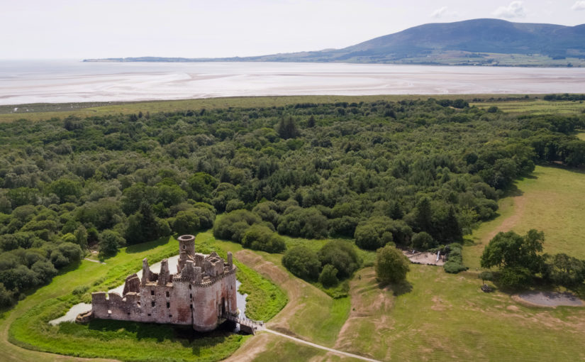
Well, somewhat later than planned or advertised, the first week of fieldwork at the old castle at Caerlaverock began on 3rd July. It has been dated by oak tree rings from the drawbridge across the moat to c. AD1229. The new castle, a couple of hundred metres away and upslope, began construction only 50 years later. Why the rebuild? This is the mystery.

Subscribe to our quarterly newsletter
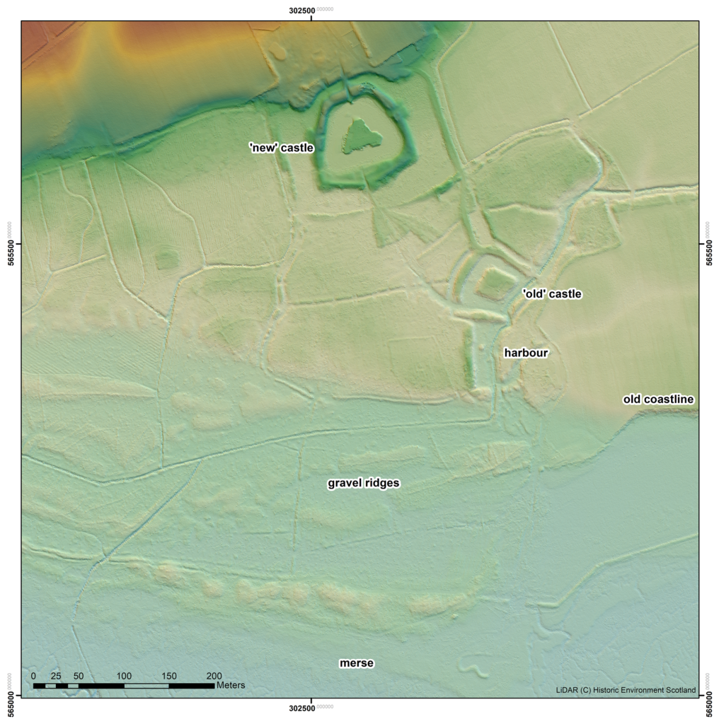
An image from a LiDAR survey, with the vegetation removed, showing the landscape and old coastline around the ‘old’ and ‘new’ castles at Caerlaverock

The natural environment played a role. Some archaeologists think the old castle started to fall apart because it was built on soft sediment, a deep clay-rich silt locally called ‘carse’. And sure enough, the new castle was built on the nearest outcrop of bedrock. But twenty years ago, a team of environmental archaeologists from the Universities of Stirling and Coventry found an additional reason for abandonment of the old castle. They found, in a wide ditch next to its moat, a thick layer of grey estuarine-marine mud penetrating the brown freshwater peat of the ditch. This suggested that very large storm surges impacted the environs of the old castle. Further work found very large gravel beach ridges, thrown up in these storms, stacked against the old shoreline.

That team included Dr Richard Tipping and Dr Eileen Tisdall from the University of Stirling. Now we are back to find more evidence and improve the dating of the sediments funded by the Castle Studies Trust, as Historic Environment Scotland, the custodians of both castles, seek to update what we know of Caerlaverock and improve the visitor experience.
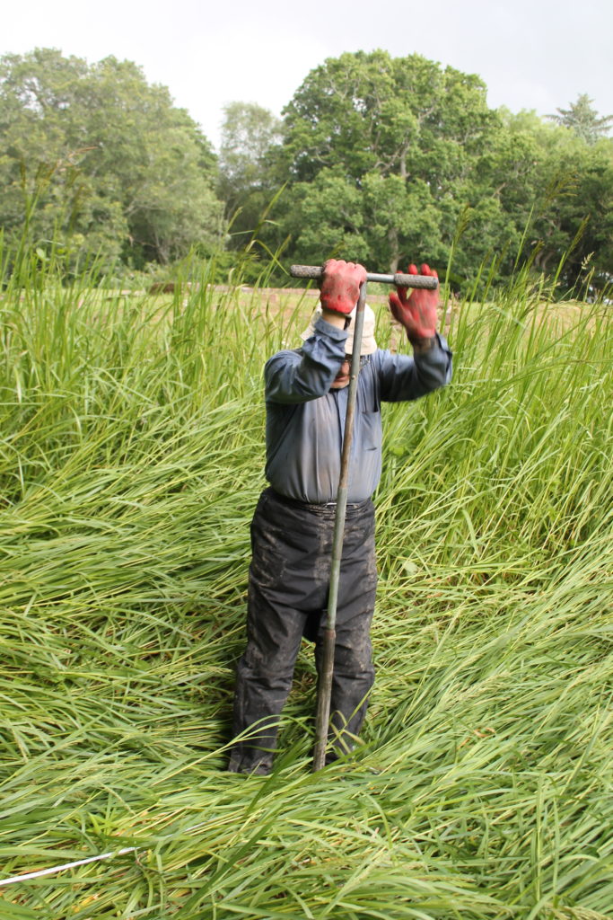
Dr Tipping using the ‘simple’ corer to extract sediment cores

For a week, 3rd-10th July, Richard Tipping stuck tiny (2.5cm diameter) holes in sediments in the ditches and moat with a simple corer, a metre-long metal gutter with a handle on the end. Push it in, turn it around to cut out a sample and pull it out, together with a metre of sediment. Record the sediment and then repeat, usually in a straight line called a transect. He did this over 80 times in the week. Isn’t science exciting? It wasn’t too hard: the sediments in the ditches and moats are less than a metre thick before the ‘natural’, as archaeologists call it, the sterile silt of the ‘carse’. But because the sediments are so thin, and because we knew that they recorded a lot of environmental ‘events’ in a short period of time, logging the cores in detail took time. A challenge, too: there are only so many shades of grey or brown.
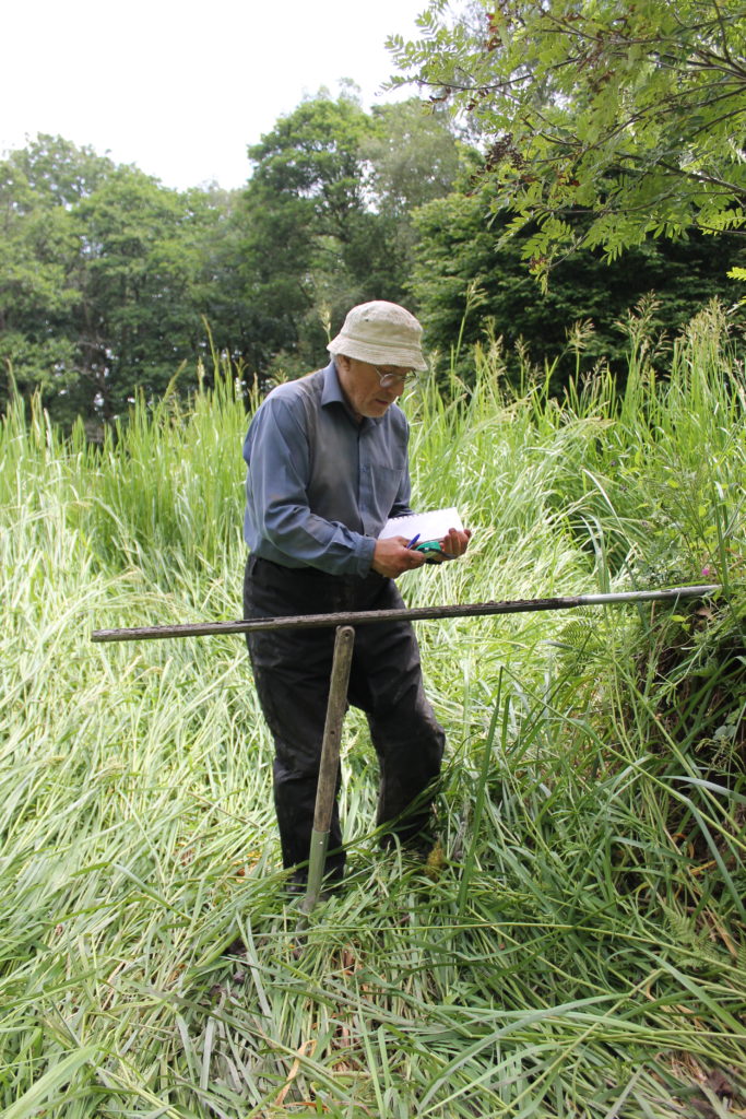
Dr Tipping logging the details of a sediment core

Coring started in the artificial ditch that runs parallel to the moat. This was where we first began, twenty years ago, to realise that something funny was going on; in fact, several funny things. Why, in the first place, dig a 60 m long, 3 m wide ditch alongside one side, and only one side, of the moat? Twenty years ago, radiocarbon dates on freshwater peat at the base of the ditch hinted that this ditch was actually earlier than the old castle, maybe 200 years earlier. We aim to clarify this. Coring found the same sediments we found last time, which is always reassuring. Peat at the base of the ditch was replaced by grey silt. This was sealed by more peat. There is more grey silt at the end of the ditch nearest the coast, although the upper layer penetrated the full 60 m length.

We could not understand, twenty years ago, the filling of the moat with sediment: too few boreholes, too far apart. This time, cores were spaced 1.5 to 3 m apart along a 40 m long line. Archaeologists generally excavate and record continuous sections. We can’t do this because the site is a Scheduled Monument, and besides, the sediment is under water (though this week mercifully dry underfoot), so we construct our section from transects of cores, ‘joining up the dots’ by correlation. For the first time we can show that the moat was probably affected by the same environmental impacts that hit the parallel ditch. This is only ‘probable’ because radiocarbon dating has yet to show the events are the same. But grey silt entered the moat from the coast, pushing up the moat, probably eroding earlier-formed peat but not penetrating the full length. At the end farthest from the coast, near the bridge, peat continued to form.
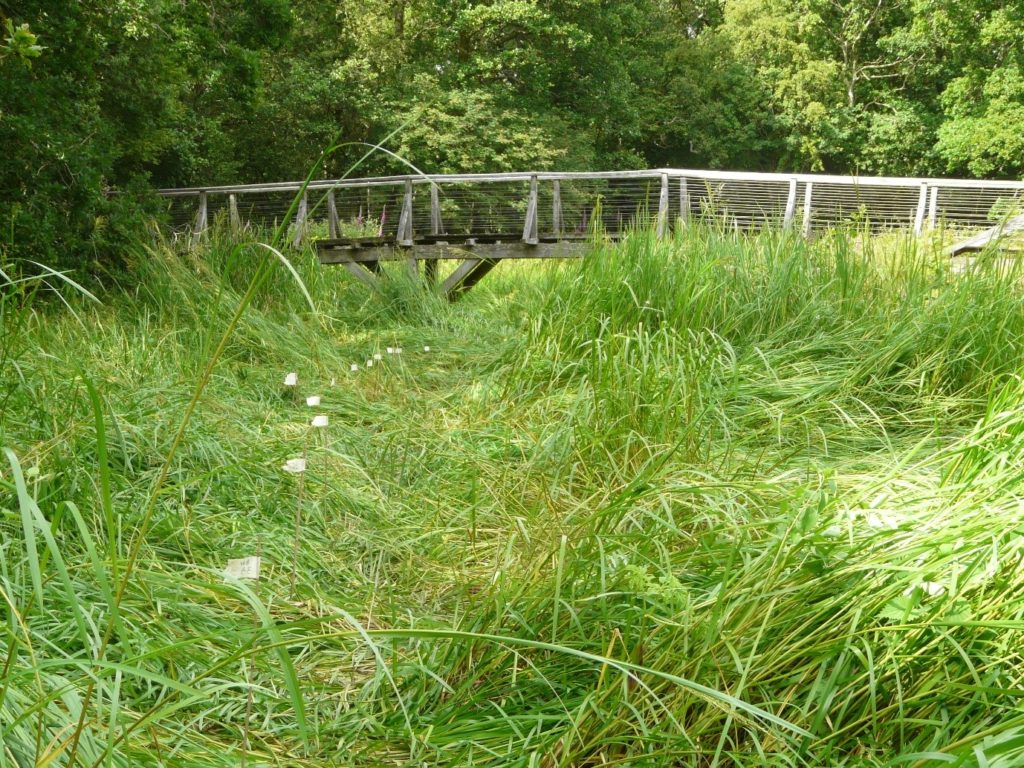
A line of flags showing the transect of boreholes in one arm of the moat, approaching the footbridge to the old Castle, itself precisely where the original drawbridge was.

Our cores also revealed two new aspects of moat construction. The first is that the constructors took a shortcut in making the moat. In two arms of the moat, they had incorporated natural stream channels in the moat, twice as deep as the rest of the moat. This was a way, of course, to ensure the moat was under water. But away from these channels, the ‘natural’ lay only 20-40 cm below the present sediment surface. If the water surface then was as it is now, the depth of water would have been barely above the knee. You might have waded to the castle rather than use the drawbridge.

Coring in parts of the moat also hit stone at shallow depths. The carse itself is stoneless, and so the stone was emplaced by people. Stabbing around with the corer revealed these stones to be large blocks. They are concentrated at one corner of the moat, nearest the coast. Maybe they were buttresses put in to strengthen the foundations of the castle, either as it started to subside, or maybe undermined by storm surges.

Now I’m thinking and planning the next part of the campaign, straightening my back, and hoping the insect bites subside: the joys of fieldwork. From 17th July we start again, for a week, away from the old castle and out onto the old beach ridges and the basins formed by them. In the early 2000s, tree-felling of Sitka spruce allowed us to see what we were doing. Now it’s a dense tangle of semi-natural oak woodland and not easy to move around in. Wish me luck!
Subscribe to our quarterly newsletter

Castle Studies Trust 2021 Grant Awards

The Castle Studies Trust is delighted to announce the award of six grants, totalling a record £31,000 not only covering a wide geographic area but also a wide range of different types of research:

Subscribe to our quarterly newsletter

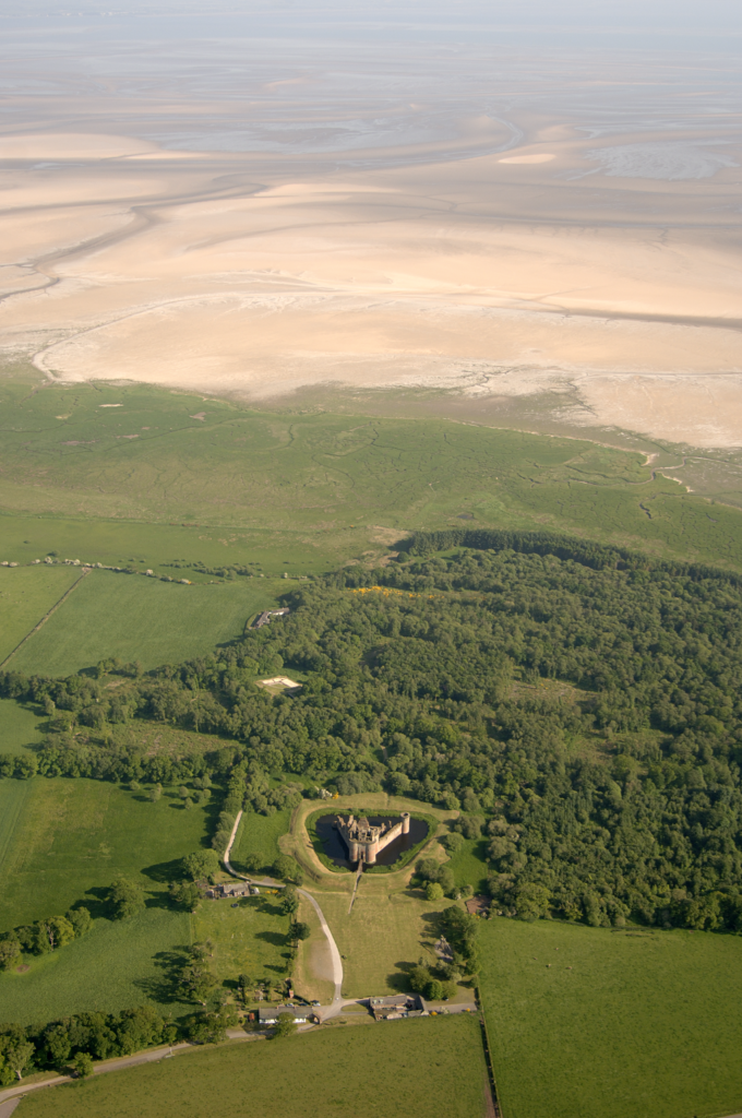
Caerlaverock new castle with old behind it and the coastline Crown Copyright Historic Environment Scotland

Caerlaverock, Dumfriesshire

The aim is to understand the chronology and geography of extreme weather events in the high medieval period, and the effects they wrought on archaeological features that led to the abandonment of the old castle built in c.1229 in favour of the new built 200m away in c.1277. The latest thinking is that it was a series of extraordinary storm surge events which pushed a series of storm driven gravel ridges across the River Nith.

The methodology to find this out is interdisciplinary, using scientific methods to enhance understanding of archaeological fieldwork. The fieldwork will involve the establishment of a series of transects across the site and surrounding landscape from which cores and samples will be extracted for sediment description, stratigraphic analysis, and Carbon 14 dating.

Depending on Covid restrictions, the aim is to start doing the work in May this year with the receipt of the final data in the autumn.

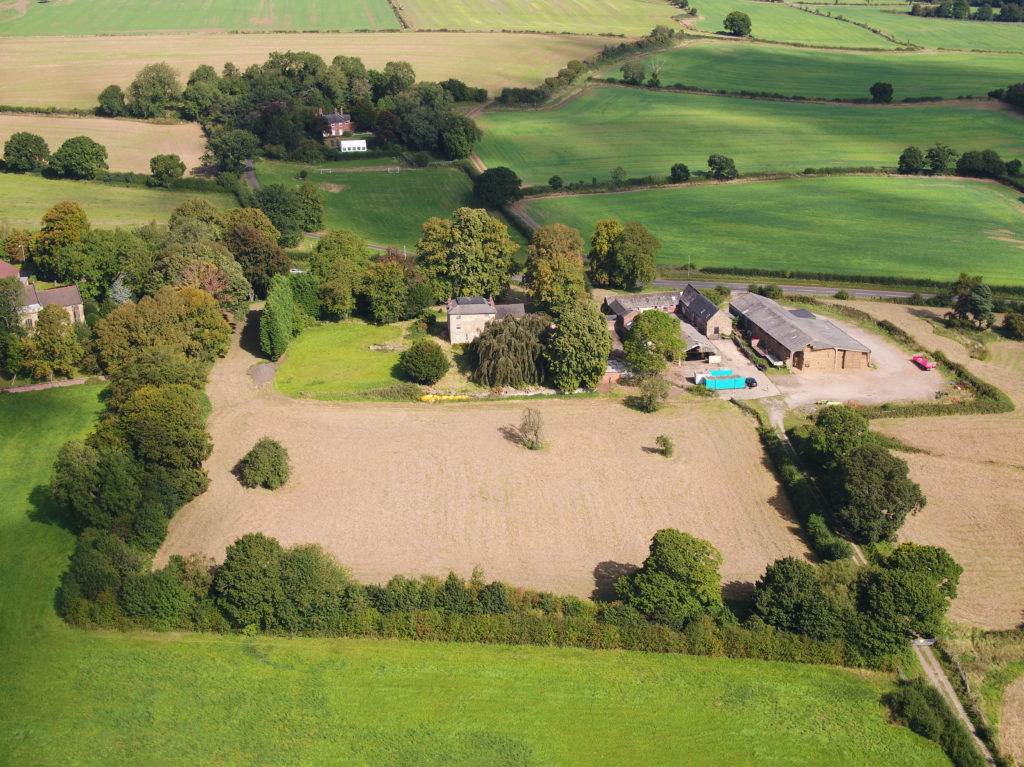
Greasley_Castle from air copyright Neil Gabriel

Greasley, Nottinghamshire

The production of an interpretative phased floor plan for Greasley Castle in Nottinghamshire.  The castle, built in the 1340s, has an obscure history and the understanding of its architectural phasing is at best very cloudy. The site is now a working farm and a number of post-mediaeval structures have been conglomerated around the remains of what is suspected to be a fourteenth century courtyard house with projecting corner towers.

The survey will act as baseline research data for a site which has not previously received serious fieldwork or publication and provide a basis for further research but also for any future conservation needs.

Work on the project will start in the early summer when covid restrictions ease.   

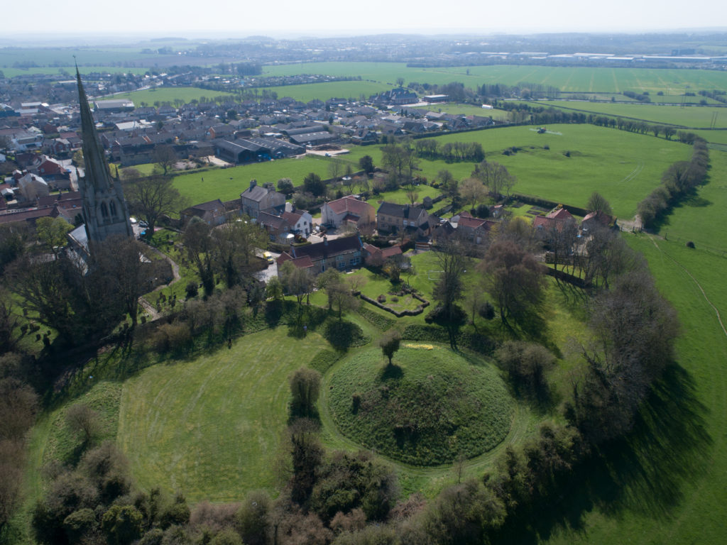
Laughton-en-le-Morthen motte and bailey castle and church

Laughton-en-le-Morthen, South Yorkshire

To provide professional illustration and reconstruction which will also be integrated into a co-authored academic article based on the two previous research projects carried out on the site by Dr Duncan Wright and funded by the Trust. A geophysical survey and then small-scale excavation which give a strong indication that the Normans had built a motte on the site of a high-status Saxon dwelling.

Part of the monies will be used to produce phase plans of Laughton during key stages of its development, and a small percentage will pay for a line drawing of the 11th century grave cover incorporated into the fabric of the nearby church. The aim will be to start the work as soon as possible.

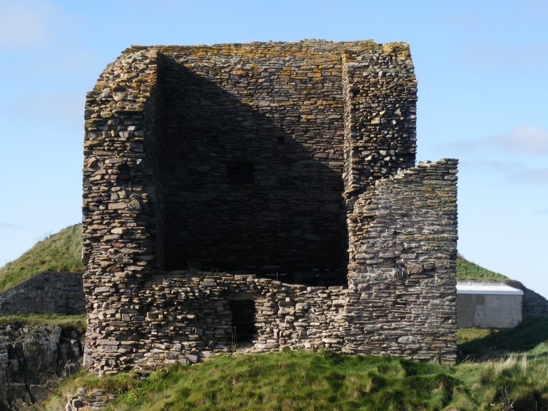
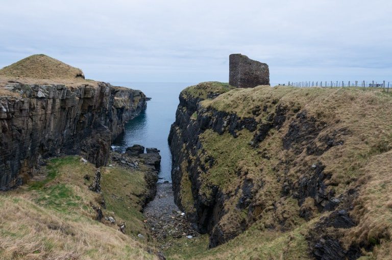
Old Wick Tower copyright Historic Environment Scotland

Old Wick, Caithness

Dendrochronological assessment of timber at the Castle of Old Wick, Caithness thought to be one of the earliest stone castles in Scotland dating from the12th century and the period of Scandinavian ascendency. Current thinking though ascribes the date to the 14th century. Analysing these samples will hopefully provide an answer.

With no architectural features or physical “independent” evidence analysing the remains of a timber joist-end (in poor condition) in one of the joist ends remains the best chance of being able to find an answer. 

The taking of the samples is likely to take place in September when conditions are still going to be favourable as the castle is situated next to the North Sea and the sample can only be found 8 metres above ground level. 

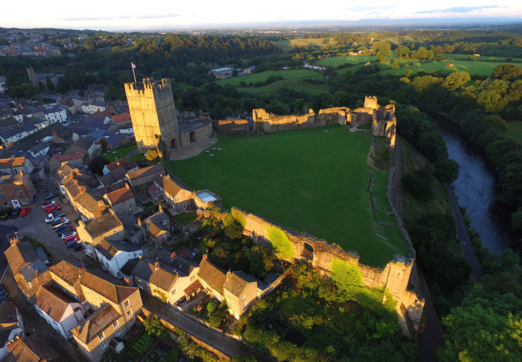
Richmond Castle copyright English Heritage

Richmond, North Yorkshire

Co-funding a three-week excavation of Richmond Castle, one of the best preserved and least understood Norman castles in the UK. The aim is to understand better the remains of buildings and structures primarily along the eastern side of the bailey including near the 11th century Robin Hood tower and near Scolland’s Hall.

Subject to the scheduled monument consent being granted the excavation will take place in late July.

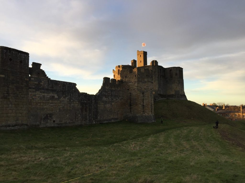
Warkworth Castle, copyright William Wyeth

Warkworth, Northumberland

Geophysical survey to explore evidence for subsurface features in and around the field called St John’s Close in a field adjacent to the castle with the aim to establish the location and eastern extent of the castle’s deer park in the 16th century as well as its entrance way. It also hoped to find evidence of a routeway running parallel to the possible park boundary which could represent an early route to the castle’s gatehouse from the south-west.

The plan is to do complete the geophysical survey by the end of March.

To keep up to date with how these projects progress over the coming months you can:

Subscribe to our quarterly newsletter

And if you donate at least £50 here and be invited to our exclusive visits to these projects: https://donate.kindlink.com/castle-studies-trust/2245 

Featured image: Old Wick Castle, Caithness, copyright Historic Environment Scotland

A Large and Eclectic Crop of Fascinating Applications for the Castle Studies Trust to Consider

The deadline for grant applications passed on 1 December. We’re going through the various projects now. Altogether the 14 projects, coming from all parts of Britain, one from Ireland, are asking for £88,000. They cover not only a wide period of history but also a wide range of topics.

We will not be able to fund as many of these projects as we would like. To help us fund as many of these projects as possible please donate here: https://donate.kindlink.com/castle-studies-trust/2245

In a little more detail here are the applications we’ve received:

Caerlaverock, Dumfriesshire: The aim is to understand the chronology and geography of extreme weather events in the high medieval period, and the effects they wrought on archaeological features that led to the abandonment of the old castle in favour of the new.

Georgian Castles: This project explores two castles in County Durham—Brancepeth and Raby—that were fundamentally reshaped and transformed in the eighteenth century to become notable homes in the area, and it advances not only our understanding of these two buildings in the period, but also the afterlife the castles in the area and the layers of history that they record.

Greasley, Nottinghamshire: The production of an interpretative phased floor plan for Greasley Castle in Nottinghamshire. The castle, built in the 1340s, has an obscure history and the understanding of its architectural phasing is at best very cloudy.

Laughton-en-le-Morthen, South Yorkshire: To provide professional illustration and reconstruction which will also be integrated into the co-authored academic article. Part of the monies will be used to produce phase plans of Laughton during key stages of its development, and a small percentage will pay for a line drawing of the grave cover.

Lost medieval landscapes, Ireland: To develop a low cost method, using drone and geophysical survey to identify native Irish (also termed Gaelic Irish) medieval landscapes and deserted settlements.

Mold, Flintshire, post excavation analysis: Post-excavation analysis from excavation on Bailey Hill of the castle

Mold, Flintshire, digital reconstruction: Visual CGI reconstruction of  Mold Castle using the new-found evidence of further masonry on the inner bailey structure and using information gathered by the Bailey Hill Research Volunteers, showcasing the many changes that have happened on this site from a Motte and Bailey Castle to present time as a public park.

Old Wick, Caithness: Dendrochronological assessment of timber at the Castle of Old Wick, Caithness thought to be one of the earliest stone castles in Scotland.

Orford, Suffolk: recording the graffiti at the castle through a detailed photographic and RTI (Reflectance Transformation Imaging) survey will add to our understanding of how the building was constructed and the ways the building was used over time, particularly 1336-1805, during which the documentary history of the castle provides little evidence of how the site developed.

Pembroke, Pembrokeshire: A second season of trial-trench evaluation of the suggested late-medieval, double-winged hall-house in the outer ward at Pembroke Castle, which is of national significance. The evaluation builds on the results of the works undertaken through previous CST grants: geophysical survey (2016) and 2018 whereby two trenches were excavated across the possible mansion site. The evaluation will again establish the extent of stratified archaeological deposits that remain within the building, which was excavated during the 1930s.

Pevensey, East Sussex: GPR survey of the outer bailey and immediate extramural area and UAV (aerial) survey of the castle to build up a 3-D model of the site.

Richmond, North Yorkshire: Co-funding a 3 week excavation of Richmond Castle, one of the best preserved and least understood Norman castles in the UK. The aim is to understand better the remains of building and structures along the western side of the bailey.

Shootinglee Bastle, Peeblesshire: Funding post-excavation work from the 2019-20 excavation season in particular some charcoal deposits from a C16 burning event.

Warkworth, Northumberland: Geophysical survey to explore evidence for subsurface features in and around the field called St John’s Close in a field adjacent to the castle.

We will not be able to fund as many of these projects as we would like. To help us fund as many of these projects as possible please donate here: https://donate.kindlink.com/castle-studies-trust/2245

The applications have been sent to our assessors who will go over them and prepare their feedback for the Trustee’s who will meet in late January to decide on which grants to award.