Greasley Castle – A Misunderstood Castle

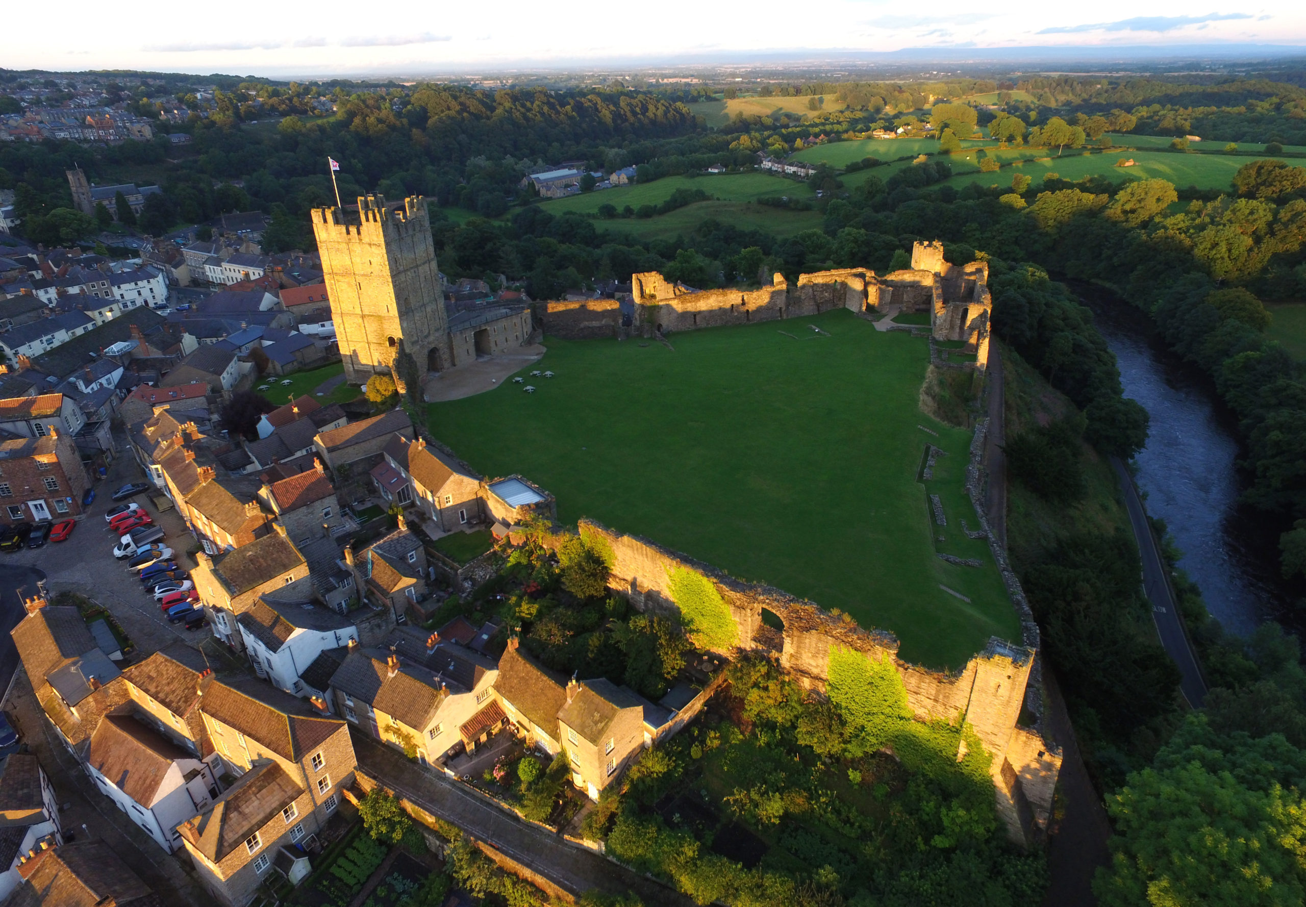
Following the publication of the results of our Warkworth geophys survey, here is the second of the Trusts 2021 grant awards publishing their results on the building survey of Greasley Castle, Nottinghamshire . Here James Wright explains what he found during his survey.

When studying castles, it is important to try and understand the contemporary experience of the buildings in the mediaeval period. A good way to do this is to look at castles which fit into the background. Researching castles built for kings, dukes and archbishops can skew data towards extraordinary structures. Equally, castles built in contested borderlands can lead to a focus on military aspects which were perhaps not part of the everyday for most sites. Surveys of lordly sites in the English midlands can help to establish a framework which explains the commonplace context for most castle builders.

Subscribe to our quarterly newsletter

The Castle of Nicholas de Cantelupe

The research funded by the Castle Studies Trust at Greasley Castle (Nottinghamshire), a relatively obscure site, has afforded the rare opportunity to look at a fourteenth century baronial castle in the midlands. The castle built in the 1340s for the socially rising Nicholas de Cantelupe was probably a type instantly recognisable to many of his aspirational peers.

Cantelupe’s story was a familiar one. Born at the opening of the fourteenth century into a family with high-ranking connections – two of his uncles were bishops – he engaged in royal service through military campaigns in Scotland, Flanders and France. Cantelupe was then appointed Governor of the key border town of Berwick-on-Tweed, named commissioner of array in Lincolnshire and became an MP. In short, Cantelupe was exactly the sort of thrusting individual who built castles to physically cement a place in society through powerful architectural statements.

Tomb of Nicholas de Cantelupe at Lincoln Cathedral (Picture Source: James Wright / Triskele Heritage)

Some scholars have pointed towards Edward III’s grant of a licence to crenellate at Greasley, which Cantelupe received in 1340. However, after that note, references to the castle largely dry up. This is probably due to what the castles specialist, Oliver Creighton referred to as a “deficiency of the field evidence”. The site, a privately owned working farm, has not received much in the way of systematic survey work. Consequently, previous statements were rather scanty – it was a misunderstood castle.

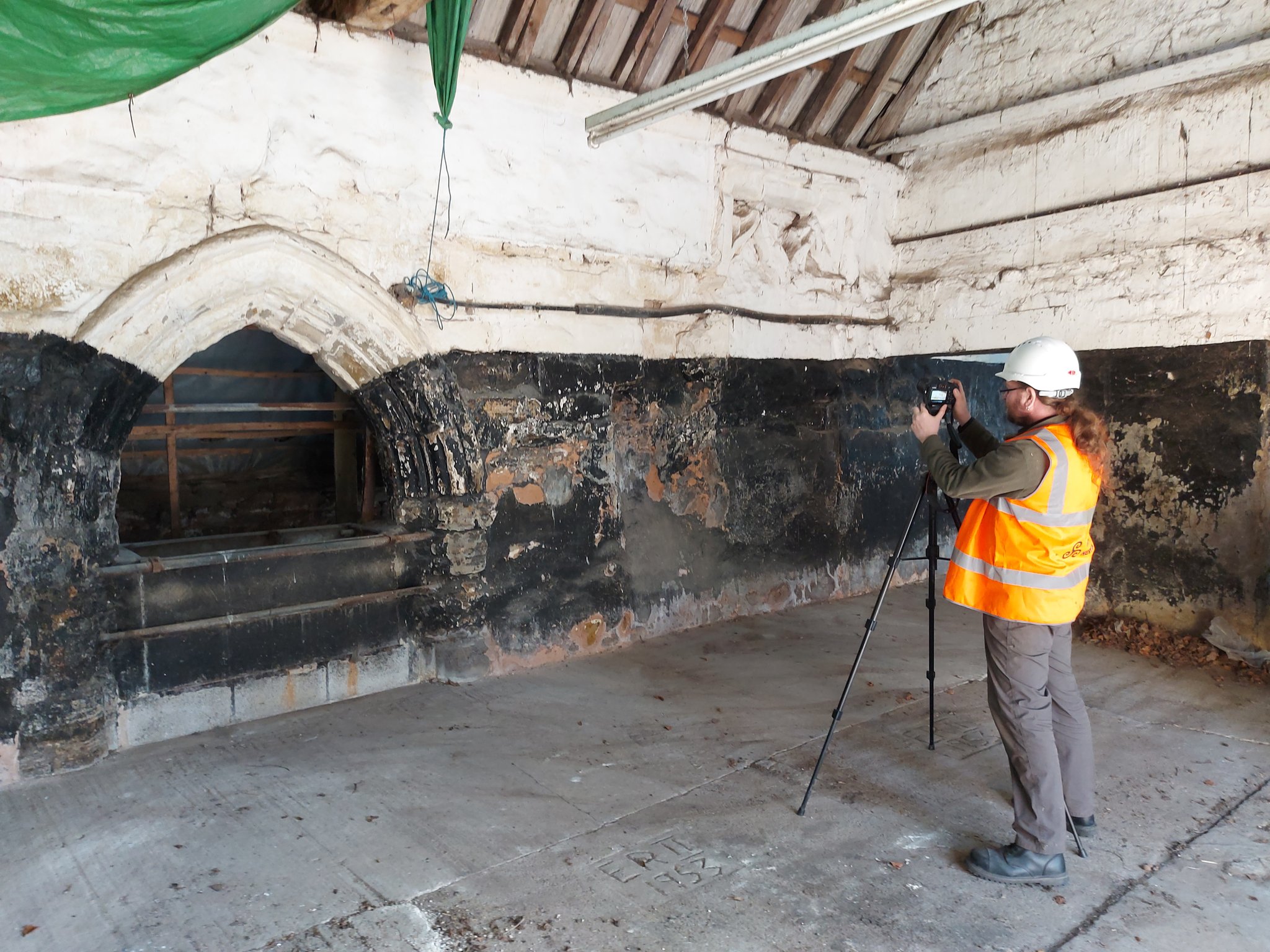
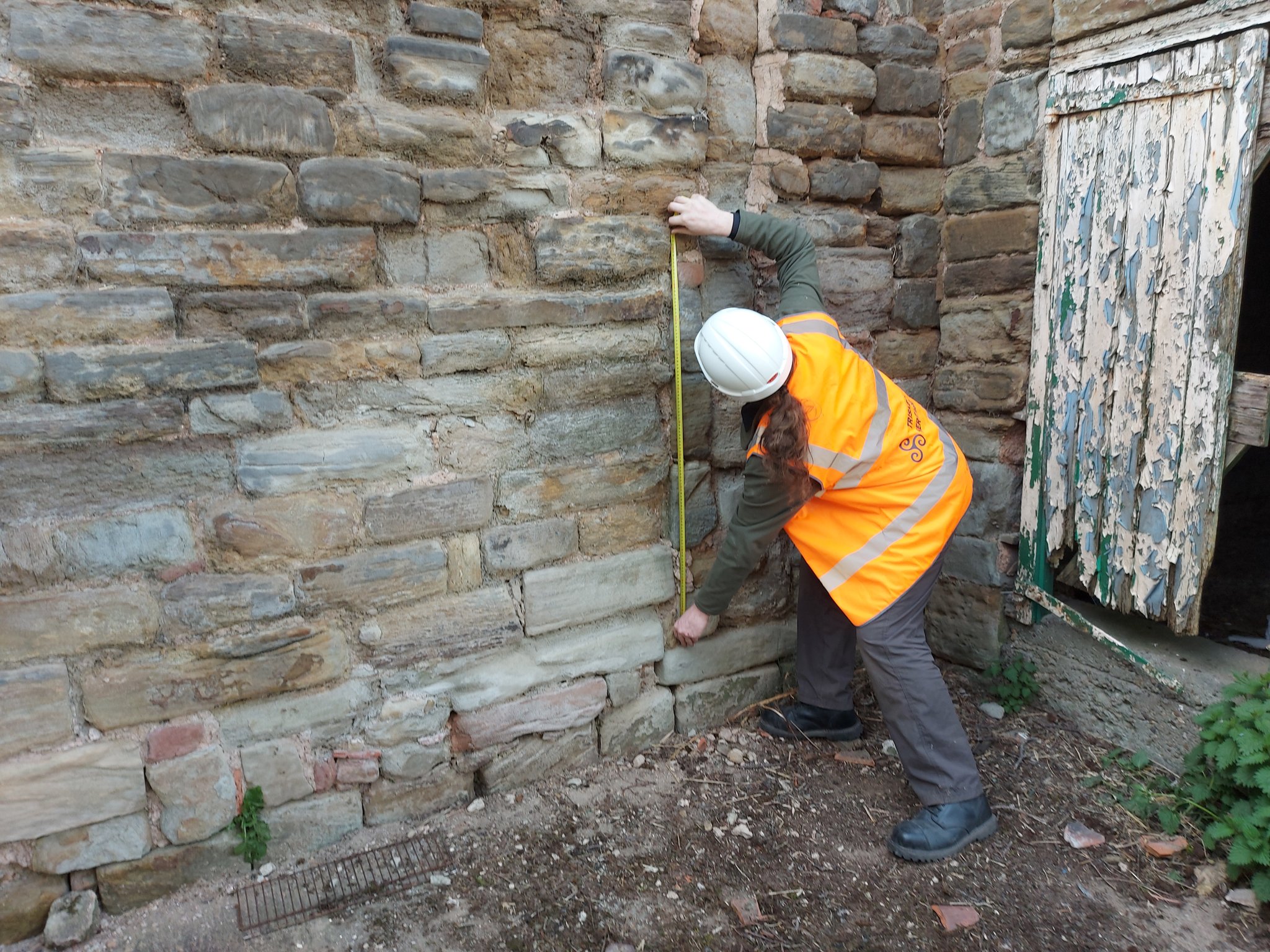
In 2021, Triskele Heritage, funded by the Castle Studies Trust, conducted a buildings archaeology survey with the intention of providing initial baseline data for the site.

Results of the Survey

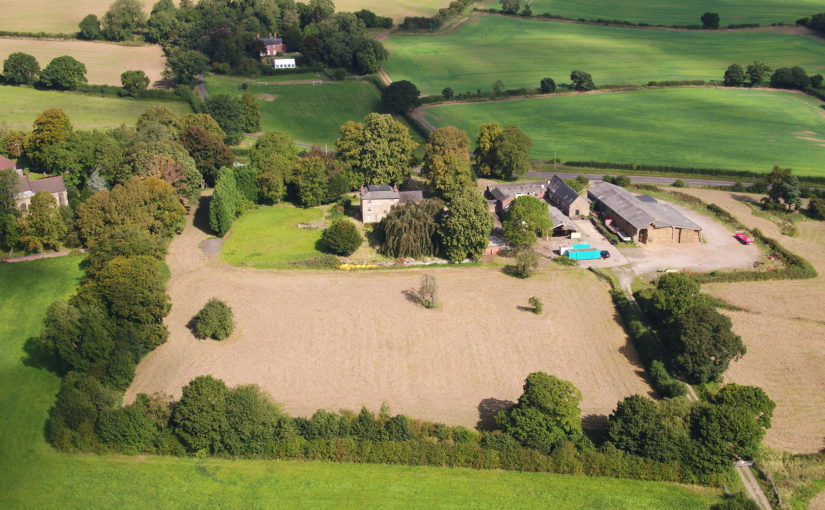
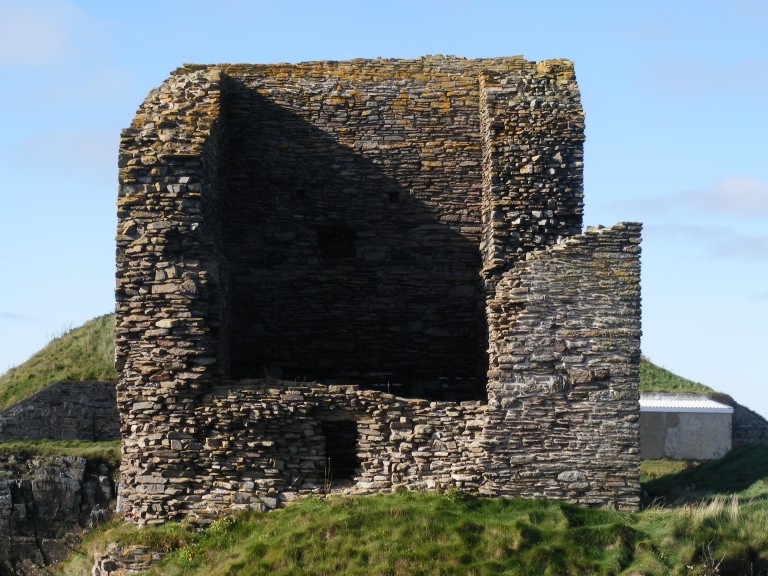
The project was able to identify that the remaining structures of the castle are located within a post-mediaeval farmyard, which lies inside a partially moated plateau. The remains of a single courtyard were identified. To the north, it is bounded by a plain curtain wall flanked bywhat were probably polygonal turrets. Part of the west curtain wall survives beneath nineteenth century farm buildings. Opposite is part of the east elevation of the great hall. Analysis revealed that a mid-fourteenth century moulded doorway allowed access into a screens passage with the hall opening to the south. Internally, this space was lit by two tall, flat headed, twin-light, double-cusped tracery windows that flanked a recessed fireplace. To the north of the hall, a stretch of ashlar wall culminates in the closer rebate of a door into a service range which probably incorporated the north-east turret.

Interpretive phased plan of Greasley Castle, Nottinghamshire (Picture Source: James Wright / Triskele Heritage)

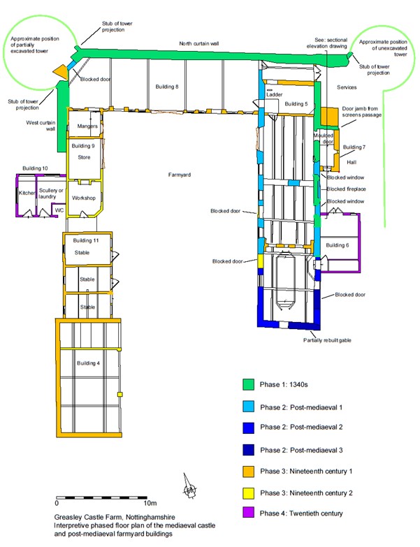
The former magnificence of Greasley can be alluded to through the identification of the substantial timbers re-used in the roof structure of a post-mediaeval barn, alongside the ex situ architectural stonework which peppers the farm structures. The latter includes carved head sculptures, tracery windows, a moulded coping, a door arch and the crown of a sexpartite vault. When considered alongside the in situ great hall door and windows, it is clear that this was once a very well-appointed castle.

Greasley in Context

With something of the plan of Greasley established, it has been possible to try and set the castle in its wider context. Cantelupe was one of several late mediaeval midlands men who sought to bolster their social position through the patronage of courtyard castles. The pattern of Cantelupe’s biography and architecture can be paralleled in the second quarter of the fourteenth century by the Vernon family at Haddon Hall (Derbyshire) and in the 1350s by Sampson de Strelley at Strelley Hall (Nottinghamshire).

Exterior of the entrance passage and great hall at Haddon Hall, Derbyshire (Picture Source: James Wright / Triskele Heritage)

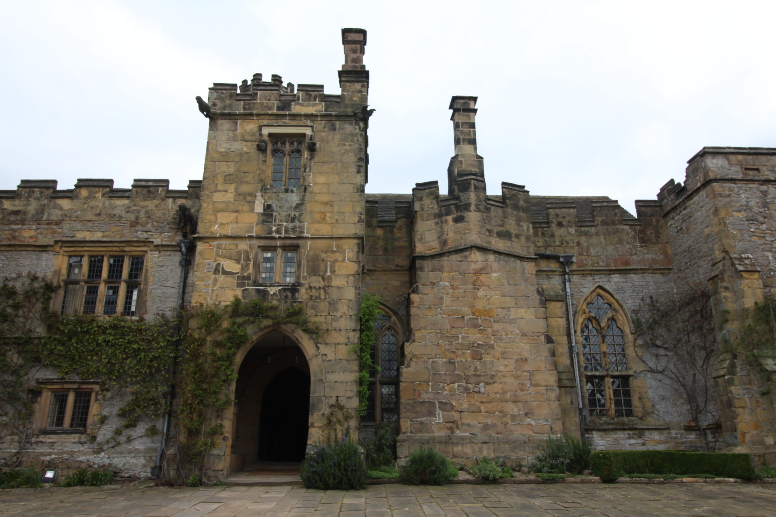
Haddon is perhaps the closest parallel to Greasley in terms of landscape and architecture. Both are directly overlooked by hills to the north. The moated plateau at Greasley is 0.91 hectares in area and the double courtyard and terraced garden at Haddon are 0.76 hectares. The projected area of the great hall at Greasley (at least 57m2) is proportionate to that of Haddon (67m2) and the layout of the two – with tracery windows flanking early examples of recessed fireplaces – seems similar. Meanwhile, the probable area of the Greasley courtyard (1026m2) is comparable to Strelley Hall (1074m2). Strelley had rectangular corner turrets, whilst Greasley is likely to have had polygonal examples which can be paralleled in the mid-fourteenth century at sites including Stafford Castle and Eccleshall Castle (Staffordshire). Furthermore, the probable relationship between the services and one of the corner turrets at Greasley can be mirrored in the 1380s Drum Tower at Bodiam.

The reasons for the decline of Greasley are, like so many other late mediaeval castles, bound up with the varied fortunes of the families that owned them. For example, the ruin of nearby Strelley was brought about via a five-way division of the estate at the end of the fifteenth century which led to decades of expensive litigation, legalwrangles with neighbouring families and a catastrophic fire. Greasley was inherited by the Zouche family during the 1370s, but they eventually lost it due to the attainder of John Lord Zouche for his support of Richard III at Bosworth. There is no architectural evidence for any mediaeval construction after the original mid-fourteenth century phase and it may be that the later owners either did not remodel the castle or let it deteriorate. By the late sixteenth century the site was a roofless tenant farm.

Greasley Castle Farm in 2021 (Picture Source: James Wright / Triskele Heritage)

Conclusions

Understanding the depreciation of Greasley from courtyard castle to working farm has been key to understanding this misunderstood site. By using buildings archaeology to unpick the later accretions from the surviving built environment of the castle, it has been possible for the plan form of the mediaeval architecture to be established for the first time.

Although a pale shadow of its former glory, Greasley can now be understood as a turreted courtyard castle with a fine great hall and associated services. The site was built for a socially rising aristocrat whose architectural patronage fitted well within the experience of his midland peers. It is intriguing to consider that Greasley may once have rivalled the rightly famous Haddon Hall in its heyday.

Subscribe to our quarterly newsletter

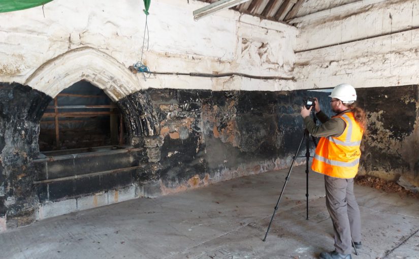
Featured Image: Buildings archaeology survey work on the exterior elevation of the great hall at Greasley Castle, Nottinghamshire (Picture Source: James Wright / Triskele Heritage)

About the author

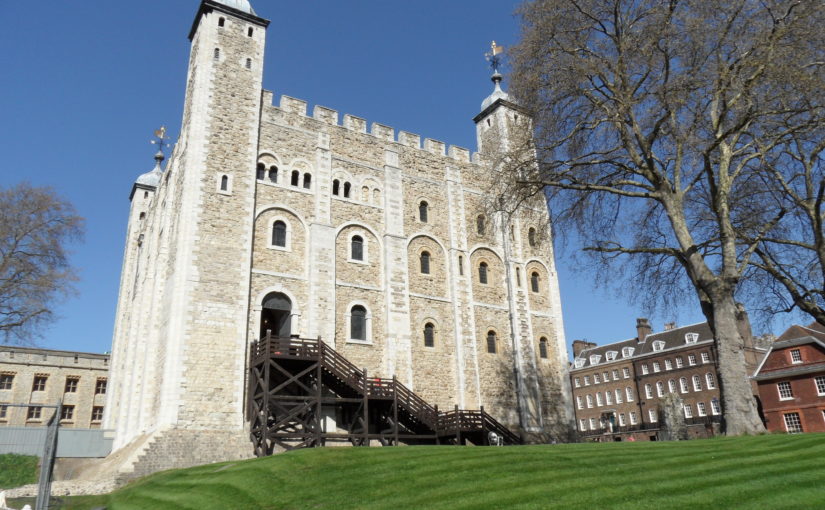
James Wright of Triskele Heritage is an award-winning buildings archaeologist. He has a long-lived research interest in mediaeval castles, palaces and great houses. He has worked on surveys of buildings including the Tower of London, Nottingham Castle, Knole, Holme Pierrepont Hall and the Palace of Westminster. He has written books on Tattershall Castle, Kings Clipstone Palace and the castles of Nottinghamshire. James led the building survey, funded by the Castle Studies Trust, at Greasley Castle.

Understanding More About a C14 Nottinghamshire Mystery – Greasley Castle

Back in January 2021 Triskele Heritage were successful in a funding bid to the Castle Studies Trust for carrying out a research project at Greasley Castle in Nottinghamshire. Here James Wright of Triskele Heritage explains what they hope to achieve with this project.

The work will focus on the production of an interpretative phased floor plan. The castle, built in the 1340s, has an obscure history and the understanding of its architectural phasing is at best very cloudy. The site is now a working farm and a number of post-mediaeval structures have been conglomerated around the remains of what is suspected to be a fourteenth century courtyard house with projecting corner towers.

Subscribe to our quarterly newsletter

The survey will act as baseline research data for a site which has not previously received serious fieldwork or publication. It will also provide a basis for further research and future conservation needs.

Work on the project will start in April 2021 and will be carried out by James Wright FSA alongside Dr Matt Beresford. We are supported in this endeavour by the landowners and Sarah Seaton of the Greasley Castle and Manor Farm History Project.

Greasley survey in action – photogrammetry

Project Background

Greasley Castle was developed for Nicholas, 3rd Baron Cantelupe (c 1301-55) after being granted a licence to crenellate by Edward III in 1340 (Davis 2006-07, 239). He was a significant figure who fought for the king in France and Scotland, served in parliament, founded Beauvale Priory and established a chantry at Lincoln Cathedral (Green 1934). Later owners of the site included John Lord Zouche – one of the few aristocrats proven to have fought for Richard III at Bosworth (Skidmore 2013, 330). After Zouche’s attainder, the castle was given to Sir John Savage in recognition for his military support of Henry VII in 1485 and remained in the family after his death at the siege of Boulogne (Green 1934).

The site is now a working farm and comprises two grade II listed buildings (NHL 1247955 and 1248033) overlying a scheduled ancient monument (NHL 1020943). The buildings sit along the northern perimeter of a 5.18 hectare earthwork enclosure and comprise a multi-phased U-shaped group of structures with an adjacent farmhouse to the north-west. The layout of the site is not well understood, but very limited prior research indicates the potential for a courtyard house with projecting corner towers.

The most substantive work on site took place in 1933 and comprised just two days of rather inadequate and poorly reported archaeological evaluation (Green 1934, 34-53). During the mid-2000s the wider landscape of the site was considered by the East Midlands Earthwork Project (Speight 2006). Greasley is routinely mentioned in surveys of castles stretching as far back as the antiquarian Throsby (1797, 239-42) and the early castle scholar Mackenzie (1896, 448-49). Although these initial commentators were of the opinion that little or nothing remained of the mediaeval castle, twentieth century authors, including Pevsner (1951, 76), his later editors (Pevsner & Williamson 1979, 135), Sarah Speight (1995, 70-71) and Oliver Creighton (1998, 479), noted in situ structures. In the twenty-first century a number of writers have pointed towards the tremendous archaeological potential of the surviving mediaeval architectural features (Emery 2000, 327; Salter 2002, 85; Wright 2008, 49-50, 65; Osbourne, 2014, 39).

Greasley survey in action: measuring

Crucially, the potential of the site has never been realised. Green (1934) noted that ‘it is not possible to be definite’ about the ground plan of the castle; a point later confirmed by Creighton (1998, 479): ‘the deficiency of the field evidence renders the exact nature and extent… obscure.’ The confusion surrounding the floor plan of the castle has been created by an overall lack of fieldwork and publication on the site. The paucity of research has led to a number of conflicting statements regarding the buildings archaeology. For example, the National Heritage List notes that the farmhouse was built c 1800 and has later nineteenth century elements (NHL 1247955); however, the most recent Pevsner edition notes that it is a seventeenth and eighteenth century building ‘with earlier origins’ (Hartwell, Pevsner & Williamson 2020, 240).

The proposed project to accurately map, assess and date the overall floor plan of the structures at Greasley Castle is long overdue and such building recording of manorial centres is specifically called for by the East Midlands research agenda (Knight, Vyner & Allen 2012, 94).

Subscribe to our quarterly newsletter

Feature image copyright Neil Gabriel

References

Castle Studies Trust 2021 Grant Awards

The Castle Studies Trust is delighted to announce the award of six grants, totalling a record £31,000 not only covering a wide geographic area but also a wide range of different types of research:

Subscribe to our quarterly newsletter

Caerlaverock new castle with old behind it and the coastline Crown Copyright Historic Environment Scotland

Caerlaverock, Dumfriesshire

The aim is to understand the chronology and geography of extreme weather events in the high medieval period, and the effects they wrought on archaeological features that led to the abandonment of the old castle built in c.1229 in favour of the new built 200m away in c.1277. The latest thinking is that it was a series of extraordinary storm surge events which pushed a series of storm driven gravel ridges across the River Nith.

The methodology to find this out is interdisciplinary, using scientific methods to enhance understanding of archaeological fieldwork. The fieldwork will involve the establishment of a series of transects across the site and surrounding landscape from which cores and samples will be extracted for sediment description, stratigraphic analysis, and Carbon 14 dating.

Depending on Covid restrictions, the aim is to start doing the work in May this year with the receipt of the final data in the autumn.

Greasley_Castle from air copyright Neil Gabriel

Greasley, Nottinghamshire

The production of an interpretative phased floor plan for Greasley Castle in Nottinghamshire.  The castle, built in the 1340s, has an obscure history and the understanding of its architectural phasing is at best very cloudy. The site is now a working farm and a number of post-mediaeval structures have been conglomerated around the remains of what is suspected to be a fourteenth century courtyard house with projecting corner towers.

The survey will act as baseline research data for a site which has not previously received serious fieldwork or publication and provide a basis for further research but also for any future conservation needs.

Work on the project will start in the early summer when covid restrictions ease.   

Laughton-en-le-Morthen motte and bailey castle and church

Laughton-en-le-Morthen, South Yorkshire

To provide professional illustration and reconstruction which will also be integrated into a co-authored academic article based on the two previous research projects carried out on the site by Dr Duncan Wright and funded by the Trust. A geophysical survey and then small-scale excavation which give a strong indication that the Normans had built a motte on the site of a high-status Saxon dwelling.

Part of the monies will be used to produce phase plans of Laughton during key stages of its development, and a small percentage will pay for a line drawing of the 11th century grave cover incorporated into the fabric of the nearby church. The aim will be to start the work as soon as possible.

Old Wick Tower copyright Historic Environment Scotland

Old Wick, Caithness

Dendrochronological assessment of timber at the Castle of Old Wick, Caithness thought to be one of the earliest stone castles in Scotland dating from the12th century and the period of Scandinavian ascendency. Current thinking though ascribes the date to the 14th century. Analysing these samples will hopefully provide an answer.

With no architectural features or physical “independent” evidence analysing the remains of a timber joist-end (in poor condition) in one of the joist ends remains the best chance of being able to find an answer. 

The taking of the samples is likely to take place in September when conditions are still going to be favourable as the castle is situated next to the North Sea and the sample can only be found 8 metres above ground level. 

Richmond Castle copyright English Heritage

Richmond, North Yorkshire

Co-funding a three-week excavation of Richmond Castle, one of the best preserved and least understood Norman castles in the UK. The aim is to understand better the remains of buildings and structures primarily along the eastern side of the bailey including near the 11th century Robin Hood tower and near Scolland’s Hall.

Subject to the scheduled monument consent being granted the excavation will take place in late July.

Warkworth Castle, copyright William Wyeth

Warkworth, Northumberland

Geophysical survey to explore evidence for subsurface features in and around the field called St John’s Close in a field adjacent to the castle with the aim to establish the location and eastern extent of the castle’s deer park in the 16th century as well as its entrance way. It also hoped to find evidence of a routeway running parallel to the possible park boundary which could represent an early route to the castle’s gatehouse from the south-west.

The plan is to do complete the geophysical survey by the end of March.

To keep up to date with how these projects progress over the coming months you can:

Subscribe to our quarterly newsletter

And if you donate at least £50 here and be invited to our exclusive visits to these projects: https://donate.kindlink.com/castle-studies-trust/2245 

Featured image: Old Wick Castle, Caithness, copyright Historic Environment Scotland

A Large and Eclectic Crop of Fascinating Applications for the Castle Studies Trust to Consider

The deadline for grant applications passed on 1 December. We’re going through the various projects now. Altogether the 14 projects, coming from all parts of Britain, one from Ireland, are asking for £88,000. They cover not only a wide period of history but also a wide range of topics.

We will not be able to fund as many of these projects as we would like. To help us fund as many of these projects as possible please donate here: https://donate.kindlink.com/castle-studies-trust/2245

In a little more detail here are the applications we’ve received:

Caerlaverock, Dumfriesshire: The aim is to understand the chronology and geography of extreme weather events in the high medieval period, and the effects they wrought on archaeological features that led to the abandonment of the old castle in favour of the new.

Georgian Castles: This project explores two castles in County Durham—Brancepeth and Raby—that were fundamentally reshaped and transformed in the eighteenth century to become notable homes in the area, and it advances not only our understanding of these two buildings in the period, but also the afterlife the castles in the area and the layers of history that they record.

Greasley, Nottinghamshire: The production of an interpretative phased floor plan for Greasley Castle in Nottinghamshire. The castle, built in the 1340s, has an obscure history and the understanding of its architectural phasing is at best very cloudy.

Laughton-en-le-Morthen, South Yorkshire: To provide professional illustration and reconstruction which will also be integrated into the co-authored academic article. Part of the monies will be used to produce phase plans of Laughton during key stages of its development, and a small percentage will pay for a line drawing of the grave cover.

Lost medieval landscapes, Ireland: To develop a low cost method, using drone and geophysical survey to identify native Irish (also termed Gaelic Irish) medieval landscapes and deserted settlements.

Mold, Flintshire, post excavation analysis: Post-excavation analysis from excavation on Bailey Hill of the castle

Mold, Flintshire, digital reconstruction: Visual CGI reconstruction of  Mold Castle using the new-found evidence of further masonry on the inner bailey structure and using information gathered by the Bailey Hill Research Volunteers, showcasing the many changes that have happened on this site from a Motte and Bailey Castle to present time as a public park.

Old Wick, Caithness: Dendrochronological assessment of timber at the Castle of Old Wick, Caithness thought to be one of the earliest stone castles in Scotland.

Orford, Suffolk: recording the graffiti at the castle through a detailed photographic and RTI (Reflectance Transformation Imaging) survey will add to our understanding of how the building was constructed and the ways the building was used over time, particularly 1336-1805, during which the documentary history of the castle provides little evidence of how the site developed.

Pembroke, Pembrokeshire: A second season of trial-trench evaluation of the suggested late-medieval, double-winged hall-house in the outer ward at Pembroke Castle, which is of national significance. The evaluation builds on the results of the works undertaken through previous CST grants: geophysical survey (2016) and 2018 whereby two trenches were excavated across the possible mansion site. The evaluation will again establish the extent of stratified archaeological deposits that remain within the building, which was excavated during the 1930s.

Pevensey, East Sussex: GPR survey of the outer bailey and immediate extramural area and UAV (aerial) survey of the castle to build up a 3-D model of the site.

Richmond, North Yorkshire: Co-funding a 3 week excavation of Richmond Castle, one of the best preserved and least understood Norman castles in the UK. The aim is to understand better the remains of building and structures along the western side of the bailey.

Shootinglee Bastle, Peeblesshire: Funding post-excavation work from the 2019-20 excavation season in particular some charcoal deposits from a C16 burning event.

Warkworth, Northumberland: Geophysical survey to explore evidence for subsurface features in and around the field called St John’s Close in a field adjacent to the castle.

We will not be able to fund as many of these projects as we would like. To help us fund as many of these projects as possible please donate here: https://donate.kindlink.com/castle-studies-trust/2245

The applications have been sent to our assessors who will go over them and prepare their feedback for the Trustee’s who will meet in late January to decide on which grants to award.