Men on the Watch: The Motte d’Olivet, Grimbosq, Normandy

In her new book Authority, Gender and Space in the Anglo-Norman World, 900-1200, Dr Katherine Weikert, Senior Lecturer in Early Medieval European History at the University of Winchester looks at how medieval manors reflected and shaped – and were shaped by – their occupants to express social authority. In this article she looks at the facinating if little known Motte d’Olivet.

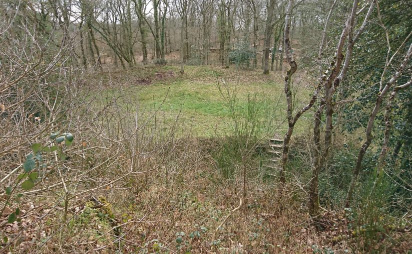
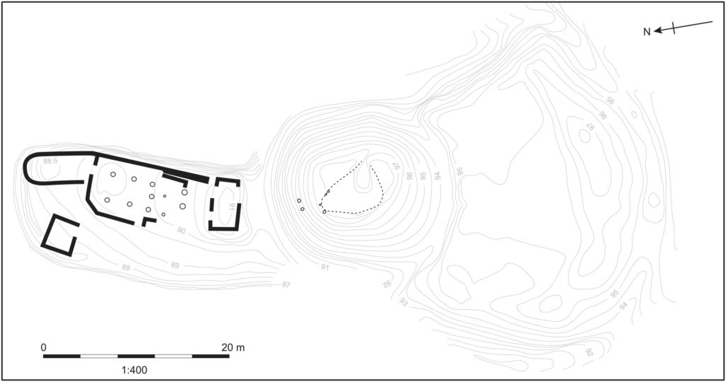
High in the lush forest of Grimbosq, Normandy, the remains of the Motte d’Olivet sit atop a lofty spur overlooking the Orne River valley. About twenty-two kilometres to the south of Caen, it’s a site that would be familiar to many castle-lovers: a man-made earthen mound, atop which formerly stood a wooden tower, with baileys on either side of it. A deep ditch around the motte kept it spatially and physically separated from both baileys. The motte-and-baileys take up the cramped, flat space on the point of the v-shaped spur surrounded by steep drops and small rivers on both sides (one charmingly called Ruisseau de Coupe-Gorge: essentially, cut-throat creek). The tower on the motte overlooked the whole area, and when the brush and forest was cut down around it, as it was in the eleventh century, the viewshed would have been spectacular. The Motte d’Olivet has long been considered a seigneurial residence, but its location, and the history of the man who built it, suggest a far less lofty purpose.

Subscribe to our quarterly newsletter

Image 1: Plan of the site of the Motte d’Olivet. Pighill Archaeological Illustrations redrawn from Decaëns 1981, published in Weikert 2020.
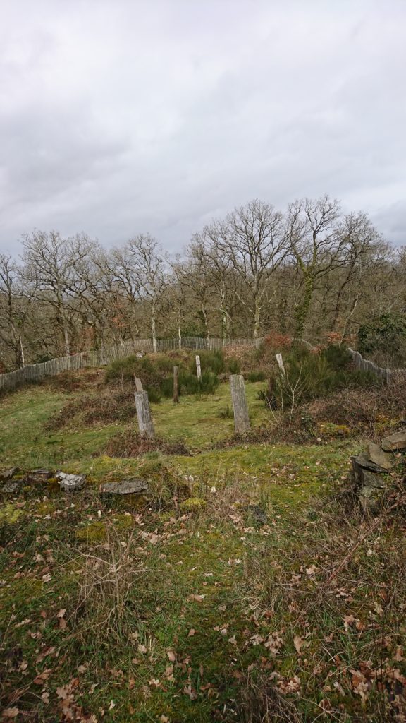
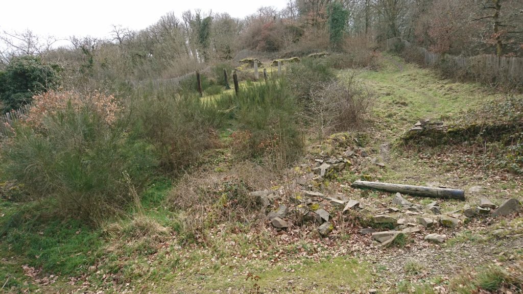
Image 2: View north from the motte towards the River Orne. The stone remains in the foreground are suggested to be part of a gatehouse to access the motte, and the modern posts are placed at the location of the posts of an aisled building. Photo by the author.

The site was excavated by Joseph Decaëns and published in 1981, though lingering questions remain about the castle and its builder. The elusive Erneis Taissan built the motte in the 1040s-50s during a period of conflict with his older brother Raoul. The Taissons come to greater prominence in Normandy in the twelfth and thirteenth centuries along Raoul’s line; Ralph Taisson, for example, was King John’s seneschal in Normandy at the turn of the thirteenth century. But in this earlier period, the family is more difficult to uncover, and the remains of the Motte d’Olivet are some of the only physical presence we have of them from this time. Decaëns even described Raoul as ‘un personnage très important mais assez énigmatique’ (a very important, but very enigmatic person)!

Seeking evidence of the brothers and their history is an exercise of charters, patience and this castle. Decaëns ascribed the tension between the brothers to each receiving portions of their father’s lands after his death, and Norman charters indicate some expression of this frustration through the brothers’ conflicting patronage of local monasteries. For example, the elder Raoul founded the abbey at Fontenay (St-Étienne de Fontenay, on the Orne north of Grimbosq) in 1050, and its foundation charter, confirmed by William the Conqueror, lists properties Raoul gave to the abbey, all to the east of the Orne. Erneis – who patronised Fontenay but may have preferred the abbey at Fontenelle – held estates mostly to the west of Raoul’s. Grimbosq and Cesny(-Bois-Halbout) are but two of these, with his descendants’ title even named for them. The lines drawn between the properties of these two brothers run straight through the forest where Erneis built his Motte.

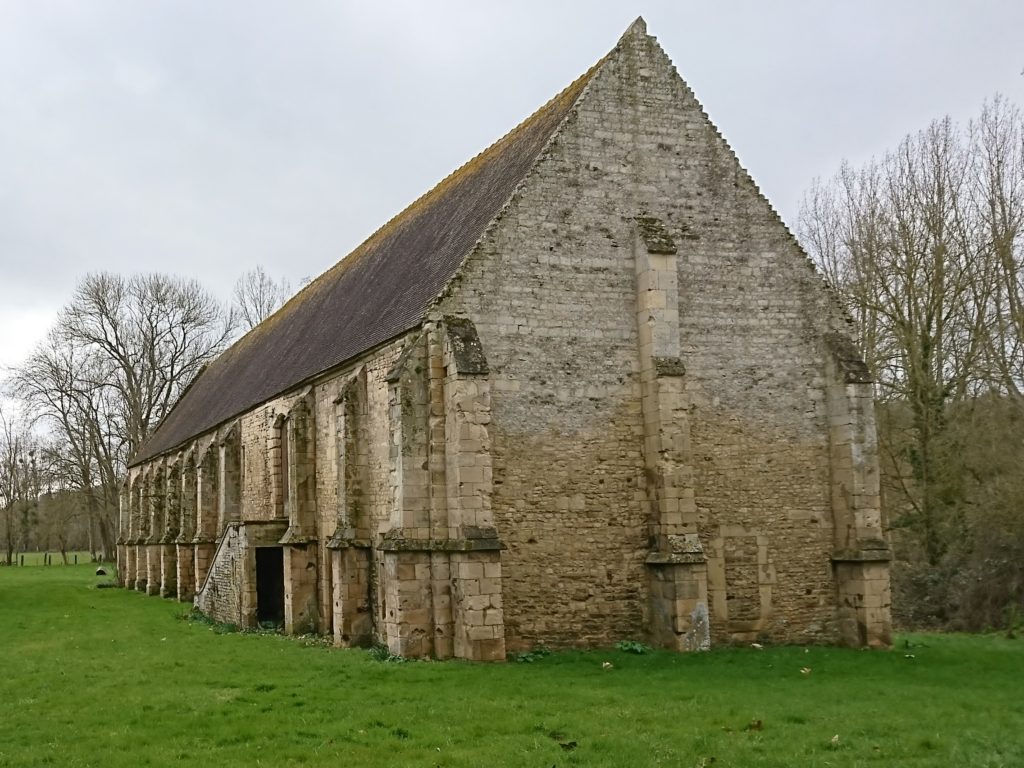
Image 3: The remains of St-Étienne de Fontenay, outside of St André-sur-Orne, Normandy, founded by Raoul Taisson c. 1050. Photo by the author.

Regardless of the cause of the tension, the Motte is the most obvious indication of the brothers’ strife, which visibly plays out the Norman landscape. The Motte directly overlooks the boundaries and roads between Grimbosq – Erneis’ land – and Mutrécy – Raoul’s land – with a clear sightline to the valley to the north, and a ridge to its east leading to Mutrécy. With this in mind, alongside the size of the castle and particularly its distance and isolation from any settlement, the Motte looks less like a seigneurial castle and more like an outpost, a short-lived watchtower to keep an eye on one’s pesky brother. It’s deeply unlikely this motte was Erneis’ main residence, but instead a place for his men to watch the boundaries of his land.

Image 4: The top of the motte, Mutrécy over the horizon. Photo by the author.

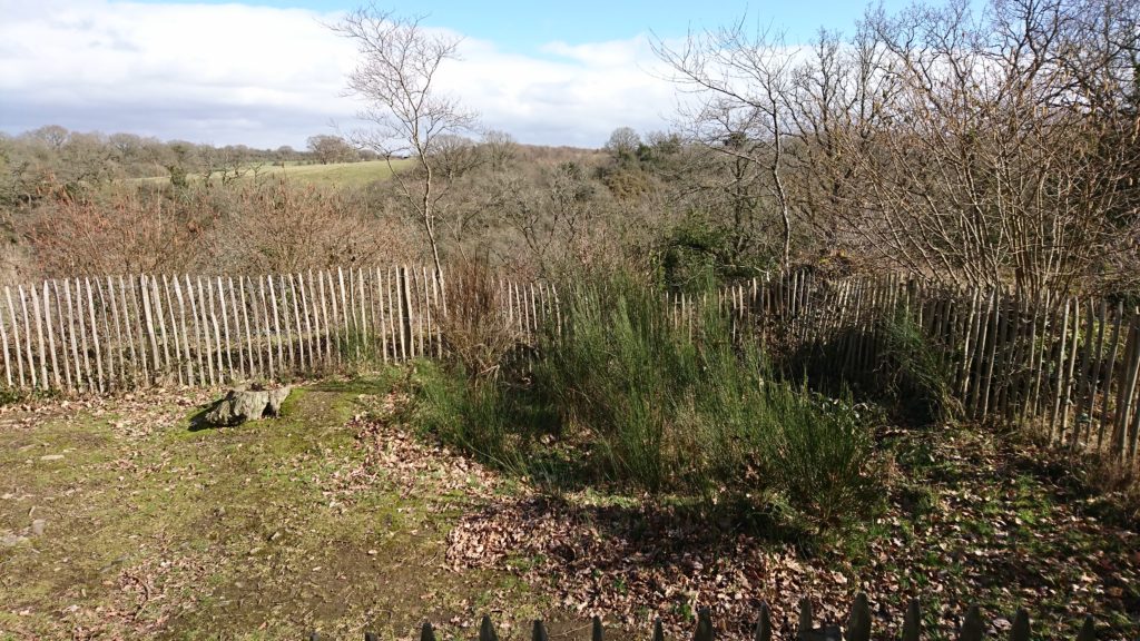
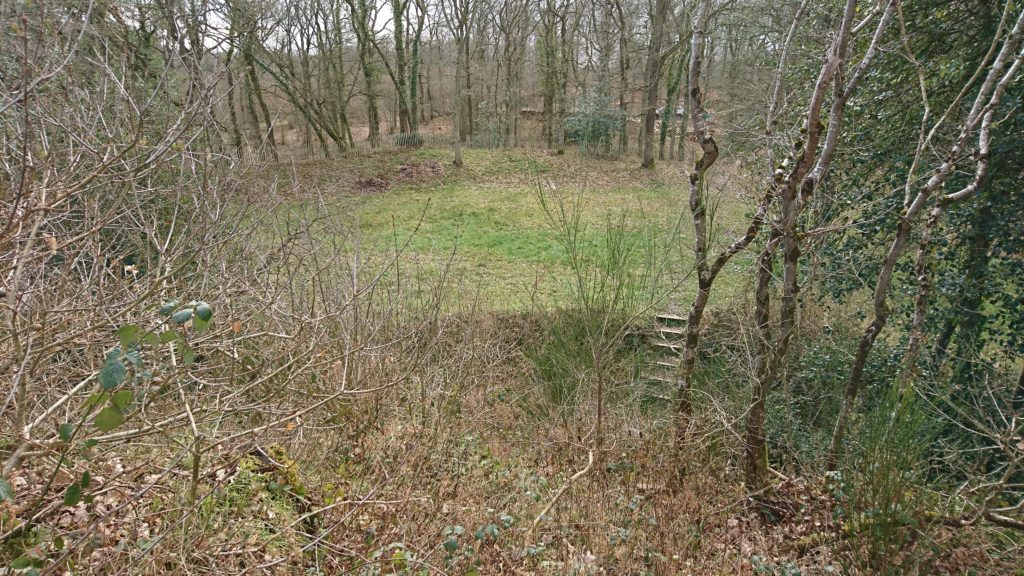
The northern enclosure holds a large aisled building, possibly two-storeyed, and additional stone rooms or buildings which have been interpreted as a sort of a gatehouse providing access to the motte, and a small separate kitchen. The apsidal room was previously interpreted as a chapel but this has recently been rejected by me on varying grounds (including location, orientation and charter evidence), which further indicates this place as less an elite residence and more an outpost. However, the state of the physical remains makes it unclear how to interpret not only the décor but quite simply the form and use of these buildings. The north bailey would probably have housed Erneis when he was there. But if that was this bailey’s primary intention, it would have only occasionally seen habitation, and more frequently seen the men on the watch accessing the motte via the gatehouse. The intention of this castle wasn’t in residency, but in the duties it performed for Erneis, in the watching and waiting done by his men.

Image 5: Remains of the ‘kitchen’ in stone, the modern post-holes marking the location of the large aisled building in the north bailey, with the motte (covered in scrub) in the background. Image by the author.

The castle’s activity would have been focused in the south bailey. The south enclosure, which held a stable and forge, would have hosted a number of people and animals, and alive with the sights, sounds and smells of a working yard – hot iron and manure, the hammer singing against the anvil. It would have been a site of activity at the castle, a place for the retinue who staffed this border outpost. Game pieces found in excavation mean men entertaining themselves, or perhaps simply passing the time, the way you’d play cards in an airport. As Susan Reynolds and many others have pointed out across the middle ages, military men of a sort gathered together to wait and watch would have probably had some training or practice to attend to themselves: we can envision the south enclosure for this.

Image 6: The south bailey from the top of the motte. Note the deep ditch surrounding the motte. Image by the author.

Wace tells us that the sons of the two men, Robert fitzErneis and Raoul (II) Taisson, both died at Hastings fighting with Duke William, and the rift between their two families was only repaired at this point. Erneis and Raoul (I) were probably already deceased and, to wit, the Motte was no longer in use by the FitzErneis line. Neither the Motte d’Olivet nor the warring brothers have been further investigated since the site’s excavation in 1981, and new questions about the place and its people can bring different views about what was once considered an elite house. What’s left of the brothers’ rift is just the landscape of this ruined castle, a lonely enclosure in an isolated place, high above the flourishing green forest, a lesson reminding us that castles have much to say about all the people who were once there.

Subscribe to our quarterly newsletter
Katherine Weikert’s new book, Authority, Gender and Space in the Anglo-Norman World, 900-1200, is available from Boydell & Brewer at http://boybrew.co/2YyHx2m. Use the special discount code BB870 for 40% off and free international shipping!

Grimbosq Forest is a part of the city of Caen. It is open to the public and filled with walking and mountain cycling routes, and sites such as an arboretum, a pet cemetery, and the Motte d’Olivet. The Motte is on the yellow walking route, and is unstaffed thought signage gives information about the site. There is free parking, and the forest is also on bus route 34 from Caen. More information can be found at https://caen.fr/annuaire-equipement/foret-de-grimbosq (French) or https://www.calvados-tourisme.co.uk/offer/la-motte-castrale-dolivet/ (English).

‘All Along the Watchtowers! Balancing Heritage Protection, Development, and Scientific Research on Buried Archaeology at European Castles’

Dr Rowena Banerjea, University of Reading, UK, with funding from a British Academy/Leverhulme Small Research Grant talks about the research project she works on All Along the Watchtowers! https://research.reading.ac.uk/castle-geoarchaeology-heritage/

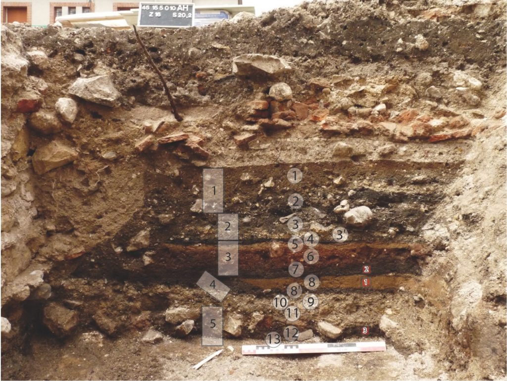
The buried or below-ground archaeology at castle sites can be exceptionally well preserved because of its burial under masonry. However, it is often overlooked in conservation and management plans in favour of protection and consolidation of standing remains and developments such as reconstruction and rebuilding projects. It provides an important lens through which we can examine important phases and hiatuses in the developmental history of these monuments.

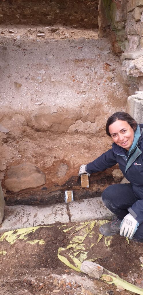
INSERT FIGURE 1. Well-preserved stratigraphy at Château de Gien, France, from c. 9th – 11th AD occupation, sealed below later masonry and collapse. The rectangles show where micromorphology samples were collected, and the circles mark the locations of spot samples for other scientific analyses. Photo credit Quentin Borderie.]

This project has been made possible due to its project partners and collaborations with several other research projects. The castle case studies represent a diverse range of cultural, environmental and heritage contexts across Europe, in which we could examine the preservation of stratigraphy, biological remains, artefacts and materials:

  • Elbląg, Poland, Karksi, Estonia, Cēsis, Latvia, important Teutonic Order castles in the Baltic region;
  • Castle Keverberg (Kessel), the Netherlands, which consisted of an original stone tower built in 1100 and covered by a motte-and-bailey castle;
  • Several French castles, which are Château de Caen, built in 1060, Château de Gien, which today hosts the National Museum of Hunting with the remains of an early (c. 9th – 11th AD) Carolingian castra below, Château de Loches and Château de Boves;
  • Two Italian case studies, Castelseprio, a UNESCO World Heritage site, and Montegrotto;
  • Molina de Aragón, Spain, situated in the Molina and Alto Tajo UNESCO Global Geopark;
  • Dunyvaig Castle, Islay, Scotland, formerly the naval fortress of the Lords of the Isles, the chiefs of the Clan MacDonald.

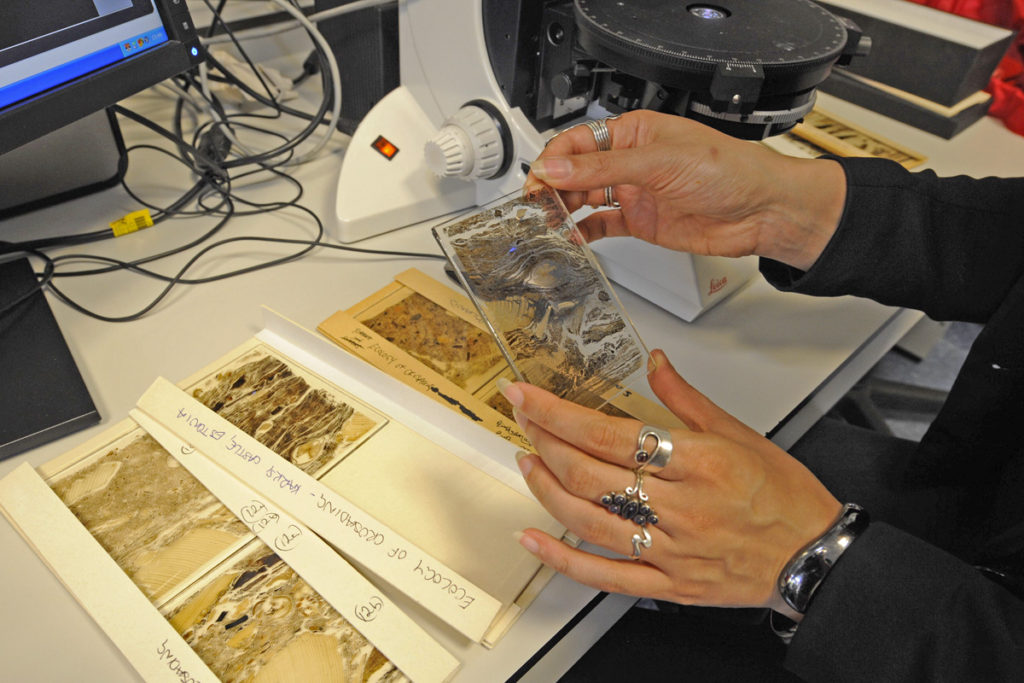
This project developed a framework for geoarchaeological research at European castles to target archaeologists, castle curators and heritage management policy-makers, so that our guidance can influence their future excavation strategies and conservation plans. Geoarchaeology applies environmental science techniques to archaeological research questions.  Soil micromorphology is a geoarchaeological technique that enables us to conduct a micro-excavation by analysing a slide, or ‘thin section’, produced from an intact, small block collected from the archaeological stratigraphy, so the inclusions are still in situ. The slide is analysed using a geological polarising microscope. Under the microscope, we record the same soil properties as archaeologists do in the field and additional ones, to understand the processes by which materials were deposited, how they have decayed due to chemical weathering, and how later human and faunal disturbances have affected the stratigraphy.

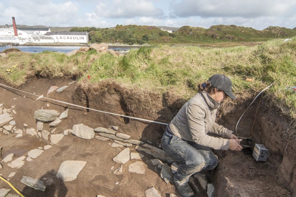
FIGURE 2. Micromorphology sampling of turf modifications to the curtain wall at Dunyvaig Castle, Islay, Scotland. Photo credit The Dunyvaig Project
FIGURE 3. Micromorphology sampling of occupation deposits sealed below later masonry and collapse during excavations ahead of conservation work on the eastern range of Cēsis Castle, Latvia. Photo credit Alex Brown
FIGURE 4. Micromorphology or ‘thin sections’ from  Elbląg (Poland) and Karksi (Estonia) castles. Photo credit Magnus Elandner

Soils and sediments are the backbone of the archaeological record. Our data revealed important stories within the soils about the early development of castle sites, the activities that took place inside different areas of the castle and how they may relate to the activities in a castle’s hinterland. We noticed that the preservation of the stratigraphy was exceptional owing to its burial under later masonry structures, masonry collapse and successive occupation layers; a phenomenon which is also observed on urban sites and Near Eastern tell sites.

Our results highlight the great potential and requirement for scientific analysis of these deposits when they are uncovered by excavation and/or building activities. These building activities include the conservation and renovation of the standing architecture and the removal of rubble, which can unseal buried archaeology affecting its preservation. Our analyses have revealed microscopic evidence for in situ animal husbandry and horse stabling, as well as the types of fodder that livestock were fed, crop processing activities, and periods of soil formation where areas of a castle have been abandoned or changed use. For example, at Castillo de Molina de Aragón, Spain, microstratigraphic data show the changing nature of the occupation the citadel, from the Islamic to Christian period which could possibly indicate a change in its role from a clean, well-maintained space to one where livestock roamed. The Islamic plaster floor surface was kept clean and very little domestic refuse accumulated  ̶  a soil formed over it, followed by a substantial destruction horizon. In comparison, units of discarded material and trampled floor surfaces characterise the (Re)Conquest phase, c. 1154, and a series of plaster floor surfaces with associated occupation residues containing herbivore dung showing that livestock were present, which probably relate to modifications during the thirteenth and fourteenth centuries.  

Subscribe to our quarterly newsletter

A wooden castle scratched in stone: a 13th-century graffito from the castle at Caen

Dr Edward Impey, one of the UK’s leading castle experts and patron of the CST examines some C13 graffito can boost our understanding of castles.

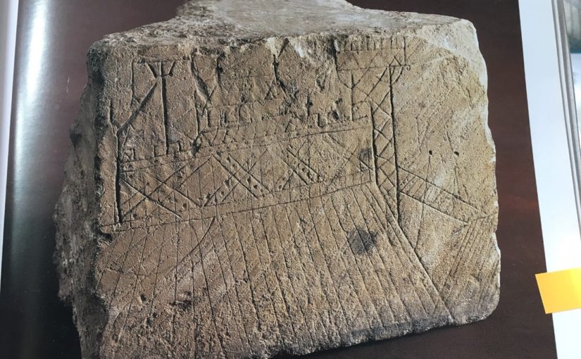
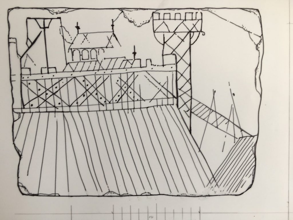
As every castle book reminds us, the defences of most castles before the mid-13th century, and the buildings within them, were built of earth and timber. The perishable nature at least of the timber parts, and their replacement in many cases in stone (obviously) makes their structural detail hard to understand, although Robert  Higham and Philip Barker’s Timber Castles of 1992, and their publication of Hen Domen (Montgomery) in 2000 achieve a great deal in this direction. As most evidence is archaeological, however, it tends to be confined to plans and layout. Herein lies the importance of this graffito, scratched into a re-used ashlar in the early 13th century and found during the excavation of the long-demolished donjon in the castle at Caen in 1966: it shows, in elevation, what is unquestionably a timber-framed castle, or part of one – either a ringwork or a motte.


The graffito re-drawn, omitting the underlying mason’s tooling and lines probably unconnected with the original image.

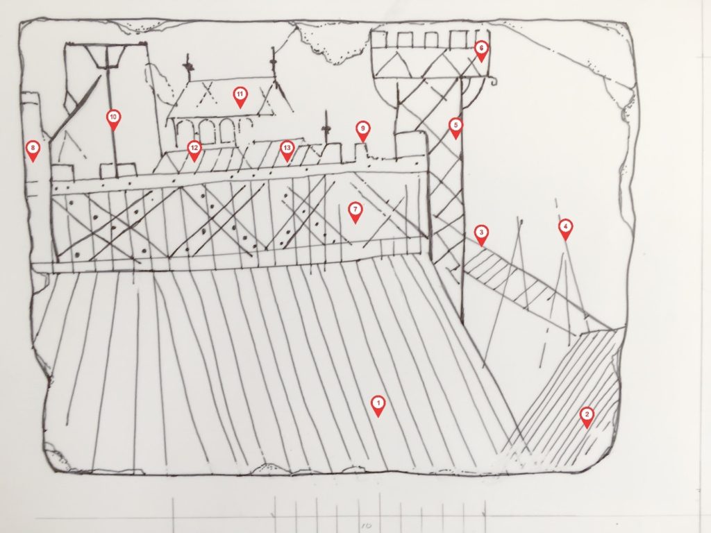
To begin our description with the mound on which the buildings stand, this is marked with a series of lines inclining inwards towards the top, which may be the draughtsman’s device to give it substance, or, possibly, represent baulks of timber covering the slope – a variant of the arrangement found for example at South Mimms (Hertfordshire) and elsewhere. To the extreme right, similarly striated, is what must be the counterscarp of the ditch, and springing from it, possibly propped by two trestle-like structures, is the bridge across it: this is of the so-called ‘flying form’ shown in the Bayeux Tapestry and found archaeologically at Hen Domen. At its top end the bridge abuts a tower, necessarily a gate tower, its side scored with the diagonal intersecting lines, probably representing cross-bracing of the form found in the bell towers at St Leonard’s, Yarpole (1195-6) and St Mary’s, Pembridge, of 1207-23 (both Herefordshire); variants are known in France and over forty post-medieval examples in central Europe. The arrangement is also shown in a carving at Modena cathedral, and in numerous 12th -and 13th– century bestiary illuminations of timber towers on the backs of elephants, prompted either by Pliny the Elder’s or the Books of the Maccabees. Siege towers could be similarly constructed, hence the French term beffroi.

. The re-drawing numbered to indicate the main features described in the text.
1. Revetted earthwork slope
2.The moat counter-scarp
3.Bridge
4.Possible trestles supporting bridge
5.Gate tower
6.Oversailing platform at tower top
7.Timber wall
8.Possible second tower
9.Battlement
10.Hoist
11.Hall?
12.Second building within the enclosure
Third building

Abutting the tower is the battlemented wall or palisade, composed of edge-to-edge vertical timbers, reinforced by a horizontal rail at top and bottom and by massive diagonal or ‘X’ braces, face-nailed to the uprights.

Inside the enclosure, our draughtsman has shown at least three buildings. The most prominent has a pitched roof terminating in finials, with a row of four round-headed windows under the eaves. Conceivably this was intended as a chapel, but the windows more probably belong to the clerestory of an aisled hall, as survive in the single-aisled hall of c.1160 in the castle at Creully, seventeen kilometres north of Caen, and has been inferred in the 12th-century timber examples at Leicester castle and the Bishop’s Palace at Hereford. In front are two lower buildings with pitched roofs, one carrying a finial.

To the left of the hall is a structure consisting of a vertical pole, a cross-bar at the top, propped by diagonal braces. At first sight rather puzzling, this is clearly identifiable as a crane or hoist, thanks to the dozens of near-identical examples in medieval images, conveniently gathered together by Günther Binding’s compendium of 2001. To the right  of the pole hangs a  rope, taut  as if being pulled or winched downwards, and which is carried over the cross-bar and two faintly-indicated pulley wheels, beyond which it hangs down again and appears to be in the act of hauling a large timber into the air.

The value of the depiction can be summarised as follows. First, it may be the only contemporary representation of a timber-built motte-top or ringwork complex, and is valuable in showing the whole apparatus of palisade, battlements, bridge, gate tower and buildings within. Second, along with the Abbaye aux Dames capital, it is one of only two known representations of face-nailed ‘X’ bracing – an arrangement by definition untraceable archaeologically – which would have endowed the palisade with immense lateral strength and was perhaps widely used. Third, this may be the only contemporary representation of a Romanesque aisled hall – if that is what it is – within a castle. Fourth, as the battlemented platform at the top of the tower oversails its sides, forming a machicolation, it is one a number of images showing that such things did not derive from hourds, but were integral at least to timber towers long before appearing in stone. Fifth, while it has long been assumed that medieval defensive towers in timber were structurally akin to 12th- and 13th-century bell-towers, this is, apart from the Modena carving, the only one to actually show this to be so. Finally, although representing a well-known type, the crane certainly adds liveliness and interest to the composition.

Who the draughtsman was is, obviously, unknown. So is whether the graffito represents a real or imaginary place, although the inclusion of the crane, in use, could be taken as a hint that a particular site, where building works were under way, was indeed intended. What is clear is that it is not a picture of the castle at Caen, nor indeed of Creully, both of quite different form.

Let’s hope that this blog and the forthcoming article (in French) will encourage the identification of other wooden castles scratched in stone, and help with their interpretation and of excavated evidence in the future.

Featured image: The graffito (reproduced by kind permission of the Musée de Normandie, Caen)

Subscribe to our quarterly newsletter

To find out more about the working being done at Caen you can visit her: https://caen.fr/actualite/un-parc-paysager-la-conquete-du-chateau

Bibliography

M. Baylé,  La Trinité de Caen: sa place dans l’histoire de l’Architecture et du plate et du Décor Romans (Paris, 1979),

A.R. Boucher and R.K. Morriss, ‘The Bell Tower of St Mary’s Church, Pembridge, Herefordshire’, Vernacular Architecture, vol. 42, issue 1, pp.23-35

G. Binding, ed., Der Mittelalterliche Baubetrieb in zeitgenössischen Abbildungen, (Darmstadt, 2001), available in translation as Medieval building techniques, (Stroud, 2004).

M. De Boüard, Le Château de Caen (Caen, 1979)

R. Higham and P. Barker, Timber Castles (London,1992)

R.Higham and P.Barker, Hen Domen, Montgomery – A Timber Castle on the English Welsh Border (Exeter, 2000),

Karel Kuča & Jiří Langer, Dřevěné kostely a zvonice v Evropě (Timber Churches and Bell Towers in Europe), 2 vols.(Prague 2009)

N. Molyneux, ‘The detached bell tower, St Leonard’s Parish Church, Yarpole, Herefordshire, Vernacular Architecture, vol. 34 (2003), issue 1, pp.68-72