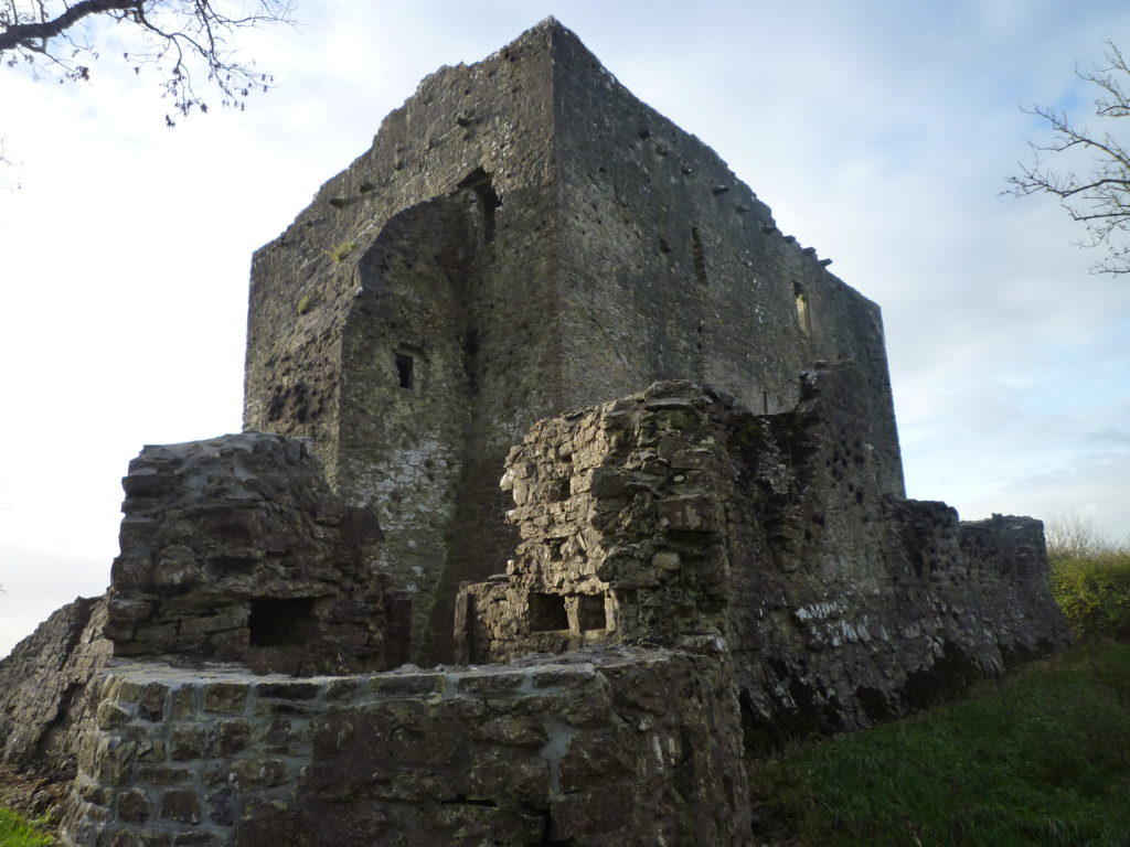
What lies beneath: Results from two geophysical surveys at Warkworth Castle, Northumberland

Dr Will Wyeth, English Heritage property historian and project lead on the two geophysical surveys the Castle Studies Trust funded on Warkworth Castle, looks at what the surveys reveal and equally importantly don’t reveal about the castle.

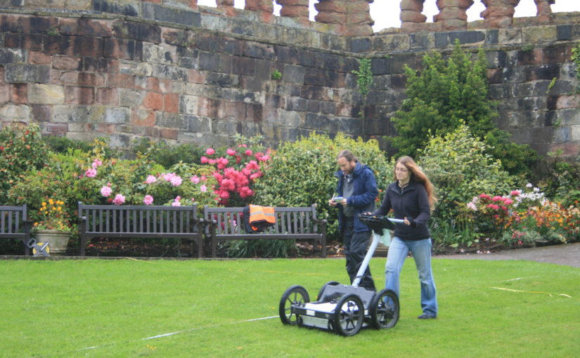
The results from two geophysical surveys in and around Warkworth Castle have now been digested and synthesized. The first survey sought to explore evidence for subsurface remains of the castle earthworks. The second survey examined a field called St John’s Close, sited within a corner of the medieval park attached to Warkworth Castle. Both surveys are intended to inform English Heritage’s on-going project to improve the way the history at the castle is explored and shared with visitors. Here, we share some of the highlights of these surveys: for the full discussion of the results, you can read the full report here.

Subscribe to our quarterly newsletter
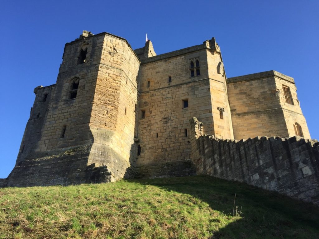
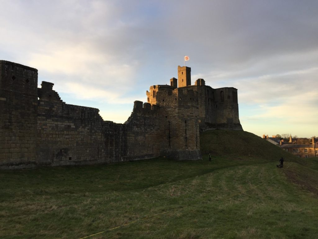
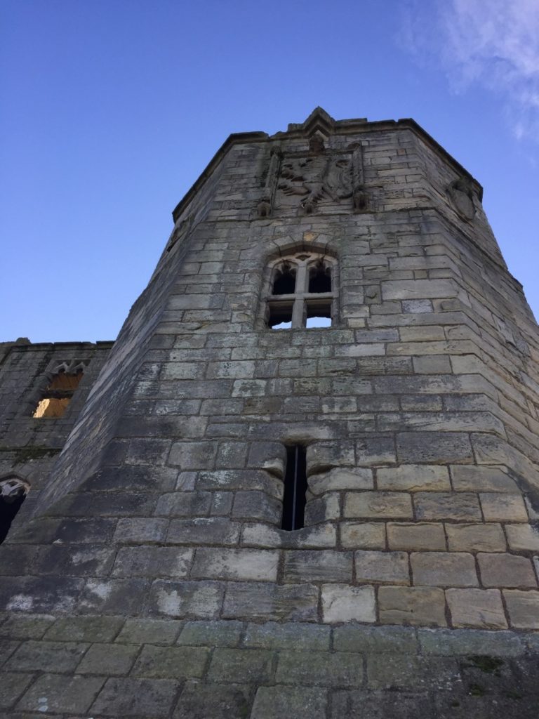
Figure 1. The Great Tower at Warkworth Castle (built late 14th century), situated atop an earthen mound (motte). View looking east from outside the embrace of the castle curtain walls (visible on the right). © Will Wyeth

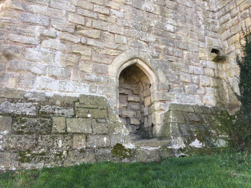
The first survey targeted three areas of the castle. The first was the top of the earthen mound, or motte (see a phased site plan here). Our aim here was to establish the presence or any subsurface features which may relate to any structures pre-dating the present late 14th-century Great Tower (Figure 1). Our results here were inconclusive: the subsurface examination certainly revealed a feature, perhaps a drain or path, associated with the postern of the present Great Tower (Figure 2). Other features may represent building or demolition rubble, but it’s not clear which.
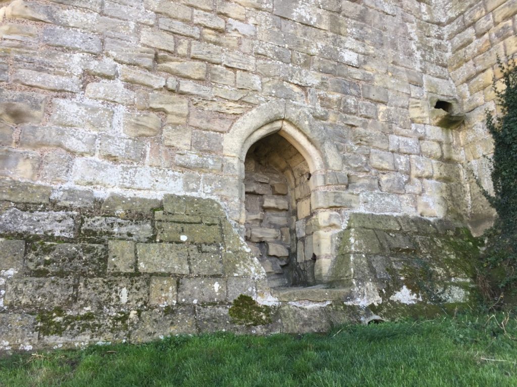
Figure 2. The blocked postern of the present, late 14th-century Great Tower, giving access from a storage area within the tower to the motte-top. A drain or path leading from the postern down the slope of the mound was detected in the recent geophysical survey of the mound.  © Will Wyeth

The second area of the castle earthworks to be examined was a portion of the castle’s raised bailey platform, east of the enclosing curtain wall presently dated to the late 12th-early 13th centuries. The earthworks of the bailey of Warkworth Castle pre-date any stone buildings known to survive at the present castle: this is because the earliest structures – among them the curtain wall – do not embrace the entirety of the earthworks (see a phased site plan here).
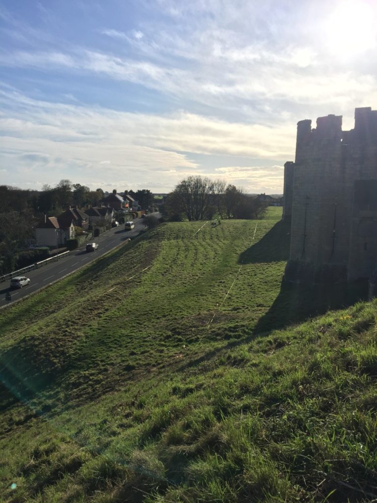
Figure 3. The unenclosed, eastern portion of the raised bailey platform at Warkworth Castle, looking south from the motte slope. The  multi-angular tower with two-storey arrowslits on the right is the Grey Mare’s Tail Tower, built in the 1290s. © Will Wyeth

Our research question here was to establish why this eastern portion of the bailey was left unenclosed, upon the construction of the enclosing curtain wall. Here, again, our results were inconclusive with regards our research question, though the survey did throw some light on possible uses of this space in the later medieval-early modern period. The survey detected a trampled path from the area east of the eastern curtain postern, south of the 15th-century stable building, heading northwards, respecting the projecting mass of the 1290s Grey Mare’s Tail Tower (see feature 14, Figure 4 ). The relative phasing of this feature does not tell us a great deal, except that the path may post-date the construction of the Grey Mare’s Tail Tower. It may also suggest that the postern in the curtain wall, currently dated to the late 14th century, could be coeval with the Grey Mare’s Tail Tower, or it may have replaced an earlier iteration. This is the earliest possible arrangement, as the path could also be more recent in date. 
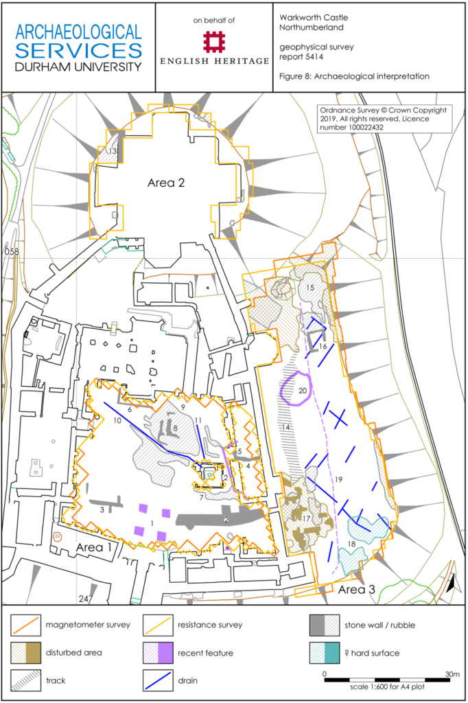
Figure 4. Interpretative plan of Warkworth Castle, with features from geophysical surveys recorded, north at top. Map Data: Ordinance Survey © Crown Copyright

The final portion of the castle earthwork survey sought to establish the location and extent of features within the enclosed portion of the bailey (‘Area 1’, see Figure 4). Uncertainty remains as to the configuration of the bailey before a major phase of construction presently dated to the 15th century. This substantial campaign of building incorporated the construction of the compressed collegiate church (perhaps never completed) with exquisite covered passage, and a comprehensive rebuilding of the eastern portions of the Great Hall, Chamber block and chapel in the bailey, of which the finest surviving portions are the Lion’s Tower and the Little Stair Tower (Figure 5).
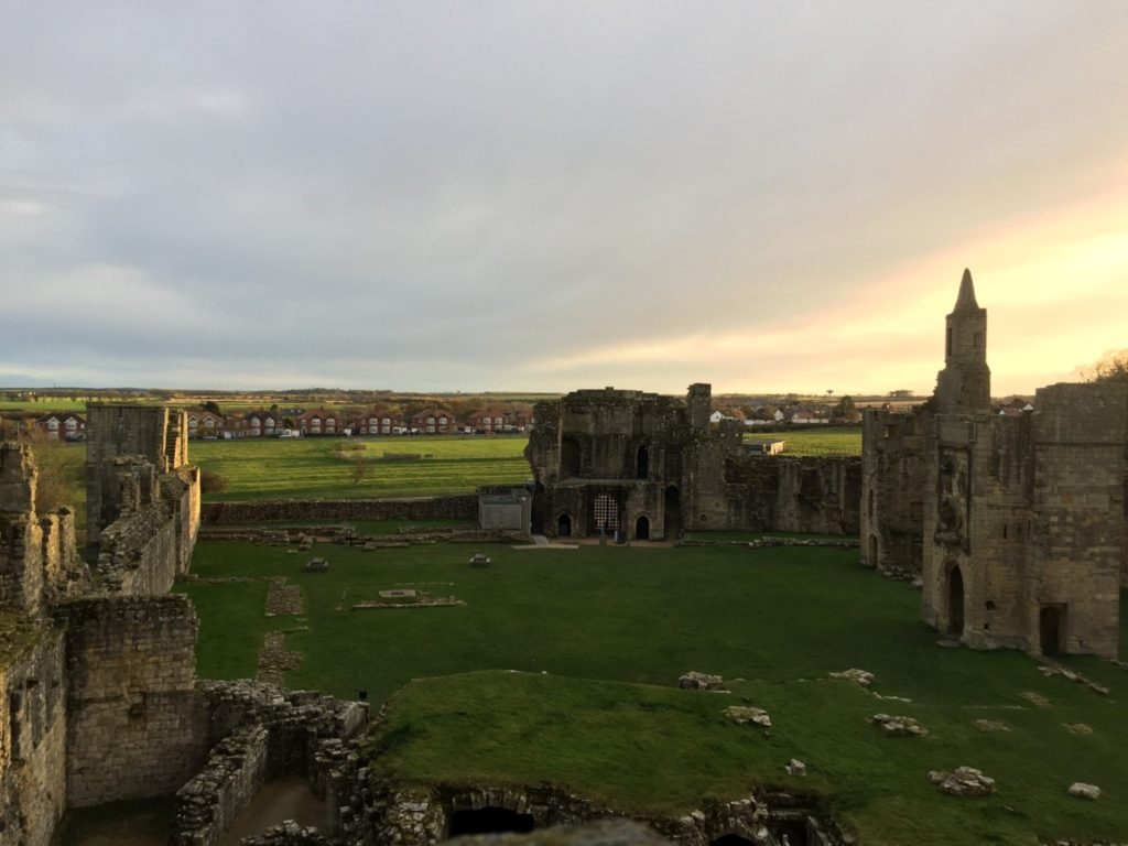
Figure 5. The enclosed portion of the bailey at Warkworth Castle, looking south. The remains of the collegiate church are in the foreground; the Lion Tower, rich in heraldic ornamentation, is on the right, and beyond it is the distinctive spire of the Little Stair Tower. Feature 2 is located approximately between the two picnic benches, in the centre left of the image. © Will Wyeth

The most substantial, and perhaps important, finding of the geophysical survey of the earthworks relates to feature 2 (see Figure 4). Located in the south-eastern quarter of the bailey, it comprises a substantial segment of buried wall or robbed wall foundations, approximately 22m long (on an east-west axis) and c.2m thick. Though the feature stops short of the bailey curtain wall here, it clearly blocks the east curtain postern already mentioned, and therefore may very well pre-date it. The massive character of this feature suggests it may have belonged to a substantial, multi-storey building. Feature 2 also appears to meet the curtain wall at a right angle, with one possible implication being that it may have formed one wall of a square- or rectangular-plan building, which was demolished to make way for the present curtain wall. Curiously, although the castle is not very extensive, the concentration of known high-status buildings from the later 12th-century onwards is on the bailey’s western side. If feature 2 relates to a high-status building, it is unusual for being located in the eastern part of the bailey. Several other features were located within the bailey; these are discussed in the full report.
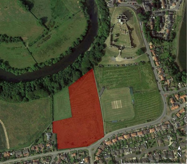
Figure 6. Satellite view of Warkworth Castle and adjacent park. The area in red, encompassing the surviving park boundary and the park’s south-east corner, was the subject of geophysical survey. © Google Earth, annotation by Will Wyeth

The second area examined by geophysical survey comprised part of the park of Warkworth Castle. The earliest record of the park is dated to the 13th century, but a park at Warkworth may have existed earlier still. Hogdson’s History of Northumberland, which assembled extensive records from the Alnwick Castle archives and elsewhere, offers a rich picture of the late medieval administration of the park, with records of repairs, infringements, agistments (a one off payment by a livestock owner to graze on the land of the landowner) and the collection and sale of underwood all recorded in 15th-century documents. The earthworks of the castle park have yet to be comprehensively mapped, but a portion of the south-east corner of the park, fossilizing the boundary of an historic field within the park called St John’s Close, does survive (see the previous Warkworth blog post for photos of these). This field was chosen as the target of geophysical survey to determine the survival of any features or buildings associated with the medieval park. Research on castle parks has demonstrated that they could feature a broad variety of structures, and were not simply enclosed areas. A further research goal was to ascertain the precise location of a documented park gate attested in a 17th-century estate map (Figure 7), which could represent the closest point of access into the park enclosure from Warkworth Castle.
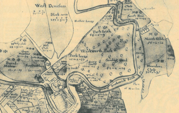
Figure 7. Estate map of the 1620s, depicting Warkworth Castle (lower left), village and park boundary. The postulated park gate is the round-headed opening roughly half-way along the park’s eastern boundary, between the castle and St John’s Close. Top is south. From Hodgson’s A History of Northumberland, V, opposite p.136 (archive.org. link here).

Unfortunately, the survey results did not yield answers to the questions we posed regarding any medieval features within the area of parkland surveyed, nor was it possible to decisively establish the location of a park gate. The most significant find was in the form of several round features, either enclosures and/or hut circles, which are very likely prehistoric in date (Figure 8). A walk-over of this area confirmed that they were not visible at ground surface level, being concealed by ridge-and-furrow deemed to be medieval in date. The largest of these, feature 2, is also bisected by a former field boundary depicted on the early 17th-century estate map mentioned earlier, though not shown on either of the 1st edition OS maps. A possible caveat to the lack of medieval finds is feature 9 (see Figure 8); this could be a path or hollow-way, and it appears to cut (and therefore post-dates) the ridge-and-furrow. As the eastern terminus of feature 9 is close to the edge of the park boundary, it may point to the location of the suspected park gate. Its western extent appears to respect the trajectory of the lost field boundary, and there it may represent an early modern, post-medieval feature. For a fuller account of the features revealed by the survey, see the full report.
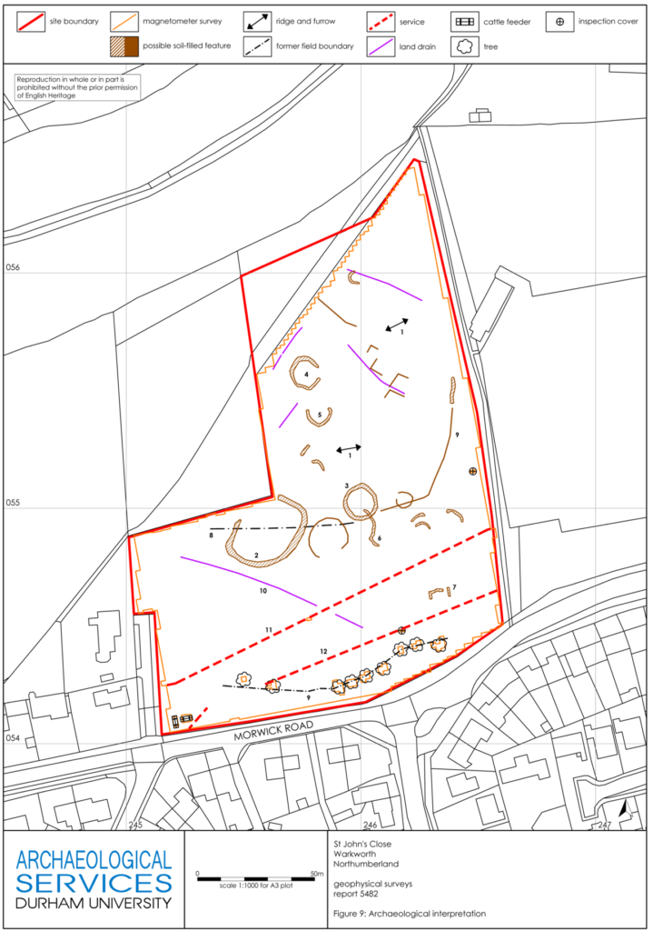
Figure 8. Interpretative plan of St John’s Close south-west of Warkworth Castle, with features from geophysical surveys recorded, north at top. Map Data: Ordinance Survey © Crown Copyright

Although neither survey succeeded in yielding clear evidence to help answer all the research questions we asked at the beginning, they certainly improved our understanding of both areas examined. In the case of the castle earthworks, it is clear that a substantial building once occupied the south-eastern portion of the bailey, and it is now possible to map this accurately in relation to surface-level features. In the case of the park, we can tentatively identify the approximate location of a gate into the park, though we cannot be certain it is medieval in origin. More work may allow us to ascribe dates, or relative phases, to these features.

For English Heritage’s interpretation project at Warkworth Castle, these surveys have been invaluable, and we are grateful for the support of the Castle Studies Trust in pursuing them – especially during the difficulties in completing the surveys resulting from the Covid-19 pandemic. Going forward, the standing buildings of the castle have also been subjected to a separate, detailed analysis, and it is hoped that the bringing together of these two sets of data will offer a fresh understanding the site. Although the research is ongoing, a preliminary integration of both appears offers some new and tantalising ideas about the history of Warkworth Castle. These will inform our presentation of Warkworth Castle to the public, and improve our collective understanding of one of England’s finest castles.

Subscribe to our quarterly newsletter

You can view the full report here: https://www.castlestudiestrust.org/Warkworth-Castle.html
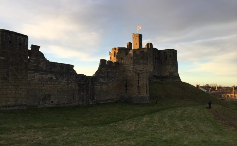
St John’s Close and the edge of the Park: the landscape of Warkworth

Dr Will Wyeth, Property Historian at English Heritage, previews the geophysical survey, funded by the Castle Studies Trust, in order to learn more about the landscapte around Warkworth castle.

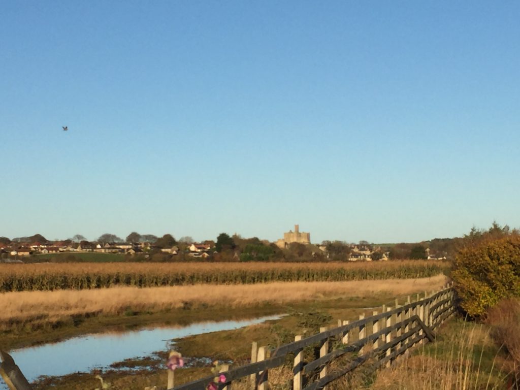
Following the success of a survey of Warkworth Castle’s earthworks in late 2020 as part of a scheme of reinterpreting this most palatial castle (report forthcoming), we on the English Heritage Warkworth project team have sought to expand upon our understanding of the medieval complex by turning towards its immediate landscape. Although much of the medieval landscape is not in the care of the charity, which looks after over 400 historic properties and sites across England, the landscape has tangible and nuanced connections which the project wants to explore. The castle is among the most prominent features in this area (Figure 1); its location adjacent to the lowest crossing point of the River Coquet means that low, somewhat boggy ground extends across the area south-east of the castle as the river widens to its mouth by the coastal village of Amble.

Subscribe to our quarterly newsletter

Figure 1. Warkworth Castle from the south-east, on the coastal road to Amble. The Great Tower, in the background, sits atop a large motte. In the foreground, low boggy ground flanks the south side of the raised coastal road. Out of shot on the right is the River Coquet as it widens to its mouth by Amble, and towards Coquet Island in the North Sea proper. © Will Wyeth

The plan of Warkworth Castle comprises a fairly typical motte and bailey, with stone superstructures of varying date and scale, and whose earliest iterations date from the late 12th century. While the antiquity of the settlement of Warkworth – laid out upon the north-south ridge of raised ground within this loop of the Coquet – is not known for sure, what is apparent is that the castle respects and influences the configuration of burgage plots and the coastal road ultimately linking Newcastle-Upon-Tyne and Berwick-Upon-Tweed. A walk around Warkworth village proper shows there are several important places and features which both relate to and indeed enrich the castle story.

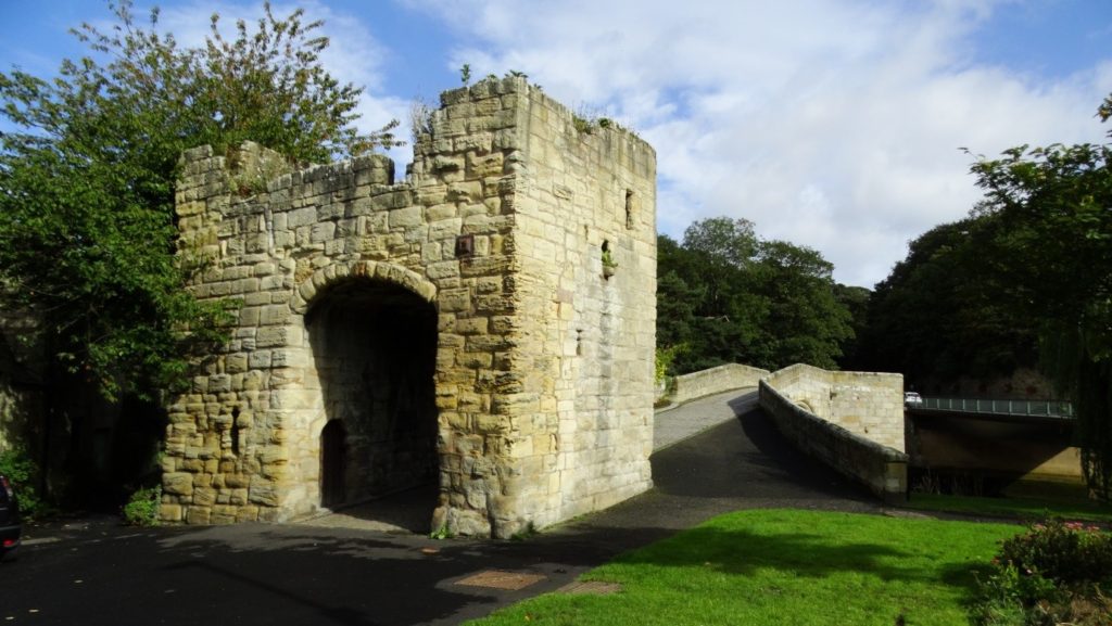
Figure 2. The remains of the late 14th-century fortified bridge, comprising a gate-tower and multi-pier crossing, at the northern end of Warkworth settlement. Photo © Colin Park (cc-by-sa/2.0) – geograph.org.uk/p/6013384.

The church of St Lawrence, itself probably constructed on the site of an earlier medieval church, is located mere metres away from the late 14th-century fortified bridge (Figure 2) which spans the northern extent of the river’s loop. The identification as a ‘fortified bridge’ is perhaps misleading. Thought to have been completed around the time the Great Tower at Warkworth Castle was finished, the bridge may be better understood as a toll collection station, though its administrative and security characteristics are not necessarily contradictory.

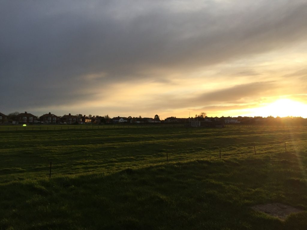
Figure 3. Low, raking light of a Northumberland autumn sunset highlights the earthworks of ridge-and-furrow immediately south of the castle. © Will Wyeth

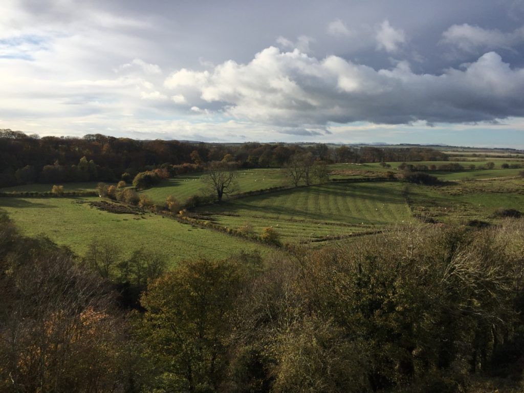
To the north, the coastal road carries on towards Alnmouth and onto Alnwick. It is in relation the immediate south and west of the castle, however, to which the Castle Studies Trust generously agreed to fund a further season of geophysical survey. Fields here testify to a legacy of cultivation which may be medieval in origin; traces of ridge-and-furrow are apparent immediately south and south-west of the castle (Figure 3), as well as in an area of ground rising gently from the river terrace, west of the Great Tower, across the river proper (Figure 4).

Figure 4. Rising ground on the west bank of the River Coquet, punctuated by pre-modern cultivation earthworks, viewed looking west from the Great Tower of Warkworth Castle. © Will Wyeth

This new geophysical survey targets a cluster of fields adjacent to a modern pedestrian route to the castle which may fossilise a medieval antecedent (Figure 5), which would substantiate theories about the architectural orientation of major elements of the southern curtain wall of the castle towards the south-west. It also looks to locate with confidence the position of a suspected medieval hunting park boundary and access gate, which are sporadically referred to in manorial documents associated with Warkworth Castle in the late medieval period, but whose origins may lie in the 12th-13th-century, or (when considering place-name evidence) earlier still. Currently the park boundary is probably represented by a linear bank (Figure 6) with a southern return going westwards.

Figure 5. Pathway leading to Warkworth Castle from the south, sandwiched between pre-modern cultivation earthworks. © Will Wyeth

One of the fields in question bears the name St John’s Close, which had previously been thought to indicate the presence of a chapel here. In fact, the name likely references the field’s ownership by the Knights Hospitallers in the late medieval period, of uncertain origin but attested in a 16th-century return. The field is depicted in an estate map (which for copyright purposes cannot be displayed here) at the corner of a hunting park.

Figure 6. In the middle distance are the best-preserved portion of a linear bank, the suspected remains of the medieval park boundary, which runs roughly north-south. The path in the foreground is the pedestrian route discussed above. The linear bank makes a rough 90-degree return westwards out of shot, on the left. © Will Wyeth

It is hoped that by firmly establishing the location of the medieval park boundary, any trace of a parallel routeway to the castle from the south-west, as well as the located of a gate into the park, English Heritage will be able to better draw the connections between castle and landscape which are now acknowledged as central components of castle culture. In turn, this will allow the charity to tell a more informed and more nuanced story about Warkworth Castle and the people who lived, worked and died here and hereabouts in its long history.

Subscribe to our quarterly newsletter

Castle Studies Trust 2021 Grant Awards

The Castle Studies Trust is delighted to announce the award of six grants, totalling a record £31,000 not only covering a wide geographic area but also a wide range of different types of research:

Subscribe to our quarterly newsletter

Caerlaverock new castle with old behind it and the coastline Crown Copyright Historic Environment Scotland

Caerlaverock, Dumfriesshire

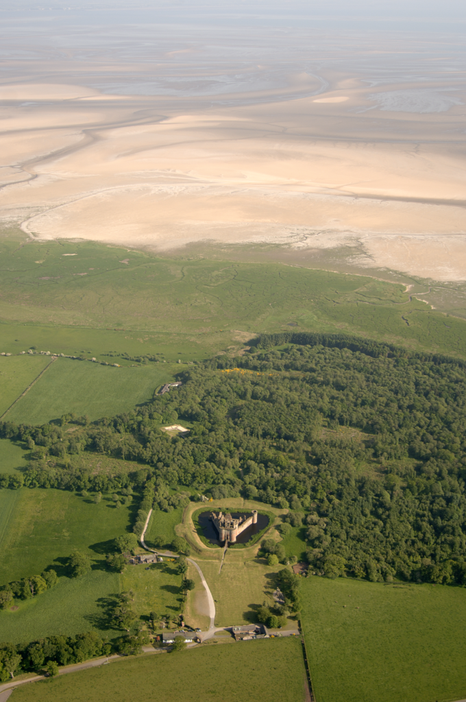
The aim is to understand the chronology and geography of extreme weather events in the high medieval period, and the effects they wrought on archaeological features that led to the abandonment of the old castle built in c.1229 in favour of the new built 200m away in c.1277. The latest thinking is that it was a series of extraordinary storm surge events which pushed a series of storm driven gravel ridges across the River Nith.

The methodology to find this out is interdisciplinary, using scientific methods to enhance understanding of archaeological fieldwork. The fieldwork will involve the establishment of a series of transects across the site and surrounding landscape from which cores and samples will be extracted for sediment description, stratigraphic analysis, and Carbon 14 dating.

Depending on Covid restrictions, the aim is to start doing the work in May this year with the receipt of the final data in the autumn.

Greasley_Castle from air copyright Neil Gabriel

Greasley, Nottinghamshire

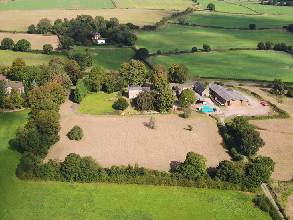
The production of an interpretative phased floor plan for Greasley Castle in Nottinghamshire.  The castle, built in the 1340s, has an obscure history and the understanding of its architectural phasing is at best very cloudy. The site is now a working farm and a number of post-mediaeval structures have been conglomerated around the remains of what is suspected to be a fourteenth century courtyard house with projecting corner towers.

The survey will act as baseline research data for a site which has not previously received serious fieldwork or publication and provide a basis for further research but also for any future conservation needs.

Work on the project will start in the early summer when covid restrictions ease.   

Laughton-en-le-Morthen motte and bailey castle and church

Laughton-en-le-Morthen, South Yorkshire

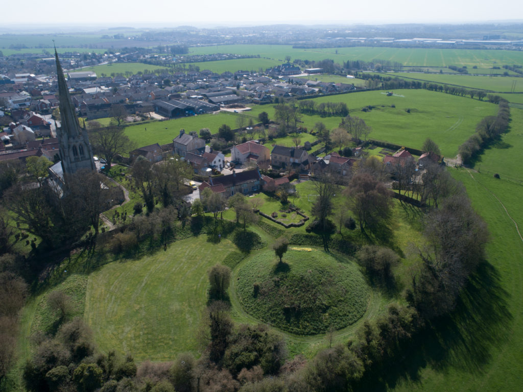
To provide professional illustration and reconstruction which will also be integrated into a co-authored academic article based on the two previous research projects carried out on the site by Dr Duncan Wright and funded by the Trust. A geophysical survey and then small-scale excavation which give a strong indication that the Normans had built a motte on the site of a high-status Saxon dwelling.

Part of the monies will be used to produce phase plans of Laughton during key stages of its development, and a small percentage will pay for a line drawing of the 11th century grave cover incorporated into the fabric of the nearby church. The aim will be to start the work as soon as possible.

Old Wick Tower copyright Historic Environment Scotland

Old Wick, Caithness

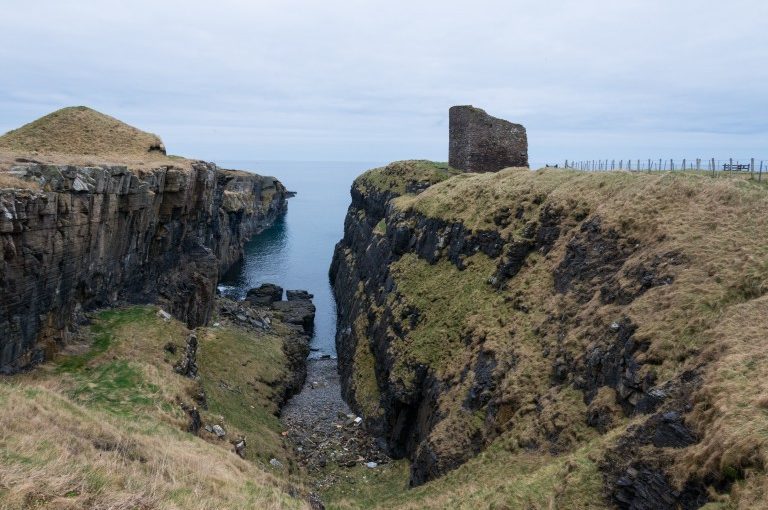
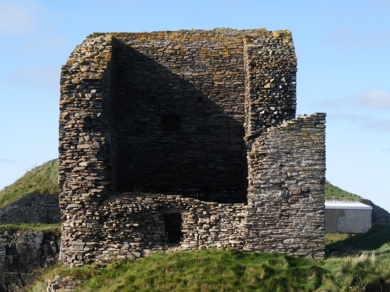
Dendrochronological assessment of timber at the Castle of Old Wick, Caithness thought to be one of the earliest stone castles in Scotland dating from the12th century and the period of Scandinavian ascendency. Current thinking though ascribes the date to the 14th century. Analysing these samples will hopefully provide an answer.

With no architectural features or physical “independent” evidence analysing the remains of a timber joist-end (in poor condition) in one of the joist ends remains the best chance of being able to find an answer. 

The taking of the samples is likely to take place in September when conditions are still going to be favourable as the castle is situated next to the North Sea and the sample can only be found 8 metres above ground level. 

Richmond Castle copyright English Heritage

Richmond, North Yorkshire

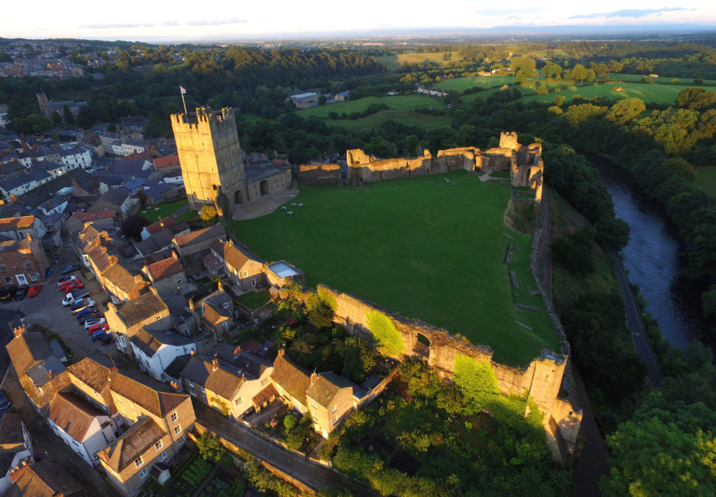
Co-funding a three-week excavation of Richmond Castle, one of the best preserved and least understood Norman castles in the UK. The aim is to understand better the remains of buildings and structures primarily along the eastern side of the bailey including near the 11th century Robin Hood tower and near Scolland’s Hall.

Subject to the scheduled monument consent being granted the excavation will take place in late July.

Warkworth Castle, copyright William Wyeth

Warkworth, Northumberland

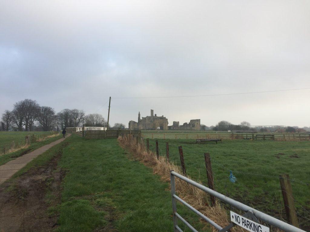
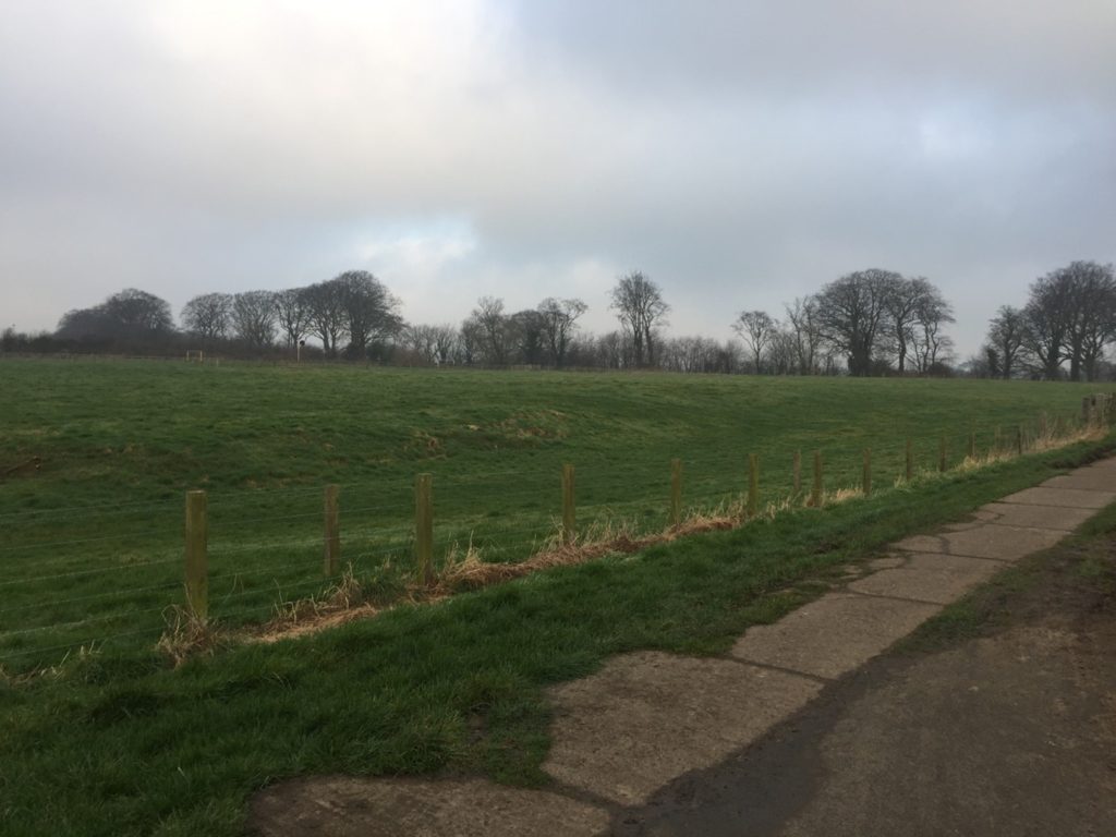
Geophysical survey to explore evidence for subsurface features in and around the field called St John’s Close in a field adjacent to the castle with the aim to establish the location and eastern extent of the castle’s deer park in the 16th century as well as its entrance way. It also hoped to find evidence of a routeway running parallel to the possible park boundary which could represent an early route to the castle’s gatehouse from the south-west.

The plan is to do complete the geophysical survey by the end of March.

To keep up to date with how these projects progress over the coming months you can:

Subscribe to our quarterly newsletter

And if you donate at least £50 here and be invited to our exclusive visits to these projects: https://donate.kindlink.com/castle-studies-trust/2245 

Featured image: Old Wick Castle, Caithness, copyright Historic Environment Scotland

A Large and Eclectic Crop of Fascinating Applications for the Castle Studies Trust to Consider

The deadline for grant applications passed on 1 December. We’re going through the various projects now. Altogether the 14 projects, coming from all parts of Britain, one from Ireland, are asking for £88,000. They cover not only a wide period of history but also a wide range of topics.

We will not be able to fund as many of these projects as we would like. To help us fund as many of these projects as possible please donate here: https://donate.kindlink.com/castle-studies-trust/2245

In a little more detail here are the applications we’ve received:

Caerlaverock, Dumfriesshire: The aim is to understand the chronology and geography of extreme weather events in the high medieval period, and the effects they wrought on archaeological features that led to the abandonment of the old castle in favour of the new.

Georgian Castles: This project explores two castles in County Durham—Brancepeth and Raby—that were fundamentally reshaped and transformed in the eighteenth century to become notable homes in the area, and it advances not only our understanding of these two buildings in the period, but also the afterlife the castles in the area and the layers of history that they record.

Greasley, Nottinghamshire: The production of an interpretative phased floor plan for Greasley Castle in Nottinghamshire. The castle, built in the 1340s, has an obscure history and the understanding of its architectural phasing is at best very cloudy.

Laughton-en-le-Morthen, South Yorkshire: To provide professional illustration and reconstruction which will also be integrated into the co-authored academic article. Part of the monies will be used to produce phase plans of Laughton during key stages of its development, and a small percentage will pay for a line drawing of the grave cover.

Lost medieval landscapes, Ireland: To develop a low cost method, using drone and geophysical survey to identify native Irish (also termed Gaelic Irish) medieval landscapes and deserted settlements.

Mold, Flintshire, post excavation analysis: Post-excavation analysis from excavation on Bailey Hill of the castle

Mold, Flintshire, digital reconstruction: Visual CGI reconstruction of  Mold Castle using the new-found evidence of further masonry on the inner bailey structure and using information gathered by the Bailey Hill Research Volunteers, showcasing the many changes that have happened on this site from a Motte and Bailey Castle to present time as a public park.

Old Wick, Caithness: Dendrochronological assessment of timber at the Castle of Old Wick, Caithness thought to be one of the earliest stone castles in Scotland.

Orford, Suffolk: recording the graffiti at the castle through a detailed photographic and RTI (Reflectance Transformation Imaging) survey will add to our understanding of how the building was constructed and the ways the building was used over time, particularly 1336-1805, during which the documentary history of the castle provides little evidence of how the site developed.

Pembroke, Pembrokeshire: A second season of trial-trench evaluation of the suggested late-medieval, double-winged hall-house in the outer ward at Pembroke Castle, which is of national significance. The evaluation builds on the results of the works undertaken through previous CST grants: geophysical survey (2016) and 2018 whereby two trenches were excavated across the possible mansion site. The evaluation will again establish the extent of stratified archaeological deposits that remain within the building, which was excavated during the 1930s.

Pevensey, East Sussex: GPR survey of the outer bailey and immediate extramural area and UAV (aerial) survey of the castle to build up a 3-D model of the site.

Richmond, North Yorkshire: Co-funding a 3 week excavation of Richmond Castle, one of the best preserved and least understood Norman castles in the UK. The aim is to understand better the remains of building and structures along the western side of the bailey.

Shootinglee Bastle, Peeblesshire: Funding post-excavation work from the 2019-20 excavation season in particular some charcoal deposits from a C16 burning event.

Warkworth, Northumberland: Geophysical survey to explore evidence for subsurface features in and around the field called St John’s Close in a field adjacent to the castle.

We will not be able to fund as many of these projects as we would like. To help us fund as many of these projects as possible please donate here: https://donate.kindlink.com/castle-studies-trust/2245

The applications have been sent to our assessors who will go over them and prepare their feedback for the Trustee’s who will meet in late January to decide on which grants to award.

Stories in Stone: Warkworth Castle and a new geophysical survey of its earthworks

William Wyeth, Properties Historian at English Heritage Trust and project lead on the Castle Studies Trust funded project to geophysically survey Warkworth Castle explains what he hopes the survey will achieve.

In 2019 English Heritage, a charity which looks after over 400 historic properties and sites across England, began a project to change the way in which the stories of the people and buildings at Warkworth Castle in Northumberland were told. The castle is a popular destination in the county, and is both connected with notorious figures from the past as well as featuring an iconic piece of medieval architecture and design in its late 14th-century Great Tower.

Subscribe to our quarterly newsletter

Figure 1. Warkworth Castle from the south-east. The Great Tower, in the background, sits atop a large motte. In the foreground, the curtain wall is punctuated by the Grey Mare’s Tail tower. Archaeologists from Archaeological Services – Durham University are surveying the unenclosed strip of bailey

Warkworth is located at the foot of a narrow loop in the River Coquet, in coastal north-eastern Northumberland, about 25 miles north of Newcastle-Upon-Tyne and 30 miles south of Berwick-Upon-Tweed, themselves both significant fixtures of the late medieval history of this area. Just north of the castle proper and nestled on three sides within the river loop is the small village of Warkworth, arrayed in quite typical medieval layout. At the north end of the high street, sitting on a rough north-south axis, is the parish church of St Lawrence, probably an early medieval foundation, as well as a bridge with a toll-collecting tower built in the later 14th century. South of the church, numerous narrow parallel plots of land spread out at right angles from the high street. The southern trajectory of the street is abruptly broken by the enormous motte (earthen mound) of the castle, which acts to physically separate the village from the land south of the river.

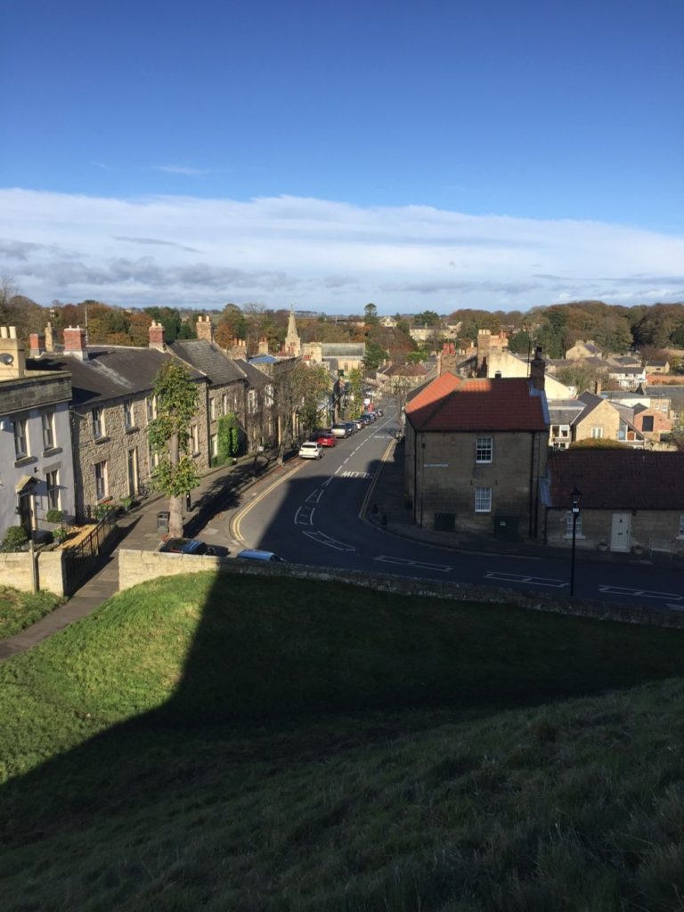
Figure 2. Looking north from the motte top down the high street of Warkworth village. The great tower casts an impressive shadow. © Will Wyeth

Among the most famous historical figures connected to the castle was Henry Percy, eldest son of the 1st Earl of Northumberland, though he is more familiar to us today as Harry Hotspur. The origin of his martial nickname is not certain, but is accounted for in several traditions, all of which confirm that they drew from his short-tempered and violent character. One later 16th-century source rhythmically noted “For his sharp quickness and speediness at need / Henry Hotspur he was called in very deed.”

Though the early history of the Percy Northumberland earls and associated figures will form a key part of the story of the castle when the interpretation project is completed in 2022, other questions about the castle, and especially its earlier history, remain as yet unresolved. Among these is the relationship of the earthworks – the motte and bailey – with the stone structures atop them, the oldest of which date to the later 12th century. The Castle Studies Trust has graciously agreed to fund a geophysical survey of much of the castle earthworks to resolve three big questions.

Subscribe to our quarterly newsletter

The first touches upon the motte, which features the Great Tower of the 1370s, but was probably topped by an earlier structure. By assessing buried deposits around the tower, we aim to reveal traces of this earlier structure. But we also want to establish evidence for the means by which the Great Tower may have been provisioned, via a secure door to the motte-top outside the enclosing curtain wall which gave access to storage areas for beer and food in the tower’s north-west segment.

Figure 3. The secure door of the great tower, giving access to the motte top and outside the enclosure of the castle. Its infilling is a secondary feature. © Will Wyeth

The second question relates to the bailey. In common with other castles of this type, the bailey was filled with buildings, often (as at Warkworth) in their earliest phases arrayed along the inner face of the enclosing wall. But were there buildings here before, or were there also buildings here from later periods, but for which above-ground evidence has been lost? Findings from the survey here will greatly influence how we understand the formal approach to the bailey’s principal buildings – its Gatehouse, Great Hall and Chapel – but also the late medieval Great Tower. The results may also shed light on the peculiar overhauling of spatial arrangements in the bailey occasioned by the construction of a 15th-century Collegiate Church which straddled the span of the bailey, arguably fundamentally changing how the castle was to be experienced.

The last question also relates to the bailey, but here to a strip of the bailey which sits outside the embrace of the late 12th-early 13th-century stone curtain wall, on the eastern side of the castle. The omission of this area from enclosure is unusual, though it is not without analogies from elsewhere, which suggest areas like this could contain gardens. It may be instructive that just within the bailey and adjacent to this strip was the location of late medieval stables – perhaps this area came to be used for the grazing of horses, though whether this was its original intended purpose remains to be seen. In addition to all of this, however, is the possibility that when the motte-and-bailey was built, perhaps well before the earliest stone parts of the castle were erected, the earliest enclosing wall of the bailey also embraced this eastern strip, thereby creating a larger bailey than the present one.

Figure 4. The north face of the great tower, facing the high street of the village. The Percy heraldic lion, standing a full storey high and with metallic claws, is one of many such images across the castle. © Will Wyeth

We hope that the survey will allow us to answer at least some of these questions. Whatever the outcome, it is certain that the results will help change how we understand the story of Warkworth Castle and its previous inhabitants.

Subscribe to our quarterly newsletter

Our five projects for 2020

The results are in, we’ve decided which projects we will be funding for 2020.

But before we get to the announcement, we want to thank all the applicants who proposed projects. It was a difficult decision, with exciting and innovative approaches to a group of fascinating castles. This year marks a milestone for us: we are award £30,000 across the successful projects which is the most we’ve given in a single year.

So without further ado, here are the five projects we will be funding in 2020. We hope you are looking forward to discovering more about them.

Lincoln Castle

Photo by Gustavo Faraon, licensed CC-BY-NC 2.0

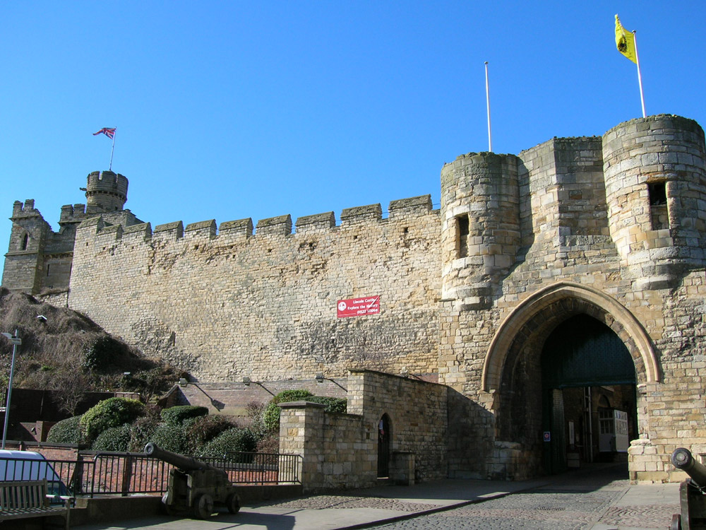
The project will develop a reconstruction drawing of the castle, as it would have been in the latter part of the 12th century, founded by William the Conqueror, in the second half of the 11th century.

Shrewsbury Castle

We will be funding a second year of excavation, following on from 2019, this time to understand the rampart of the inner bailey.

Sowing the Seeds

Castlecarra is one of the sites to be investigated. Photo by Karen Dempsey.

The aim of the project is to try and understand better everyday life in castles by seeing if there are any surviving plants at four Irish castles that were planted, grown, and cared for by medieval people.

The Wirk

Could the Wirk be a Norse castle? Based on the island of Rousay, this stone tower is situated close to the old parish church and recently discovered Norse Hall. However, no one knows what this tower was used for or even when it was built.

Warkworth

 Photo by Karl Davison, licensed CC-BY-NC 2.0

Using various forms of geophysical survey to try and understand the subsurface features for the former caput of the Earls of Northumberland.

Donate regularly for invitation to exclusive site visits

Regular donors will be invited to all exclusive visits to the projects we fund.

Those who are able to donate £500 a year or more (excluding Gift Aid) will also have the opportunity to attend our annual special castle visit to major/privately owned castles. In 2020 this will be at Edinburgh Castle on Saturday 6 June where we will visit parts of the castle not open to the public.

Any new donations by standing order or payroll giving will be matched by a generous supporter for the next two years up to a maximum of £2,000 a year in total.

You can donate regularly via payroll giving or by setting up a standing order. Please return the form to the address on the forms, with the gift aid form if applicable.