Thanks to funding from the Castle Studies Trust, Historic Environment Scotland are working with researchers Dr Richard Tipping and Dr Eileen Tisdall to understand the chronology and geography of extreme weather events in the high medieval period, and the effects they wrought on archaeological features that led to the abandonment of the old castle built in c.1229 in favour of the new built 200m away in c.1277. Here Richard Tipping gives an update on the fieldwork which too place last Saturday (2 October).
Subscribe to our quarterly newsletter
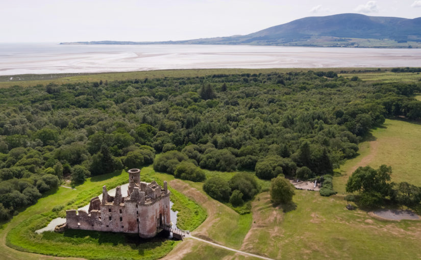
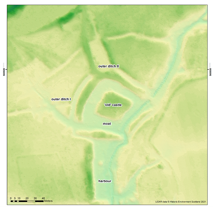
One of the great puzzles of old Caerlaverock is the so-called harbour (Image 1). It is south of the old castle, two metres lower, and just north of where we think the early medieval coastline was, so it’s difficult to think what else it could have been. But it’s never been independently dated, there are rumours that it was Roman, and there are knotty interpretative problems. One is that the floor of the harbour is at an altitude that would make it tricky to get more than rowing boats in and out in the Middle Ages; this is also a problem if the harbour was older. A second is that there is a fourth side at the southern end, which greatly restricts access. As Richard Tipping explains below:
The harbour has three metres of sand above bedrock. We don’t know how old the sand is. One idea is that it’s all very old – 8000-6000 years old. This would mean that the harbour was never deeper than it is now. Another idea is that the sand is of two periods, with an older bed covered by medieval sand: the same stuff that filled the moat of the Old Castle. And a third is that all three metres of sand are medieval in age. This would imply that the builders created a five metre deep harbour, which was then filled with sand as storm surges drove sediment onshore.
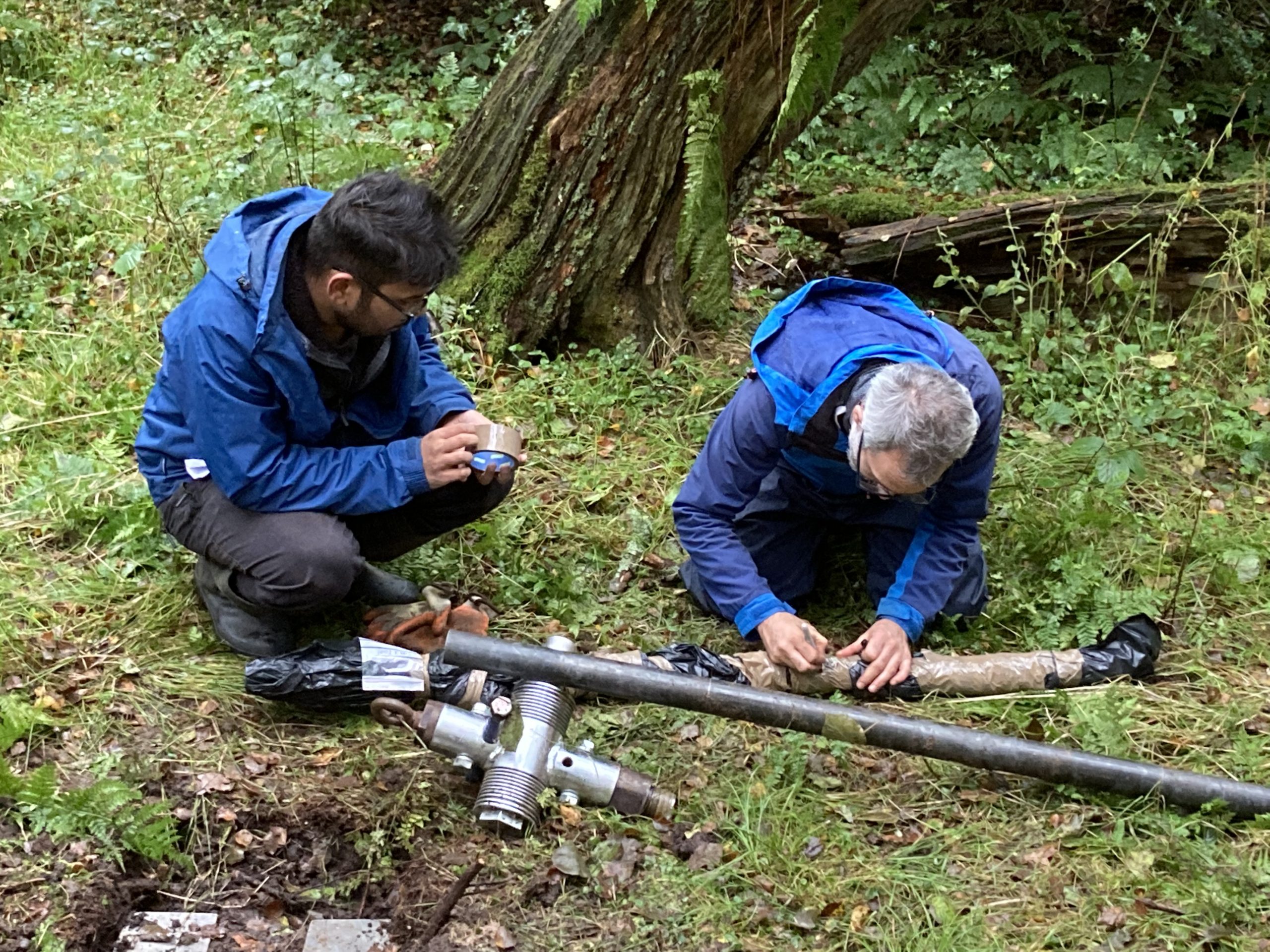
Dating of the sand is the answer. To this end, a team of eight (Richard Tipping and Eileen Tisdall from Stirling; Tim Kinnaird, Aayush Srivastava, Richard Bates and Laura Bates from St Andrews, and Morvern French and Steve Farrar from Historic Environment Scotland) assembled under gloomy skies and a more intimidating forecast to sample the sediment.
Here Richard Bates explains what they are going to do:
Richard Bates had a vibro-corer, a machine that went through three metres of sand as if it was butter: astonishingly impressive:
The three cores came out and were immediately wrapped in black plastic bags because sunlight, even that under grey clouds, cannot be allowed to shine on the samples. The reason for this bizarre behaviour is in how the sediment will be dated
Tim and Aayush are specialists in optically stimulated luminescence (OSL) and infra-red stimulated luminescence (IRSL) dating. This is a kind-of accumulation clock. Over time, quartz and feldspar sand grains buried by sediment accumulate energy released from surrounding sediments at a constant rate. This energy is released if sunlight hits the sand, or under controlled laboratory conditions, when light at optical or infra-red wavelengths hits the sand. If the energy released can be measured, which is Tim’s and Aayush’s job, we can establish the age of the sand as Tim explains here:
The Castle Studies Trust grant will fund three OSL dates from the base of the sand, the middle, and towards the top. As soon as we learn the results, you will.
And the rain stayed away.
Subscribe to our quarterly newsletter
All images and videos courtesy and copyright of either HES and/or Morvern French of HES
One thought on “Caerlaverock: Harbour Fieldwork”