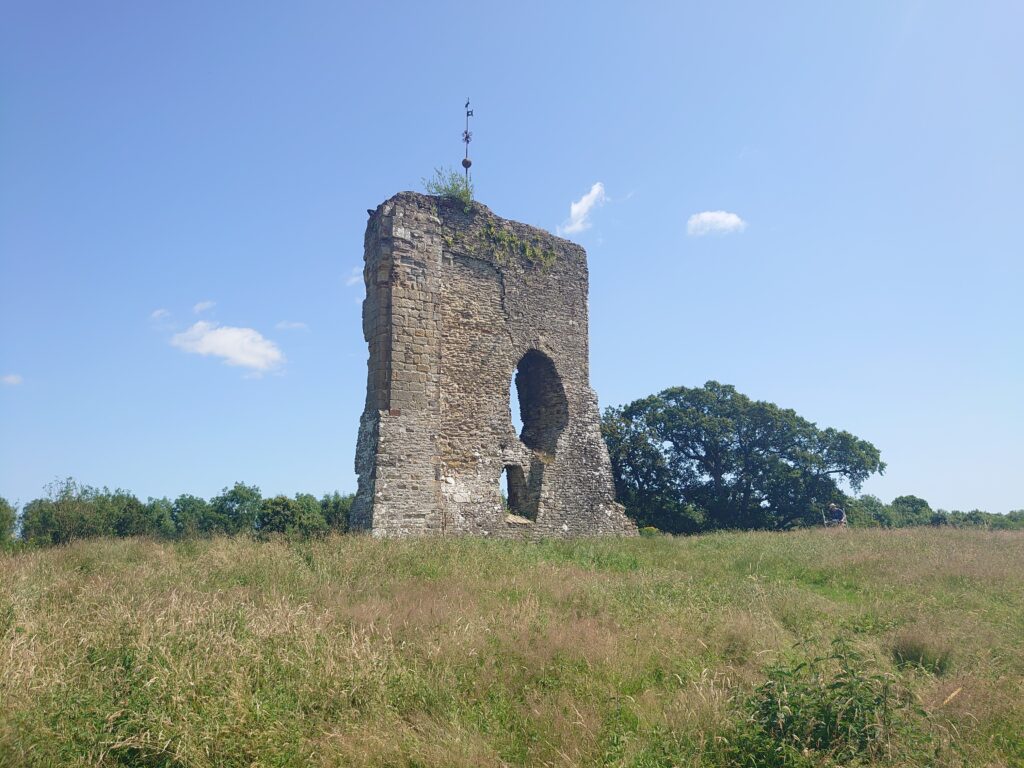
Clavering Castle Excavation Dig Diary: End of Week 2

As we head in to the last week of digging here’s what the team has found so far at the end of week two.

Subscribe to our quarterly newsletter
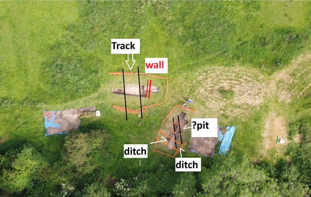
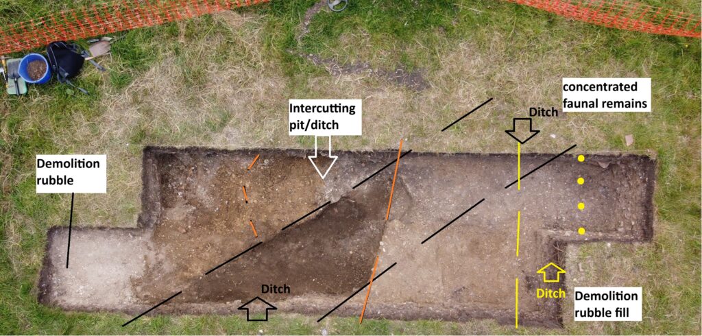
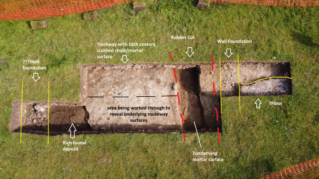
Annotated aerial view of trench one, copyright Simon Coxall

Trench 1

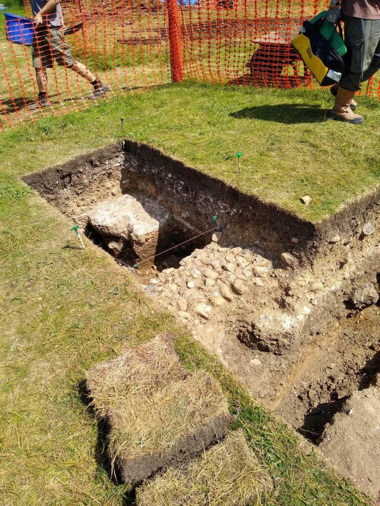
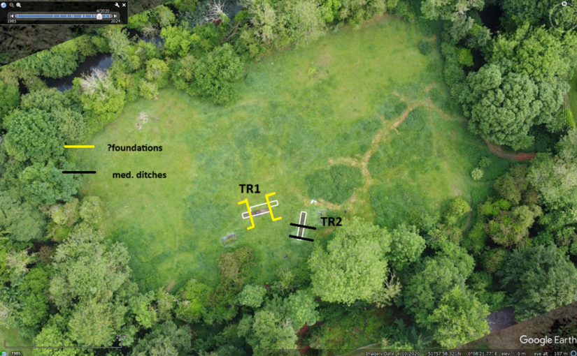
As previously mentioned, trench 1 was sited to explore the suspected ‘gatehouse’ entrance to the site as indicated by earlier resistivity survey. This reveals evidence throughout for the concerted demolition of the site; activity which with the almost total absence of artefacts dating beyond the 16th century appears to have been undertaken shortly after its seizure by the Crown with the demise of Margaret Pole, Countess of Salisbury in 1541.

Ephemeral evidence for residual structural foundations (flint, brick, roof tile, clunch, daub etc) have been found to frame a surviving entrance routeway of beaten chalk sand/mortar which is approximately 6m in width and is associated with ceramic dating evidence.

Sampling of this routeway context reveals it as the last of a number of trackways using it appears the same entrance point to the estate and excavation continues to explore these earlier routeway surfaces and ‘associated’ ditches. All such evidence is consistent with the geophysical findings.

Subscribe to our quarterly newsletter
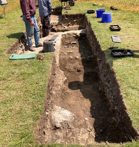
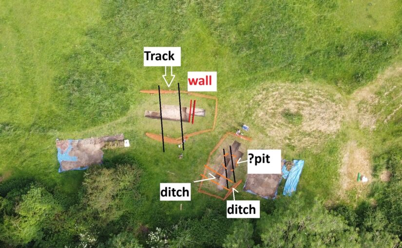
Annotated aerial shot of trench two, copyright Simon Coxall

Trench 2

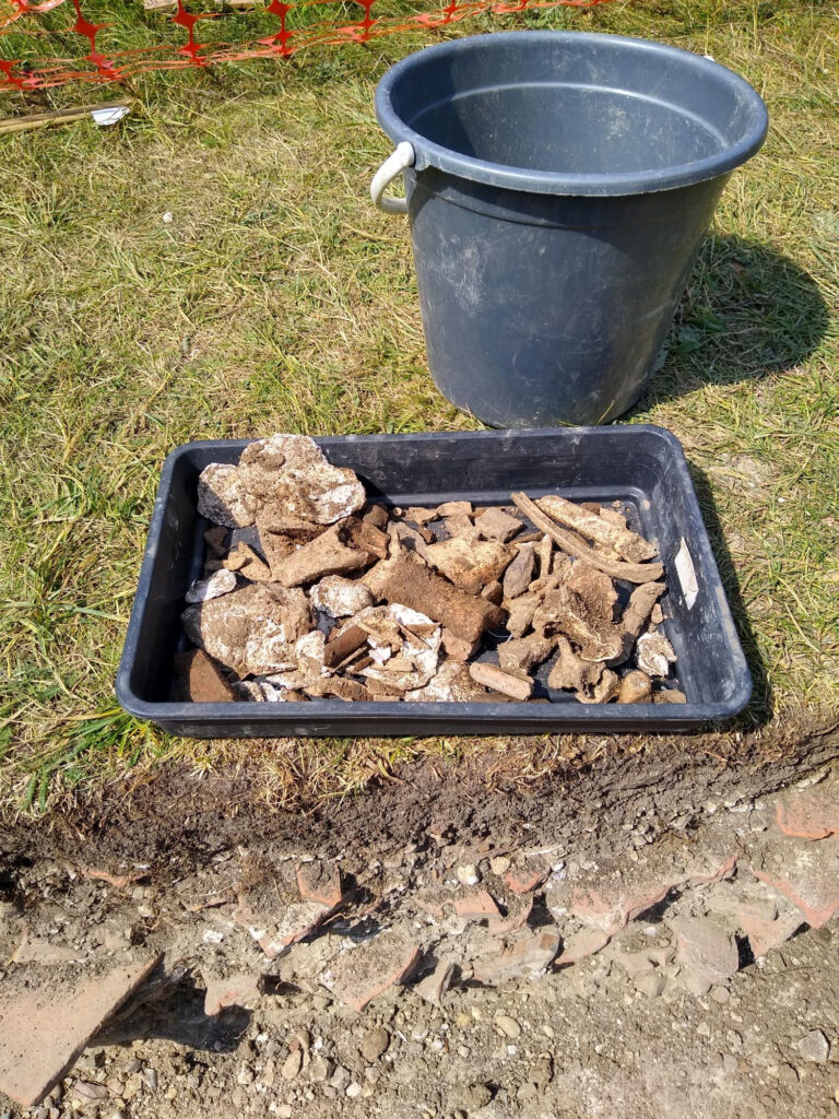
The historical evidence suggests in the mid-14th century the castle site went through a major refurbishment and between 1350 and 1550 it is likely to have been refurbished again and again so we wanted to put a trench where it wasn’t disturbed by those later efforts and this has proven its value in terms of that there is no evidence of any structures. The ditch at far end is probably 15th/16th century and full of Tudor demolition material. At south end is full of sand brought here as has a lot of material to level this part of the site. The part with the darker dirt is a huge ditch which just keeps going. It is 14th century material coming out of this ditch, although not a huge amount and it is mainly stacks of animal bones but some interesting bits of pot. Like the other ditch it is likely to be amongst the earliest features this far on this site.

Imagine a landscape which doesn’t have this gatehouse, and these ditches may well have been there before that. The object here is to find the oldest bone at the lowest level because one of the dating opportunities is to date the animal bone through carbon dating, but pottery is less precise for dating.

With only one week to go of the excavation the key focus is to continue to get down to the lowest possible level allowed of 1.2 metres with the aim of finding suitable material to use to try and date the earliest period of use of the site.

Subscribe to our quarterly newsletter

Clavering Castle Dig Diary Day Nine – Going Deeper

Since the last update, the excavators continue to make progress although the finds have not been numerous.

Subscribe to our quarterly newsletter

Drone image of trench one with annotations by Simon Coxall, copyright Simon Coxall

The first fragmentary cobble walls have appeared in trench one associated with the gatehouse structures on the east side. The emphasis there is on going down through the trackway to get to the lower levels / early period. The top layers are producing 15th/16th century pottery and underlying levels coarser sandy wares going back to the 14th / 15th century. Plenty of depth still to go. Widespread faunal remains in trench one.

Drone image of trench two with annotations by Simon Coxall, copyright Simon Coxall

Trench two is now extended to 6x2m shows below demolition levels two sizeable ditches and perhaps a pit cutting same. One holds demolition period material, the pot and other ditch are larger features and in terms of alignment appear to have no relation to the structures suggested by the geophysics. These appear deeply cut and hold almost exclusively faunal remains in a dark humic fill. The lower levels of these features may offer environmental and carbon-dating opportunities. The same area suggests some evidence for smithing slag.

The emphasis in both trenches now is going deeper into identified contexts to our 1.2m maximum.

Subscribe to our quarterly newsletter

Clavering Castle Excavation: Day Five Update

Excavation director Simon Coxall gives an update of what happened on Friday 6 June.

In Trench 1 the trackway limits were established and exploration of its junction with the structural foundations to the west has been a little problematic at first. The foundations appear to consist of a dense concretion of sand gravels and small sub-angular flint cobbles rather than the larger flint cobbles that were anticipated. Such larger cobbles as survive are redeposited remnants of the former walls perhaps not though worthy to recover from the demolition.

Subscribe to our quarterly newsletter

There is nearby corroboration of this foundation method from records of when Saffron Walden castle was explored.

‘…Archaeological excavation and monitoring was carried out prior to and during repair work to the retaining wall between the north side of Saffron Walden Castle and the rear of 30 Castle Street. A 1m-wide trench, stepped for safety, was excavated through the deposits to the south of the wall. Natural chalk was exposed in the base of the trench at a depth of c. 2m below the ground surface. This was sealed by buried medieval topsoil upon which were a series of compacted sand, flint and chalk deposits interpreted as the foundations of the mid-14th century inner bailey curtain wall. The foundations were found to extend along the length of the retaining wall during monitoring. ‘

The depth of these foundations has still to be established. Both the foundation and trackway are to be sampled for evidence of construction methods and perhaps phased construction.

Discovery of the ditch on Wednesday at first thought to be a beam slot, courtesy of Jacky Cooper

In Trench 2 the beam slot found on Wednesday has morphed into a ditch with dark humic fill. At its uppermost levels this contained two sherds of medieval pottery Sandy ware probably for the same vessel estimated as being 14th century. This is being cleaned/defined prior to full excavation of its fill. The ditch encountered at the southern extent of Trench 2 has been excavated and found to contain in the main demolition materials in its upper levels with a medieval jug handle (?) present in the lower fills as presented in the trench’s eastern balk.

The trench has shown the propensity for features hitherto not recorded by geophysics and will be explored further.

A sketch with approximate trench locations is the featured image and courtesy of Simon. The trenches are being georeferenced in with Oxford Archaeology East assistance on Monday. There’s a decision to be made today (Saturday) regarding extension of either trench to achieve the current excavation limit of 2 x c.2m trenches.

Subscribe to our quarterly newsletter

Clavering Excavation Dig Diary Middle of Week One

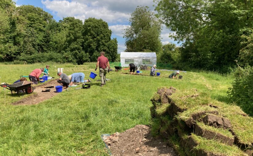
On Monday 2 June volunteer excavators led by Simon Coxall, along with his Warboys Archaeology Group (WAG) and Oxford Archaeology East got underway with the opening of two trenches at Clavering Castle focussed on the eastern side of the castle.

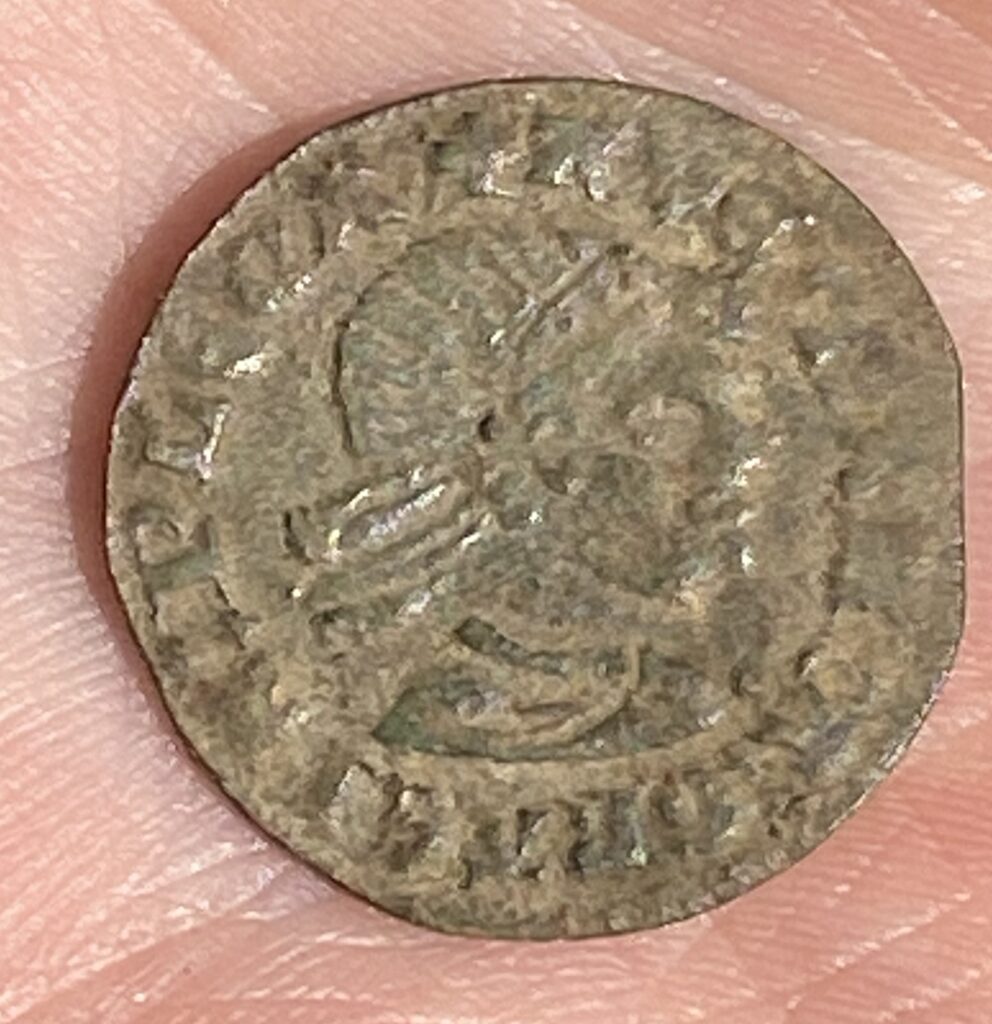
On the first couple of days the excavators predominantly demolition rubble such as roof tiles, but other finds too some worked flint and some medieval nails, a musket ball and most interestingly a fourteenth or fifteenth century French jetton. According to one of the WAG team, Andrew Noakes, the jetton is quite a rare item because it features a Moor’s head. The inscription in French translates as ‘For the queen and her almonry’.

Subscribe to our quarterly newsletter

French jetton with Moors head copyright Jacky Cooper

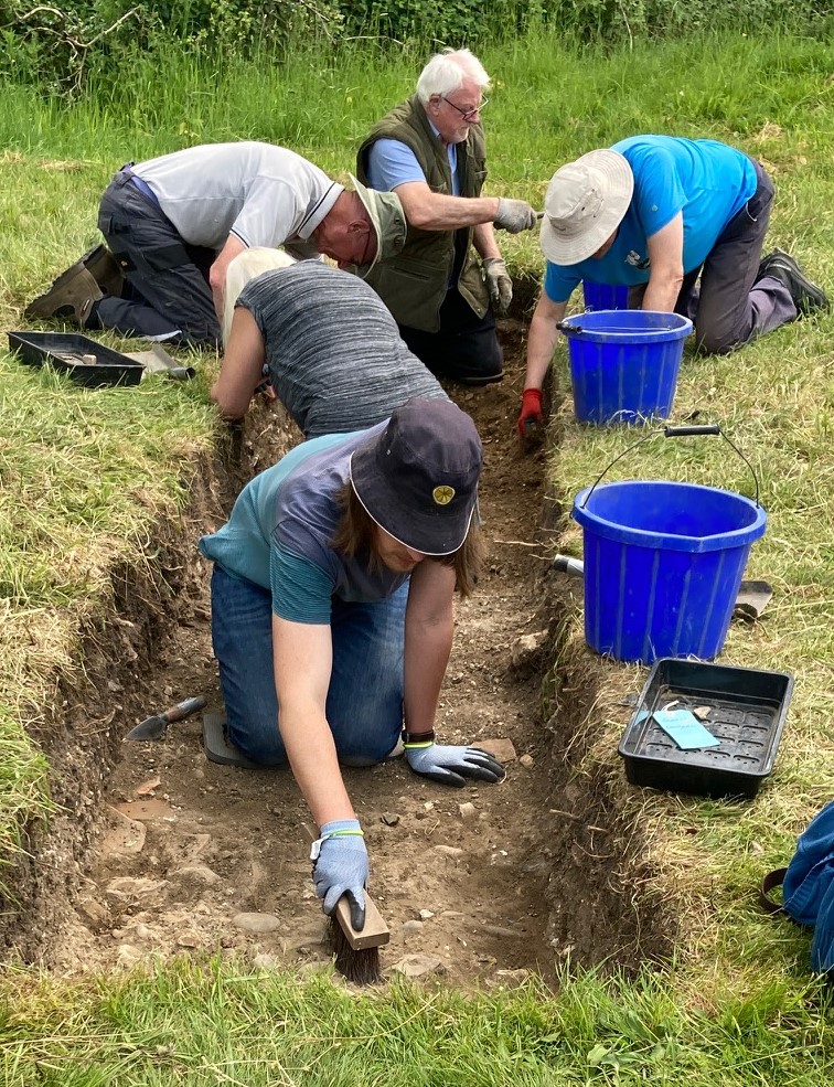
The Clav25 dig at Clavering Castle was sadly hit by rain on the third and fourth days but nevertheless there was good progress in both trenches. In Trench 1 a sandy grit surface was reached which proceeds 2m north to south across the centre of the trench. This is interpreted as the central trackway of the Castle’s entrance court. Some sherds of late medieval/ early modern pottery were recovered from the demolition layers immediately overlaying the trackway.  The trackway appears to extend across the area between the evidence for flint structures to the east and west. Meanwhile, at the southern limits of Trench 2, a ditch has been exposed which appears full of demolition material. Material coming out of the trenches includes a lot of roof tile and oyster shell, but very little pottery so far. 

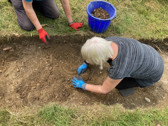
Hard at work in trench two on Wednesday, copyright Jacky Cooper

With the trenches starting to show promise more we will have an update at the end of the week, weather permitting. If it isn’t being kind then early next week.

Subscribe to our quarterly newsletter

Setting the Scene for the Clavering Castle Excavation 2025

Excavation Director, and lead archaeologist for the past two decades in the investigation of Clavering Castle sets the scene for what they hope to find over the the next three weeks.

Norman knights fleeing the forces of Earl Godwin of Wessex coupled with miraculous encounters between King Edward the Confessor and St John the Evangelist form just part of the shady historical drama hidden behind the leafy tranquillity of Clavering Castle in north-west Essex.

Subscribe to our quarterly newsletter

The scheduled site of Clavering castle is recognised as a rare example of a castle established in Anglo-Saxon England before the Norman Conquest. The castle has been subject of a twenty year programme of detailed historical and archaeological research by the Clavering Landscape History Group. This summer, archaeologists led by Simon Coxall of Warboys Archaeology Group, under a consent granted by Historic England and supported by the Castle Studies Trust, have a unique opportunity to explore by excavation this mysterious and previously unexcavated site.

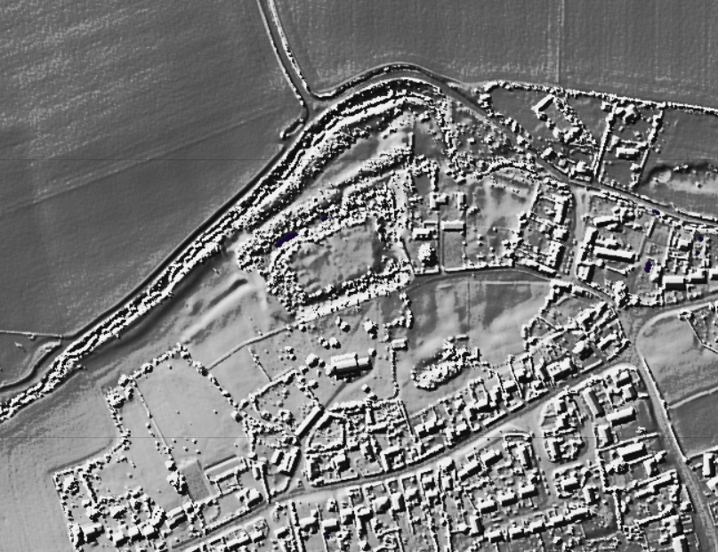
Clavering LiDAR base

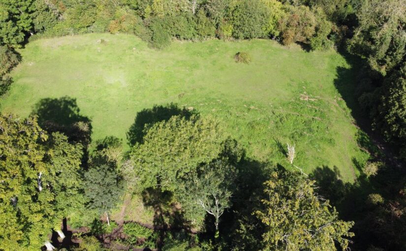
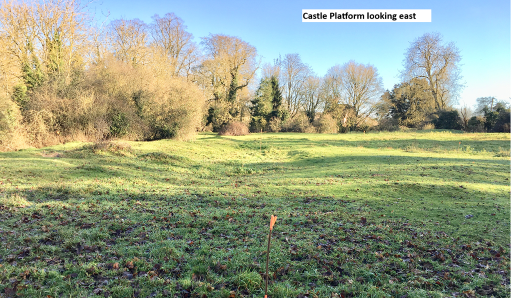
The castle platform which is entirely man-made is surrounded on all sides by imposing moated defences c4m deep and sits in the valley of the river Stort which evidence suggests witnessed significant diversion and management  of its river system to accommodate the estate.

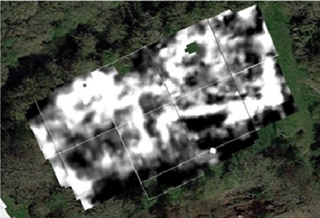
Resistivity Survey of Clavering Castle Platform, copyright Warboys Archaeology

Geophysical survey suggests structures occupying twin courtyards once existed spanning across the sub-rectangular platform which measures c100m x 60m. The Castle platform abuts the parish churchyard to its south. Here further geophysical survey suggests the location of the now ‘lost’ chapel of St John the Evangelist which bore witness to Edward the Confessor’s aforementioned ‘Miracle of the Ring’. The twin courtyards appear connected to one another by an entrance court which issued out onto a bridged crossing of the moat connecting the castle with the family chapel where the alleged miracle occurred. It is suspected the geophysical evidence primarily relates to the powerful Neville family’s reconstruction of the castle site in the later 14th century, although some more ephemeral readings hint at the presence of earlier structures.

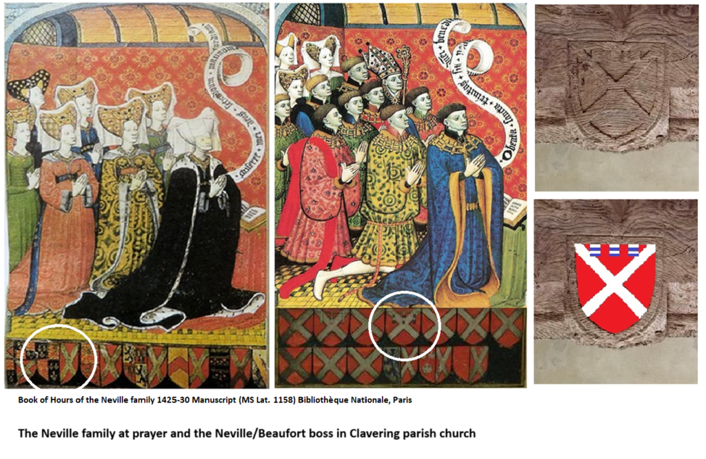
The Nevilles were arguably the most powerful baronial family in England during the 15th century and were through their marriage alliances with the Plantagenet royal family at the forefront of the dynastic conflicts now known as the Wars of the Roses. Clavering was selected by the Nevilles as their southern caput, these notorious northern lords presiding over their lordship and hundred of Clavering lying just a day’s ride from London. Clavering castle was successively held by the Neville Earls of Westmorland, Richard Earl of Salisbury, Richard Earl of Warwick and, through his Neville wife, George Duke of Clarence, the executed brother of the Yorkist kings Edward IV and Richard III. With the fall of the house of Neville the castle was seized by the Crown and stayed a crown possession until it was granted back to effectively the last Neville lord of Clavering – Margaret Pole, Countess of Salisbury (1473-1541) Though she refurbished elements of the castle and chapel in the 1520’s, as a devout Catholic and one of the last surviving scions of the Plantagenet royal family she too was executed on the orders of Henry VIII in 1541.

Beneath the levels denoting the Neville tenure of the lordship, archaeologists are hopeful of encountering earlier evidence of the de Clavering and FitzWymarc occupation of the castle. The de Claverings were, like the Nevilles, powerful lords of the north who feature extensively as Magna Carta sureties and later campaigning knights under Edward I and Edward II. With Robert FitzWymarc (c1030-1075) we return to the pre-conquest evidence that promises to push the history of the site back a thousand years to the dying days of Anglo-Saxon England.

Clavering Castle Platform looking east, copyright Simon Coxall

This summer’s excavations will initially focus upon the key area around the entrance court connecting the castle platform with the adjacent churchyard. Such will seek to explore the entrance court and bridged crossing, the various phases involved in their construction, the materials used and its status, whilst testing the geophysical responses.

Digging deeper still, in the same key area archaeologists are hopeful of exploring the earliest evidence for the construction of the castle platform as revealed by the layers underlying the later medieval structures on site. In doing so fresh light will be shone upon the earliest days of castle construction in medieval England.

Subscribe to our quarterly newsletter

Castle Studies Trust Awards a Record Amount in Grants

The Castle Studies Trust is delighted to announce the award of five grants, totalling a record amount of £42,000, to a wide range of projects with different types of research. The amount means that since our foundation we will have given over £300,000 to castle research projects – a landmark to celebrate.

Subscribe to our quarterly newsletter

The five projects we will be funding are:

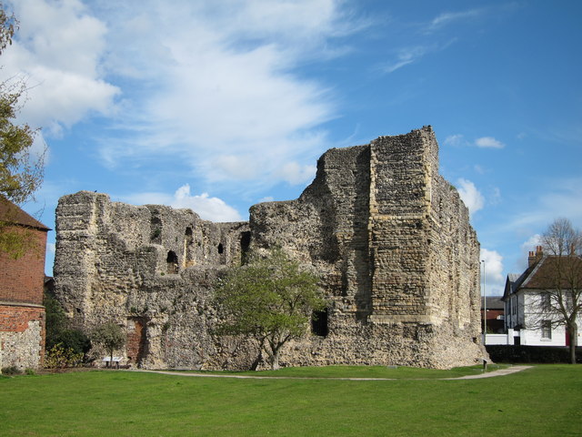
Canterbury Castle Keep copyright geograph.co.uk

Canterbury, Kent: To create an interactive digital model of the castle’s keep. The keep is one of the largest surviving from early Norman England dating to the late eleventh / early twelfth century. Now much ruined and inaccessible to visitors due to instability, the project will use the findings of previous archaeological research to create an interactive model. Work will start in March and be completed within ten months.

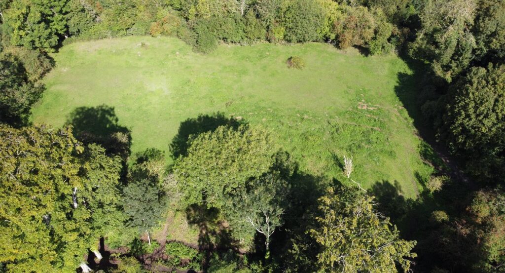
Clavering Castle platform copyright Simon Coxall

Clavering, Essex: To fund an excavation to help understand the development of the site which was occupied for over 600 years and which could be one of the very few pre-conquest castles in the UK. The excavation will build on the extensive survey work carried out by the local group of the site. They are planning to do the excavations in June.

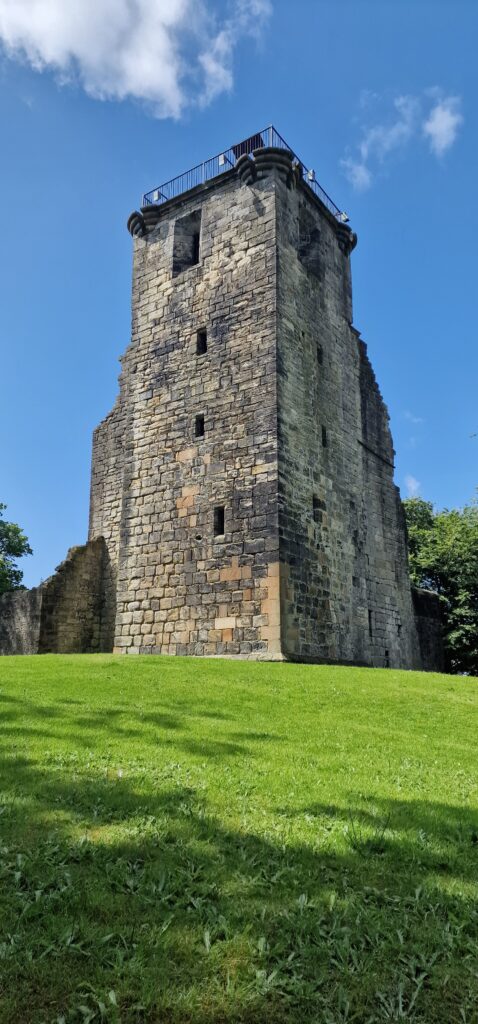
Crookston Castle copyright Friends of Crookston

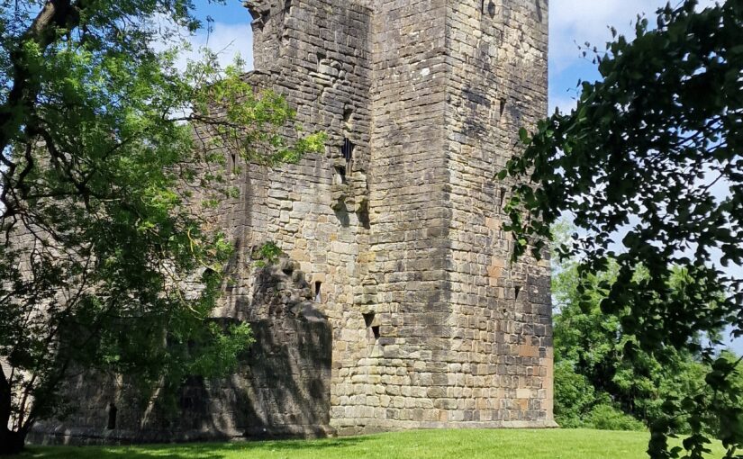
Crookston, Glasgow: A community-led geophysical survey, using multiple techniques, through which the Friends of Crookston Castle in conjunction with HES hope to learn more about Glasgow’s only castle. While the standing remains are believed to date from the early fifteenth century, it is believed that the castle dates back to the twelfth century. The group hopes to discover evidence of that earlier history and whether it was based on an earlier Iron Age hillfort. They plan to do the survey in early August.

Knepp Castle copyright Richard Nevell

Knepp, West Sussex: An excavation building on a geophysical survey to better understand the site’s development and its relationship to the local area of this important baronial centre thought to be built by the de Braose family. The first documentary evidence is from 1210 when it was under royal control, documenting repairs, while the geophysical survey shows activity that pre-dates the extant stone tower. Excavations are planned for late July/ early August 2025.

Image of Transcript copyright Esther van Raamsdonk

Transcription and translation of C17  Dutch Engineer’s Survey of English castles and fortifications: A joint project between Dutch academic Dr Esther van Raamsdonk and English Heritage to transcribe and translate part of an early seventeenth-century manuscript of a Dutch surveyor’s examination of castles and forts in England. The sample covers five of the 22 castles and fortifications in the document, which is called SP 9/99,   held by the National Archives in Kew.  The sample will include Dover, Walmer and Deal. The document is filled with detailed drawings and maps of these fortifications with often lengthy descriptions of their condition. Esther has already started work on it.

Subscribe to our quarterly newsletter