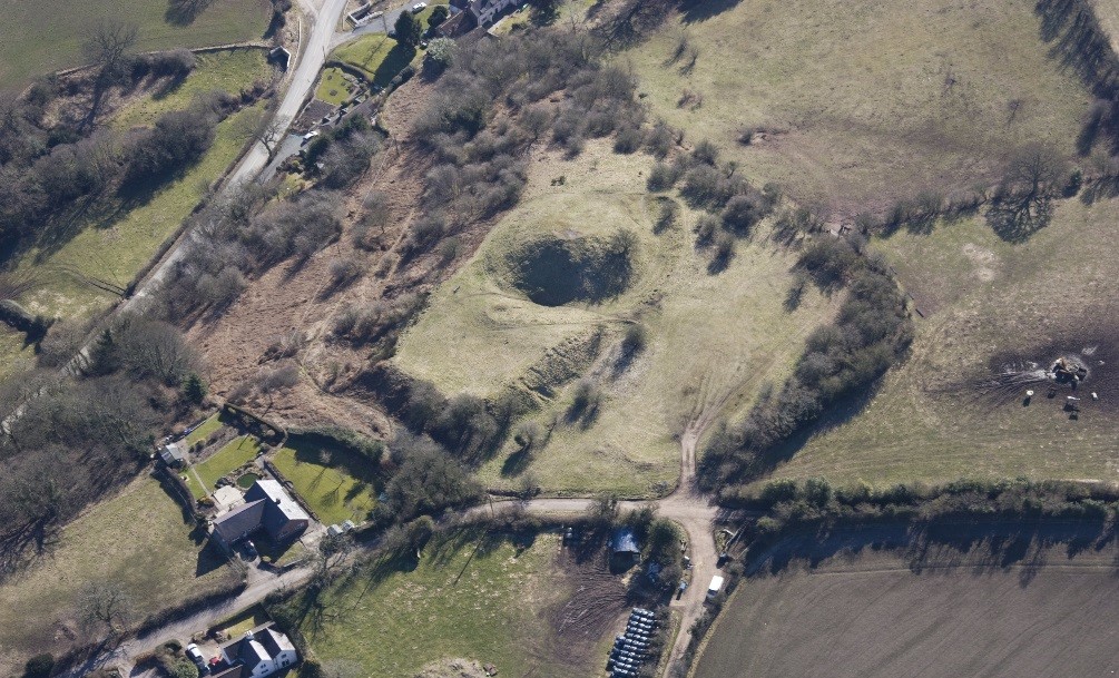
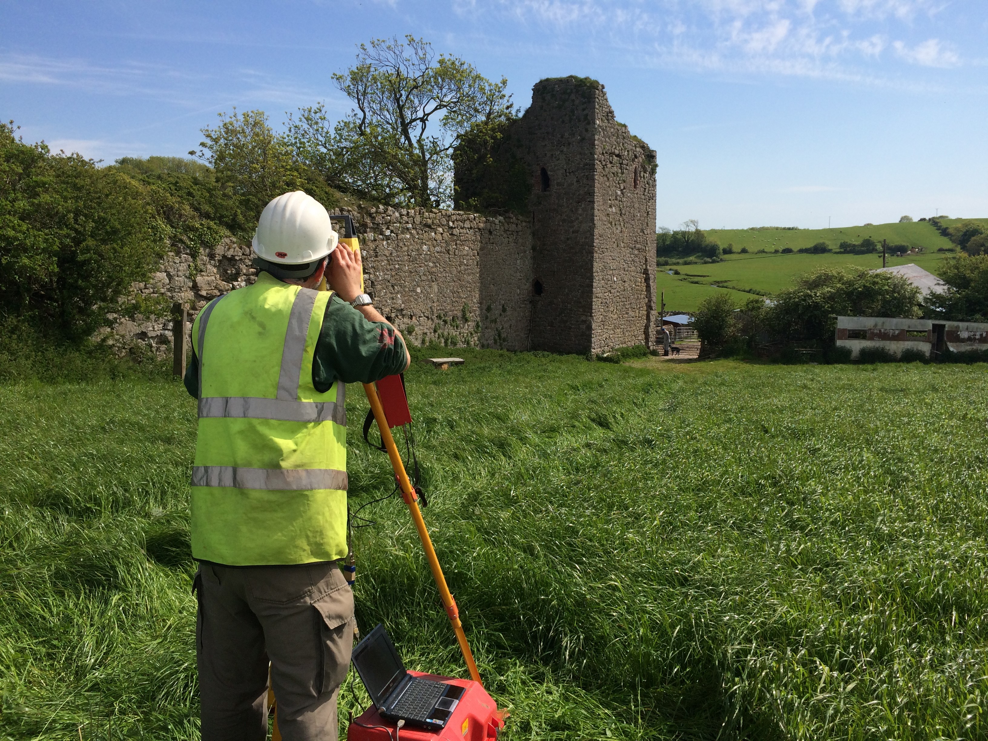
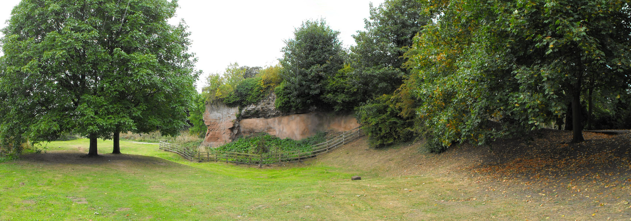
Geophysical and photogrammetric surveys of this motte and bailey castle. Abandoned by c.1200 this has the potential for us to advance our understanding of early castles along the Welsh border.
One of the earliest castles in the UK and one of the most important along the Welsh border the geophysical survey and excavations, along with separately funded building analysis, will help understand the morphology of this little understood site. The CSG visited it as part of the 2016 annual conference. Please note this is a privately owned site and not accessible to the general public.
Co-funding with Cadw a geophysical survey of the most complete, but little understood, native Welsh built castle to discover what structures lie beneath the surface.
With almost nothing left above ground the geophysical and earthwork surveys will help shed light on the form of castle with strong royal associations, in particular the C15 palace associated with the House of York and birthplace of Richard III. Please note this is a privately owned site and not accessible to the general public.
Analysis of castle masonry from the completely destroyed late C15 castle built by Thomas, Lord Stanley either found via excavations or reused in the current building. This will help understand what the castle looked like and early Tudor palaces around London, like Richmond. Please note this is a privately owned site and not accessible to the general public.
The deadline for grant applications passed on 15th December and we’re going through the various projects now. Altogether the 11 projects, coming from all parts of the British Isles and Italy, are asking for over £50,000. They cover a wide period of history and types of research. For a little more detail, here are the applications we’ve received:
Abergavenny Castle, Wales – a geophysical survey of the whole site. The castle was an important baronial site and saw a lot of military action from when it was first built in the 11th century up until it was slighted (partially demolished) in the Civil War.
Bamburgh, England – assess and conserve a large collection of medieval metal work dating from the 8th to the 11th century discovered in the west ward. Bamburgh was a major elite fortress from the early medieval period so the project should help potentially understand how the site changed over the centuries.
Caldicot Castle, Wales – geophysical of the whole scheduled area. Building on the previous resistivity survey in the project will use all three types of survey technique to get the best understanding of any below ground remains of this major baronial site.
Castle Pulverbatch, England – geophysical and photogrammetric surveys of the site, one of the finest examples of a Norman motte-and-bailey castle in Shropshire.
Clifford Castle, England – geophysical survey and excavations to help understand the morphology of one of the earliest castle sites in the UK, and one of the principal castles on the Anglo-Welsh border. Please note this is a privately owned site and not accessible to the general public.
Dinas Bran, Wales – geophysical survey of the most extensive and complete Welsh-built castle to understand what structures lie beneath the surface.
Edinburgh Castle, Scotland – mapping and categorising suspected conflict damage at this iconic castle.
Fotheringhay, England – understanding the morphology of the caput of the honor of Huntingdon and 15th-century palace associated with the House of York and birthplace of Richard III, using ground penetrating radar and small unmanned aircraft. Please note this is a privately owned site and not accessible to the general public.
Lathom House, England – analysis of masonry dating from the late 15th-century castle built by Thomas, Lord Stanley either found via excavations or potential reused in the current building.
Lecce, Italy – to help with the publication of a history of the castle of Lecce which was founded by the Normans.
Lough Key, Ireland – to improve understanding of the medieval MacDermot lordship of Moylurg and its relationship with the Rock of Lough Key.
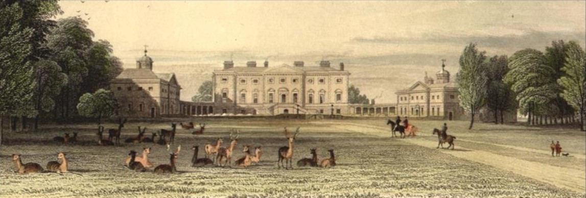
The only date in British history everyone remembers is 1066, when, on 14 October, William duke of Normandy defeated and killed Harold, king of England, and began a new era in this island’s history. Those interested in the castle know that it was William’s followers who brought it with them. 950 years on, it may come as a surprise to hear that what we know about castles built by the Norman conquerors in the years after 1066 is less than what we still don’t know: castle studies still matter and the work of organisations like the Castle Studies Trust is vital in encouraging better understanding of these monuments, and our own past.
Before 1066 the only castles in England were a handful built by Norman nobles who had been favourites of king Edward the Confessor. English nobles used a different type of residence and we will never know if they would eventually have followed the continental trend.
The Norman conquest did not end on 14 October 1066, it only began. William had wiped out the English royal family and much of the aristocracy but the battle of Hastings (and subsequent surrender of Dover and London) only secured him control of the south east. He then faced and defeated resistance and rebellions including that of Hereward “the Wake” in the Fens, while the people of York destroyed the first castle built there by the invaders in 1068 leading to the infamous “harrying of the north” in 1069. To understand the building of early Norman castles it’s important to bear in mind that the conquerors could not relax and believe they were secure for a number of years.
Castles featured from the start. From the quickly fabricated timber palisades put up to protect the army when it landed to the foundation of the new “Tower of London”, William ordered the construction of royal castles while also encouraging the bishops and nobles who had followed him to build their own. Many great stone castles standing today were originally put up as earthworks in the years immediately after 1066. In turn, the great lords who replaced virtually the entire English ruling class encouraged their own followers to secure themselves in their own castles. We don’t know the reasons why each was built: sometimes sitting on the previous owner’s (unfortified) hall, the new castle was evidently a visual statement confirming change of ownership, but may also reflect concerns about security by the new landowner, living among and exploiting a much larger peasantry speaking another language.
The larger castles have been well studied. The lesser ones have not. There are probably at least a thousand earthworks in what was then England, most of which have never been excavated, never dated, their function only guessed at. Many are called “mottes” with no more evidence than that they look like one. The old certainty that all Norman castles were originally of motte and bailey design has been replaced with awareness that the recognisable conical mound forming the motte was sometimes added later to a simpler enclosure defined by a ditch, rampart and palisade. The bailey too is proving more complex: why did some castles have two (or more), why are some so vast? Some now seem to have enclosed whole villages, others are too cramped for any but the smallest buildings. The CST-funded project at Caus (Shropshire) tackles this question.
950 years after William began the conquest of England, we are asking questions about Norman castles based not on old prejudices about what castles were, but on historical and archaeological study based in a better understanding of the reality of eleventh and twelfth century societies.
This post was written by Louise Martin, Cultural Heritage Officer for Morecambe Bay Partnership
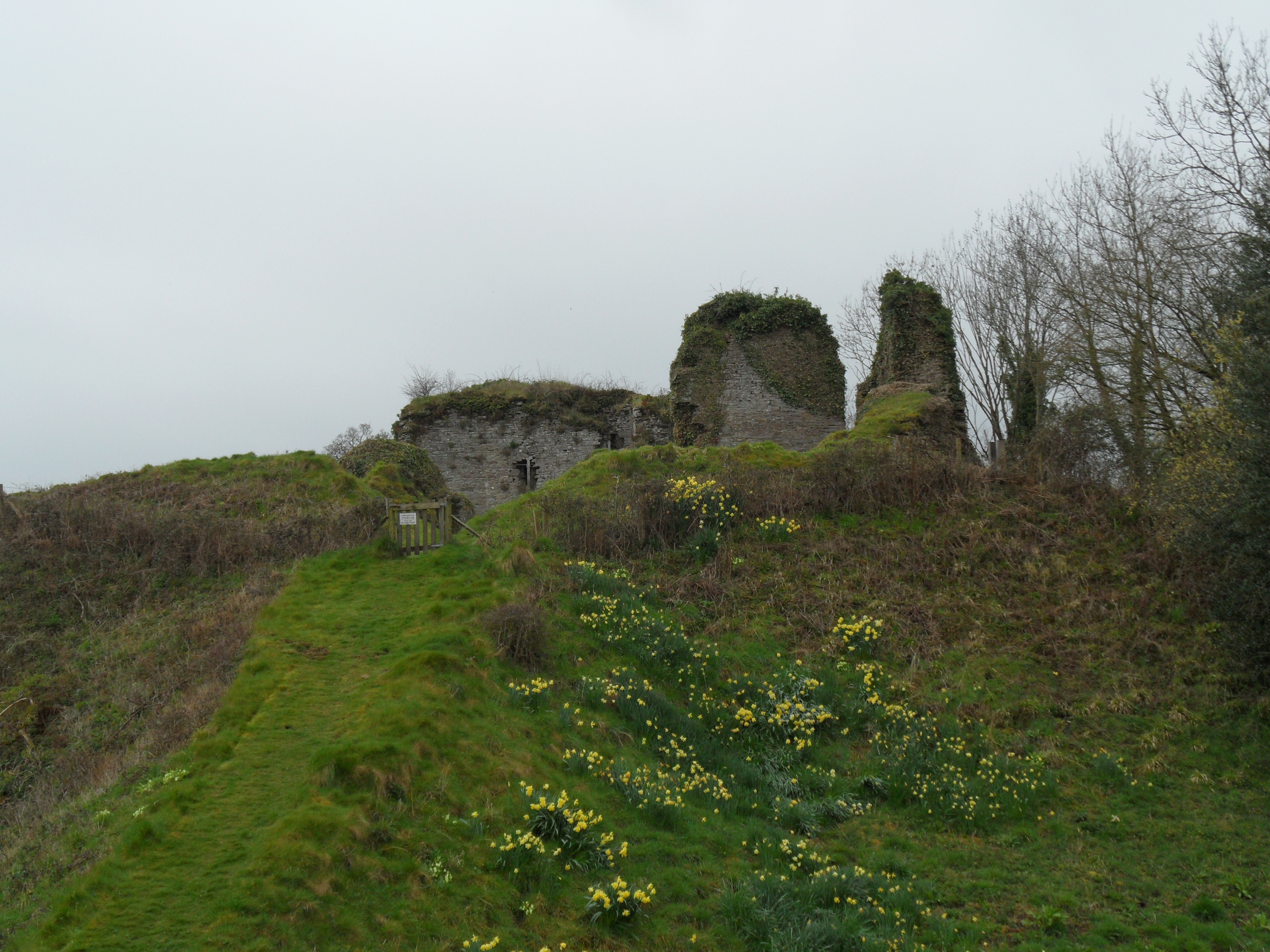
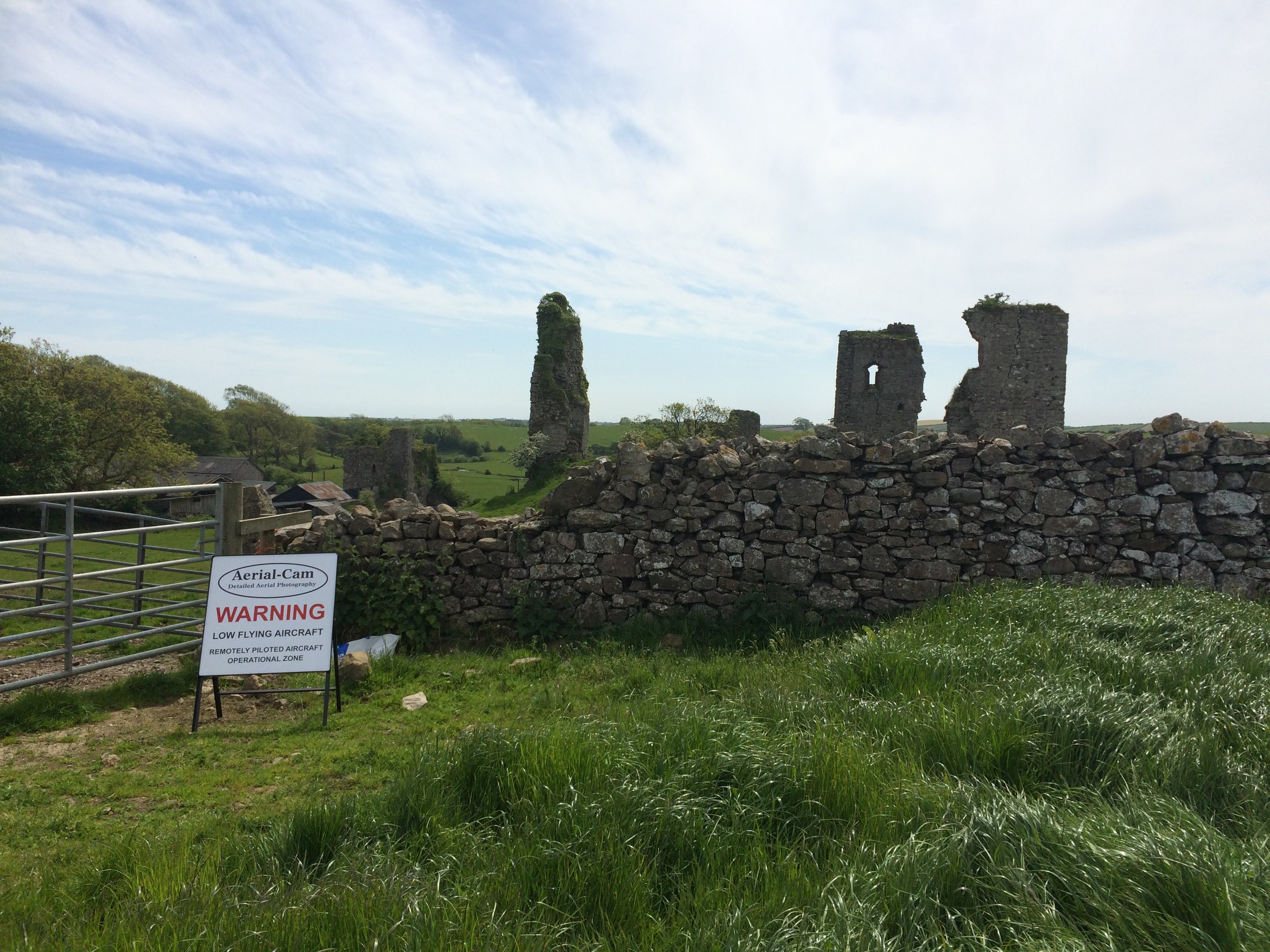
Gleaston Castle is a gem of a site; a little known and poorly understood courtyard or enclosure castle, located in the beautiful Furness Peninsula. The history of the site is scant and whilst it has been the subject of antiquarian and more recent documentary research, its origins and reason for construction still remain unclear. Some writers have proposed that the castle was constructed in the early 14th century as a response to the Scottish raids, although the site is not mentioned in documentary sources until some 30 years after these raids and may simply be a reflection of the wealth and status of the Lord of the Manor.
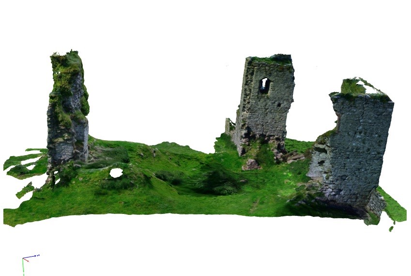
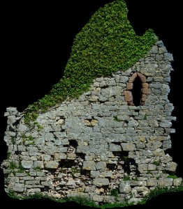
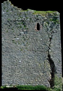
Today the site survives as the ruins of three towers with an associated curtain wall. As a Grade I listed building and Scheduled Monument this unique site is protected from development or destruction, however, this site is currently on the Heritage at Risk register with many conservation concerns.
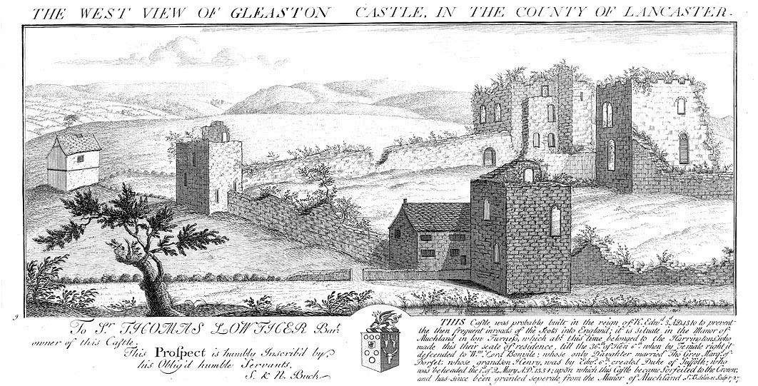
Its crumbling stature is not new, the site is believed to have been dismantled after it ceased to be a manorial residence. It was described as a ruin in the mid-16th century and is depicted as such in engravings from the early 18th century.
Engraving of Gleaston Castle by Samuel and Nathaniel Buck, 1727 showing the site in a ruinous state
Whilst the site was subject to antiquarian attention, with plans and descriptions produced in the early 19th century, I was surprised to discover that the site had never been fully recorded, in particular the elevations of the structures which survive from its original layout.
To bridge this gap in the archaeological record and gain a better understanding of the site, Morecambe Bay Partnership applied to the Castle Studies Trust for a grant in late 2014. I was thrilled and delighted to hear the news that our application had been accepted and a generous £5,000 grant had been awarded to enable an aerial photographic survey and 3D model of the site to be produced. In addition, the grant would fund the production of a conservation assessment, outlining the historical background and current issues for the site.
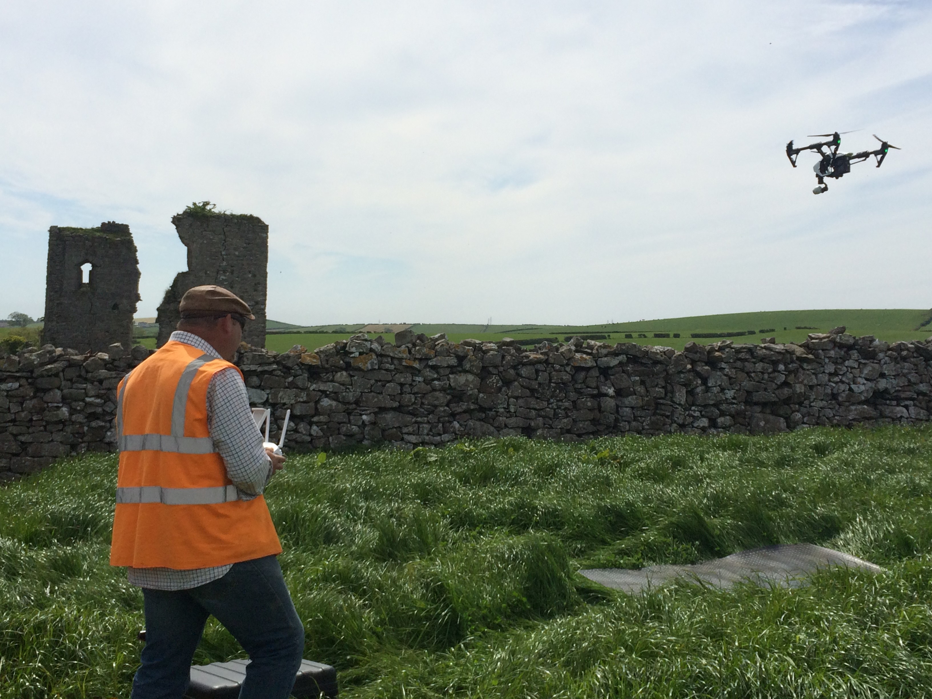
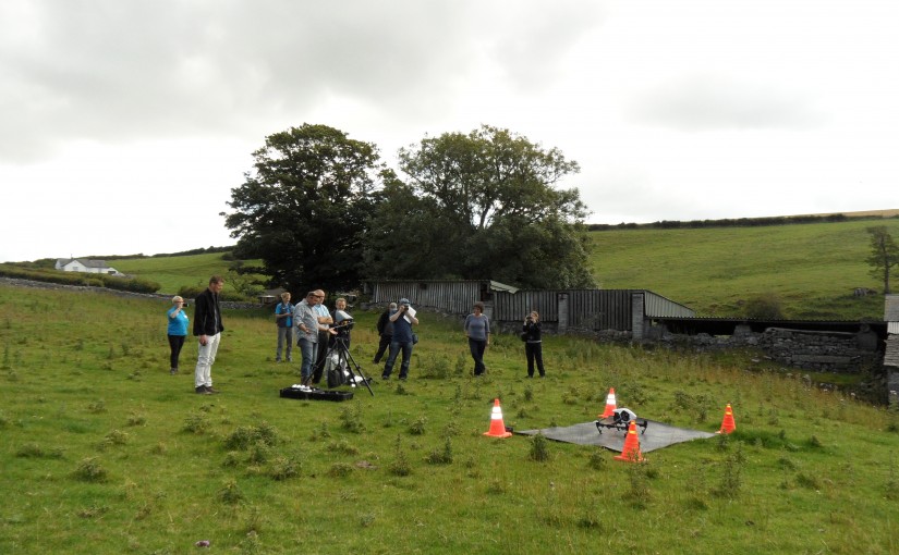
Greenlane Archaeology Ltd. was commissioned to run the project, bringing in professional archaeological photographer Adam Stanford from Aerial-Cam to undertake the survey work. During the summer of 2015 Adam flew over the site with Remotely Piloted Aircraft (RPA)-a DJI Inspire 1 quadracopter fitted with an X3 gimballed camera producing still images at 12 megapixels. Professional photographers, such as Adam, have to follow strict guidance and regulations as part of their licence to undertake such work.
Many precautions had to be put in place before the RPA survey was undertaken by Adam a CAA licenced pilotAdam from Aerial-Cam operating the quadracopter RPA
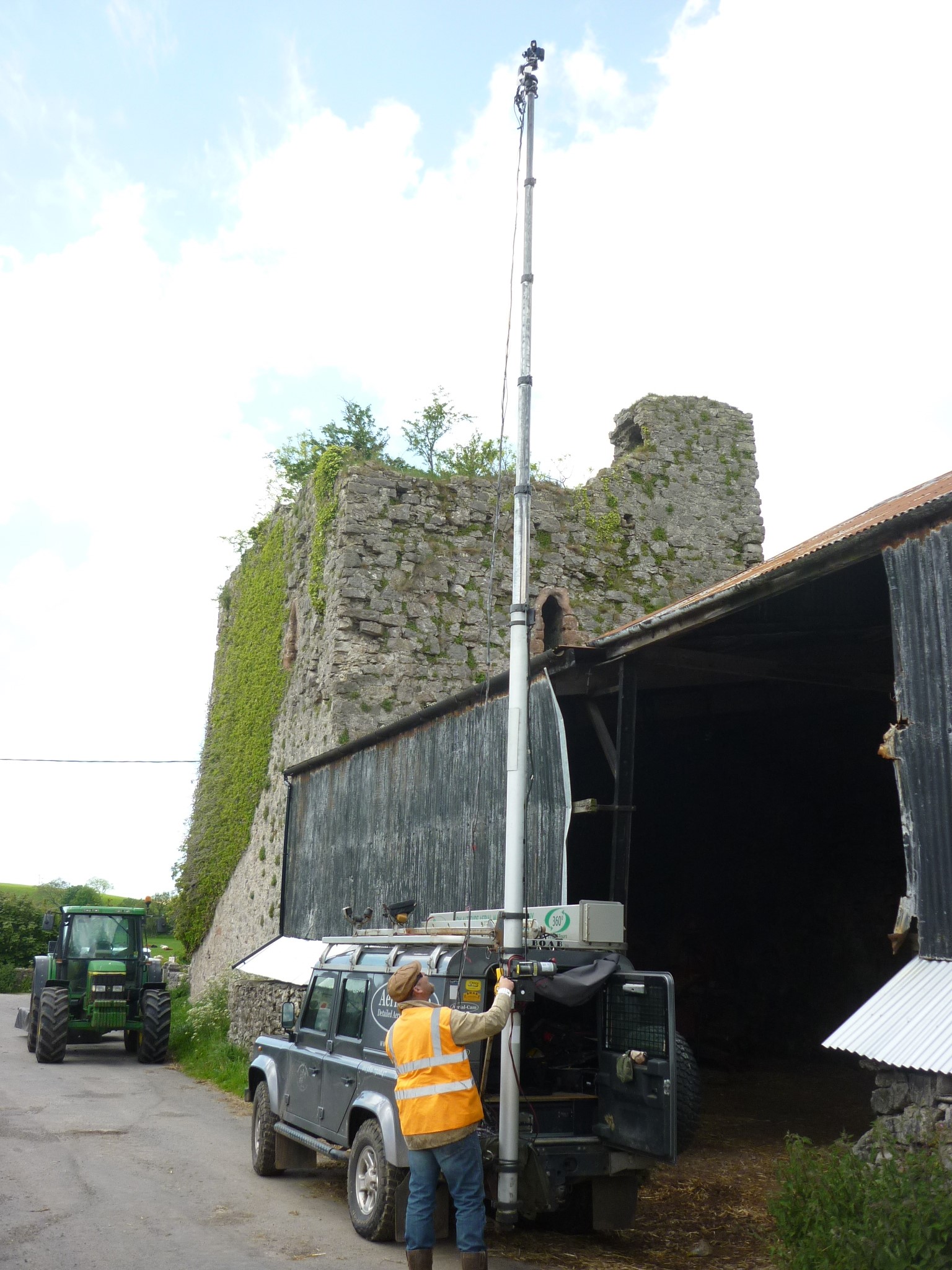
The photographic record from the air was supplemented by high-resolution (24 megapixel) images captured with a high-level telescopic pole and more traditional ground-based photography to obtain close up images of the structure.
Over 600 overlapping photographic images were taken to capture a detailed record of the site. Back in the office Adam used Agisoft Photoscan to process the data collected. The results were stunning, including aerial images and the creation of a 3D model, which enables the site to be ‘explored’ from the safety and comfort of a PC or tablet through Sketchfab.
Adam capturing some of the elevated images that would be used alongside the RPA images to produce an accurate and detailed 3D record of the site
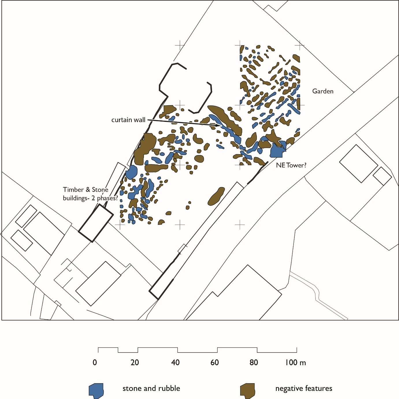
One of the most important outcomes of this project was the detailed orthophotos that were captured of the elevations of the castle’s ruins. We have been using these images to inspect the construction and conservation issues for the site, but primarily they form a permanent record of the castle that was lacking until this survey in 2015.
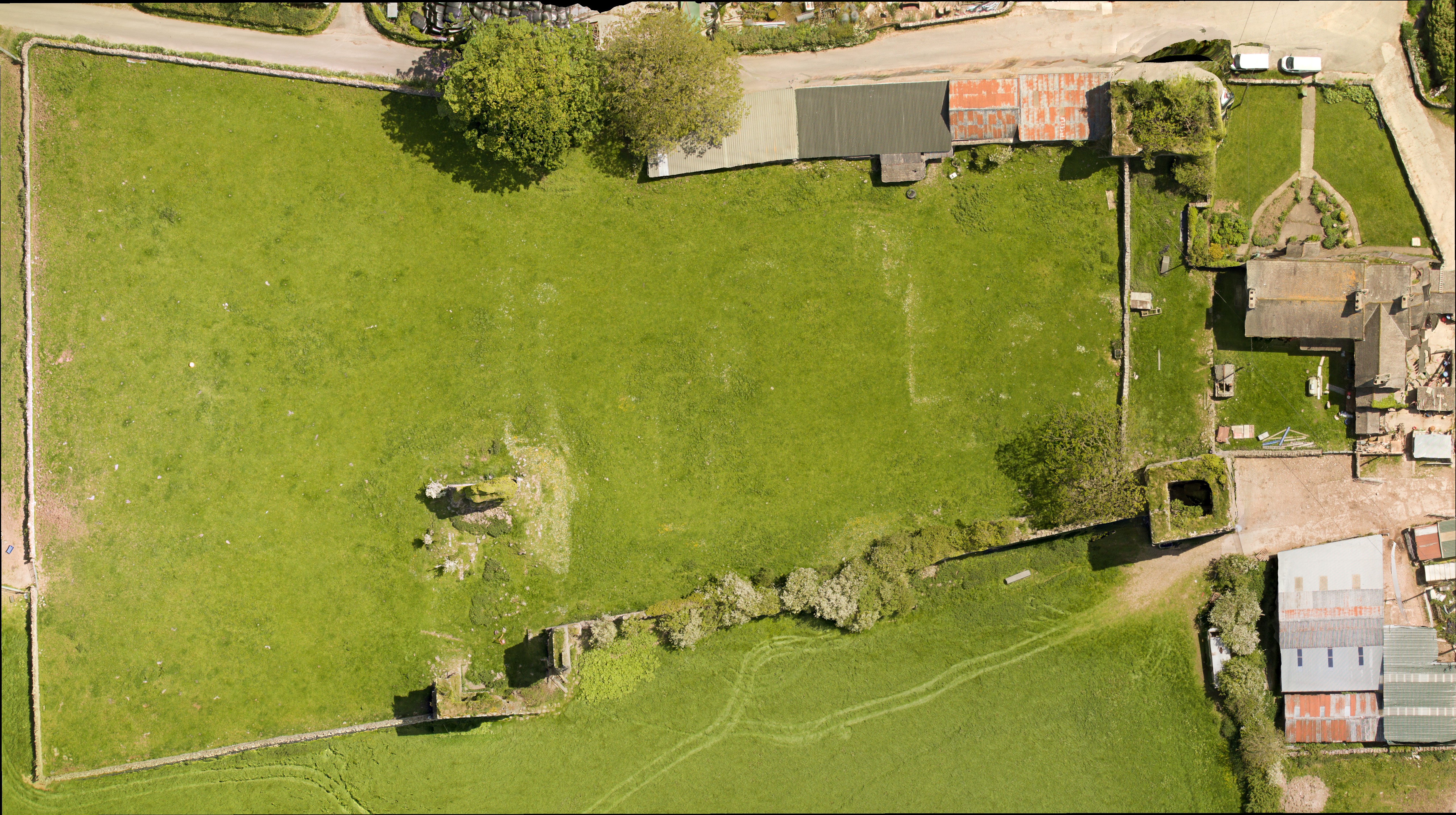
The aerial image and subsequent grey scale shading was particularly informative revealing furrows and a possible track way to the north-east of the castle. The track appears to lead to the north-western tower, the largest structure at the site and probably once the manorial residence. Within the curtain walls, areas of terracing and possible building platforms could be identified – but what could they be?
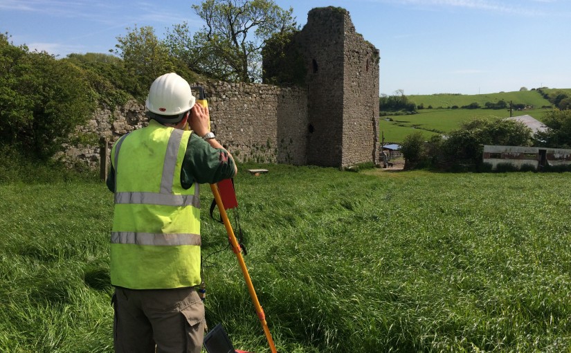
Supplementing the photographic work Greenlane Archaeology also undertook a topographic survey of the site to complement and enhance the results obtained.
Daniel Elsworth from Greenlane Archaeology undertaking the topographic survey of the south-east tower
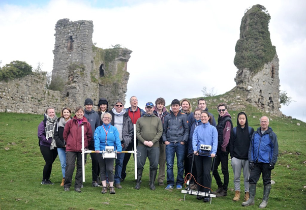
In August 2015 we were delighted to host some of the trustee’s from the Castle Studies Trust (CST) along with supporters of the CST charity, who travelled to the Furness Peninsula to see the survey work in action. We were joined by the Historic England Heritage at Risk Officer, the Lead Archaeologist from Cumbria County Council, and Helen Evans who had compiled the Conservation Statement. Adam from Aerial-Cam gave a detailed demonstration on how the RPA captures the photographic images and how these are enhanced and combined to form the incredible 3D records of the site.
Adam from Aerial-cam demonstrating to Trustee’s and supporters of the Castle Studies Trust how the RPA captures the images from the air
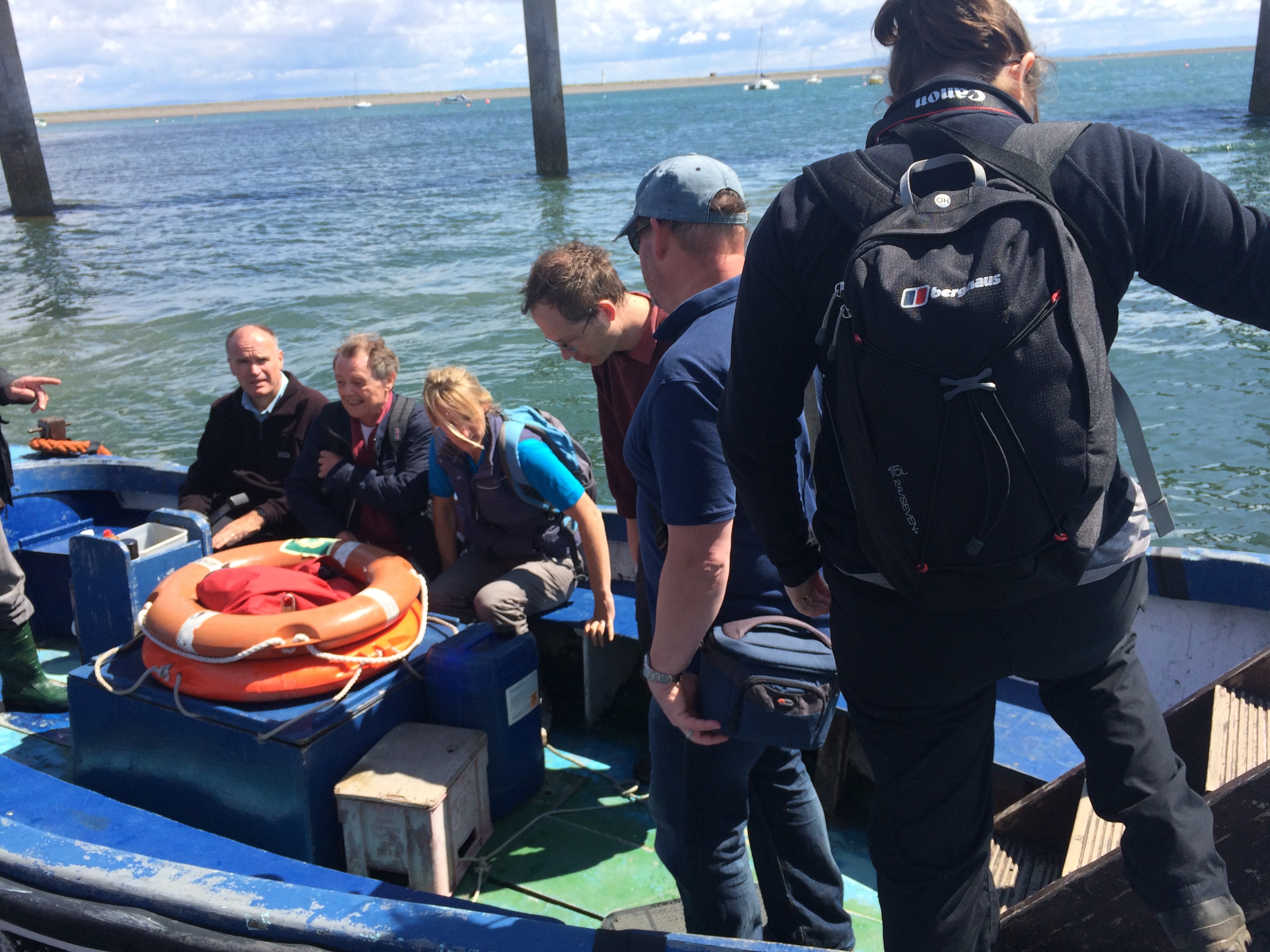
To put the site of Gleaston into context, the visitors were also taken on a tour of Piel Castle, which can be seen from the elevated position of the north-west tower at Gleaston. Piel Castle is positioned on a tidal island and we had to use the local ferry service to reach the site.
Boarding the ferry to Piel Island and castle
It was some months later, during discussions with Dr Richard Peterson and Dr James Morris of University of Central Lancashire (UCLan) Archaeology and Anthropology Department that the next piece of fieldwork was being determined. Each year UCLan host a field school for their first year archaeology students and the team were looking for a site to use to teach the concepts and theories of geophysical survey and laser scanning. We had some interesting research questions to answer, which had been formulated following the photographic survey – do any buildings survive within the courtyard formed by curtain wall and what are the features shown to the north of the castle? Together we thought that Gleason was the ideal site for this year’s field school.
Before any plans to be laid out we had to get permission from the landowners to allow this work to go ahead. Once this had been secured, we had to apply to Historic England for a Section 42 licence, as the site is Scheduled and such work is strictly monitored by Historic England inspectors.
Permission was granted for the work and the fieldwork was scheduled for the end of April 2016. In addition to UCLan students, the survey training was opened up to the community, with fifteen places available per day through the Heritage Lottery Funded Headlands to Headspace (H2H) Landscape Partnership Scheme, which I am currently running part of for Morecambe Bay Partnership.
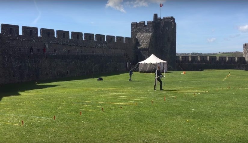
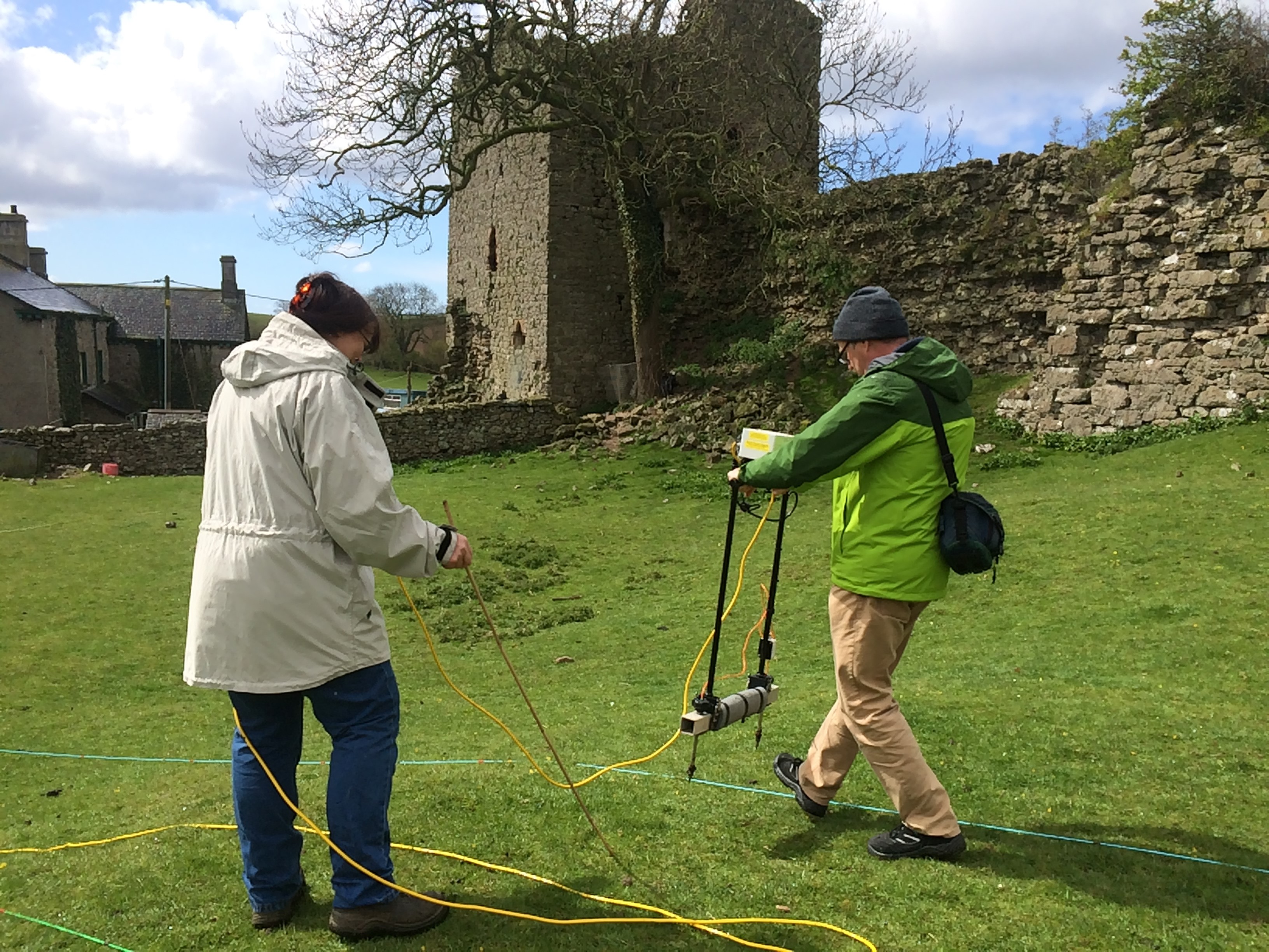
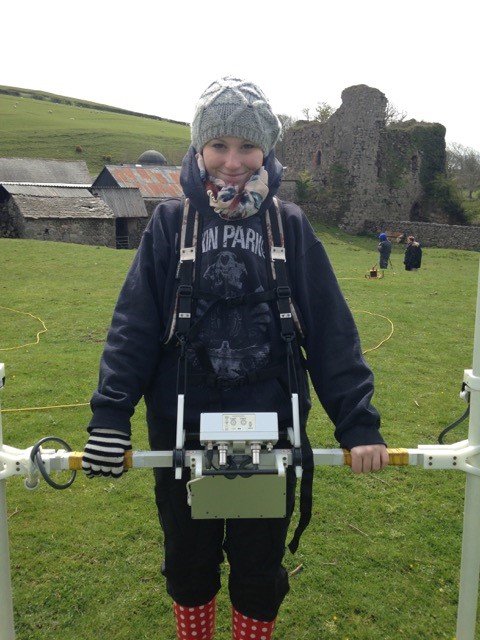
On 25th April we started the work at the site, using earth resistance and magnetometry to survey areas within the curtain wall and to the north of the castle, where we had identified ridge and furrow and the track way. The training attracted participants from as far afield as Liverpool and Carlisle as well as some local residents to Gleaston Village. The north-west tower was also subject to detailed laser scanning, which will supplement the photographic record produced by Aerial-Cam. The weather was, well, challenging especially for the end of April with heavy downpours and even snow hampering our progress on site!
H2H volunteers undertaking an earth resistance survey at the siteOne of the first year students from UCLan undertaking a magnetometry survey. Still smiling despite the cold!
The team of students, together with volunteers and the fabulous UCLan staff persevered and we completed a significant amount of survey across the site. The results of the survey work are currently being processed by the team at UCLan, however, initial interpretation of the data is highlighting garden features to the north of the site and possible post-built structures to the south-west of the courtyard.
All this recent work is enabling professionals to gain a better understanding of the site. For the first time we have an accurate photographic record of all the standing remains and have started investigating what below-ground remains may survive beneath the soil.
Morecambe Bay Partnership would like to thank the Castle Studies Trust and all their supporters for enabling the survey work to take place and highlight the importance of this site and the conservation issues the site currently faces.
We would also like to thank the landowners who have provided us with special permission to undertake this survey work and the team from Historic England and Cumbria County Councils Lead Archaeological Advisor who have provided advice and guidance along the way.
It is hoped that the work undertaken so far will be built on in future years with additional survey and assessment, finding positive solutions to protect this rare and fascinating site.
Every September thousands of historic sites in England, Scotland, Wales and Northern Ireland are opened. It is a chance to visit some sites which are closed the rest of the year. You can find out more details online. Here are four places to get you started.
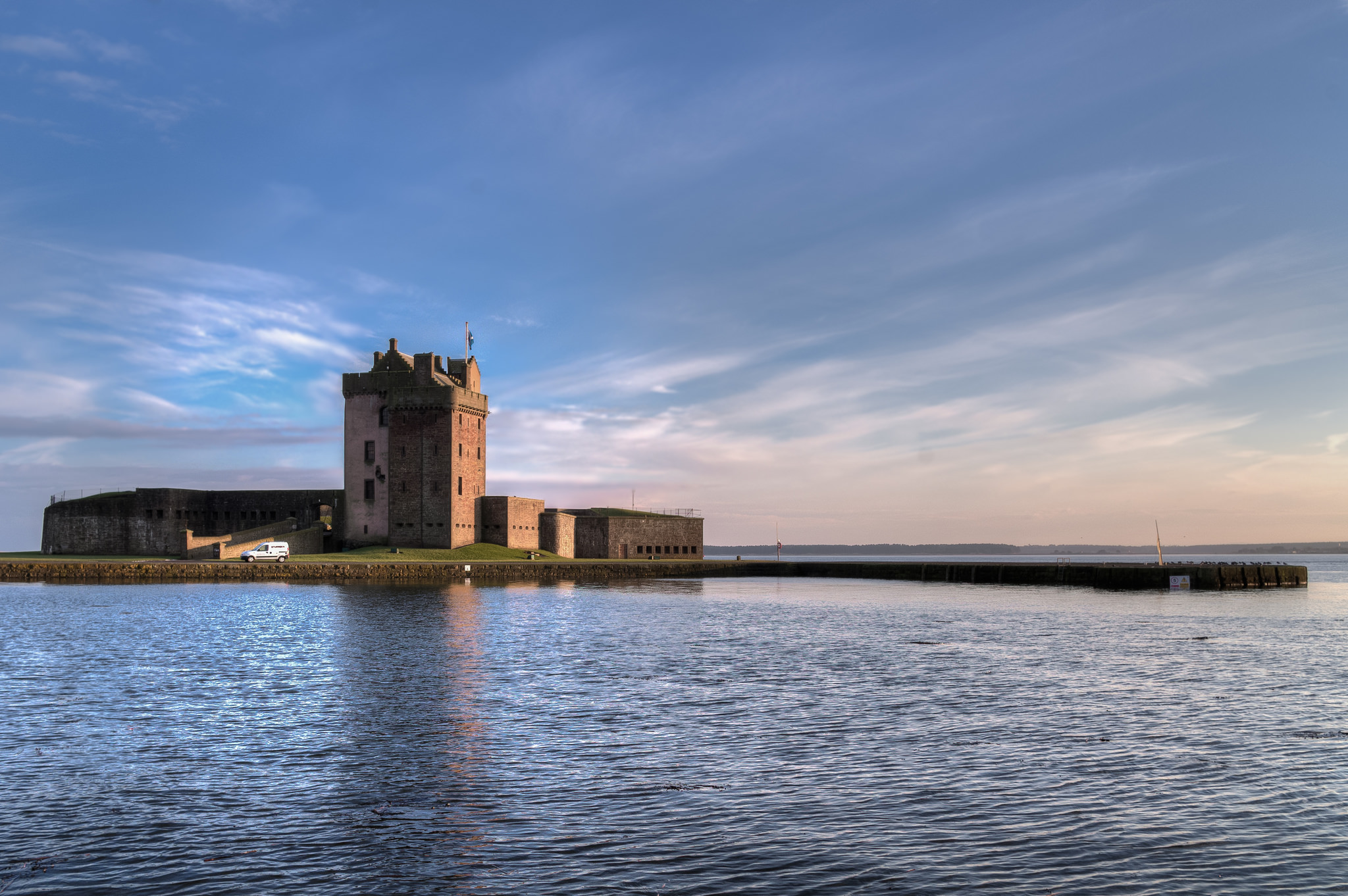
Sat on the banks of the River Tay, Broughty Castle in Scotland was built in 1496. It was involved in several sieges including during ‘the Rough Wooing’ and the War of the Three Kingdoms. The castle has been open as a museum since 1969.
Broughty Castle is open from 1pm to 3pm on Sunday 18th September.
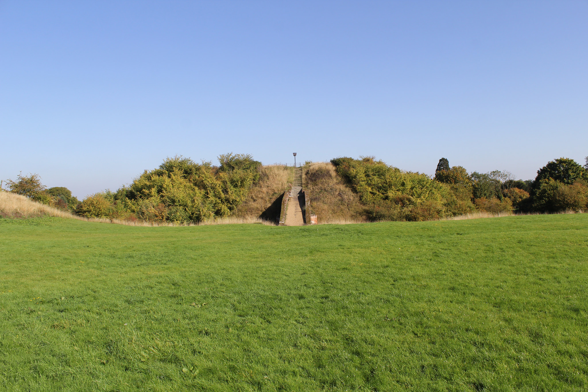
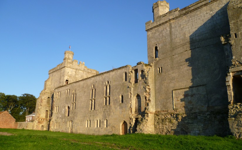
Pleshey Castle in England was built by William de Mandeville, one of the richest men in 12th-century England. It was confiscated by the king, slighted, restored, and used for centuries afterwards. The castle was even mentioned in Shakespeare’s Richard II.
The motte-and-bailey castle survives as some impressive earthworks. Excavations were carried out between 1972 and 1981 but never published. In 2015 the Trust funded part of the publication of the work from this important site.
Pleshey Castle is open on Sunday 11th September with tours at 2pm, 3pm, and 4pm. Advanced booking is required.
Built in 1601, Moyry Castle is being included in Northern Ireland’s heritage open days for the first time. Three-stories high and perched on top of a rocky hill the castle has a good view of the surrounding area.
Moyry Castle is open from 9am to 8pm on Saturday 10th and Sunday 11th September and is free to visit.
Constructed in the 13th century, Holt Castle was amongst the fortifications built by the English in north Wales. The red sandstone makes the castle stand out, as does its unusual pentagonal design. It was used by Richard II as a treasure house and slighted after the English Civil War.
You might recognise Holt as one of the very first projects the Trust worked on: Rick Turner and Chris Jones-Jenkins created a reconstruction of the castle as it would have appeared c1495. The 17th century was not kind to the castle, so the reconstruction is worth watching to get an impression of how it looked.
Holt Castle is open from 10am to 4pm on Saturday 17th and Sunday 18th September and is free to visit.
We often think of castles as formidable fortifications around which the medieval world pivoted. Fierce sieges were invested to capture key sites; the Keeper of the Tower of London was a prestigious role, and Dover Castle was the ‘key to the kingdom’.
But castles also had a domestic side. They were residences of the barons, earls, and monarchs who ruled in medieval society.[1] They were decorated with rich tapestries as seen at Chateau d’Angers in France, the scene of magnificent feasts, and wrapped up in symbolism. The Earl of Cornwall built a castle at Tintagel because the place was linked to Arthurian legend.
Personalities are intricately linked to the story of each castle, not always those who owned them. Thomas Percy built Wressle Castle in the 1390s. The Percy family was a powerful dynasty in northern England and Wressle was a fortress-palace within carefully constructed garden. Designed by John Lewyn, one of the leading architects of late 14th-century England, the castle had only recently been completed when the fortunes of the Percy family took a turn for the worse.
In 1403 Harry Hotspur, Thomas’ nephew, rebelled against King Henry IV with a string of grievances. Thomas joined the rebellion which was eventually defeated the battle of Shrewsbury. Thomas was captured and executed for his role and the Crown took control of Wressle Castle.
For nearly 70 years the castle either remained with the Crown of was temporarily given to favourites of the king. In 1471 it was finally returned to the Percys, with Henry Algernon Percy making his mark on the castle by updating the interior and the gardens. The gardens contained a two-storey building call the ‘School House’ with paintings of proverbs across the interior. This may have been where Henry Algernon Percy came for some quiet reading.
Wressle Castle never witnessed a siege, though it was garrisoned during the English Civil War in the 17th century. In fact the majority of castles never faced the attacks they were designed to withstand. Despite that the castle lies in ruins today. The garrison themselves left their mark, causing damage estimated at £1,000! After the war the castle was partly demolished, leaving just a quarter standing which can be seen today – though it is on private land. The following century the interior was stripped by fire when a tenant tried unsuccessfully to clear a blocked chimney.
Wressle has a rich history which the survey we funded in 2014 and carried out by Ed Dennison Archaeological Services shed further light on. When Thomas Percy decided he wanted a castle in the late 14th century the village of Wressle lay in the way. The settlement used to extend further to the west, but was pulled down to make way for the castle gardens.
Castles have a direct impact on local communities, and those castles are shaped by the personalities that live in them, who drag them into disputes, and who occasionally fail to unblock chimneys. Next time you’re at a castle take a moment to learn about the people who shaped the building you’re standing in and think what it must have been like.
[1]Catriona Cooper at the University of Southampton used digital media to explore the experience of living inside a medieval castle, looking at Bodiam and Ingtham Mote.
Gleaston Castle, April 2016. Written by Matthew Emmott.
Throughout the week of the 25th to the 29th of April, the Morecambe Bay Partnership and the University of Central Lancashire’s archaeological department teamed up to give a lucky few a golden opportunity to take part in a further survey of Gleaston Castle in Cumbria.
Following on from the aerial survey undertaken at the end of July last year using a grant from the Castle Studies Trust, it was hoped that any buried structures beneath the courtyard would be identified and mapped out. Adam Stanford’s 2015 survey (Aerial-Cam) used the latest in drone technology, utilising high definition photography\photogrammetry to capture the full character of Gleaston’s ruins, and in the process produced some intriguing survey results pointing towards the possible remains of buildings and platforms beneath the courtyard.
Tools on offer to assist in the survey, and provided by the University of Central Lancashire’s Archaeological department, were ground penetrating radar, a magnetometer, an electrical resistivity meter, high definition cameras and laser scanners.
Aided and abetted by Louise from the Morecambe Bay Partnership, volunteers and students were taken through the process of mapping out grids and the use of the equipment. And then the real work was done. By the end of the week it looked as if the whole of the courtyard had been scanned using all the available techniques…..all we have to do now is wait for the results and hope that Gleaston has at last given up some more of her secrets.
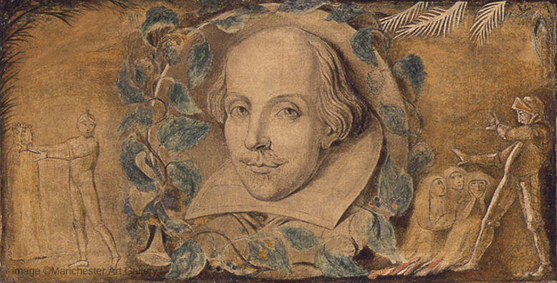
Today is the 400th anniversary of Shakespeare’s death. Some of English literature’s greatest works would have been completely different had it not been for castles. They are the perfect scenery for some of his most dramatic plays.
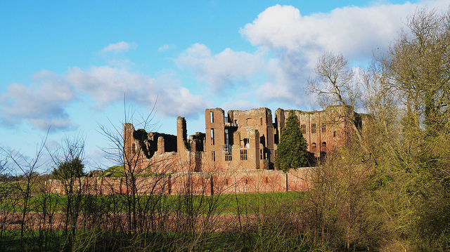
Kenilworth was renowned in Tudor England and features in Shakespeare’s Henry VI Part 2. While at Kenilworth the king receives news that the Duke of York has arrived from Ireland, accusing the Duke of Somerset of being a traitor.
We have an idea of the condition of about 300 castles in the mid-16th century: only about a third were in good condition, and generally those looked after by the Crown were better off. Today the ruins of Kenilworth give some idea of how grand it was before it was demolished in the 17th century. Robert Dudley famously held lavish banquets at Kenilworth while courting Queen Elizabeth.
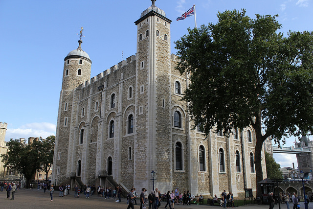
In Shakespeare’s Richard III, Richard is declared king at Baynard’s Castle, while the young princes, Edward and Richard, are imprisoned and murdered at the Tower of London.
It is rare enough for somewhere to have two castles, but the City of London had three. Only the Tower of London stands today, while Montfichet’s Tower was demolished in 1213 and Baynard’s Castle in 1666.
Today the ruins of Pontefract Castle are on Historic England’s ‘Heritage at Risk’ register, but in its heyday it was one of the most impressive castles in Yorkshire. Pontefract Castle has a colourful history, with its owners falling in and out of royal favour and major sieges during the English Civil War, but the most famous event was the reputed murder of Richard II.
Unsurprisingly this is an important part of Shakespeare’s Richard II and Richard III. He described the castle (renamed Pomfret) as a “bloody prison, fatal and ominous to noble peers”.
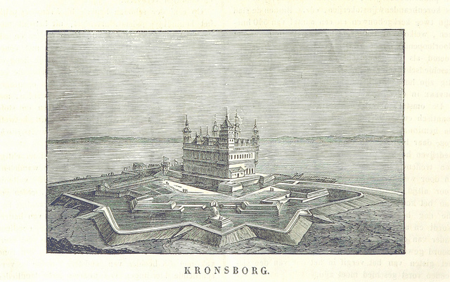
Kronborg
British Library HMNTS 10002.g.16-19.
Shakespeare’s plays were set across Europe, including Hamlet which took place in Denmark’s Elsinore Castle. Elsinore Castle was based on Kronborg Castle in Helsingør. The 15th-century castle is the second UNSECO World Heritage Site in this list along with the Tower of London.
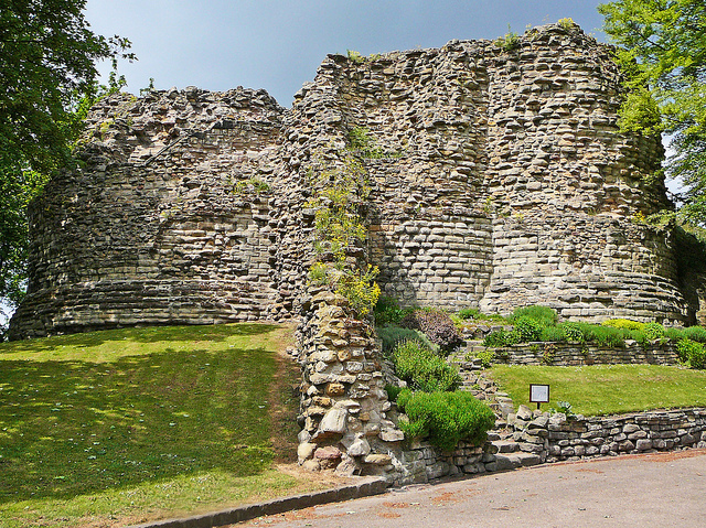
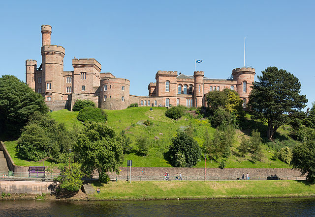
The Tragedy of Macbeth sees the title character murder the Scottish King Duncan in his own castle at Inverness. While the play is set in the 10th century, it is uncertain when the castle at Inverness was actually built, but where better as a setting for the murder of a king.
The Castle Studies Trust is delighted to announce the award of two grants for 2016:
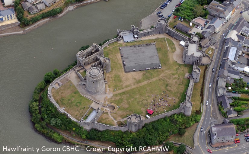
Pembroke Castle – geophysical survey of the castle’s interior. Best known for its massive round keep built by William Marshal, the greatest knight of his age, little else is known about what exactly was in the castle’s interior. Dyfed Archaeological Trust with the guidance of well-known castle expert Neil Ludlow will use the latest geophysical techniques including ground penetrating radar to try and reveal some of the secrets.
Caus Castle – earthwork, geophysical and photogrammetric survey of the castle. Frequently referenced in medieval research as an example of a Marcher castle and associated failed borough on the Welsh borders, nobody has done any proper analysis of one of the most important medieval sites on the Anglo/Welsh border. This first detailed archaeological analysis will be carried out by Dr Michael Fradley who has previously undertaken ground breaking surveys of castles at Wallingford (Oxon), Sudeley (Glos), and Newhall (Ches) and Giles Carey. The focus of the project will be on the outer bailey where the medieval borough was situated.
Donate to Have Opportunity to Visit the Selected Projects
Within the next year the Trust will be organising exclusive visits the selected projects during the initial research stages or at completion of them. These visits are only open to those supporters who have donated to the Trust.
If you would like to be invited to a site visit you can donate in a variety of different ways:
By cheque (made payable to the Castle Studies Trust) or standing order – completing the linked form and return either along with the gift aid form if applicable to the address on the forms.
Not only will you have the chance to visit the sites you will also be increasing the amount we can give away to more exciting projects like the ones above next year.
The deadline for grant applications passed on 15th December. We’re going through the various projects now. Altogether the nine projects are asking for £38,000. If you have been following us on social media you will have seen which sites have been proposed. For a little more detail, here are the applications we’ve received:
Pembroke Castle, Wales – a geophysical survey of the wards. The castle was once owned by William Marshall, one of the most famous knights of his time.
Lochore Castle, Scotland – post-excavation analysis of finds. The site was excavated in 2015, but the team need funding for specialist work on their finds.
Lancaster Castle, England (1) – wall penetrating radar of the walls of the castle’s Norman keep. The castle was used as a prison until 2011, so until recently there has been little opportunity for investigation of this sort.
Lancaster Castle, England (2) – creating drawings and 3D models to help present the site to the wider public.
Caus Castle, England – geophysical and photogrammetic survey of the earthworks of this motte and bailey castle. Caus was one of many such castles while can be found in the Marches of the border between England and Wales.
Laughton en le Morthen, England – geophysical survey of the earthworks of a motte and bailey castle. This castle may have been built on top of an earlier Saxon hall.
Wressle Castle, England – an examination of the evidence for the slighting of the castle in the 17th century and comparing it to other slighted castles in Yorkshire.
Codnor Castle, England – create a virtual reality tour of the castle showing how it once would have appeared.
Dunamase, Ireland – remote sensing and landscape survey. Like Pembroke was also owned by William Marshall at one point.
The applications have been sent to our expert assessors who will go over them. In January the blog will have more information on the assessment process, so be sure to visit again.
However there is not enough money to fund them all and so if you would like to donate to help us fund more and gain a chance for an exclusive visit to the chosen projects go here: https://mydonate.bt.com/charities/castlestudiestrust
 One of the earliest castles in the UK and one of the most important along the Welsh border the geophysical survey and excavations, along with separately funded building analysis, will help understand the morphology of this little understood site. The CSG visited it as part of the 2016 annual conference. Please note this is a privately owned site and not accessible to the general public.
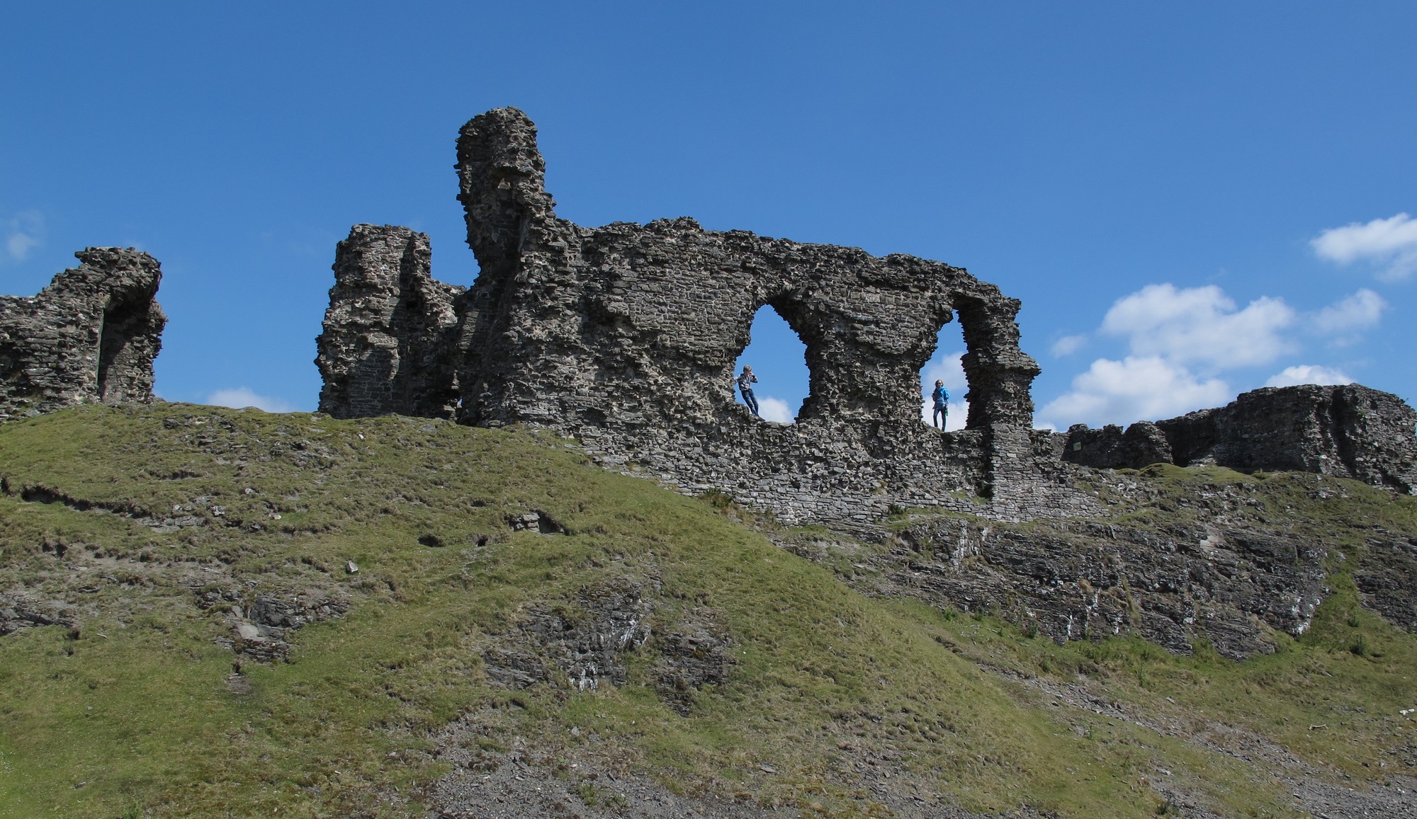


