Dr Nigel Baker, Excavation Director of the Shrewsbury Castle Excavation 2022 outlines what he hopes him and his team hope to find over the next two weeks with the main focus on the previously unexplored motte.
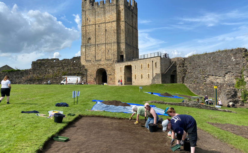
A third season of excavation funded by the Castle Studies Trust is about to begin at Shrewsbury Castle. In 2019 a trench was excavated across the interior of the inner bailey and in 2020 an inner bailey rampart was sampled. Attention has now turned to the top of the motte, and to the north curtain wall. The excavations, the first ever to take place at the castle are carried out by a team of local archaeological volunteers under the direction of Dr Nigel Baker and David (Dai) Williams together with students of University Centre Shrewsbury (University of Chester) led by Dr Morn Capper.
Subscribe to our quarterly newsletter
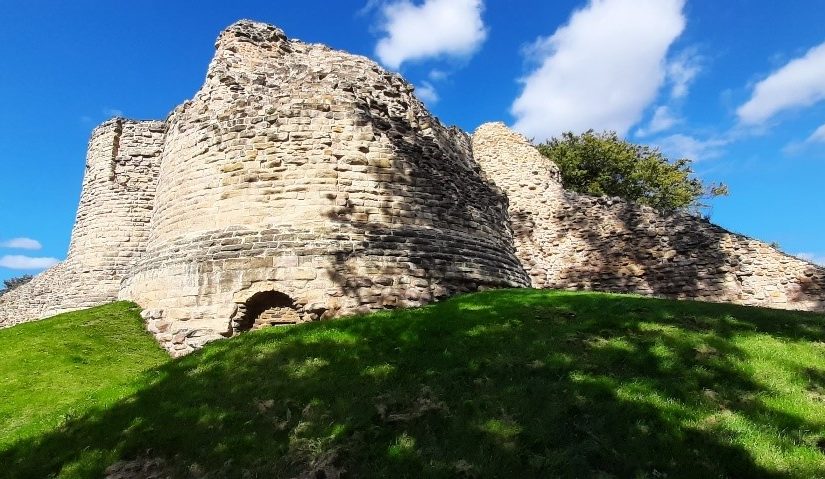
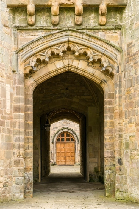
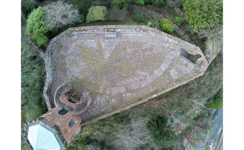
The motte top excavation will establish just how much damage Thomas Telford did to the medieval motte when he was modernising the hall and landscaping the castle in 1786-1790. Ruins on the motte top were cleared to make way for a Gothic summerhouse known as Laura’s Tower, with a garden laid out around it. The team will be looking in particular for surviving evidence of the Tower of Shrewsbury, the timber watch-tower, assumed to be of 11th-century origin, that is known to have collapsed in 1269-71.
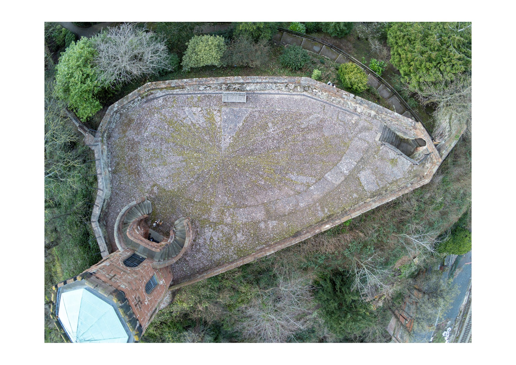
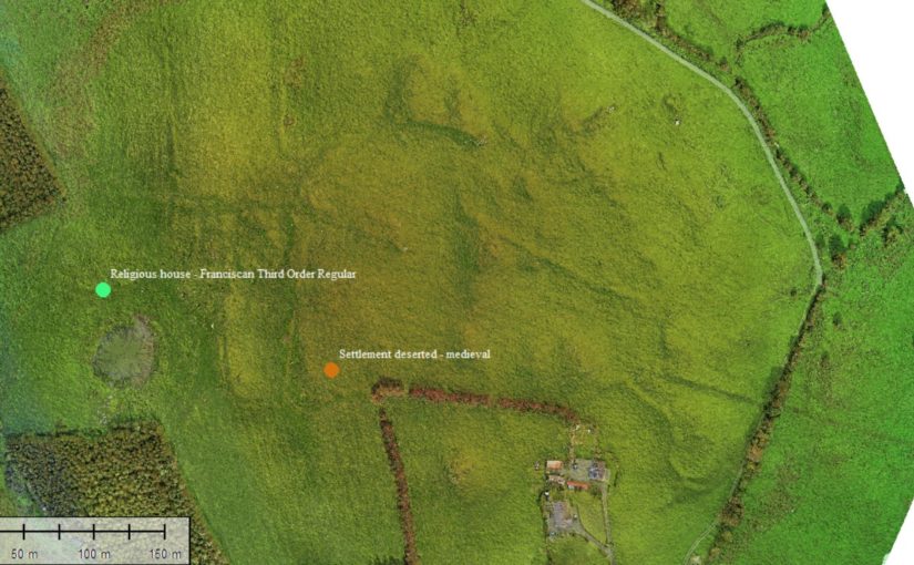
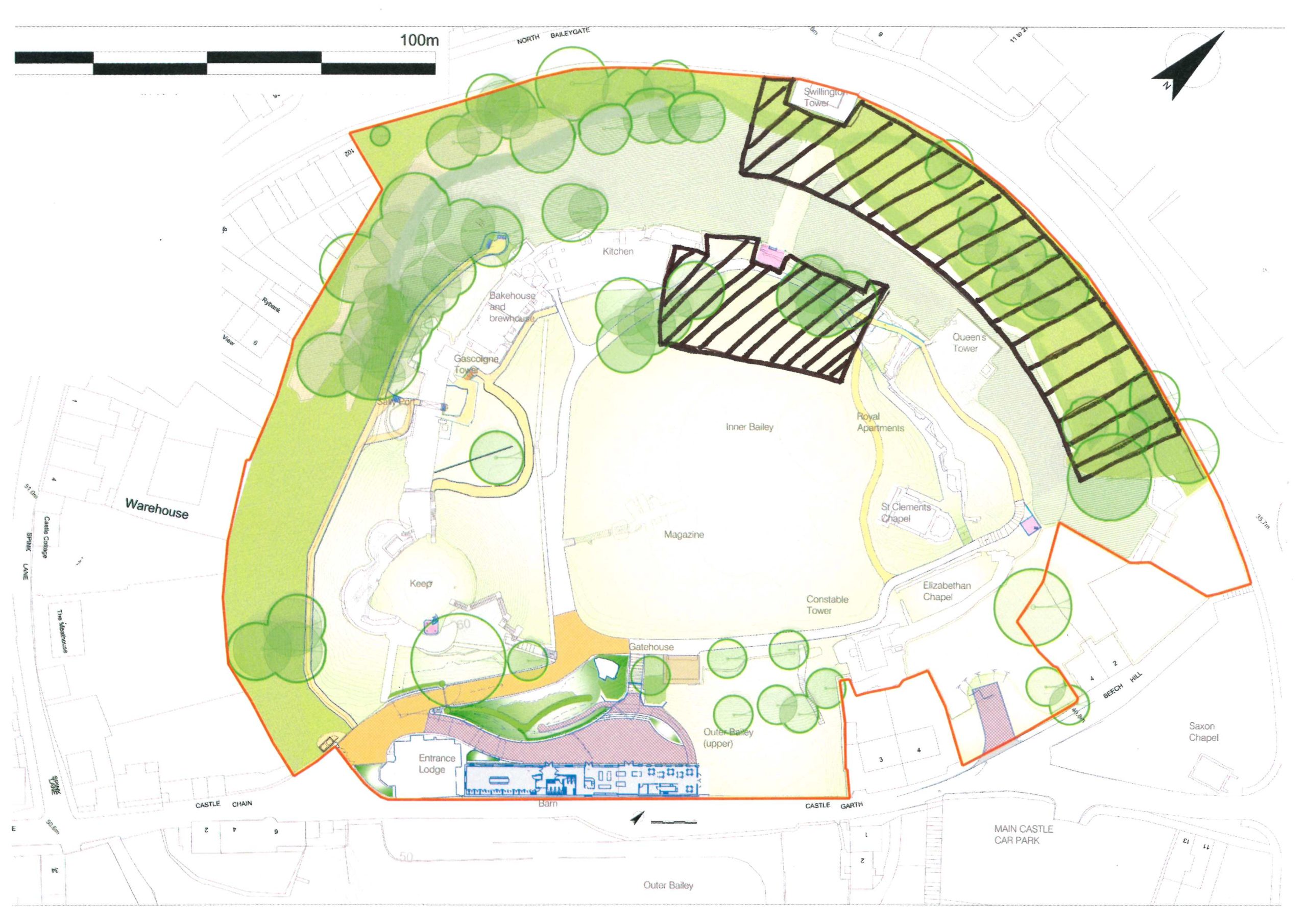
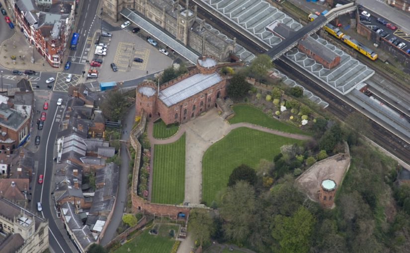
The irregular plan of the motte top seen in the drone photo (undertaken by James Brennan Associates for the current conservation management plan for Shropshire Council, the site owner) arises from a number of factors. Originally probably oval, the straight line across the bottom of the picture is a pale sandstone wall with red sandstone stripes built, probably by Edward I’s masons, across the damaged side of the motte after a landslip into the river below in the 13th century. Laura’s Tower occupies the bottom left corner, set off-centre on the base of a 13th-century tower demolished by Telford. The lobed shape of the motte on the left of the photo results from at least two phases of medieval building incorporated in the retaining walls: an angled structure with a high chamfered plinth and recessed masonry panels, superimposed over a projecting curving rubble footing. These remains were seen and recorded for the first time this year as part of the ongoing CMP work.
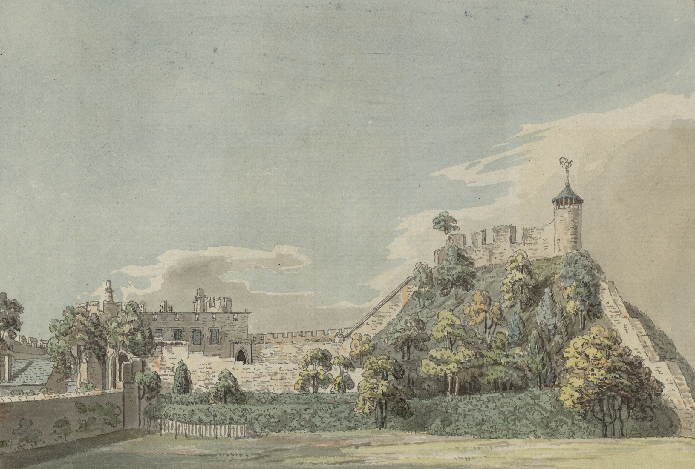
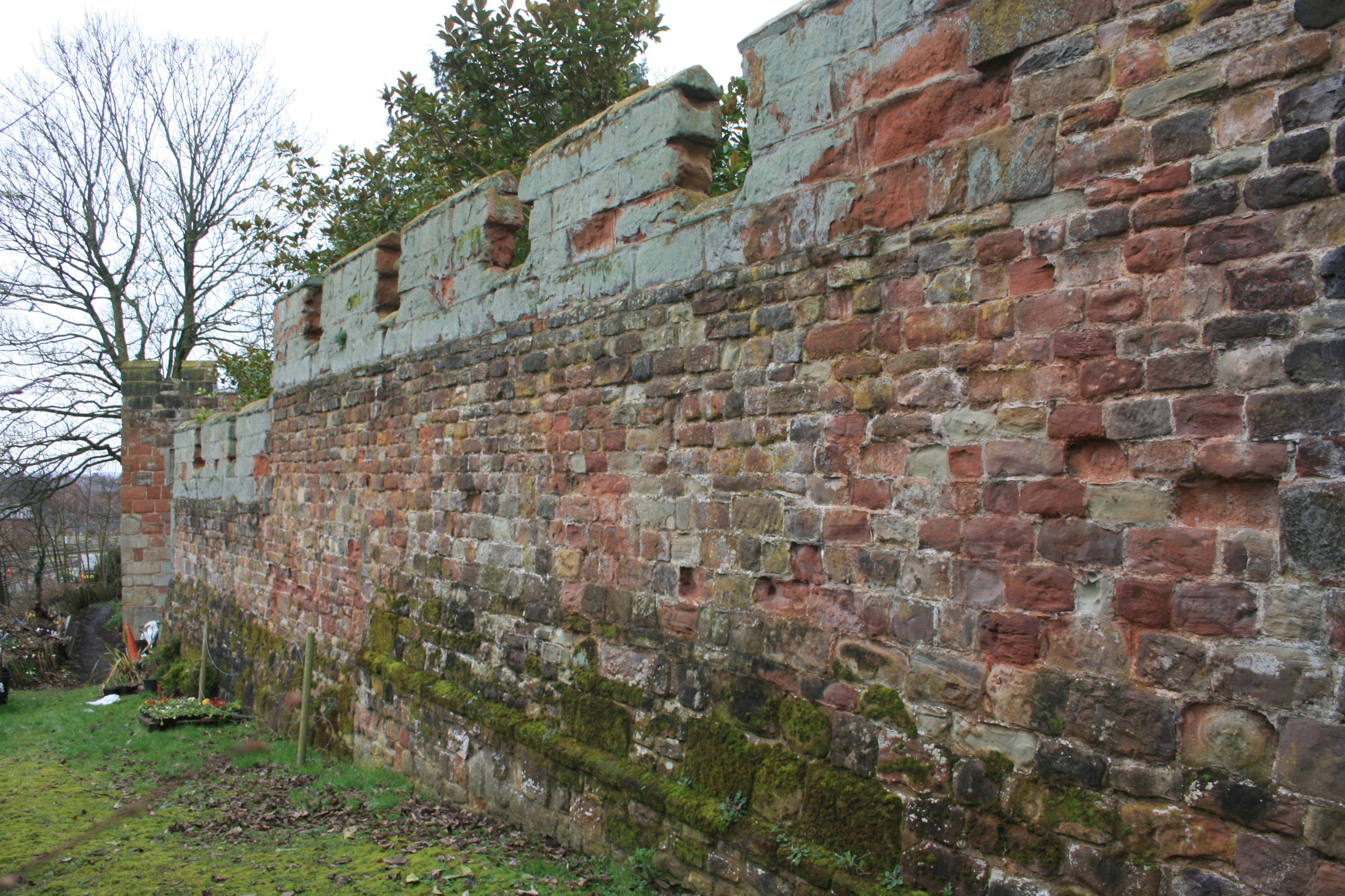
A second trench is to be opened on the north curtain wall. A long stretch of this wall is unusually consistent in its fabric, with small, squared rubble and two offset courses. 18th-century illustrations show however that a projecting bastion formerly stood in this area, of which no trace can be seen in the standing masonry. The suspicion is that a major part of the wall here has been rebuilt, and the trench is designed to explore this question – and to establish the nature of the surrounding stratigraphy.
In addition to an introductory display to be mounted in the on-site marquee, there will be two further displays in the town running concurrently with the excavations. In Shrewsbury Museum & Art Gallery in the Square, Dr Capper’s team is assembling a display featuring artefacts found in the first two seasons, while in Castle Gates Library (the former Grammar School buildings) a display is in place that explores the evidence for the former castle outer bailey, within whose perimeter the library stands.
The excavations run from July 18th to 28th. Visitors are welcome every day except those when the castle is closed (Thursday 21st and Thursday 28th).