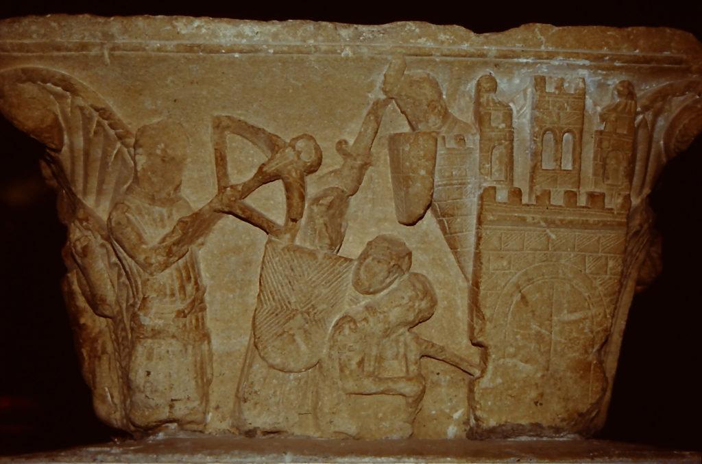
Commemorating Bedford Castle on the 800th anniversary of the great siege of 1224

On Saturday, 24 August, the Higgins Museum in Bedford hosts an event to mark eight centuries since the town’s castle was subject to an 8-week long siege by the army of the teenage King Henry III (booking details at the end). Dr Peter Purton, FSA, outlines what happened in the siege.

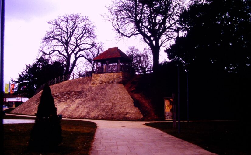
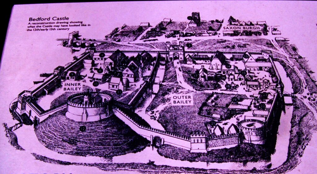
Not much remains now of Bedford Castle – just a degraded and much altered mound near the river Great Ouse in the town centre and a few excavated fragments of stone buildings, making it hard to visualise that it was once a large stone-built fortress with a moat, barbican, two wards and a stone tower on top of the motte which marked the original castle built after the Norman Conquest. A display board nearby reconstructs its possible appearance in 1224.

Subscribe to our quarterly newsletter
Image of display board showing how Bedford might have looked in 1224

 In that year, Henry III was assembling an army which was to be transported to France in an attempt to recover Poitou, part of the once extensive Angevin empire. This plan unravelled with the rebellion of Fawkes de Breauté. Fawkes had been one of the captains of King John, Henry’s father, and had become rich and powerful. He had been granted Bedford castle and we are told that he had strengthened the fortifications to make it “impregnable”. Rebelling against the crown, he prudently left the country while leaving Bedford in the hands of his brother, who in arresting the justices sent there by the king made it inevitable that he would face royal retribution: this was a direct insult to royal authority and following years of civil war and rebellion following John’s reign, there was no possibility that it could be ignored. The royal army, assembling conveniently nearby at Northampton, was diverted to Bedford. What happened next was recorded in several contemporary chronicles while royal expenditure was detailed in surviving accounts, a combination of evidence which is rare enough and which allows an unusually detailed reconstruction of the siege.

The royal army deployed seven stone-throwing engines (mangonels and petraries) and built two siege towers but the garrison resisted stoutly and inflicted heavy casualties on the attackers. Eventually the barbican and outer ward were breached and captured by royal soldiers then miners, summoned from the Forest of Dean, brought down the wall of the inner bailey and did the same with the tower on the motte, to which the defenders had withdrawn. The prisoners were set free and the entire garrison was hanged as punishment for their rebellion. The castle was then demolished.  A period of instability in England was thereby ended, but so too was English rule in Poitou, the French capturing La Rochelle at the same time as Bedford was being besieged.

These events were therefore of international as well as national significance, and through archaeology, it is possible to now know much more about Bedford castle. All these themes will be discussed at the conference on 24 August, the speakers are Professor David Carpenter, expert and author specialising in this period, Dr James Petre who has written about Bedford, Ben Murtagh who has been exploring Bedford Castle, Jeremy Oetgen (Albion Archaeology) who will update us on a long history of archaeology on the site, and the author of this blog who will place the siege in the context of contemporary siege warfare.

Anyone interested in attending can find all the details and book a ticket at the museum website: www.thehigginsbedford.org.uk. Tickets cost £15 and advance booking is encouraged.

Subscribe to our quarterly newsletter

The Virtual 3-D Reconstruction of 12th-Century Lincoln Castle

Dr Jonathan Clark, Historic Buildings Director, FAS Heritage and project lead for the Castle Studies Trust funded 3-D Reconstruction of C12 Lincoln Castle explains how it was done and the challenges faced in doing it.

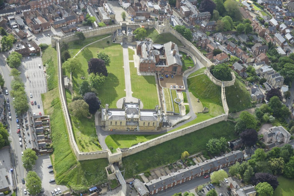
A virtual 3-D reconstruction of Lincoln Castle as it may have looked in the late 12th-century has been completed by Peter Lorimer, Pighill Illustration in collaboration with FAS Heritage.  The reconstruction was funded by the Castle Studies Trust and made possible through 15 years of archaeological research for the Lincoln Castle Revealed project. The project consisted of a £22m repair and restoration programme to conserve the site and renew the visitor experience funded by the National Lottery Heritage Fund, Lincolnshire County Council and the European Regional Development Fund. The programme provided opportunities for research-led archaeology which yielded a wealth of new information about the site.

Subscribe to our quarterly newsletter

Mondern day Lincoln Castle from the west copyright Andy Tyner Photography on behalf of FAS Heritage and Lincolnshire County Council
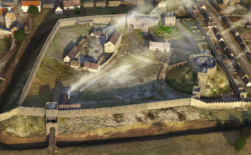
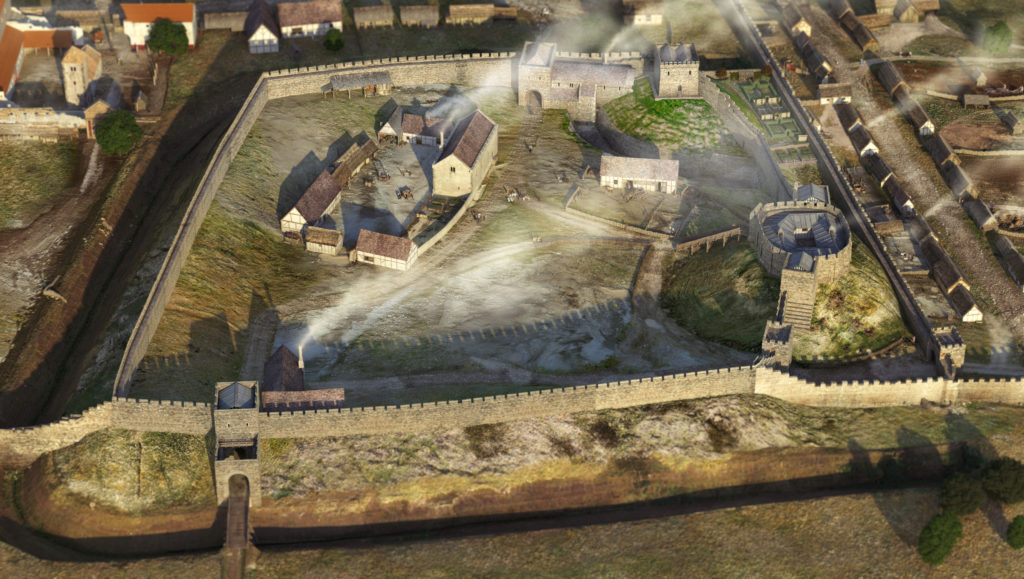
Lincoln Castle as it could have been in the late C12 copyright FAS Heritage and Pighill Illustrations

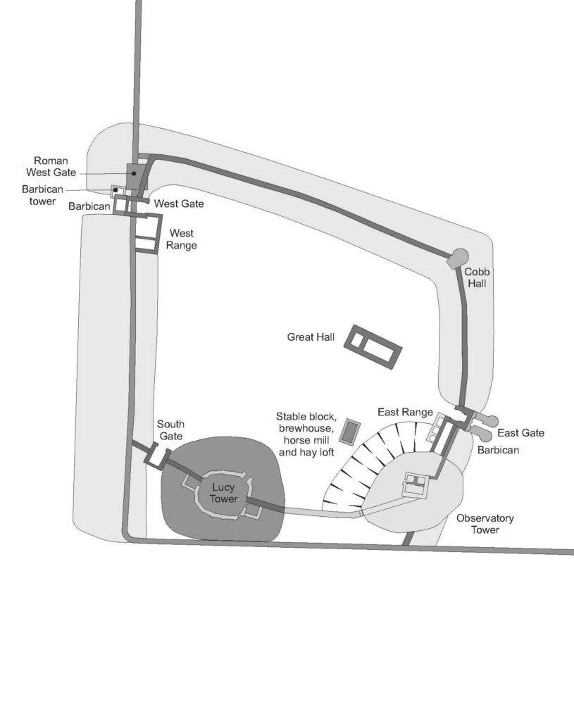
William the Conqueror established Lincoln Castle in 1068 in the walled enclosure of the former Roman colonia. The Lucy Tower motte was built in its southwest corner reusing the west and south walls to defend the new inner bailey. The next 100 years saw rapid development: originally earth and timber, the Conquest-period castle was replaced in masonry, a process now understood to have started by the 1080s including East and West Gates; by the early 12th century the stone enclosure of the bailey and internal gate ranges were complete, along with the Lucy Tower shell-keep and later Observatory Tower. Inner bailey buildings were also contacted during excavation including the Great Hall, stables, East Range and the Observatory Tower motte and ditch, all contributing information to the reconstruction. Evidence for a lost South Gate to match East and West Gates was found; along with a reappraisal of the early form of the Lucy Tower shell-keep it provided information about a former southern enclosure. This enclosure was abandoned, probably by the early 13th century, when the castle contracted to the form of the current enclosure.

It was the culmination of this intense century of development, arrived at by the late 12th century that was selected for the digital reconstruction.

Plan of Lincoln Castle in C12 copyright FAS Heritage

Archaeological excavation and detailed building recording formed most information about the early form of the castle, but the assembly of the 3-D reconstruction led to reappraisal of other parts of the castle; previously unnoticed anomalies were discovered which required further analysis.

Subscribe to our quarterly newsletter

The lost southern enclosure and South Gate were both identified from fragmentary evidence and establishing the exact position and size of the original south wall presented a challenge. When reconstruction began there was little information on this wall except a projection of the line of the southern colonia wall. This placed the south wall slicing through the Lucy Tower motte – a relationship which did not seem likely. However, recent work on this part of the motte during a programme of banks stabilisation provided more information. A substantial medieval masonry wall measuring 3m wide and traversing the Lucy Tower motte west-east was revealed. The wall is probably founded on the Roman wall indicates the motte may have been constructed against it, flattening its southern side.

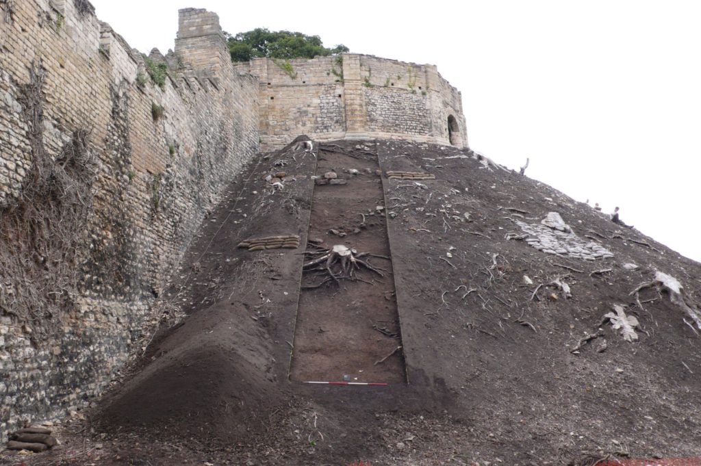
The Lucy Tower Motte after the removal of dense vegetation.  The fragmentary masonry remains of a structure can be seen towards the top of the trench. Copyright FAS Heritage

The reconstruction provides a sense of where concentrations of occupation were; around East Gate and Observatory Tower, the Lucy Tower, the Great Hall and around West Gate. With the discovery of South Gate it is easier to appreciate how these areas were autonomous. Other areas within the castle, particularly the western side, are presented as large open spaces; without further investigation these zones cannot be reconstructed easily.

The Lucy Tower, sat upon on an enlarged motte, can now be shown with its original east and west chamber blocks, internal ranges and window overlooking the city. With the tower, wing walls and South Gate, these formed a discrete enclosure.

Detail on the form of the Observatory Tower in the late 12th century can also be added. The tower is shown as a gaol tower which replaced a predecessor developed by Earl Ranulf during the Anarchy, later commandeered to become the county gaol. A stone ‘skirt’ around the base of the motte and a motte ditch were found and formed a hard circuit detaching the gaol from the rest of the castle.

The reconstruction will be made available across a range of media. The analytical process and collaboration with Pighill Illustration provided an opportunity to translate the archaeological study of the castle into a tangible representation. It enables the results of the research programme to be conveyed to a wide audience and goes hand-in-hand with the publication of a book about the Lincoln Castle Revealed Project in July 2021.

Subscribe to our quarterly newsletter

Rethinking Pleshey Castle – new discoveries from old records

Back in 2015 the Castle Studies Trust co-funded the post excavation & publication of Steven Bassett’s excavations 1972-1981 of Pleshey Castle in Essex. In the November 2018 issue of Current Archaeology (334) Patrick Allen explains how the review of the excavation materials has transformed our understanding of the castle and provided new insights into its character and development.

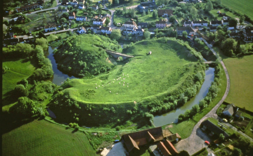
Around 5 miles northwest of Chelmsford in Essex we find a classic example of a motte and bailey fortification. Pleshey Castle offers invaluable insights into constructions of this kind, as while all of its buildings have long been demolished (apart from the late 15th-century brick bridge over the motte moat), its medieval earthworks have survived intact thanks to their never having been rebuilt in stone.

Subscribe to our quarterly newsletter

Its motte is original, dating from c.1100, while the ramparts of the south bailey are largely the result of refortification which took place in 1167. A second bailey to the north of the motte is now buried beneath the modern village, but its original outline can still be seen in Pleshey’s semi-circular street plan and in 1988 was confirmed by excavation. Its defences were levelled in the 13th century and replaced by a much larger town enclosure, whose earthworks still surround the modern village.

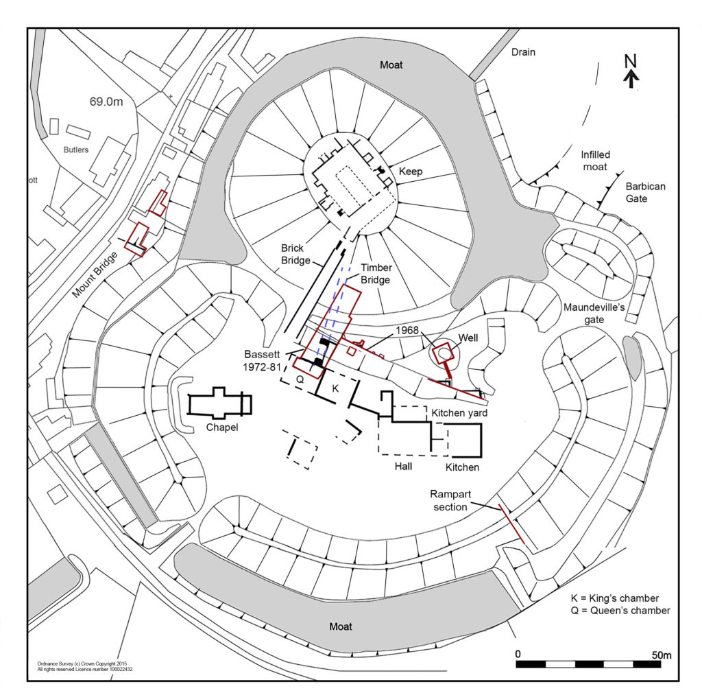
Planof the castle shows the keep and buildings in the south bailey with excavation areas in red

Previous descriptions of the castle had assumed that the north bailey was part of the original castle and the south bailey added later – but recent reassessment of all available evidence has transformed this picture completely.

Evolving the castle

What can we unpick about the castle’s origins? Its earliest documentary reference comes from 1143, when Geoffrey II de Mandeville surrendered all his lands, including Pleshey Castle, to King Stephen. Yet scientific research suggests the site is much older. Analysis of topsoil buried beneath the motte, and a calculation of the rate of its formation, suggests that the castle was completed 30-40 years after the Norman Conquest.

As for when construction began, tree-ring dating of a timber from the north bailey palisade provides a date no earlier than 1083, and a construction date of c.1100 seems entirely plausible. This would link the castle’s creation not to Geoffrey II de Mandeville, but to Geoffrey I – a logical conclusion as the core of his extensive estates lay in mid-Essex and Pleshey is close to his chief manor of Waltham (now Great Waltham).

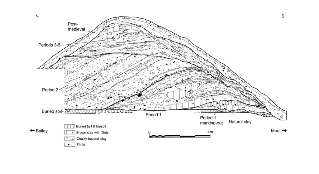
A section through the south bailey rampart shows how its earliest incarnation, as constructed c.1100 (Period 1), still survives at its base. Period 2 reflects the boundary’s englargement and refortification after 1167.

It is also becoming increasingly clear how the fortifications developed; Chelmsford Museums Service has been revisiting unpublished reports from an excavation that Steven Bassett undertook immediately to the south-east of the brick bridge in 1972-1981. Interestingly, a section that he recorded through the outer rampart confirms that the south bailey was also part of the original construction of the castle – that is, Pleshey boasted two baileys from its inception. Within this rampart (which was dated to the later 12th century by previous excavations headed by Philip Rahtz in 1959-1963), Bassett also found traces of a smaller, earlier rampart which had been built up in two stages, suggesting an initial temporary earthwork which was completed after a short interval.

As for later developments, historical accounts record that in 1157-1158 Henry II returned the de Mandeville lands to Geoffrey III on the condition that he dismantled the defences of his castles – but in 1167, Geoffrey’s younger brother William II de Mandeville was given permission to refortify. There is good archaeological evidence for a large-scale restoration of the castle defences after this date, following the same plan as before. Bassett’s excavation uncovered clear signs of a comprehensive clearing out of the moat during this period, and sections recorded by both Bassett and Rahtz (in an early dig) show the south bailey rampart being massively enlarged at the same time.

This, though, was the last major improvement to the castle defences. Its earth and timber fortifications provided sufficient protection against local insurrection, but the castle was not defensible against a major attack, and during the civil war that followed King John’s rejection of Magna Carta it changed hands twice. On Christmas Eve 1215 Pleshey Castle was seized by a detachment of the king’s army, and in the winter of 1216-1217 it was recaptured by the rebel barons – both times it was surrendered without a siege. The castle was militarily outdated, and after it was inherited by the powerful de Bohun family in 1227/1228 it became increasingly important not as a fortification but as their main residence and the administrative centre of a great aristocratic estate.

Subscribe to our quarterly newsletter

Bridges and bailey buildings

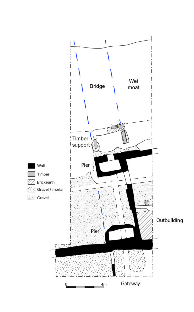
Between Pleshey’s refortification in 1167 and the late 14th/early 15th century four successive wooden bridges spanned the motte moat. Traces of these trestle structures were recorded by Bassett as well as in a small trench excavated by Elizabeth and John Sellers. The final development of the south end of the bridge consisted of two stone pier bases which would have supported box-frame timber uprights and, in front of these, a wooden structure supporting massive raked timbers which carried the central span of the bridge over the wet part of the moat.

At the south end of the timber bridge (its late C14 foundations are shown on this plan) was a gatehouse whose uppper space has been identified as the Queen’s chamber described in the building accounts

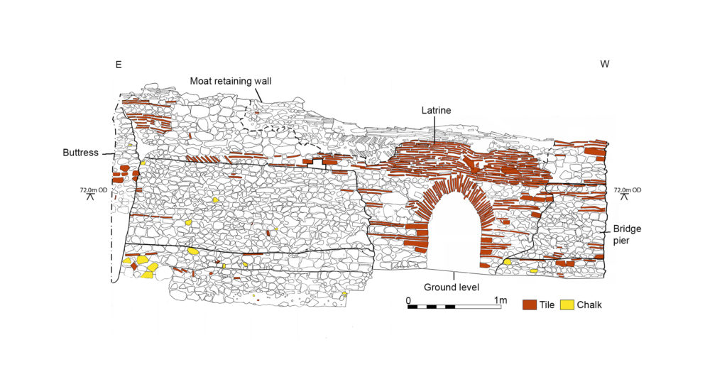
These strong foundations were needed at the bailey end of the bridge to support the greater load there from the bridge’s superstructure, whose walkway would have sloped steeply from the motte down to the bailey. Meanwhile, the elevation of the outer face of the northern bridge pier shows its solid construction and its continuation to the east to form a retaining wall for the moat. This pier was later reworked to create a latrine in the late 15th century – when the wooden bridge was replaced by a brick one – evidence of this change still survives in the form of an inserted arch and changes to the upper stonework.

This elevation shows the northernmost pier base of the late C14 bridge and the retaining wall to its east (the lower stonework) that shored up the moat. It was rebuilt in the late C15 as a latrine with an arched outlet.

What of other structures? As mentioned before, all of the castle’s buildings have long been demolished, but it is possible to piece together some clues. A plan of the buildings that were present in the south bailey from the 14th century onwards can be reconstructed using evidence from Bassett’s excavations and a 1960s parchmark survey by Elizabeth and John Sellers. Furthermore, the function of some specific buildings can be identified thanks to Pat Ryan’s study of the surviving mid-15th-century Duchy of Lancaster building accounts for the castle.

We are able to locate the chapel at the west end of the bailey, which was excavated by Rahtz in 1959-1963. To the east, the hall is easily identifiable, with its adjoining kitchen, pantry, and buttery. On its north side, storehouses were ranged around a kitchen yard which was accessible from the main gate immediately to the east. To the west of the hall was a range of large private chambers at first-floor level, above a wardrobe and other storerooms. These were a ‘revealing chamber’ (audience chamber), and at the west end of the range lay the ‘King’s chamber’ and, beyond it, the ‘Queen’s chamber’. This relates to the period 1421-1483 when Pleshey became part of the Duchy of Lancaster, the private estate of the Lancastrian kings, and was granted to three successive Queens of England: Catherine of Valois, Margaret of Anjou, and Elizabeth Woodville, the wives of Henry V, Henry VI, and Edward IV respectively.

Bassett’s excavations also recorded part of a stone-built gatehouse at the south end of the bridge, whose upper chamber can be identified as the Queen’s chamber in the building accounts. The gateway and the room to its west, possibly a guard chamber, were surfaced in gravel and mortar, but material found in the demolition rubble indicates that the Queen’s chamber above was much grander, with a floor of Penn-type decorated tiles, painted plastered walls, and leaded glazed windows.

Bassett’s investigations date the completion of the building range along the north side of the bailey to the late 14th century. These buildings would have been constructed by the de Bohuns and completed by Thomas of Woodstock, Duke of Gloucester (the youngest son of Edward III), who married Eleanor, the elder de Bohun heiress. It is she, as Duchess of Gloucester, who would have originally occupied the Queen’s chamber in its initial guise.

Exploring the keep

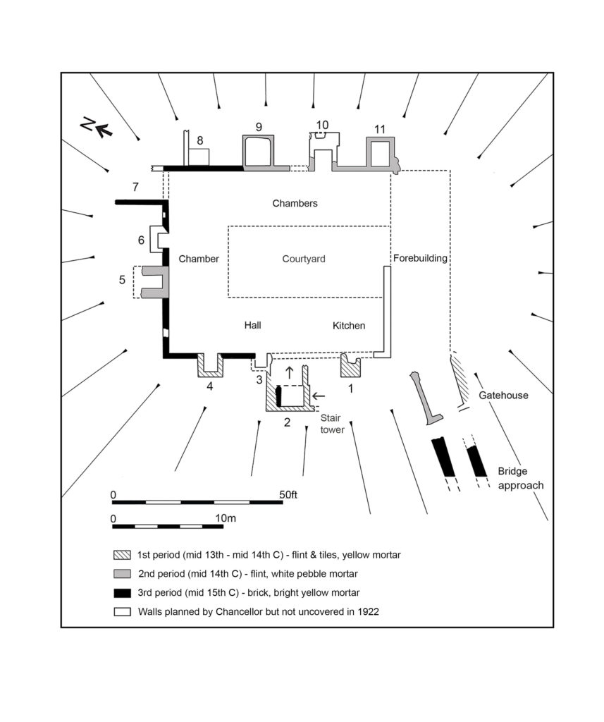
Our project also reassessed the results of the excavations focusing on the castle keep in 1907 and 1921-1922. There, the original excavators were puzzled by the ‘extreme thinness of the walls’, but we suggest that they should be interpreted as facades built around a timber-framed courtyard structure. The keep’s great hall has been located using its description in the building accounts, while the other ranges are thought to represent chambers with ‘ensuite’ accommodation, each with a fireplace and a privy (which survive as rectangular projections that are open to the interior, and enclosed, respectively).

A reconstructed plan of the keep, with added stair tower, fireplaces/chimneys and latrines

The final renovation of the keep – carried out on the orders of Margaret of Anjou and described in detail in the building accounts for 1458-1459, where the keep is referred to as a ‘tower’ – was finished in brick. The accounts also record that 29 oaks were felled for the work and that most of the money was spent on employing carpenters – confirmation that the keep was mainly built in timber, as suggested above. Two earlier periods of flint facades and additional structures are dated to the mid-13th/mid-14th century and the late 14th century respectively (by comparison of mortar types with well-dated structures recorded in Bassett’s excavations). No doubt the stone and brick facades made an essentially timber structure look more impressive.

The renovation of the keep was completed by building the brick bridge over the moat, probably in 1477-1480, according to Pat Ryan’s study of the building accounts. This was 20 years after the work on the keep itself – perhaps the works were delayed by the Wars of the Roses (1455-1487). The brick bridge is one of the earliest of its type in Europe and, with its wide span, was a very advanced design for its time. By the mid-16th century, though, the castle had become derelict, with the motte mound used as a rabbit warren, and it was sold by Elizabeth I in 1559. Ironically, the brick bridge was preserved only because the Duchy of Lancaster surveyors recommended that it be retained to maintain access to the warren. Today, it still stands as one of the few elements of the castle surviving above ground. Analysis of excavated evidence has enabled us to add much more colour to this picture, and to reconstruct Pleshey Castle’s appearance once more.

Subscribe to our quarterly newsletter

The author would like to thank the following for grants towards the project: the Castle Studies Trust, the Marc Fitch Fund, the Essex Heritage Trust, and the Essex Society for Archaeology and History.

Featured image: Aerial view of Pleshey courtesy of Chelmsford Museums Service

Kings, barons, miners and inedible pigs: the great siege of Rochester in 1215 now on video!

Dr Peter Purton FSA, leading expert on medieval siege warfare examines one of the most famous British medieval sieges, that of Rochester in 1215.

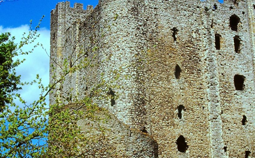
The great donjon of Rochester castle (Kent) is still visible from miles around – including from the Eurostar. It stands above a bridge across the tidal waters of the river Medway and that was one reason why it was subject to a famous six- week siege which ended when an entire corner of the great tower was brought crashing to the ground, leading to the fall of the castle on 30 November 1215.

This was the first big battle in the civil war that broke out between King John (1199-1216) and the barons who had forced him to seal Magna Carta in June of that year. The king got the pope to declare it null and both he, in the south, and the barons, based in London, began to gather soldiers. We know a great deal about what happened because contemporary chroniclers, including eyewitnesses and those closely associated with men fighting there, wrote it down; and because some government records survive. We know the names of the nobles and many of the knights on both sides, of the engineers paid to construct the King’s five stone-throwing siege engines, and the master miners from the Forest of Dean who with their team (altogether 13 miners) undermined first the wall of the bailey and then the great tower itself.

Sappping a tower: Foix castle museum

The first castle was built after the Norman conquest but the great tower dated from 1127 when it was built for the archbishop of Canterbury, then William of Corbeil, who shared ownership and use with the crown. It is the tallest keep in the British Isles (125 feet, 38 metres) and unusually boasts two floors above the main level and basement below, divided vertically by a spine wall that gave access to the castle well. Richly provided with latrines and comfortable chambers, two spiral staircases, beautifully decorated stonework, it was a place fit to entertain king or archbishop. But in 1215 none of this mattered, archbishop Stephen Langton ignored John’s demand to hand it over and instead allowed rebel baron William de Albini and 60 or 80 knights, their retinues and archers and crossbowmen, to take possession.

Interior of Rochester’s keep showing the rebuilt corner. To the left is the spine wall the defenders fell back to after the sapping

Control of the ancient bridge over the Medway was vital for both sides, and so it became John’s first target once he had gathered an army of several thousand experienced fighters mainly from Flanders, Poitou and Gascony. The defenders resisted every attack for weeks, inflicting many casualties on John’s men. In the end the besiegers turned to their miners, who first broke through the bailey wall (we don’t know where), then, using the grease from 40 slaughtered pigs (‘of the kind not fit for eating’) as an accelerant to burn the props they had used to prop up the masonry while they sapped  the south east corner turret of the great tower, brought it crashing down. The defenders retreated behind the spine wall but had run out of food so surrendered. King John wanted to hang them all  but was dissuaded by his own captains who didn’t want to meet the same fate if the wheel of fortune should turn against them.

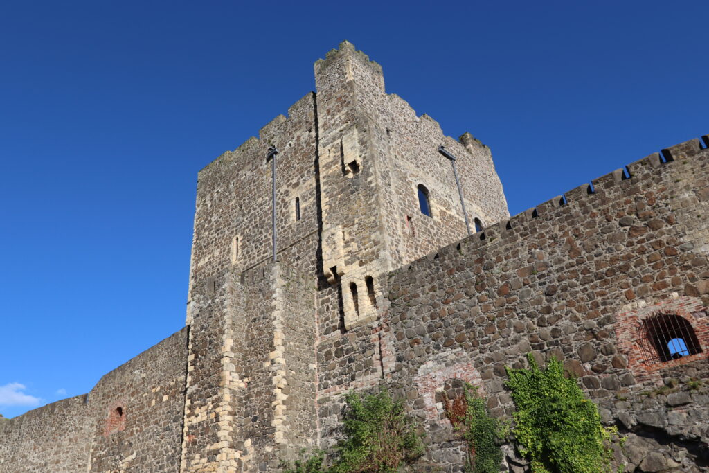
To this day one can see the join on the sides of the donjon where the wall had to be rebuilt after the siege.

In 2015 the Castle Studies Group (www.castlestudiesgroup.org.uk) held a conference there to mark the 800th anniversary and I presented a short paper analysing the siege. Now, following an invitation from across the Atlantic, an extended and illustrated version of that talk can be viewed at: