Picton Castle – form, function and affinities – new work at an enigmatic Pembrokeshire castle

Starting on September 11 2023, Dyfed Archaeological Trust, with Neil Ludlow, will undertake survey and recording at Picton Castle, near Haverfordwest in Pembrokeshire. This work, wholly funded by the Castle Studies Trust, will be fully analytical: it will provide a comprehensive record, underpinned by new research, in an attempt to unravel some of the mysteries of one of Wales’s – and indeed Britain’s – most enigmatic castles. Here Neil Ludlow and Phil Poucher from DAT explain more about the project.

Subscribe to our quarterly newsletter

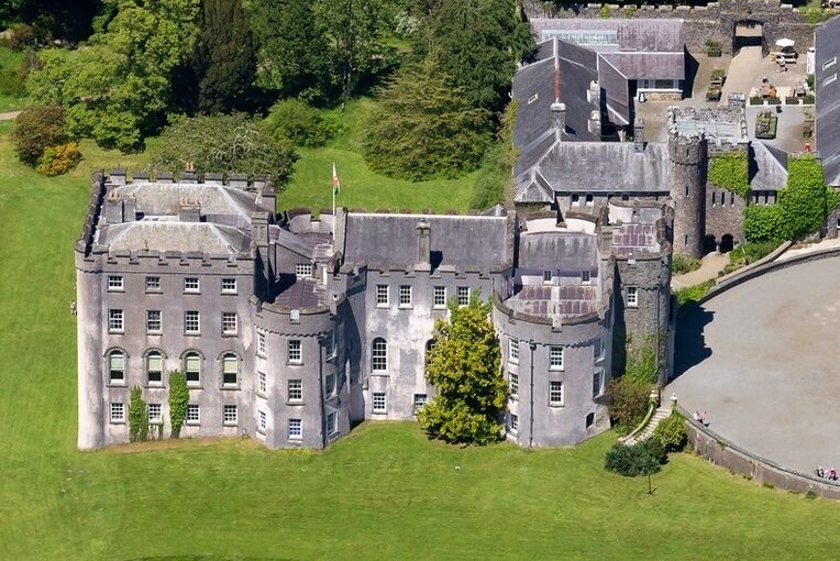
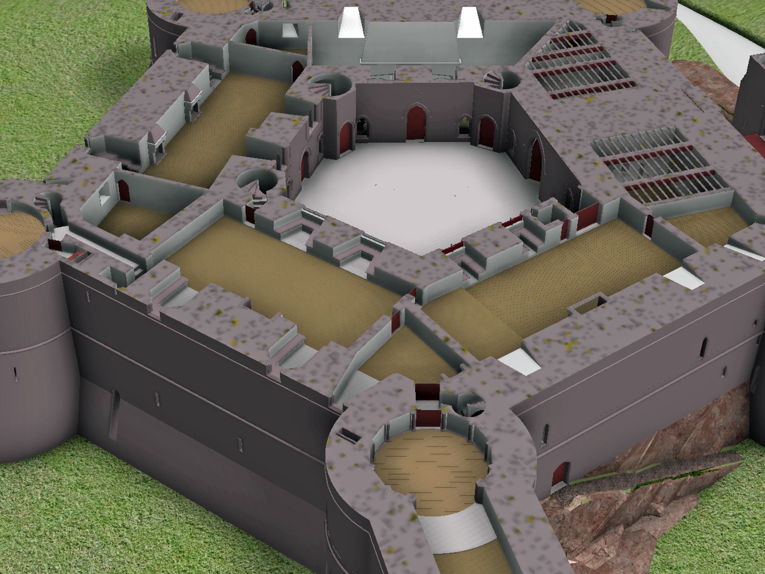
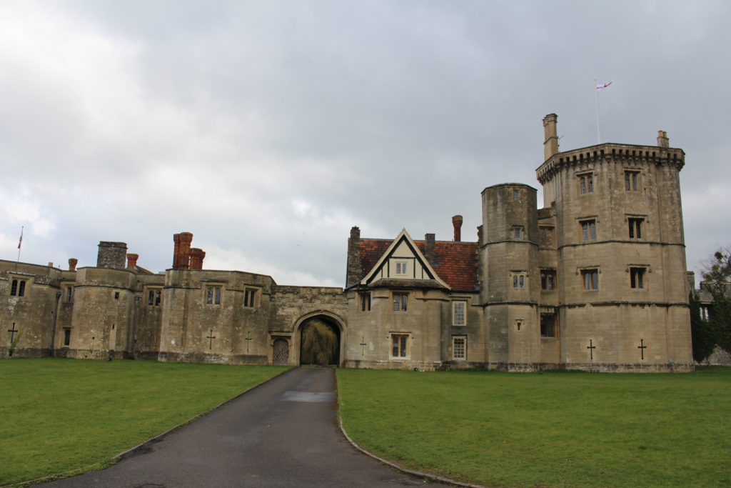
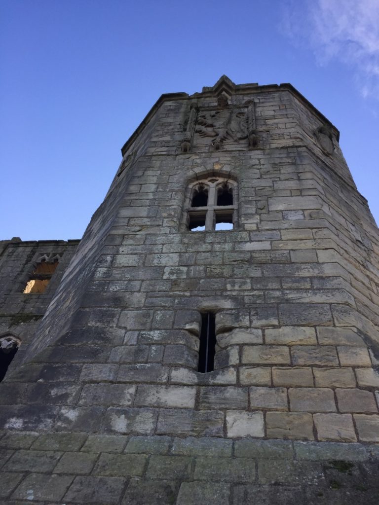
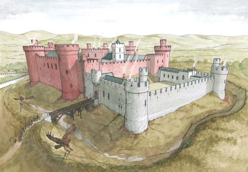
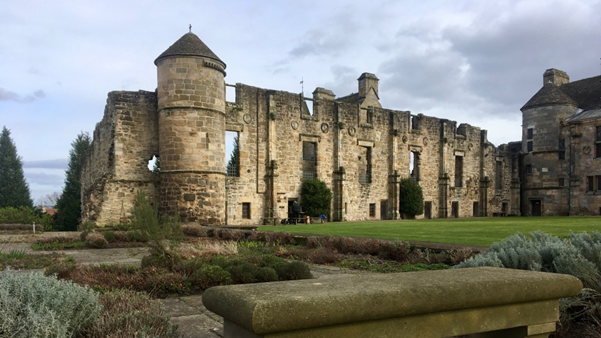
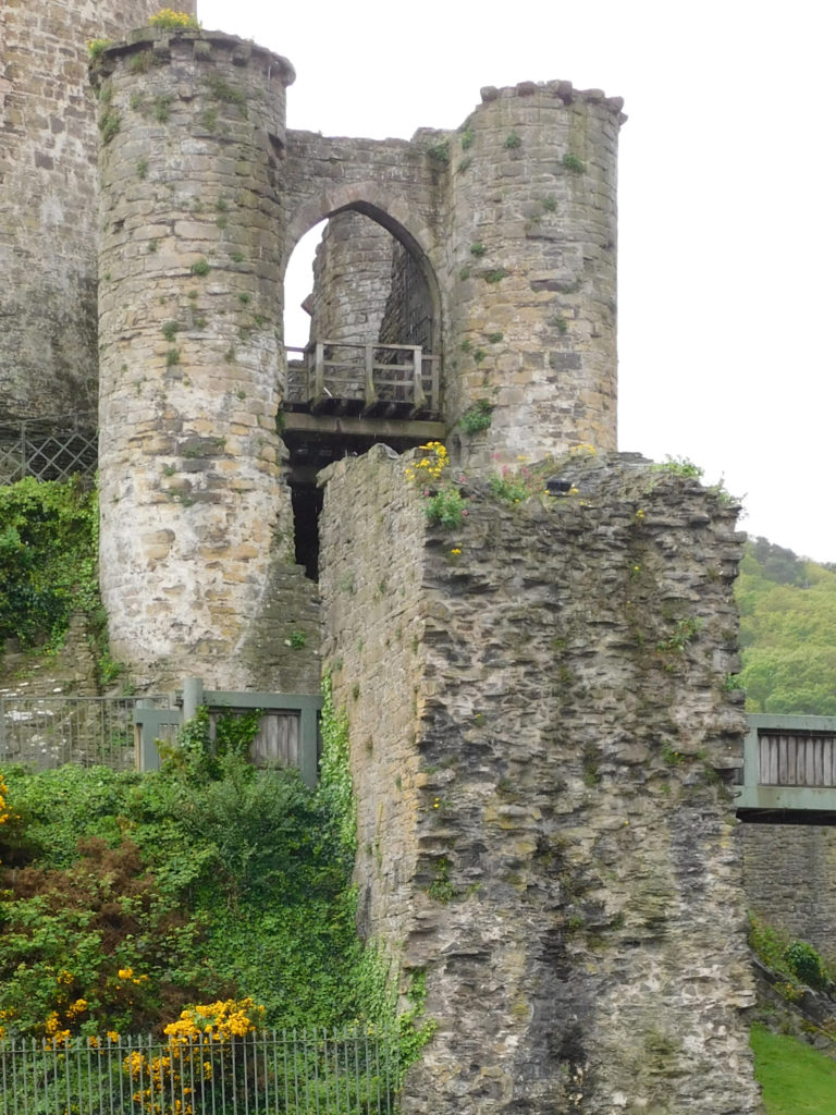
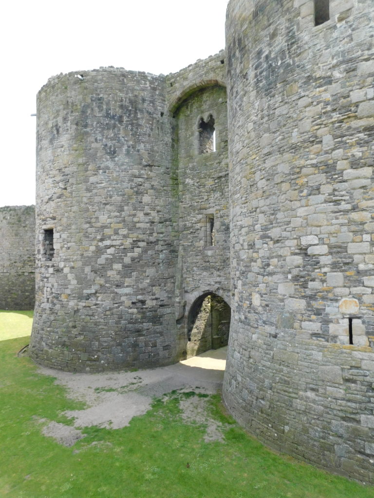
Picton Castle has been continuously occupied since it was built, and was substantially modified over the centuries, now wearing the veneer of an eighteenth-/nineteenth-century country house. Underneath, however, is a baronial castle from around 1300-20, of a highly unusual plan without close parallels in Britain and Ireland. A small, compact building, it comprised a hall-and-chamber block flanked for D-shaped towers, one near each corner, with a twin-towered gatehouse at one end – possibly unique – and a D-shaped tower, now lost, at the other. Variations on this basic ‘towered hall-block’ layout are seen in castles of similar date – and somewhat earlier – in the West Midlands, Scotland and the border, Ireland and even southwest France. But none fully mirror Picton’s plan-form – which might conceivably have been at least partly modelled on the large ‘keep-gatehouses’ of the late thirteenth century.

In addition, Picton shows strongly regional attributes including a first-floor hall, corbelled parapets and an abundance of squinched features in the external angles. The towers rise from pyramidal spur-buttresses with an unusual octagonal footprint, otherwise seen only in the gatehouses at St Briavels Castle (Gloucs.) and Tonbridge Castle (Kent). So a variety of influences – regional, national, international and purely personal – may lie behind design at Picton.

Picton Castle Ground Floor (incl ribbed vaulting)

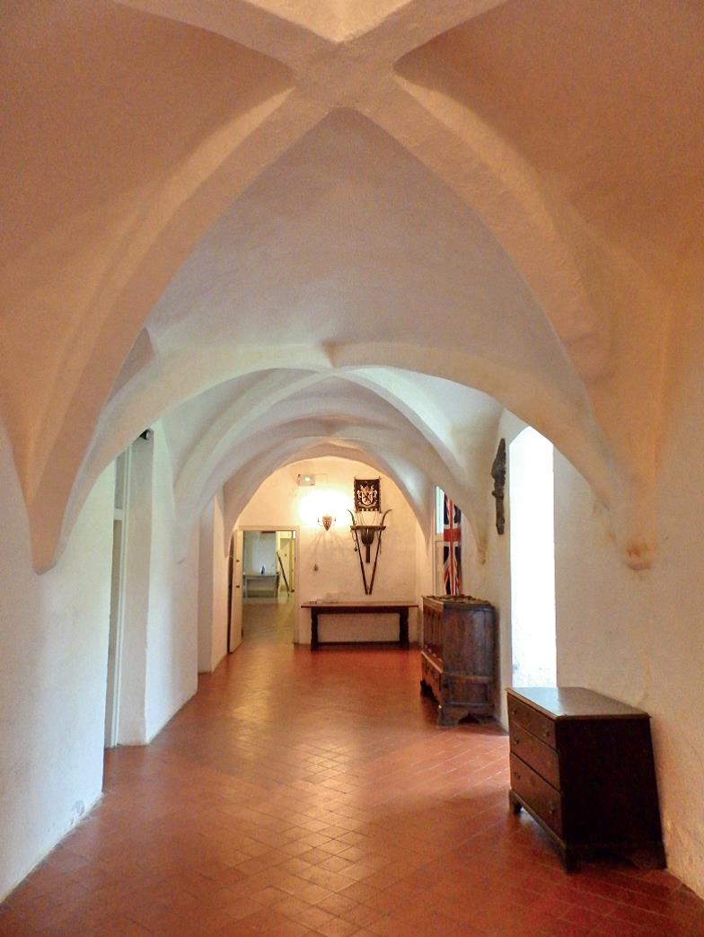
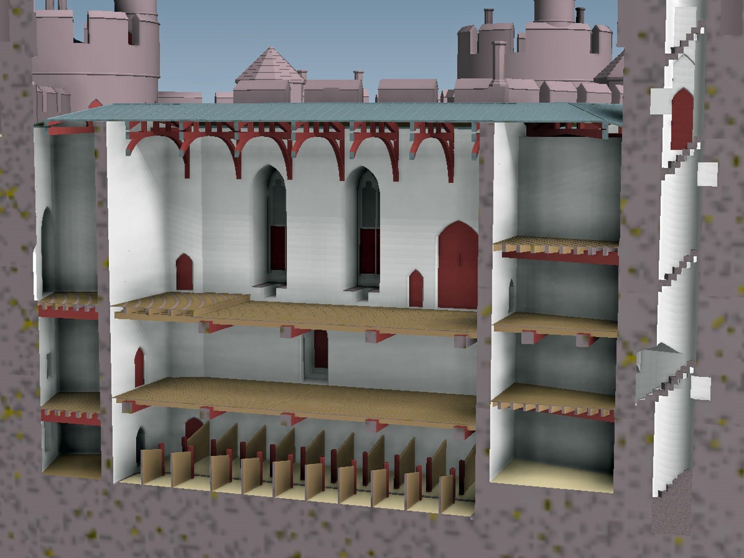
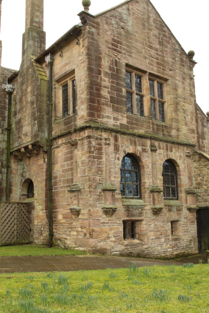
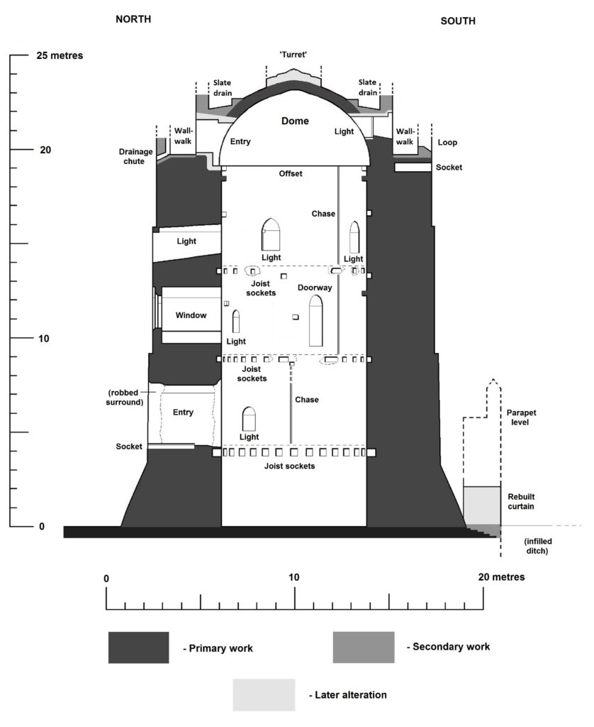
No structured survey and analysis of the castle has yet been undertaken, and it is fundamental questions like this that the present study will address. In addition, little is known of how the castle actually functioned. The service end of the hall is currently assumed to have lain towards the gatehouse, where blocked doorways possibly led to a buttery and pantry; at the opposite end, it’s possible that the two western towers were united to form a storeyed chamber-block, to which the lost D-shaped tower was a bedchamber. But medieval access arrangements are still a mystery, as are the use and relative status of many internal spaces. For instance, it’s speculated that a broad flight of steps might have led from the gatehouse, through a ‘processional’ archway, to the hall. But the ground floor is, unusually for the region, rib-vaulted throughout – can it really have been ‘cellarage’, or did it provide access (and an anteroom) to the hall and chamber? Two spiral stairs connect ground- and first-floor level, one of them with very broad treads – were the distinguished by the status of their users? Or did the vaulted ground-floor corridor lead to a stair accessing the high end of the hall?

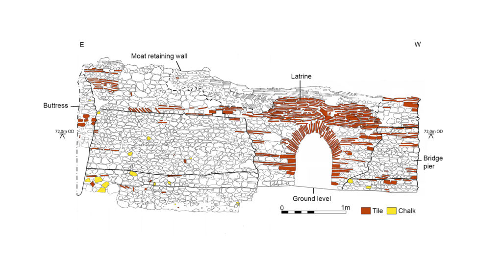
Not all internal walls have been dated – some, at least, may be post-medieval. Similarly, it is clear that not all medieval features such as openings, entries, stairs, latrines, fireplaces, ovens and hearths have yet been identified. Their correct identification and dating will tell us a lot more about status and usage of interior spaces, and about circulation between them. The location of the kitchen and bakehouse – and method of water-supply – are also still unknown: were they separate from the main building? A chapel was in existence by the seventeenth century, and is assumed to have a medieval predecessor, but it is yet to be shown whether it lay over the gate-passage like its successor.

The 2023 work aims to resolve such questions, and to achieve a full understanding of the form, functions and affinities of the medieval building. A combination of total-station theodolite survey, drone photography, drawn elevations, a high-resolution photographic record and, where possible, 3D modelling will be used to obtain a comprehensive record, supported by new research. All evidence for medieval features, openings and architectural detail will be recorded, along with former levels and access between them, and any indication of different building campaigns. The report, with all survey drawings and photos, will be posted on the Castle Studies Trust website. 3D models will be accessible via Sketchfab.

Subscribe to our quarterly newsletter

The Castle Studies Trust five projects for 2023

The Castle Studies Trust have awarded five grants totalling £35,000 to support research into castles. This is a record amount for the Trust, and as we enter our tenth year as a charity, we could not have managed this without our supporters.

We will bring you updates from these projects throughout the year as the teams get stuck in. But first, let’s get to know them a bit better. They are from across England, Scotland, and Wales and take different approaches to understanding castles.

Subscribe to our quarterly newsletter.

Bamburgh

A stone building with a square tower in the middle. It stands on an outcrop, prominent in the landscape. In the foreground is a beach.
Bamburgh Castle on the coast of Northumberland. Photo by Michael Hanselmann via Wikimedia Commons, licensed CC-BY-SA 3.0.

Standing on a rocky outcrop on the coast of Northumberland, Bamburgh’s history stretches back to the early medieval period when it was home to a palace of the Kings of Northumbria. Bamburgh Castle itself was owned by royalty at various points, and rebuilt in the 18th century.

Bamburgh is a massive site: its history has been illuminated by excavations, and there is still more to learn.

Dr. Joanne Kirton and Graeme Young of the Bamburgh Research Project plan to carry out a geophysical survey and a masonry survey of the castle’s outworks.

Dunoon

The mound at Dunoon Castle. Photo by Rosser1954 via Wikimedia Commons, licensed CC-BY-SA 4.0.

A castle at Dunoon was first mentioned in the late 13th century but may be older. The ruins visible today date from the 14th century. It stands on a hill on the coast of the Firth of Clyde. The castle was besieged and captured multiple times over its centuries-long history and became a royal residence.

Despite the castle’s royal links, little is known about its layout and dating. Dr. Manda Forster’s team at DigVentures will carry out geophysical surveys (resistivity and magnetometry) of the mound and the area around it to find out where there may be buried walls, foundations, or other archaeological remains.

They will also organise workshops for the local community to learn how geophysics work. So as well as learning more about the castle, they may inspire the next generation of archaeologists!

Lowther

Google Map of the medieval Lowther Castle

The present Lowther Castle was built in the 17th century, but a few hundred metres north lie the medieval remains of a castle and possible deserted village. Lancaster University Archaeology Unit surveyed the earthworks in the 1990s, but there has been no other archaeological investigation since.

Being able to date the site would be a crucial step in understanding the Norman influence in the region. Could this be part of the remains of the Norman conquest of the Kingdom of Cumbria in the late 11th century?

Dr. Sophie Ambler has devised the project to carry out geophysical surveys at Lowther Castle followed by excavations. Working with the University of Central Lancashire and Allen Archaeology, this aims to establish the site’s building chronology.

Picton

Picton Castle in 2021 by Ruth Sharvile, via Geograph. Licensed CC-BY-SA 2.0.

Pembroke’s Picton Castle is a medieval building with later alterations and additions. It is uncertain when it was built and by who, but it is likely to have been established in about 1300 by Sir John Wogan. Picton has an unusual layout but may have parallels with French medieval castles.

Neil Ludlow and the Dyfed Archaeological Trust will carry out a measured survey of the building, recording its structure and creating a photographic record of the site. This will be an invaluable resource to understand the site, and help show the castle’s development over the centuries.

Wigmore

Photo of Wigmore © Philip Hume

Wigmore was amongst the early castles established in England in the wake of the Norman conquest. It was founded by William Fitz Osbern, Earl of Hereford and later became the home of the Mortimer family. They were an influential family in the Welsh marches, and they developed the castle to reflect their growing power.

Small-scale excavations at Wigmore and geophysical surveys in the 1990s demonstrated the archaeological potential of the site, but what is missing is a reconstruction of how it looked during its heyday.

Chris Jones-Jenkins will create a reconstruction of how Wigmore Castle used to appear. This will draw on archaeological and historical sources to bring the reconstruction to life. You may also have seen Chris’ work with his reconstructions of Ruthin and Holt.

Subscribe to our quarterly newsletter to receive updates on these projects and our other ongoing work in the field of castle studies.

Header image: Bamburgh Castle by Michael Hanselmann via Wikimedia Commons, licensed CC-BY-SA 3.0.

A large and eclectic crop of fascinating applications asking for over £100,000 for the Castle Studies Trust to Consider

The deadline for grant applications passed on 1 December. We’re going through the various projects now. Altogether the 15 projects, coming from all the home nations and one from Ireland, are asking for over £110,000. They cover not only a wide period of history but also a broad range of topics.

We will not be able to fund as many of these projects as we would like. To help us fund as many of these projects as possible please donate here:

Kindlink Donation Form App

In a little more detail here are the applications we’ve received:

Bamburgh, Northumberland: The aim of the project is to better understand the outworks to the north of the castle, by using various geophysical survey techniques and a preliminary survey of the masonry remains, it will include a 3D model of the recently excavated Elmund Tower and provide materials for interactive displays.

Barnard Castle, Co Durham: The aim of the project is to try and understand a lot more about the outer ward of the castle, using a variety of methods including geophysical survey, aerial survey and test excavation

Cavers Castle, Roxburghshire: Through a combination of building survey and excavation to try to understand the early form of this important baronial castle.

Dunoon, Argyll: A community-led geophysical survey project to understand better the form and scale of this important castle that was the seat of the Lord High Stewards of Scotland. The original castle dates back to the 1200s and the remains above currently ground date from the fourteenth century.

Fun Kids, Castle Podcasts for 7-13 Year Olds: To produce a series of 8 podcasts for children aged 7-13 to engage children to explore a what, how and why of 8 castles. The series will focus on a variety of castles and build awareness of less common castles that families can explore.

Galey, Co. Roscommon: Geophysical and topographical surveys to explore the possible motives behind the placement of, as well as immediate landscape context, morphology and any attached settlement and industrial activity, that occurred at a lakeshore-sited late medieval Gaelic-constructed tower house castle.

Hartlebury, Worcestershire: The seeks to explore what looks like a possible civil war bastion ditch, which seems to have been partially revealed in a 2022 drone survey of this former bishop’s palace with remains dating from the fifteenth century. This will be done through geophysical survey and excavation.

Lowther Castle, Cumbria: Through a combination of geophysical survey and excavation to try to learn more about this ringwork castle and settlement, thought to date from the late eleventh century. the aim is to try to discover if it dates from this period and was therefore a Norman plantation; and also its history after its foundation.

Millom, Cumbria: The project will involve a drone survey to assess the condition of the 14th century fortified manor combined with a geophyisical survey to understand if there is any link between it and the nearby church and monastery.

Muncaster, Cumbria finds assessment: To make a complete assessment of the finds from the 2021 excavations which took place near the 14th century tower along with two nearby kiln sites.

Muncaster, Cumbria geophys and archaeology survey: To carry out a geophysical survey of the area surrounding the castle and to investigate a large stone feature in the cellar of the castle to understand its purpose and possible date

Northern Frontier, Beacon Hill Yorkshire: A geophysical survey of Pickering Beacon Hill, a siege castle used for the siege of Pickering in the lead up to the Battle of the Standard (1138) to better understand the landscape at the time and see how much life was disrupted during the period known as the Anarchy.

Picton, Pembrokshire: The aim of the project is to achieve a full understanding of the form, functions and affinities of the medieval part of Picton Castle through a building survey. It has an unusual plan with no close parallels within Great Britain, but shows some affinities with castles further afield including, possibly, Gascony in France

Snodhill, Herefordshire: Excavation to explore the early masonry defences and attempt to resolve the entrance arrangements and to do a geophysical survey of the Eastern Bailey

Wigmore, Herefordshire: To provide a digital reconstruction drawing of Wigmore Castle using a mixture of archaeological and archival evidence

We will not be able to fund as many of these projects as we would like. To help us fund as many of these projects as possible please donate here: Kindlink Donation Form App

The applications have been sent to our assessors who will go over them. You can see how the assessment process works from our blog back in January 2016: How the Castle Studies Trust Selects its Projects – Castle Studies Trust Blog

Reconstructing Holt Castle, Denbighshire

Little physically now remains of Holt Castle, however, one of the first projects the Castle Studies Trust was for leading buildings reconstruction artist Chris Jones-Jenkins and the late and much missed Dr Rick Turner to digitally reconstruct the castle using a mixture of historical sources and recent archaeological excavations to bring the castle back to life with a series of images and a video fly through. Here, in a piece first published in History Extra in 2015 explains how it was done.

Subscribe to our quarterly newsletter

History:

To secure his conquest of north-east Wales, Edward I created five new Marcher lordships in 1282, and gave them as reward to his political allies and close friends in recognition of their loyal service. The lordship of Bromfield and Yale was granted to John de Warenne, sixth earl of Surrey (1231-1304). It is not known when he started building Castrum Leonis or ‘Chastellion’ as Holt Castle was known in the Middle Ages. The castle is first referred to in 1311 some years after it was probably completed. Warenne’s master mason chose an open and relatively flat site above the west bank of the River Dee, close to one of the ferry crossings into Cheshire. This allowed him to create a symmetrical pentagonal castle with a tall round tower at each corner, and the main rooms ranged around an inner courtyard. There were up to three storeys raised above the original ground level, with the moat and up to additional three basement levels cut down into the sandstone bedrock. It was a revolutionary design and was one of a group of similar architectural experiments being undertaken by the other new Marcher Lords at castles such as Denbigh, Ruthin and Chirk. At all these sites geometrical complexity, architectural grandeur and the provision of well-appointed accommodation seemed to be more important than their defensive capabilities.

Holt Castle as it was in its pomp courtesy of Chris Jones Jenkins

            The sixth earl was succeeded by his grandson John, the seventh earl of Surrey (1286-1347). Described by Alison Weir as ‘a nasty, brutal man with scarcely one redeemable quality’, he was involved with the political upheavals of Edward II’s reign, including the loss of Holt Castle for a time to Thomas, earl of Lancaster. This John died without a legitimate heir, and Edward III intervened to settle his estates upon Richard FitzAlan, third earl of Arundel (c.1313-1376). His son, Richard the fourth earl (1346-1397) was one of the ‘Lords Appellant’, who had curbed Richard II’s powers and had the king’s closest allies executed or exiled during the ‘Merciless Parliament’ of 1388. It took nine years before the king was able to wreak his revenge on these powerful men. Arundel was brought to trial for treason at Westminster on 21 September 1397, and was convicted and beheaded on the same day. Richard II seized his estates and incorporated Bromfield and Yale into his new principality of Cheshire, with Holt Castle as its main stronghold. Building work was commissioned in 1398, which saw the Chapel Tower extended and included a water-gate, called ‘Pottrell’s Pit’ in later documents, linked to the river. Over the next year more than £40,000 in coin, jewellery, gold and silver plate was transferred from the royal treasury in London to Holt for safe keeping. When Henry Bolingbroke – later Henry IV – returned to England in 1399, he shadowed Richard II up the Welsh Marches and was quick to recapture Holt Castle. Despite being defended by 100 men-at-arms and being well provisioned, Henry’s men, including the French chronicler Jean Creton, were able to enter through the new water-gate and ascend ‘on foot, step by step’, to take the castle unopposed and so recover this vast proportion of the king’s disposable wealth.

Subscribe to our quarterly newsletter

            Over the next 139 years, three more owners or stewards of the lordship of Bromfield and Yale were to be executed for treason. The first was Henry Stafford, second duke of Buckingham (1455-83). A year after his death, Sir William Stanley (c.1435-1495) acquired the lordship from Richard III. Despite his role at the Battle of Bosworth which brought his relative Henry VII to the throne, he was implicated in the Perkin Warbeck affair and was executed in 1495 after which Holt Castle reverted to the Crown. The last of this group was William Brereton (c.1487×90-1536) who was appointed steward of the castle where he held ‘great porte and solemnities’, before he was convicted of adultery with Anne Boleyn and beheaded.

            Holt Castle remained the property of the Crown and was to form part of the estates of the Princes of Wales. It was held for the king during the Civil War and in the 1670s, the buildings were sold off to Sir Thomas Grosvenor, who systematically dismantled nearly all the fabric and transported it to help in the building of his Eaton Hall, a few miles south of Chester. This has left us with the stump of rock and walling which survives today.

Reconstructing the Castle:

Two attempts have been made to understand the original the former appearance of Holt Castle: by Alfred Palmer in 1907 and Lawrence Butler in 1987. They had access to plans and views of the castle drawn in 1562 and 1620. The problem they faced was that these two sets of drawings are contradictory and they were hard to relate to what survived. Since 1987, new evidence has been made available:

  1. Documentary evidence for Richard II’s building work.
  2. The publication of a transcript of the Holt Castle inventory taken after Sir William Stanley’s arrest in 1495.
  3. The discovery of a new early-seventeenth century plan of the castle in the National Library of Wales.
  4. A programme of masonry consolidation, archaeological excavation and survey led by Steve Grenter, Wrexham County Borough Council, in partnership with the Holt Local History Society.

This new work prompted me to undertake another attempt to reconstruct Holt Castle. With the help of a grant from the Castle Studies Trust, I was able to commission the well-known castle reconstruction artist, Chris Jones-Jenkins, to develop a 3D digital model which was flexible enough to capture and assimilate the new data and modify the structure as new insights were gained.

The challenge has been to weigh each source of evidence and identify which strands should have precedence when contradictions emerge. A hierarchy was developed:

  1. The visible masonry of the castle and the modern topographical survey of the site provided the primary terrain model on which the remainder of the castle was constructed.
  2. The archaeological evidence for the rock-cut footings, the bases of three of the towers and the line of the channel leading into the water-gate provided other fixed points in the model.
  3. By considering the content and the potential reasons for the drawing of the three, early-modern ground plans and the two associated views, that of 1562 was assessed to be the most reliable for the details that it showed, the early seventeenth century plan for its dimensions, and those by John Norden of 1620 to be the most inaccurate, despite them being the ones most frequently published.
  4. The list of rooms and the route followed by the appraisers of the 1495 inventory provides the most comprehensive source for the internal layout of the castle. However, it became clear that those rooms without contents, such as the triangular ante-rooms to the towers and the latrines, were not listed.
  5. None of the views of the castle were architecturally detailed, and none showed all of the exterior or much of the inner courtyard. This information had to be derived from surviving details from other Edwardian castles in North Wales or from work undertaken in Richard II’s reign, when considering the projection from the Chapel Tower.
Holt First floor floor plan with with watergate to the fore and great hall and stable section to the right, copyright Chris Jones-Jenkins

The development of the model became an iterative process between the historian and the artist. Different combinations of layout and floor heights were tried, building on the fixed points surviving at basement level and rising up in an effort to accommodate all the rooms. Suites of accommodation began to emerge. Sir William Stanley’s great chamber led off the high end of the hall and controlled access in one direction to his counting house and the chapel, and in the other to the Treasure House and the High Wardrobe, where all the valuables were kept. Across the courtyard his wife, Elizabeth, had her own great and bed chamber, linked to the nursery. Above her accommodation was a chamber for her gentle women, well away from the yeomen’s dormitory under the lord’s great chamber. One range was dominated by the kitchen, rising the full height of the castle, connected at basement level to a larder, pastry house, well house and a wine cellar on one side and offices for the cook and butler on the other. As was normal the constable had a suite over the inner gate, but unusually a stable for 20 horses was created in a basement below the hall with access for the animals across the moat and up a ramp into the castle.

Holt Great Hall and Stables copyright Chris Jones-Jenkins

Working on this reconstruction, our admiration only grew for the original designer. He created a symmetrical plan and external appearance but produced complex internal arrangements to meet his patron’s needs. Holt is as much a chivalric ideal as a practical castle. An animation of the reconstruction of Holt Castle has been produced by Mint Motion of Cardiff and can be viewed here:

Subscribe to our quarterly newsletter

Feature image courtesy of Wrexham Borough Council

Castle Studies Trust Christmas Quiz – the Answers

So how many did you get right? Find out below

  1. Lincoln (2020 project)
  2. Pembroke (2018)
  3. Shrewsbury (2018 and 2019)
  4. Pulverbatch, Shropshire (2017)
  5. Pleshey, Essex (2015)
  6. Druminnor, Aberdeenshire (2019)
  7. Thornbury
  8. Warkworth (2020)
  9. Ruthin
  10. Ravenscraig, Aberdeenshire
  11. Hoghton Tower, Lancashire (2019)
  12. Wigmore
  13. The Wirk (2020)
  14. Slingsby, Yorkshire – article by Bethany Watrous on her digital reconstruction
  15. Caus, Shrophshire (2016)
  16. Gleaston, Cumbria (2015)
  17. Laughton (2018, 2019)
  18. Shrewsbury again (found during 2018 execavation)
  19. Clifford, Herefordshire (2017)
  20. Ballintober, Ireland (2014)

Subscribe to our quarterly newsletter

Castle Studies Trust Christmas Quiz

To help keep you entertained during this strange and hopefully unique Christmas the Castle Studies Trust has prepared a Christmas quiz. Can you name the castles these pictures are or images are taken from either our projects from all years or blog posts during the year?

Subscribe to our quarterly newsletter

  1. Where is this?

2. Where did this CST funded excavation take place?

3. Where is this?

4.What motte and bailey castle, which we funded a geophysical survey for, is this?

5. Where can you find this bridge which the Trust co-funded post excavation work on?

6. In which Scottish castle did the geophysical survey we funded find this well?

A latter coming protruding from a circular opening in the ground.
Photo by Iain Ralston and licensed under a Creative Commons Attribution ShareAlike 4.0 licence.

7. Where is this?

8. Where is this great tower?

9. This is a reconstruction drawing of which castle?

10. Where is this castle built by a queen?

Subscribe to our quarterly newsletter

11. Where is this castle?

12. The entrance to which border castle is this?

13. Where is this base a tower? It’s one of the projects the CST has funded

14. Where is this?

15. The plan of which castle is this, which the CST funded work on?

16) Which castle is this? We funded a building survey on it previously?

17. For which castle are these aerial images of, which include results of the geophys survey the CST funded on it?

18. These pieces of Saxon pottery were found at which excavation the CST funded?

19. This is a CST study day at our first ever excavation we funded? Which castle?

20. The CST funded a buildings survey of this castle. Where is it?

Subscribe to our quarterly newsletter

James of St George and the Edwardian Castle

Malcolm Hislop, researcher and author, writes about some of the themes of his most recent book.

Often thought as a highpoint of English military architecture, the castles of Edward I and his followers in north Wales hold a special place in hearts and minds of many in this country and abroad. Scholars have spent much time and effort on researching this (relatively brief) episode of intensive castle construction. We feel we know these buildings so well, and yet, notwithstanding the many accounts of individual castles, it is strange to relate that no lengthy general survey of the architecture (as opposed to the building history) has ever been published. Nor, despite presenting an obvious opportunity for furthering our understanding of the manner in which architectural style was formulated and disseminated in the late thirteenth century, have the influences on and of the Edwardian castle been widely discussed.

Conwy. The outer gatehouse and truncated approach ramp of c. 1283 by James of St George.

Edward’s Welsh castles are inextricably linked to the technical mastermind behind the project, the Savoyard mason, James of St George. Castle builders (in the practical sense) tend to be less well known than their patrons. The ones who can be identified are far outweighed by those who remain anonymous. Moreover, a master builder whose career can be reliably reconstructed to a significant degree is a rarity to be cherished. Master James is one such exception, his reputation as an architect of international repute being established in one of the great historical detective stories of the later twentieth century, which did much to personalise the often anonymous process of medieval construction.

Beaumaris. The North Inner Gate of c. 1295 etc. by James of St George.

Master James’ star has not ridden quite so high in recent years. His architectural role questioned, his artistic contribution doubted, James now seems a slightly diminished figure, with only his organisational and planning abilities remaining unchallenged. There were certainly other master builders employed on the royal works who exercised a degree of independence; it is clear too that there were other influences on the royal works in Wales than can be accounted for by Master James’ accumulated experience in Savoy. In particular, what was the part played by Walter of Hereford, the technical and artistic master mind behind Vale Royal Abbey, and resident master at Caernarfon from 1295? These are interesting issues requiring a greater depth of enquiry, but the initial conclusions of a broader than usual sweep of the architecture are that in addition to his organisational and technical responsibilities Master James also exercised a significant creative role.

Duffus. The great tower of c. 1305 built in Moray with Edward’s assistance.

Edward’s crushing of all resistance in north Wales was swiftly followed by an attempt to subjugate Scotland. Building work in Wales was mothballed and James of St George and Walter of Hereford were redirected northwards. The impact of Edward’s invasion of Scotland on castle building in the northern kingdom tends to receive little attention. Most of the royal works were in timber, little survives above ground level, and archaeology has not yet revealed much that can enlighten the subject. On the other hand, it is becoming increasingly clear that there is a good deal more to say about the contemporary building works of his supporters, that survival of which is much greater, and that in a number of instances there was an English contribution to design and construction. The story of Edwardian castle building in Scotland is only just beginning to take shape.

Newark. The river front of c. 1300, probably influenced by Caernarfon.

Another under-researched theme is the effect of the Edwardian castles in Wales on the architecture of England. There has been an understandable tendency to view the years immediately following the Edwardian conquest of Gwynedd as an anti-climax in English castle building, and that there is little continuity from the Welsh project. Yet the craftsmen dispersed, and building went on, not in such concentrated or dramatic fashion, but often in small quiet ways that escape the notice of the wider world. The full extent of this influence on fourteenth-century castle design is yet to be recognised, but it includes both the broader aspects and the smaller details and represents the final chapter in the story of the Edwardian castle.

Subscribe to our quarterly newsletter

Malcolm Hislop’s book James of St George and the Castles of the Welsh Wars (September 2020) is published by Pen and Sword. Hardback, 302 pages, 175 colour and monochrome illustrations.

A Large and Eclectic Crop of Fascinating Applications for the Castle Studies Trust to Consider

The deadline for grant applications passed on 1 December. We’re going through the various projects now. Altogether the 14 projects, coming from all parts of Britain, one from Ireland, are asking for £88,000. They cover not only a wide period of history but also a wide range of topics.

We will not be able to fund as many of these projects as we would like. To help us fund as many of these projects as possible please donate here: https://donate.kindlink.com/castle-studies-trust/2245

In a little more detail here are the applications we’ve received:

Caerlaverock, Dumfriesshire: The aim is to understand the chronology and geography of extreme weather events in the high medieval period, and the effects they wrought on archaeological features that led to the abandonment of the old castle in favour of the new.

Georgian Castles: This project explores two castles in County Durham—Brancepeth and Raby—that were fundamentally reshaped and transformed in the eighteenth century to become notable homes in the area, and it advances not only our understanding of these two buildings in the period, but also the afterlife the castles in the area and the layers of history that they record.

Greasley, Nottinghamshire: The production of an interpretative phased floor plan for Greasley Castle in Nottinghamshire. The castle, built in the 1340s, has an obscure history and the understanding of its architectural phasing is at best very cloudy.

Laughton-en-le-Morthen, South Yorkshire: To provide professional illustration and reconstruction which will also be integrated into the co-authored academic article. Part of the monies will be used to produce phase plans of Laughton during key stages of its development, and a small percentage will pay for a line drawing of the grave cover.

Lost medieval landscapes, Ireland: To develop a low cost method, using drone and geophysical survey to identify native Irish (also termed Gaelic Irish) medieval landscapes and deserted settlements.

Mold, Flintshire, post excavation analysis: Post-excavation analysis from excavation on Bailey Hill of the castle

Mold, Flintshire, digital reconstruction: Visual CGI reconstruction of  Mold Castle using the new-found evidence of further masonry on the inner bailey structure and using information gathered by the Bailey Hill Research Volunteers, showcasing the many changes that have happened on this site from a Motte and Bailey Castle to present time as a public park.

Old Wick, Caithness: Dendrochronological assessment of timber at the Castle of Old Wick, Caithness thought to be one of the earliest stone castles in Scotland.

Orford, Suffolk: recording the graffiti at the castle through a detailed photographic and RTI (Reflectance Transformation Imaging) survey will add to our understanding of how the building was constructed and the ways the building was used over time, particularly 1336-1805, during which the documentary history of the castle provides little evidence of how the site developed.

Pembroke, Pembrokeshire: A second season of trial-trench evaluation of the suggested late-medieval, double-winged hall-house in the outer ward at Pembroke Castle, which is of national significance. The evaluation builds on the results of the works undertaken through previous CST grants: geophysical survey (2016) and 2018 whereby two trenches were excavated across the possible mansion site. The evaluation will again establish the extent of stratified archaeological deposits that remain within the building, which was excavated during the 1930s.

Pevensey, East Sussex: GPR survey of the outer bailey and immediate extramural area and UAV (aerial) survey of the castle to build up a 3-D model of the site.

Richmond, North Yorkshire: Co-funding a 3 week excavation of Richmond Castle, one of the best preserved and least understood Norman castles in the UK. The aim is to understand better the remains of building and structures along the western side of the bailey.

Shootinglee Bastle, Peeblesshire: Funding post-excavation work from the 2019-20 excavation season in particular some charcoal deposits from a C16 burning event.

Warkworth, Northumberland: Geophysical survey to explore evidence for subsurface features in and around the field called St John’s Close in a field adjacent to the castle.

We will not be able to fund as many of these projects as we would like. To help us fund as many of these projects as possible please donate here: https://donate.kindlink.com/castle-studies-trust/2245

The applications have been sent to our assessors who will go over them and prepare their feedback for the Trustee’s who will meet in late January to decide on which grants to award.

Carreg Cennen in the Wars of the Roses

The striking ruins of Carreg Cennen Castle in south Wales have a rich history, bound up in power struggles between the Welsh and English and the Wars of the Roses. Dr. Dan Spencer takes us on a journey through its past.

Carreg Cennen Castle on a limestone crag. © Dan Spencer

Carreg Cennen was most probably founded by the Welsh prince of Deheubarth, Rhys ap Gruffydd, in the late twelfth century. It is situated in a prominent position on a high limestone crag overlooking the River Cennen. Carreg Cennen was later captured by the English during the conquest of north Wales in the late thirteenth century. Edward I granted the castle to John Giffard, Lord Giffard of Brimpsfield, who extensively rebuilt the castle. Carreg Cennen was acquired by Henry, duke of Lancaster, in 1340, and thereafter by marriage to his son-in-law, John of Gaunt, duke of Lancaster, son of Edward III. The duchy of Lancaster subsequently passed into royal ownership, upon the accession of Henry IV, Gaunt’s eldest son, to the throne in 1399. Carreg Cennen was captured by the rebels of Owain Glyn Dŵr in the early fifteenth century, with repairs carried out during the reign of Henry V.1

The main approach to the castle © Dan Spencer

In 1455, Welsh landowner Gruffydd ap Nicolas seized the castle, taking advantage of a power vacuum in south Wales, where many of the principal royal offices were held by absentee officials. This move was not welcomed by the government of Henry VI. Gruffydd subsequently came into conflict with Edmund Tudor, earl of Richmond, a half-brother of the king, in the following year. Richmond eventually emerged victorious from the struggle in the late summer of 1456, at which time it appears that Gruffydd relinquished control of Carreg Cennen.2 The earl died of the plague later that year, with the task of maintaining royal authority in southern Wales thereafter entrusted to his brother, Jasper Tudor, earl of Pembroke.

In 1459, civil war broke out when the Yorkist lords, Richard, duke of York, Richard Neville, earl of Salisbury, and his son Richard Neville, earl of Warwick, attempted to seize power. This development prompted Jasper to install a garrison in the castle, which remained in place until at least the following year.3 It is not known how large the garrison was, and Carreg Cennen appears not to have seen any military action at this time. This is not surprising, as potential attackers would have been deterred by its strong defences. It was also in a relatively isolated location, far removed from the main areas of conflict.

One of the towers, with buttresses at the base © Dan Spencer

Instead the fate of Carreg Cennen was decided by events elsewhere. The decisive clash of the conflict took place at the Battle of the Towton on 29 March 1461, the largest engagement of the Wars of the Roses. The Yorkists led by Edward IV were victorious, with Henry VI and his remaining supporters forced to take refuge in Scotland. Later that summer, Edward delegated the task of subduing Wales to some of his trusted supporters, who included William, Lord Herbert.4

By the end of 1461, the Yorkist commanders had succeeded in conquering almost all of Wales (with the main exception of Harlech in the north-west), and Jasper Tudor fled overseas. This left Carreg Cennen as the last remaining Lancastrian fortress in the south. In the spring of 1462, Lord Herbert instructed his half-brother, Sir Richard Herbert, and another member of the gentry, Sir Roger Vaughan, to take control of the castle. They set off from Raglan Castle, Herbert’s ancestral seat, with a force of 200 gentlemen and yeomen and soon reached Carreg Cennen. The defence of the latter was led by Thomas and Owen ap Gruffydd, sons of the recently deceased Gruffydd ap Nicolas. It is unclear whether they had been given this responsibility by Jasper Tudor, or if they had exploited the situation to take control of the castle. Either way, the brothers were said to have a large force under their command and had a strong defensive position. Nevertheless, the futility of the Lancastrian cause prompted them to surrender under terms. They were pardoned in return for pledging allegiance to Edward IV.5

The view from the castle © Dan Spencer

On Lord Herbert’s instructions, the castle was provisioned, and a garrison was installed for its safeguard. This consisted of a small force of nine men, who served there from the beginning of May until mid-August. These men each received 4d. per day in wages, the standard rate for footmen or archers at this time, as well as 1s. 10d each per week to pay for their expenses.6 The garrison was required, as is explained in a surviving letter from Edward IV, because ‘the said castle was of such strength that all the misgoverned men of that country there intended to have inhabited the same castle and to have lived by robbery and spoiling our people of the country’. However, as the letter went on to explain ‘we soon after were advised that the said castle should be thrown down and destroyed’ to avoid the inconvenience of expending money on maintaining its defence. The source of this advice is unspecified, but it could have been from Lord Herbert, who, as chamberlain of south Wales, was acutely aware of the financial burden of paying for its garrison. This was an extraordinary decision, as no other castle was slighted  by royal command at this time, which may have reflected Yorkist concerns about its potential as a formidable fortress in an area with Lancastrian sympathies. It could also have stemmed from more general unease about law and order in the region. The king therefore issued orders to Herbert to oversee its destruction. A labour force of 500 men was recruited who used a variety of tools to ‘break and throw down’ the castle.7 The extent of the destruction is unclear, but at the very least the labourers made the place uninhabitable, with Carreg Cennen thereafter falling into ruin.

Subscribe to our quarterly newsletter

Dr. Dan Spencer is the author of The Castle in the Wars of the Roses, published by Pen & Sword, which is due for release on 30 October: https://www.pen-and-sword.co.uk/The-Castle-in-the-Wars-of-the-Roses-Hardback/p/18426


Footnotes

[1] J. M. Lewis, Carreg Cennen (Cardiff: Cadw, 2016), p 1; H. M. Colvin, The History of the King’s Works, volume 2 (London: H.M.S.O, 1963), p. 602.

[2] For Gruffydd’s seizure of the castle and conflict with Edmund Tudor see, William Rees, ed., Calendar of Ancient Petitions relating to Wales (Cardiff: University of Wales Press, 1975), pp. 184-6; PL, I, pp. 392-3.

[3] For the garrisoning of Carreg Cennen by Jasper see, TNA, DL 29/584/9249; DL 29/596/9558.

[4] For an overview of these events see, Anthony Goodman, The Wars of the Roses (London: Routledge & Kegan Paul, 1991).

[5]. For the occupation of the castle by the sons of Gruffydd ap Nicolas and its surrender see, TNA, SC 6/1224/6; SC 6/1224/7.

[6] TNA, SC 6/1224/6.

[7] Quoted from TNA, SC 6/1224/7, whose Middle English text has been modernised.


Pembroke Castle keep – William Marshal’s statement in stone

Neil Ludlow, co-project lead in both the Castle Studies Trust funded 2016 geophysical survey and 2018 excavations looks at Pembroke Castle’s most iconic structure, it’s keep.

Pembroke Castle is probably best-known for its magnificent cylindrical keep, begun in 1201-2. But why was it built? And how was it used? These and other questions are being explored as part of the wider study of the castle.

Great keeps like these were bold statements of power and prestige. At Pembroke, it seems the keep was also celebratory and commemorative, marking the marriage, ennoblement and inheritance of its builder, William Marshal – and in the most conspicuous way. But it was not intended for residential use: there is neither bedchamber, latrine nor water supply. Household accommodation was instead provided by the great hall, while a chamber block served the Marshal earls on their rare visits to Pembroke.

Subscribe to our quarterly newsletter

Use of the keep, as intended, was restricted and episodic, probably confined to the handful of occasions when the earl visited. Access was clearly limited to those above a certain rank – for instance, there is only one spiral stair and no separate stair for lower ranks. And the interior had to be crossed to get to the stair, showing that its use was strictly controlled.

Pembroke Castle keep section drawing. Copyright Neil Ludlow

The main chamber lay on the second floor, which has a high-quality window and a fireplace. It may have been intended as an audience or reception chamber, and a setting for formal and ceremonial occasions. It has been suggested that its external doorway was served by an external bridge and stair from the curtain wall, but such an arrangement is inconsistent with the remains. The doorway may instead have led onto an appearance balcony, visible from the town before the outer bailey was added and allowing the earls to be seen by their subjects. Similar balconies existed at King Henry II’s round keeps in France.

Pembroke keep second floor door. Copyright Neil Ludlow

The first floor, at entrance level, may have been an anteroom or ‘waiting area’ for the second floor. It too has a fireplace. The uppermost chamber lies beneath the unique, masonry dome. It lacks a fireplace, suggesting events here were of short duration. Nevertheless, it is lit by a second elaborate window, while a decorative painted scene can perhaps be envisaged on the underside of the dome. It may have been a ‘prospect chamber’ for entertaining special guests. Other openings, at all levels, are very narrow slits which are too small, too narrow and too high up to have been used by archers, and were probably for light and ventilation only.

At summit level, at least one major change in design occurred during construction, which culminated with the crenellated parapet and concentric inner wall that now crown the keep. As originally built, the dome seems to have been circled by a wide, slate-lined drainage channel. The slates are fossilised, as a series of crests and troughs, within the concentric inner wall and seem to have been truncated when the present wall-walk was established. It is not known whether they were contemporary with the overhanging timber hourd, the sockets for which can be seen beneath the present parapet, but it is difficult to envisage how the two could have worked together.

Pembroke Castle keep from southeast (photo: Adam Stanford @ Aerial-Cam)

Hourds like this are now thought to have often been leisure-related rather than military,providing a viewpoint from which a lord’s estates could be shown off to his important guests. At any rate, this overall scheme was replaced, possibly before it was complete, by the present parapet, wall-walk and concentric inner wall. Another slate channel, within the latter, runs around the haunches of the dome and is of very similar design to the earlier drain. These substantial drainage arrangements may indicate that the dome was not roofed, perhaps instead being finished with slates like the domes of some later medieval church towers in south Pembrokeshire.

Much later alterations at summit level included the insertion of a floor beneath the dome – creating an attic space which was accessed from the wall-walk through a secondary doorway, and lit by crudely-inserted window – showing how the keep’s role changed through time, with loss of its original prestige. And much of the dome’s facework was robbed, perhaps to make the central ‘turret’ that now occupies the summit. Part of the second drainage channel was removed in order to create access to this turret, confirming that it is a later addition, but it was present by c.1600 when it was shown in a sketch of the castle.

Either one of these summit alterations may be contemporary with the partition in the body of the keep, the chase (or scar) for which survives in the internal plaster. The plaster contains coal fragments; a corresponding absence of charcoal suggests that the present finish may itself be late, but also means that it cannot be radiocarbon-dated.

Pembroke Castle keep from north (feature photo) Adam Stanford @ Aerial-Cam

Subscribe to our quarterly newsletter