Dr Nigel Baker, Excavation Director of the Shrewsbury Castle Excavation 2022 outlines what he hopes him and his team hope to find over the next two weeks with the main focus on the previously unexplored motte.
A third season of excavation funded by the Castle Studies Trust is about to begin at Shrewsbury Castle. In 2019 a trench was excavated across the interior of the inner bailey and in 2020 an inner bailey rampart was sampled. Attention has now turned to the top of the motte, and to the north curtain wall. The excavations, the first ever to take place at the castle are carried out by a team of local archaeological volunteers under the direction of Dr Nigel Baker and David (Dai) Williams together with students of University Centre Shrewsbury (University of Chester) led by Dr Morn Capper.
The motte top excavation will establish just how much damage Thomas Telford did to the medieval motte when he was modernising the hall and landscaping the castle in 1786-1790. Ruins on the motte top were cleared to make way for a Gothic summerhouse known as Laura’s Tower, with a garden laid out around it. The team will be looking in particular for surviving evidence of the Tower of Shrewsbury, the timber watch-tower, assumed to be of 11th-century origin, that is known to have collapsed in 1269-71.
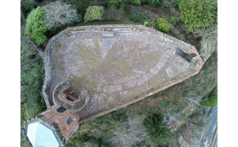
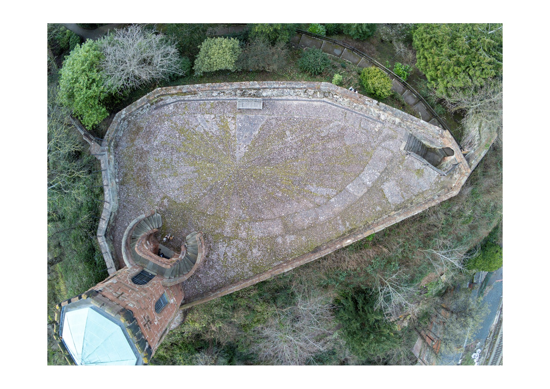
Vertical view of Shrewsbury Castle Motte (copyright James Brennan Associates)
The irregular plan of the motte top seen in the drone photo (undertaken by James Brennan Associates for the current conservation management plan for Shropshire Council, the site owner) arises from a number of factors. Originally probably oval, the straight line across the bottom of the picture is a pale sandstone wall with red sandstone stripes built, probably by Edward I’s masons, across the damaged side of the motte after a landslip into the river below in the 13th century. Laura’s Tower occupies the bottom left corner, set off-centre on the base of a 13th-century tower demolished by Telford. The lobed shape of the motte on the left of the photo results from at least two phases of medieval building incorporated in the retaining walls: an angled structure with a high chamfered plinth and recessed masonry panels, superimposed over a projecting curving rubble footing. These remains were seen and recorded for the first time this year as part of the ongoing CMP work.
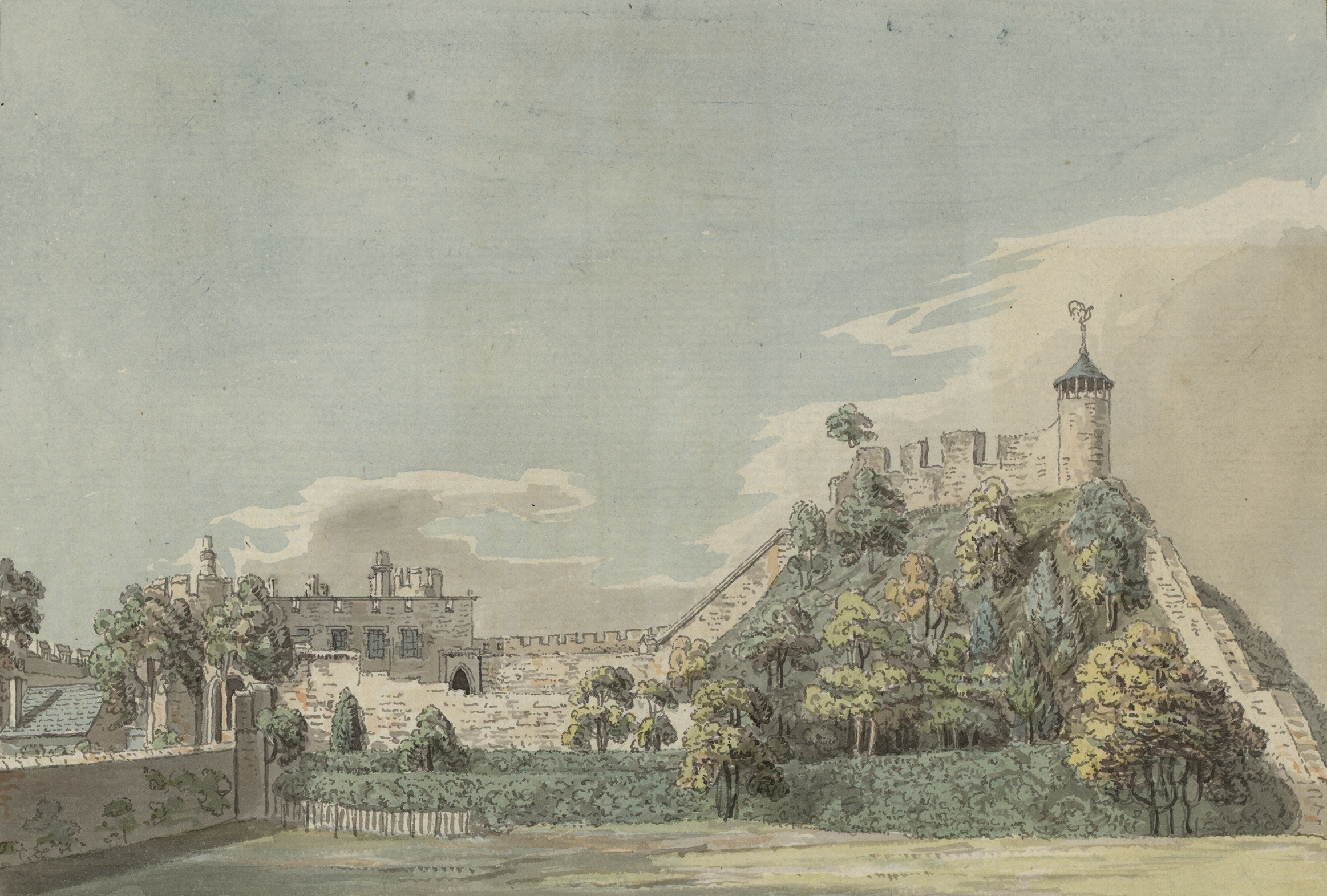
Antiquarian (18c) image of Shrewsbury motte showing what looks like the base of large windows possibly from a first floor Great Hall
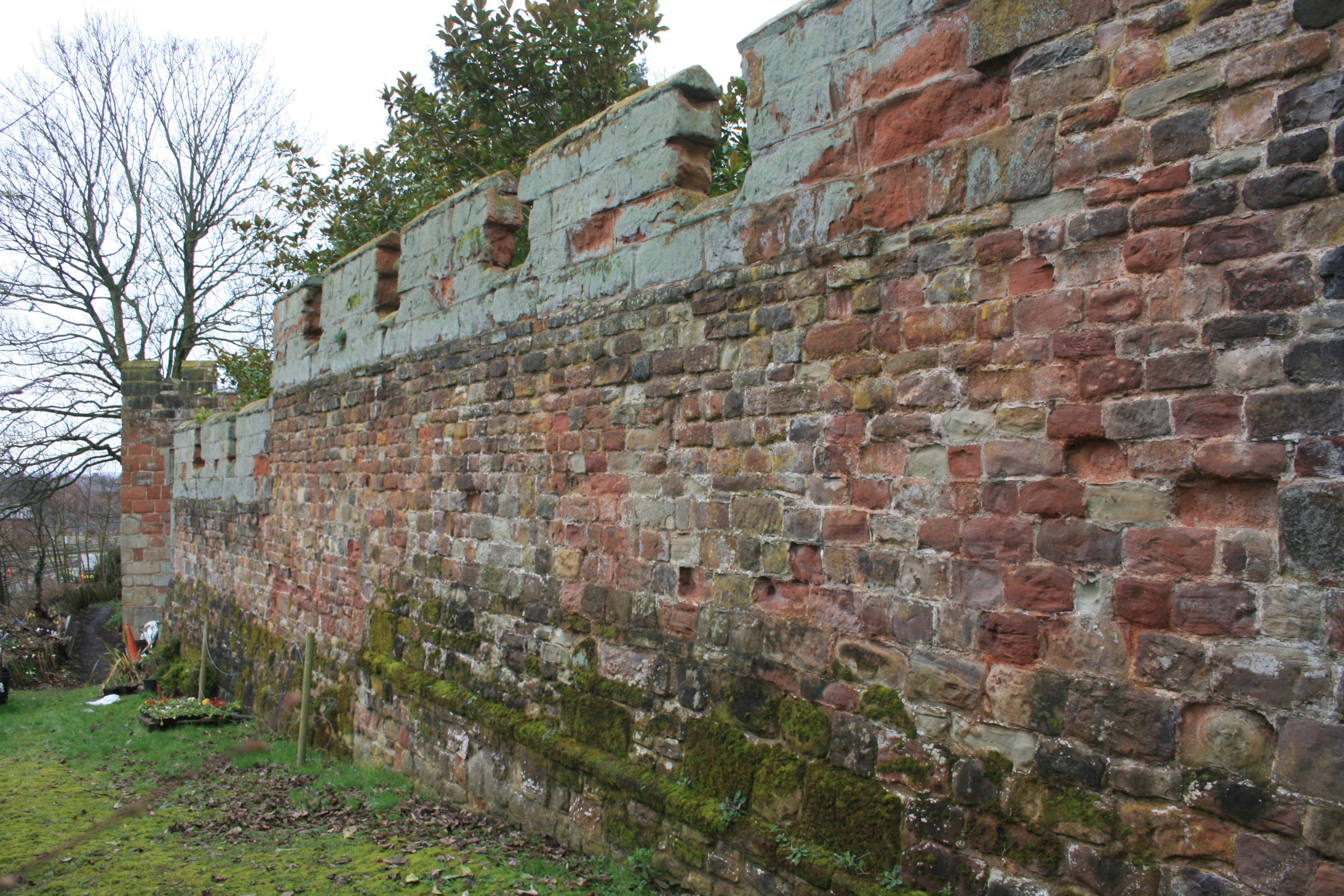
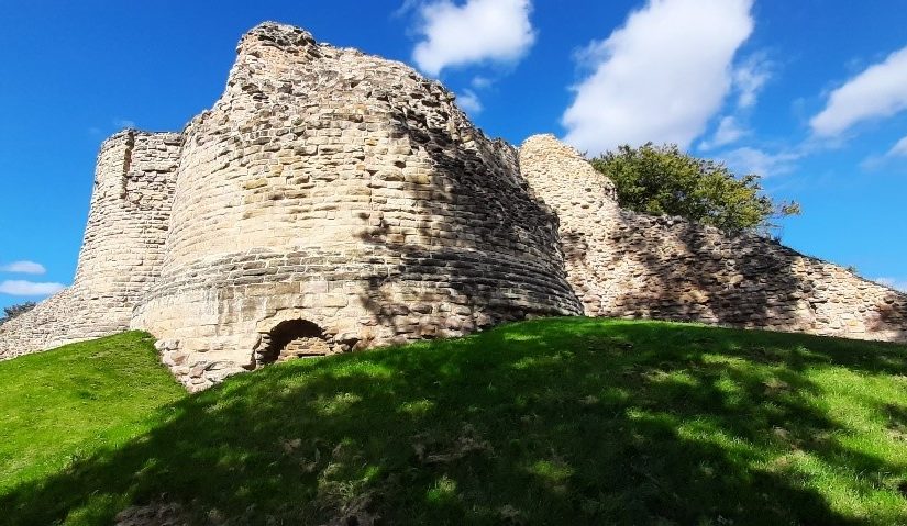
A second trench is to be opened on the north curtain wall. A long stretch of this wall is unusually consistent in its fabric, with small, squared rubble and two offset courses. 18th-century illustrations show however that a projecting bastion formerly stood in this area, of which no trace can be seen in the standing masonry. The suspicion is that a major part of the wall here has been rebuilt, and the trench is designed to explore this question – and to establish the nature of the surrounding stratigraphy.
Part of the north curtain wall of Shrewsbury Castle. The even coursing apparent over this long stretch of masonry is at odds with the complex fabric visible elsewhere in the wall and with 18th and early 19th-century illustrations showing a projecting bastion in this area. Excavation will seek to confirm whether or not this stretch has been rebuilt, and to locate in plan the features seen in the illustrations. Copyright Nigel Baker
In addition to an introductory display to be mounted in the on-site marquee, there will be two further displays in the town running concurrently with the excavations. In Shrewsbury Museum & Art Gallery in the Square, Dr Capper’s team is assembling a display featuring artefacts found in the first two seasons, while in Castle Gates Library (the former Grammar School buildings) a display is in place that explores the evidence for the former castle outer bailey, within whose perimeter the library stands.
The excavations run from July 18th to 28th. Visitors are welcome every day except those when the castle is closed (Thursday 21st and Thursday 28th).
Vicky McAlister, project lead of the Geophysical Survey of Kilmachill explains the reasons behind the survey.
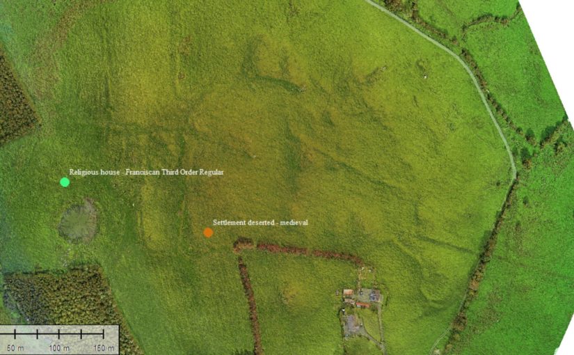
“Can we use drone (UAV) gathered imagery to see how spaces around castles were being used?” This was the question that spurred the addition of geophysical survey to a wider study of the landscape surrounding the deserted medieval settlement complex at Kilmacahill, County Westmeath. The data will then be delivered to the Human-Environmental Exchanges in the Landscape (HELM) project team for analysis to detect possible subsurface archaeological remains. HELM is led by project co-Principal Investigators Dr. Vicky McAlister and Dr. Jenny Immich, with Target Archaeological Geophysical GVC commissioned to undertake the survey.
Kilmacahill was selected for this interrogation because of its layered landscape history and good above surface archaeological remains. The vernacular settlement site of Kilmacahill is adjacent to a Franciscan Third Order Regular monastery and within visual range (c. 1km) of Joanstown motte and bailey, located to the west of the site. The work at Kilmacahill already undertaken includes UAV collected aerial photographs and topographic data over the deserted settlement complex for analysis in geographic information systems (GIS) software.
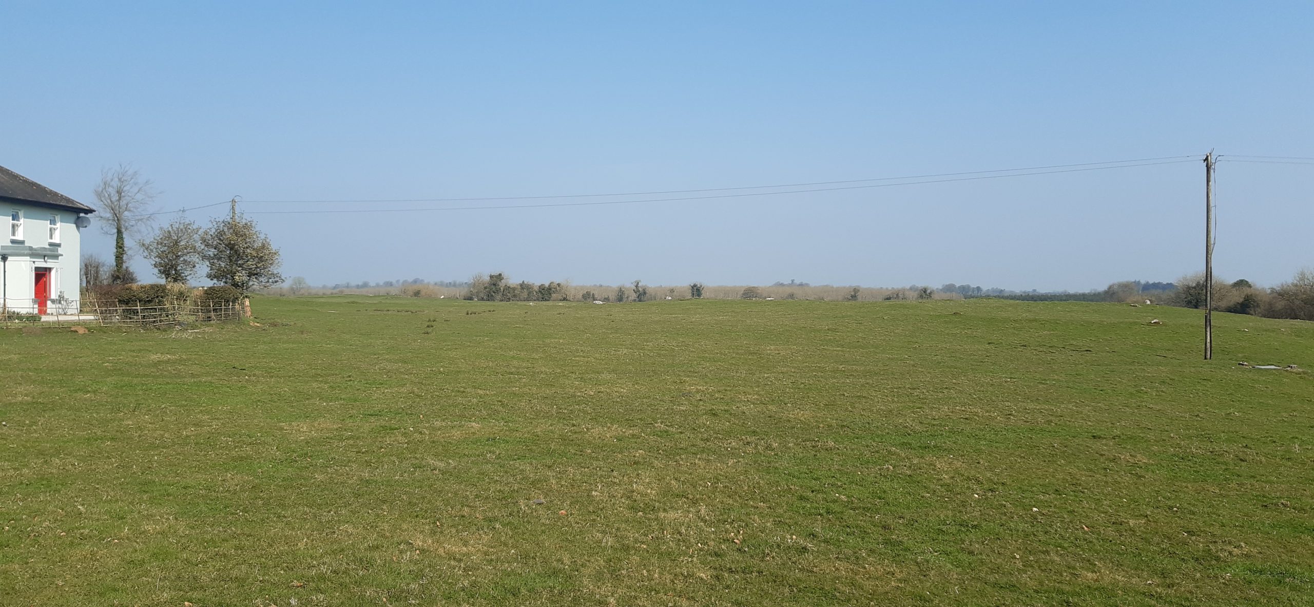
Geophysical Area 1
In its first project phase (2019-2021) HELM addressed the theory that Anglo-Norman medieval vernacular settlements could be found in close physical proximity to elite secular and religious sites. More specifically, we hypothesised that peasant settlement could be found clustered around castle sites, parish churches, and monastic sites. To test this theory, HELM analysed UAV-gathered data for four castle sites in counties Limerick and Tipperary. At three of these four sites we found what we interpreted to be burgage plots clustered in the area between the castle and parish church. One of them, Glenogra in County Limerick, looked to have a deserted medieval village showing different areas and types of house plot compared to the very planned and regular appearance of such plots at the other sites. We wondered if this indicated that both Anglo-Norman settlers and Gaelic Irish tenants were living in this settlement.
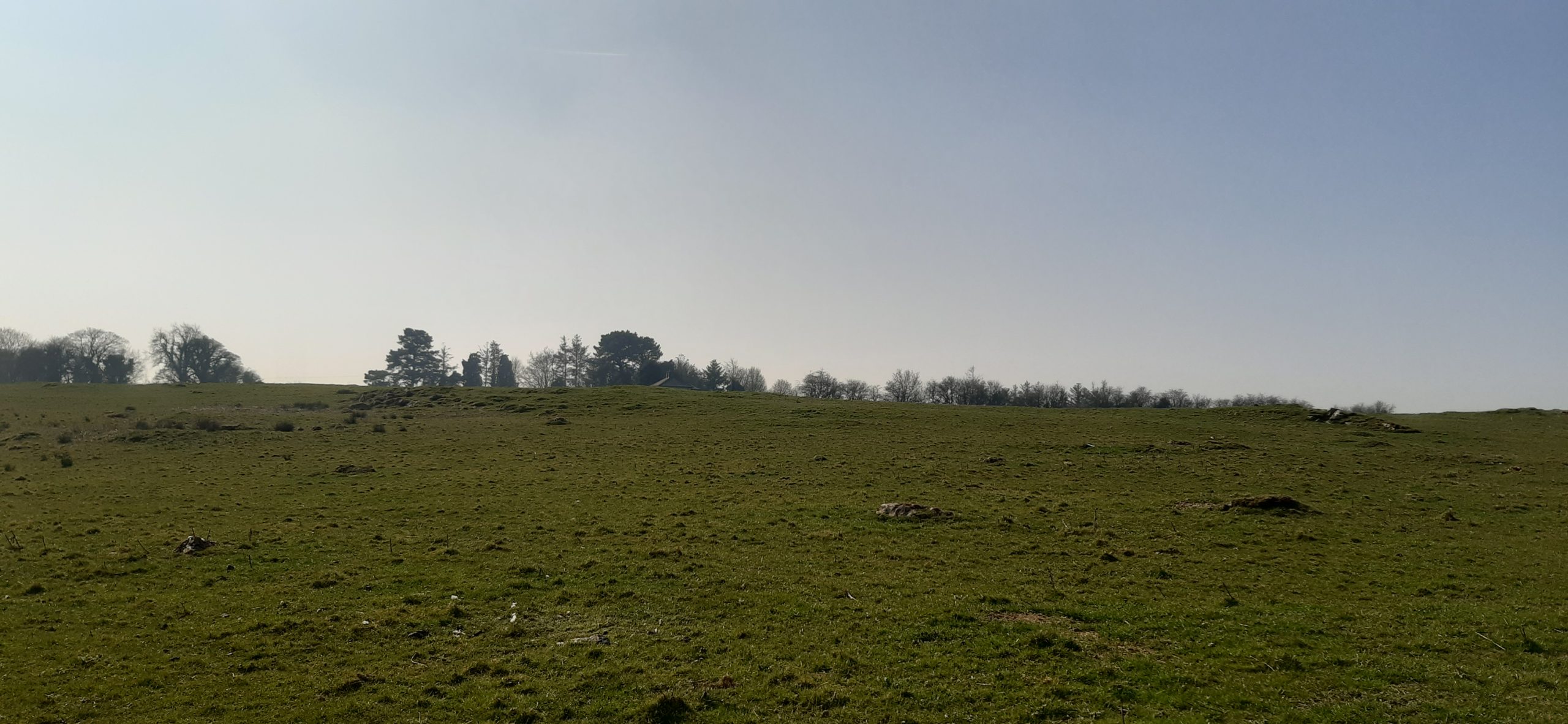
Geophysical Area 2
This led the HELM team to begin phase two of the study, which is looking at three potential deserted medieval settlement sites in County Westmeath: Fore, Kilbixy, and Kilmacahill. Westmeath was the contact zone or frontier between the Anglo-Normans and Gaelic Irish for an extended period of time. This duration made us interested in what the medieval settlements associated with castles there looked like morphologically: more like Glenogra and haphazard, or something else entirely?
In late 2021, thanks to funding from the American Philosophical Society, Dr. Paul Naessens of Western Aerial Survey collected data from UAV flights at these three sites. At one of them – Kilmacahill – he also tested a new addition to the arsenal of digital archaeologists: UAV-mounted multispectral cameras. Multispectral data is traditionally used by scientists as an effective tool to examine soil productivity and plant health. In archaeological contexts, multispectral imagery can be analysed to reflect relative differences in vegetation health as a proxy to indicate near-surface or subsurface anthropogenic features – such as field boundaries made of stone, pits with charcoal in them, crushed gravel pathways, or other architectural features. The vegetation above these man-made features appears not as healthy as that above natural ground in the data analysis. The UAV-gathered photogrammetry data showed some interesting house plots, but also details of a complex circular enclosure not listed on the Sites and Monuments Record.
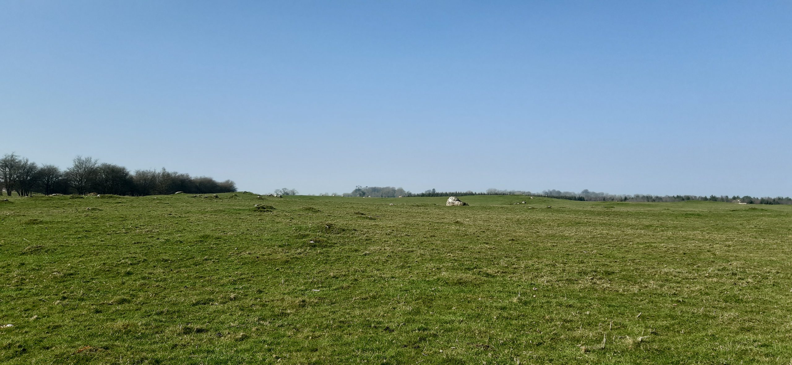
Geophysical Area 3
The HELM team agreed that concentrating our resources on one site would help to test our methodology and thus we applied to the Castle Studies Trust for funding for geophysical survey. We hope that the combination of three methods will tell us the most about vernacular settlement located between the Franciscan house at Kilmacahill and the motte castle at Joanstown. We will also be able to test the robustness of our UAV-based methodology against geophysics, which is much more expensive but is standard practice for identifying low-lying archaeological features. Geophysics currently costs up to ten times the amount of flying a site with a drone, so if we are successful in using UAV data to identify castle features, then this will be good news for everyone seeking to know what’s going on around their sites!
The data produced by the three collection methods (UAV photogrammetry, multispectral, geophysics) will be incorporated in GIS software to create a visual of the immediate subsurface archaeological remains of the DMV and will uncover finer features of the site as a whole. The HELM team should have the exciting results of the surveyed area by Autumn 2022.
Ian Downes from Wakefield Council looks at the geophysical survey being carried out week commencing 9 May 2022 on parts of Pontefract Castle yet to be explored archaeologically. The work, funded by the Trust is being carried out by Wessex Archaeology.
Pontefract Castle in West Yorkshire is a Norman motte and bailey castle, built upon a Saxon royal palace, and used extensively during the English Civil Wars, when it suffered three prolonged sieges. In that time, it went from being the property of a Norman Baron, to a powerful Dukedom, to the principal royal castle of the North of England.
At the end of the Civil Wars the castle was pulled down by the people of Pontefract by order of Parliament. The site was initially used as a market garden before it was leased by the Dunhill family for the cultivation of liquorice. Finally, it was converted into a park in 1880. To this day the site remains a park and major tourist attraction in the town.
Now managed by Wakefield Council on behalf of the Duchy of Lancaster the castle has recently undergone a thorough restoration project seeing the ruins conserved and new visitor facilities created.
Parts of the site were excavated in the 1880s and again in the 1980s. More recently, work commencing in 2017 to restore the site saw new areas excavated including the Gatehouse.
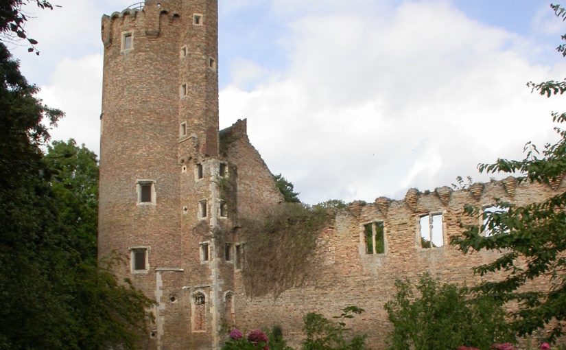
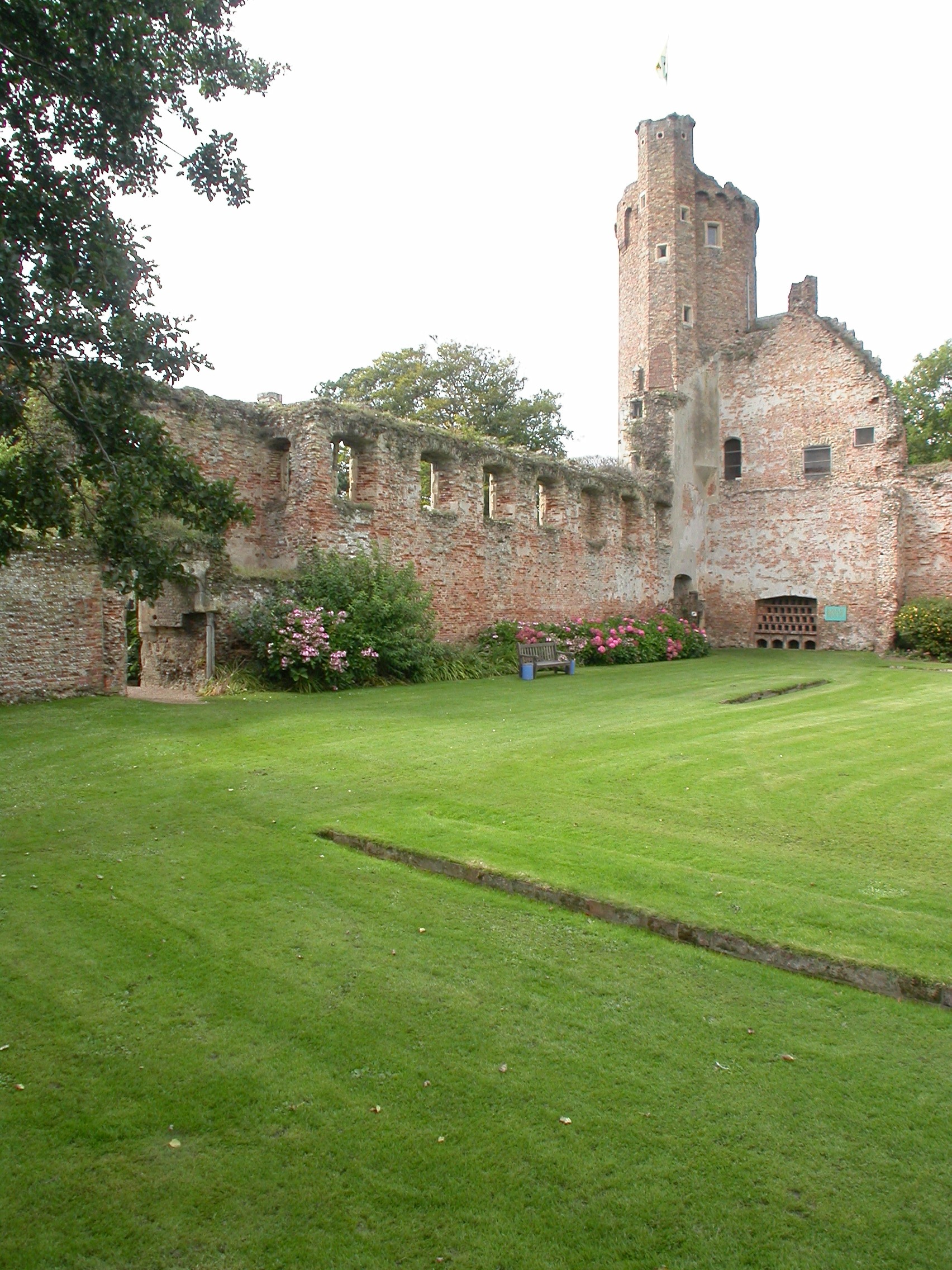
The Keep of Pontefract Castle courtesy of Wakefield Council.
As the Victorian excavations weren’t fully recorded or published, and more recent archaeology has been focused on areas where construction and conservation has taken place, this has left many parts of the site relatively unexplored.
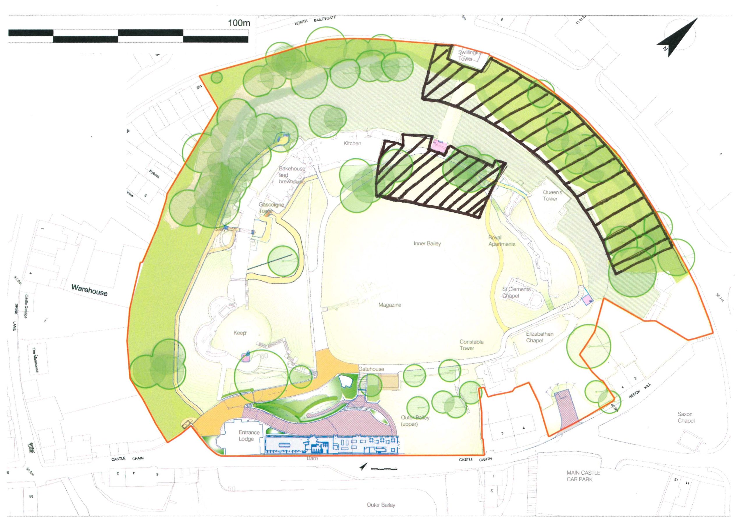
The two areas we will be looking at as part of this project are the area from the Kitchens through to the Royal Apartments within the Bailey; and the northern ramparts below the royal apartments.
The first of those two is where a series of “service buildings” were sited according to historic maintenance records for the castle. We know little more, but it was probably also the site of a gatehouse leading to a walkway to the Swillington Tower. We hope this project will find some evidence of the footprint of the buildings, possible locations of fireplaces and to get an indication of how much survives below ground.
Area occupied by the service buildings between the kitchens and Royal Apartments. courtesy of Wakefield Council
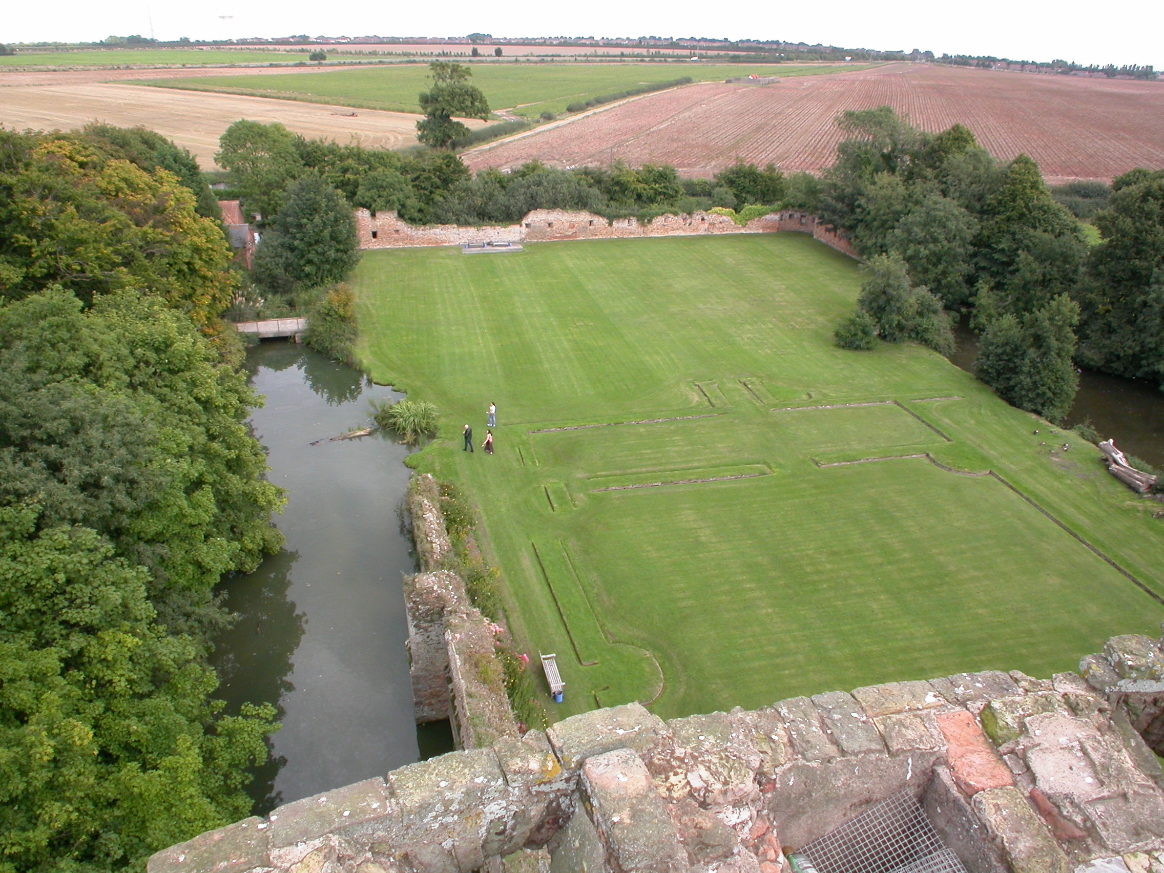
The second area to be investigated is an area outside of the curtain wall, which was subjected to heavy bombardment during the three sieges. This may also be the location of a medieval garden, again mentioned in historical records, and Victorian walkways and paths.
This area should include the bottom section of the walkway from the bailey down to the Swillington Tower. We hope to answer questions such as whether the earth mound at the side of the tower covers the remains of this walkway and how much of it survives under the start of the ramparts.
The site has seen little activity since the Victorian paths were laid, with that area falling into disuse relatively quickly. This lack of later use raises the potential for evidence of all these things, but most excitingly the possibility of pinpointing further evidence of Civil War activity.
The outer ramparts looking from the Queens Tower back towards the Swillington Tower.
The project will see specialists from Wessex Archaeology conduct various forms of geophysics on the two areas including resistivity, magnetometry and ground penetrating radar. The use of multiple techniques has been chosen to maximise the potential for making discoveries with the potential for quite complex buried remains being high.
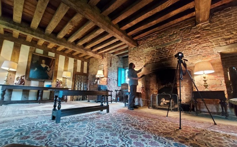
The team at Raby Castle were delighted to hear that their application to the Castle Studies Trust for funding to support the creation of a digital model of the 14th century Nevill stronghold. The acual survey to create the model will not take place until May, but preparation is well underway including extensive documentary research by volunteeers. Their curator, Julie Biddlecombe-Brown who will oversee the project during 2022 reflects here on what the project will entail and what they hope to achieve.
Raby Castle is one of the most impressive intact castles in the North of England. Built in the 14th century by the powerful Nevill family, it has a fascinating history. The castle was seized by the Crown in 1569 after the failed ‘Rising of the North’. In 1626 the castle was purchased by courtier Henry Vane the Elder and has remained in the family ever since. Over the last 300 years, successive generations have altered, updated and modernised parts of the building and although from the exterior, the 14th-century core is still evident, internal reworkings of the spaces mean that it is sometimes difficult to imagine and interpret the castle’s medieval past.
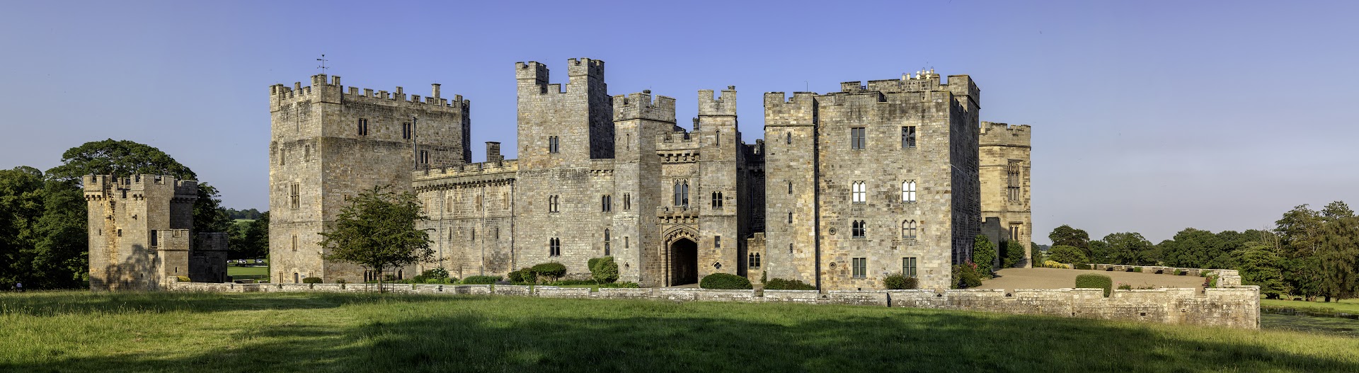
West Side of Raby Castle copyright Graeme Peacock, Raby Castle
In 2016, the castle was inherited by Harry Vane, Twelfth Baron Barnard. Under his stewardship, ambitious development plans were passed to enhance the visitor journey at Raby Castle, Park and Gardens. The dynamic scheme known as The Rising will restore and preserve historic buildings which have been without purpose for decades, providing contemporary event and exhibition spaces, retail and dining experiences and a visitor’s hub. The transformation of the visitor offer at the castle, park and gardens include improved interpretation of the castle building. An important part of this for the Raby team is increasing our understanding of how the castle functioned during it medieval heyday. In 1378 Bishop Hatfield granted John Nevill a licence to crenellate reflecting a building that was changing from a fortified manor house to the castle we see today. Less than 50 years later, John’s son Ralph arranged the betrothal of his daughter Cecily to his young ward, Richard Duke of York; a marriage that would play a central role in the Wars of the Roses and ultimately in shaping British history.
With no significant collections in the castle to reflect this period, Raby’s greatest medieval asset is the castle itself. Alterations over the past 400 years have reshaped the building, modernising it for residents as tastes and technologies changed. Whilst it is still medieval in appearance, key features of the 14th century building have been lost. In order to explore how the castle may have looked before these alterations, our 2022 project will create a digital model of the castle that allows visitors then to view the castle’s past appearance based on our ongoing research.
The creation of the digital model will be carried out by Durham University’s Archaeological Services, using a DJI S900 drone or equivalent. Photographs will be taken utilising a 14mm lens and 36 megapixel sensor, supported by RTK GNSS positioning. The data captured will then be uploaded and processed through Agisoft Metashape Professional and output as a 3D model utilising AutoCad Map 3D and giving the team the opportunity to ‘strip back’ known later additions and ‘rebuild’ known, lost features, such as the Barbican. The resulting model will be used in new interpretation at the castle, sharing our findings with our visitors.
Instrumental to the success of this project will be a team of Raby’s dedicated volunteers. A group of the castle’s regular volunteers formed a research group to work with the curator to pull together all known sources for the castle’s architectural changes to support this project. They have researched documentary sources including primary and secondary accounts, topographical pictures, maps and plans and in advance of the project will be surveying the castle walls. Their findings will be brought together in a portfolio of evidence which can then be reviewed by specialists from Durham University Archaeological Services who will be carrying out further research and eventually creating the model itself.
There has never been a full archaeological survey of Raby Castle and opportunities for research have been limited in the past. This project reflects the ambitions and vision of Lord and Lady Barnard, the castle’s owners who firmly believe that it is by understanding and sharing the castle’s past that we will secure its future. This project is part of that important story.
Castle Studies Trust patron John Goodall explains the reason behind his latest book The Castle (Yale University Press) using the intriguing example of what happened to Caister Castle after the death of Sir John Fastolf, the castle’s owner.
Those who have seen a copy of The English Castle (2011), which I published more than a decade ago, may be surprised to learn that it was originally intended to be a short book. The attempt to tell the story of the architectural development of the castle from the Norman Conquest of 1066 to the Civil Wars of the 1640s, however, inexorably and necessarily transformed it into a long and richly illustrated one. So long and so richly illustrated that, when it was completed, I never thought I would wish to return to the subject.
Several friends and at least one reviewer, however, observed that the story it told about the history of the castle was incomplete. If the castle was—by my own definition—the residence of a noble made magnificent by the trappings of fortification, then what was there to say about such buildings in later centuries? They were right, of course, and this new book The Castle. A History is an attempt to complete a story that my previous book—for all its length and scale—only partially told.
Caister Castle Bailey from the Great Tower copyright John Goodall
Rather than continue the narrative in the same form, however, and produce another door-stopping volume, I thought I would try and condense the whole story of the castle from beginning to end in a single and much shorter volume. In this sense, this second book on the subject of castles is actually cast in the intended form of the first that I planned more than a decade ago. To make this possible I also decided to approach the subject in a way that I hope will strike readers as both unexpected and engaging.
Presented here are effectively a series of anecdotes organised in a huge chronological span of two millennia and drawn from every kind of source, from chronicles to sermons, poetry to building accounts, and novels to correspondence. All of them are about castles or take place within the context of these buildings. There are also some images that are treated in the same way. The result is a story presented through many different modes and voices across a span of over two millennia.
Part of the joy of this approach is that the book can be read in many different ways, either as a volume that the reader can dip into casually at any point or as an overarching narrative. More importantly, however, it allows for the exploration of specific detail in a way that is impossible in a conventional narrative history. In the process, the human dimension of the past is also brought to the fore. As an added benefit it allows for the exploration of small episodes and the specifics surrounding them that would be impossible in a conventional narrative history.
What could be better as a taster for the volume, therefore, than take a relatively well known anecdote about a siege that didn’t make the final cut for reasons of length and present it in the formula adopted in the book.
Caister Castle Great Tower from the Bailey copyright John Goodall
In the autumn of 1459 the childless Sir John Fastolf, a wealthy veteran of the French wars, tried from his deathbed to finalise the details of a long-discussed proposal to turn his seat at Caister—variously described as a ‘great mansion’, ‘castle’, ‘manor’ and ‘fortress’—into a Benedictine Priory and almshouse. When he died on November 5, his trusted administrator John Paston announced that Sir John had issued a final will by word of mouth. This nuncipative will gave Paston control of all Sir John’s property and tasked him with founding the priory. We will never know the truth of Paston’s assertion. Given the value of what was at stake, however, not to mention England’s descent into the Wars of the Roses, it was never going to go unchallenged.
After the Battle of Edgecote on July 26, 1469, Edward IV was briefly imprisoned and royal authority collapsed. A wave of violence broke as individuals across the kingdom took the opportunity to settle scores. Among them was the Duke of Norfolk, who decided to seize Caister by force. The ensuing siege lasted about three weeks and details of it are recorded in the writings of a former secretary of Sir John Fastolph, the scholar, historian and topographer, William Worcestre. He was an excluded executor of Sir John’s will:
Memorandum that at the feast of the Assumption of the Blessed Mary [15 August] 9 years ago was the siege of Caister; Saint Bartholomew’s [Day, August 24] was a cruel day with guns fired at the castle [castrum]; the siege lasted for five weeks and three days.
Here follow the names of the men at arms besieging the castle and fortalice [castellum et fortalicium] of Caister Fastolf, beginning on Monday, [August 21] before the feast of Saint Bartholomew in the ninth year of King Edward IV, the King being at Coventry; and the siege lasted until September 27.
John, Duke of Norfolk… [followed by a list of 37 other knights and squires].
The names of certain defenders of the siege against the Duke:
John Paston junior, esquire, defending the siege in place of John Paston knight his brother, during his absence, being with:
Dawbeney esq slain with a quarrel
Osbern Bernay esq
Valets: Osbern of Caister valet; Sander Cokby of Maltby valet; Richard Tolle valet; Mundynet, born in France; Thomas Salern of Caister; servants of John Paston junior John Vincent; W. Vincent; W. Wod; N, Bylys; Robert Owmond of Maltby. Davy Coke, servant of John Fastolf; John Roos of Filby; John Osbern of Filby; John Norwood; Raulyns, a stranger; William Peny, a soldier from Calais; John Loe of Calais; Mathew, a Dutchman; Thomas Stompys, handless, and wished to shoot for a noble; John Pampyng of Norwich; John Chapman, soldier of the Duke of Somerset; J. Jaksone of Lancashire; J. Sparke of Marsham
And first the said Duke John, before laying siege to the said castle, a week beforehand, sent Sir John Heveningham, knight, a cousin of Sir John Fastolf, to John Paston, junior Esquire, lieutenant of his brother, John Paston knight, for the safekeeping of the said castle for the use of his brother during his absence on service and on business…. The Duke said that he had bought the castle from a certain accursed William Yelverton Justitiar of Norfolk named one of the executors of Sir John Fastolf knight and lord of the castle, although it was against his will and testament that it should be sold, for he had ordained in his testament that it was to be a house of prayer and for poor people, to be founded to pray for ever for his soul and those of his parents. The said lieutenant of Caister refused to deliver up the castle, for that he had not taken custody of it from the Duke, but only from John Paston his brother. Afterwards, within ten days, that is on the said Monday, the Duke himself with his army to the number of 3,000 armed med laid siege to the castle. Three parts of it were under fire from arms called in English guns and culverins [gonnys culveryns] and other pieces of ordnance of artillery, with archers etc.
William of Worcestre, Itineraries (trans. J. Harvey)
The list of the garrison is curious because it shows that besides a force of locals and servants (including the handless Stompys, who ambiguously wished to ‘shoot for a noble’ or gold coin) there was a smaller group of mercenaries, many of them with experience in Calais, then an English frontier town in France. The latter appear to have been given command of sections of the fortifications and in the months before the siege helped train the former. The fighting seems to have been restricted to bombardment followed by negotiation, at the end of which the castle capitulated. Beside the unfortunate Daubeney, whose brass survives at nearby Sharrington Church, two of the besiegers were also killed by a single cannon shot. The Duke issued terms of surrender on September 26 that:
John Paston and his said fellowship being in the said manor shall depart and go out of the said manor without delay, and make thereof deliverance to such persons as we will assign, the said fellowship having their lives and goods, horses and harness, and other goods being in the keeping of the said John Paston, except guns, crossbows, and quarrels, and all of the hostelments to the said manor annexed and belonging…
September 26, 1469, passport to the besieged
The siege was one episode in a long battle over Fastolf’s will but Caister never became a monastery (a 20th-century equivalent would be the donation of a house to the National Trust). Instead, much of his land was used to endow Magdalen College, Oxford.
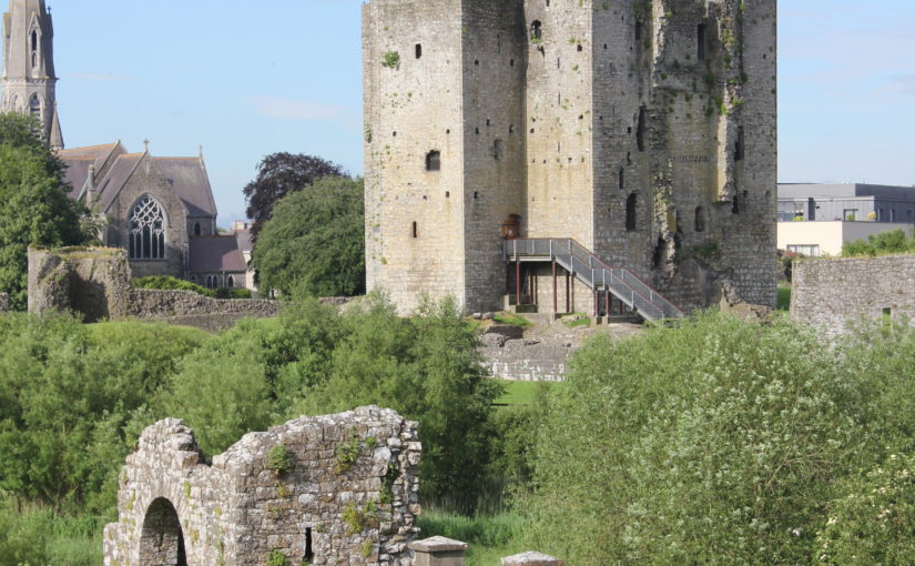
Scott Stull, archaeology lecturer at SUNY Cortland, looks at the results of an interdisciplinary led by Physicist Michael “Bodhi” Rogers, that he took part in looking at the landscape and viewscapes of Trim Castle.
Trim Castle, in County Meath, Ireland, was built starting in 1187 by the De Lacy family as part of the Anglo-Norman conquest of Ireland. After a long history of conflict, disputed ownership, expansion, change, and decay, the castle was finally abandoned in the mid-sixteenth century when it was described as being full of cattle and dung. The medieval landscape around Trim is remarkably well preserved, including the walls of the town, a fourteenth-century bridge over the River Boyne, a variety of religious institutions, and the farmlands, called the Porchfields, which still have their ridge and furrow plough marks.
In 2016 and 2017, Michael “Bodhi” Rogers led a team of students to digitally record Trim Castle and the surrounding landscape. That scanning project was described in Archaeology Ireland (https://www.jstor.org/stable/pdf/26565802.pdf). The results of that project allowed further study and analysis of the landscape, and specifically the viewscape, of Trim Castle. In a three-way interdisciplinary project, Scott Stull (archaeology), Michael “Bodhi” Rogers (physics), and Michael Twomey (medieval literature) looked at Trim Castle and how the views from the castle were carefully constructed as part of the creation of medieval power and authority.
Trim Castle showing the Dublin Gate (foreground) and Keep (background), image credit Michael “Bodhi” Rogers
The starting point for this study, which is a chapter of the upcoming volume, Bailey, Kinsella, Thomas (eds) Architectural Representation in Medieval Textual and Material Culture (Arc Humanities Press, 2022), is the concept of the cultural landscape. The cultural landscape is how people shape a landscape and put meaning on it, to influence perception, behaviour, and patterns of social interaction. It can be practical, such as food production, or it can be tied to belief systems, such as religious sites, places associated with an ethnic or group identity, or associated with structures of power and authority. Castles, while often associated with military activity, embody most of these elements, and as part of the cultural landscape help create beliefs that support those practices and perceptions.
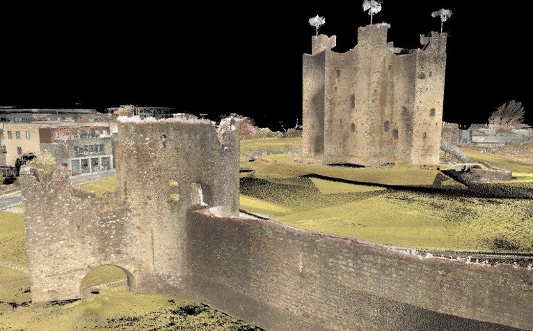
Viewscapes are a specific aspect of a cultural landscape, and in this case are the views from the castle. At Trim, the castle is placed to oversee the town, roads, bridge, farm fields, and religious institutions. There are a variety of ways to identify and record viewscapes, such as with mapping and GIS systems (for example: Lisa Karen McManama-Kearin, The Use of GIS in Determining the Role of Visibility in the Siting of Early Anglo-Norman Castles in Ireland, BAR British Series 575, Oxford: British Archaeological Reports, 2013). Our study, overseen by Bodhi Rogers, used ground-based lidar to make a 3D record of Trim Castle and its surroundings. The result of the recording is effectively a 3D photograph which you can examine from any angle or point in space. This allows us to see from windows which are inaccessible physically, or from spots which have been lost due to decay or collapse over time.
Digital record of Trim Castle showing the view from the Constable’s Tower toward the Dublin Gate and River Boyne, image credit Michael “Bodhi” Rogers.
While a useful modern tool, viewscapes were a fundamental part of the medieval understanding of castles. We see castles used as viewing platforms, as symbolic places of literal and figurative elevation, and as part of medieval romances where the view from the window represents both the desire and distance of a romantic attraction. In many cases, the lady views the desired knight from the castle window, and the knight is inspired by the glimpse of the lady in the window, affirming the ideals of courtly love. Religious allegories have the castle as a tower of morality, and the viewscape is often overlooking humanity in all its faults and mundanities. By looking at medieval literature, we can gain an understanding of the medieval mindset.
Combining the physical context of a castle with the medieval mindset allows us to gain a more complete understanding of medieval life. The nobility used castles as structures of power and created a cultural landscape which made that system of power seem normal and natural. Castles were a central part of everyday life in medieval Europe, and the lived experience of medieval people was shaped by the created landscapes in and around a castle. At Trim, the castle overlooked the social and economic centres of the community, from the Porchfields to the monasteries. The viewscapes from the castle were specifically created to reinforce the position of the De Lacy family and its successors over the lands and cultural landscape in Trim. Trim castle was the dominant element in both the physical and social landscape.
As the team has now finished its field work at Caerlaverock Castle as part of a project to try and understand the impact of climate change on the changing of the location of the castle in the late thirteenth century, they are now testing the samples in their labs. Here, in two short videos, Tim Kinnaird shows what is involved in the luminescence dating process
In 2020, the Castle Studies Trust funded Dr Karen Dempsey to undertake an innovative new line of research in castle studies, namely to explore the use of plants in castles in medieval Ireland. In this article, Karen explains what she and her colleague Dr Fiona MacGowan discovered.
Over the course of this Pandemic many people have a newfound or renewed appreciation for the green world that we live in. This might take material form by growing potted plants at home and if fortunate caring for a garden space of your own or somewhat less tangibly, the contemplation of changing seasons in your local park. The (anecdotal) health benefits we might feel from these activities are increasingly underscored by health professionals who assure us of the roles of green spaces in wellbeing. This connection is not a modern phenomenon – plants (and gardens) played a significant role in the diet, healthcare and spirituality of people living as part of castle households.
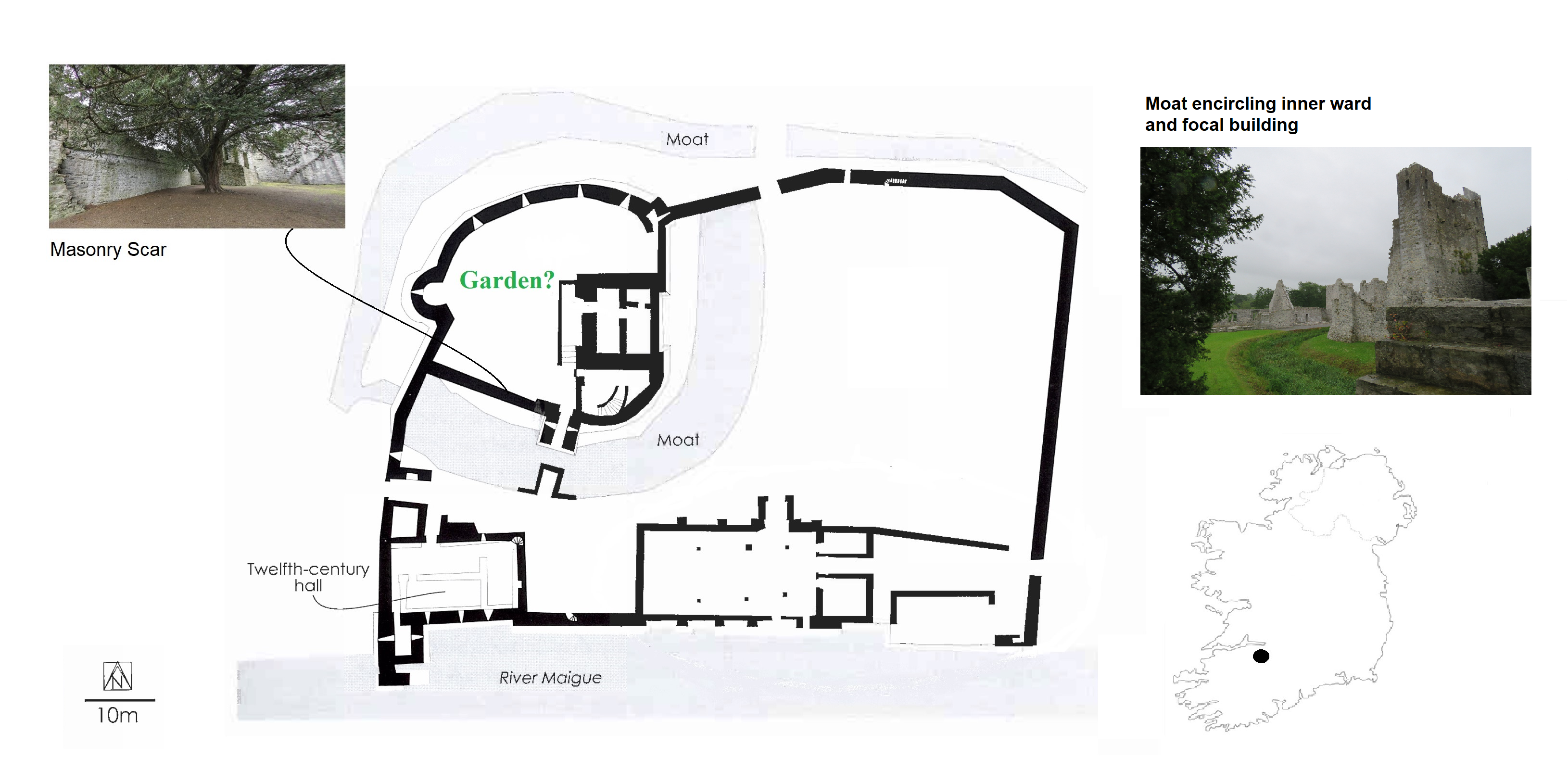
‘Sowing Seeds of Interdisciplinary Work’, the Castle Studies Trust funded project, showed how relict plants can deliver new insights into everyday life at medieval castles. Relict plants – understood to be the descendants of plants grown, cared for and used by (medieval) people – were identified through botanical surveys at four geographically diverse but culturally similar medieval castles: Adare, Co. Limerick, Castleroche, Co. Louth, Carbury, Co. Kildare and Castlecarra, Co. Mayo (as detailed in my previous blog post). As an initial step in researching relict plants, particular attention was paid to archaeophytes, those plants which arrived in Ireland pre-1500 CE. I believed that these plants may have participated in the various colonisation processes of the twelfth century. Their introduction could be linked to new gardening and other health practices especially those related to novel plant medicines which were emerging across Europe at this time but were perhaps previously unknown in Ireland.
Relict Plant Findings
Botanical surveys began during mid-2020 in the very wet months of June and July after a hot May.
Next site on our Relict Plants project @CastleStudies is Castle Carra Co.Mayo. Built by Adam de Staunton c. 1240. Castle with hall and chamber, with the vill, parish church and abbey c. 1km east. pic.twitter.com/yJISGh7DiL
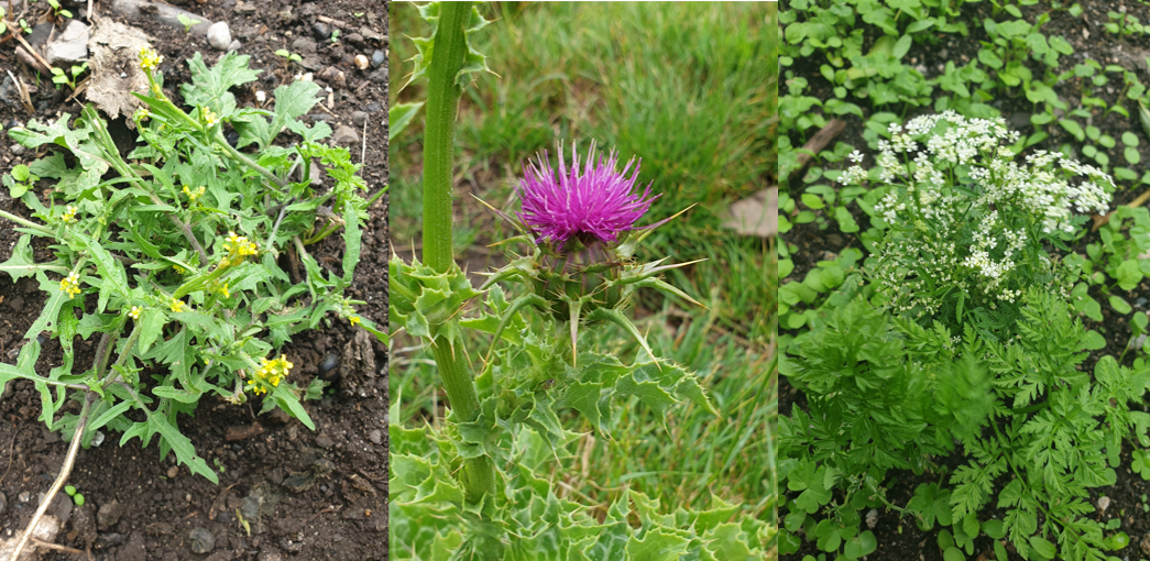
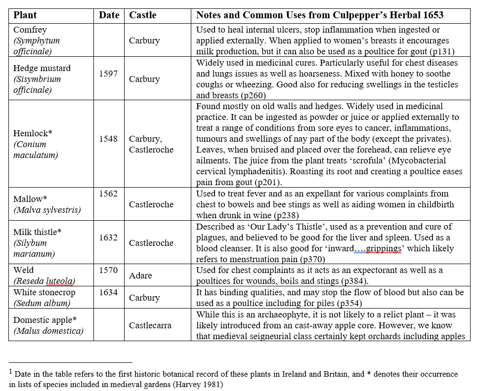
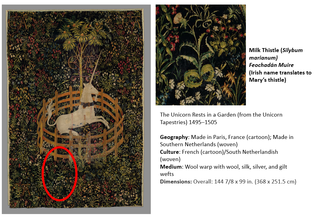
Over the course of the survey eight archaeophytes were revealed (Table 1) as well as a range of rare and common native plants. You can read Dr MacGowan’s botanical report here. These findings are significant: four of the eight plants were historically recorded as present in medieval gardens. The plants – comfrey, mallow, milk thistle and hedge mustard – are widely recognised as having medicinal properties (Fig 1). They feature in medieval recipes, continued as part of the tradition of plant medicine captured in Culpepper’s Herbal of 1653 and some, like milk thistle, remain in use today (see Table 1).
Figure 1 Milk thistle at Castleroche; Hedge mustard and Hemlock (Conium maculatum) at Carbury; (pictures by Dr MacGowan)
Table 1 List of Archaeophytes and neophytes at four selected castles in Ireland[1]
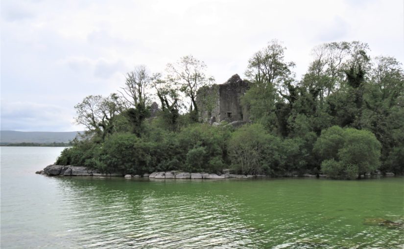
Figure 2 Castleroche, Co. Louth, sited for maximum spectacle across a locally significant elevation at the foothills of the Mourne Mountains
Relict Plants in their Castle Contexts
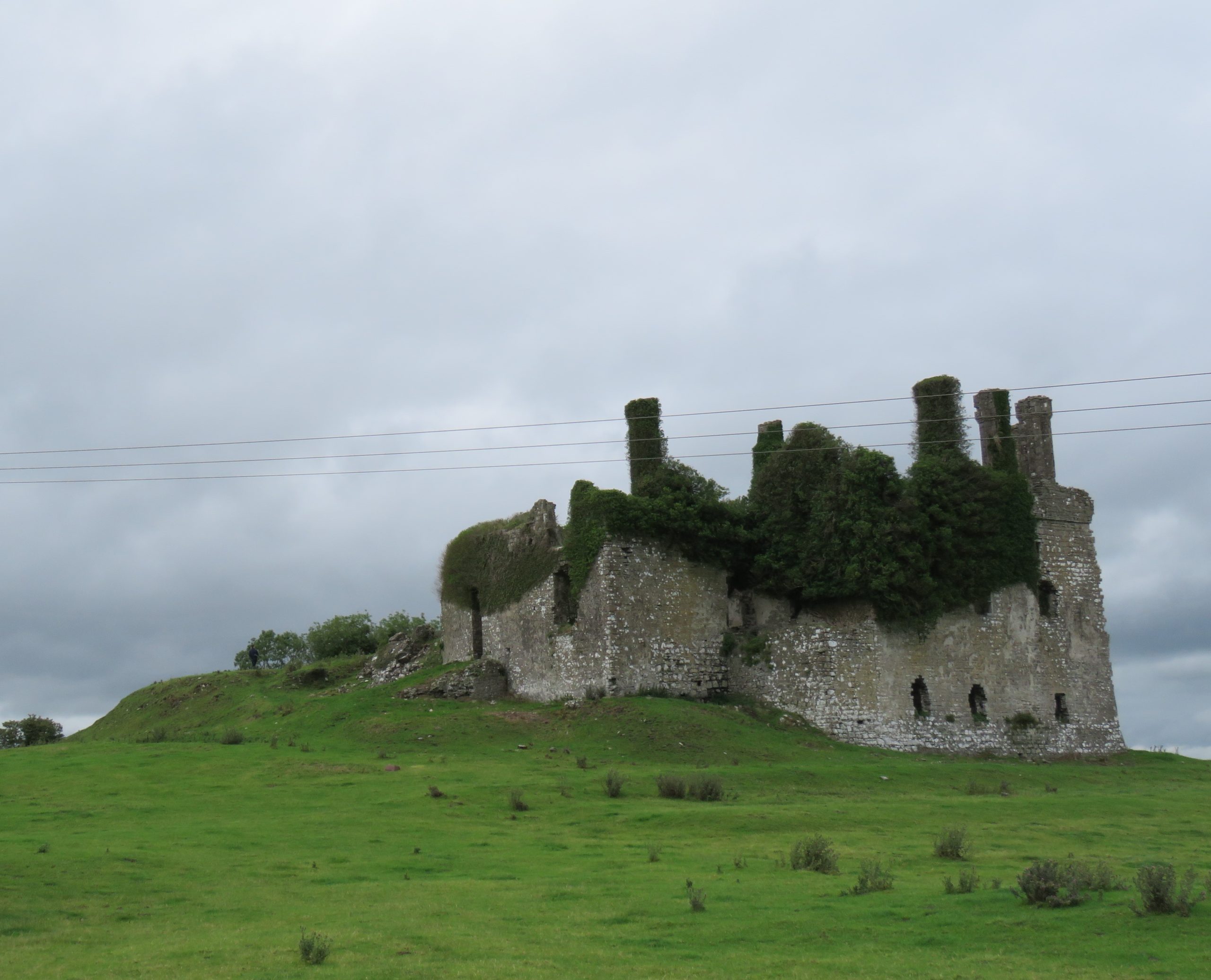
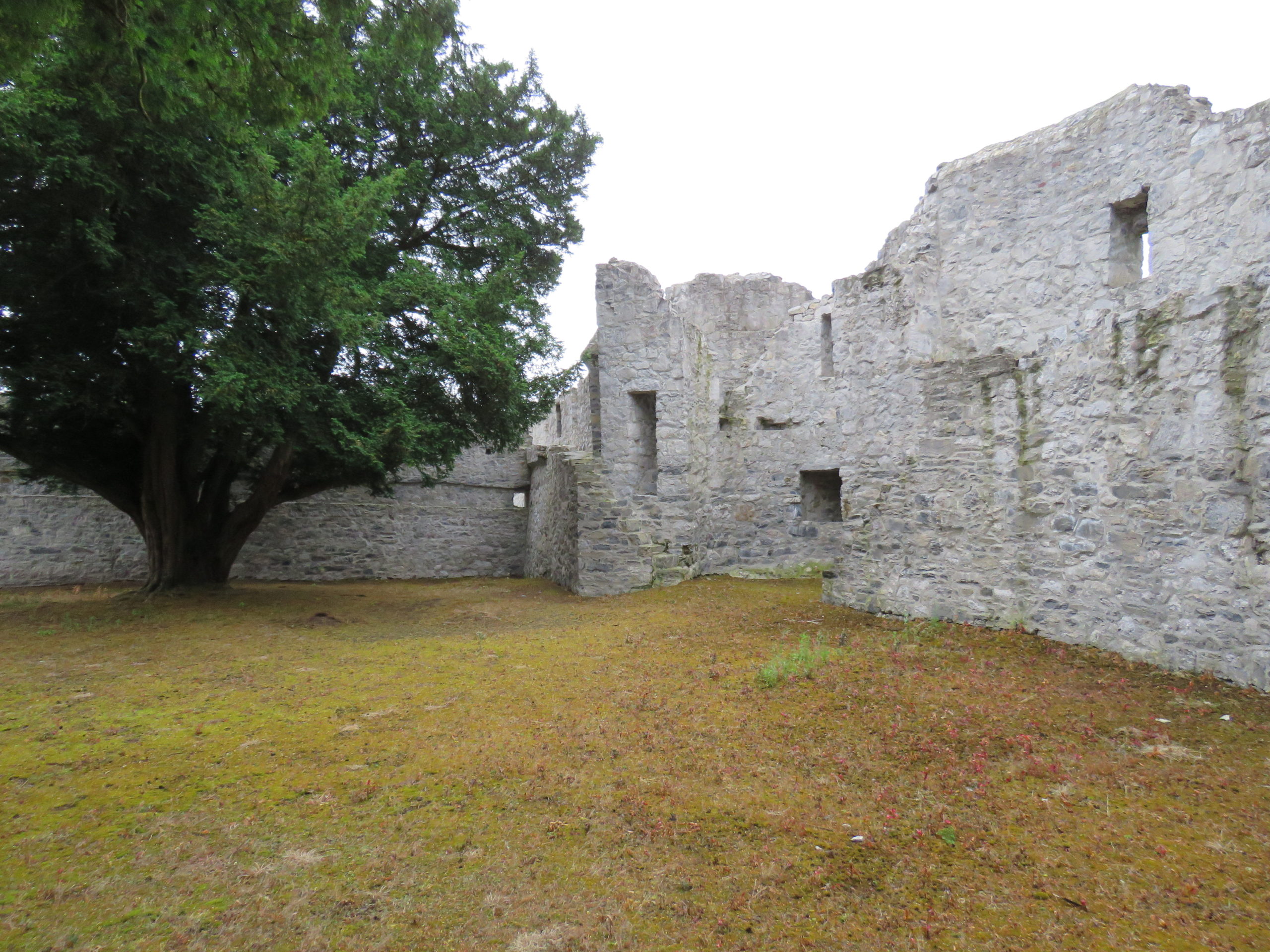
Castleroche was the first site surveyed for our fieldwork. It is spectacularly situated on a locally significant rocky outcrop, framed to the north by the foothills of the Mourne Mountains (Fig 2). The castle has been long understood as a defensive site, believed to have been positioned as authoritative infrastructure to exercise territorial control. Its’ patron, Roesia de Verdun (d.1247) is renowned as the only historically attested woman to have founded a castle in thirteenth-century Ireland This castle while now in ruins was once a busy place with an associated village replete with a weekly market and annual fair. I considered this site to have great potential for relict plants given that historic sources noted the presence of ‘gardinia’ (gardens associated with castles) coupled with the high-status of its’ patron who had a considerable number of estates across England and France. These connections must have given her and her staff access to, and knowledge of, different cultural traditions including gardening and medicinal practices. We were delighted to identify three archaeophytes: Hemlock (Conium maculatum), Mallow (Malva sylvestris) and Milk thistle (Silybum marianum). Milk thistle is a particularly important identification, it is very rare in Ireland and Britain. For medieval people, it was culturally and symbolically tied to the Virgin Mary as well as understandings of fertility and motherhood (Fig 3). This allows us to reconsider the idea of Castleroche only as a frontier site; perhaps there was a diverse resident population for much longer than previously understood. Their health concerns may be represented by the continued occurrence of these plants. Exploring the botanical legacy of Castleroche adds further layers to the story of this complex site.
Figure 3 The Unicorn Rests in a Garden (from the Unicorn Tapestries) 1495–1505. https://www.metmuseum.org/art/collection/search/70007568Figure 4 Carbury, Co. Kildare: a multiperiod castle complex comprises a motte, an early masonry focal building with later additions including an Elizabethan extension crowned with multisided cut stone chimneys
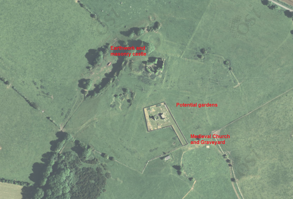
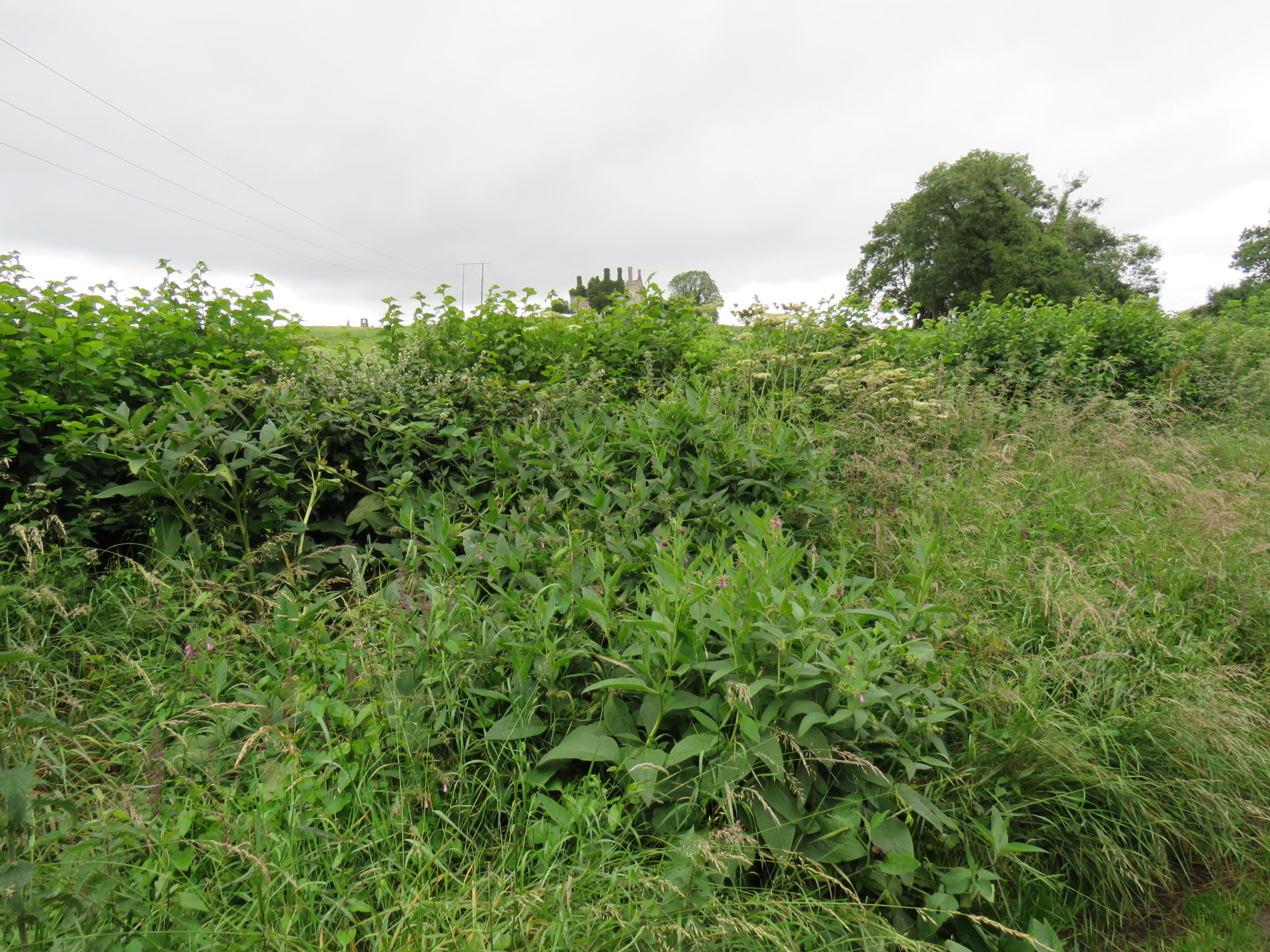
A less well-known castle but equally deserving of attention is the medieval settlement at Carbury (Fig 4). This multiperiod complex comprises an earthwork castle, a twelfth or very early thirteenth-century masonry castle with later additions including an Elizabethan extension and related gardens (Fig 5). Carbury is entangled with generations of nobles. It acted as a central node in shifting political allegiances and dynastic disputes within the territory of Leinster. The longevity in occupation of Carbury is interesting, it attests – at least in part – to its suitability as a residence. Is this reflected in the immediate castle landscape? Is there a possibility that the early-modern gardens here overlay medieval predecessors? Four archaeophytes were found at Carbury: Hemlock, Comfrey (Symphytum officinale), Hedge mustard (Sisymbrium officinale) and White stonecrop (Sedum album), three of which were adjacent to or within the masonry castle and the fourth – Comfrey – which was found within the hedgerow that forms the historically significant boundary to the castle landscape (Fig 6). These plants are not uncommon, but perhaps their relative ubiquity is reflected in their suitability for use within different plant medicine traditions. Comfrey is particularly notable, known as knitbone, it was widely used as a healing poultice for broken bones throughout medieval medical texts. Pharmacologically, this plant contains allantoin, which promotes the creation of new cells and healing of connective tissue. Relict plant studies at Carbury allows us to reflect on how this place was a home to many different generations of people who participated in caring roles (for plants and people) whilst also being a locus for political tensions.
Figure 5 Aerial Imaging of Carbury Castle with evidence for potential gardens surrounding the castle.Figure 6 Comfrey (Symphytum officinale) and Hedge woundwort (Stachys sylvatica) noted among other medicinal plants in hedgerow with Carbury Castle in background
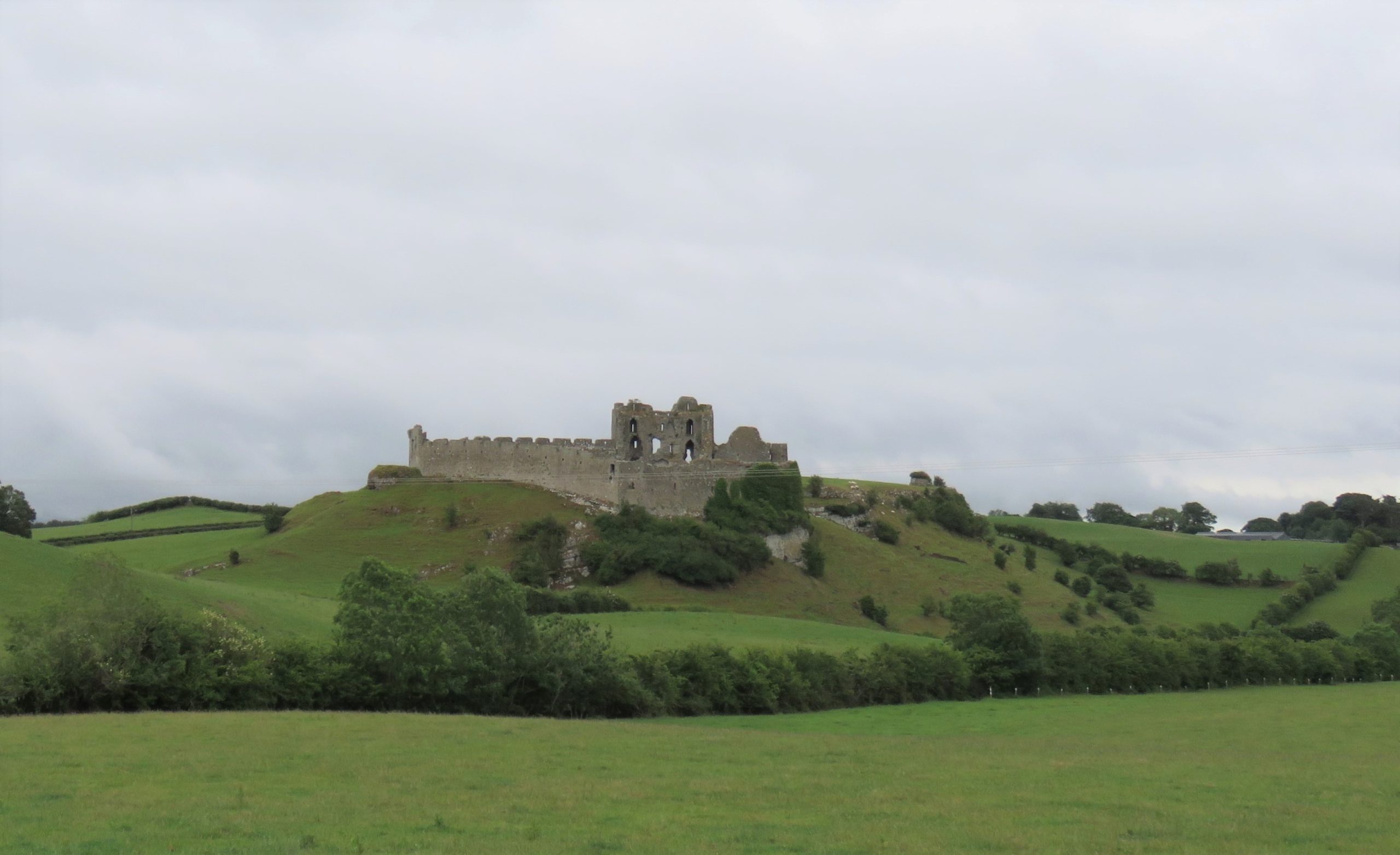
With these exciting discoveries at both Castleroche and Carbury, we were very hopeful that the survey at Adare Castle would be equally rewarding. Adare was an important castle as the caput of the Geraldine family. Unlike the other sites, it has been subject to major study including detailed historical and archaeological investigation. Adare Castle was constructed on a pre-Norman power centre from which the castle emerged as a large D-shaped earthwork with a surrounding large ditch and river-fed moat (Fig 7). This later formed the inner ward, which was further enclosed by an external wall to the north-west with a single mural tower and a gatehouse to the south. The outer court is enclosed by masonry walling which is augmented by a ditch to the north and west. At Adare, the grounds are intensely managed, with manicured lawns and ongoing pesticide use (Fig 8). Unfortunately, this was particularly pronounced in the inner ward, the area I have suggested was likely to have contained an enclosed garden. Disappointingly, only one archaeophyte was identified: Weld (Reseda luteola). This dyeplant was predominantly used to give a bright colourfast yellow but also used medicinally to treat chest complaints. A number of neophytes – those plants whose introduction post-dates 1500 CE – were found in the associated areas surrounding the castle as detailed by Dr MacGowan. Species such as Himalayan pheasant berry (Leycesteria formosa) were identified, indicating that relict plants studies can also illuminate the afterlife of the castle when it played a role as a romantic ruin in the eighteenth-century landscape of Adare Manor. This shows the potential for relict plants studies to add layers to castles stories across their life histories.
Figure 7 Plan of Adare Castle with possible garden (after Dempsey 2021 and O’Keeffe 2015)Figure 8 Adare Castle, inner ward subject to extensive pesticide use
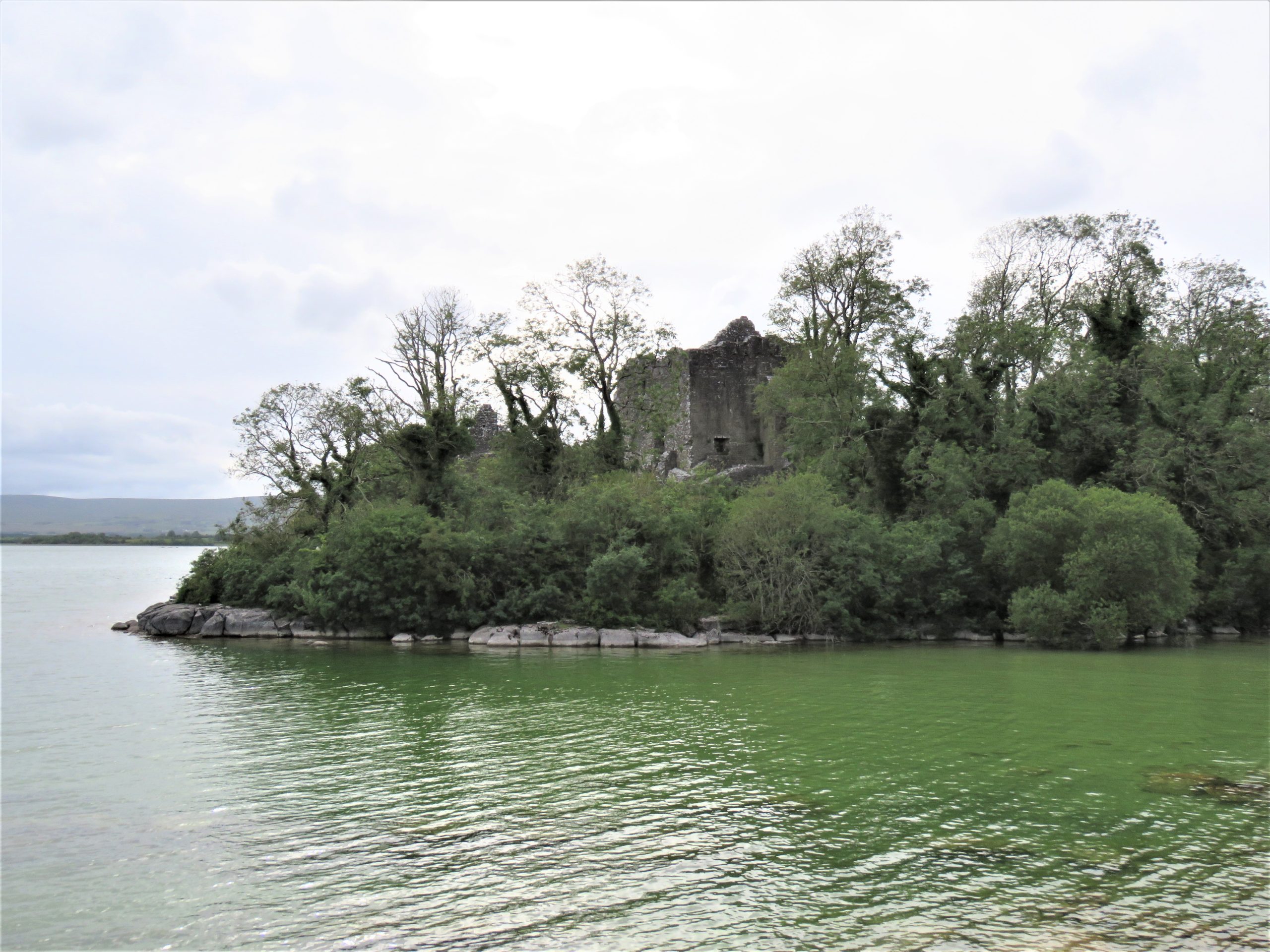
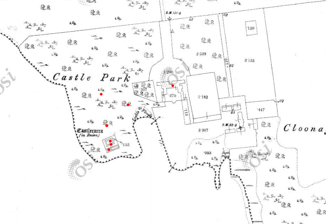
The final site, Castlecarra, falls lower down the social hierarchy of medieval Ireland than the other three castles but it was still an important baronial residence (Fig 9). It is situated on the eastern shore of Lough Carra. The castle now comprises a large three-storey focal building set within a very compact enclosure which is a later, potentially fifteenth-century addition. The castle was constructed as one part of the c. 1236 Anglo-Norman territorial expansion into Connacht. This site, like the others, has a long history of occupation. An early-modern (sixteenth-century?) house was constructed c. 125m NE of the castle, and the surrounding landscape appears to have been remodelled to suit a new tradition of landscape gardening which included a ha-ha and tree-lined avenue of Hornbeams (Carpinus betulus) (Fig 10). Archaeophytes were not recorded at Castlecarra but numerous native species as well as neophytes were present. This absence is remarkable but perhaps native plants at Castlecarra served the castle household needs. For example, Purging buckthorn (Rhamnus catharticus) was identified. This plant is native but rare in Ireland, and it was used medicinally as a purgative, as the name suggests. The botanical profile of Castlecarra leads to further questions around the transmission and sharing of medicinal and plant knowledge.
Figure 9: Castlecarra, Co. Mayo on shore of Lough CarraFigure 10 Castlecarra, Co. Mayo: a multiperiod site with medieval castle that forms part of the landscape of an early modern (c. later 16th / early 17th house). Ordnance Survey Map 1925, Castlecarra to lower left and historic home including outbuildings and gardens centrally placed. https://maps.archaeology.ie/HistoricEnvironment/
Research, Heritage Futures and Reflection
One of this project’s aims was to test and refine the methodologies of relict plant studies for medieval castles. In Ireland there are currently 96 species recorded as archaeophytes (but with no established dates of introduction). Despite the findings of some notable plants, the overall numbers of archaeophytes at the castle sites in ‘Sowing Seeds’ seemed low. Of course, our findings may have been constrained by single survey days, unseasonal weather as well as conservation and management issues – both present-day and historic. Future work is necessary. It is important that sites have the benefit of multiple visits across a wider seasonal survey period. Nevertheless, the baseline botanical surveys of this project will be of use for future research within and outside of castle studies. It has also revealed the need for a detailed survey of archaeobotanical evidence from excavations in Ireland to establish as far as possible exact introduction dates for particular plants.
Including a wider range of plants and castles over a longer time span would provide comparative material with a greater capacity to capture change over time. Neophytes were noted in the botanical surveys but not part of the research agenda for ‘Sowing Seeds’. Their occurrence at castle sites may be revealing of expanding connections with sixteenth-century colonising and trading practices beyond Europe. Later medieval towerhouses are of particular interest as they are often situated within less managed and therefore within potentially better-preserved landscapes. But equally, native plants should also be included. For example, self-heal (prunella vulgaris) and pellitory-of-the-wall (Parietaria judaica) occur widely and were both used as medicinally. It would be of great interest to compare and contrast different plants at castles whether native, anciently introduced or more recent. Consideration too could be given to the afterlives of medieval castles as romantic ruins as indicated at Castlecarra and Adare. This would develop a wider appreciation of the long lives of medieval castles that continue in dialogue with contemporary communities as heritage today. Relict plant studies enable castle studies to participate in emerging conversation around green heritage and climate change.
‘Sowing Seeds’ was a novel project – both conceptually and methodologically – I wanted to find a way to explore potential ‘green identities’ of castle households. Accessing the relationships medieval people may have had with their environments (as we might term it today) offers a different way of telling stories about the medieval past whose narratives are often caught into concerns of power, authority or control. By including botanical surveys of relict plants in castle landscapes, we have expanded further the multidisciplinary approach of castles studies. We can show how stories of castles are richly textured: populated by many people and plants over the course of their lives and beyond into their afterlives as romantic ruins and archaeological monuments. Doing this for the first time meant engaging with new material and unfamiliar sources from archaeology, history, and medical knowledge to heritage and folklore. This wide-reaching research methodology is a core strength of this project. It enables a dialogue between different disciplines that are traditionally separate or rarely integrated. These findings are a beginning: they encourage new avenues of future research on castles households relating to human-plant relations, plant medicine and related concepts of care. The results also invite conversations with heritage agencies regarding site management and conservation practices of both biodiversity and past vegetation. Rather than offering conclusive findings, we have revealed tantalising hints and a vast array of potential new avenues in which to take this research.
This research was generously funded by the Castle Studies Trust. Their support enabled new ideas to be explored. As an early career researcher being awarded a grant to undertake (potentially) interpretatively risky work is a wonderful opportunity.
Helpful commentary and feedback was received from two assessors whose insights improved this report.
Thanks to Dr Fiona MacGowan for participating in this research project and carrying-out the botanical surveys at the selected sites.
Thanks to the landowners of Castleroche, Castlecarra and Carbury, and the Office of Public Work who manage Adare, for access to the sites for this project.
[1] Dates in the table refer to the first historic botanical record of these plants in Ireland and Britain, and * denotes their occurrence in lists of species included in medieval gardens (Harvey 1981)
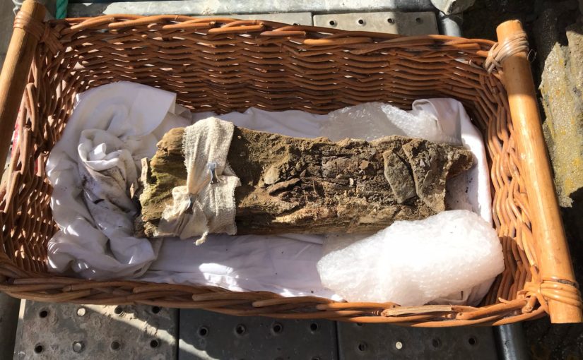
In September 2021, Dr Coralie Mills and Hamish Darrah from Dendrochronicle along with a team from Historic Envirnoment Scotland led by Rachel Pickering removed an original timber from the Great Tower at Old Wick in Caithness to help date the castle.
Following on from the successful removal of the piece of wood Dr Coralie Mills and her colleague Hamish Darrah have taken the wood back to their lab for further analysis. In three short videos they explain what they have been doing and what they have found.
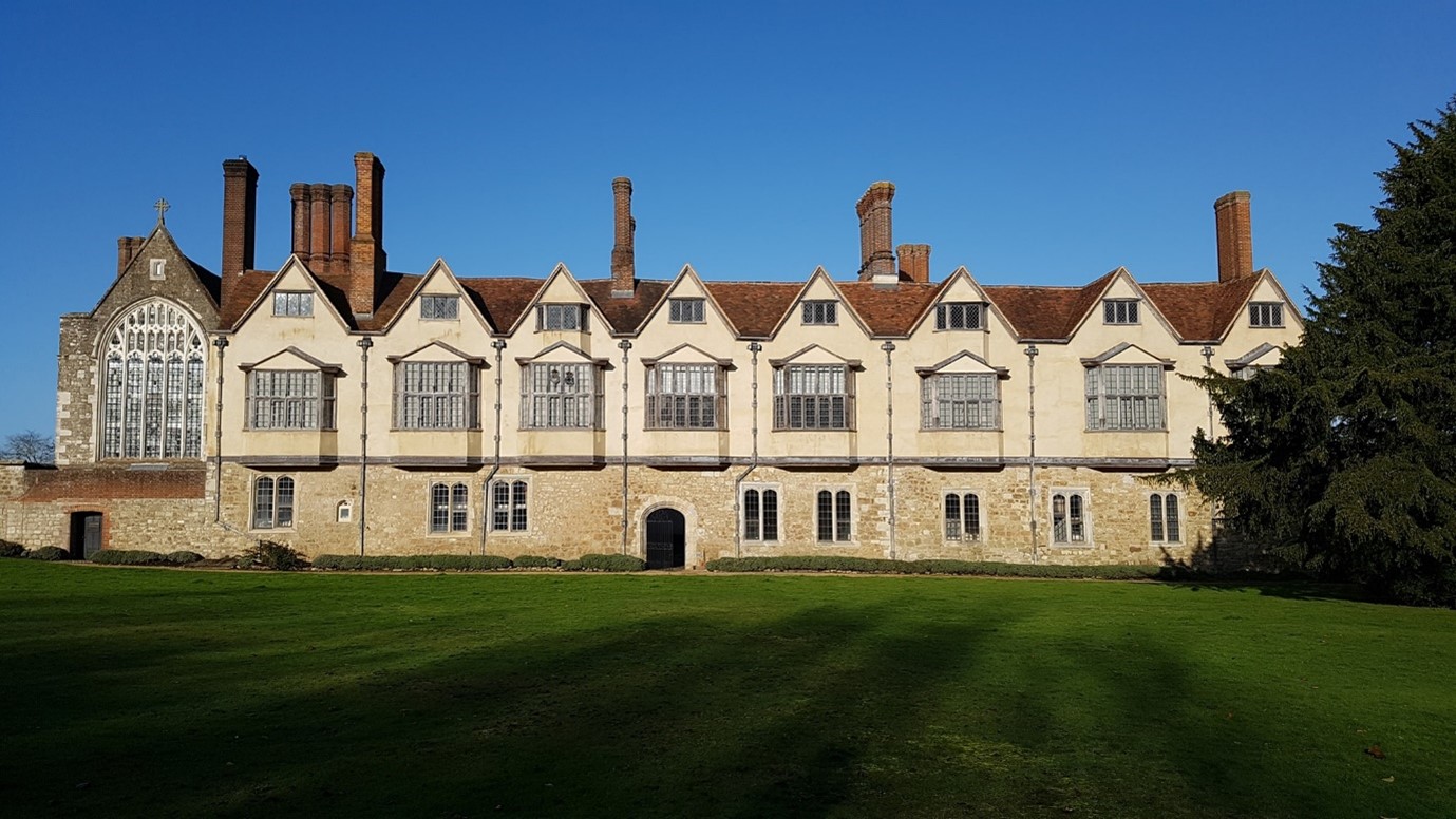
James Wright FSA, buildings archaeologist and project lead on our Greasley building survey project takes a look at how buildings archaeology can help us understand castles.
The study of mediaeval castles, palaces or great houses and the discipline of buildings archaeology have closely related histories. The Castle Studies Trust has asked me, as a buildings archaeologist with a long-established research interest in such structures, to write a blog outlining these relationships.
Buildings archaeology has been defined as: ‘the study of buildings as archaeological objects in their own right… the development of structure… fabric, form and function’ (Morris 2000, 14). Ultimately, the subject demands the forensic methods associated with the careful unpicking of stratigraphy in below-ground archaeological excavation but applies those techniques to standing buildings.
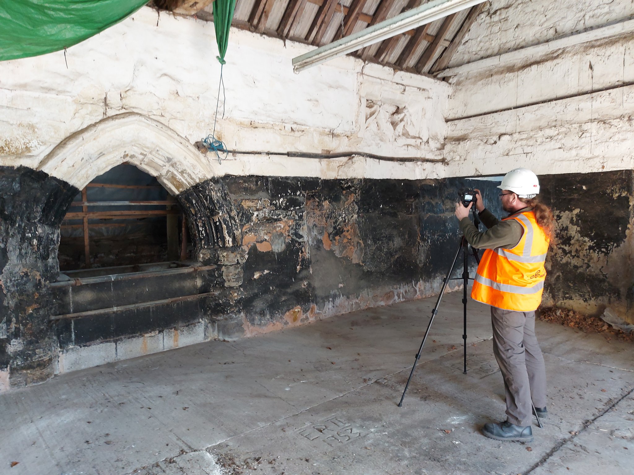
Survey work at Holme Pierrepont Hall (Picture: James Wright / Triskele Heritage)
Early Castle Studies: Military Historians
Although some antiquarians had demonstrated an interest in the structures of castles, most early castle specialists approached the subject from the archives. Scholars such as G. T. Clark (1884) and Alexander Thompson (1912) were concerned with documented building phases, ownership of castles and events which took place within their walls. Both authors were also very concerned with military matters and, for them, the castle was primarily a defensive fortification.
The military focus dominated castle studies for around a century. Philip Warner (1973, 8), a senior lecturer at the Royal Military Academy, summed this up when he stated the principal purpose of a castle was: ‘for delaying and dislocating an invading army.’ David Stocker (1992, 415-20) has pointed out that the prevailing notion that castles were primarily fortifications was perhaps due to so many castle scholars having seen military service.
Alternative perspectives can be traced back as far as Ella Armitage (1912, 8) who acknowledged the military uses of castles, but also emphasised their important domestic aspects as: ‘private fortified residences of great landowners’. This balance of military and residence can then be felt in the writings of Reginald Brown (1954), Colin Platt (1982) and Norman Pounds (1990).
Throughout much of the twentieth century the study of castles tended towards a sharp division of labour between historians and archaeologists who rarely collaborated. When the two disciplines were brought together the results were generally much improved – as happened with Howard Colvin and Philip Rahtz’s work on the royal palace at King’s Clipstone (Rahtz & Colvin 1960, 21-43). However, it was still the case that Colvin looked in the archives whilst Rahtz wielded his trowel and the standing architecture was largely overlooked.
Modern Castle Studies: A Holistic Approach
Subsequently, an emerging generation of researchers sought a more holistic approach which skilfully entwined archival sources, archaeological excavation, art and architectural history, landscape studies and the physical examination of standing buildings. Important re-assessments of sites, such as Bodiam Castle, placed emphasis on the symbolic and prestigious aspects of castles rather than the military versus residential debate (Coulson 1992; Everson 1996).
Bodiam Castle (Picture: James Wright / Triskele Heritage)
Buildings archaeology helped to revolutionise approaches to interpreting castles through the work of scholars, such as Philip Dixon and Pamela Marshall, who engaged with high quality, site-specific studies including Knaresborough Castle (Dixon 1990), Hedingham Castle (Dixon & Marshall 1993) and Newark Castle (Marshall 1998). Such work helped to build up a strong body of published fieldwork that chimed with a newly complex view of castles. Such projects placed castles in their contemporary moment as a mechanism for understanding the mediaeval lived experience.
With castle studies no longer shackled to rigid debates, the discipline was truly able to take wing. Oliver Creighton (2002, 2009) developed research into castle landscapes, Matthew Johnson (2002) took a strong theoretical approach and Robert Liddiard (2005) offered the wider context into which castle studies could be framed. Meanwhile, the multi-disciplinary investigation of individual buildings such as the Tower of London (Impey 2008), Knole (Cohen & Parton 2019) and Oxford Castle (Munby et al 2019) have remained central.
Knole (Picture: James Wright / Triskele Heritage)
Investigating Castles
When approaching a new site, such as the recent survey of the late mediaeval courtyard house at Holme Pierrepont, I first like to walk around the entire building with the landowner or curator. This recce is one of the most important moments, as the site is gradually revealed, and I can listen to my companion’s impressions of a structure that they know intimately. However, it is important to maintain a level of detachment – misidentifications, mistakes and myths can creep into the dialogue. This is why I also have a preference for not doing a deep dive into the documents prior to visiting a castle. I find it useful to let the structure “speak” without what can often be conflicting archival sources distracting me.
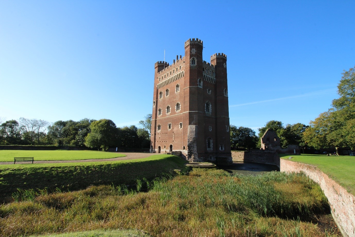
Then the real work begins! It is important to approach the survey methodically. When working at Tattershall Castle, I concentrated on the structures of each enclosure separately: starting with the gatehouse to the Outer Ward and gradually working my way, structure by structure, into the heart of the castle. This technique allowed a detailed progression of land-use to emerge in a sequence that would be recognisable to the lived experience of a mediaeval visitor to the castle. The last building that I tackled was the great tower – the most significant, complex and private space of the castle (Wright 2021).
Tattershall Castle (Picture: James Wright / Triskele Heritage)
Although we can employ many pieces of equipment – digital cameras, drones, total stations, laser scanners and sampling for dendrochronology (all very useful for data gathering) – the most essential gear on site are the eyes and experience of the buildings archaeologist. Trained observation and interpretation are key. Therefore, my first task at sites, such as Greasley Castle, will be to either create measured drawings – floor plans, elevations and sectional-elevations – of the building or to check, add to and annotate pre-existing surveys. Quantifying what is actually present on site underpins analysis. We can also create new data by producing measured sketches or scaled drawings of features such as roof structures and areas of the building which are difficult to photograph due to spatial constraints.
Observations on site might include noting the stratigraphical relationships between different phases of structures – a mediaeval window blocked in the post-medaeval period at Greasley Castle, the fifteenth century great tower at Tattershall Castle which abuts a thirteenth century mural tower (Wright 2021), or evidence for the wholesale reorganisation of roof structures at Knole (Sorapure & Wright 2013, 263-70). Depth is given to the survey by noting the stylistic typologies of particular structures – a Norman doorway at Kings Clipstone, thirteenth century window tracery at the Palace of Westminster or a late mediaeval chimneypiece at Nottingham Castle (Wright 2016, 34-37; Wright 2014; Wright 2017a, 19-23). Recording details such as mason’s marks, carpenter’s assembly marks and historic graffiti at Knole and Home Pierrepont Hall added to the understanding of the human agency behind the construction and occupation of the buildings (Sorapure & Wright 2013-14, 263-70).
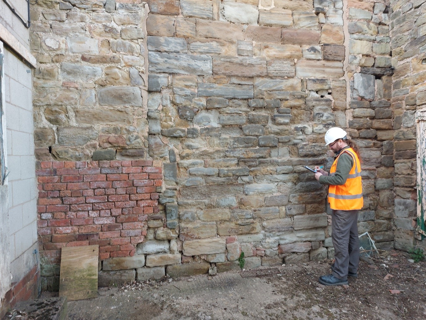
Survey work at Greasley Castle (Picture: James Wright / Triskele Heritage)
Each space will be recorded systematically – usually (but not exclusively) starting at the bottom and working upwards, before looking at the exteriors. When all of the areas of the building have been drawn and annotated, it is time to move on to a comprehensive photographic survey, including both general and detailed shots. It is particularly important to capture all of the relevant data, whilst still on site to refer back to during the write up.
A standing building report will usually comprise two principal elements. Firstly, comes the historical background which establishes the known history of the structure based on a trawl of archival and published sources. At Tattershall Castle these included the 1231 licence to crenellate, building accounts from the 1430s and 40s, biographical data on its patron Ralph Lord Cromwell, parliamentary records of the slighting in 1650, antiquarian images showing its visual appearance in the eighteenth and nineteenth centuries and the letters and papers of Lord Curzon which related to the castle’s conservation in the 1910s (Wright 2021; Wright 2020). It is crucuial to tell the whole story of the castle from its inception right up to the modern day. Secondly, the archaeological analysis of the structure will link back to historical events which may have led to alteration of the structure of the castle. This analysis is typically ordered either chronologically or by physical space, sometimes a mixture of both. The text will be liberally illustrated with photographs, historic images and measured drawings.
There are many ways in which buildings archaeology can be reported. These include site reports, published articles, books, websites, blogs, social media posts, press reports, guidebooks, on-site interpretation, mobile apps, film-making and interpretation panels. A mixture of platforms has become the norm, but reporting is literally the most important part of any archaeological project. There is simply no point doing the fieldwork if you don’t tell other people what you have found!
Surveying at Greasley Castle (Picture: James Wright / Triskele Heritage)
Conclusions
The incorporation of modern buildings archaeology into castle studies helped to fill a fundamental gap left by projects that had previously concentrated on archival research or archaeological excavation. By taking a detailed approach to the analysis of standing structures, alongside other data streams, the scholarship was able to move on to vital new interpretations.
In my own work on castles, I have been able to apply buildings archaeology techniques to better understand the form, function, building materials, phasing, development and histories of entire sites such as Tattershall Castle or Kings Clipstone Palace (Wright 2021; Wright 2016). It has also led to significant discoveries, such as the identification of Edward IV’s personal livery badge on a chimneypiece at Nottingham Castle or graffiti connected to the Gunpowder Plot at Knole (Wright 2017a, 19-29; Wright 2017b, 78-80). Meanwhile, on my most recent sites, at Holme Pierrepont Hall and Greasley Castle, we are helping to provide an understanding of the archaeological phasing of structures which have previously eluded specialist attention.
Elements of this blog have been remodelled from Wright, J., 2021, ‘Background to English Castle Studies’ in Tattershall Castle: Building a History. Unpublished PhD thesis. University of Nottingham.
About the author
James Wright of Triskele Heritage is an award-winning buildings archaeologist. He has a long-lived research interest in mediaeval castles, palaces and great houses. He has worked on surveys of buildings including the Tower of London, Nottingham Castle, Knole, Holme Pierrepont Hall and the Palace of Westminster. He has written books on Tattershall Castle, Kings Clipstone Palace and the castles of Nottinghamshire. He is currently engaged in a building survey, funded by the Castle Studies Trust, at Greasley Castle.
Featured image: Buildings archaeology survey at Holme Pierrepont Hall (Picture: James Wright / Triskele Heritage)
References
Armitage, E., 1912, The Early Norman Castles of the British Isles. John Murray. London.
Brown, R. A., 1954, English Medieval Castles. Batsford. London.
Clark, G. T., 1884, Medieval Military Architecture in England Vol. 1 & 2. Wyman & Sons. London.
Cohen, N. & Parton, F., 2019, Knole Revealed. National Trust. Swindon.
Coulson, C., 1992, ‘Some Analysis of Bodiam Castle, East Sussex’ in Harper-Bill, C. & Harvey, R. (ed.s), Medieval Knighthood Volume 4. Boydell Press. Woodbridge.
Creighton, O., 2009 (2013 edition), Designs Upon the Land – Elite Landscapes of the Middle Ages. Boydell & Brewer. Woodbridge.
Creighton, O., 2002, Castles and Landscapes. Equinox. Sheffield.
Dixon, P., 1990, ‘The Donjon of Knaresborough: the Castle as Theatre’ in Château Gaillard Vol. 14. Publications du CRAHM.
Dixon, P. & Marshall, P., 1993, ‘The great tower at Hedingham Castle: a reassessment’ in Fortress Volume 18. Beaufort Publishing. Liphook.
Everson, P., 1996, ‘Bodiam Castle, East Sussex: Castle and its Designed Landscape’ in Château Gaillard Volume 17. Publications du CRAHM.
Impey, E. (ed.), 2008, The White Tower. Yale University Press. New Haven and London.
Johnson, M., 2002, Behind the Castle Gate. Routledge. London.
Liddiard, R., 2005, Castles in Context. Windgatherer Press. Macclesfield.
Marshall, P., 1998, ‘The Twelfth-Century Castle at Newark’ in Alexander, J. (ed.), Southwell and Nottinghamshire: Medieval Art, Architecture and Industry. British Archaeological Association Conference Transactions Volume 21. British Archaeological Association. London.
Morris, R. K., 2000, The Archaeology of Buildings. Stroud. Tempus.
Munby, J., Norton, A., Poore, D. & Dodd, A., 2019. Excavations at Oxford Castle: 1999-2009. Oxford Archaeology. Oxford.
Platt, C., 1982 (1995 edition), The Castle in Medieval England & Wales. Chancellor Press. London.
Pounds, N. J. G., 1990, The Medieval Castle in England and Wales: A Social and Political History. Cambridge University Press. Cambridge.
Rahtz, P. & Colvin, H. M., 1960, ‘King John’s Palace, Clipstone, Nottinghamshire’ in Transactions of the Thoroton Societyof Nottinghamshire Vol. 64. Thoroton Society. Nottingham.
Sorapure, D. & Wright, J., 2013-14, ‘Water Court: smaller and quite demure’ – A recent building survey of a forgotten late medieval courtyard at Knole, Kent’ in Castle Studies Group Journal Volume 27. Castle Studies Group.
Wright, J., 2016, A Palace For Our Kings – the history and archaeology of a Mediaeval royal palace in the heart of Sherwood Forest. Triskele Publishing. London & Cheltenham.
Wright, J., 2014, Archaeological Assessment of Stonework on the River Thames Foreshore at Victoria Tower Gardens. Unpublished archaeological report. MOLA.