Unravelling the past of Hoghton Tower

Steven Spencer and Elena Faraoni of the Hoghton Tower Preservation Trust, look at the results of their work, funded by the Castle Studies Trust in 2019, in trying to find out more about Hoghton Tower in Lancashire.

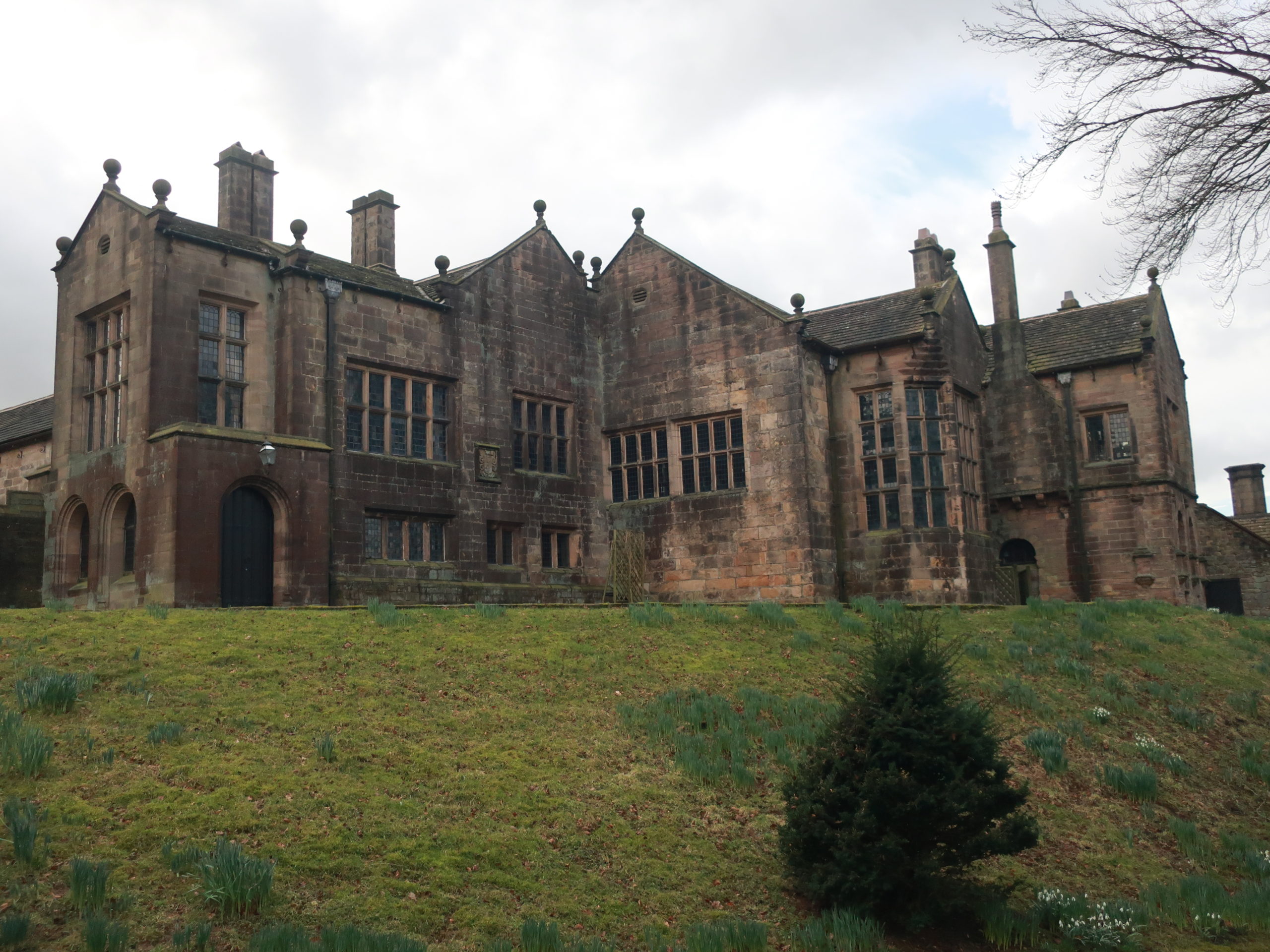
Hoghton Tower sits 650 ft above sea-level in the heart of the Lancashire countryside. The stories of its visitors and family members are documented and shared whether it be in books, portraits, family albums or documents in the Lancashire archives. But there is one story which has always intrigued us and that is: what was the first tower of Hoghton Tower and where was it? It is clear when looking at the building today that this, like many other historic houses, is a ‘patchwork’ of different projects by different generations interlaced and blended…but where did Hoghton Tower start? Where was the original tower?

Subscribe to our quarterly newsletter

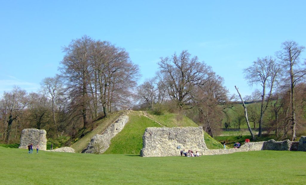
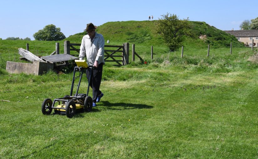
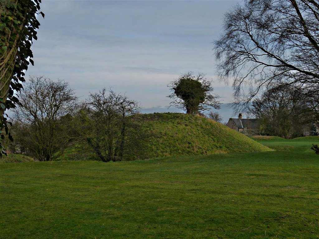
 There are some clues: the ageing of the stone, the position of the well house, family stories passed down the generations, the shape of the windows and a mysterious mound of stones on the north side of the buildings. One of these stones has an intriguing mason’s mark… Spurred on by the interest of a group of our amazing volunteers who had just finished some research into historic graffiti and masons’ marks it was time to do some investigation under the guidance of Dr Mike Nevell and his team at Salford University. We designed a research project based on archaeological digs, building recording, geophysics and archives research based on the key exam question “where was the great keep of the Hoghton Tower hill?”

North side of Hoghton Tower (copyright Hoghton Preservation Trust)

 Thanks to the grant from the Castle Studies Trust, work quickly got underway. Through a series of Salford-led workshops, the team surveyed, recorded and reviewed old photographs and pictures.

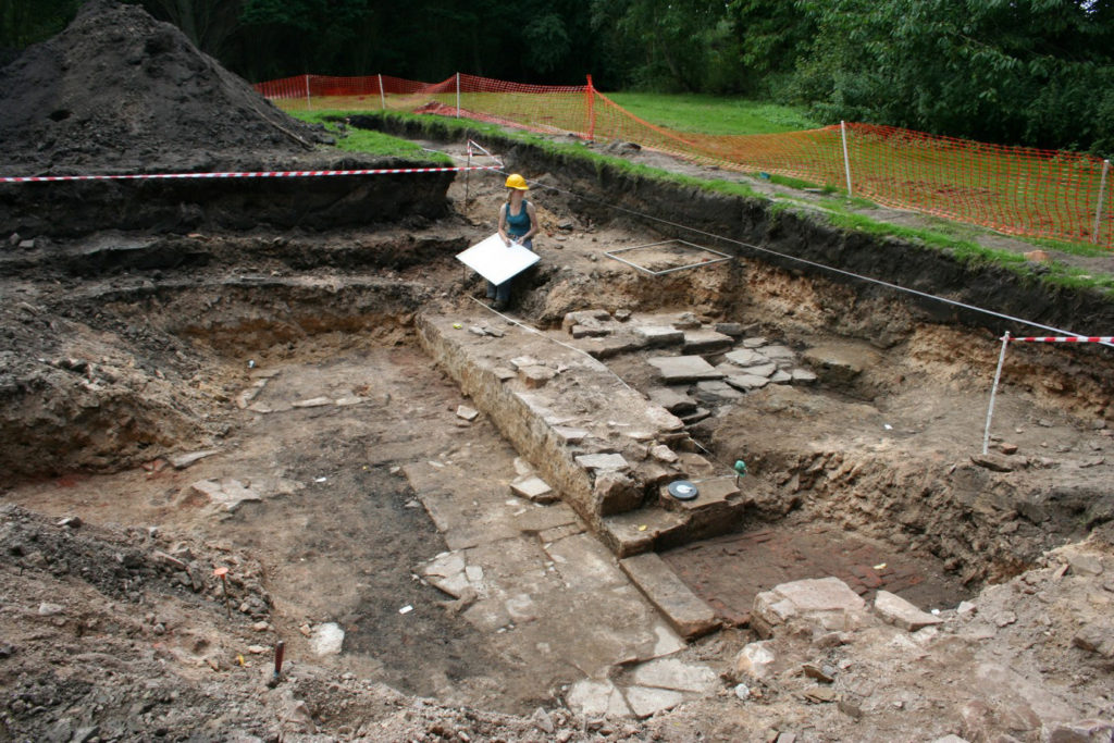
Then there was the wonderful five-day archaeological dig.

As they passed through the perimeter fencing on to the dig site, the usually mild-mannered volunteers underwent personality transformations as pairs of friends and even married couples were ‘pitted’ against one another. Was this the site of a 14th century Pele Tower, a 1643 victim of the First Civil War, who would make the crucial find?

Under the patient guidance and control of the Salford team, the test pits were marked out and the excavations began, to many this was the chance of a lifetime and was eagerly embraced. Each find was announced with enthusiastic shouting from the discoverer and muted derision from those yet to make a meaningful contribution.

Hoghton Tower Gatehouse from inside the courtyard (copyright Hoghton Tower Preservation Trust)

As the week progressed, 14th to 19th century finds were unearthed, thankfully shared out between the eight test pits. Clay pipe bowls (1640 to 1680), a musket ball, heat affected glass, sherds of medieval pottery and fragments of medieval roof tiles. Below a stone rubble layer, evidence of a stone-built structure was revealed in the form of large dressed stone blocks, together with walls and a stone flagged floor.

Spurred on by the whole experience, and encouraged by the de Hoghton family, the volunteers have produced and presented an ‘Outdoor History’ tour which aims to share the latest thoughts and discoveries. 

Was this the site of the Hoghton Tower? Did we find anything categorical? Well yes and no. The archaeology revealed previously unrecorded stone structures. These together with the artefactual evidence were able to confirm that this part of the hilltop was occupied during the late medieval/early post-medieval periods. The geophysics also gave us other areas that warrant more digging and researching. So, some confirmation but also a lot more to understand and discover on this windswept hill!

Subscribe to our quarterly newsletter

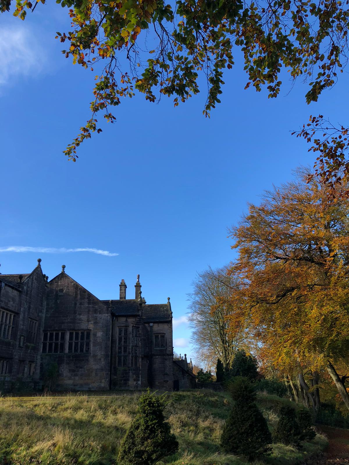
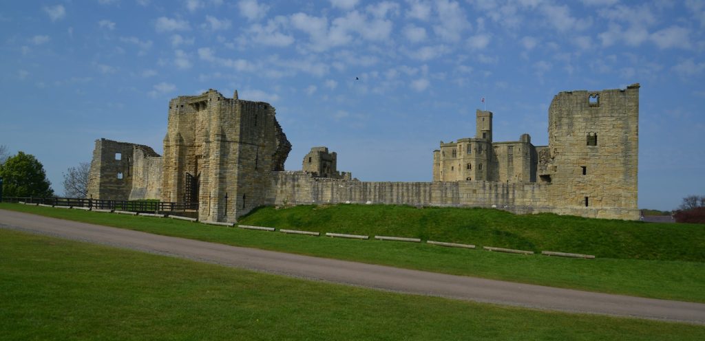
Featured image of Hoghton Tower, copyright Hoghton Tower Preservation Trust

A Large and Eclectic Crop of Fascinating Applications for the Castle Studies Trust to Consider

The deadline for grant applications passed on 30th November. We’re going through the various projects now. Altogether the 13 projects, coming from England, Ireland, and Scotland are asking for over £88,000. They cover not only a wide period of history but also a wide range of topics. In a little more detail, here are the applications we’ve received:

Bamburgh, Northumberland

Photo by Thomas Quine, licensed CC BY 2.0.

The main aim is to recover evidence for the base natural topography around the approach to the main gate of the once royal castle, from the area of the medieval village, and explore how this was altered, presented and exploited to create a sense of theatre for visitors to the site.

Berkhamsted, Hertfordshire

Photo by Sean Wallis, licensed CC BY NC 2.0.

A geoarchaeological auger survey of the moats that surround this former royal castle and palace of Thomas Becket. The survey aims to answer such questions as what were the moats original profiles, when were the moats filled and how do the two moats compare with each other.

Dunollie, Argyll

Photo by Paul Lloyd, licensed CC BY NC SA 2.0.

To try and understand the date of the construction of the castle owned by the MacDougall clan through various through buildings and materials analysis including radiocarbon dating and mortar analysis.

Fraoch Eilean, Loch Awe

Photo by Andrea Hope, licensed CC BY SA 2.0.

To try and understand the date of the construction of the former royal castle through various through buildings and materials analysis including radiocarbon dating and mortar analysis.

Hoghton, Lancashire

The aim of the project to continue the work the CST funded in 2019 with excavations and building survey. Further excavations will try and understand the purpose of the structures found in the 2019 excavation season and if they were related to the original great tower.

Holme Pierpont, Nottinghamshire

To build up an understanding of this late medieval great house, never previously researched. The work will include a mixture of desk research, building survey and geophysical survey of the parkland surrounding it. The house is the most complete of the three late medieval brick-built houses in Nottinghamshire.

Lincoln, Lincolnshire

Photo by Ben Keating, licensed CCY BY NC SA 2.0.

To develop a reconstruction drawing of the castle as it would have appeared in the second half of the 12th century. Lincoln Castle was founded by William the Conqueror in the late 11th century.

Shrewsbury, Shropshire

To fund a second year of excavation, this time to understand the rampart of the inner bailey. The geophysical survey carried out in the 2019 suggested there could be remains of buildings there, possibly even a late Saxon church. Shrewsbury was a very important border castle up until the 13th century and frequently used as a base for English raids into Wales.

Sowing the Seeds

Hortus conclusus depicted by Meister des Frankfurter Paradiesgärtleins

The aim of the project is to try and understand better everyday life in castles by seeing if there are any surviving plants at four Irish castles that were planted, grown and cared for by medieval people. The research will involve ecological surveys at each location.

Strongholds of Wessex

Photo of Silbury Hill by Greg O’Beirne, licensed CC BY SA 3.0.

The aim of the project is to understand the military organisation of the northern part of Wessex (Wiltshire and West Oxfordshire) from the transition from Saxon to Norman rule between the 9th and 12th centuries. The work will involve documentary research, landscape and place name surveys. Sites examined will include Castle Combe, Cricklade and Silbury Hill.

The Wirk, Orkney

Rousay - The Wirk

Could the Wirk be a Norse castle? Based on the island of Rousay, this stone tower is situated close to the old parish church and recently discovered Norse Hall. However, no one knows what this tower was used for or even when it was built. The work would involve a geophysical survey of the surrounding area as well as two trial trenches to try and find dating evidence.

Thermal Imaging of Castles

A thermogram of Cirencester Roman amphitheatre by Dr John Wells, licensed CC BY SA 4.0.

To test how useful thermal imaging could be in understanding castles. The thermal survey using a FLIR camera of two castle facades in different climates. within the UK—Caisteal Uisdein, on the coast of Loch Snizort, and a castle farther south and slightly inland, Castle Rising.

Warkworth, Northumberland

Photo by Barry Marsh, in the public domain

Using various forms of geophysical survey to try and understand the subsurface features for the former caput of the Dukes of Northumberland. The survey will focus on the bailey inside the 12th-century curtain wall as well as the strip of land outside but on the early earthwork castle, the motte and field near the entrance to the castle.


The applications have been sent to our expert assessors who will go over them. And if you want to know more about how the assessment process works, we have a brief summary.

Five New Awards and £100,000 in six years

We are excited to announce five grants totalling a record £27,000 that will advance our understanding of castles. These awards mean we have reached the landmark of giving away £100,000 in grants. It has taken six years for us to do that during which time the Trust has doubled the maximum amount we can award to £10,000.

Before you read about the five projects below, be sure to subscribe to our newsletter if you haven’t already.

  • Druminnor, Aberdeenshire – Using GPR for an investigation of the 15th century core of the castle – presently under a hardcore car park. This was the original caput of the lords of Forbes. During the 15th century they were amongst the most powerful families in the North-east of Scotland.
  • Hoghton Tower, Lancashire – This project aims to form an axis of research into Hoghton Tower’s unique physical history. The main focus will be to investigate and advance the knowledge of the pre-1560 site and specifically try to test the hypothesis that the north side building may form part of the ‘original’ Hoghton Tower.
  • Laughton en le Morthen, South Yorkshire – Excavation to try to confirm the findings of the geophysical surveys the CST funded in 2018. These indicated that the castle was placed right on the top of a high status Saxon dwelling.
  • Shrewsbury, Shropshire – Geophysical survey and excavation to determine how the castle buildings were laid out in the bailey. This will be the first time the well preserved motte-and-bailey castle has been excavated. First mentioned in 1069, Shrewsbury Castle was a key point along the Anglo-Welsh border and fell into ruin following the conquest of Wales.
  • Wressle, East Yorkshire – A geophysical survey of the area to the south of the castle ruins which had been covered by the previous earthwork survey funded by the CST, to get more information about the various garden structures there, as well as other details regarding the deserted village, moat and fishponds. The 14th century castle was one of the most important castles owned by the Earls of Northumberland.

Be sure to follow us on social media where we’ll be bringing you updates from the field, with work starting this month. In the meantime, here are some of our supporters discussing our work. we hope you’re looking forward to this year’s projects as much as we are!

The projects we’re considering for 2019

The deadline for grant applications passed on 30th November. We’re going through the various projects now. Altogether the 12 projects, coming from all parts of Britain and one from Ireland, are asking for over £75,000.* They cover not only a wide period of history but also a wide range of topics. In a little more detail, here are the applications we’ve received:

Collyweston, Northamptonshire

  • Contributing towards a community excavation at the early Tudor palace commissioned by Henry VII’s mother, Margaret Beaufort. According to building accounts the palace was built around three courtyards and was the first brick building in Northamptonshire. The palace was demolished in 1640 and the site has never been excavated before.

Druminnor, Aberdeenshire

[10] Druminnor Castle - "Woops!"
Using Ground Penetrating Radar for an investigation of the 15th-century core of the castle – presently under a hardcore car park. This was the original caput of the lords of Forbes. During the 15th century they were amongst the most powerful families in the North-east of Scotland.

Hoghton Tower, Lancashire

hoghton tower
This project aims to form an axis of research into Hoghton Tower’s unique physical history. The main focus will be to investigate and advance the knowledge of the pre-1560 site and specifically try to test the hypothesis that the north side building may form part of the ‘original’ Hoghton Tower.

Lathom, Lancashire

Excavation to establish the form and location of the southern perimeter of the curtain wall of the 15th-century castle known as the Northern Court of which nothing remains above ground from the period. It was one of the most important castles in the north west of England in the late 15th and 16th centuries. The castle was besieged twice in the English Civil War and then slighted. In 2017 we funded analysis of masonry recovered in earlier excavations, which indicated architectural links with Caernarfon Castle.

Laughton en le Morthen, South Yorkshire

Photo by Mike Neid

Following on from last year’s grant, this project would undertake excavation to investigate features identified during the geophysical survey. The survey suggested that the castle was built over an Anglo-Saxon lordly residence, and the excavation would test whether there is further evidence to corroborate this.

Lewes, East Sussex

Photo by Richard Gailey, licensed CC-BY 2.0.

This research aims to answer an intriguing question: why does Lewes Castle, East Sussex, have two mottes? Do they represent a highly distinctive architectural statement, or did burial mounds of possible Romano-British or earlier origins influence the form of the 11th century fortification?

Loughmoe, County Tipperary

Castles of Munster, Loughmoe, Tipperary - geograph.org.uk - 1542634
To produce the first-ever detailed survey and structural history of the building which dates from the 15th and 16th centuries, and to determine using geophysics the extent of the original castle and whether the renaissance part had a precinct, other buildings, and gardens.

Raglan, Monmouthshire

Photo © Jeremy Cunnington

Using inferences from previous geophysical surveys to focus on key areas of the lower terraces and bowling green of the castle potentially revealing more about the clandestine political activity of the Somerset family in the late 16th and 17 centuries.

Shrewsbury, Shropshire

Shrewsbury Castle looking West
Geophysical survey and excavation concentrating on the inner bailey to in particular examine the tail of the north rampart. Despite being one of the main fortresses on the Welsh border no major excavations have taken place in the bailey. Thus the medieval plan of the enclosure, and the missing domestic ranges that should be there, are completely unknown.

Snodhill, Herefordshire

Photo © Jeremy Cunnington

Excavations in this important Welsh border fortress that was in use from just after the conquest to the English Civil War. The aim is to answer some key questions about the castle e.g. the keep’s entrance and final form, to establish the form of the North Tower and along the south side to see if that was where the entrance was.

Tarbert, Argyll

East Loch Tarbert and Tarbert Castle - geograph.org.uk - 1624617
Funding post-excavation costs of a community archaeology project. The project will be trying to see discover a number of things about this royal castle including if there was a southern entrance into the outer bailey, and what buildings there were along the north east range of the inner bailey.

Wressle, East Yorkshire

A geophysical survey of the area to the south of the castle ruins which had been covered by the previous earthwork survey funded by the CST, to get more information about the various garden structures there, as well as other details regarding the deserted village, moat and fishponds. The 14th century castle was one of the most important castles owned by the Dukes of Northumberland.

The applications have been sent to our expert assessors who will go over them. You can see how the assessment process works from our blog back in January 2016. And don’t forget to subscribe to our newsletter.

*The article was updated at 15:28, 10th December to remove Halton Castle.