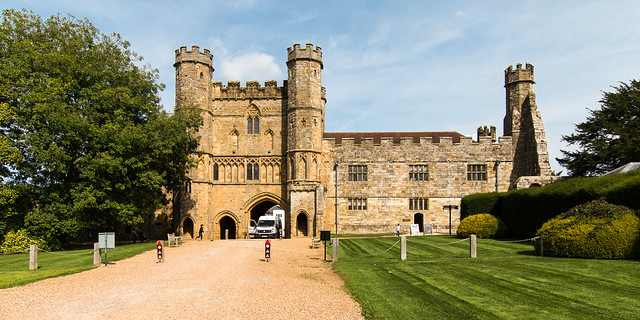
The Castle Studies Trust five projects for 2023

The Castle Studies Trust have awarded five grants totalling £35,000 to support research into castles. This is a record amount for the Trust, and as we enter our tenth year as a charity, we could not have managed this without our supporters.

We will bring you updates from these projects throughout the year as the teams get stuck in. But first, let’s get to know them a bit better. They are from across England, Scotland, and Wales and take different approaches to understanding castles.

Subscribe to our quarterly newsletter.

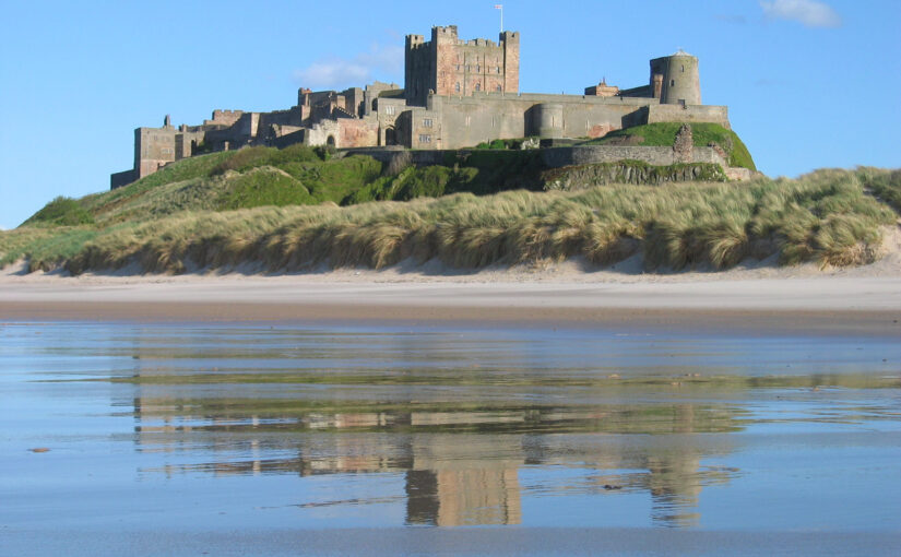
Bamburgh
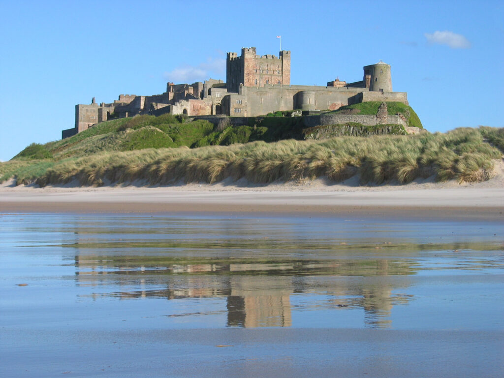
A stone building with a square tower in the middle. It stands on an outcrop, prominent in the landscape. In the foreground is a beach.
Bamburgh Castle on the coast of Northumberland. Photo by Michael Hanselmann via Wikimedia Commons, licensed CC-BY-SA 3.0.

Standing on a rocky outcrop on the coast of Northumberland, Bamburgh’s history stretches back to the early medieval period when it was home to a palace of the Kings of Northumbria. Bamburgh Castle itself was owned by royalty at various points, and rebuilt in the 18th century.

Bamburgh is a massive site: its history has been illuminated by excavations, and there is still more to learn.

Dr. Joanne Kirton and Graeme Young of the Bamburgh Research Project plan to carry out a geophysical survey and a masonry survey of the castle’s outworks.

Dunoon

The mound at Dunoon Castle. Photo by Rosser1954 via Wikimedia Commons, licensed CC-BY-SA 4.0.

A castle at Dunoon was first mentioned in the late 13th century but may be older. The ruins visible today date from the 14th century. It stands on a hill on the coast of the Firth of Clyde. The castle was besieged and captured multiple times over its centuries-long history and became a royal residence.

Despite the castle’s royal links, little is known about its layout and dating. Dr. Manda Forster’s team at DigVentures will carry out geophysical surveys (resistivity and magnetometry) of the mound and the area around it to find out where there may be buried walls, foundations, or other archaeological remains.

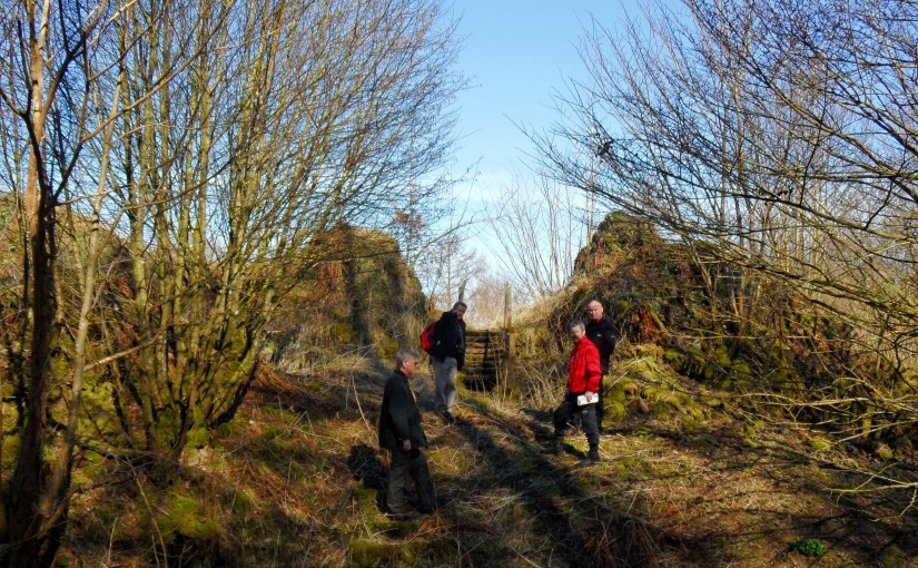
They will also organise workshops for the local community to learn how geophysics work. So as well as learning more about the castle, they may inspire the next generation of archaeologists!

Lowther
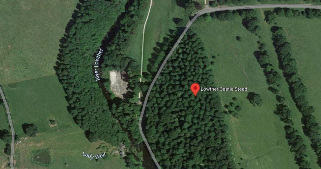
Google Map of the medieval Lowther Castle

The present Lowther Castle was built in the 17th century, but a few hundred metres north lie the medieval remains of a castle and possible deserted village. Lancaster University Archaeology Unit surveyed the earthworks in the 1990s, but there has been no other archaeological investigation since.

Being able to date the site would be a crucial step in understanding the Norman influence in the region. Could this be part of the remains of the Norman conquest of the Kingdom of Cumbria in the late 11th century?

Dr. Sophie Ambler has devised the project to carry out geophysical surveys at Lowther Castle followed by excavations. Working with the University of Central Lancashire and Allen Archaeology, this aims to establish the site’s building chronology.

Picton

Picton Castle in 2021 by Ruth Sharvile, via Geograph. Licensed CC-BY-SA 2.0.

Pembroke’s Picton Castle is a medieval building with later alterations and additions. It is uncertain when it was built and by who, but it is likely to have been established in about 1300 by Sir John Wogan. Picton has an unusual layout but may have parallels with French medieval castles.

Neil Ludlow and the Dyfed Archaeological Trust will carry out a measured survey of the building, recording its structure and creating a photographic record of the site. This will be an invaluable resource to understand the site, and help show the castle’s development over the centuries.

Wigmore
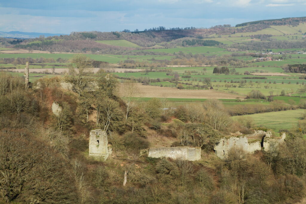
Photo of Wigmore © Philip Hume

Wigmore was amongst the early castles established in England in the wake of the Norman conquest. It was founded by William Fitz Osbern, Earl of Hereford and later became the home of the Mortimer family. They were an influential family in the Welsh marches, and they developed the castle to reflect their growing power.

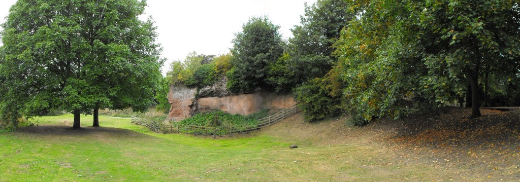
Small-scale excavations at Wigmore and geophysical surveys in the 1990s demonstrated the archaeological potential of the site, but what is missing is a reconstruction of how it looked during its heyday.

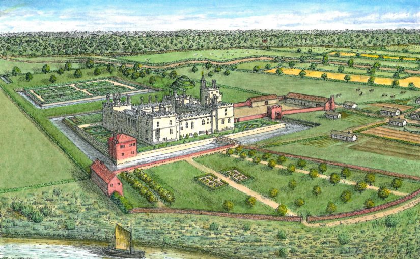
Chris Jones-Jenkins will create a reconstruction of how Wigmore Castle used to appear. This will draw on archaeological and historical sources to bring the reconstruction to life. You may also have seen Chris’ work with his reconstructions of Ruthin and Holt.

Subscribe to our quarterly newsletter to receive updates on these projects and our other ongoing work in the field of castle studies.

Header image: Bamburgh Castle by Michael Hanselmann via Wikimedia Commons, licensed CC-BY-SA 3.0.
What happens to your castle when you upset the king?

Slighting is the destruction of a high-status building, and in the Middle Ages it was all about power: damaging property meant exercising power over its owner. Castles were statements of the owners’ strength and status, so damaging one said a lot about how that status had changed, or their strength undermined. One especially interesting example comes from Bedford Castle.

During King John’s war with the barons in 1215–16 one of his captains was Falkes de Breauté. Falkes seized control of Bedford Castle from William de Beauchamp who had joined the rebellion against John.  John died in 1216 and was succeeded by his son, Henry III; Falkes was a key figure at the battle of Lincoln in 1217 which ended the rebellion against royal power and secured Henry’s reign.

Subscribe to our quarterly newsletter

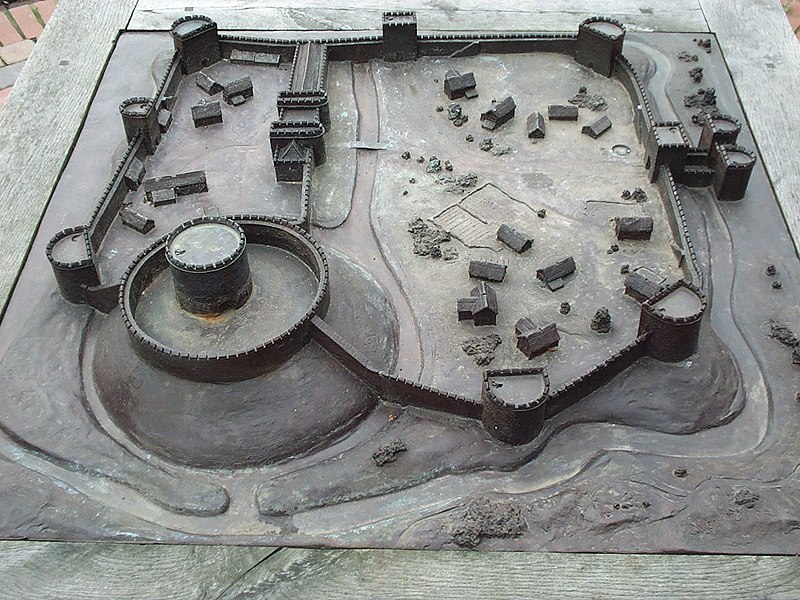
A model at Bedford Museum, showing how the castle may have appeared before the siege of 1224. Photo by Simon Speed (public domain).

After the war ended, Falkes made himself at home in Bedford, expanding the castle and even tearing down two churches in the process. At the same time, William de Beauchamp was trying to persuade the young Henry III to give him back Bedford Castle. Falkes was a powerful man in the royal court, despite making enemies. He clashed with Hubert de Burgh, who was Henry III’s justiciar, and in November 1223 Falkes nearly sparked a new civil war by attempting to seize the Tower of London alongside the earls of Chester and Gloucester and the count of Aumale.

Falkes lost a lot of power and influence because of this failed gambit and in 1224, he was instructed to give up Bedford Castle (along with some other properties). Falkes refused and things came to a head in June when Falkes’ brother, William de Bréauté, imprisoned a royal official at Bedford Castle.

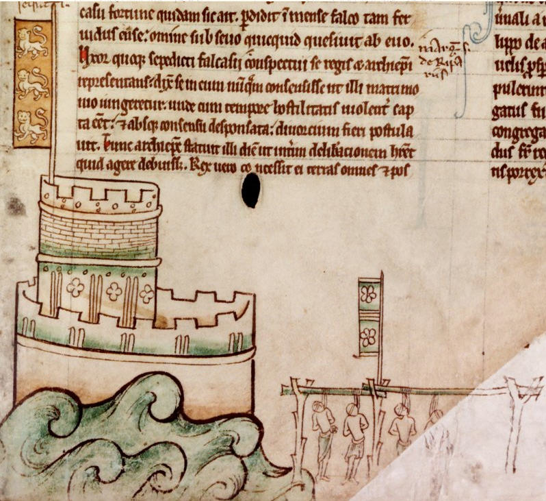
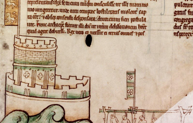
William had been left in charge of Bedford Castle, and Falkes supported his brother’s refusal to release the royal official and surrender the castle to the king. Henry quickly diverted the army he was gathering for an expedition to Poitou to undertake a full blown siege of Bedford Castle. Falkes might have hoped he would get some support from his allies, including the earl of Chester but he was left isolated. An eight-week siege followed, with four attacks on the castle and more than 200 deaths on the side of the royalists. William led the defence of the castle while Falkes fled to safety. Bedford Castle’s garrison surrendered on 14 August and all of them, including William, were swiftly executed.

A drawing from Matthew Paris’ Chronica Majora showing the execution of Bedford Castle’s garrison. Chronica Majora, II, fol. 60 (public domain).

With Falkes asking Henry III for forgiveness, the king had all the power to decide what to do next. He could give Bedford Castle to William de Beauchamp, the previous owner who had been seeking its return for years. He could keep it under direct royal control, or he could slight it – unmaking the castle expanded by Falkes. Henry III chose the destructive option: royal records show that the tower was levelled, the ditches filled, buildings in the outer bailey demolished, and the walls of the lesser bailey lowered. This amount of detail in the historical record is unusual, and where we do have details of castle slighting they are often much more brief and may just cover how much was spent.

Excavations between 1969 and 1972 found evidence of the castle’s destruction, with plenty of rubble strewn across the site. They also showed that the motte was lowered, which wasn’t mentioned in the royal records. The slighting of the castle was an especially destructive event. There are many other castles which were slighted where the destruction was less extensive, or the castle later repaired and rebuilt. At Bedford, that was never an option.

With no allies left, a wife seeking divorce, and having turned over all his lands to royal control, Falkes went into exile. Henry III did eventually grant the castle to William de Beauchamp on the condition that only an unfortified house could be built on the castle.

The destruction of Bedford Castle was a high-profile way for Henry III to reassert his authority after having been challenged by Falkes de Breauté. In the Middle Ages, not every slighted castle was the result of a royal order, but they were the majority. Visiting Bedford Castle today, there isn’t much to see, but in the early 13th century it was a strong stone-built fortress. Its destruction emphatically marked Falkes’ fall from power.

For many slighted castles we often only have archaeological or documentary evidence; at Bedford we are lucky enough that they coincide so we can confirm the documented events took place and give context to the evidence of destruction on the ground.


For more on slighting generally, you can read Richard’s paper in The Archaeological Journal.

Subscribe to our quarterly newsletter

Baffling Bolingbroke: understanding Henry IV’s home

In rural Lincolnshire, nearly 30 miles east of Lincoln, stand the remains of a castle once held by royalty. The remaining walls and towers of Bolingbroke Castle are still 3m tall in some parts, and you can make out its distinctive hexagonal shape. The buildings that once crowded together inside the castle have long-since disappeared.

Bolingbroke Castle was founded in the 1220s by Ranulf de Blundeville, Earl of Chester and Lincoln and through marriage it ended up in the ownership of the House of Lancaster. John of Gaunt, Duke of Lancaster, lived here in the 1360s and the castle gave its name to his son Henry Bolingbroke, later crowned King Henry IV, who was born here in 1367. The history of the site is reasonably well documented, especially compared to castles not owned by the Crown, but there remain unanswered questions about its origins and development.

In 2018 we gave Heritage Lincolnshire a grant to delve deeper. They would carry out a geophysical survey to establish if there are buried remains immediately south of the castle and on Dewy Hill, which might be the site of an earlier castle, built before the stone one still visible at Bolingbroke.

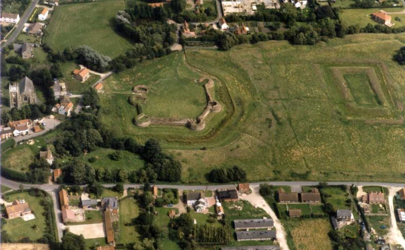
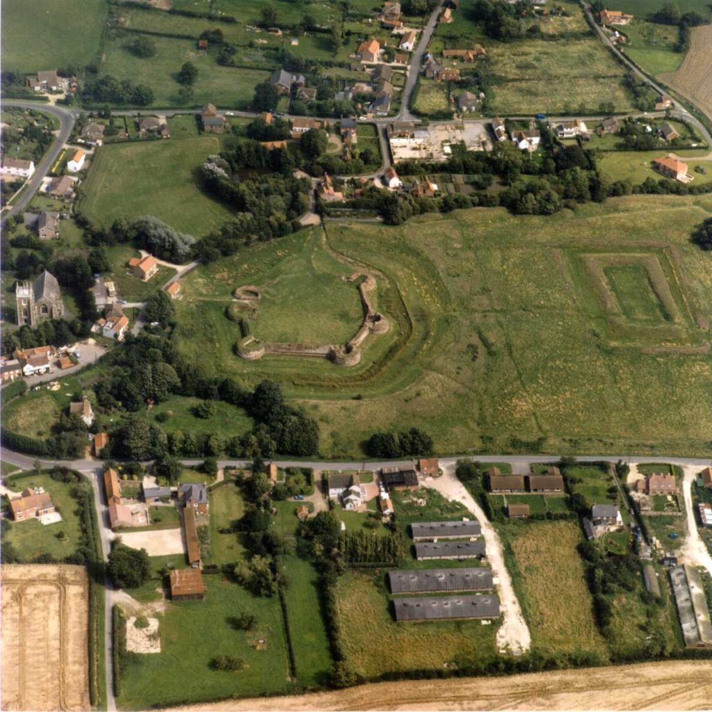
Aerial photo of a green field surrounded by houses. At one end of the field stand the remains of a hexagonal castle.
Bolingbroke Castle on the left and the rectangular ‘Rout Yard’ on the right. Courtesy of Heritage Lincolnshire.

The plan was to use ‘magnetometry’. It works by measuring how magnetic the soil is and then plotting the results on a map. It allows you cover a large area quickly, and over the course of two days the Heritage Lincolnshire team surveyed more than five hectares (about five times the size of Trafalgar Square).

There is some natural variation in the soil, but typically human activity such as cooking hearths or stone walls have a different magnetic signature to the soil around them as they are made from different materials. Magnetometry can also be used to find filled-in ditches as the fill might contain traces of human occupation.

The first stage was to survey Dewy Hill, sitting 400m north-west of Bolingbroke Castle. It was excavated in the 1960s, and a digital survey of the terrain suggests a rectangular feature still survives. We hoped the geophysical survey would show how extensive the buried remains are, and the shape and size might give us an idea of what it is. Essentially, was it a castle or some other type of important place? There was a slight hitch…

But Heritage Lincolnshire did eventually get to take their magnetic gradiometer for a spin! Next, they surveyed the area south of the castle as it might contain an extension of the castle which has since been dismantled. Are there traces of this possible enclosure, or was there perhaps a garden here? In the later Middle Ages it was especially popular to shape the landscape around a castle. Right in the middle of this area is a rectangular piece of ground called the ‘Rout Yard’, but it’s unclear when it was created so the survey aimed to establish how this area relates to the castle.

Understanding the results takes a trained eye, and Heritage Lincolnshire have a highly skilled team of experts. They were able to find a few anomalies, but they either appear to be modern (there may be a concrete slab on Dewy Hill) or natural geological features.

The point of an exploratory project is to find out what lies beneath. Oddly, we expected something to be at Dewy Hill since earlier excavations suggested there might be some activity. The search for a possible bailey suggests that perhaps one did not exist or if it did it may have been insubstantial. That would mean the ruins we see today may represent the extent of the castle at its peak. Interestingly the fashion for having gardens might have passed Bolingbroke by. It was an important place, so may have begun to fall out of use by the time gardens became a common part of high-status medieval landscapes.

Despite the siege of 1643, the survey did not uncover ‘siegeworks’ which would have been built by the Parliamentarians. This might be because the siege was relatively short.

As a result of this work, we know more about how the surroundings of Bolingbroke Castle. Other types of geophysical survey may pick up different pieces of evidence, helping build a fuller picture of the area. Surveys like this are an important tool to understand sites, and Heritage Lincolnshire’s work will inform any future work at the castle.

Thank you to the owners, the Duchy of Lancaster, for allowing us to carry out the survey, to English Heritage who are guardians of the site, and to the volunteers from the local community who helped with the fieldwork. Projects like this really do take a village.

A full report has been prepared by Heritage Lincolnshire.

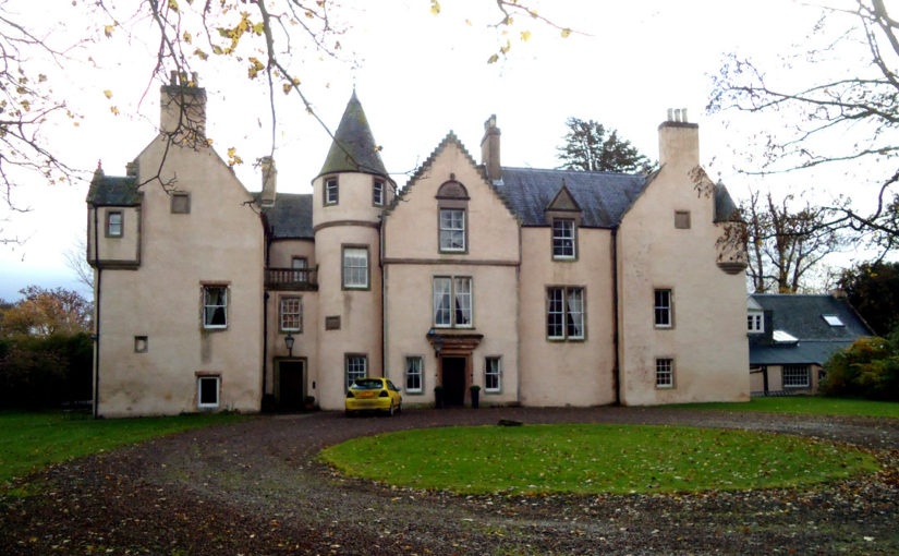
Going in search of Keith Marischal

In the later Middle Ages, the Keith family were some of the most important people in Scotland. Sir Robert Keith was made marischal of Scotland in 1293, a title that descended through his heirs. As marishal, Sir Robert and his successors were could hold courts during wartime and were responsible for maintaining order within the Scottish parliament. The castle at Keith Marischal, half a day’s journey from Edinburgh, was the family’s ancestral home.

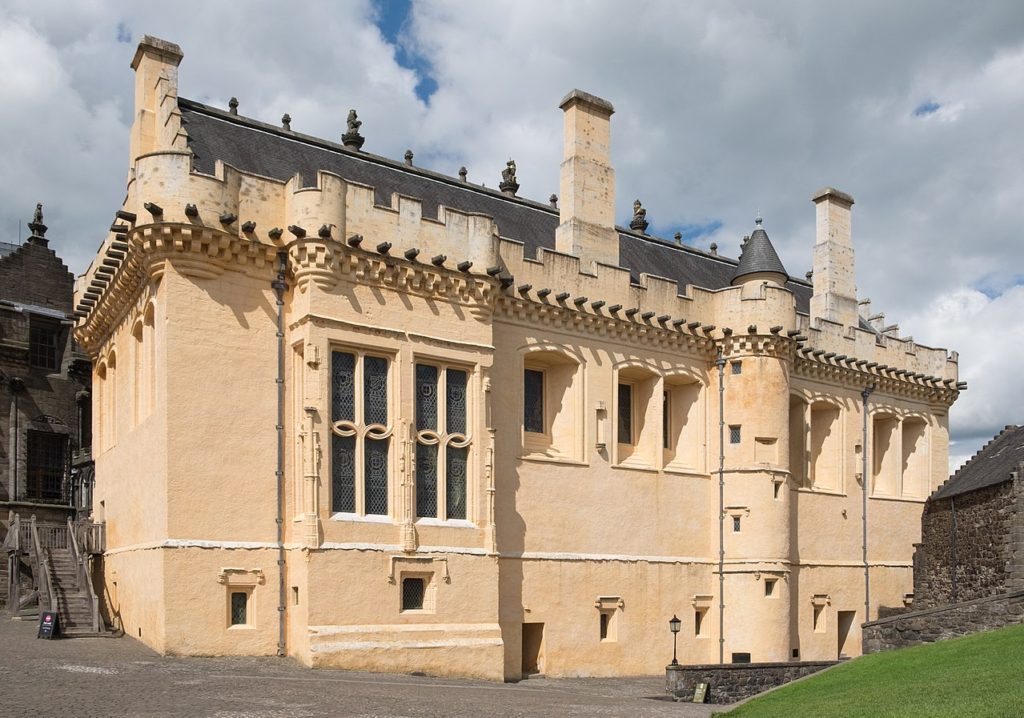
For a family which was amongst Scotland’s richest in the 16th century, their seat was an important place which would have embodied their power and prestige. The great hall, the social heart of the castle, vied with royal palaces in its size. William Keith, 7th Earl Marischal was forced to sell Keith Marishcal during the Civil Wars, and, despite being an important piece of Scottish history, the castle was gradually demolished. Part of the castle survives and was incorporated into the later house built on the site, but much of Keith Marischal has vanished.

Stirling Castle’s great hall. Photo by ‘DeFacto’, licensed CC-BY-SA 4.0.

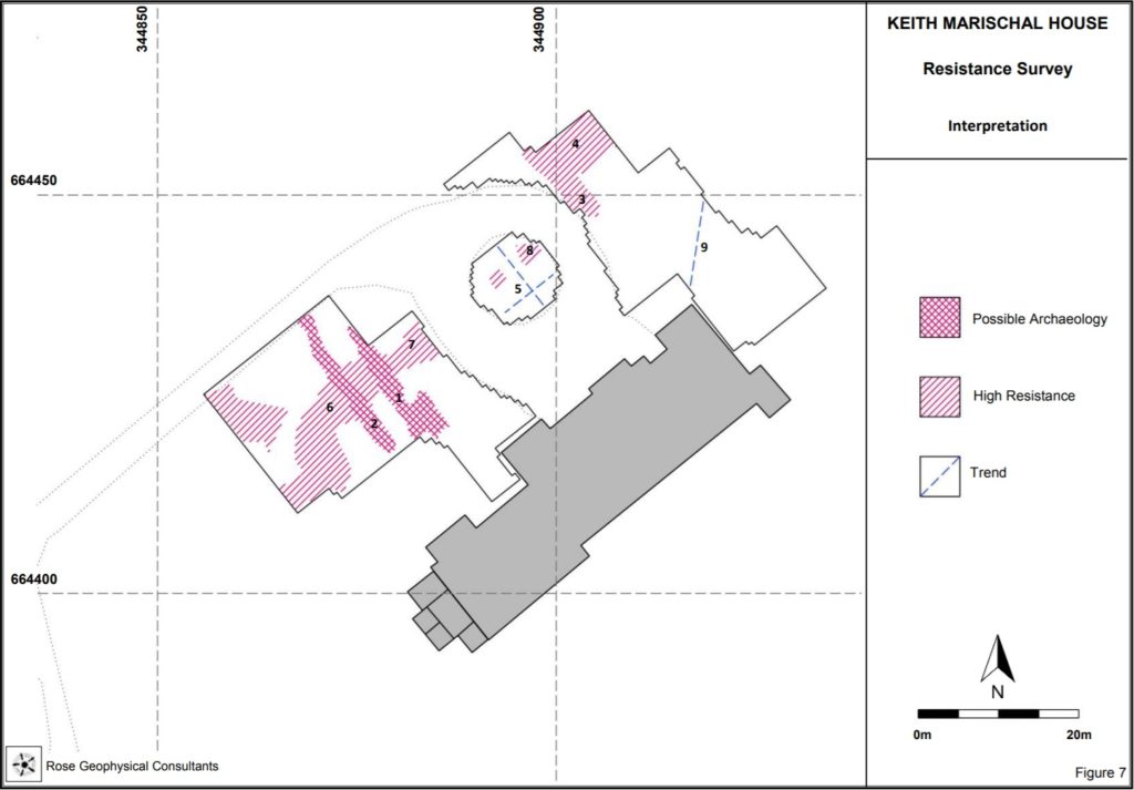
In 2017, Miles Kerr-Peterson suggested carrying out a geophysical survey to look for buried remains just north of where the house currently stands. He successfully applied to the Castle Studies Trust for funding, and in May 2018 he and Rose Geophysical Consultants visited Keith Marischal to search for the evidence in an area of 2 hectares.

Two methods were used: resistivity and ground penetrating radar (GPR). As different materials conduct electricity differently, testing the electrical resistance of the ground can be used to find features such as walls (high resistance as there is little water) or ditches (low resistance as ditches tend to hold water), and is effective to a depth of about 0.75m. GPR works by sending electromagnetic pulses into the ground and tracking how they are reflected. Part of the area north of the house is a carpark, which makes survey resistivity ineffective, but GPR can still be used.

Deciphering a geophysical survey takes a trained eye. The resistivity survey found several features, and working out what they are has been an interesting challenge. There are two features running in a mostly straight line perpendicular to the current house at the west end of the survey. The longer of the pair could be a drain, but it’s uncertain. And what are the features at the north end? The feature runs beyond the edge of the survey, so we don’t know the full shape and size of it. With trees nearby it could even be part of a root system, but the straight lines suggest it could be man-made and could be part of the lost castle.

GPR allows us to peer deeper, and to work out a rough stratigraphy of features. The survey was able to corroborate some of the anomalies found with resistivity. The pair of parallel features at the west end are visible, but the one on the right runs deeper. The fact it’s so narrow suggests it might be a drain. The GPR also found an anomaly at the north end of the survey area, lining up with the one found using resistivity. It was visible some 0.38-0.63m deep, which suggests it might be artificial rather than natural.

The results of the survey are certainly interesting. We didn’t find the extent of the lost Keith Marischal Castle, but most discoveries don’t happen overnight. Geophysics is an excellent way to identify areas of interest ahead of excavation. Without excavation, we can’t be sure about the interpretation of these features. If the anomaly at the north end of the survey is part of the lost castle, we don’t have a way of dating it without breaking out a trowel.

The survey was a vital step in the understanding Keith Marischal. Thanks to Miles and Rose Geophysical Consulting, any future excavations will know where to look. Keith Marischal has an exciting future, and the Castle Studies Trust are proud to be able to have played our part in supporting the work.

Dr Miles Kerr-Peterson is an affiliate in Scottish History at the University of Glasgow. His new book, A Protestant Lord in James VI’s Scotland George Keith, Fifth Earl Marischal, touches on the Keiths and is out now.

The art of the reconstruction

When walking round ruined castles, it can be difficult to picture how they once were. There may be missing floors, the roofs aren’t the same, and entire buildings might have vanished. Even when a structure appears to survive intact, we are usually missing the interior – how it was decorated, the furniture, even how light changed throughout the day.

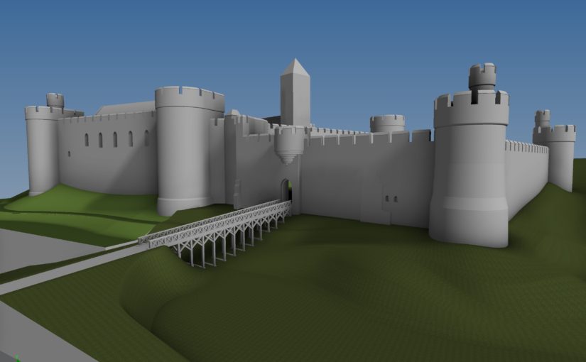
Reconstructions are a wonderful tool for bringing castles back to life. This year, the Castle Studies Trust is funding one such reconstruction. Chris Jones-Jenkins is helping us understand how Ruthin Castle would have looked. You might recognise his name from 2015, when he worked on one of our very first projects, the digital model of Holt Castle, or from his various work with Cadw and English Heritage.

We caught up with Chris to learn a bit about what goes into these illustrations and how he got into reconstructions. Older illustrations, like those done by Alan Sorrell decades ago, were done by hand while a lot of reconstructions today are done on a computer. Chris has experience of both, and they are very different processes. When working by hand, you need to start off by choosing your viewpoint and deciding what it is you’re going to show. With a digital reconstruction, you have the option to change the position of where you’re looking from. Chris reconstructs everything in the image and the viewpoint might be the last thing to be settled. With Holt for example, if that had been reconstructed 20 years ago the viewpoint would have been one of the first things decided – what to show, what to discreetly tuck away, and how to balance highlighting everything you want. Instead, as Chris created the whole thing digitally it was possible to use the model to create a flythrough video.

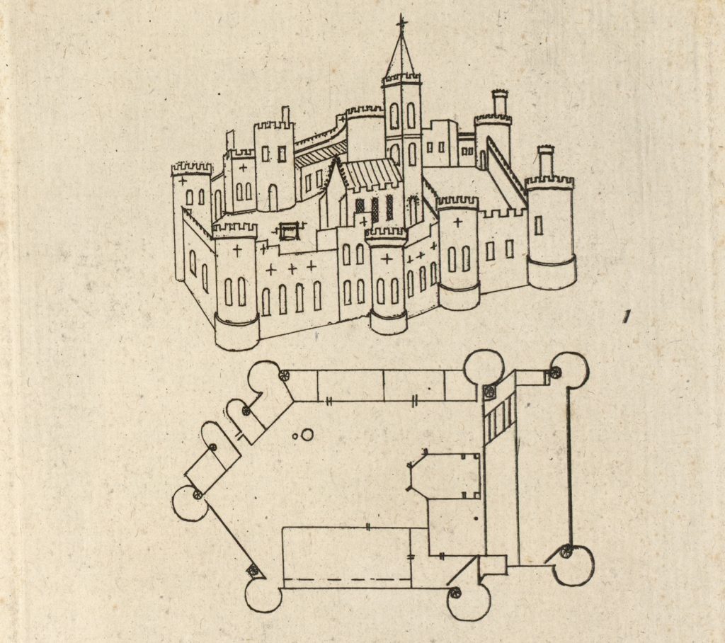
A plan of Ruthin Castle from Thomas Pennant’s 1781 edition of ‘A Tour of Wales’, from the collection of the National Library of Wales. Image in the public domain.

A wealth of information goes into reconstructions. For Holt and Ruthin, any standing remains are taken into account and modelled, while historical evidence such as paintings or documents are used to fill in the gaps where parts of the structure are missing. Chris trained as an architect and early in his career so has an eye for how buildings are put together, complimenting his skill as an artist and years of experience with historic buildings. Will Davies and Sian Rees have been helping with the research into Ruthin Castle and how it appeared, giving Chris the best information possible to work from. There was a survey of the curtain wall, but done to the wrong scale, which kept the team on their toes.

Working with some kinds of source material you get a feel for how useful and accurate it is. For instance, in the 17th century Randle Holme made some useful plans of Holt Castle in pen and ink. He also created a view of Ruthin Castle, but for some reason his work here wasn’t as reliable. The test is that the parts of the castle that still survive weren’t well illustrated by Holme, so his work needs to be used carefully.

A lot of time and effort goes into reconstructions. It can take over six months from start to finish, with drafting, redrafting, tinkering with details, and pausing to research a particular feature or issue. Over this time, the reconstruction grows from a plain model to a textured, colourful building. Reconstructions have an element of educated guesswork, but attention to detail is important. If you misstep and include something not appropriate for the period there are eagle-eyed heritage lovers who spot this kind of thing! New information is being uncovered about Ruthin, which directly informs Chris’ work. But there are some questions, like the forms of buildings, which are only likely to be answered by excavation.

Chris has been working on reconstructions since the 1980s, and aside from the change in technology has noticed an interesting trend. Previously, there was often emphasis on showing the structure while more recently the organisations commissions reconstructions want to populate these buildings, showing daily life inside.

Talking to Chris, one thing that cropped up is that reconstruction artists don’t often get to hear what the public think about their work which is a real shame as it can make a world of difference to a site. So when going round a historic site, if you see a reconstruction that captures your imagination or helps you understand the place better, pass on that positive feedback.

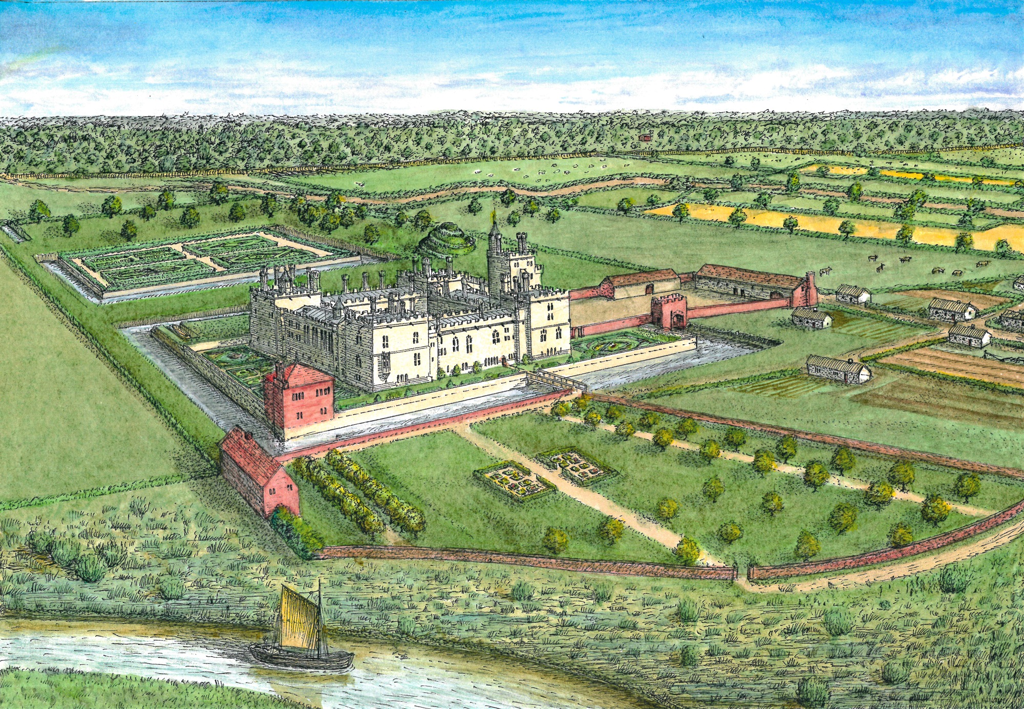
The image at the top of this page shows the a work-in-progress version of the reconstruction. Subscribe to our quarterly newsletter so you don’t miss news about the finished reconstruction and our other projects.

An Introduction to the Battle of Hastings

William the Conqueror, 1066, an arrow in the eye. The Battle of Hastings is one of those events that sticks in the mind. It was a defining moment in English history, and without the Normans we wouldn’t have castles dotted up and down the country. So how much do we know about what led to this point, and what happened at Hastings?

Why did William invade England?

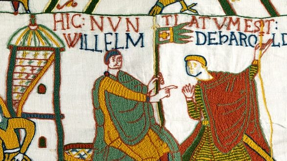
The Bayeux Tapestry showing William with the papal banner

The story of the Norman Conquest and the battle of Hastings goes back before 1066. In 1051, Edward the Confessor promised William, Duke of Normandy, that when he died the Norman would become king of England. Harold Godwineson – a powerful Anglo-Saxon earl – met William and swore would recognise the duke’s claim to the English throne when Edward died. But there was a twist still to come. Edward the Confessor fell ill late in 1065, and on his deathbed made Harold his heir. On hearing the news of Edward’s death and Harold’s coronation, William sent a message to the pope, asking for his permission to invade England and take the crown.

The calm before the storm

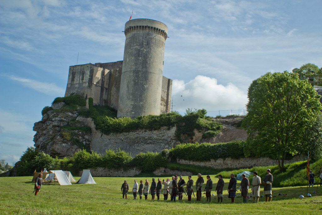
Chateau de Falaise in Normandy, where William grew up. Photo by Elisa Pictures, licensed CC by NC-ND 2.0.

Harold had fought alongside William and expected the duke to attempt an invasion. The new king of England raised an army in May 1066 and camped in the south of England, ready to fight. With the pope’s support, William built a fleet of ships for his army but bad weather prevented them from crossing the Channel. This delayed the invasion for so long, that in early September Harold disbanded his own fleet of ships.

Everything happens at once

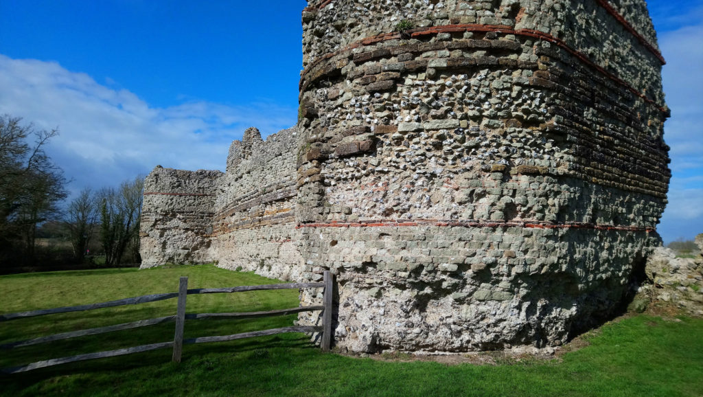
William landed at Pevensey Bay on the morning of 28 September 1066 and fortified the nearby Roman fort. Photo by Richard Nevell, licensed CC by-SA 2.0.

Harold’s younger brother, Tostig, was in exile and had been raiding England. In September he and Harald Hadrada, king of Norway, landed 300 ships in northeast England to claim the English throne. At the battle of Fulford on 20 September they defeated an Anglo-Saxon army led by the earls of Northumbria and Mercia. Harold marched north, and on 25 September faced the invading army at Stamford Bridge in Yorkshire. Tostig and the Norwegian king were both killed in the battle, ending in victory for Harold.

While Harold’s army was recovering after a bloody battle and a long march, William’s luck changed. The weather turned, and he set sail across the Channel on 27 September, landing at Pevensey Bay in Sussex on the morning of 28 September. William and his Norman,  French, and Breton soldiers set up camp in the Roman fort at Pevensey. They began raiding the local area which happened to belong to King Harold himself. News of William’s arrival reached Harold in York on 1 October. He reacted to the news (and the insult) by marching back south, going via London to collect more soldiers.

The Battle of Hastings begins

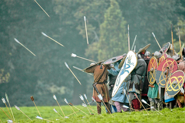
Hastings 2006
William had moved his army from Pevensey to Hastings, a few miles away. On the morning of 14 October 1066, Harold marched his army to the ridge now known as Senlac Hill. He planned to fight on the defensive which suited strength of the shield wall. William’s forces arrived from the south. The two armies, both around 7,000 strong lined up for battle. The sound of trumpets marked the outbreak of fighting, and William made the first move by advancing his foot soldiers up the hill with the cavalry following.

Harold’s army holds strong

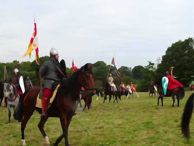
Battle of Hsatings 950th anniversary (121)
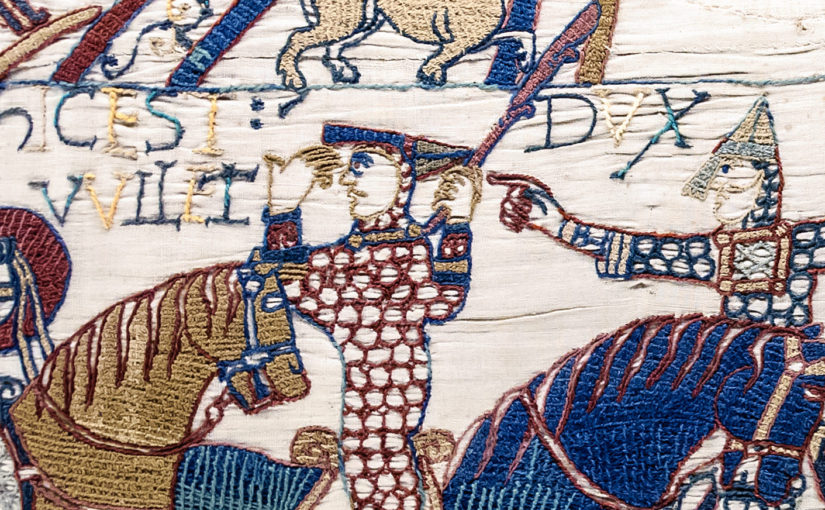
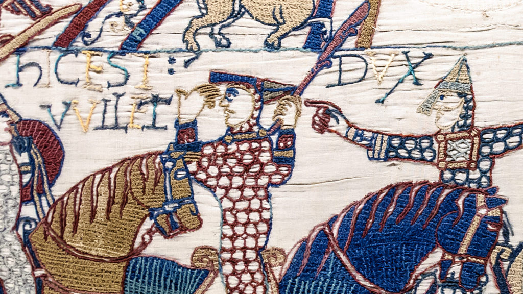
The shield wall was a fearsome obstacle, and hard to break. Harold’s disciplined army resists William’s first assault. As the first wave retreated, a rumour ran through the Norman ranks that William had been killed. Knowing he had to rally his soldiers or lose the battle, William rode in front of his army and lifted his helmet so they could see he lived.

William in control

Tapisserie de Bayeux – Scène 55 : le duc Guillaume se fait reconnaître.

Seeing the Normans fall back, part of Harold’s army followed them down the hill, attempting to route them. William managed to bolster his soldiers in time to turn and face the attack coming down the hill. Outnumbered and out of formation, Harold’s men had given up the advantage of the shield wall and were defeated.

Seeing how effective this was in reducing the strength of Harold’s army, William pretended to retreat another two times. The ruse worked each time, giving William the advantage.

Harold’s defeat at Hastings

Battle Abbey Gatehouse
In the midst of the hard fought battle, King Harold was killed. The Bayeux tapestry seems to show that he was hit in the eye by an arrow, while contemporary chroniclers suggest he was hacked down in the fighting. Either way, with their leader and his brothers dead, the Anglo-Saxon army broke.

Afterwards, William marched through southeast England, capturing important towns before arriving in London. He was crowned king of England on Christmas Day 1066 in Westminster Abbey. William ordered the construction of Battle Abbey on the field where he defeated Harold, with the high altar over where Harold fell.

To secure the conquest, William and his supporters built castles across the country, especially in important towns like Lincoln and Norwich to control the area. The Norman Conquest led to the age of the castle in England.

Make your own scene in the style of the Bayeux Tapestry and share it with us on Twitter. If you want more on Hastings and its impact you can read Peter Purton’s blog post or the Oxford Dictionary of National Biography’s entries on William and Harold which were used when writing this piece.

Re-imagining Wressle Castle

Reconstructions are a wonderful tool for showing how places looked in their heyday. I contacted Peter Brears to ask about sharing one of his drawings of Wressle Castle in Yorkshire and he sent this magnificent illustration:

Wressle Castle is a quadrangular stone building. There is a river in the foreground, a village to the right, and gardens next to the castle and behind it.
Wressle Castle by Peter Brears, based on the 2014 survey. Click the image to enlarge.

One of our very first grants supported a survey by Ed Dennison Archaeological Services of the landscape around Wressle. It was more than just a castle, it was practically a palace. Wressle Castle was built for Thomas Percy in the 1390s: he was a royal favourite, and his family was one of the most powerful in northern England.

However, the ruins you can see today are just a small part of the castle which was slighted several time between 1646 and 1650. Peter’s drawing is based on our 2014 survey: you can see the gardens to the north and south of the castle, and in the small strip of land between the moat and castle. The  lower court and village are just to the east. And perhaps best of all, the castle is intact with all four sides.

If you happen to have access to The Archaeological Journal, Peter’s other reconstructions of Wressle are definitely worth a look.

Most importantly, thank you Peter for sharing this drawing, it really brings the castle back to life!

Visiting Dinas Bran

Standing out in the landscape

Every year we organise visits to the projects we’ve supported. These visits are open to our donors and typically involve a guided tour and a sneak peek at the results. In May we journeyed to Castell Dinas Bran near Llangollen in North Wales.

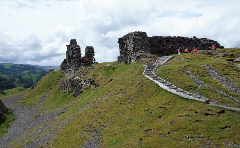
The Welsh built the medieval castle on the site of an Iron Age hillfort and it dominates the surrounding area. It’s a steep climb up, making you appreciate the effort involved to bring in building materials or even everyday supplies. And the higher you get, the stronger the winds are. Now in ruins, it must have been an imposing site visible for miles around in the landscape.

Fiona Gale, County Archaeologist for Denbighshire County Council, lent her expert eye to the guided tour. She explained the important consolidation work over the past few years as well as the recent archaeological fieldwork. The castle is mostly built from slate, and in many places the weathered walls have needed modern intervention to make them safe and prevent further collapse.

The castle might owe its present condition partly to slighting (deliberate partial demolition) and archaeologists noticed patches of scorched stone before ramps were added to mitigate erosion.

The survey at Castell Dinas Bran

With funding from ourselves and CADW, archaeologists could carry out a geophysical survey of the castle, using resistivity and magnetometry to peer beneath the surface. The report is nearly ready, and when signed off will be shared on our website. The results are tantalising, and give us more information about the use of the castle, while leaving some questions which might have to be answered by excavation.

Castell Dinas Bran is an important Welsh castle, and one of the better surviving examples. After important steps to preserve the site and keep it open to the public, we have been able to add to our understanding of the castle.

Subscribe to our newsletter for updates from the projects we support.

Robert the Bruce and Windsor Castle: what you didn’t know about Tibbers Castle

Robert the Bruce is famous for leading Scotland in their wars with England in the early 14th century. He became king in 1306 and embarked on an unprecedented campaign. What you might not know is that to achieve his aims he demolished (this act is known as slighting) many of the castles in Scotland to prevent the English from using them. A chronicler writing in the 14th century remarked that “Robert Bruce had all the castles of Scotland demolished, except Dumbarton”.

Bruce adopted this policy from 1307, which explains why when he captured Tibbers Castle from the English in 1306 it was left standing. This allowed the English to recapture it soon after. The Scottish king had witnessed enough siege warfare to appreciate the role of castles and how pivotal they were to the English plan to control the country, and when he wrestled control of Edinburgh, Stirling, and Roxburgh in 1314 he set about dismantling them so that they could not be used against his own countrymen.

Today Tibbers mostly survives as a series of large earthworks with a little masonry above ground. Walking round you find some rubble tumbled down the ditches around the outer bailey and the motte, giving just a hint at what once stood here. You wouldn’t know it to look at Tibbers, but it seems that when the Scots recaptured the castle in 1313 it avoided the fate of many other fortifications in the region and was left intact.

Funding from the Castle Studies Trust and Historic Scotland allowed this site to be re-examined. A geophysical survey was carried out and a new plan of the site was carefully drawn. This research gave new insight into the early form of the castle. It found that early in Tibbers’ history the castle probably consisted of a motte with a single small bailey. When the earth and timber defences were replaced in stone the single bailey was replaced by two much larger enclosures, giving the castle the form we recognise today. This double-enclosure arrangement is quite unusual for a motte-and-bailey castle. You can see another example at Windsor Castle where the motte is flanked by two baileys.

The work at Tibbers was our first contribution to Scottish archaeology; in fact it was one of the very first grants we gave out back in 2014. Built in the 12th or 13th century, changing hands several times during the Anglo-Scottish Wars and then descending through the earls of Moray and the earls of March before being taken over by the Scottish monarchy, Tibbers has a storied past. Fortunately we have been able to add a few details to that colourful history.

Click here for the full report from RCAHMS on the survey, with a potted history of the site.

4 more castles to visit this month

Every September thousands of historic sites in England, Scotland, Wales and Northern Ireland are opened. It is a chance to visit some sites which are closed the rest of the year. You can find out more details online. Here are four places to get you started.

Broughty

"Sunset over the Castle" by Neil Williamson, licensed CC BY-SA 2.0.
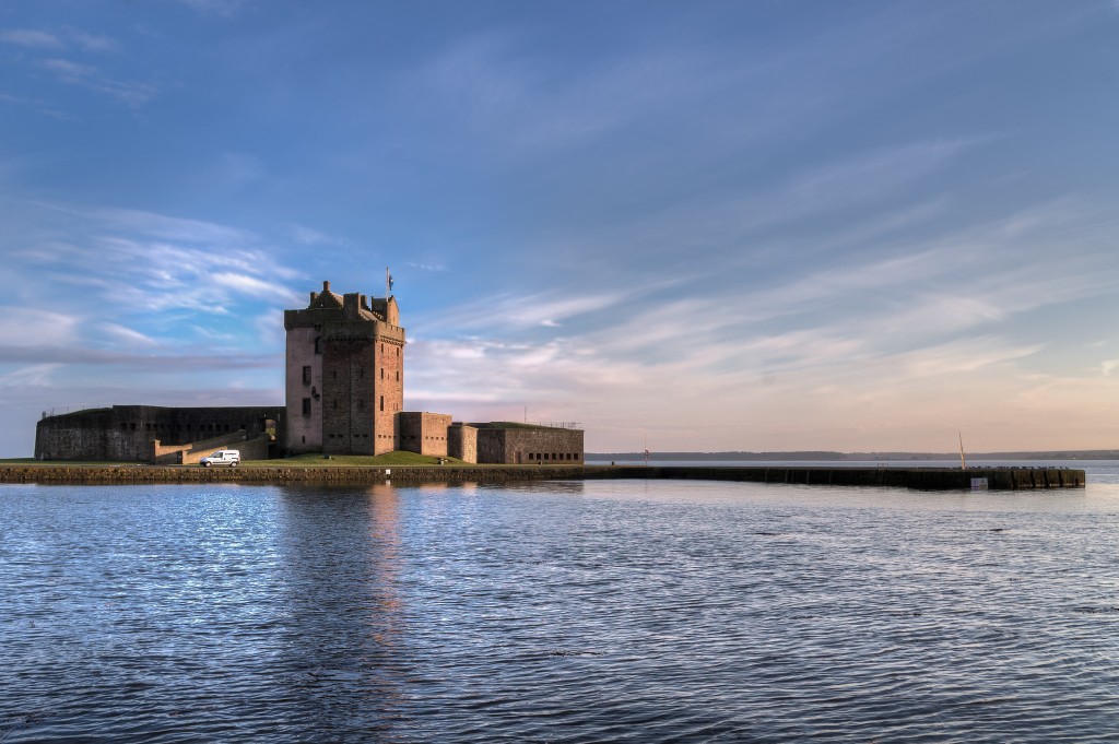
Sunset over the Castle” by Neil Williamson, licensed CC BY-SA 2.0.

Sat on the banks of the River Tay, Broughty Castle in Scotland was built in 1496. It was involved in several sieges including during ‘the Rough Wooing’ and the War of the Three Kingdoms. The castle has been open as a museum since 1969.

Broughty Castle is open from 1pm to 3pm on Sunday 18th September.

Pleshey

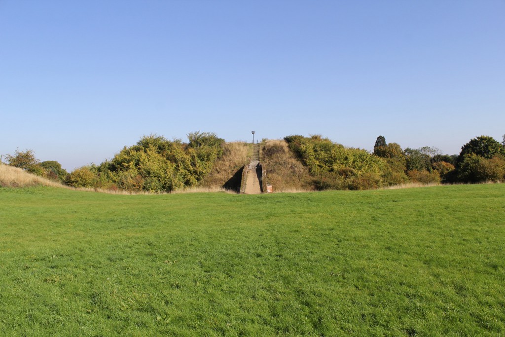
Pleshey Castle” by Richard Nevell, licensed CC BY-SA 2.0.

Pleshey Castle in England was built by William de Mandeville, one of the richest men in 12th-century England. It was confiscated by the king, slighted, restored, and used for centuries afterwards. The castle was even mentioned in Shakespeare’s Richard II.

The motte-and-bailey castle survives as some impressive earthworks. Excavations were carried out between 1972 and 1981 but never published. In 2015 the Trust funded part of the publication of the work from this important site.

Pleshey Castle is open on Sunday 11th September with tours at 2pm, 3pm, and 4pm. Advanced booking is required.

Moyry

"Moyry Castle" by IrishFireside, licensed CC BY 2.0.
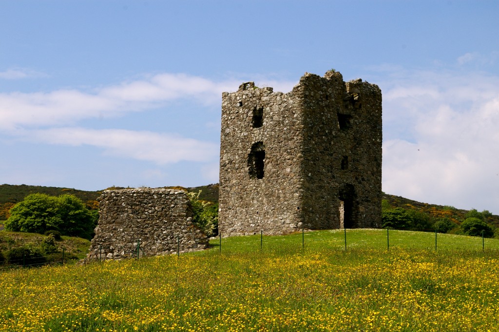
Moyry Castle” by IrishFireside, licensed CC BY 2.0.

Built in 1601, Moyry Castle is being included in Northern Ireland’s heritage open days for the first time. Three-stories high and perched on top of a rocky hill the castle has a good view of the surrounding area.

Moyry Castle is open from 9am to 8pm on Saturday 10th and Sunday 11th September and is free to visit.

Holt

"Holt Castle" by Richard Nevell, licensed CC BY-SA 2.0.
Holt Castle” by Richard Nevell, licensed CC BY-SA 2.0.

Constructed in the 13th century, Holt Castle was amongst the fortifications built by the English in north Wales. The red sandstone makes the castle stand out, as does its unusual pentagonal design. It was used by Richard II as a treasure house and slighted after the English Civil War.

You might recognise Holt as one of the very first projects the Trust worked on: Rick Turner and Chris Jones-Jenkins created a reconstruction of the castle as it would have appeared c1495. The 17th century was not kind to the castle, so the reconstruction is worth watching to get an impression of how it looked.

Holt Castle is open from 10am to 4pm on Saturday 17th and Sunday 18th September and is free to visit.