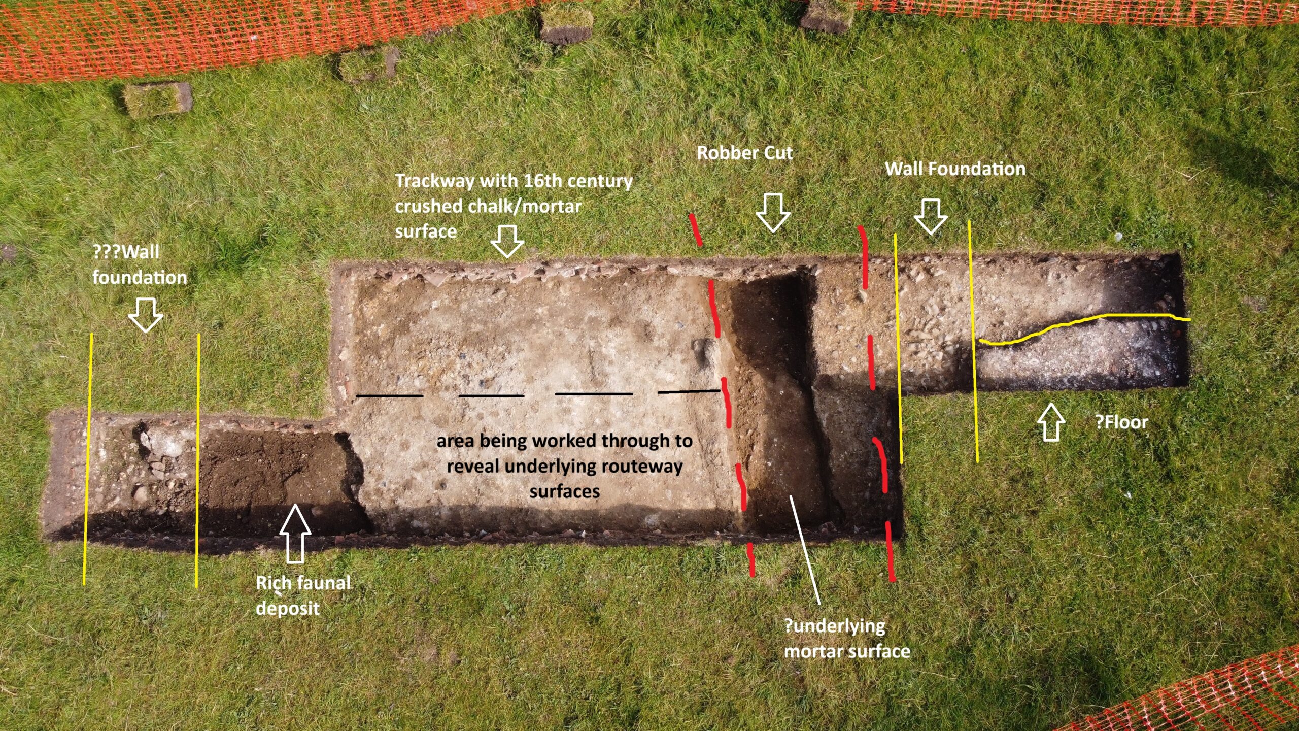
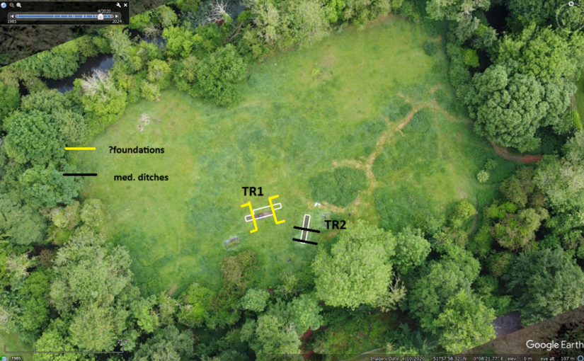
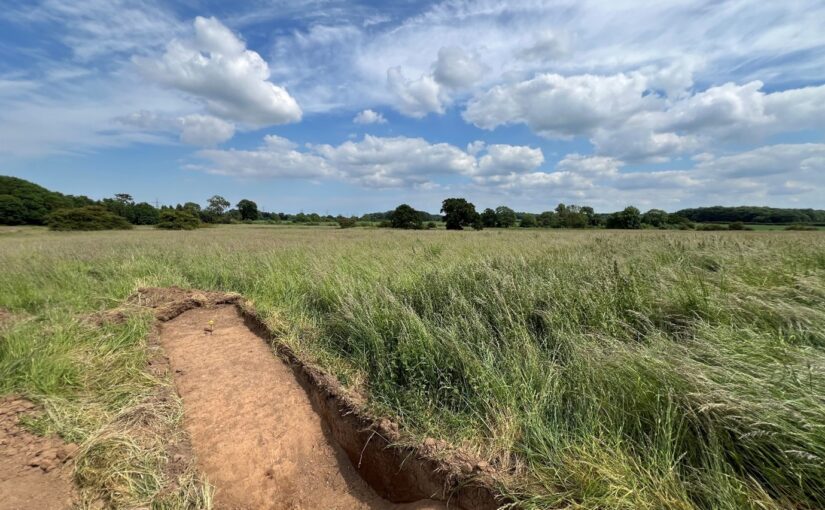
Annotated aerial view of trench one, copyright Simon Coxall
Trench 1
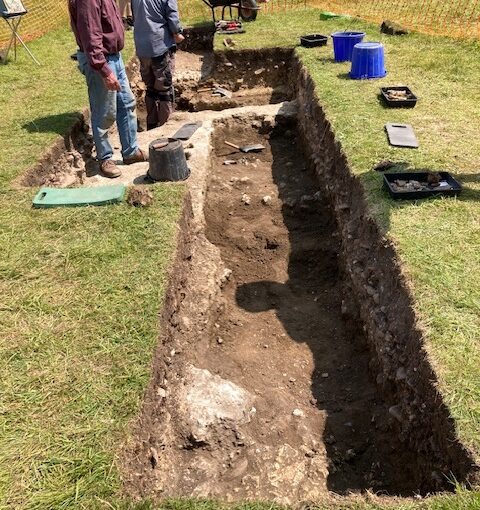
As previously mentioned, trench 1 was sited to explore the suspected ‘gatehouse’ entrance to the site as indicated by earlier resistivity survey. This reveals evidence throughout for the concerted demolition of the site; activity which with the almost total absence of artefacts dating beyond the 16th century appears to have been undertaken shortly after its seizure by the Crown with the demise of Margaret Pole, Countess of Salisbury in 1541.
Ephemeral evidence for residual structural foundations (flint, brick, roof tile, clunch, daub etc) have been found to frame a surviving entrance routeway of beaten chalk sand/mortar which is approximately 6m in width and is associated with ceramic dating evidence.
Sampling of this routeway context reveals it as the last of a number of trackways using it appears the same entrance point to the estate and excavation continues to explore these earlier routeway surfaces and ‘associated’ ditches. All such evidence is consistent with the geophysical findings.
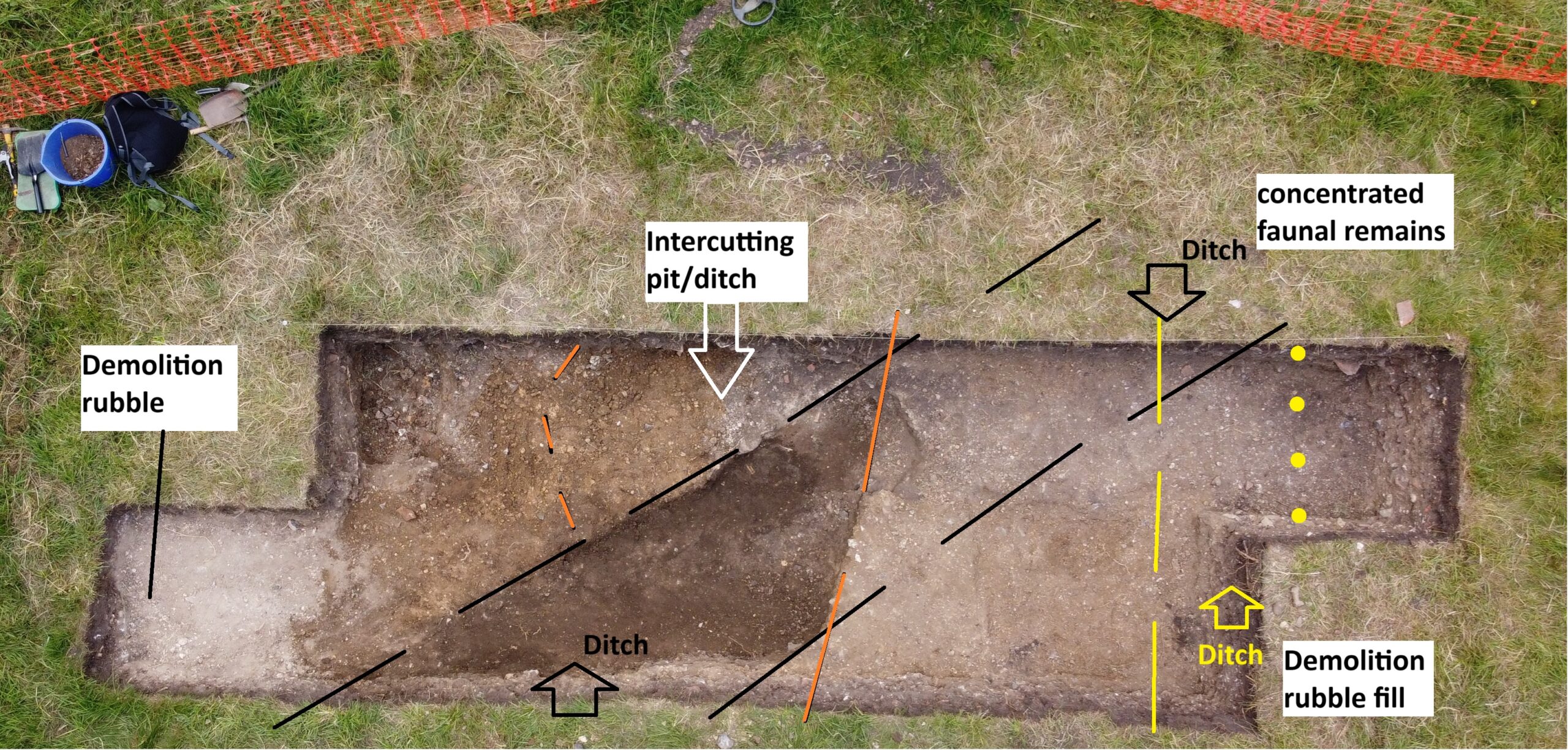
Annotated aerial shot of trench two, copyright Simon Coxall
Trench 2
The historical evidence suggests in the mid-14th century the castle site went through a major refurbishment and between 1350 and 1550 it is likely to have been refurbished again and again so we wanted to put a trench where it wasn’t disturbed by those later efforts and this has proven its value in terms of that there is no evidence of any structures. The ditch at far end is probably 15th/16th century and full of Tudor demolition material. At south end is full of sand brought here as has a lot of material to level this part of the site. The part with the darker dirt is a huge ditch which just keeps going. It is 14th century material coming out of this ditch, although not a huge amount and it is mainly stacks of animal bones but some interesting bits of pot. Like the other ditch it is likely to be amongst the earliest features this far on this site.
Imagine a landscape which doesn’t have this gatehouse, and these ditches may well have been there before that. The object here is to find the oldest bone at the lowest level because one of the dating opportunities is to date the animal bone through carbon dating, but pottery is less precise for dating.
With only one week to go of the excavation the key focus is to continue to get down to the lowest possible level allowed of 1.2 metres with the aim of finding suitable material to use to try and date the earliest period of use of the site.
Drone image of trench one with annotations by Simon Coxall, copyright Simon Coxall
The first fragmentary cobble walls have appeared in trench one associated with the gatehouse structures on the east side. The emphasis there is on going down through the trackway to get to the lower levels / early period. The top layers are producing 15th/16th century pottery and underlying levels coarser sandy wares going back to the 14th / 15th century. Plenty of depth still to go. Widespread faunal remains in trench one.
Drone image of trench two with annotations by Simon Coxall, copyright Simon Coxall
Trench two is now extended to 6x2m shows below demolition levels two sizeable ditches and perhaps a pit cutting same. One holds demolition period material, the pot and other ditch are larger features and in terms of alignment appear to have no relation to the structures suggested by the geophysics. These appear deeply cut and hold almost exclusively faunal remains in a dark humic fill. The lower levels of these features may offer environmental and carbon-dating opportunities. The same area suggests some evidence for smithing slag.
The emphasis in both trenches now is going deeper into identified contexts to our 1.2m maximum.
Excavation director Simon Coxall gives an update of what happened on Friday 6 June.
In Trench 1 the trackway limits were established and exploration of its junction with the structural foundations to the west has been a little problematic at first. The foundations appear to consist of a dense concretion of sand gravels and small sub-angular flint cobbles rather than the larger flint cobbles that were anticipated. Such larger cobbles as survive are redeposited remnants of the former walls perhaps not though worthy to recover from the demolition.
There is nearby corroboration of this foundation method from records of when Saffron Walden castle was explored.
‘…Archaeological excavation and monitoring was carried out prior to and during repair work to the retaining wall between the north side of Saffron Walden Castle and the rear of 30 Castle Street. A 1m-wide trench, stepped for safety, was excavated through the deposits to the south of the wall. Natural chalk was exposed in the base of the trench at a depth of c. 2m below the ground surface. This was sealed by buried medieval topsoil upon which were a series of compacted sand, flint and chalk deposits interpreted as the foundations of the mid-14th century inner bailey curtain wall. The foundations were found to extend along the length of the retaining wall during monitoring. ‘
The depth of these foundations has still to be established. Both the foundation and trackway are to be sampled for evidence of construction methods and perhaps phased construction.
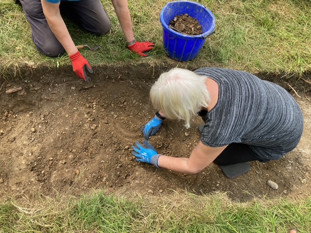
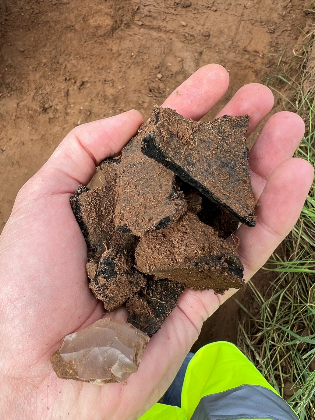
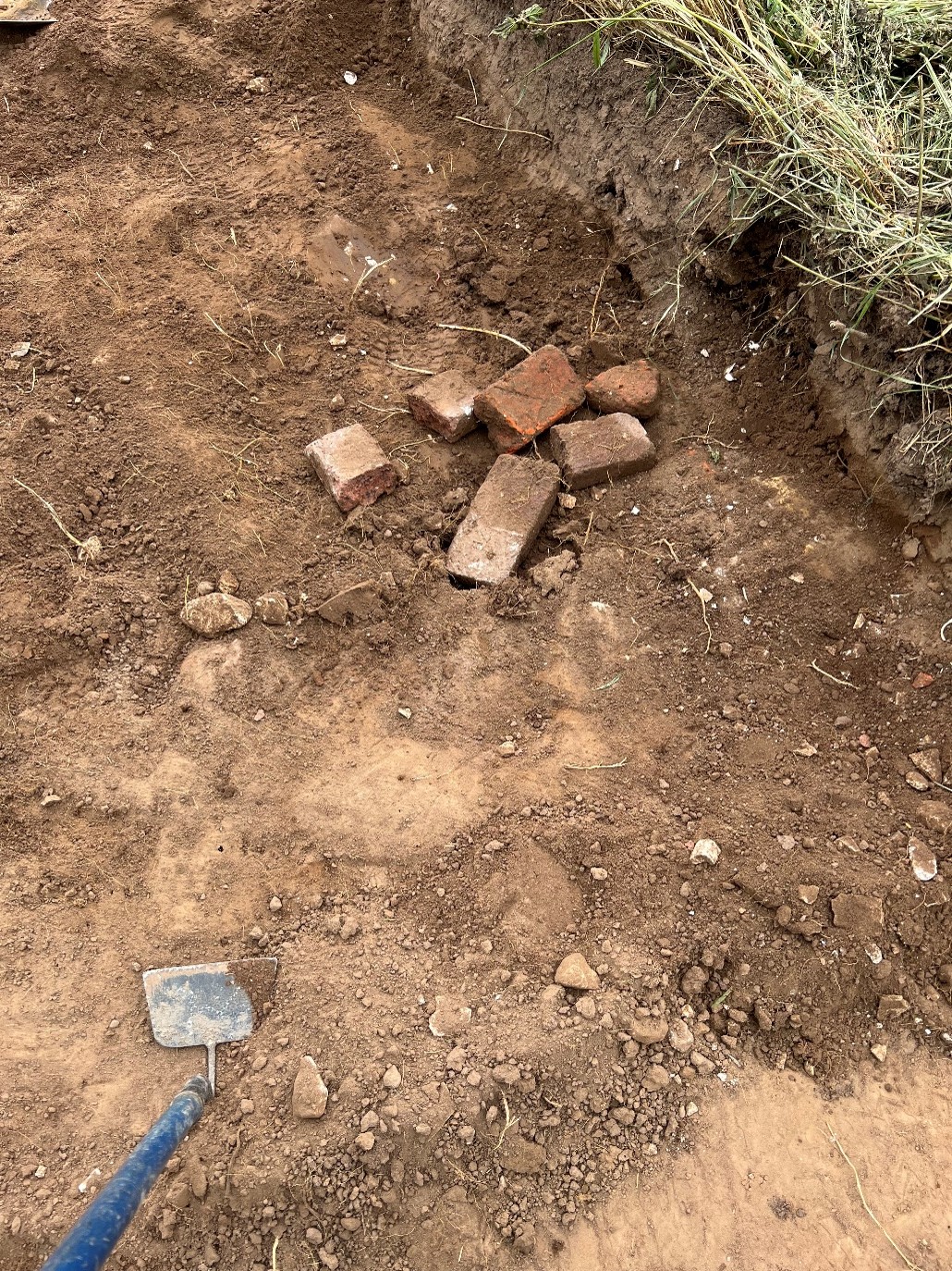
Discovery of the ditch on Wednesday at first thought to be a beam slot, courtesy of Jacky Cooper
In Trench 2 the beam slot found on Wednesday has morphed into a ditch with dark humic fill. At its uppermost levels this contained two sherds of medieval pottery Sandy ware probably for the same vessel estimated as being 14th century. This is being cleaned/defined prior to full excavation of its fill. The ditch encountered at the southern extent of Trench 2 has been excavated and found to contain in the main demolition materials in its upper levels with a medieval jug handle (?) present in the lower fills as presented in the trench’s eastern balk.
The trench has shown the propensity for features hitherto not recorded by geophysics and will be explored further.
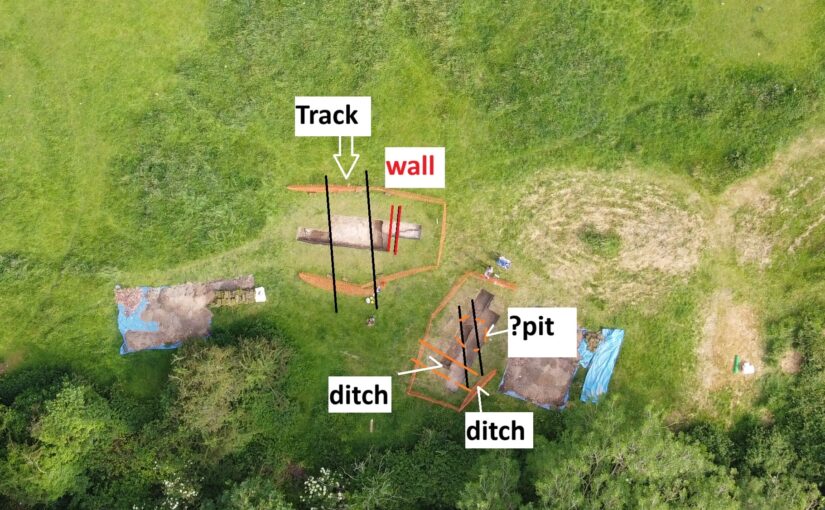
A sketch with approximate trench locations is the featured image and courtesy of Simon. The trenches are being georeferenced in with Oxford Archaeology East assistance on Monday. There’s a decision to be made today (Saturday) regarding extension of either trench to achieve the current excavation limit of 2 x c.2m trenches.
On Monday 2 June volunteer excavators led by Simon Coxall, along with his Warboys Archaeology Group (WAG) and Oxford Archaeology East got underway with the opening of two trenches at Clavering Castle focussed on the eastern side of the castle.
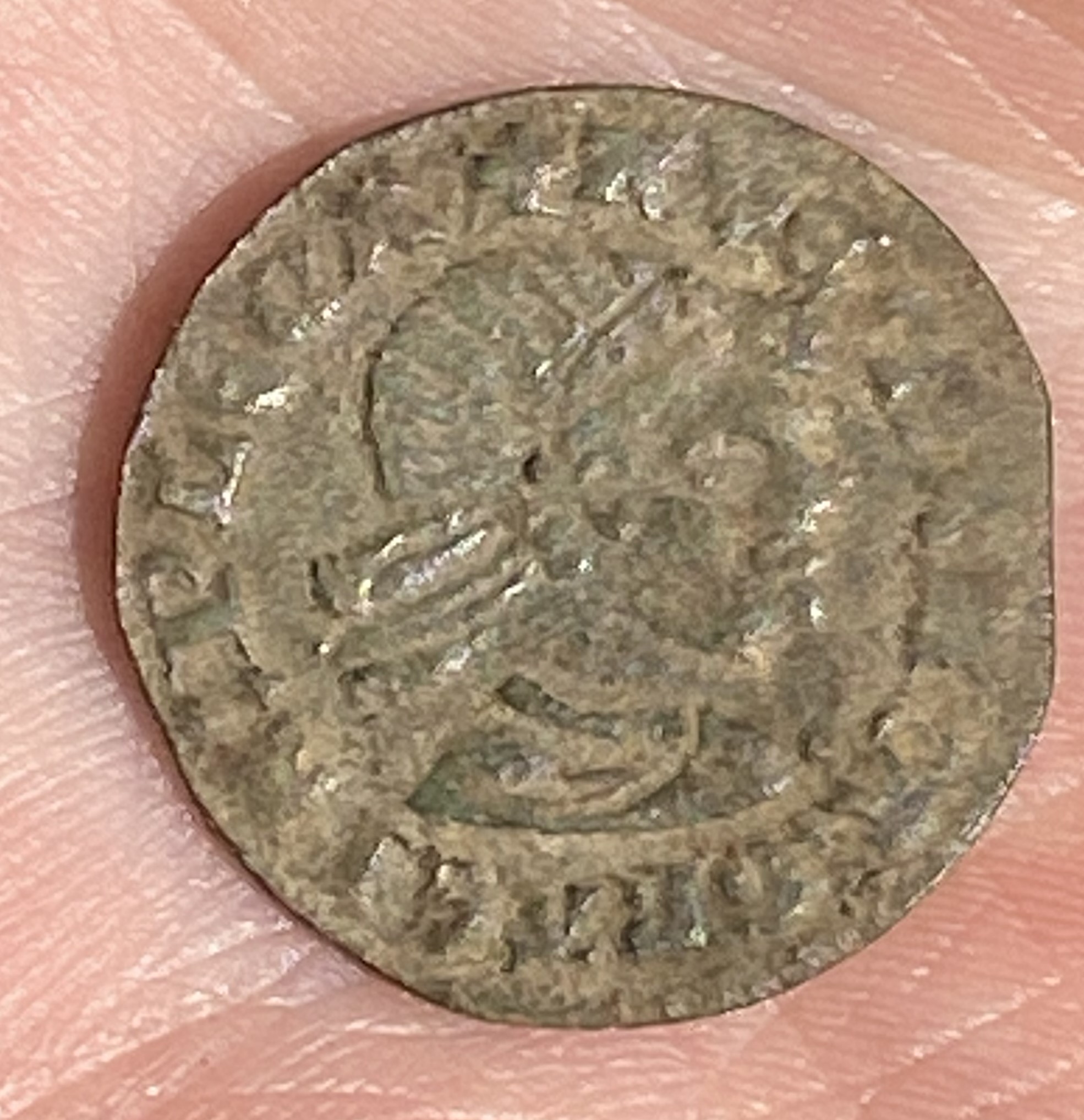
On the first couple of days the excavators predominantly demolition rubble such as roof tiles, but other finds too some worked flint and some medieval nails, a musket ball and most interestingly a fourteenth or fifteenth century French jetton. According to one of the WAG team, Andrew Noakes, the jetton is quite a rare item because it features a Moor’s head. The inscription in French translates as ‘For the queen and her almonry’.
French jetton with Moors head copyright Jacky Cooper
The Clav25 dig at Clavering Castle was sadly hit by rain on the third and fourth days but nevertheless there was good progress in both trenches. In Trench 1 a sandy grit surface was reached which proceeds 2m north to south across the centre of the trench. This is interpreted as the central trackway of the Castle’s entrance court. Some sherds of late medieval/ early modern pottery were recovered from the demolition layers immediately overlaying the trackway. The trackway appears to extend across the area between the evidence for flint structures to the east and west. Meanwhile, at the southern limits of Trench 2, a ditch has been exposed which appears full of demolition material. Material coming out of the trenches includes a lot of roof tile and oyster shell, but very little pottery so far.
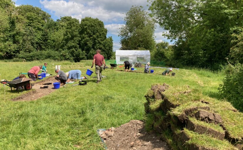
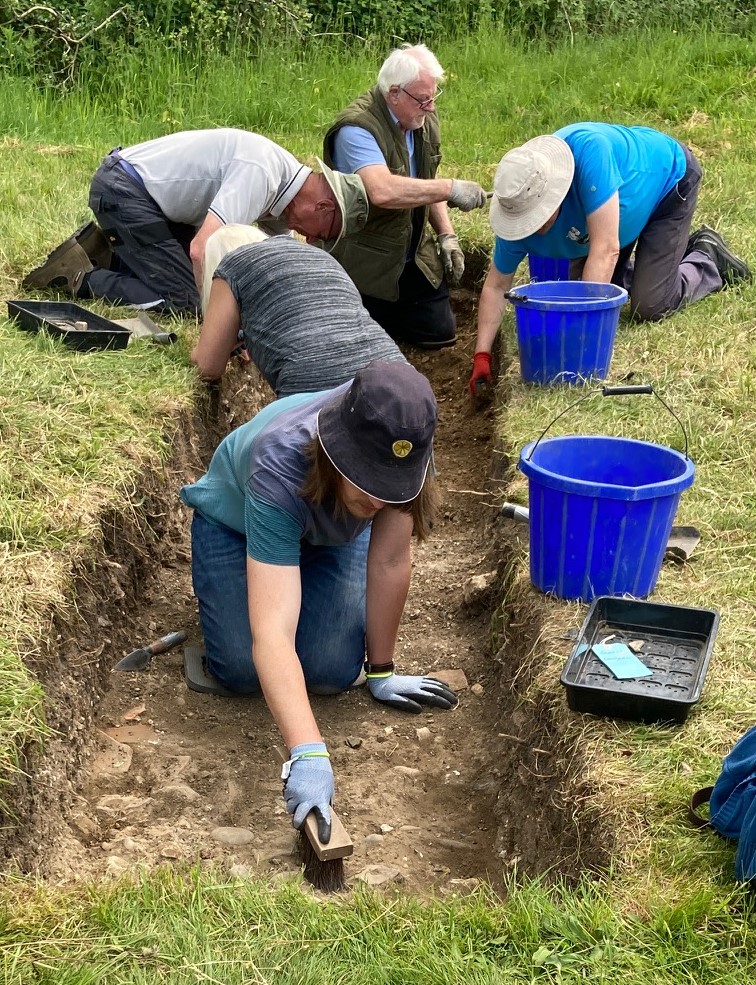
Hard at work in trench two on Wednesday, copyright Jacky Cooper
With the trenches starting to show promise more we will have an update at the end of the week, weather permitting. If it isn’t being kind then early next week.
Excavation Director, and lead archaeologist for the past two decades in the investigation of Clavering Castle sets the scene for what they hope to find over the the next three weeks.
Norman knights fleeing the forces of Earl Godwin of Wessex coupled with miraculous encounters between King Edward the Confessor and St John the Evangelist form just part of the shady historical drama hidden behind the leafy tranquillity of Clavering Castle in north-west Essex.
The scheduled site of Clavering castle is recognised as a rare example of a castle established in Anglo-Saxon England before the Norman Conquest. The castle has been subject of a twenty year programme of detailed historical and archaeological research by the Clavering Landscape History Group. This summer, archaeologists led by Simon Coxall of Warboys Archaeology Group, under a consent granted by Historic England and supported by the Castle Studies Trust, have a unique opportunity to explore by excavation this mysterious and previously unexcavated site.
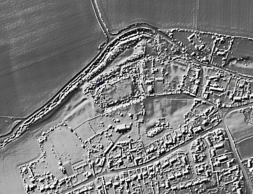
Clavering LiDAR base
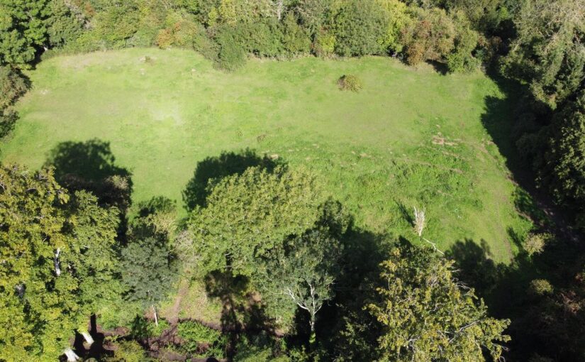
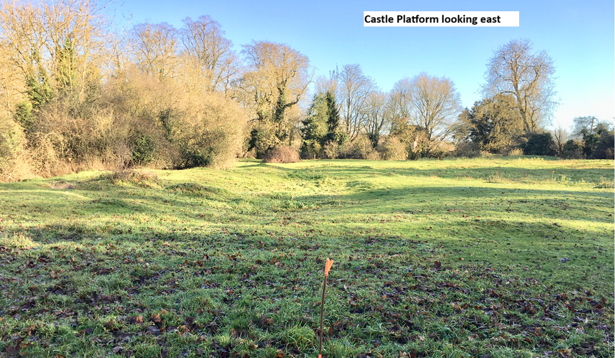
The castle platform which is entirely man-made is surrounded on all sides by imposing moated defences c4m deep and sits in the valley of the river Stort which evidence suggests witnessed significant diversion and management of its river system to accommodate the estate.
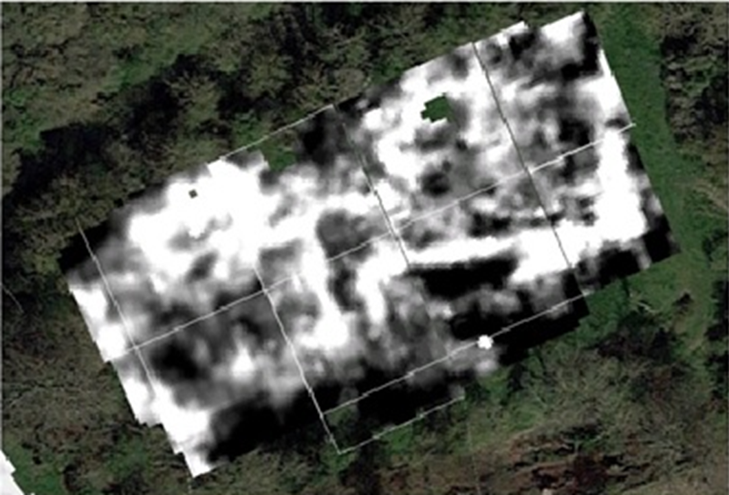
Resistivity Survey of Clavering Castle Platform, copyright Warboys Archaeology
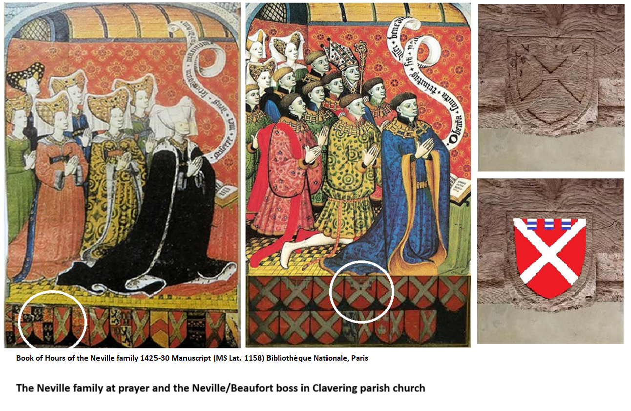
Geophysical survey suggests structures occupying twin courtyards once existed spanning across the sub-rectangular platform which measures c100m x 60m. The Castle platform abuts the parish churchyard to its south. Here further geophysical survey suggests the location of the now ‘lost’ chapel of St John the Evangelist which bore witness to Edward the Confessor’s aforementioned ‘Miracle of the Ring’. The twin courtyards appear connected to one another by an entrance court which issued out onto a bridged crossing of the moat connecting the castle with the family chapel where the alleged miracle occurred. It is suspected the geophysical evidence primarily relates to the powerful Neville family’s reconstruction of the castle site in the later 14th century, although some more ephemeral readings hint at the presence of earlier structures.
The Nevilles were arguably the most powerful baronial family in England during the 15th century and were through their marriage alliances with the Plantagenet royal family at the forefront of the dynastic conflicts now known as the Wars of the Roses. Clavering was selected by the Nevilles as their southern caput, these notorious northern lords presiding over their lordship and hundred of Clavering lying just a day’s ride from London. Clavering castle was successively held by the Neville Earls of Westmorland, Richard Earl of Salisbury, Richard Earl of Warwick and, through his Neville wife, George Duke of Clarence, the executed brother of the Yorkist kings Edward IV and Richard III. With the fall of the house of Neville the castle was seized by the Crown and stayed a crown possession until it was granted back to effectively the last Neville lord of Clavering – Margaret Pole, Countess of Salisbury (1473-1541) Though she refurbished elements of the castle and chapel in the 1520’s, as a devout Catholic and one of the last surviving scions of the Plantagenet royal family she too was executed on the orders of Henry VIII in 1541.
Beneath the levels denoting the Neville tenure of the lordship, archaeologists are hopeful of encountering earlier evidence of the de Clavering and FitzWymarc occupation of the castle. The de Claverings were, like the Nevilles, powerful lords of the north who feature extensively as Magna Carta sureties and later campaigning knights under Edward I and Edward II. With Robert FitzWymarc (c1030-1075) we return to the pre-conquest evidence that promises to push the history of the site back a thousand years to the dying days of Anglo-Saxon England.
Clavering Castle Platform looking east, copyright Simon Coxall
This summer’s excavations will initially focus upon the key area around the entrance court connecting the castle platform with the adjacent churchyard. Such will seek to explore the entrance court and bridged crossing, the various phases involved in their construction, the materials used and its status, whilst testing the geophysical responses.
Digging deeper still, in the same key area archaeologists are hopeful of exploring the earliest evidence for the construction of the castle platform as revealed by the layers underlying the later medieval structures on site. In doing so fresh light will be shone upon the earliest days of castle construction in medieval England.
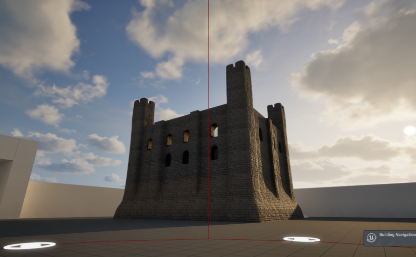
Canterbury Christ Church University was thrilled to receive funding from the Castle Studies Trust for a nine-month project that will produce a new digital reconstruction of Canterbury Castle’s Norman keep in the first century of its construction. The project’s ambition is to then use this new digital asset to create a pop-up exhibition and develop a curriculum resource for schools.
Screenshot of initial ‘whitebox’ of Canterbury Castle’s Norman keep and surrounding structures (courtesy of Mike Farrant)
Canterbury Castle is one of 104 national examples of a tower keep castles (Scheduled Monument Number 1005194 (link)), and one of 20 Norman Castles built in Kent. It is part of a series of royal castles on the route from Dover to London and identified as being one of the earlier examples of the period, usually dated to between 1085-1125, with archaeological evidence suggesting a date c.1100-1125. It has been comparatively overlooked in the research of royal castles of the area, and the role that the castle has played in shaping the city has been overshadowed by other historic monuments, namely Canterbury Cathedral.
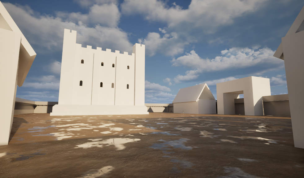
Screenshot of whitebox interior of Norman keep (courtesy of Mike Farrant)
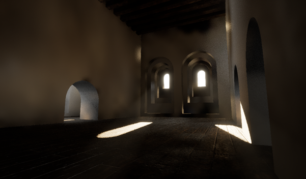
The digital model is being made in Unreal Engine 5, a games engine that enables the development of detailed and immersive digital environments, and draws on existing excavation data. Using a games engine to create the reconstruction facilitates an enhanced user experience; people will be able to walk around the keep’s grounds, and up through the floors of the castle giving them an enhanced sense of place and scale. Additionally, environmental conditions can be included to simulate seasons, weather patterns and even the night time constellations that would have been visible on a given date in the 12th century.
Visualising Canterbury Castle aims to interrogate the potential of multidisciplinary expertise in developing digital heritage projects. To support this, the project’s methodology includes an iterative design process where subject-specialists* will take part in a series of four co-design sessions.
The first co-design session was held on May 22nd, and participants were able to explore a ‘whitebox’ version of the Norman keep and surroundings. ‘Whitebox’ refers to an early stage of a digital reconstruction where a structure’s overall form is created without surface textures, furnishings, or other fixtures. Participants explored the model using large touchscreens and were able to evaluate how the excavation information had been interpreted to date, provide feedback on the current user experience, and make suggestions for how the experience could be developed. The session demonstrated to both the project team and participants the benefits of simultaneously considering the historical data and the audience experience. As Dr Jeremy Ashbee, Head Properties Curator, English Heritage, explained:
I am very interested in how digital media combined with scholarship can be used to improve public access and comprehension of these sites, which even to people like me who have become obsessive about them for decades, still are beguilingly mysterious.
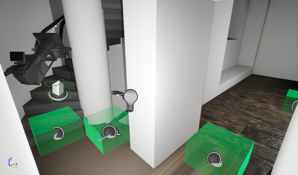
Screenshot demonstrating the development of the underlying user experience functionality including the camera rail system for climbing the staircases and the green travel nodes for touchscreen navigation. (Courtesy of Mike Farrant)
The next milestone for the project will be a public engagement event at this year’s Medieval Pageant and Trail (link) on July 5th where visitors of all ages will be able to explore the reconstruction on screens and provide feedback. Following that, the second co-design session will take place on July 16th.
The project team comprises Dr Katie McGown (Principal Investigator), Mike Farrant (Lead 3D artist), and co-investigators Dr Catriona Cooper, Prof Leonie Hicks, Sam Holdstock, and Prof Alan Meades whose combined expertise range from Norman History, Education, Digital Heritage, Exhibitions, to Games Design. To date, the project has recruited participants from organisations including English Heritage, Canterbury Museums, Canterbury Cathedral, Canterbury Council and Canterbury Business Improvement District.
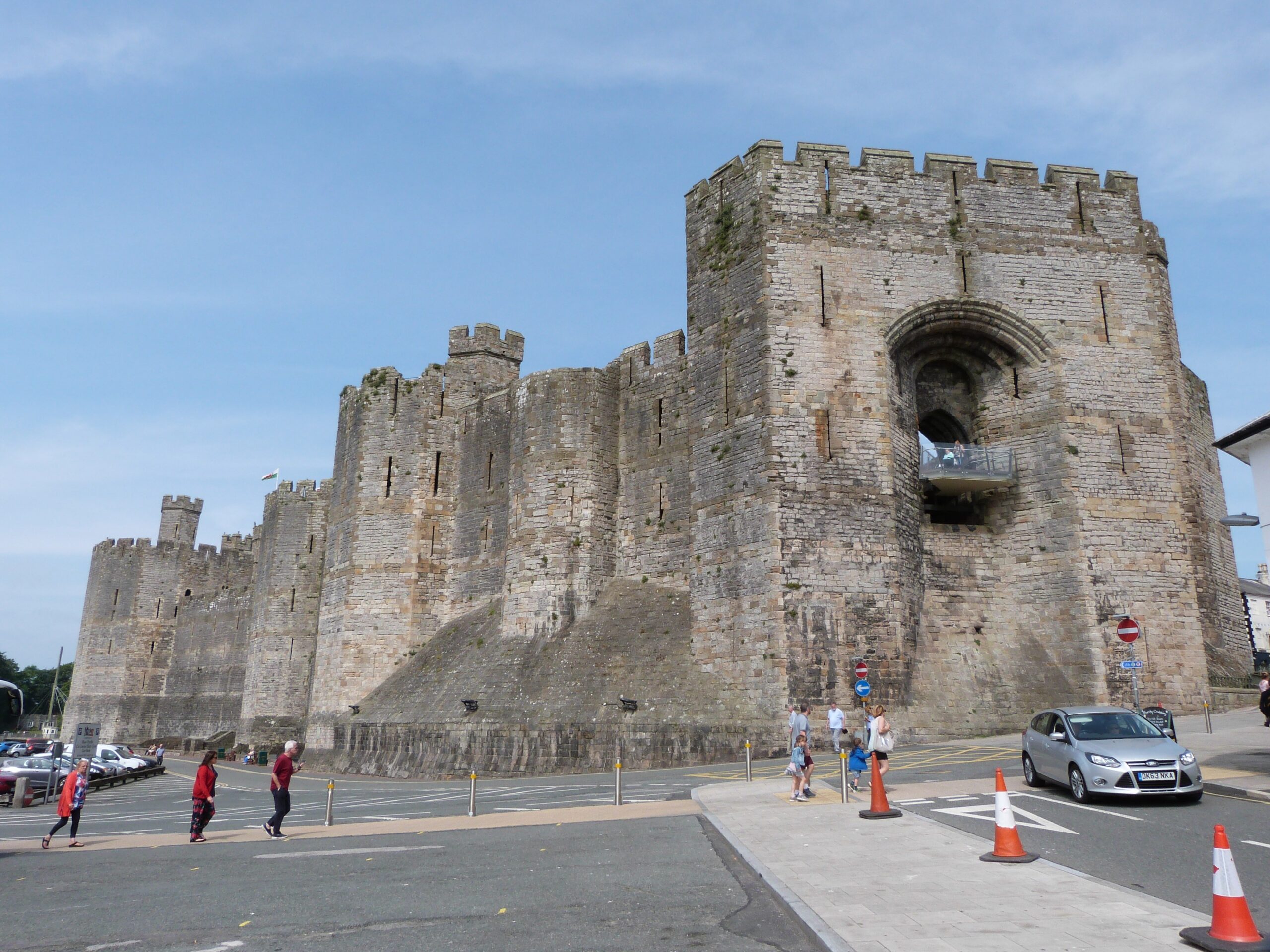
The conquest of Wales in 1283 did more than enforce English military control over Gwynedd: it reshaped the cultural and symbolic landscape of both the principality and its borderlands. At the centre of this transformation was Queen Eleanor of Castile. Though often overshadowed by her husband, King Edward I, Eleanor’s influence on the ideological dimensions of conquest has received increasing attention. My recent publication has focused on Caernarfon Castle in Gwynedd, re-evaluating its design in the light of Eleanor’s cultural and political presence: see Living the Dream. This blog also touches briefly on her involvement with Overton, historically in Flintshire and now part of Wrexham Borough.
Eleanor’s broader impact on the architectural and material culture of the crown is becoming more widely acknowledged, especially in relation to estates and gardens. Yet her role in the narrative landscapes of conquest, particularly in Wales, has remained underexplored. Caernarfon Castle, long seen primarily as a fortress and statement of English dominance, may also be read as part of a more deliberate, symbolic project – one in which Eleanor’s influence shaped both meaning and memory.
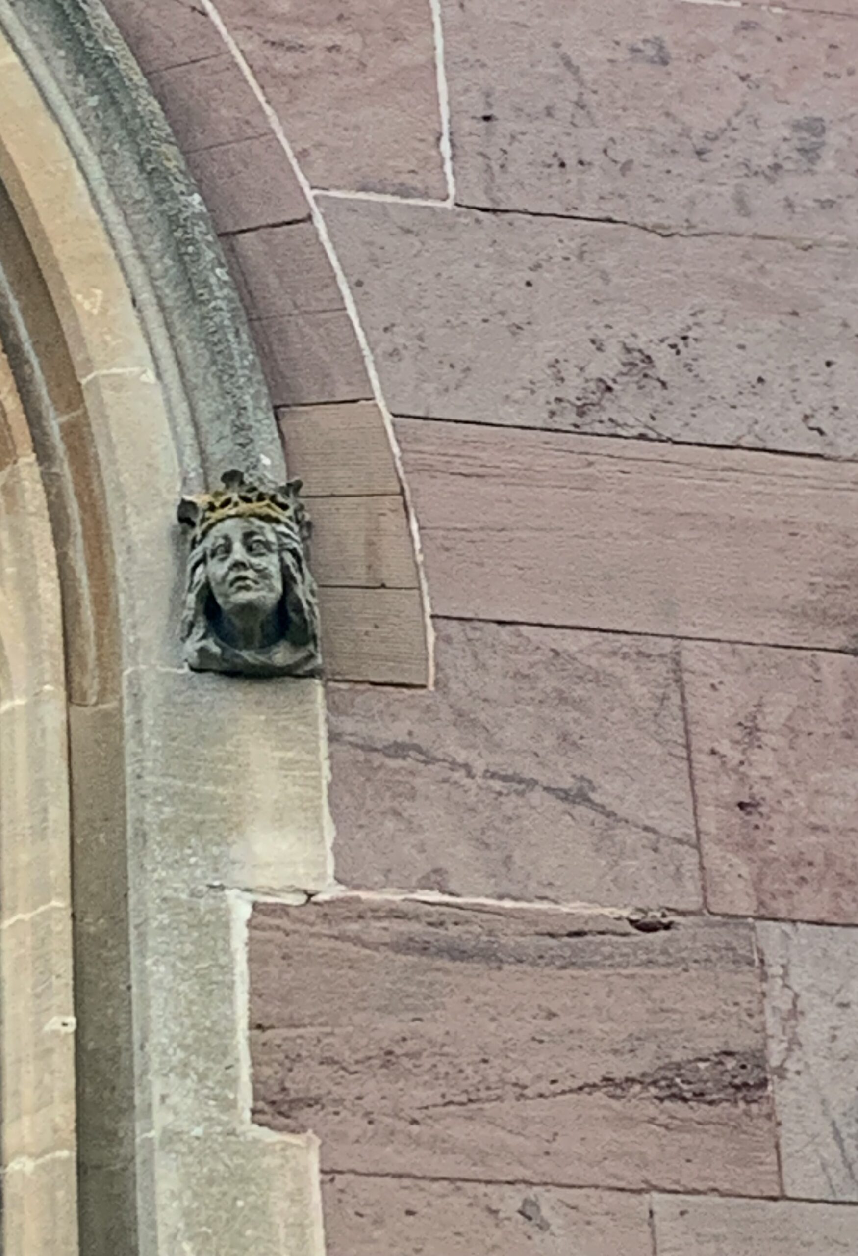
Image of Eleanor of Castille (probable) at Overton Parish Church. Copyright Rachel Swallow
Born into the Castilian royal family around 1241, Eleanor brought with her an appreciation for garden culture, symbolic space, and the communicative potential of architecture. She shared Edward’s interest in Arthurian and Roman imperial narratives, themes that appear in the design language of his castle builds in Gwynedd. At Caernarfon, such symbolism could well have echoed ideas of conquest – not simply as occupation, but as renewal through continuity and legend.
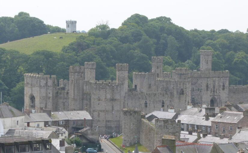
Caernarfon Castle’s banded masonry may have been intended to recall the Theodosian walls of Constantinople, visually linking Edward’s authority with that of Roman emperors. Its location near the Roman fort of Segontium strengthens this earlier interpretation, suggesting a conscious linking of past imperial power to present rule. Yet the site also draws from native Welsh tradition, particularly from the medieval Welsh romance, The Dream of Macsen Wledig, in which the Roman emperor Macsen dreams of a great fortress beside a river, where he meets Elen Luyddog, a Welsh noblewoman who becomes his queen.
Macsen Wledig is not merely mythical: he corresponds to the historical figure Magnus Maximus, proclaimed emperor in Britannia, and later Gaul, in the late 4th century and whose memory was preserved in Welsh legend and genealogy. Magnus was said to have married his daughter to the British king Vortigern—a story enshrined on the Pillar of Eliseg near Valle Crucis Abbey in Denbighshire. The alignment of Eleanor with Elen—a queen associated with building, mediation, and dynastic continuity—would have positioned her within a narrative of legitimacy that transcended simple conquest.
Queen’s Gate, Caernarfon Castle, with motte evident. Copyright Rachel Swallow
This symbolic layering is most clearly visible at the Queen’s Gate at Caernarfon. Set above the landscape beyond and to the east of the walls of the castle and town walls, and with no obvious external access, I suggest that the gate served as a gloriette: an elevated, private space from which the castle’s elite landscape could be viewed. It overlooked a garden laid out in the former bailey of the Earl of Chester’s late-11th-century motte-and-bailey castle, recorded in 1284 as the garden previously belonging to the Welsh Prince’s llys (palace). This elevated viewpoint and garden arrangement is strikingly like Eleanor’s garden and gloriette at Leeds Castle, constructed in 1278. Replacing the former garden of the Welsh Princes, therefore, Eleanor transformed a site of pre-conquest identity into an English and Castilian landscape at Caernarfon.
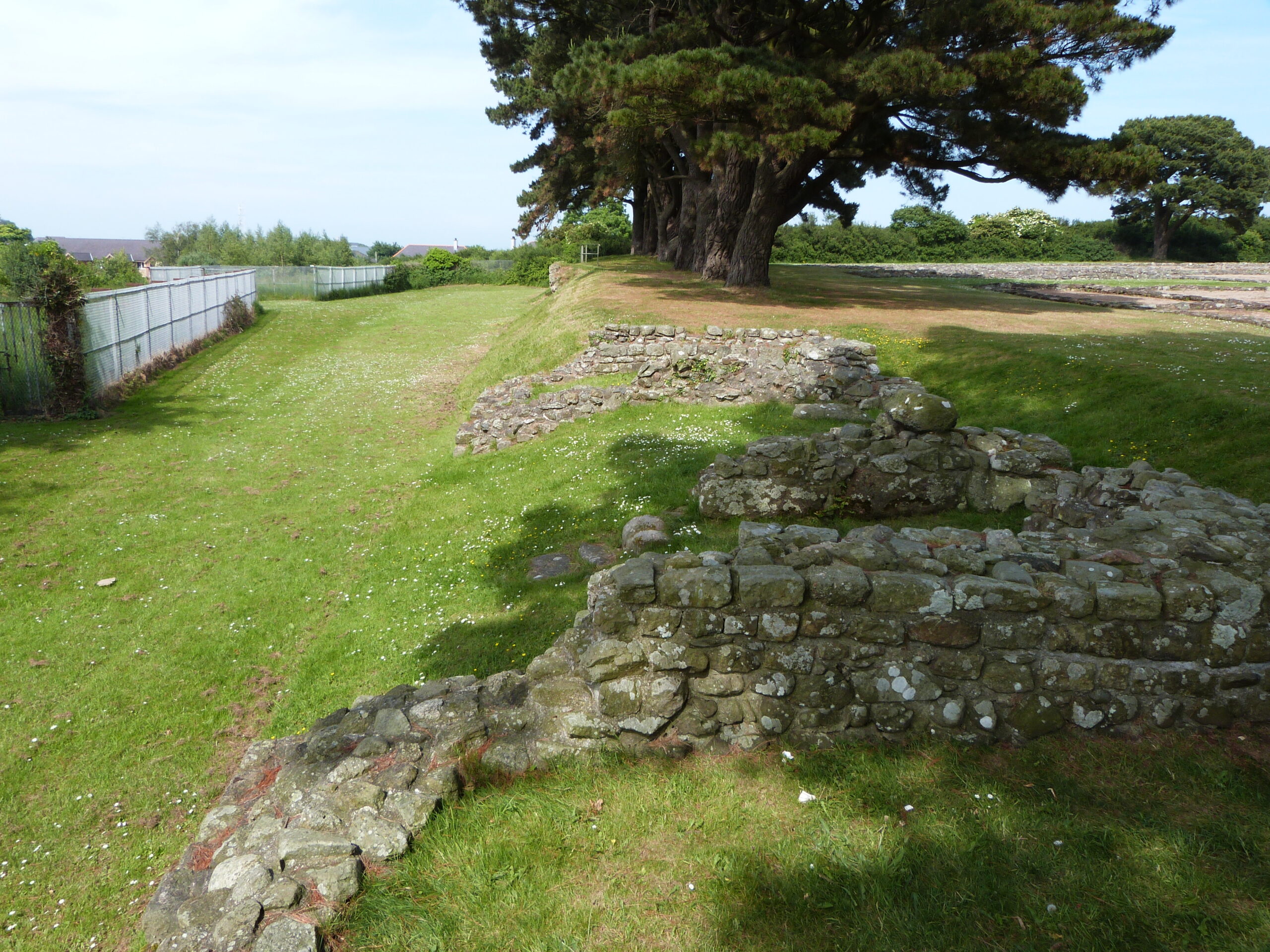
Segontium Fort, Caernarfon. View from East. Copyright Rachel Swallow
Beyond the garden lay the route later known as the King’s Way, following an old Roman road from the Queen’s Gate from the east of the castle site to Segontium fort and the early Christian site of St Peblig. This axis—linking Roman, sacred, and regal geographies—was further extended through the nearby royal hunting park at Coed Helen. The resulting landscape echoed and enhanced upon the ceremonial design of Eleanor’s other gardens and estates, and brought together memory, power, and place.
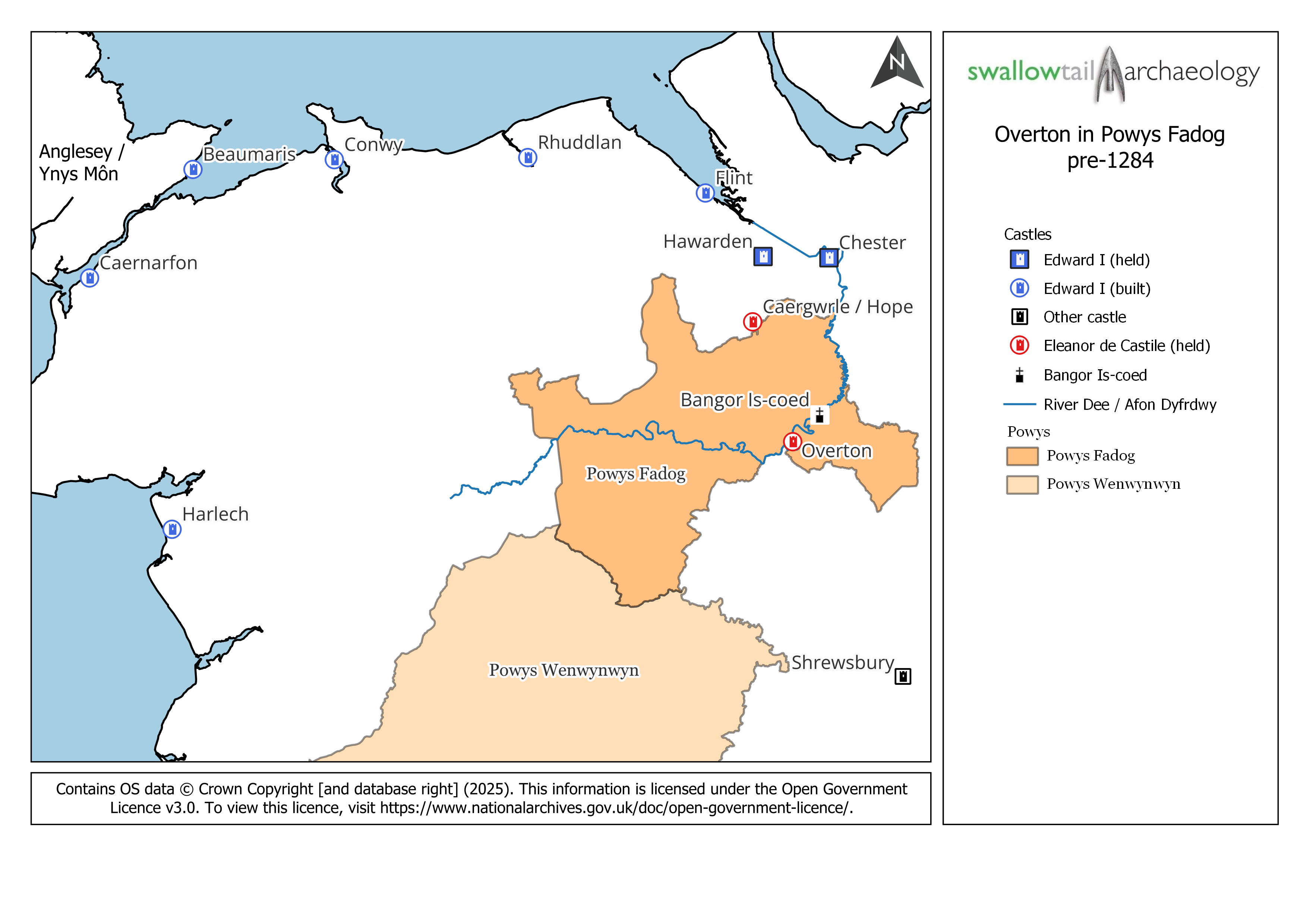
Map showing location of Overton in relation to Edward’s Welsh Castles
Elsewhere, Eleanor’s influence now appears more discreetly. At Overton, then in Flintshire, granted to her as part of her dower lands in 1283, the traces of Eleanor’s presence are quieter but still significant. The site—once a Powysian princely centre—was visited multiple times by Eleanor and Edward and was elevated to borough status in 1292. Contemporary sources refer to a castle, chapel, mill, and gardens. In 1284, Eleanor commissioned stained glass for the chapel and hosted a feast there with the entertainment of over 1,000 Welsh minstrels – an ostentatious display of political theatre.
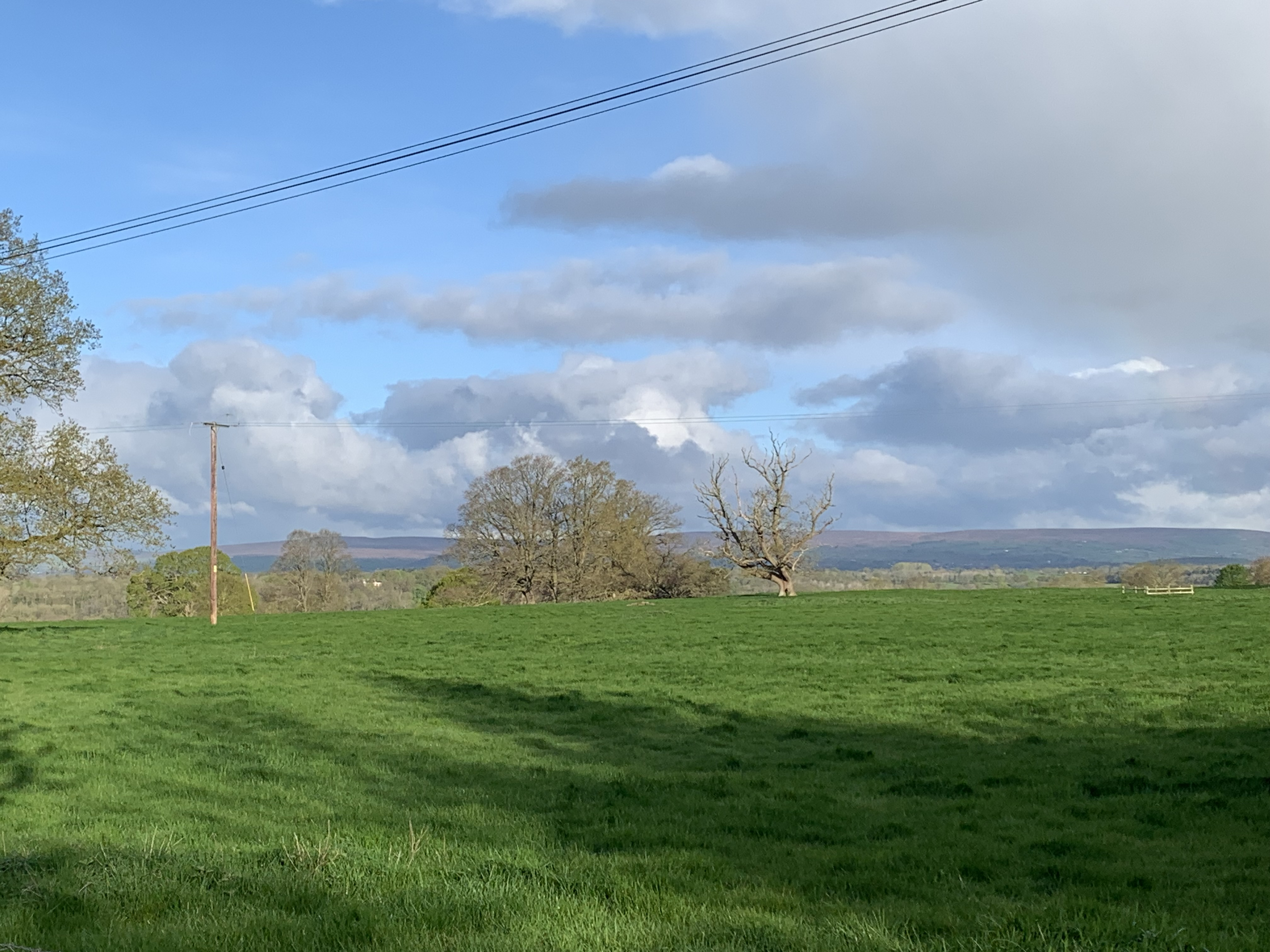
North of Overton. View north west of hills of Clwydian Range. Copyright Rachel Swallow
Overton’s significance extended beyond its material fabric. It lay within a region imbued with historical and legendary associations, particularly those of Powys, whose rulers claimed descent from Magnus Maximus. This legendary lineage, recorded on the Pillar of Eliseg near Valle Crucis Abbey, presented Powys as a kingdom with both Roman and British roots.
The geography of Powys is also preserved in another legendary dream: The Dream of Rhonabwy, a Middle Welsh tale set during the reign of Madog ap Maredudd, the last prince of the entire kingdom of Powys. In this story, Rhonabwy dreams of travelling back to the court of King Arthur, and the landscape described places Powys stretching from Porffordd (modern Pulford in Cheshire, north of Overton) to Gwarfan in Arwystli.
By considering Caernarfon and Overton together—not as isolated places, but as connected elements within Eleanor’s political and symbolic geography—we gain a deeper understanding of how legend, landscape, and queenship intersected in the making of English authority in Wales. Eleanor emerges not simply as a consort, but as a queen whose influence shaped a vision of rule grounded in ancient Welsh tales, place, and space.
My ongoing research and future publication are uncovering the form and probable siting of the lost castle at Overton, revealing its full role within the broader narrative of royal presence and designed landscape. Watch this space!
Rachel Swallow FSA (Swallowtail Archaeology ) is an archaeologist whose research has reshaped our understanding of castles and their landscapes. Elected as a Fellow of the Society of Antiquaries of London in 2018, her work explores the social, political, and architectural significance of these sites within their broader contexts. Rachel completed her PhD in 2015, and she is a Visiting Research Fellow at the University of Chester and holds an honorary fellowship at the University of Liverpool.
The Castle Studies Trust has awarded a research grant to Dr Esther van Raamsdonk (University of Utrecht, Netherlands) and Paul Pattison (English Heritage) to work on an early 17th-century manuscript from the National Archives, concerning fortifications and castles on the south coast of England.
The manuscript was discovered over 40 years ago by Charles Trollope, following which, the late John Kenyon published a preliminary assessment (Fort vol 11, 1983, pp 35-56), showing that it related to a survey of several coastal fortifications along the south coast of England, mainly those that originated in Henry VIII’s castle building programme in the 1540s. However, the manuscript is in Dutch, so as Kenyon rightly says: ‘translation of the Dutch is required to assess the document’s full significance and to possibly produce a more exact date than I am able to postulate at this moment’ (p. 37). His article examines some of the plans in the document, but there is no engagement with the Dutch text, which is more than 50% of the document. No transcriptions or translations have therefore been made before.
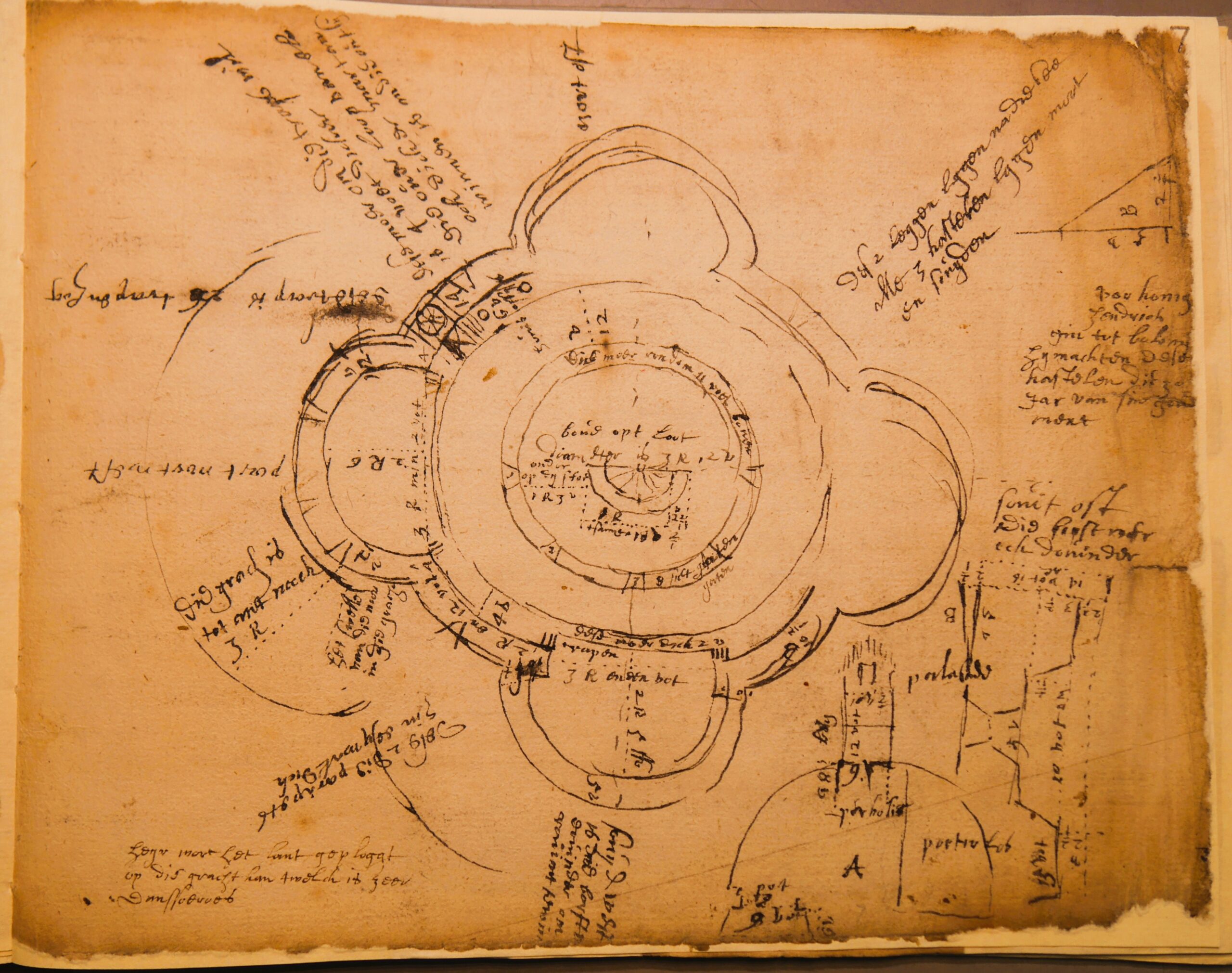
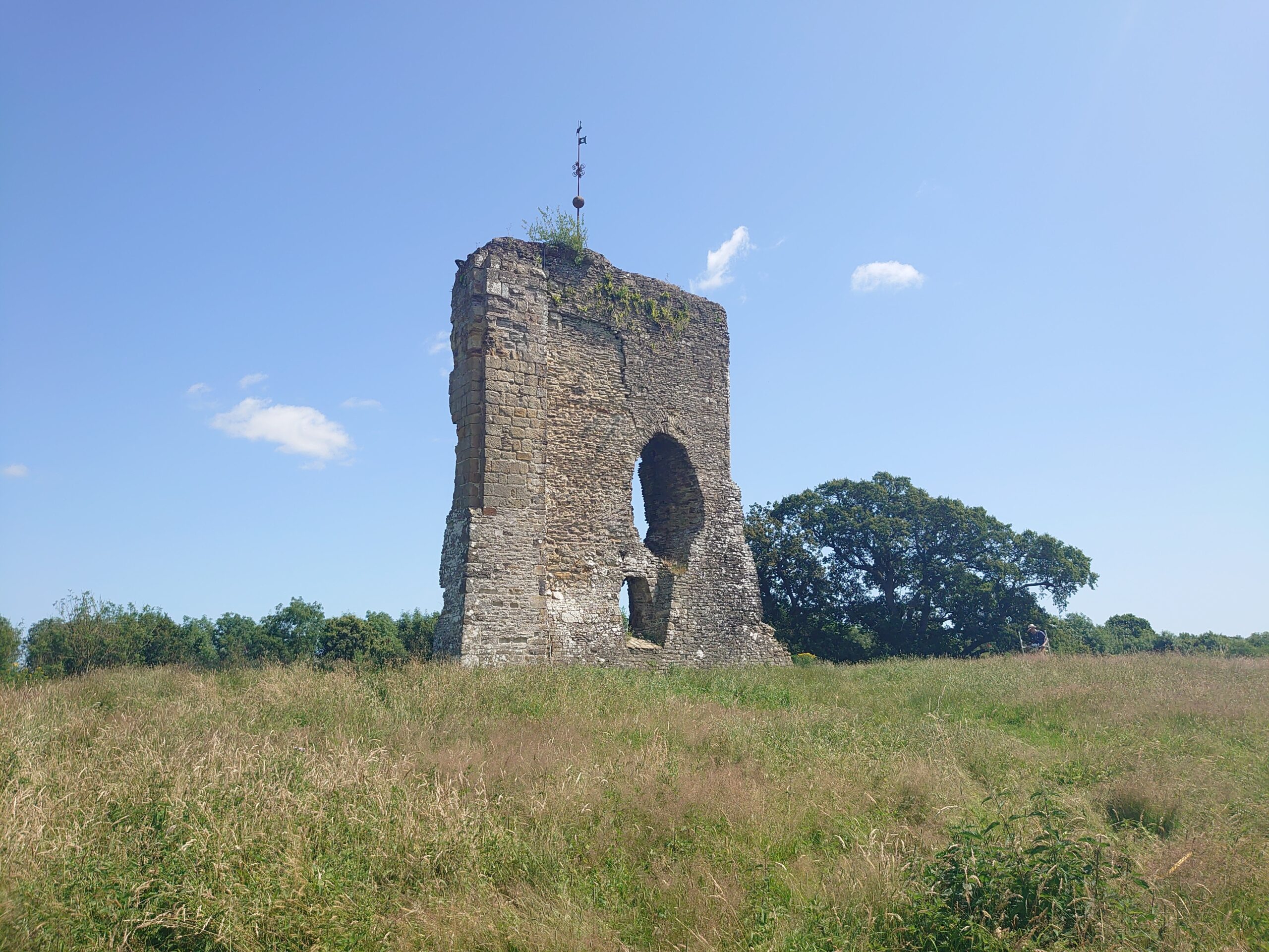
Sketch of Walmer Castle by the Dutch Engineer, courtesy of the the National Archive
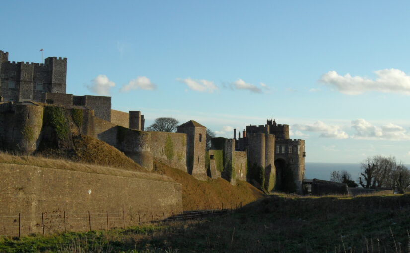
The manuscript seems to be a surveyor’s on-site notebook, comprising fairly accurate and proportioned sketch plans. These beautiful drawings show a highly-skilled engineer at work, and one with a talent for exact survey drawings. These are supported by keyed notes and more detailed explanatory text. It covers most of the main fortifications and castles along the south coast, from Sandown Castle near Deal in Kent to Pendennis Castle at Falmouth in Cornwall.
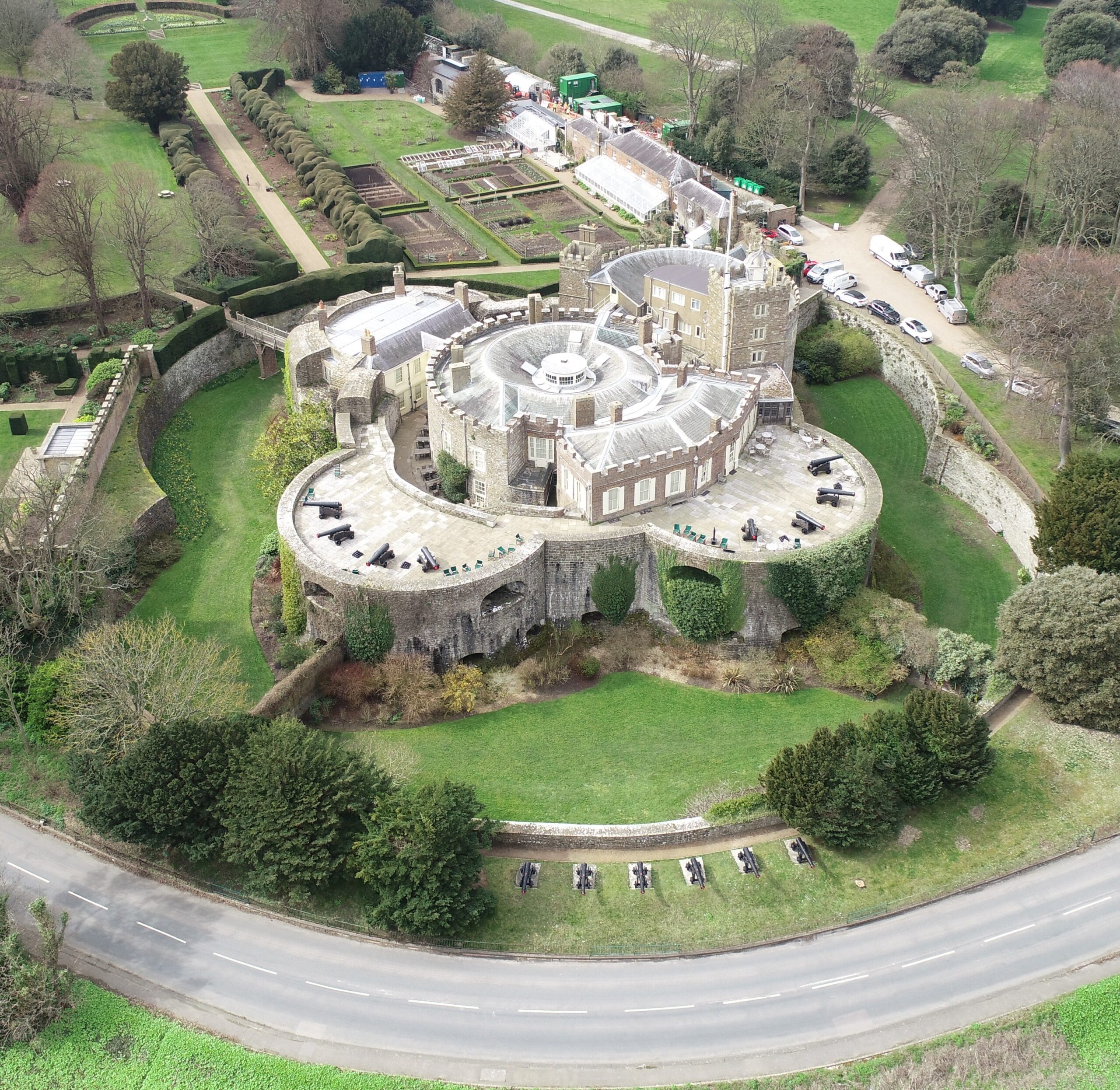
Walmer Castle today copyright English Heritage
Paul came across the manuscript several years ago and recently, prior to writing a new guidebook for Yarmouth Castle, Isle of Wight, looked for a palaeographer to transcribe and translate the pages for Yarmouth – enter Esther. Paul is a historic fortifications specialist, and his job is to help to make sense of the translation, as the conversion to English is not always obvious: there are many military and technical terms and sometimes the meaning is not immediately apparent. However, the sketched plans are annotated and keyed, which should help in understanding specific parts of each fortification. Esther is an expert palaeographer, having taught early modern English palaeography courses for some years, and scholar of 17th-century Anglo-Dutch relations. The grant is towards her costs of transcribing and translating the text and notes. It is not an easy task. The hand is a difficult one and several pages are faded. The Dutch engineer spent some time in England and the result is a hybrid language, a phonetic (for Dutch readers) spelling of English words. The document also functioned as a shorthand for the author, using non-standard abbreviations, idioms, and little drawings. The exercise is therefore not of a straight-forward transcription but requires quite a bit of puzzling.
As mentioned, we used the Yarmouth example to see what information we could gather from the manuscript. From this test case we know that the surveyor was commenting on condition and making recommendations for repairs and changes. Because of the detailed map and key, we could pinpoint the function of some rooms that were hitherto unknown. We look forward to see what further secrets the document will reveal about the other buildings.
The funding will enable us to examine a sample of the manuscript covering several sites in the Cinque Ports area of jurisdiction – Sandown, Deal, Walmer, Dover, Sandgate and possibly Camber. All of these are well known to Paul, and it is hoped that significant details about the condition of each castle or fortification will be forthcoming, for comparison with other contemporary accounts in English, to see and understand where this survey fits and whether or not it resulted in any repairs or additions on each site. John Kenyon thought it might date to the 1620s: we would like to try and confirm that, or otherwise, by comparison with earlier and later surveys, and to establish the political context for its commissioning. This will lead to at least one provenance article. The transcriptions (some of which will be published) will also provide a very valuable snapshot of the south coast fortifications 80 years or so after their creation, and form a test for the usefulness of going further and transcribing the whole manuscript. There is an exciting journey ahead.
The Castle Studies Trust is delighted to announce the award of five grants, totalling a record amount of £42,000, to a wide range of projects with different types of research. The amount means that since our foundation we will have given over £300,000 to castle research projects – a landmark to celebrate.
Canterbury, Kent: To create an interactive digital model of the castle’s keep. The keep is one of the largest surviving from early Norman England dating to the late eleventh / early twelfth century. Now much ruined and inaccessible to visitors due to instability, the project will use the findings of previous archaeological research to create an interactive model. Work will start in March and be completed within ten months.
Clavering Castle platform copyright Simon Coxall
Clavering, Essex: To fund an excavation to help understand the development of the site which was occupied for over 600 years and which could be one of the very few pre-conquest castles in the UK. The excavation will build on the extensive survey work carried out by the local group of the site. They are planning to do the excavations in June.
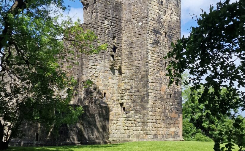
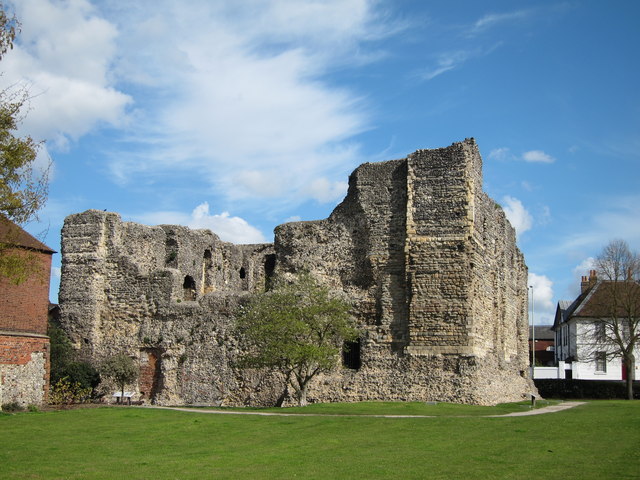
Crookston Castle copyright Friends of Crookston
Crookston, Glasgow: A community-led geophysical survey, using multiple techniques, through which the Friends of Crookston Castle in conjunction with HES hope to learn more about Glasgow’s only castle. While the standing remains are believed to date from the early fifteenth century, it is believed that the castle dates back to the twelfth century. The group hopes to discover evidence of that earlier history and whether it was based on an earlier Iron Age hillfort. They plan to do the survey in early August.
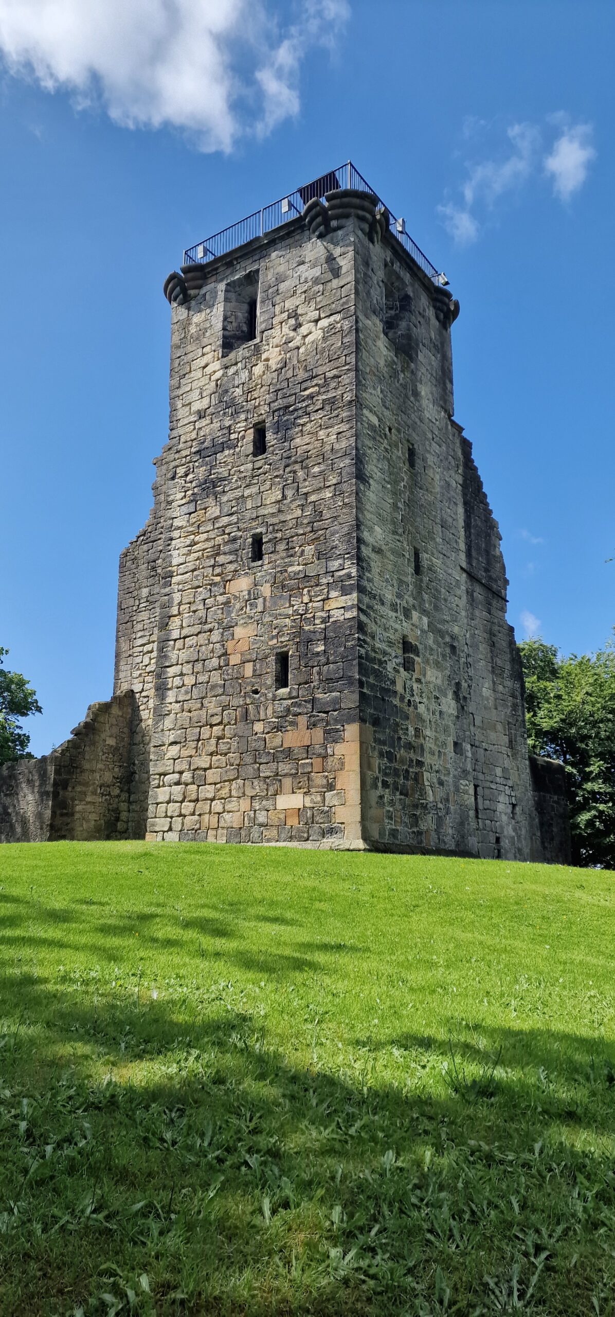
Knepp Castle copyright Richard Nevell
Knepp, West Sussex: An excavation building on a geophysical survey to better understand the site’s development and its relationship to the local area of this important baronial centre thought to be built by the de Braose family. The first documentary evidence is from 1210 when it was under royal control, documenting repairs, while the geophysical survey shows activity that pre-dates the extant stone tower. Excavations are planned for late July/ early August 2025.
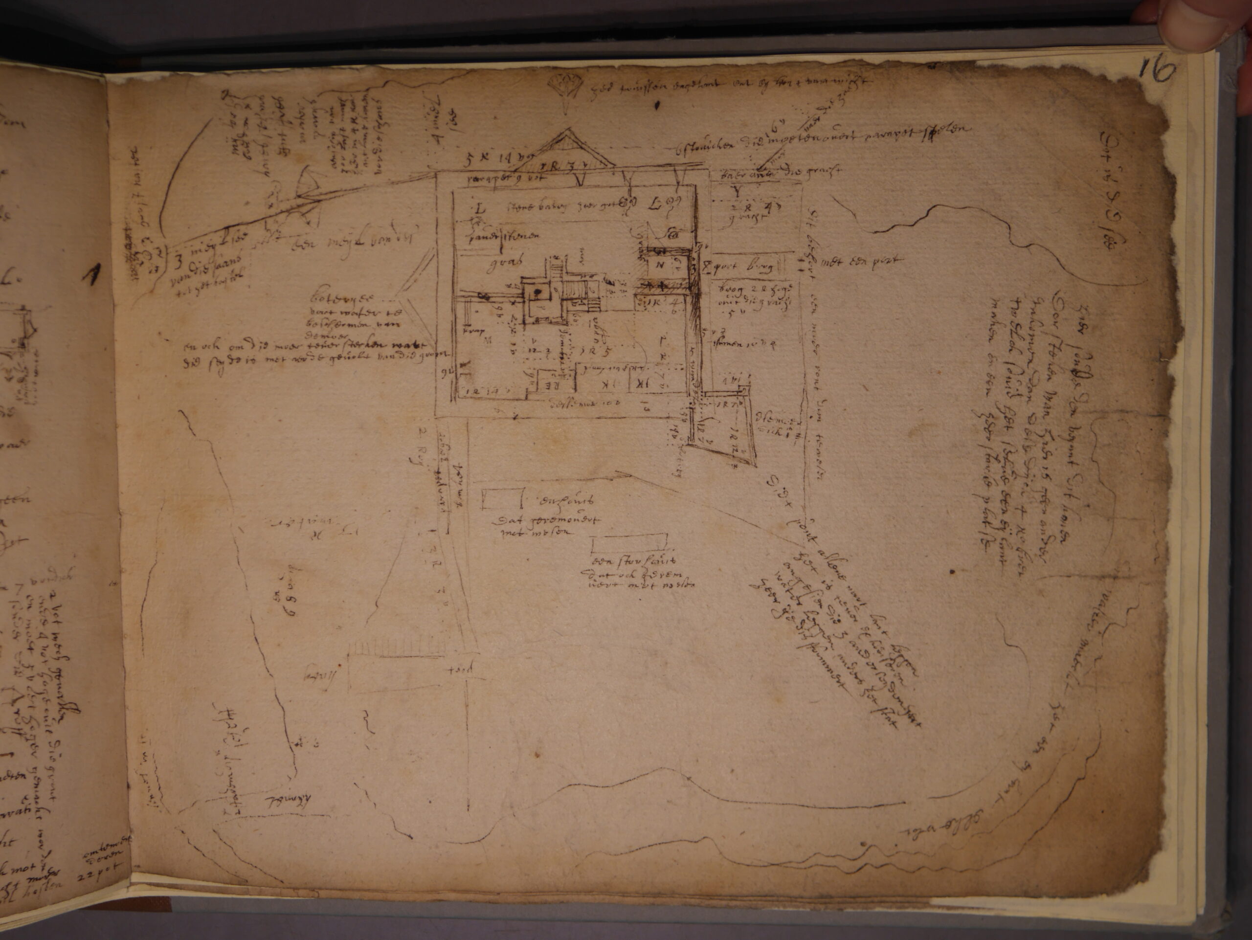
Image of Transcript copyright Esther van Raamsdonk
Transcription and translation of C17 Dutch Engineer’s Survey of English castles and fortifications: A joint project between Dutch academic Dr Esther van Raamsdonk and English Heritage to transcribe and translate part of an early seventeenth-century manuscript of a Dutch surveyor’s examination of castles and forts in England. The sample covers five of the 22 castles and fortifications in the document, which is called SP 9/99, held by the National Archives in Kew. The sample will include Dover, Walmer and Deal. The document is filled with detailed drawings and maps of these fortifications with often lengthy descriptions of their condition. Esther has already started work on it.
Dr Ryan Prescott, project lead, looks at what the excavations at Newhouse have uncovered, now the final report is in.
In June 2024, a team from Humber Field Archaeology completed a trial excavation at the presumed site of Newhouse Castle in Brocklesby, North Lincolnshire, generously funded by the Castle Studies Trust. The fieldwork, which followed a geophysical survey conducted in 2023, aimed to uncover evidence of the castle which was soon replaced by a monastery during the period known as ‘The Anarchy’. The results of the excavation, now available in the post-excavation report, have provided fascinating insights into the site’s more complex history.
Two trenches were carefully excavated, revealing a narrative that spans many more centuries than what had previously been understood about the site:
Prehistoric Activity: Flint tools and pottery fragments hinted at Neolithic and Bronze Age activity, suggesting the site has held importance for millennia.
Anglo-Saxon Origins: A potted cremation burial, complete with grave goods like a knife and a decorated glass bead, was unearthed in Trench 1. This burial, dating back to the mid-6th century, suggests the site was already significant long before the construction of the castle and abbey at Newhouse. Nearby, leather and woven textile fragments were recovered, providing a rare glimpse into the craftsmanship of the era.
Medieval Ditches: Sections of a moat-like ditch encircling the earthwork were excavated. Their sharp cuts and rapid infilling suggest limited use. Although devoid of finds evidence (very frustrating!), a post hole was recovered near to the ditch within the interior of the earthwork, possibly tied to the short-lived history of Newhouse Castle.
Post-Medieval Activity: Traces of later use included 17th-century brick deposits, potentially linked to landscaping efforts attributed to Capability Brown when it would appear that material was moved across the site in this new phase of occupancy.
Pottery fragments and flint tools show how the site was occupied long before the mid-twelfth century.Early Modern brick assemblages underline the continued use of the site following the Dissolution of the Monasteries.
Summary
The findings from Newhouse underline the site’s long-term occupation and its ongoing significance in the landscape of North Lincolnshire. Although no definitive structural remains of the castle were identified (this was always going to be tricky!), the excavation enhances our understanding of how the site evolved—from its prehistoric roots, to its medieval prominence, and beyond.
The full post-excavation report is now available, offering a detailed account of the discoveries and their importance. Perhaps inevitably, we have sparked potentially more questions than answers. However, we have nonetheless helped to advance the debate and our understanding of this intriguing site. We extend our gratitude to the Castle Studies Trust for their support.
The final report is on the project page of our website.