This post was written by Dr Audrey Thorstad, Lecturer in Early Modern History at Bangor University.
As castle scholars and enthusiasts, we enjoy learning about history, exploring how the remains of the past can teach us about the lives of people who came before us, and perhaps what we might learn about ourselves through their experiences. Did those in the past feel the same way? How did they view their own history? How did they embrace or even manipulate the history of the landscape in which they lived?
The physical and material remains tell us a story of a layered history. Any given castle can have centuries of history layered and intertwined with one another. For Tudor castle owners, builders, and renovators, the past played an important role in how they used and interpreted the building and the landscape.
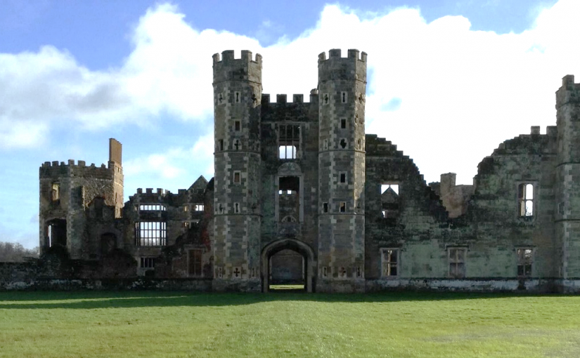
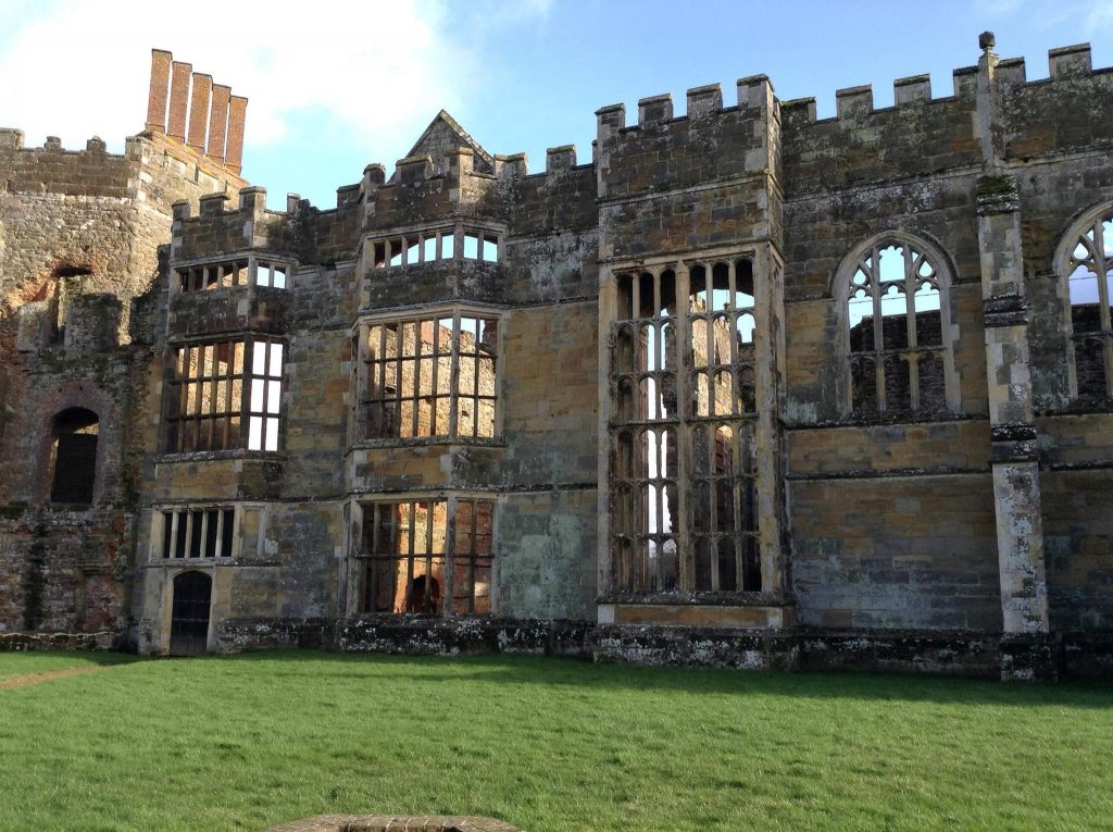
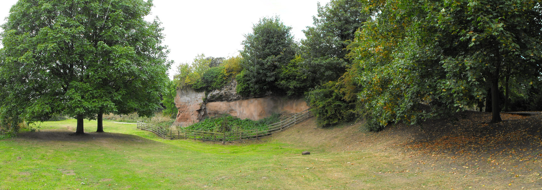
An interesting example, though just one of many, is Cowdray House or Castle in West Sussex. The building that survives today had two main phases of construction during the late 15th and early 16th centuries. The first phase started by Sir David Owen from around 1492 and saw the completion of the eastern and northern ranges. The second phase began when Sir William Fitzwilliam, later earl of Southampton bought the estate in the late 1520s and completed the southern and western ranges. Although it appears that the surviving physical remains depict a completely new build, thirteenth-century floor tiles indicate there may have been an earlier residence on the site.
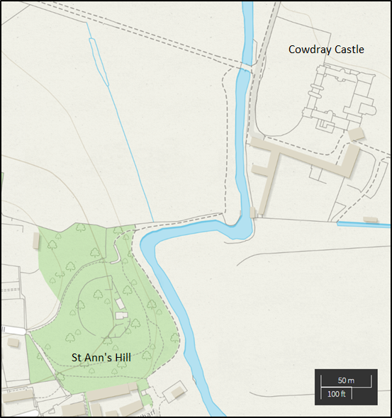
The placement and building of Cowdray was no mistake. To the west, the residence looks out onto the town of Midhurst; to the north and east the castle looks out onto parkland. Fitzwilliam received a licence to impark and crenellate in 1533 from Henry VIII. The licence allowed him to impark 600 acres of land, meadow, pasture and wood.[1] To the south of Cowdray is St Ann’s Hill, the location of a Saxon cemetery dating from the fifth and sixth centuries as well as a Norman castle owned by the Bohun family until the 15th century.[2] These views were meant for those in the castle as well as those approaching the castle. The town and parkland scenery evoked lordly privilege and status, while the closeness of the newly built Cowdray and the old Norman castle gave the observer a sense of historical significance.
By rebuilding the castle not on the original site of St Ann’s Hill, but approximately 400 meters away, the Tudor builders were using the past in very interesting ways. The new build broke away from the Norman past and the Bohun family tradition, yet kept the site as a physical memory of that history. Cowdray does not have a completely new history starting in 1492 when Owen started building the castle, but an intertwining and connected history to the town and historical sites around it.
Owen and Fitzwilliam were not alone in their endeavour to create their own legacy by shaping the past. John de Vere, thirteenth earl of Oxford renovated his familial stronghold at Hedingham Castle making the Norman great tower the central building of the inner bailey with his late-fifteenth-century brick towers surrounding the twelfth-century great tower like a monument to his ancestors. It was not just castle building that allowed the Tudor nobility and gentry to use the past. Sir Rhys ap Thomas, for example, used the coat of arms of Urien of Rheged as his own, claiming descent from the sixth-century king of Gower. The use, and arguably manipulation, of history by the sixteenth century elite was nothing new. The nobility and gentry throughout the Middle Ages were interpreting and adopting the past. What sets castles apart is the constant, and at times, unbridled incorporation of structures, materials, landscapes, and histories that came before.
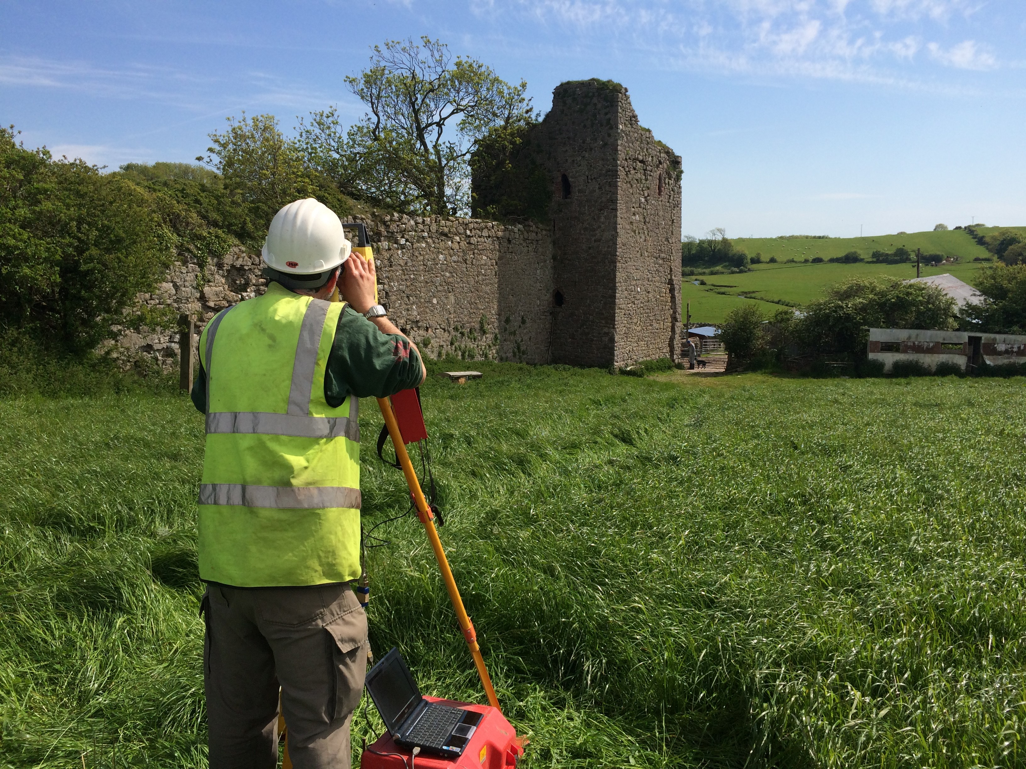
Geophysical and photogrammetric surveys of this motte and bailey castle. Abandoned by c.1200 this has the potential for us to advance our understanding of early castles along the Welsh border.
One of the earliest castles in the UK and one of the most important along the Welsh border the geophysical survey and excavations, along with separately funded building analysis, will help understand the morphology of this little understood site. The CSG visited it as part of the 2016 annual conference. Please note this is a privately owned site and not accessible to the general public.
Co-funding with Cadw a geophysical survey of the most complete, but little understood, native Welsh built castle to discover what structures lie beneath the surface.
With almost nothing left above ground the geophysical and earthwork surveys will help shed light on the form of castle with strong royal associations, in particular the C15 palace associated with the House of York and birthplace of Richard III. Please note this is a privately owned site and not accessible to the general public.
Analysis of castle masonry from the completely destroyed late C15 castle built by Thomas, Lord Stanley either found via excavations or reused in the current building. This will help understand what the castle looked like and early Tudor palaces around London, like Richmond. Please note this is a privately owned site and not accessible to the general public.
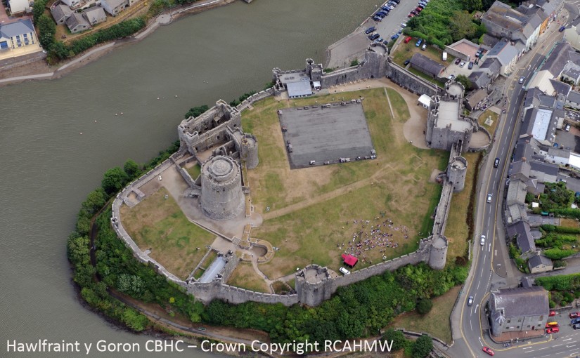
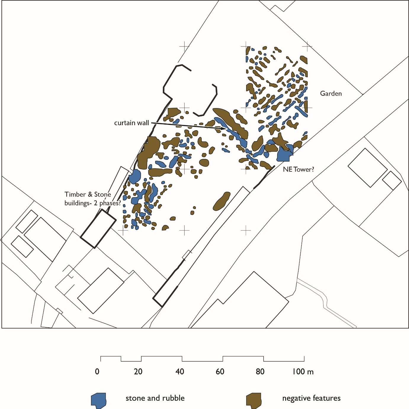
Aerial photo of Pembroke Castle from the west, showing parchmarks (Crown Copyright RCAHMW, AP_2013_5162)
New work by Neil Ludlow and Dyfed Archaeological Trust (DAT) has revealed the remains of long-vanished buildings, and other features, at Pembroke Castle. Pembroke is famous for its large round keep, built by earl William Marshal, and a number of stone domestic buildings are preserved in the inner ward. But the large, outer ward has been an empty space since at least the eighteenth century.
In 2013, routine aerial photography, by Toby Driver of the Royal Commission on the Ancient and Historical Monuments of Wales (RCAHMW), revealed a number of ‘parchmarks’ in which the outlines of buried walls could be seen, as shorter grass, in the castle. He contacted Neil, who applied to the Castle Studies Trust for a grant to carry out further work at the castle. Thanks to their funding Neil, in partnership with DAT, was able to undertake a full geophysical survey of both the inner and outer wards in May 2016.
Three different methods were applied. Magnetometry, which measures magnetic variation below the ground, was carried out by DAT while Tim Southern undertook resistivity survey, which measures electrical resistance, on DAT’s behalf. Both processes can reveal buried walls and ditches and Ground Penetrating Radar, which can detect features to a depth of over 1.5 metres, was also undertaken in the outer ward, by Tim Fletcher of TF Industries Ltd..
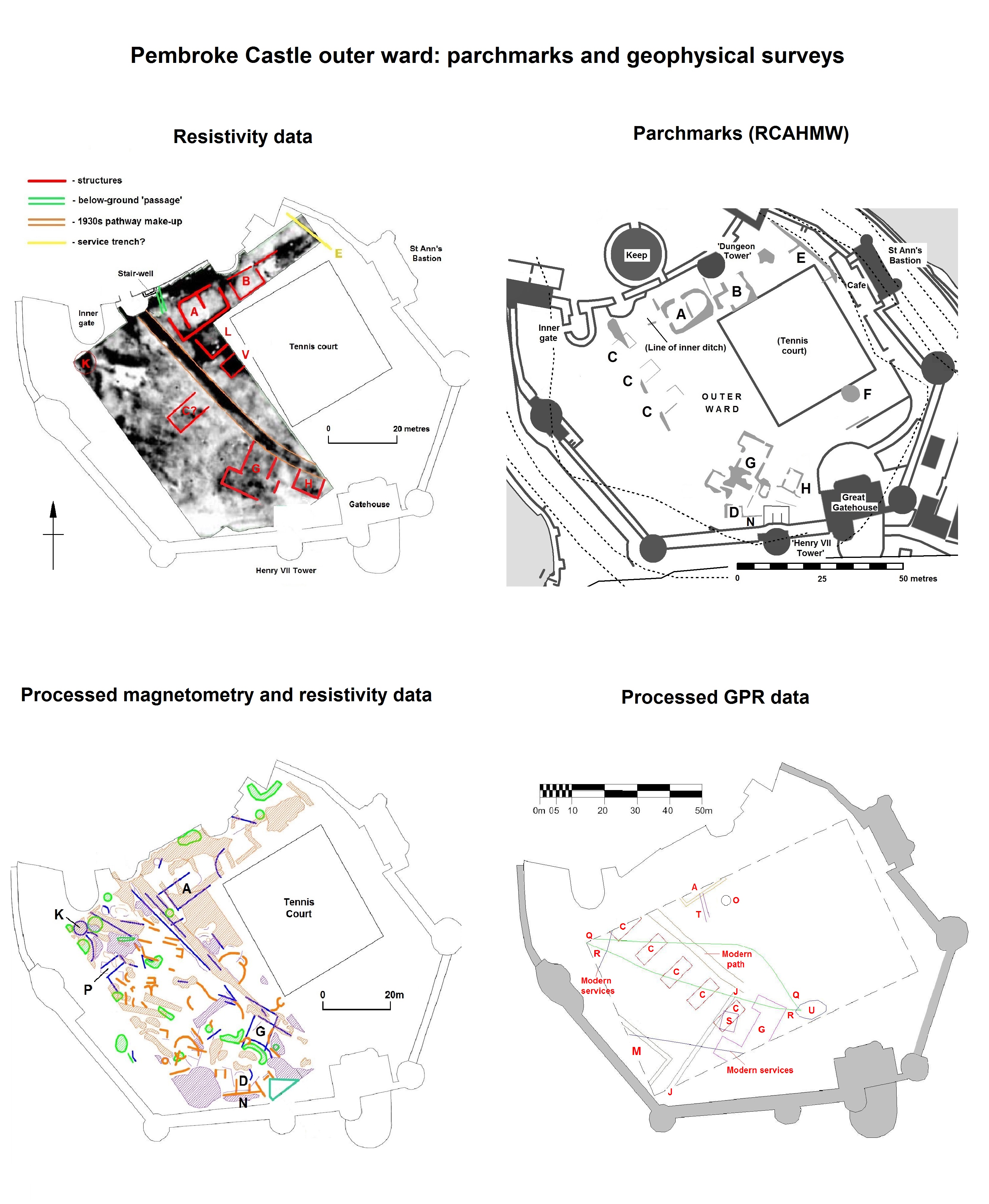
Plans of Pembroke Castle showing the parchmarks and the results of the geophysical survey. Copyright Dyfed Archaeological Trust and TF Industries Ltd.; Crown Copyright RCAHMW.
Survey in the inner ward suggested that two or possibly three previously unknown buildings may lie beneath the grass, but they couldn’t be dated or characterised. At least one of them may, however, be connected with food preparation as neither a kitchen nor bakehouse has yet been conclusively identified at the castle, which would have been necessary to feed the people who made up the earl’s household, his retinue, and the garrison.
The results in the outer ward were outstanding – and surprising. Even allowing for later disturbance, which was slight, the area seems to have been largely empty of buildings during most of the Middle Ages – in contrast to the busy, congested scene that’s normally imagined. This area was enclosed with an impressive curtain wall and towers in the mid-thirteenth century but may always have been envisaged as an open space – for ‘civil’ assembly, for military gatherings, for pageantry and display or for leisure, or perhaps all four; a garden was certainly present by the fifteenth century, and may have been laid out around 1300-20.
Some buildings were however present. A large rectangular building M against the southwest curtain wall, and a possible smaller lean-to N against the southern curtain, are both probably medieval; was the large building for storage, or was it domestic? To account for the apparent absence of a well in the castle, a number of local stories had developed including one which involved a system of water-pipes; the discovery of a possible well, O, may solve the mystery. Most exciting of all was the confirmation that an arrangement of parchmarks G, recorded in 2013, belong to a free-standing, winged mansion-house. Its form suggests that it’s from the late fifteenth century, and it may have been the building within which King Henry VII was born, which is known to have stood in the outer ward.
A ditch formerly separated the outer ward from the inner ward, and a buried masonry structure K, opposite the inner gate, may be a bridge abutment. This ditch was possibly infilled to improve the setting of the fifteenth-century mansion, and garden. Alternatively, the infill may belong to the Civil War period (1642-48) when the castle was held against the Crown, and then against Cromwell. Two former buildings A and B, which overlay the infilled ditch, may date to the Civil War; one of them was associated with a below-ground ‘passage’ that may be a gunpowder magazine. The castle again saw military use during the Second World War, when five ‘Hall-huts’ C were built to house troops based at the castle.
While a number of the other features denote modern service trenches, some may belong to early use of the castle site. A linear feature J may represent the boundary of a burgage plot, perhaps confirming that the outer ward was laid out over part of the town; if so, some of the patchwork of smaller, formless features may also be urban in origin. Others may be hints of prehistoric occupation.
While the results show what can be achieved through geophysics – and generous grant-aid – more work is required before they can be fully understood. In particular, even limited excavation in the mansion may confirm its date and form, and suggest how the outer ward was used during the fifteenth century. The mansion seems to have contained a latrine, so with luck some good palaeoenvironmental evidence has been preserved. Pembroke is a castle of national significance, both architecturally and as a setting for major historic events: it will repay close study.
The deadline for grant applications passed on 15th December and we’re going through the various projects now. Altogether the 11 projects, coming from all parts of the British Isles and Italy, are asking for over £50,000. They cover a wide period of history and types of research. For a little more detail, here are the applications we’ve received:
Abergavenny Castle, Wales – a geophysical survey of the whole site. The castle was an important baronial site and saw a lot of military action from when it was first built in the 11th century up until it was slighted (partially demolished) in the Civil War.
Bamburgh, England – assess and conserve a large collection of medieval metal work dating from the 8th to the 11th century discovered in the west ward. Bamburgh was a major elite fortress from the early medieval period so the project should help potentially understand how the site changed over the centuries.
Caldicot Castle, Wales – geophysical of the whole scheduled area. Building on the previous resistivity survey in the project will use all three types of survey technique to get the best understanding of any below ground remains of this major baronial site.
Castle Pulverbatch, England – geophysical and photogrammetric surveys of the site, one of the finest examples of a Norman motte-and-bailey castle in Shropshire.
Clifford Castle, England – geophysical survey and excavations to help understand the morphology of one of the earliest castle sites in the UK, and one of the principal castles on the Anglo-Welsh border. Please note this is a privately owned site and not accessible to the general public.
Dinas Bran, Wales – geophysical survey of the most extensive and complete Welsh-built castle to understand what structures lie beneath the surface.
Edinburgh Castle, Scotland – mapping and categorising suspected conflict damage at this iconic castle.
Fotheringhay, England – understanding the morphology of the caput of the honor of Huntingdon and 15th-century palace associated with the House of York and birthplace of Richard III, using ground penetrating radar and small unmanned aircraft. Please note this is a privately owned site and not accessible to the general public.
Lathom House, England – analysis of masonry dating from the late 15th-century castle built by Thomas, Lord Stanley either found via excavations or potential reused in the current building.
Lecce, Italy – to help with the publication of a history of the castle of Lecce which was founded by the Normans.
Lough Key, Ireland – to improve understanding of the medieval MacDermot lordship of Moylurg and its relationship with the Rock of Lough Key.
As the days get shorter and the number of times you have to defrost the car in the morning rises substantially, the chance of large gatherings and feasting also increases. People try to figure out how to fit large numbers of guests in their homes, share their news and hopes for the upcoming year and, sometimes, settle business. Thinking about castles as warm and lively places is not necessarily the easiest when they present a cold, wet, bare-stoned backdrop to our lives today but the gathering of people and feasting would have warmed the halls of lords as well.
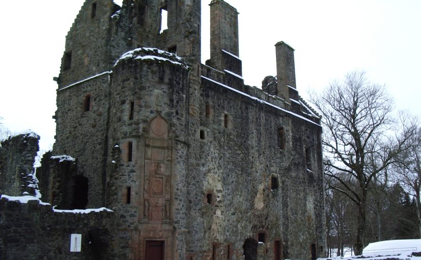
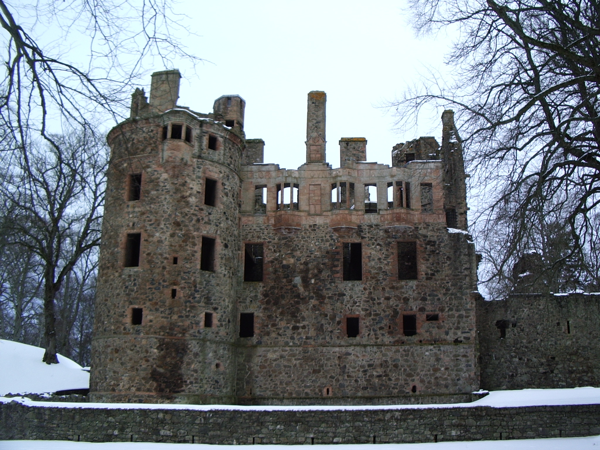
While huddled over a steaming cup of tea or mulled wine and eating mince pies, I invite you to take a moment to consider a winter gathering that took place at Huntly Castle (Aberdeenshire), the seat of the Gordon family. Huntly is well known for its magnificent inscription commemorating the marriage of George, the Sixth earl of Huntly, to Lady Henrietta Stewart in 1588 and the surviving heraldry within the 16th century palace block, but it has a long architectural history.
There have been three major stages of building at the site of Huntly Castle. First, there was a 12th century timber motte and bailey castle known as the Peel of Strathbogie. Second was an early 15th century L-plan tower. Third was a mid-15th century palace, built in partial conjunction with the establishment of the property as an earldom. Although the palace has been remodelled in the 16th and 17th centuries to what we see in ruins today, the basement largely consists of the first stage of this palace block.
A small gathering of people took place during the first stage of the palace block and the life of the Second Earl of Gordon, George (earl from 1470-1501). On 12 January 1492, George, Earl of Huntly and Lord of Badenoch, passed the lands of Auchannochquhy in the forest of Boyne in the county of Banff to Walter Ogilvy of Boyne and his heritors. This charter was witnessed by Richard Strathquhayne, Prior of Monymusk, Patrick Berclay, lord of Grantuly, James Abirnethy, son and heir apparent of George Abirnethy of Uggistoune, Andrew Hay, D. Patrick Grantuly, rector of the church of Glas, and D. John Andrew, vicar of the church of Bocarne in diocese of Moray.[1] This charter was later confirmed by James IV on 3 December 1495 at Perth (RMS, Vol II, 2289).
Judging from the locations identified with the names of the witnesses, most came from a relatively short distance (under 10 miles) from Huntly Castle. The prior of Monymusk seems to have travelled the furthest, at approximately 24 miles, and is likely to have been seeking accommodation. These six witnesses were likely accompanied in their travel to Huntly Castle but there is no reason to suspect a large retinue. Although it is not necessarily a gathering that suggests a feast of celebration, it was not uncommon for this kind of business to take place at such a gathering. The Christmas celebrations had finished and it may have just been a gathering of neighbours.
The record of this gathering clearly reflects business but is also a gathering of neighbours and acquaintances in witness of this transaction, whether as an aside to an already gathered feast or specifically for this occasion. Against the darkness of a Scottish January, this gathering is a small remnant of the warmth of gathering neighbours, likely drinking warm drinks around a fire, while discussing business among other things.
[1] All spelling of names and places has been taken from the document as printed in Scotorum, Registrum Magni Sigilli Regum. “The Register of the Great Seal of Scotland.” (1886).
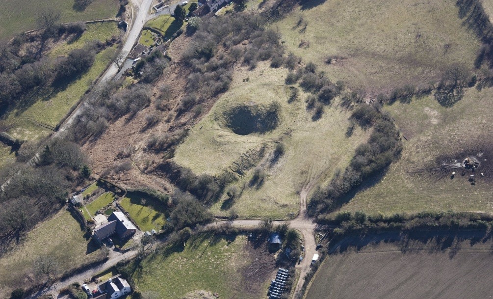
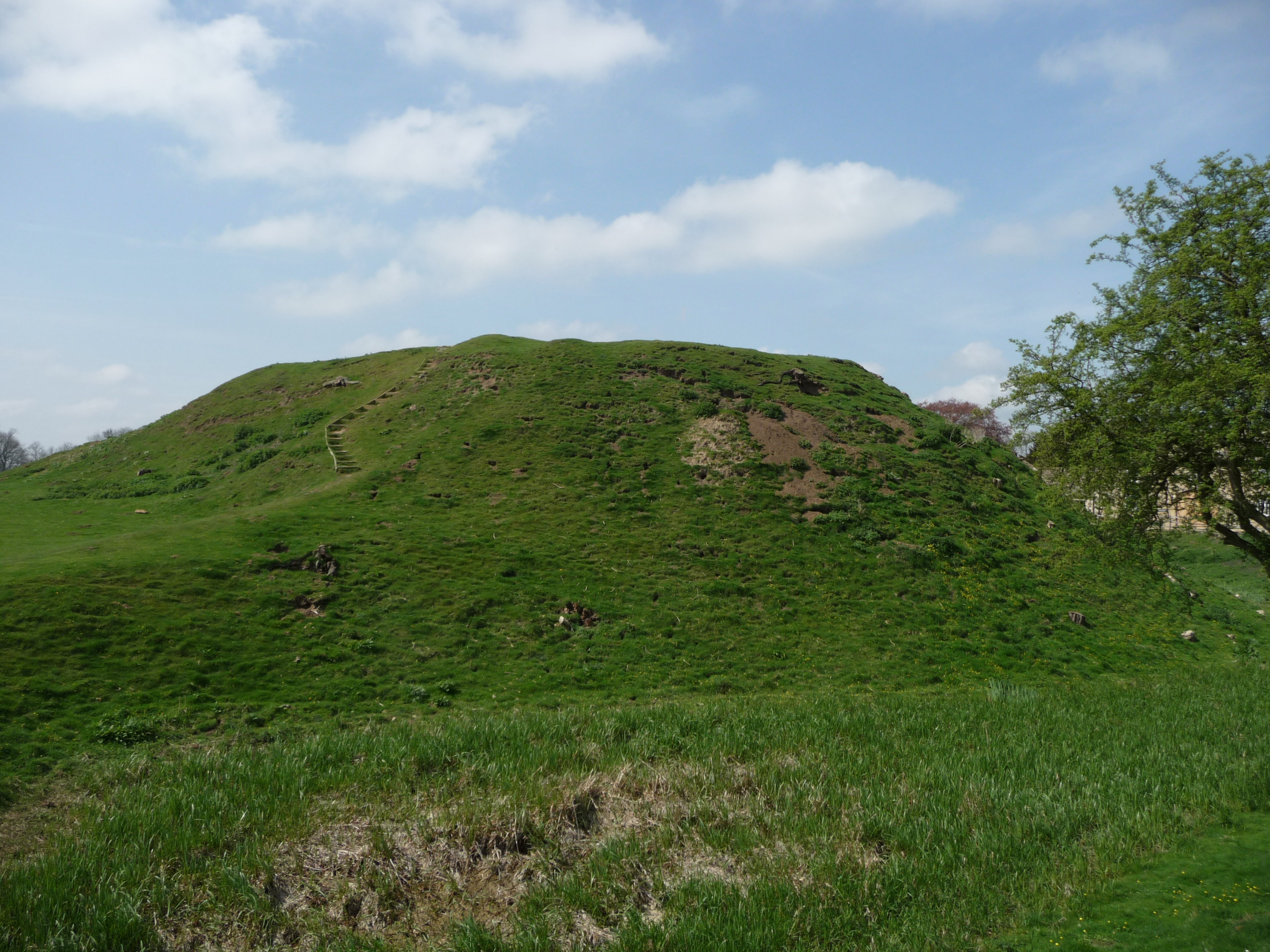
Robert the Bruce is famous for leading Scotland in their wars with England in the early 14th century. He became king in 1306 and embarked on an unprecedented campaign. What you might not know is that to achieve his aims he demolished (this act is known as slighting) many of the castles in Scotland to prevent the English from using them. A chronicler writing in the 14th century remarked that “Robert Bruce had all the castles of Scotland demolished, except Dumbarton”.
Bruce adopted this policy from 1307, which explains why when he captured Tibbers Castle from the English in 1306 it was left standing. This allowed the English to recapture it soon after. The Scottish king had witnessed enough siege warfare to appreciate the role of castles and how pivotal they were to the English plan to control the country, and when he wrestled control of Edinburgh, Stirling, and Roxburgh in 1314 he set about dismantling them so that they could not be used against his own countrymen.
Today Tibbers mostly survives as a series of large earthworks with a little masonry above ground. Walking round you find some rubble tumbled down the ditches around the outer bailey and the motte, giving just a hint at what once stood here. You wouldn’t know it to look at Tibbers, but it seems that when the Scots recaptured the castle in 1313 it avoided the fate of many other fortifications in the region and was left intact.
Funding from the Castle Studies Trust and Historic Scotland allowed this site to be re-examined. A geophysical survey was carried out and a new plan of the site was carefully drawn. This research gave new insight into the early form of the castle. It found that early in Tibbers’ history the castle probably consisted of a motte with a single small bailey. When the earth and timber defences were replaced in stone the single bailey was replaced by two much larger enclosures, giving the castle the form we recognise today. This double-enclosure arrangement is quite unusual for a motte-and-bailey castle. You can see another example at Windsor Castle where the motte is flanked by two baileys.
The work at Tibbers was our first contribution to Scottish archaeology; in fact it was one of the very first grants we gave out back in 2014. Built in the 12th or 13th century, changing hands several times during the Anglo-Scottish Wars and then descending through the earls of Moray and the earls of March before being taken over by the Scottish monarchy, Tibbers has a storied past. Fortunately we have been able to add a few details to that colourful history.
Click here for the full report from RCAHMS on the survey, with a potted history of the site.
The only date in British history everyone remembers is 1066, when, on 14 October, William duke of Normandy defeated and killed Harold, king of England, and began a new era in this island’s history. Those interested in the castle know that it was William’s followers who brought it with them. 950 years on, it may come as a surprise to hear that what we know about castles built by the Norman conquerors in the years after 1066 is less than what we still don’t know: castle studies still matter and the work of organisations like the Castle Studies Trust is vital in encouraging better understanding of these monuments, and our own past.
Before 1066 the only castles in England were a handful built by Norman nobles who had been favourites of king Edward the Confessor. English nobles used a different type of residence and we will never know if they would eventually have followed the continental trend.
The Norman conquest did not end on 14 October 1066, it only began. William had wiped out the English royal family and much of the aristocracy but the battle of Hastings (and subsequent surrender of Dover and London) only secured him control of the south east. He then faced and defeated resistance and rebellions including that of Hereward “the Wake” in the Fens, while the people of York destroyed the first castle built there by the invaders in 1068 leading to the infamous “harrying of the north” in 1069. To understand the building of early Norman castles it’s important to bear in mind that the conquerors could not relax and believe they were secure for a number of years.
Castles featured from the start. From the quickly fabricated timber palisades put up to protect the army when it landed to the foundation of the new “Tower of London”, William ordered the construction of royal castles while also encouraging the bishops and nobles who had followed him to build their own. Many great stone castles standing today were originally put up as earthworks in the years immediately after 1066. In turn, the great lords who replaced virtually the entire English ruling class encouraged their own followers to secure themselves in their own castles. We don’t know the reasons why each was built: sometimes sitting on the previous owner’s (unfortified) hall, the new castle was evidently a visual statement confirming change of ownership, but may also reflect concerns about security by the new landowner, living among and exploiting a much larger peasantry speaking another language.
The larger castles have been well studied. The lesser ones have not. There are probably at least a thousand earthworks in what was then England, most of which have never been excavated, never dated, their function only guessed at. Many are called “mottes” with no more evidence than that they look like one. The old certainty that all Norman castles were originally of motte and bailey design has been replaced with awareness that the recognisable conical mound forming the motte was sometimes added later to a simpler enclosure defined by a ditch, rampart and palisade. The bailey too is proving more complex: why did some castles have two (or more), why are some so vast? Some now seem to have enclosed whole villages, others are too cramped for any but the smallest buildings. The CST-funded project at Caus (Shropshire) tackles this question.
950 years after William began the conquest of England, we are asking questions about Norman castles based not on old prejudices about what castles were, but on historical and archaeological study based in a better understanding of the reality of eleventh and twelfth century societies.
This post was written by Louise Martin, Cultural Heritage Officer for Morecambe Bay Partnership
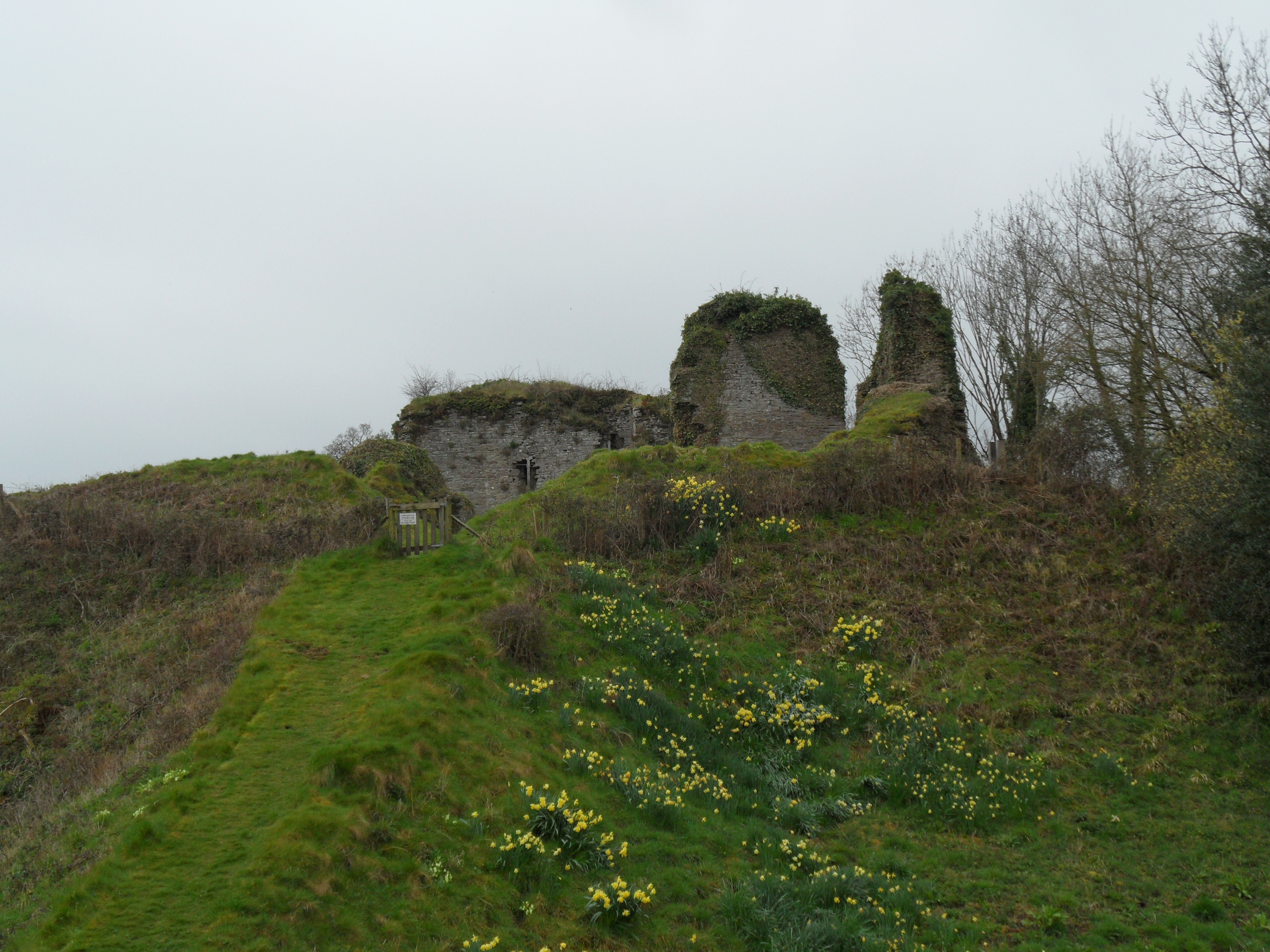
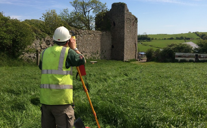
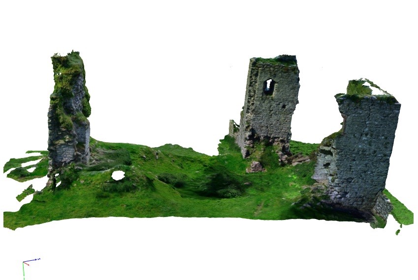
Gleaston Castle is a gem of a site; a little known and poorly understood courtyard or enclosure castle, located in the beautiful Furness Peninsula. The history of the site is scant and whilst it has been the subject of antiquarian and more recent documentary research, its origins and reason for construction still remain unclear. Some writers have proposed that the castle was constructed in the early 14th century as a response to the Scottish raids, although the site is not mentioned in documentary sources until some 30 years after these raids and may simply be a reflection of the wealth and status of the Lord of the Manor.
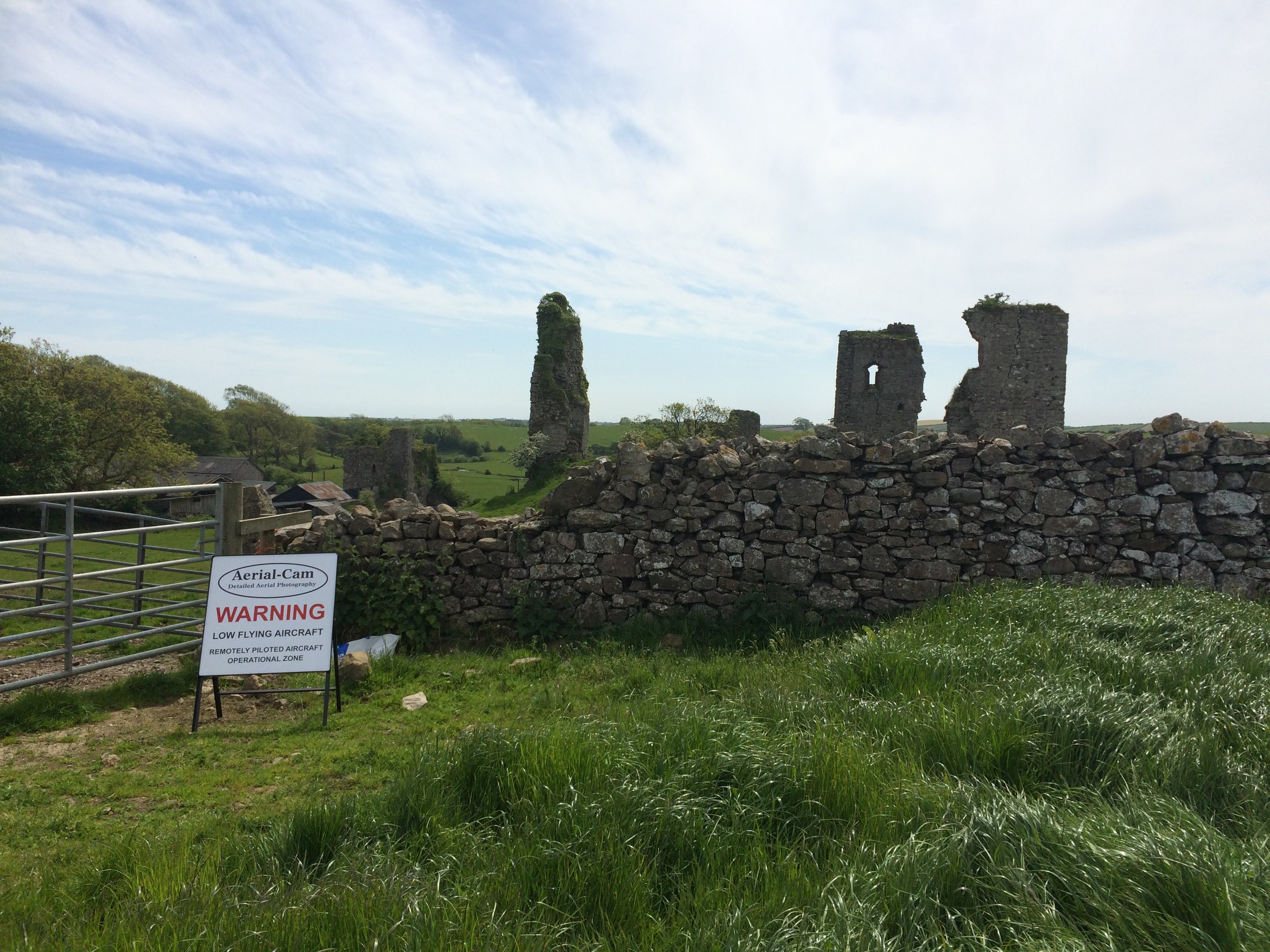
Today the site survives as the ruins of three towers with an associated curtain wall. As a Grade I listed building and Scheduled Monument this unique site is protected from development or destruction, however, this site is currently on the Heritage at Risk register with many conservation concerns.
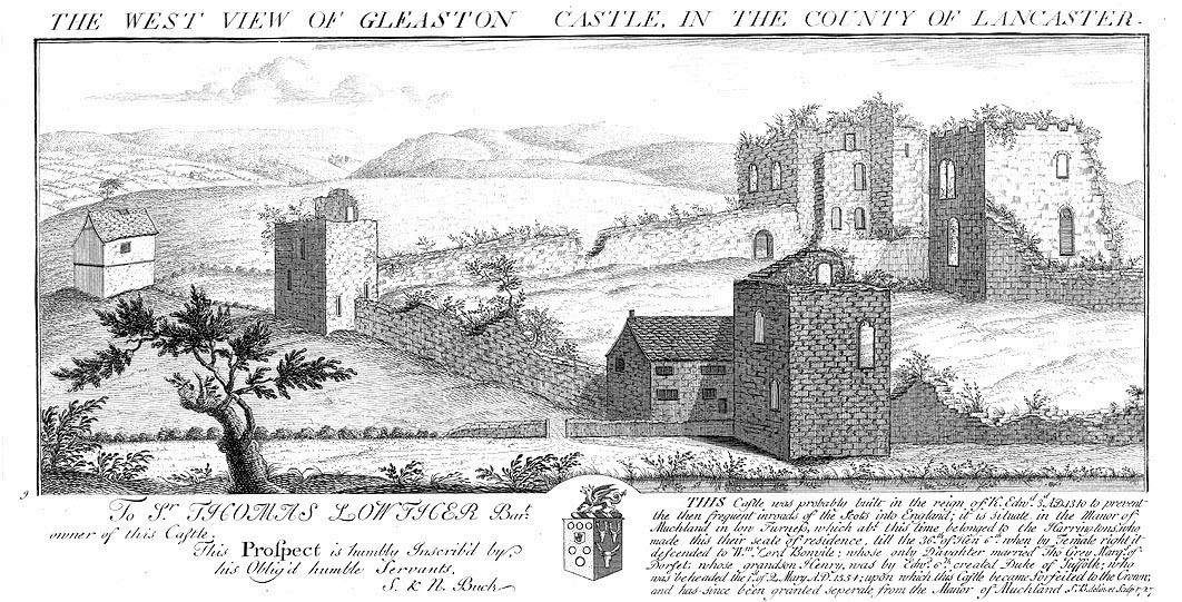
Its crumbling stature is not new, the site is believed to have been dismantled after it ceased to be a manorial residence. It was described as a ruin in the mid-16th century and is depicted as such in engravings from the early 18th century.
Engraving of Gleaston Castle by Samuel and Nathaniel Buck, 1727 showing the site in a ruinous state
Whilst the site was subject to antiquarian attention, with plans and descriptions produced in the early 19th century, I was surprised to discover that the site had never been fully recorded, in particular the elevations of the structures which survive from its original layout.
To bridge this gap in the archaeological record and gain a better understanding of the site, Morecambe Bay Partnership applied to the Castle Studies Trust for a grant in late 2014. I was thrilled and delighted to hear the news that our application had been accepted and a generous £5,000 grant had been awarded to enable an aerial photographic survey and 3D model of the site to be produced. In addition, the grant would fund the production of a conservation assessment, outlining the historical background and current issues for the site.
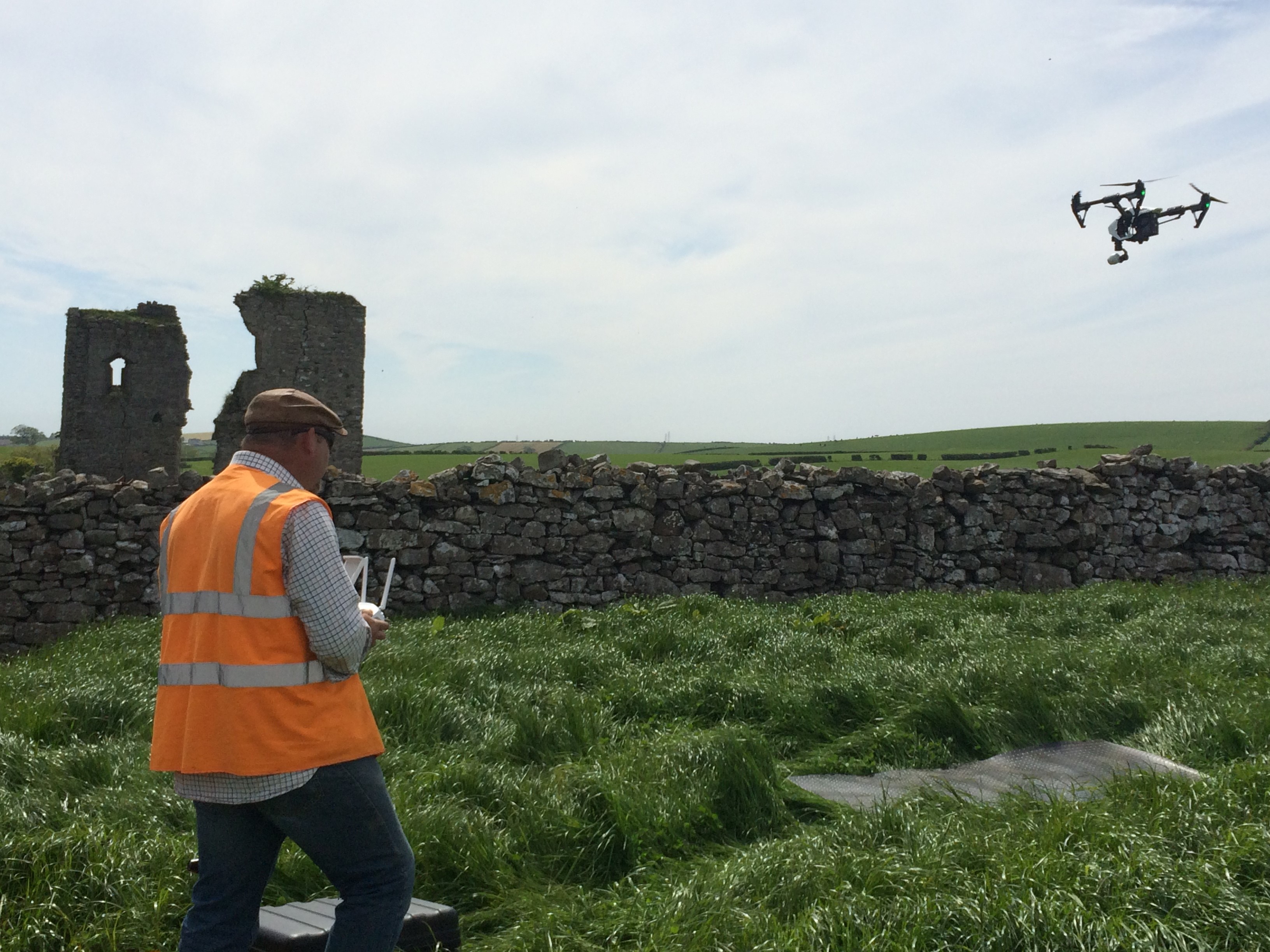
Greenlane Archaeology Ltd. was commissioned to run the project, bringing in professional archaeological photographer Adam Stanford from Aerial-Cam to undertake the survey work. During the summer of 2015 Adam flew over the site with Remotely Piloted Aircraft (RPA)-a DJI Inspire 1 quadracopter fitted with an X3 gimballed camera producing still images at 12 megapixels. Professional photographers, such as Adam, have to follow strict guidance and regulations as part of their licence to undertake such work.
Many precautions had to be put in place before the RPA survey was undertaken by Adam a CAA licenced pilotAdam from Aerial-Cam operating the quadracopter RPA
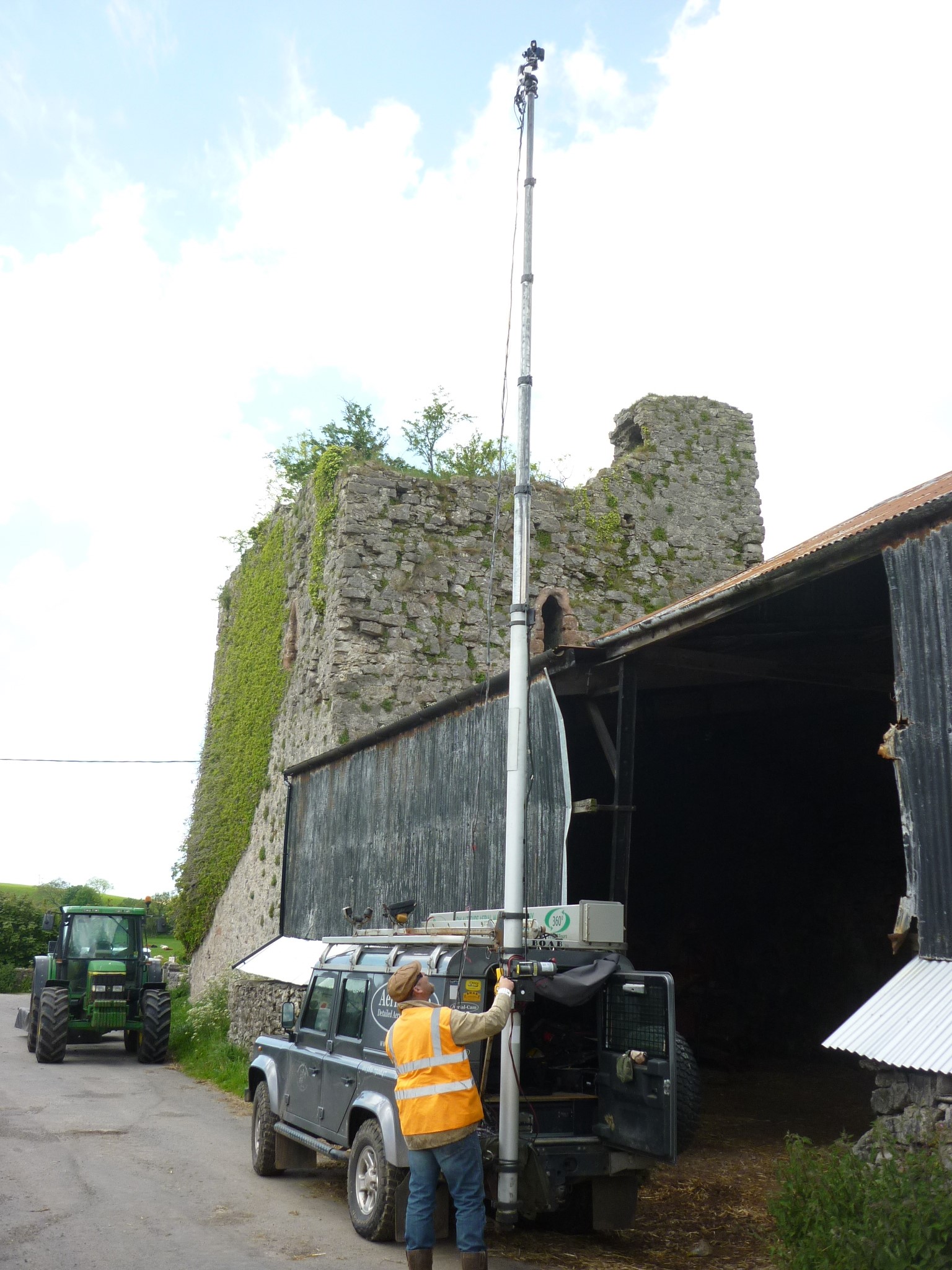
The photographic record from the air was supplemented by high-resolution (24 megapixel) images captured with a high-level telescopic pole and more traditional ground-based photography to obtain close up images of the structure.
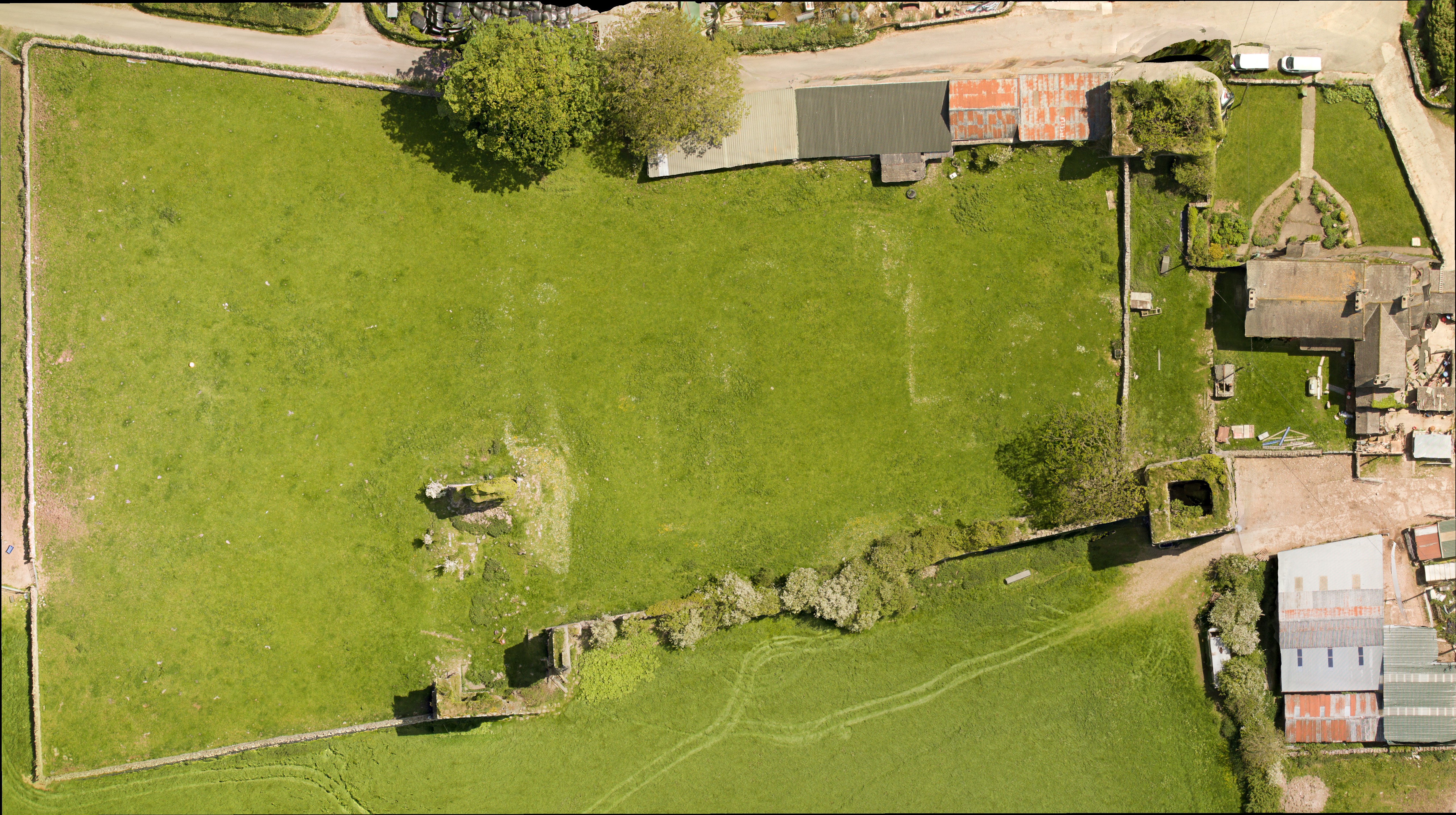
Over 600 overlapping photographic images were taken to capture a detailed record of the site. Back in the office Adam used Agisoft Photoscan to process the data collected. The results were stunning, including aerial images and the creation of a 3D model, which enables the site to be ‘explored’ from the safety and comfort of a PC or tablet through Sketchfab.
Adam capturing some of the elevated images that would be used alongside the RPA images to produce an accurate and detailed 3D record of the site
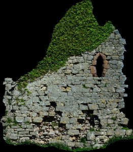
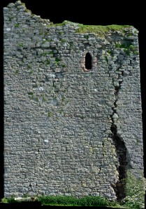
One of the most important outcomes of this project was the detailed orthophotos that were captured of the elevations of the castle’s ruins. We have been using these images to inspect the construction and conservation issues for the site, but primarily they form a permanent record of the castle that was lacking until this survey in 2015.
The aerial image and subsequent grey scale shading was particularly informative revealing furrows and a possible track way to the north-east of the castle. The track appears to lead to the north-western tower, the largest structure at the site and probably once the manorial residence. Within the curtain walls, areas of terracing and possible building platforms could be identified – but what could they be?
Supplementing the photographic work Greenlane Archaeology also undertook a topographic survey of the site to complement and enhance the results obtained.
Daniel Elsworth from Greenlane Archaeology undertaking the topographic survey of the south-east tower
In August 2015 we were delighted to host some of the trustee’s from the Castle Studies Trust (CST) along with supporters of the CST charity, who travelled to the Furness Peninsula to see the survey work in action. We were joined by the Historic England Heritage at Risk Officer, the Lead Archaeologist from Cumbria County Council, and Helen Evans who had compiled the Conservation Statement. Adam from Aerial-Cam gave a detailed demonstration on how the RPA captures the photographic images and how these are enhanced and combined to form the incredible 3D records of the site.
Adam from Aerial-cam demonstrating to Trustee’s and supporters of the Castle Studies Trust how the RPA captures the images from the air
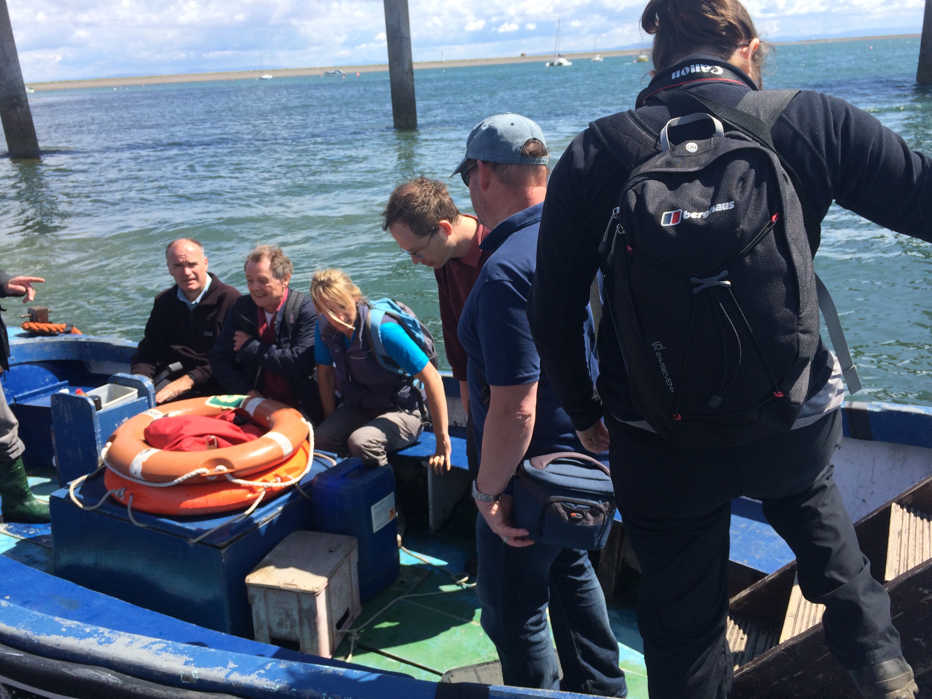
To put the site of Gleaston into context, the visitors were also taken on a tour of Piel Castle, which can be seen from the elevated position of the north-west tower at Gleaston. Piel Castle is positioned on a tidal island and we had to use the local ferry service to reach the site.
Boarding the ferry to Piel Island and castle
It was some months later, during discussions with Dr Richard Peterson and Dr James Morris of University of Central Lancashire (UCLan) Archaeology and Anthropology Department that the next piece of fieldwork was being determined. Each year UCLan host a field school for their first year archaeology students and the team were looking for a site to use to teach the concepts and theories of geophysical survey and laser scanning. We had some interesting research questions to answer, which had been formulated following the photographic survey – do any buildings survive within the courtyard formed by curtain wall and what are the features shown to the north of the castle? Together we thought that Gleason was the ideal site for this year’s field school.
Before any plans to be laid out we had to get permission from the landowners to allow this work to go ahead. Once this had been secured, we had to apply to Historic England for a Section 42 licence, as the site is Scheduled and such work is strictly monitored by Historic England inspectors.
Permission was granted for the work and the fieldwork was scheduled for the end of April 2016. In addition to UCLan students, the survey training was opened up to the community, with fifteen places available per day through the Heritage Lottery Funded Headlands to Headspace (H2H) Landscape Partnership Scheme, which I am currently running part of for Morecambe Bay Partnership.
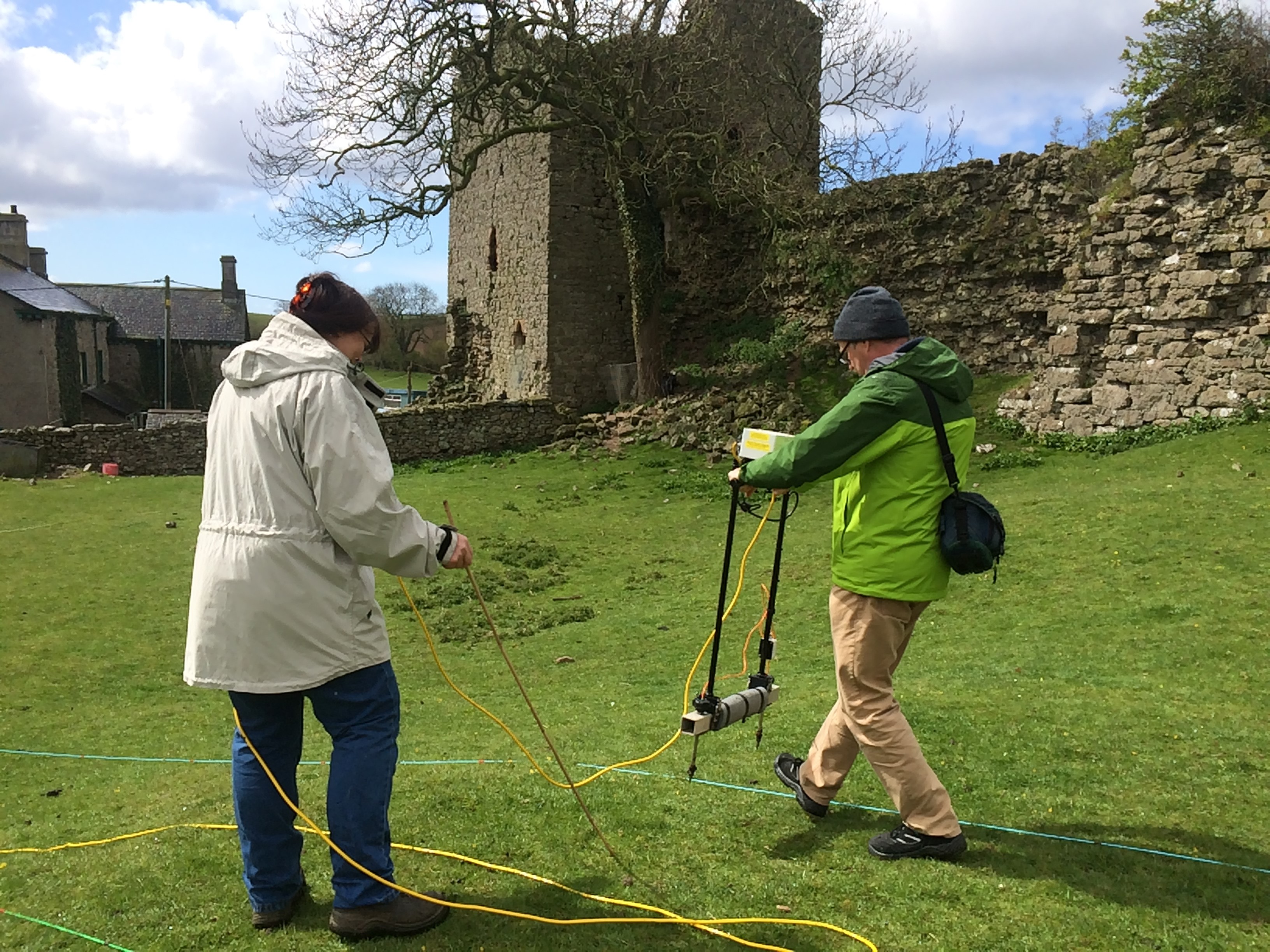
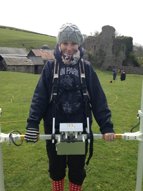
On 25th April we started the work at the site, using earth resistance and magnetometry to survey areas within the curtain wall and to the north of the castle, where we had identified ridge and furrow and the track way. The training attracted participants from as far afield as Liverpool and Carlisle as well as some local residents to Gleaston Village. The north-west tower was also subject to detailed laser scanning, which will supplement the photographic record produced by Aerial-Cam. The weather was, well, challenging especially for the end of April with heavy downpours and even snow hampering our progress on site!
H2H volunteers undertaking an earth resistance survey at the siteOne of the first year students from UCLan undertaking a magnetometry survey. Still smiling despite the cold!
The team of students, together with volunteers and the fabulous UCLan staff persevered and we completed a significant amount of survey across the site. The results of the survey work are currently being processed by the team at UCLan, however, initial interpretation of the data is highlighting garden features to the north of the site and possible post-built structures to the south-west of the courtyard.
All this recent work is enabling professionals to gain a better understanding of the site. For the first time we have an accurate photographic record of all the standing remains and have started investigating what below-ground remains may survive beneath the soil.
Morecambe Bay Partnership would like to thank the Castle Studies Trust and all their supporters for enabling the survey work to take place and highlight the importance of this site and the conservation issues the site currently faces.
We would also like to thank the landowners who have provided us with special permission to undertake this survey work and the team from Historic England and Cumbria County Councils Lead Archaeological Advisor who have provided advice and guidance along the way.
It is hoped that the work undertaken so far will be built on in future years with additional survey and assessment, finding positive solutions to protect this rare and fascinating site.
Every September thousands of historic sites in England, Scotland, Wales and Northern Ireland are opened. It is a chance to visit some sites which are closed the rest of the year. You can find out more details online. Here are four places to get you started.
Sat on the banks of the River Tay, Broughty Castle in Scotland was built in 1496. It was involved in several sieges including during ‘the Rough Wooing’ and the War of the Three Kingdoms. The castle has been open as a museum since 1969.
Broughty Castle is open from 1pm to 3pm on Sunday 18th September.
Pleshey Castle in England was built by William de Mandeville, one of the richest men in 12th-century England. It was confiscated by the king, slighted, restored, and used for centuries afterwards. The castle was even mentioned in Shakespeare’s Richard II.
The motte-and-bailey castle survives as some impressive earthworks. Excavations were carried out between 1972 and 1981 but never published. In 2015 the Trust funded part of the publication of the work from this important site.
Pleshey Castle is open on Sunday 11th September with tours at 2pm, 3pm, and 4pm. Advanced booking is required.
Built in 1601, Moyry Castle is being included in Northern Ireland’s heritage open days for the first time. Three-stories high and perched on top of a rocky hill the castle has a good view of the surrounding area.
Moyry Castle is open from 9am to 8pm on Saturday 10th and Sunday 11th September and is free to visit.
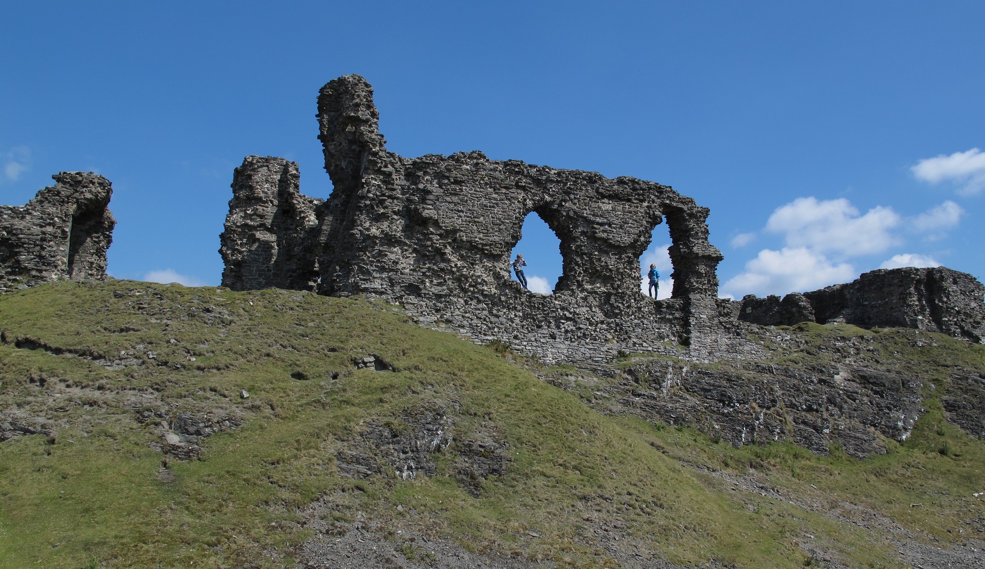
Constructed in the 13th century, Holt Castle was amongst the fortifications built by the English in north Wales. The red sandstone makes the castle stand out, as does its unusual pentagonal design. It was used by Richard II as a treasure house and slighted after the English Civil War.
You might recognise Holt as one of the very first projects the Trust worked on: Rick Turner and Chris Jones-Jenkins created a reconstruction of the castle as it would have appeared c1495. The 17th century was not kind to the castle, so the reconstruction is worth watching to get an impression of how it looked.
Holt Castle is open from 10am to 4pm on Saturday 17th and Sunday 18th September and is free to visit.
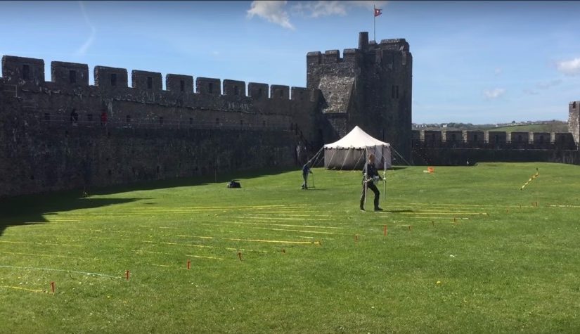
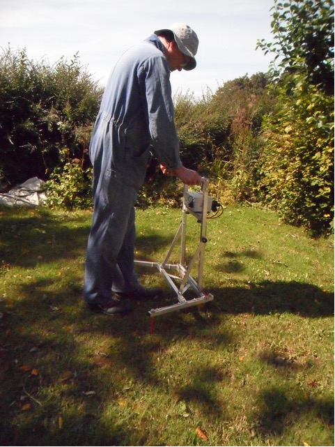
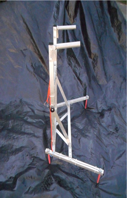
Some of the Castle Studies Trust’s projects have made innovative use of cutting edge technology. Nick Tarr explains how a new survey technique was used this year at Pembroke Castle.
Geophysical Survey Technologies (GST) was formed to improve survey equipment for archaeologists to use in all environments including equipment suitable for use in woodlands. The equipment, ideally, should be within the financial reach of amateur groups.
The prototype survey frame resulted from research into voltage surveys (commonly called resistance surveys) where geology or other conditions are unfavourable for conventional methodology. The frame uses a commercially available data logger and power supply but has all four electrodes on a compact mobile frame which is collapsible to fit in boot of a car.
The version used at Pembroke Castle was aimed at keeping the energy from the power supply within the archaeological layers so maximising any opportunity of detecting any archaeology present. A comparison with the conventional twin array in both parallel and zig-zag walking modes was made over a single grid which contained part of a building and a track. The existing twin array frame gave no clear signal for the building, the track was the only major feature seen.
The prototype frame gave much better results. A further test across a monastic site in west Wales has also shown improved results over the conventional twin array methodology. Development work continues.