Ellesmere Castle – Revealing the Secrets of a Major Castle of the Welsh Marches

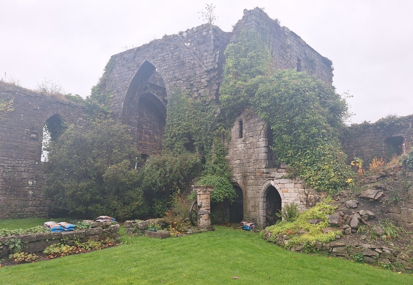
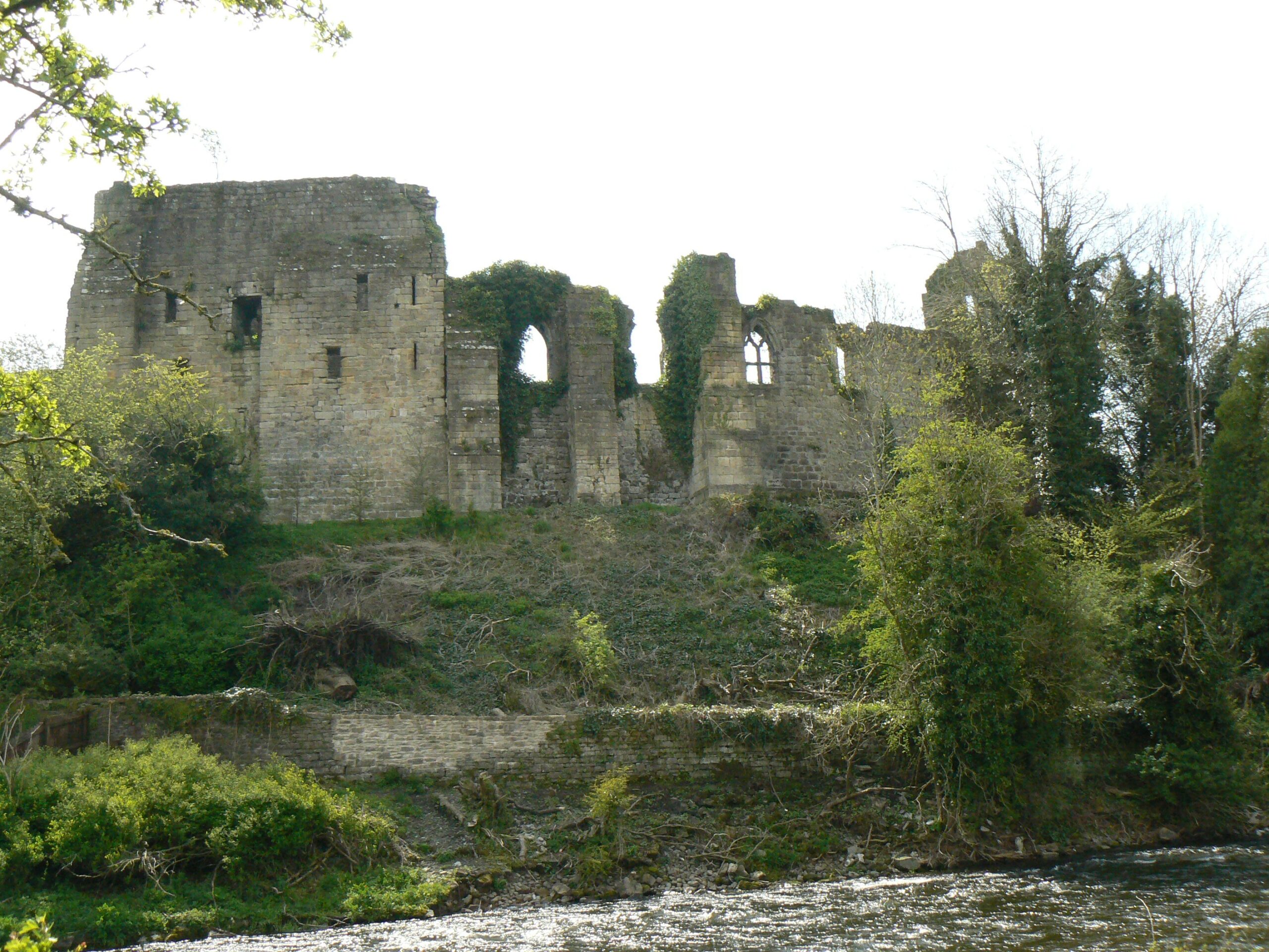
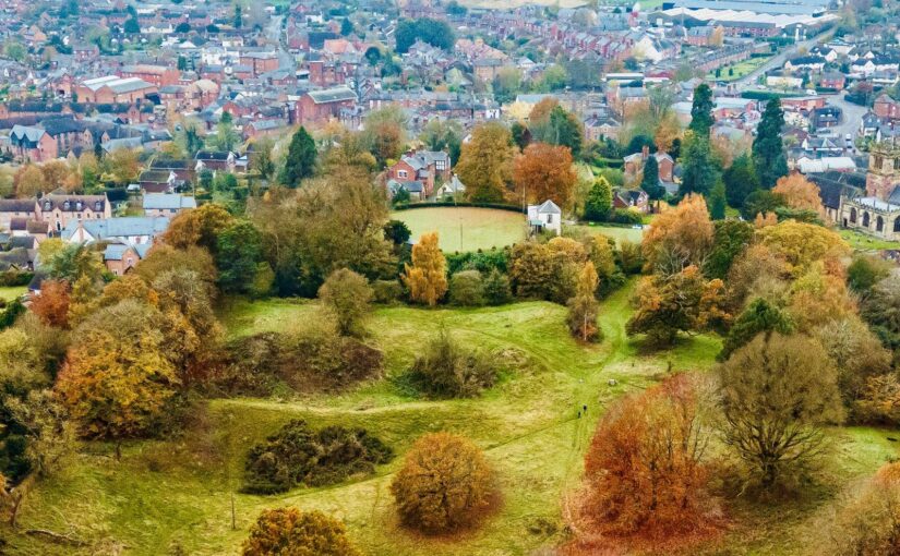
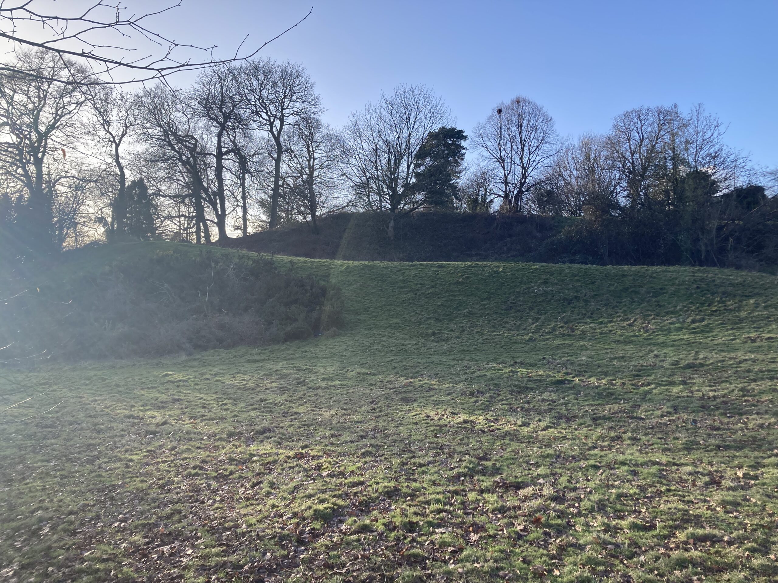
Ellesmere Castle in Shropshire is a substantial motte and bailey castle in the Welsh Marches that played an important role in the history of the area. However, very little is known about its form and structure with no standing remains above ground, or indeed when it was first constructed.

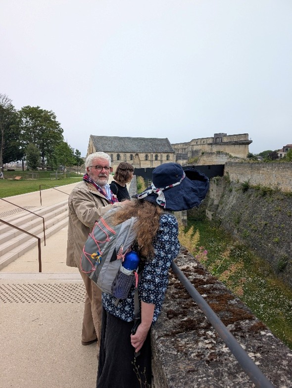
Starting on Monday 23 March, on behalf of the owners of the motte, Ellesmere Bowling Club, and with the support of owners of the rest of the castle Shropshire Council and funded by the Castle Studies Trust, archaeologists from the heritage organisation Heneb will be undertaking a programme of geophysical survey at the castle to assess the potential for surviving sub‑surface archaeological remains. The methods being used include magnetic gradiometry and electrical resistivity survey.

Subscribe to our quarterly newsletter

Ellesmere motte top, showing size as an shape of possible structure shown by GPR survey

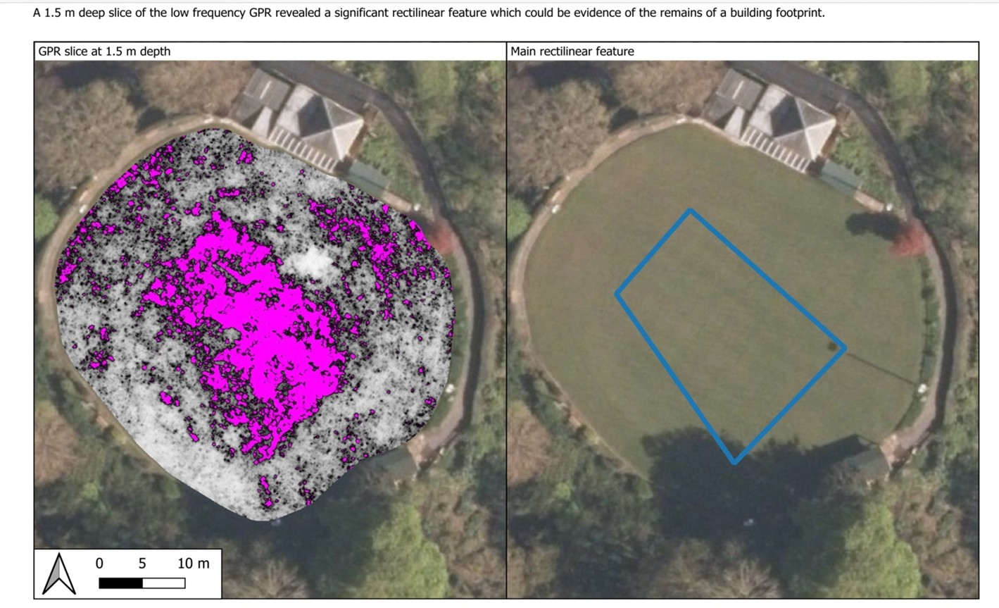
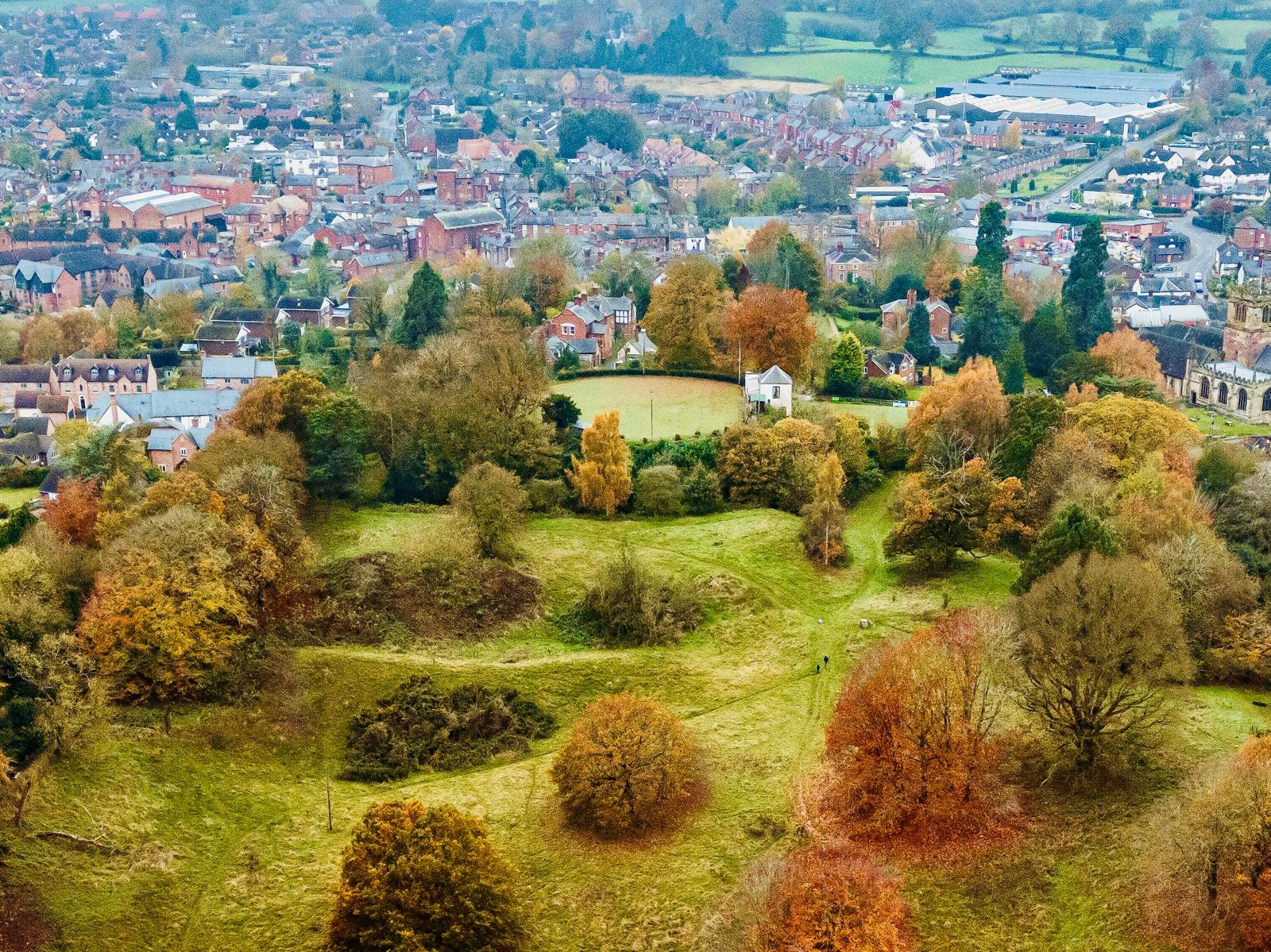
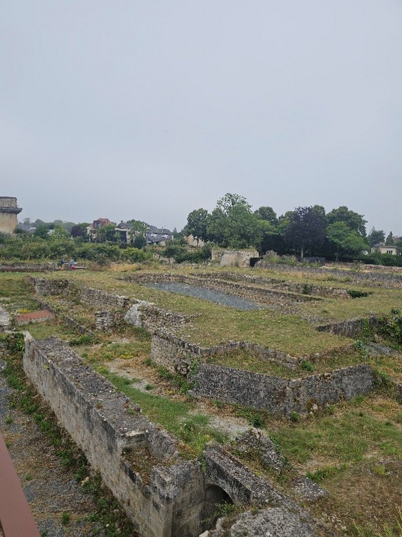
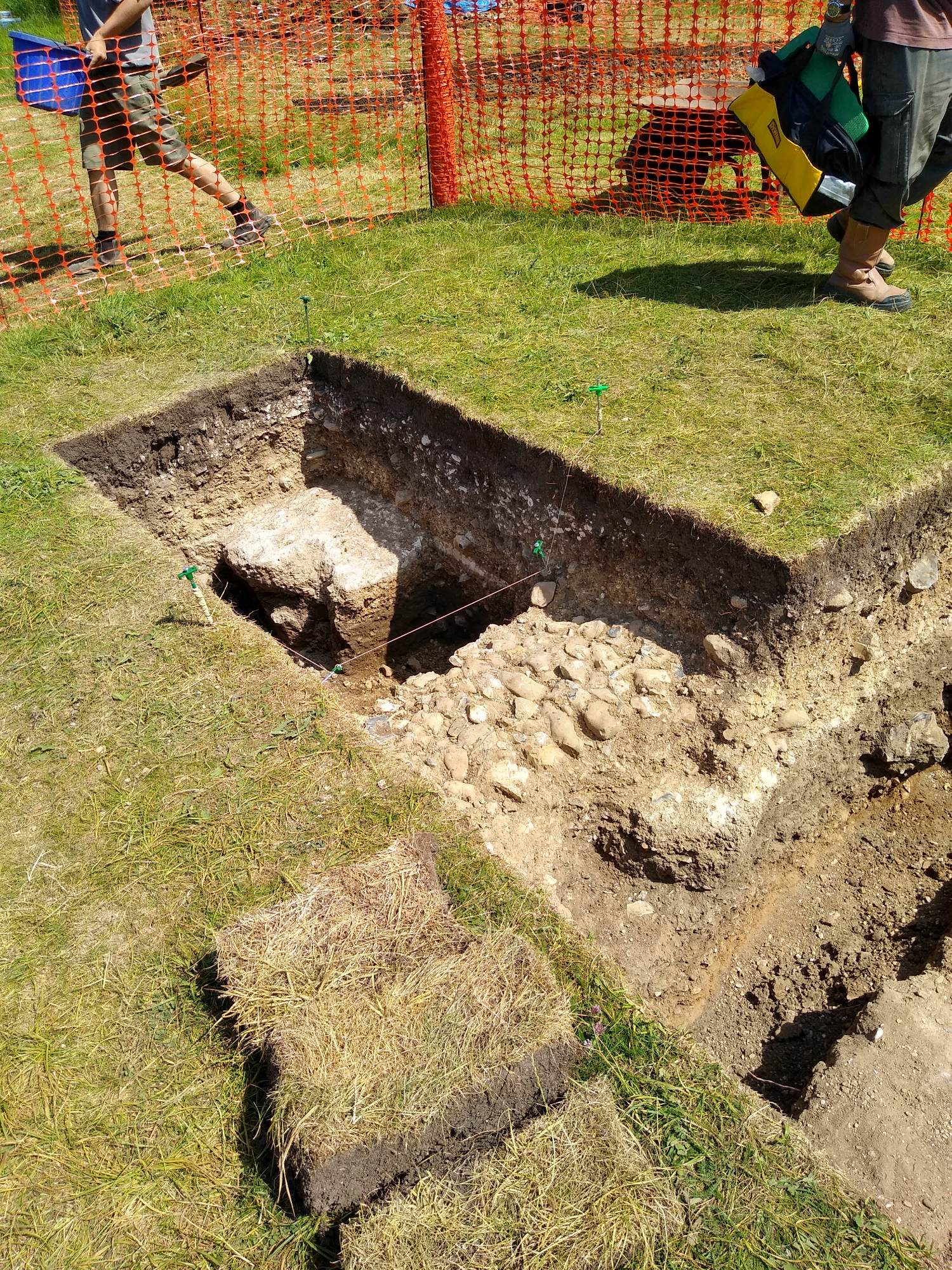
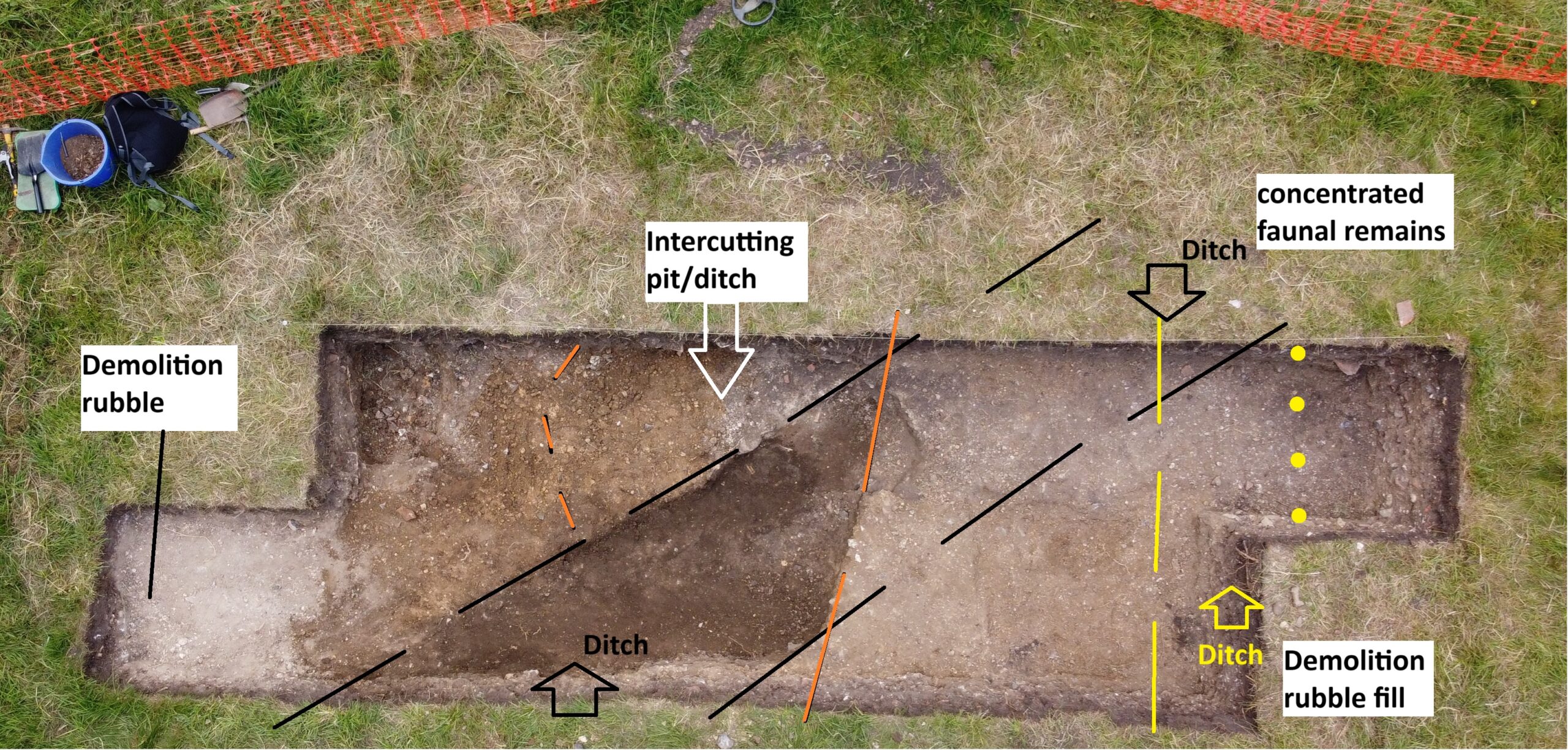
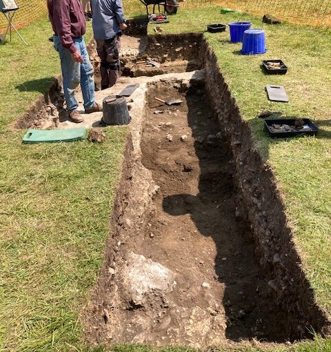
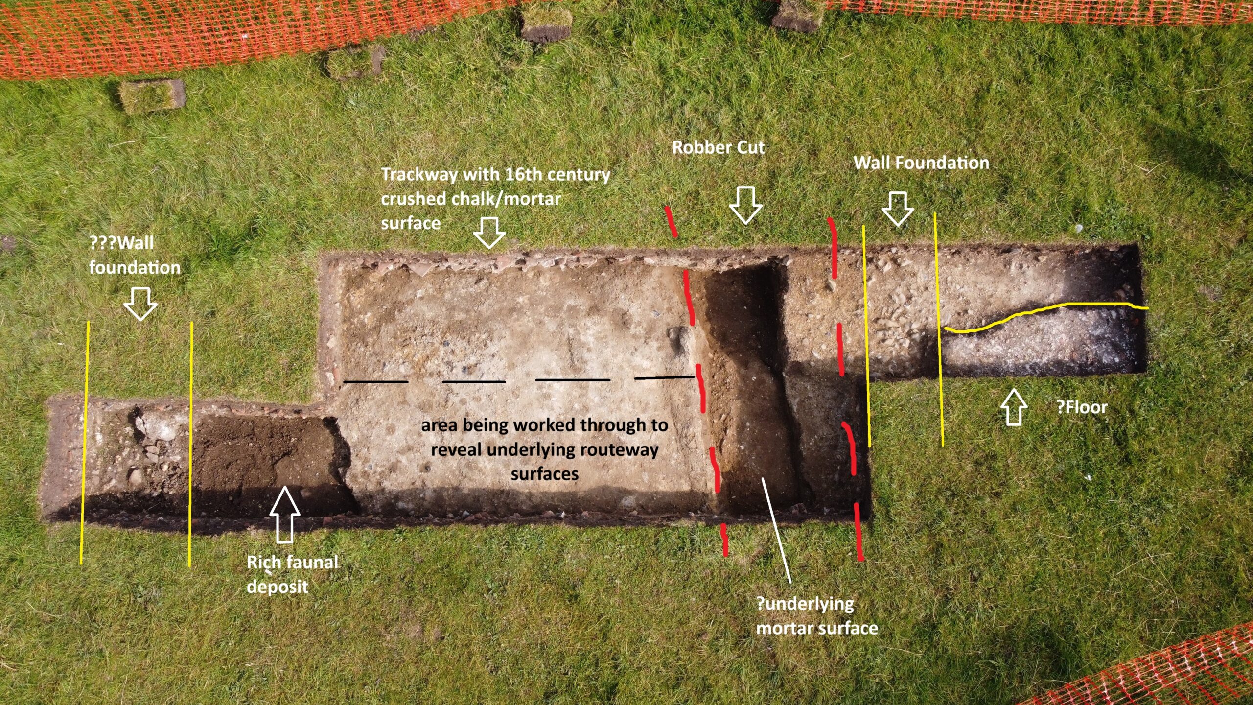
The motte itself is substantial. It is approximately 80m in diameter at its base, 52m across the top and stands about 11m high. A steep-sided ditch, about 20m wide and 3m deep, separates the motte from the bailey to the south east. In 2024, a partial and informal Ground Penetrating Radar GPR survey was carried out, which suggested and indicated a substantial structure, probably indicating a stone structure with the dimensions of 23m x 14m.

Lidar image of Ellesmere Castle including areas of geophysical survey

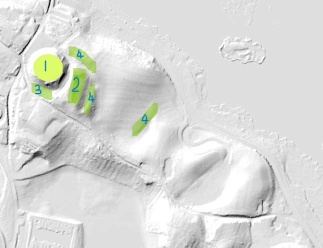
This current survey builds on the work carried out in 2024. It will be covering four areas of this very large castle site. The LiDAR image below shows the four targeted areas for geophysical survey:

  1. Motte: to pinpoint the position of the curtain wall along with any other buildings within.
  2. Bailey: to determine the location and size of the buildings.
  3. Area three, to establish where the outer defensive wall once stood that came down from the top of the motte, and to understand the width and depth of the defensive ditch, along with deciphering the extent of the bailey (No2), part of which had been quarried away sometime in the past.
  4. Earthworks which are believed to be the outer defensive walls, showing what appears to be an entrance in the north east section, and to investigate the furthest easterly earthworks to determine whether there was both an inner and outer bailey.

Subscribe to our quarterly newsletter

The date of construction is unknown: it could have been built as early as the late eleventh century, by marcher lord Roger de Montgomery. The lands were confiscated by the crown following his son Robert de Bellesme’s rebellion. The castle was certainly in existence by 1138. In 1174 Henry II confirmed the manor to Dafydd ab Owain, a north Welsh prince, when he married Henry’s sister Emma in 1174. During the early to middle part of the 13th century the manor of Ellesmere passed in and out of royal control and throughout much of that century there are numerous accounts of building or repair works especially during the reign of Henry III.

Ellesmere Castle bailey with motte in the background, copyright Gary Bick

In 1241 John le Strange was paid forty pounds to build a castle also in the same year twenty one pounds was spent on building two bretasches. In 1256, the King’s house within castle was repaired at a cost of five pounds ten shillings and nine with a further one hundred and sixteen pounds being spent on castle repairs further emphasising the castle’s significance.

In historical terms, perhaps its most well-known claim to fame is that Joan, daughter of King John and wife of Llywelyn ap Iorwerth, was confined to the castle for about a year following her infidelity.

While the survey will not answer questions on its history, it will hopefully supply more details on the castle’s form, and potential targets for future excavation so we can learn more about its history.

Subscribe to our quarterly newsletter

Cockermouth Castle: a major baronial fortress of which we know little

Tom Addyman of Addyman Archaeology looks ahead to the first modern detailed study of Cockermouth Castle, a major baronial castle near the Scottish border which is starting this week.

With the generous support awarded by the Castle Studies Trust new survey work is to commence this week at Cockermouth Castle.  Located in the extreme west of the historic county of Cumberland, Cockermouth is the caput of a major early landholding, the barony of Allerdale and Honour of Cockermouth.  The castle is an extensively surviving baronial fortress that occupies a strong defensive site, a high spur of land at the confluence of the Rivers Derwent to the north and Cocker to the south and overlooking the medieval town extending to the south-east. 

Subscribe to our quarterly newsletter

Outer Gatehouse of Cockermouth Castle looking North West, copyright Addyman Archaeology

Roughly triangular in plan, the complex’s major walls and defensive towers essentially survive intact, comprising a small inner ward at the point of the promontory and a larger outer ward facing level ground to the east, defended by a ditch, now infilled.  The outer ward is accessed by a massively constructed gatehouse at the north angle of the east side.  The gatehouse and later ranges built against the north, east and south perimeter walls of the enclosure are still in occupation.  The now-ruinous inner ward, containing the principal domestic apartments, had been accessed by means of a second major gatehouse to the centre of its east side.

Cockermouth Castle gatehouse to the inner ward facing south west, copyright Addyman Archaeology

Subscribe to our quarterly newsletter

Following recent appraisal during the 2024 Chateau Gaillard conference there was considerable consensus as to both the importance of the site and its surviving architecture and in recognizing that its fabric has seen little study and was very notably lacking a reliable evidence-based analysis.  It seems the most up-to-date published plan of the site is that of 1910 by John Curwen who also provided an account of the castle’s evolution.  The only subsequent in-depth study that relates the detailed analysis of the physical development of the site to its ownership history is that of JB Bradbury (Bradbury’s History of Cockermouth, 1996); however this now requires comprehensive revision through scholarly review of the physical evidence.  Other accounts, by Lord Leconfield (1959) and Pevsner, as revised by Hyde (2010), are more summary in nature.  The understanding of the castle and its history has most recently been assessed by Dr Edward Impey in a draft paper (July 2024) that provides a firm basis upon which the more detailed assessment of the site will be built and its interpretation re-considered.

Cockermouth Castle inner ward with all and chamber block and the kitchen tower on the far left. copyright Addyman Archaeology

Led by a team from Addyman Archaeology, the project will focus upon developing a detailed understanding of the physical fabric of the structurally complex inner ward area.  The major building periods will be defined and related to the site’s known history and occupancy, to early illustrative material, and in terms of the broader evolution of castle architecture.  Particular focus will be the massive redevelopment of the site in the 14th century under the de Lucy and Percy families.  Incorporating parts of a pre-existing masonry curtain, these works included the creation of chamber, hall and service arrangements, the magnificent kitchen tower (reminiscent of the work of Master John Lewyn), and the inner ward’s idiosyncratic gatehouse, a structure of defensive appearance though of limited capability and without close parallel.  Together the gatehouse and the domestic ranges to either side occupy the site of an earlier defensive ditch; these structures present a specific interpretative challenge in that they incorporate the remains of vaulted cellarage of a predecessor range that may never have been completed.  

Cockermouth Castle Kitchen Tower looking North West, copyright Addyman Archaeology

The present project prioritises the establishment of new base-line survey information.  As far as existing vegetation and safe access permits the structures of the inner ward will be subject to a close and systematic visual assessment and non-invasive survey to be carried out primarily through photogrammetry.  The latter will lead to the development of a record drawing set that will be overlain with comprehensive analytical and phasing data.    The study will include a detailed component-by-component analysis and description, and a narrative account of the visible stratigraphic evidence.  Working with the estate archivist and a local historical group the project will also involve scoping of historical materials relevant to the understanding of the castle fabric.  The project will lead to the development of research questions and a possible scope of works for ongoing study of the site.

Subscribe to our quarterly newsletter

Tree-ring dating and 3D imaging the original roofs of Sudeley Castle’s Outer Courtyard Ranges

Project lead Dr Andy Moir (Chairman of the Gloucestershire Building Recording Group) takes a look at the project to see if we need to re-evaluate our existing understanding of the building history of Sudeley Castle.

Sudeley Castle is a grade I listed building (Historic England List No: 1154791). Although the castle has origins as a Saxon house, its history really began with Ralph Boteler who in 1441 became the Lord Admiral, and then Baron Sudeley and Lord Chamberlin of the Kings Household. Ralph Boteler set about buildings a castle to reflect his new found status and is reputed to have built the Portmare Tower, the Dungeon Tower, the banqueting Hall, and the Tithe barn. In 1547 Thomas Seymour married King Henry VIII widow Katherin Parr (who’s tomb is at the castle) and set about the refurbishment of the estate. Historical documents record that stonemasons and carpenters built a complete new suite of apartments. Queen Mary granted the castle to Sir John Brydges in 1554 creating him Lord Chandos and later the third Lord Chandos entertained Queen Elizabeth I three times at Sudeley.

Subscribe to our quarterly newsletter

The castle was bombarded by cannon in 1644 during the Civil War and ordered ‘slighted’ (which is stated to have included the removal of the roofs) in 1649. After this the castle was left in ruins for the next 180 years and then extensively restored in the 19th century.

Figure 1: Outer Courtyard Ranges of Sudeley Castle, copyright Dr Andy Moir

Due to the slighting previously little of the earlier builds at Sudeley were thought to survive. However, in November 2025 the Outer Courtyard of Sudeley Castle was visited by the Gloucestershire Building Recording Group (GBRG) and a brief visual survey of the west, north and east range roofs undertaken (Figure 1). Some of stylistic features of timbers that survive in the roofs are useful to estimating their date of contraction, because date ranges of similar features have been identified in through the GBRG’s previous tree-ring dated projects on buildings in Gloucestershire. For instance, the use of queen struts (Figure 2) in the castle roofs are rarely used before the 1440s, and the use of clasped purlins are generally restricted to between the 1380s and 1500s. Diminished principal are present and these are rarely used before the 1440s and to date no examples have been found after the 1550s. Similarly the use of curved wind braces are typically restricted to before the 1570s, after which straight wind braces become more common used. Also in terms of carpentry, 80º saw marks are usually a reliable indicator that the timbers were pit-sawn, which generally comes into use from the 1540s. Overall, the stylistic features recorded suggest that the West and North Range roofs were likely constructed in the first half of the 16th century, some time between the 1500s and 1550s. This evidence suggests that the West and North ranges may be part of the new suite of apartments built by Thomas Seymour around 1547. However, precise dating of the timbers would be required to resolve this issue.

Subscribe to our quarterly newsletter

Figure 2: East range raking queen strut truss constructed using oak timbers, copyright Dr Andy Moir
Figure 3: A core taken for tree-ring dating (top) and a pencil (bottom), copyright Dr Andy Moir
 

Through the taking of small pencil like cores from timbers (Figure 3), tree-ring analysis can often identify an exact year of felling of the timbers used in construction of a building. Most medieval woodworkers use green wood (as seasoned wood is much more difficult to work with) and so a year of felling is generally accepted to identify the year of construction. During the recording of the roof at Sudeley Castle the timbers were also assessed for their potential use in tree-ring dating. Oak timbers with more than 50 rings, traces of sapwood or bark, and accessibility were the main considerations. The oak timbers in the roofs of all three ranges contain sufficient rings and bark to indicate tree-ring dating would likely produced precise felling dates and so significantly advance the understanding of the development of Sudeley Castle. Thanks to funding from the Castle Studies Trust the roof will be recorded and samples for tree-ring dating taken near the end of February 2026 and the results of this project available near the end of March 2026. The GBRG would like to express their thanks to Lady Ashcombe for kindly granting access to Sudeley Castle for this project.

Subscribe to our quarterly newsletter

Castle Studies Trust 2026 Grant Awards

The Castle Studies Trust is delighted to announce the award of eight grants, totalling a record  £44,500, to a wide range of projects involving a wide variety of research methods. This total means that, since our foundation, we will have given nearly £350,000 to castle research projects – a landmark to celebrate.

Subscribe to our quarterly newsletter

Cockermouth Kitchen Tower and Great Hall Range from river, copyright Richard Oram

Cockermouth, Cumbria: Cockermouth Castle is an extensively surviving major multi-phase northern fortress whose evolutionary history has never been subject to systematic or formal assessment.  The building survey will focus upon developing a detailed understanding of the physical fabric of the castle’s inner ward structures with a view to mapping their evolution, and to provide contextualization by relating the major building periods to the site’s known history and occupancy, and in terms of the broader evolution of castle architecture. The survey will be carried out by Tom Addyman with the support of Edward Impey and Richard Oram.

Durham Castle’s twelfth century entrance way, copyright Dr Andrew Ferrara

Durham Castle, County Durham: Investigating the Twelfth-Century Entranceway of Durham Castle. The aim of the project is to utilise digital archaeological techniques to create high-resolution images and models of the twelfth-century archway into Durham Castle’s North Range, enabling detailed investigation of the architectural features. The Durham University team carrying out the work will be led by Andrew Ferrara and Giles Gasper.

Ellesmere Castle from the air, copyright Joe Bickerton

Ellesmere, Shropshire: Geophysical survey of the large motte and bailey castle in Shropshire which, prior to June 2024, had never been surveyed before when the large motte was surveyed by GPR which revealed possible buildings. The resistivity and magnetometry surveys would confirm that, as well as extend the survey to the rest of the site which played an active part in the Marcher disputes in the reign of Henry III. The survey, carried out by Heneb, will take place in the week starting 9 March, with the results ready in the early summer.

Subscribe to our quarterly newsletter

Fyvie Castle, copyright National Trust of Scotland

Fyvie, Aberdeenshire: The project aims to create new interpretation drawings to showcase key stages in the architectural development of the castle, which dates to the thirteenth century, and share these as part of outreach and engagement. The drawings by Jan Dunbar will be commissioned by Annie Robertson of the National Trust and are expected to start in April.

Kilkenny Castle, copyright of the Discovery Programme

Kilkenny, Leinster, Republic of Ireland: This project proposes the use of geophysical survey to locate and map the lost Flemingstown of Kilkenny Castle – a unique example of a purpose-built Flemish colonial suburb. While some of the outer ward has already been investigated, the one area missing has been around the site of the township’s tower. The geophysical survey will be carried out by The Discovery Programme and will take place in early to mid March, led by David Stone with the support of Susan Currant and Coilin O Drisceoil.

Newcastle Keep, copyright Peter Purton

Newcastle, Northumberland: To co-fund the publication of the report of the excavations of Newcastle Castle, one of the major royal castles in the North East of England, which took place over 20 years between 1974-95. The funds will be for synthesising all the different excavations, updating specialist reports and preparing relevant reports. We are only part funding £2,000 of the £8,000 asked for, as we lacked the means to fund any more. . The grant from the CST will allow him to commission the illustration work for the building interpretation and the excavation illustrations. The part funding has also spurred on other funders to cover the remaining part of the grant. The project will be led by Don O’Meara of the Society of Antiquaries of Newcastle with the support of John Nolan and Richard Pears.

Subscribe to our quarterly newsletter

Ruthin Castle great gatehouse, copyright Ruthin Castle Preservation Trust

Ruthin, Denbighshire: Co-funding a structural survey and analysis of the great gatehouse of this formidable thirteenth century baronial castle that was a key part of Edward I’s strategy to secure the conquest of Wales. The project is led by Fiona Gale, chair of the Ruthin Castle Preservation Trust who will commission Mann Williams to do the survey with add context provided by Will Davies from Cadw.

Sudeley Castle outer courtyard, copyright Andy Moir

Sudeley Castle, Gloucestershire: Tree-ring dating and recording with 3D imaging the original roofs of Sudeley Castles Outer Courtyard Ranges. The castle site dates to the anarchy but the castle was rebuilt in the fifteenth century by Lord Sudeley. The sampling and photography will take place on 25 and 26 February. The project will be led by Andy Moir of the Gloucestershire Building Recording Group.

Subscribe to our quarterly newsletter

Dutch Transcription and Translation December 2025 Update: Interpreting SP9/99

In their latest update Drs Paul Pattinson and Esther van Raamsdonk look at how far they have progressed with the transcription and translation of the Seventeenth Century survey of fortifications in southern England, revealing some pleasant surprises that have awaited them.

In our last update on Transcribing and Translating SP9/99: A Seventeenth-Century Dutch Survey of 22 English Castles and Fortifications, we concentrated on just that, the challenging process of transcription and translation of a difficult Dutch manuscript that uses unorthodox words (whose meaning is sometimes unknown), a note-like format, and a complete lack of punctuation. That process is now essentially complete, bar a few words that may be technical terms, and about which we are consulting with fortification experts in the Netherlands. However, we can now begin to interpret the manuscript and what it can tell us about the coastal artillery castles and bulwarks along the south-east and south coasts of England in the early seventeenth century.

Subscribe to our quarterly newsletter

After looking briefly at the whole manuscript of 23 folios (46 pages), we can now say that there are details of at least 29 fortifications, not just 23, and that may not be the final number. In due course we hope to establish a complete list. For the time being, the work for which we were generously grant-aided by the CST focussed on 9 folios covering 6 artillery castles, all of which were built or modified during the early stages of the ‘device’ programme of Henry VIII, between 1539 and 1541. We selected these as a suitable sample of the manuscript because historically they formed a discrete group in the jurisdiction of and under the command of the Lord Warden of the Cinque Ports: they are the castles at Sandown, Deal, Walmer, Dover, Sandgate and Camber.

Plan of Sandgate from one of the folios of the document. Courtesy of Paul Pattison

Even though our unknown Dutch engineer was clearly in a hurry with his survey, as we reported last time, his work is accurate. For most sites there is usually a main plan taking up one face of a folio – a detailed and well-proportioned sketch with copious annotations that include measurements and notes on features of interest, sometimes including room use, and often pointing out defects requiring attention. In rare cases a room is named, notably ‘The Queen’s Room’ at Sandgate, a lovely, early reference to a tradition recording Elizabeth I’s stay at the castle in 1572. Sometimes, room functions are specified e.g. the porter’s lodge at Camber, giving valuable insight to the daily workings of a castle.

As well as a main drawing, the engineer also made smaller sketch plans and elevations to show details e.g. an elevation of the cupola at the centre of the roof at Deal Castle, noting also its use as both a gunpowder store and a sea mark; or a plan of a double-splayed gun embrasure at Walmer Castle. Typically, the particulars of each site are further noted in a separate block of text taking up another side of a folio, sometimes also incorporating small sketches. This text tends to summarise defects and requirements, so does not provide a full picture of the castle, but rather concentrates on repairs needed and remedies.

However, there is one atypical folio that mentions two known individuals. One is the relatively well-known master gunner at Dover Castle, William Eldred, notable for his authorship of The Gunners Glasse, a treatise on gunnery published in 1646. The other was a Mr Griffiths, secretary to Edward, Lord Zouche, who was Lord Warden of the Cinque Ports between 1615 and 1625. We are presently exploring them both in the State Papers at the National Archives and in other documents at the British Library and we are confident – and excited – that we will be able to tie down the date of the survey to the year.

The translation of three other folios for Dover Castle represents a real step forward in understanding that castle during this otherwise hazy period in its history. The manuscript names and provides details of eight mural towers, two gates and three other buildings explored by the engineer, most of which we can relate to those surviving today, possibly the earliest evidence we have for named towers in the castle: a few of the names are previously unknown. There are three sketches of tower plans, which should enable their identification: one is certainly Fitzwilliam Gate. Many of the Dover Castle towers needed significant repairs, for which the engineer estimated costs. The Dover folios also record two forts defending the harbour and anchorage. The first is Moats Bulwark, the battery at the base of the cliff below the castle, just above the beach, and the small angle-bastioned fort guarding the western harbour, Archcliffe Fort.

Only recently, we have begun to look closely at another survey, long thought to be broadly contemporary, carried out in 1623 by the Board of Ordnance at the request of James I and his Privy Council. Our initial work on this, comparing entries for the same sites, suggests that the two surveys may be closely related and we look forward to providing another update here, when we have fully explored that intriguing possibility.

Subscribe to our quarterly newsletter

Update from Visualising Canterbury Castle: the importance of the site visit

Project lead of the Canterbury Castle Visualisation project, Dr Katie McGown, gives an update on how the project is progressing.

The Visualising Canterbury Castle project is in the process of producing a new digital reconstruction of Canterbury Castle’s Norman keep. In our last post we discussed the first of a series of co-design sessions we have organised to allow a range of expertise and stakeholders to help us develop and interrogate the model we are producing. However, this is not the only way we are collating information to inform our understanding of the built structure.

Subscribe to our quarterly newsletter

Canterbury Castle has been closed to the public since 2018, and as it is currently being refurbished, the walls are obscured by scaffolding. Because of this, initially we drew heavily on Excavations at Canterbury Castle (Bennet et al, 1982) published by CAT, which features elevation and plan drawings. This helped us map out the size and shape of the building for the early stages of the model. However, over the course of the development of the project, questions have arisen about areas of the building which are no longer extant, and we’ve had to piece together information from other sources, and crucially, by visiting other castles. 

After the first co-design session our student interns, Ethan Serfontein and Joseph Seare, and Technical Lead, Mike Farrant, were invited to Rochester Castle by Dr Jeremy Ashbee, Head Properties Curator, English Heritage. Through visiting a similar structure, the team gained greater understanding of both the defining features of a Norman keep, and how we can draw evidence from the building to inform our reconstruction.

Joseph (l) and Ethan (r) from the project team visiting Rochester Castle (copyright Dr Katie McGown)

As we continued to develop the digital reconstruction, questions began to emerge about the structure of the outer staircase and how this would look. This is a difficult question to answer given that the structure no longer exists. However, the team were able to develop a better understanding of how the space might have worked by comparing their observations in Rochester with a visit to Dover Castle. Professor Alan Meades, Dr Cat Cooper, Mike, Joseph and Ethan went down to Dover and spent time discussing the differences between the three Royal Norman castles in Kent, and documenting features like the staircase. Dover Castle also gave the team the opportunity to appreciate the lovely Norman interiors.

Subscribe to our quarterly newsletter

Dover Castle Keep copyright Dr Katie McGown
Christchurch, Canterbury visualising team visiting Dover Castle, copyright Dr Katie McGown

Recently, we were able to visit Canterbury Castle, courtesy of Lian Harter from Purcell and Alison Hargreaves from Canterbury City Council. Dr Katie McGown and Cat donned high vis, hard hats, and steelies to climb the scaffolding. This visit allowed them to think about sight lines around the city, but also observe important details such as this stunning herringbone brickwork in the fireplace. The tour also gave us incredible insight into the refurbishment of the keep, and how that process might be incorporated into the eventual curriculum resource that accompanies the project.

Dr Katie McGown visiting Canterbury Castle refurbishment
Canterbury Castle refurbishment copyright Dr Katie McGown
Herringbone fireplace at Canterbury Castle, copyright Dr Katie McGown

We’ve also been thinking more broadly about how the project might fit into wider activities in development for the 2027 European Year of the Normans. Professor Leonie Hicks, Cat and Katie travelled to Caen Castle to see about possible collaborations for work at the site, and were delighted to have a detailed tour led by Curator Jean-Marie Levesque around the delicate foundations of Caen Castle’s Norman keep. The team also took the opportunity to see the Bayeux Tapestry prior to its voyage to the British Museum.  

Caen Castle, copyright Dr Katie McGown
Canterbury Castle visualisation team with Caen Castle curator Jean-Marie Levesque

Each of these visits informs the development of the digital reconstruction. For example, following the visit to Canterbury Castle, the fireplaces were adjusted to showcase the herringbone brickwork.

Original visualisation of Canterbury Castle fireplace prior to visit. Copyright Canterbury Castle Visualisation
Canterbury Castle Visualisation updated fireplace with herringbone stonework. Copyright Christchurch Canterbury Visualisation

Similarly, being able to see the refurbishment of Canterbury’s Caen stone has informed the exterior of the digital reconstruction.

Refurbishment of Canterbury Castle with new Caen stone, copyright Dr Katie McGown
Canterbury Castle Visualisation updated to include Caen stone noted in the castle restoration, copyright Christchurch Canterbury Visualisation team

The team has one final visit planned to Norwich Castle before the end of the project, and we are looking forward to continuing to develop our understanding and appreciation of Norman keeps.   

Subscribe to our quarterly newsletter

Deciphering the Text: the Process of Transcribing SP9/99

Project leads Paul Pattison and Esther van Raamsdonk give an update on how their project on transcribing and translating of the Seventeenth Century survey by a Dutch Engineer of 22 castles and fortifications.

Now we are reaching the end of our research project – Transcribing and Translating SP9/99: A Seventeenth-Century Dutch Survey of 22 English Castles and Fortifications – we wanted to share a little more about the process of coming to grips with this engrossing manuscript.

Subscribe to our quarterly newsletter

A brief bit of context: the National Archives holds an anonymous manuscript, currently undated but certainly early seventeenth century, which contains a survey of at least 22 English castles and fortifications. This survey was carried out by a Dutch engineer, who clearly spent considerable time in England, as he has adopted several English words (albeit with idiosyncratic spellings). Because of the linguistic and material challenges – the unorthodox Dutch, the difficult handwriting, and the bad condition of the paper – it has never been transcribed and translated. The value of understanding the manuscript, however, is clear. The survey outlines the condition of the castles and fortifications at the time; it provides early modern names of buildings and their elements, some of which are now lost. It also provides suggestions for improvement, some of which we know have later been realised. We can now relate these improvements to the suggestions of the survey. More will be said in due course about some of our findings concerning what we can learn about the history and development of the 6 particular castles that we have now transcribed and translated – Sandown, Deal, Walmer, Dover, Sandgate and Camber – but here we wanted to elaborate a little on the fun and challenges of transcription.  

The engineer was from the Low Countries. It is difficult to pinpoint exactly where, but it was likely the southern end of the Netherlands, as the language does not follow the more standardised version of Dutch that by that time flourished in the North. Beyond the language, there is no punctuation in the document, not even a full stop. Almost all text is in phrases; there are no complete sentences; frequently verbs are missing. It reads like a list or a summing up of the engineer’s thoughts as he examined the sites. However, the content is also careful and precise, noting measurements, directions, costs and uses, all accompanied with skilful drawings and plans.

Subscribe to our quarterly newsletter

We will give you here two examples from Camber Castle. We have included the engineer’s full sketch plan here but will zoom in on the central keep. Having spent several months with this engineer and his handwriting, it can feel like we know the man quite well. He was often in a rush. This is visible in the way he sometimes repeats the same word in a row, and the density of abbreviations used. In the early modern period, abbreviations were common, and were themselves often standardised. For example, yt for that, or Sr for sir. These could be marked in several ways, but most often in either superscript or with a line above the word. Our engineer liked to break with tradition and places a characteristic C above a word. In my years working as palaeographer, I have never come across this, so we can reasonably conclude that this engineer was not formally trained. That is to say, he did not go to university; for most of the early modern texts that we work with, the authors had received a formal education and conform to the ‘rules’ of writing, but our engineer had worked out his own system of noting deviations. In a similar break with tradition, he uses the C symbol in three ways: to mark an abbreviation, to flag where he has made a mistake, or to indicate an English word and that he does not know how to spell it. Which one of these is the case for individual words is up to us to find out.

Image of Camber Castle from manuscript SP9/ 99. Copyright Paul Pattison

In the image below, there is a good example of the difficulty of these abbreviations or deviations. In the keep of Camber castle, there is written ‘ende boven, …… 3r 1v’. We know there is something strange going on with the word ‘boven’ because of the symbol C. To confuse matters further, this handwriting uses the same letter for v and n, and its e is often written as an o. We therefore assumed that this word would be an abbreviation of ‘benen’ (sometimes written as benéen), meaning ‘beneden’, which is Dutch for beneath or underneath. However, after working on several castles, it did not make sense that he would be talking about a roof beneath a room, and we therefore had to revisit all instances of benen and realised in some cases it had to be ‘boven’, meaning above. In this case the C symbol merely signifies the confusion between n and v, that the engineer himself clearly also suffered from.

Camber Castle image close up from SP9 / 99. Copyright Paul Pattison, National Archive Kew

To give an example of the engineer’s haste, or possibly enthusiasm, we can turn now to the marks just above the word ‘boven’ in the previous image. As is clearly visible from the full photo of Camber castle, this was a gifted draftsman. Camber Castle is certainly not the most technically difficult of the castles in the manuscript, but, as ever, his attention to detail and scale is impressive. The care he took in the drawing itself is not always present in his annotations, presumably because these were in draft form. As a result, the distinction between what is part of the drawing and what are notes that were added later is blurred. In the below image on the left, there is a strange mark which can be transcribed as ‘hffo’. This is not even close to an early modern Dutch word. The h also misses its characteristic full loop in the bottom curve. We thought it might be an abbreviation, although the C-symbol is not present, or some sort of mark highlighting an element of the building. It was only after we went over the full transcription several times again, that we realised he had misspelled ‘hoff’, like the word on the right, meaning ‘courtyard’ in Dutch. In his rush he had jumbled the order of the letters and not fully closed his h.

Camber Castle image close up 2 from SP9 / 99 at National Archives, Kew. Copyright Paul Pattison

These moments of breakthrough are rather exhilarating. Most of the transcriptions and translations that we have made still have some outstanding ‘curiosities’ to be solved. However, as a result of these idiosyncrasies or oddities, we have been drawn very close to the material and grappled with all aspects of it: the material history, the background of the engineer, the process of surveying these castles and fortifications, and the long history of repair. We are now in the process of puzzling over the new information the survey has brought to light and how it fits with what we already know about these buildings. We look forward to disclosing further updates here, hopefully in fully legible modern English.

Subscribe to our quarterly newsletter

Leybourne Castle, Kent: a monument to female patronage?

In the second half of 2024, Heneb’s Phil Poucher with the support and expert analysis of Neil Ludlow did the first ever detailed modern survey of the privately owned castle of Leybourne Castle, Kent, which has often intrigued castellologists as a key stepping stone in the development of gatehouses. Here Neil Ludlow explains what they found.

Leybourne Castle gatehouse was introduced to this blog last summer, just before the commencement of a programme of CST funded survey and research. The work is now complete, and really does show the value of in-depth studies like this: a somewhat different, and much more interesting picture has emerged. The Welsh Marches aspects of the gatehouse design had been noted, along with patterns of baronial influence including the close links between Leybourne’s lords and the Valence earls of Pembroke; a start-date between c.1300 and 1310 had also been mooted. However, certain key features revealed by detailed study of the gatehouse allow its dating and affinities to be refined more closely, while pointing fairly persuasively to a female builder.

Subscribe to our quarterly newsletter

Figure 1: Plan of Leybourne Castle copyright Neil Ludlow

With origins as a ringwork castle, Leybourne was later ‘fortified’ in masonry, rather lightly, to become a rectangular courtyard house somewhat awkwardly superimposed upon the earlier earthwork. The masonry comprises a twin-towered gatehouse attached to a large, rectangular storeyed building – now gone – that may have been a chapel or, perhaps more likely, a chamber-block. The latter appears to have been connected by a passage to a third D-shaped tower at the southeast corner. This tower lies opposite a smaller, rectangular building at the southwest corner, that may represent a service-block and overlying chamber, with a Great Hall formerly lying east-west between them. The remaining side of the castle, to the west, was defined by a lowish wall.

Figure 2: Leybourne Castle Gatehouse north elevation copyright Neil Ludlow
Figure 3: Leybourne Castle Gatehouse south elevation copyright Neil Ludlow

Subscribe to our quarterly newsletter

Stylistic evidence suggests all the masonry at the castle belongs to one overall campaign, centering on the years 1305-25 and showing influence from the Welsh borderlands – probably via associations between the Leybourne lords and two Marcher families, the Valences and the Cliffords. The evidence for its dating and affinities is fairly precise, and can be summarised as follows –

  • The gatehouse shows a high outer arch, a feature with origins in the Welsh Marches 1280-1300.
  • It also shows fully-oilletted cruciform loops, which were similarly developed in the Welsh Marches 1280-1300 where they were extensively employed by the Clare lords of Glamorgan, and also by the Valences. One of the Leybourne loops survives unaltered, demonstrating that they are original features, though mostly now rebuilt or modified.
  • The gate-passage lies beneath a quadripartite rib-vault, normally confined to the 1330s onwards but with an early example in the gatehouse built by Aymer de Valence, earl of Pembroke, at Bampton Castle, Oxon., in 1315-24.
  • A ‘letterbox chute’ overlies the entry, as at Caerphilly Castle, Glam. (1270s) and Bampton Castle (1315-24).
  • The entry is deeply recessed between flanking towers, as in Edward I’s Welsh Castles at Rhuddlan, Harlech and Beaumaris (1270s-1300).
  • The windows have double-chamfered rebated surrounds, in a Marches style and similar to windows built by the Valences (1280s-90s) and another Marcher lord, Robert de Clifford (1300-1314), eg. at Goodrich Castle (Herefs.) and Brough Castle (Westmorland).
  • The Southeast Tower shows a doorway with a raised threshold (like a ship’s bulkhead door), as in work from 1300-1310 at Bothwell Castle, Lanarks., and Brougham Castle, Westmorland, by Aymer de Valence and Robert de Clifford respectively. Two more possible raised thresholds have been revealed at Leybourne in service trenches.
  • The portcullis would have been fully-visible when raised, as at Chirk Castle, Denbighs., and Tonbridge Castle in Kent, which itself shows considerable Marches influence; both are probably from the 1290s.
  • The portcullis grooves have ¾ round profiles as in the outer gate at at Corfe Castle (1280s), but their margins are refined with rounded chamfers.
  • The gatehouse is flanked by a D-shaped latrine turret that may be influenced by a similar turret at the Clares’ Llangibby Castle, Mon. (1307-14), at least in function, if not in its precise form: unlike Llangibby, it lies parallel with the axis of the tower.
  • It houses a fireplace with a rounded back, normally characteristic of earlier work but also seen in the Great Hall fireplaces at Pembroke Castle (William de Valence, 1270s) and Haverfordwest Castle, Pembs. (probably Aymer de Valence, 1308-15).
  • Aspects of their design, detail and planning suggest the D-shaped Southeast Tower, the former ?chamber-block and the Southwest Building were all contemporary with the gatehouse.

Subscribe to our quarterly newsletter

During the period 1305-25, Leybourne Castle appears to have been in the sole possession of a woman – Alice de Leybourne (née de Toeni). She received the castle and manor on the death of her husband Thomas de Leybourne in 1307, and all evidence suggests that she held it, in her own right, until her own death in 1324. She was the only beneficiary when her brother Robert died in 1310, providing the necessary resources. Under her tenure, Leybourne appears to have retained its status as the caput of an extensive Kentish lordship, and it is likely that the gatehouse represented accommodation, and administrative space, for its officials. Alice may therefore join the list, currently very short, of women castle-builders.

A number of other results have emerged from the present study. I suggest that a significant amount of work was undertaken by the Leybourne family at Leeds Castle, Kent, before it was acquired by Edward I’s queen Eleanor in c.1278, that this work included the creation of the lakes for which the site is celebrated, and that they may have been the inspiration for the lakes at Caerphilly Castle. It is also possible that the extensive work from c.1300 at Brough Castle, Westmorland, was undertaken by another woman – Alice’s aunt, Idonea de Leybourne.

Subscribe to our quarterly newsletter

To see the full report please go here: Leybourne, Kent | Castle Studies Trust

Please note Leybourne Castle is privately owned and not open to the public.

Recording, final excavation, reinstatement

Simon Coxall, Dig Director of our Clavering Castle excavation looks at the end of the excavation and what happens next.

The excavation phase at Clavering castle neared completion in time for a community open day on Saturday 21st June 2025.

As well as welcoming around two hundred members of the public on a guided tour of the excavation trenches, the project has been blessed with visits from Historic England and Professor Robert Liddiard of the University of East Anglia.

Subscribe to our quarterly newsletter

Trenches 1 and 2 at Clavering Castle from the Air copyright Simon Coxall

Trench 1 and 2 have now been thoroughly excavated, with just a little more to do in Trench 2 of which more below. Across much of the trench the layers representing the top of the original castle platform have been reached. The castle platform approximately 100m W- E by 60m N-S and approximately 4m deep was constructed by placing a large ‘brick’ of made-up ground in the valley of the River Stort and using the course of the river as the northern arm of the moat.  The remaining three arms of the moat were then cut, their contents in part being used to build up the platform. Accordingly, there is no natural on site within reach of the excavation trenches, which have a maximum depth of c 1.25m. Nevertheless the uppermost surface of the platform at the time of its original construction is identifiable across both trenches. This layer is uniform orange-brown compacted clay with flint rubble in appearance and bears no evidence for occupation.

Chalk floor of possible gatehouse porter’s lodge in trench one, copyright Jeremy Cunnington

In Trench 1 cleaning and recording casts into sharper focus the features of the gatehouse entrance to the castle estate first exposed by geophysics in 2020. This consisted of a metalled trackway approximately 4-5m in width on a broadly N-S trajectory and bordered to its east by a flint walled building (??porters lodge) with chalk rendered internal walls and surviving chalk floor. At the time of the demolition, c1540’s, the tiles of its roof cascaded onto the adjacent trackway. The external faces of this structure directly abutted the trackway but had been completely removed down to their sandy gravel base by the demolition crew. On the western side of the trackway a further structure had been even more comprehensively demolished, the evidence being limited to a scattering of flint nodules just below the topsoil and a large pit full of substantial daub with their rod impressions still intact. There appears no later disturbance of the site suggesting, following its concerted demolition, neglect sealed the site as a capsule of life on site between c1050 and 1550.

Subscribe to our quarterly newsletter

Some of the finds from 18 June from trackway of trench 1 from the earliest context excavated, copyright Jeremy Cunnington

The trackway has presented the potential for exploring a time slice of activity in this routeway area spanning the lifetime of occupation on the castle. As one descends here below the Tudor trackway, pottery recovered here stretches back from the glazed Tudor period wares through the earlier sandy wares to the shell-tempered wares dating back to the origins of the castle estate which is estimated as the mid-11th century. Small finds have also appeared: a 2cm gilded fastening or item of jewellery at some of the lowest levels in the sequence, together with a fragment of robust blue ‘vessel’ glass.

All is accompanied by hundreds of oysters within the demolition levels and hundreds of animal bones distributed through almost all contexts. Post-excavation analysis promises to define dating with greater precision.

Trench 2 from earlier in the dig, copyright Simon Coxall

Trench 2, while beyond the main evidence for structures, still betrays evidence for a concerted refashioning of the site roughly dated to the later 14th century. This coincides with historical evidence for the Neville family’s refashioning of the estate. An earlier surface cut into by ditches and pits associated with early phases of occupation, was across Trench 2 capped by a consistent capping layer of compacted sands and gravels, thus sealing the animal bone-rich contexts in such features. Approximately 1500 animal bones have been recovered across all contexts. It is intended this assemblage will be sent to a university as subject matter for a student’s zooarchaeological analysis.

The last of these ditches at the northern limits of the trench continues to descend deep into a ditch penetrating the sites’ original platform material. This continues to produce pottery including a large fragment of medieval mortarium and more animal bone some, of which will find themselves submitted for C14 analysis. These sealed dark humic contexts also lend themselves as key areas of environmental sampling which is being done by Oxford Archaeology East.

As with all sites, as trenches begin to be filled in, the work has only just begun.

Subscribe to our quarterly newsletter

Clavering Castle Excavation Dig Diary: End of Week 2

As we head in to the last week of digging here’s what the team has found so far at the end of week two.

Subscribe to our quarterly newsletter

Annotated aerial view of trench one, copyright Simon Coxall

Trench 1

As previously mentioned, trench 1 was sited to explore the suspected ‘gatehouse’ entrance to the site as indicated by earlier resistivity survey. This reveals evidence throughout for the concerted demolition of the site; activity which with the almost total absence of artefacts dating beyond the 16th century appears to have been undertaken shortly after its seizure by the Crown with the demise of Margaret Pole, Countess of Salisbury in 1541.

Ephemeral evidence for residual structural foundations (flint, brick, roof tile, clunch, daub etc) have been found to frame a surviving entrance routeway of beaten chalk sand/mortar which is approximately 6m in width and is associated with ceramic dating evidence.

Sampling of this routeway context reveals it as the last of a number of trackways using it appears the same entrance point to the estate and excavation continues to explore these earlier routeway surfaces and ‘associated’ ditches. All such evidence is consistent with the geophysical findings.

Subscribe to our quarterly newsletter

Annotated aerial shot of trench two, copyright Simon Coxall

Trench 2

The historical evidence suggests in the mid-14th century the castle site went through a major refurbishment and between 1350 and 1550 it is likely to have been refurbished again and again so we wanted to put a trench where it wasn’t disturbed by those later efforts and this has proven its value in terms of that there is no evidence of any structures. The ditch at far end is probably 15th/16th century and full of Tudor demolition material. At south end is full of sand brought here as has a lot of material to level this part of the site. The part with the darker dirt is a huge ditch which just keeps going. It is 14th century material coming out of this ditch, although not a huge amount and it is mainly stacks of animal bones but some interesting bits of pot. Like the other ditch it is likely to be amongst the earliest features this far on this site.

Imagine a landscape which doesn’t have this gatehouse, and these ditches may well have been there before that. The object here is to find the oldest bone at the lowest level because one of the dating opportunities is to date the animal bone through carbon dating, but pottery is less precise for dating.

With only one week to go of the excavation the key focus is to continue to get down to the lowest possible level allowed of 1.2 metres with the aim of finding suitable material to use to try and date the earliest period of use of the site.

Subscribe to our quarterly newsletter