Pembroke Castle keep – William Marshal’s statement in stone

Neil Ludlow, co-project lead in both the Castle Studies Trust funded 2016 geophysical survey and 2018 excavations looks at Pembroke Castle’s most iconic structure, it’s keep.

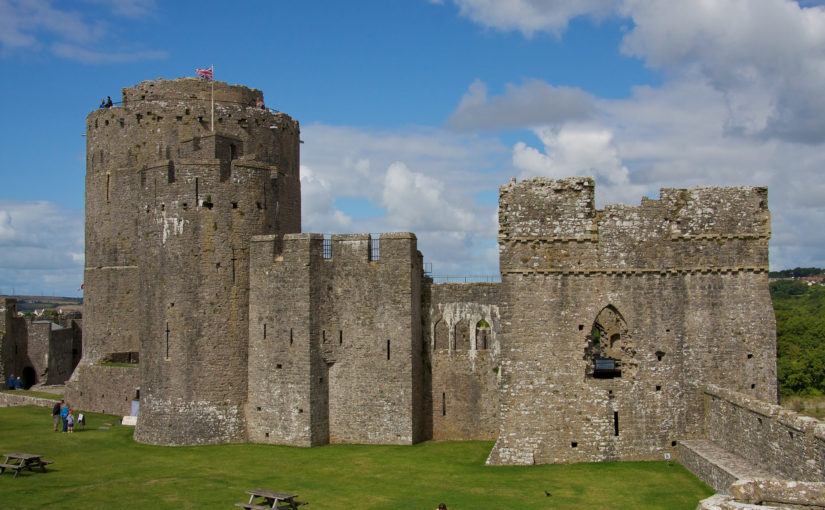
Pembroke Castle is probably best-known for its magnificent cylindrical keep, begun in 1201-2. But why was it built? And how was it used? These and other questions are being explored as part of the wider study of the castle.

Great keeps like these were bold statements of power and prestige. At Pembroke, it seems the keep was also celebratory and commemorative, marking the marriage, ennoblement and inheritance of its builder, William Marshal – and in the most conspicuous way. But it was not intended for residential use: there is neither bedchamber, latrine nor water supply. Household accommodation was instead provided by the great hall, while a chamber block served the Marshal earls on their rare visits to Pembroke.

Subscribe to our quarterly newsletter

Use of the keep, as intended, was restricted and episodic, probably confined to the handful of occasions when the earl visited. Access was clearly limited to those above a certain rank – for instance, there is only one spiral stair and no separate stair for lower ranks. And the interior had to be crossed to get to the stair, showing that its use was strictly controlled.

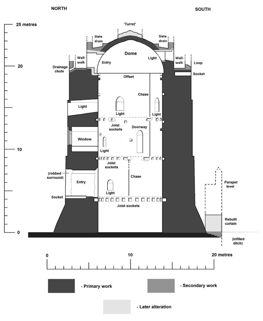
Pembroke Castle keep section drawing. Copyright Neil Ludlow

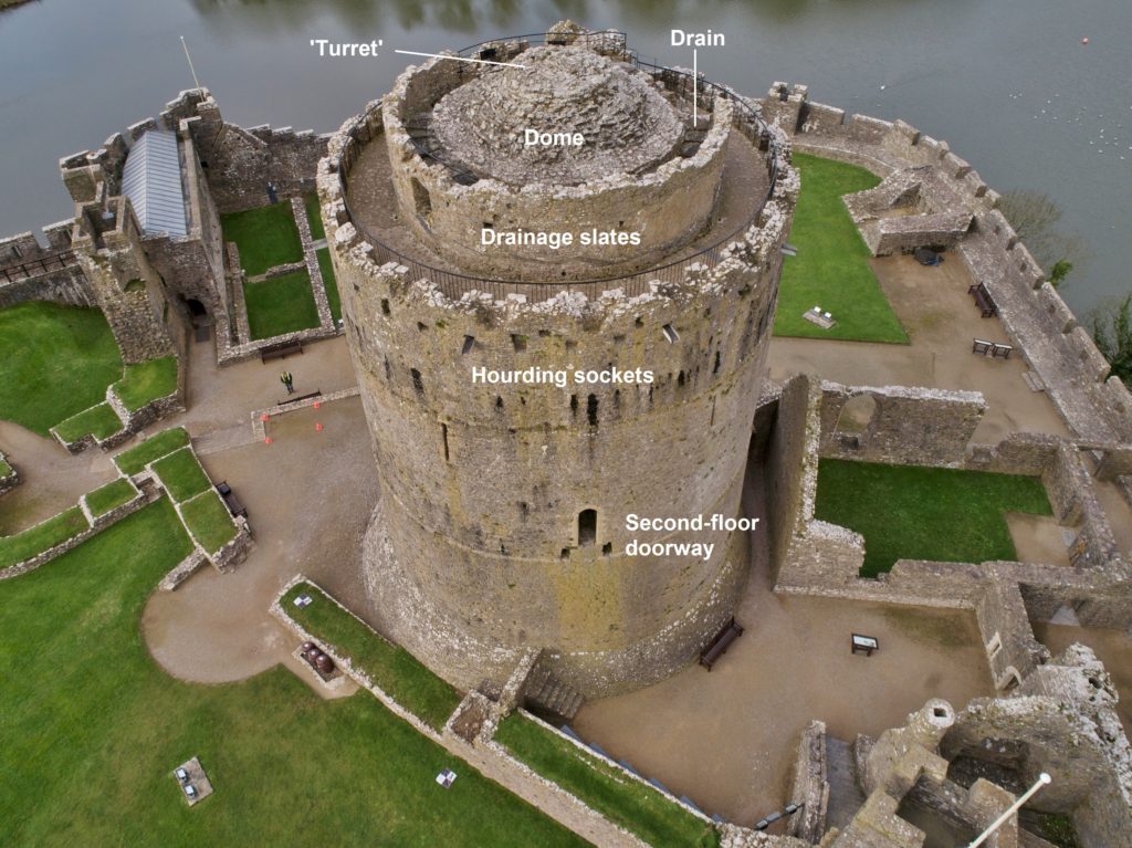
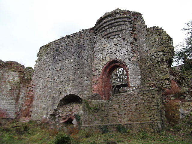
The main chamber lay on the second floor, which has a high-quality window and a fireplace. It may have been intended as an audience or reception chamber, and a setting for formal and ceremonial occasions. It has been suggested that its external doorway was served by an external bridge and stair from the curtain wall, but such an arrangement is inconsistent with the remains. The doorway may instead have led onto an appearance balcony, visible from the town before the outer bailey was added and allowing the earls to be seen by their subjects. Similar balconies existed at King Henry II’s round keeps in France.

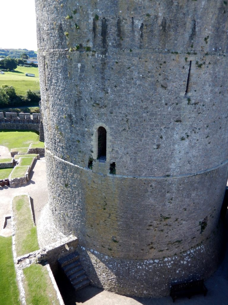
Pembroke keep second floor door. Copyright Neil Ludlow

The first floor, at entrance level, may have been an anteroom or ‘waiting area’ for the second floor. It too has a fireplace. The uppermost chamber lies beneath the unique, masonry dome. It lacks a fireplace, suggesting events here were of short duration. Nevertheless, it is lit by a second elaborate window, while a decorative painted scene can perhaps be envisaged on the underside of the dome. It may have been a ‘prospect chamber’ for entertaining special guests. Other openings, at all levels, are very narrow slits which are too small, too narrow and too high up to have been used by archers, and were probably for light and ventilation only.

At summit level, at least one major change in design occurred during construction, which culminated with the crenellated parapet and concentric inner wall that now crown the keep. As originally built, the dome seems to have been circled by a wide, slate-lined drainage channel. The slates are fossilised, as a series of crests and troughs, within the concentric inner wall and seem to have been truncated when the present wall-walk was established. It is not known whether they were contemporary with the overhanging timber hourd, the sockets for which can be seen beneath the present parapet, but it is difficult to envisage how the two could have worked together.

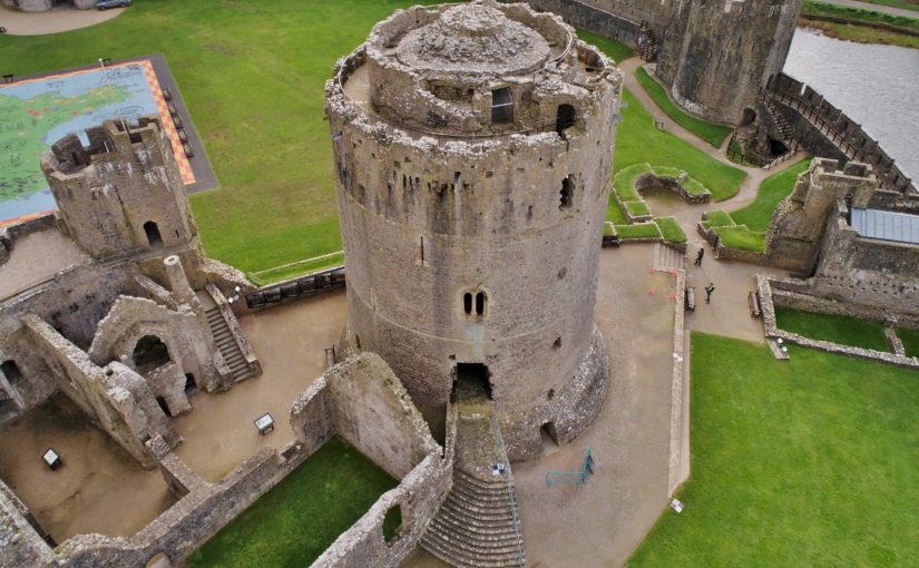
Pembroke Castle keep from southeast (photo: Adam Stanford @ Aerial-Cam)

Hourds like this are now thought to have often been leisure-related rather than military,providing a viewpoint from which a lord’s estates could be shown off to his important guests. At any rate, this overall scheme was replaced, possibly before it was complete, by the present parapet, wall-walk and concentric inner wall. Another slate channel, within the latter, runs around the haunches of the dome and is of very similar design to the earlier drain. These substantial drainage arrangements may indicate that the dome was not roofed, perhaps instead being finished with slates like the domes of some later medieval church towers in south Pembrokeshire.

Much later alterations at summit level included the insertion of a floor beneath the dome – creating an attic space which was accessed from the wall-walk through a secondary doorway, and lit by crudely-inserted window – showing how the keep’s role changed through time, with loss of its original prestige. And much of the dome’s facework was robbed, perhaps to make the central ‘turret’ that now occupies the summit. Part of the second drainage channel was removed in order to create access to this turret, confirming that it is a later addition, but it was present by c.1600 when it was shown in a sketch of the castle.

Either one of these summit alterations may be contemporary with the partition in the body of the keep, the chase (or scar) for which survives in the internal plaster. The plaster contains coal fragments; a corresponding absence of charcoal suggests that the present finish may itself be late, but also means that it cannot be radiocarbon-dated.

Pembroke Castle keep from north (feature photo) Adam Stanford @ Aerial-Cam

Subscribe to our quarterly newsletter

Reconstructing Ruthin Castle

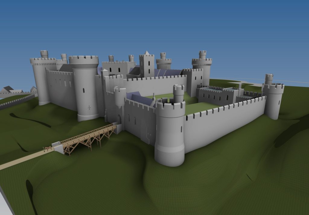
The commission to carry out a reconstruction drawing of Ruthin Castle came after several years of visits and informal discussions with Will Davies and others, all anxious to bring the castle to greater prominence. Once the Ruthin Castle Conservation Trust had been set up in 2016 to arrest the deterioration of the castle ruins, it became imperative that better researched material, texts and drawings be produced to raise awareness of the castle and the critical condition of the ruins. The Trust accordingly commissioned a reconstruction drawing with grant aid from Castle Studies Trust, Castle Studies Group, and the Cambrian Archaeological Association.

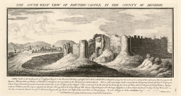
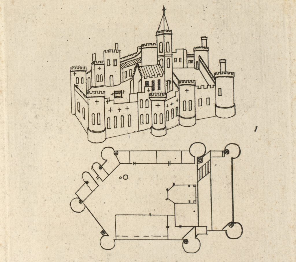
The available documentary sources were scarce. Principal among them was the somewhat hesitant plan drawn by Randle Holme in the 17th century, complete with alterations and amendments, accompanied by two very similar versions of a perspective view, and the inevitable Buck from a century later.

An engraving by the Buck brothers in 1742 from the collection of the National Library of Wales.

Rick Turner identified a detail in the background of a 17th-century picture of “Orpheus Charming the Animals” housed at Chirk Castle, which he believed represented Ruthin. After several attempts at getting a good look at it, some shots were obtained for me by helpful member of National Trust staff. All this was greatly enhanced by a reasonably good topographical survey of the hotel and gardens prepared some years ago.

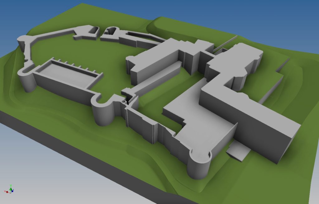
I began by creating a very rough block model of the remains of the castle with the hotel in place, to better identify the elements missing completely and those in doubt, with a view to possibly carrying out some minor excavations to resolve some of these issues. Unfortunately this was not to happen within our timescale, so such revelations still await us in the future.

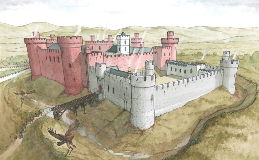
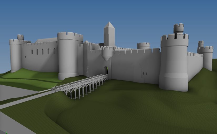
The need to produce a useful image for the Trust rather than a long drawn out programme of investigation resulted in a quick agreement of the general viewpoint, displaying the most dramatic surviving parts of the castle in a completed medieval context, but in such a way that minimised the missing pieces. The result was essentially the Buck and Holm views, but altering some details contained in the latter which did not agree with the surviving remains. A lower vantage point was chosen to conceal the missing details of the buildings in the background.

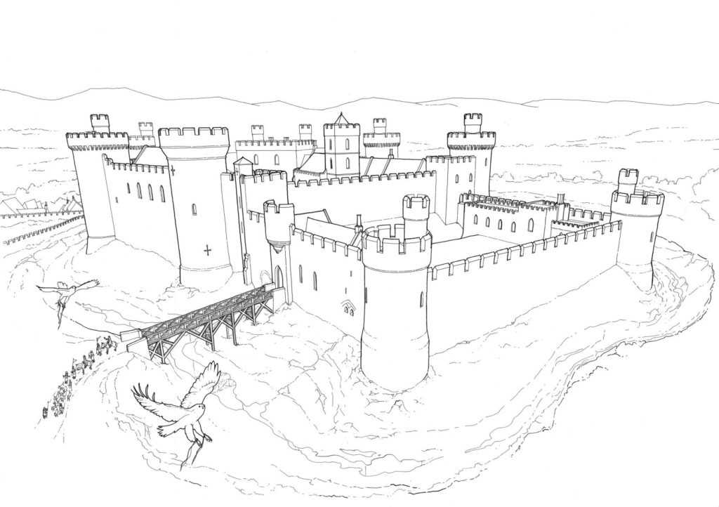
The model was subtly orientated to provide the optimum view, turned into a line drawing, and then the final colour version was produced.

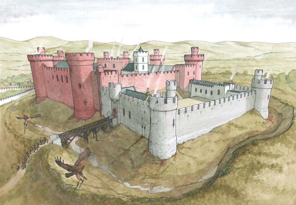
Ironically, it was at this point that the most heated discussion began, regarding the colour of the walls. The present remains of the outer ward are predominantly of a deep red sandstone, with the inner ward of light grey limestone (with some red quoins). The implications of this were far reaching, but for the purposes of the drawing the issue was simply to render or not to render, and if rendered, what colour? The castle is described in some documentary sources as “Castell Coch”, hence red was taken to be the main colour, so perhaps the inner grey ward was rendered red. In the end the consensus was not to render at all, but to expose the masonry as it presently appears, with the red colour of the outer bailey dominant, giving rise to the name. Even then there was some dissent over the strength of the colour of the natural red sandstone in the final image, but “Castell Coch” won out.

Reconstruction drawing of Ruthin Castle from the south-west as it may have appeared in the late medieval period. 
Artist: Chris Jones-Jenkins. Copyright: Ruthin Castle Conservation Trust.

The original painting has now been elegantly framed and is hanging in the foyer of the Castle Hotel, available for all to see. It is hoped that the image will go on to stimulate further discussion in the years to come and generate interest in and publicising the work of the Trust in promoting this historic asset.


To hear more about our work please subscribe to our newsletter.

[mc4wp_form]

Pembroke Castle 2018 Excavations – the results

Parchmarks, and geophysical survey funded by the Castle Studies Trust in 2016, show that a large building once occupied the outer ward of Pembroke Castle. In outline, it seemed to be a free-standing, winged ‘mansion-house’, of a kind broadly dateable to the fifteenth century – making it a compelling candidate for the location of King Henry VII’s birth in 1457. But further investigation was needed to confirm its form and date.

Subscribe to our quarterly newsletter

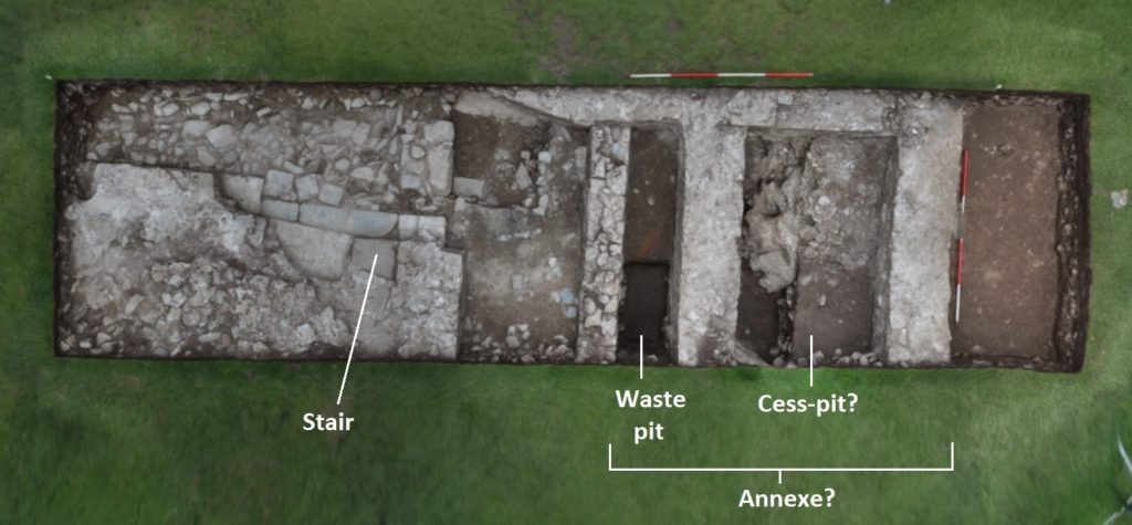
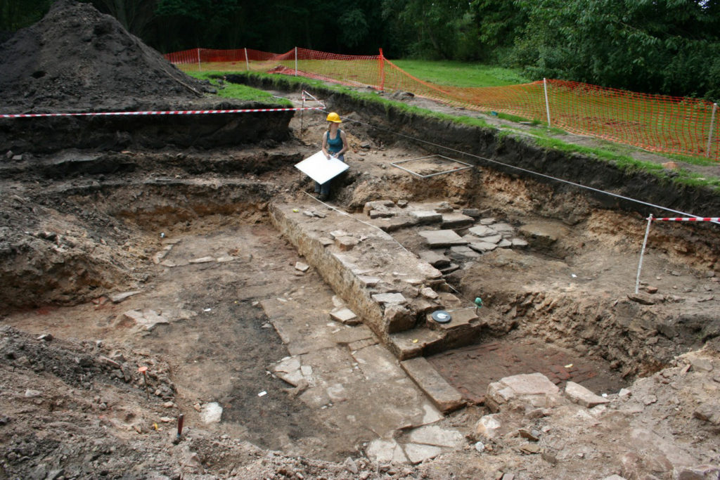
This began in 2018, with an archaeological evaluation that again was funded by the Castle Studies Trust, and carried out by Dyfed Archaeological Trust with the assistance of dedicated volunteers, and the support of Pembroke Castle Trust and staff. In essence, this was a preliminary scoping exercise: two trial trenches were excavated, representing around 20% of the suspected area of the building. And, as Pembroke Castle is a Scheduled Ancient Monument, the consent needed to carry out the work specified that the bulk of the stratified deposits had to be left in situ. Project objectives had, therefore, to be kept within realistic boundaries, namely to establish the condition, character and extent of the building – and, if possible, its date.

Pembroke Excavations Trench 1

Despite these limitations, we feel that the evidence uncovered does not seriously challenge our interpretation of the building as a winged house. It was shown to have had stone walls, one of which housed a stairway suggesting it had at least one upper floor, and an annexe containing a pit for kitchen waste alongside a possible cess-pit. The dating evidence was not precise, but does not rule out a late-medieval date, while the stair was of a helical form seen in fifteenth-century buildings in Pembrokeshire. Which means that we could still be looking at Henry VII’s birthplace.

Subscribe to our quarterly newsletter

And the trenches may confirm our suspicions about the antiquity of the castle site. It has long been suggested that the medieval remains overlie an earlier, Iron Age fort, which may have continued to be used throughout the Roman period – and perhaps even right up until the Norman Conquest. The waste deposits seemed to slump into an earlier pit or trench, and contained Roman pottery and charcoal yielding a Roman-period radiocarbon date. Both perhaps came from disturbance of deposits within the earlier feature.

Future Plans

We feel that further excavation is the only way to fully unlock the secrets of this intriguing building, as the best clues to its date, status and function will probably be found in its form and plan. This information may in fact prove even more useful than the dating evidence provided by finds and radiocarbon samples. This is because the area around the building was heavily disturbed by excavation in the 1930s, following which soil, containing pottery, seems to have been brought in from outside the castle for landscaping. In addition, the scheduled monument consent limits the excavation of the undisturbed deposits.

Further investigations will hopefully begin next year. Another trench in the area of the suspected cess-pit may confirm whether or not it occupies a winged ‘annexe’ housing a suspected second stairway, while a trench in the suggested kitchen wing may show whether it did contain any ovens or fireplaces. It is hoped that, eventually, the entire ground-plan of the building will be revealed. We may then also see how it related to other deposits and features in the outer ward. Excavation can be a cautionary tale, which advises against letting prior assumptions govern interpretation of the results. It is entirely possible that a very different storyline from the one suggested above may yet emerge.

Neil Ludlow – consulting archaeologist on the excavation

To read the full report you can download it here: https://www.castlestudiestrust.org/Pembroke-Castle-2018.html

subscribe to our quarterly newsletter

Five New Awards and £100,000 in six years

We are excited to announce five grants totalling a record £27,000 that will advance our understanding of castles. These awards mean we have reached the landmark of giving away £100,000 in grants. It has taken six years for us to do that during which time the Trust has doubled the maximum amount we can award to £10,000.

Before you read about the five projects below, be sure to subscribe to our newsletter if you haven’t already.

  • Druminnor, Aberdeenshire – Using GPR for an investigation of the 15th century core of the castle – presently under a hardcore car park. This was the original caput of the lords of Forbes. During the 15th century they were amongst the most powerful families in the North-east of Scotland.
  • Hoghton Tower, Lancashire – This project aims to form an axis of research into Hoghton Tower’s unique physical history. The main focus will be to investigate and advance the knowledge of the pre-1560 site and specifically try to test the hypothesis that the north side building may form part of the ‘original’ Hoghton Tower.
  • Laughton en le Morthen, South Yorkshire – Excavation to try to confirm the findings of the geophysical surveys the CST funded in 2018. These indicated that the castle was placed right on the top of a high status Saxon dwelling.
  • Shrewsbury, Shropshire – Geophysical survey and excavation to determine how the castle buildings were laid out in the bailey. This will be the first time the well preserved motte-and-bailey castle has been excavated. First mentioned in 1069, Shrewsbury Castle was a key point along the Anglo-Welsh border and fell into ruin following the conquest of Wales.
  • Wressle, East Yorkshire – A geophysical survey of the area to the south of the castle ruins which had been covered by the previous earthwork survey funded by the CST, to get more information about the various garden structures there, as well as other details regarding the deserted village, moat and fishponds. The 14th century castle was one of the most important castles owned by the Earls of Northumberland.

Be sure to follow us on social media where we’ll be bringing you updates from the field, with work starting this month. In the meantime, here are some of our supporters discussing our work. we hope you’re looking forward to this year’s projects as much as we are!

The projects we’re considering for 2019

The deadline for grant applications passed on 30th November. We’re going through the various projects now. Altogether the 12 projects, coming from all parts of Britain and one from Ireland, are asking for over £75,000.* They cover not only a wide period of history but also a wide range of topics. In a little more detail, here are the applications we’ve received:

Collyweston, Northamptonshire

  • Contributing towards a community excavation at the early Tudor palace commissioned by Henry VII’s mother, Margaret Beaufort. According to building accounts the palace was built around three courtyards and was the first brick building in Northamptonshire. The palace was demolished in 1640 and the site has never been excavated before.

Druminnor, Aberdeenshire

[10] Druminnor Castle - "Woops!"
Using Ground Penetrating Radar for an investigation of the 15th-century core of the castle – presently under a hardcore car park. This was the original caput of the lords of Forbes. During the 15th century they were amongst the most powerful families in the North-east of Scotland.

Hoghton Tower, Lancashire

hoghton tower
This project aims to form an axis of research into Hoghton Tower’s unique physical history. The main focus will be to investigate and advance the knowledge of the pre-1560 site and specifically try to test the hypothesis that the north side building may form part of the ‘original’ Hoghton Tower.

Lathom, Lancashire

Excavation to establish the form and location of the southern perimeter of the curtain wall of the 15th-century castle known as the Northern Court of which nothing remains above ground from the period. It was one of the most important castles in the north west of England in the late 15th and 16th centuries. The castle was besieged twice in the English Civil War and then slighted. In 2017 we funded analysis of masonry recovered in earlier excavations, which indicated architectural links with Caernarfon Castle.

Laughton en le Morthen, South Yorkshire

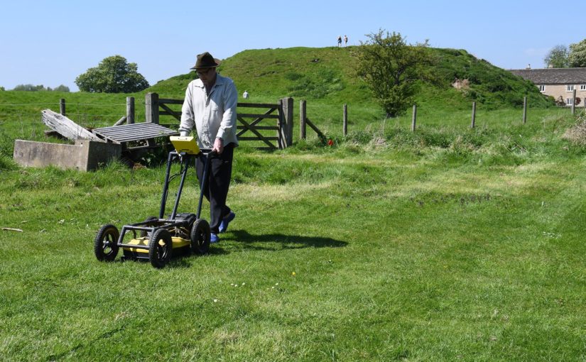
Photo by Mike Neid

Following on from last year’s grant, this project would undertake excavation to investigate features identified during the geophysical survey. The survey suggested that the castle was built over an Anglo-Saxon lordly residence, and the excavation would test whether there is further evidence to corroborate this.

Lewes, East Sussex

Photo by Richard Gailey, licensed CC-BY 2.0.

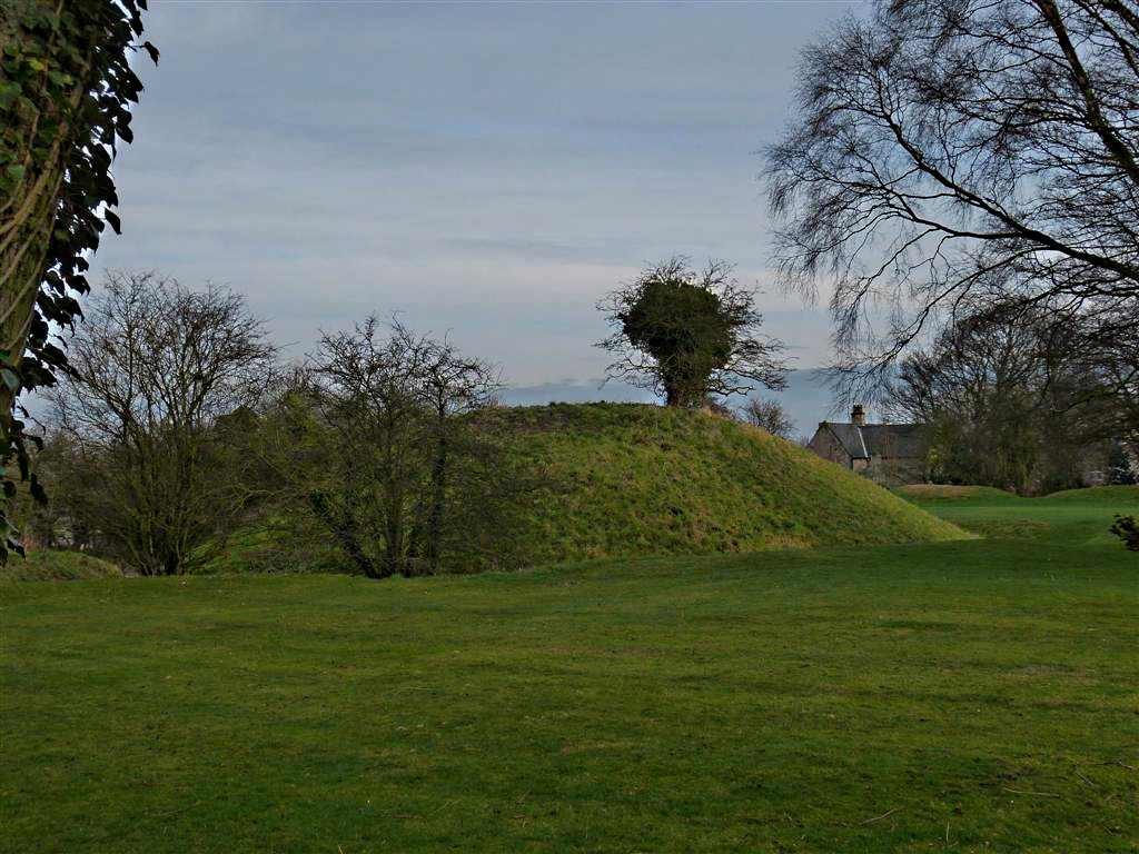
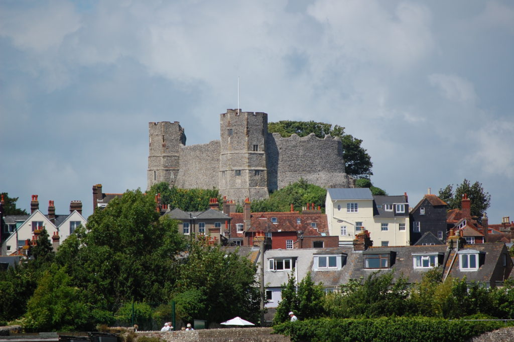
This research aims to answer an intriguing question: why does Lewes Castle, East Sussex, have two mottes? Do they represent a highly distinctive architectural statement, or did burial mounds of possible Romano-British or earlier origins influence the form of the 11th century fortification?

Loughmoe, County Tipperary

Castles of Munster, Loughmoe, Tipperary - geograph.org.uk - 1542634
To produce the first-ever detailed survey and structural history of the building which dates from the 15th and 16th centuries, and to determine using geophysics the extent of the original castle and whether the renaissance part had a precinct, other buildings, and gardens.

Raglan, Monmouthshire

Photo © Jeremy Cunnington

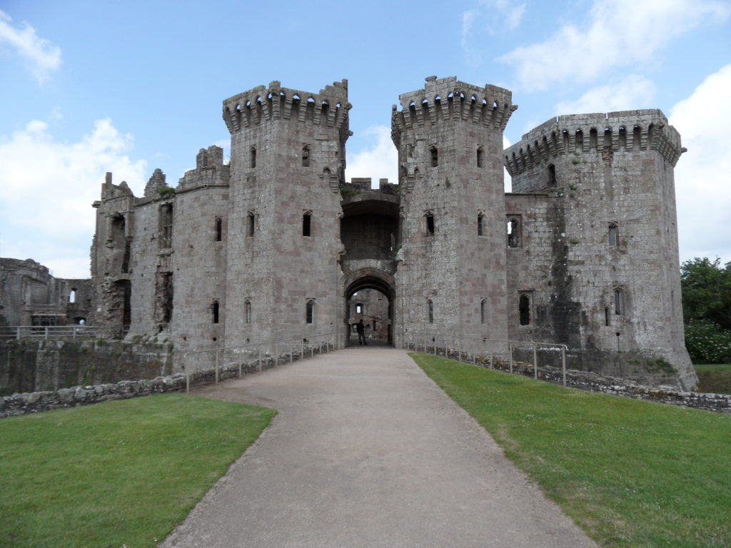
Using inferences from previous geophysical surveys to focus on key areas of the lower terraces and bowling green of the castle potentially revealing more about the clandestine political activity of the Somerset family in the late 16th and 17 centuries.

Shrewsbury, Shropshire

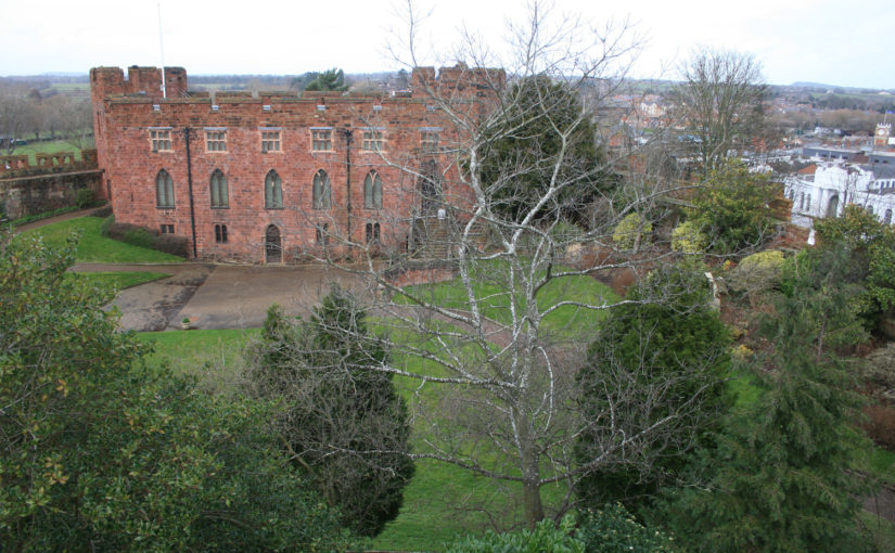
Shrewsbury Castle looking West
Geophysical survey and excavation concentrating on the inner bailey to in particular examine the tail of the north rampart. Despite being one of the main fortresses on the Welsh border no major excavations have taken place in the bailey. Thus the medieval plan of the enclosure, and the missing domestic ranges that should be there, are completely unknown.

Snodhill, Herefordshire

Photo © Jeremy Cunnington

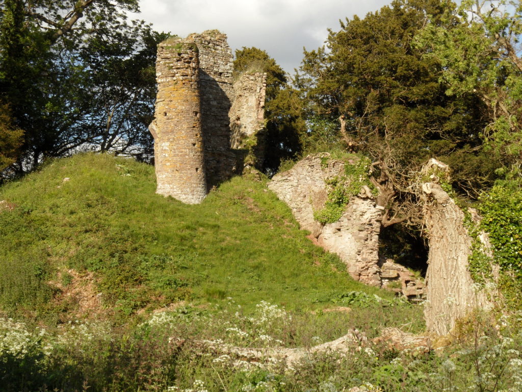
Excavations in this important Welsh border fortress that was in use from just after the conquest to the English Civil War. The aim is to answer some key questions about the castle e.g. the keep’s entrance and final form, to establish the form of the North Tower and along the south side to see if that was where the entrance was.

Tarbert, Argyll

East Loch Tarbert and Tarbert Castle - geograph.org.uk - 1624617
Funding post-excavation costs of a community archaeology project. The project will be trying to see discover a number of things about this royal castle including if there was a southern entrance into the outer bailey, and what buildings there were along the north east range of the inner bailey.

Wressle, East Yorkshire

A geophysical survey of the area to the south of the castle ruins which had been covered by the previous earthwork survey funded by the CST, to get more information about the various garden structures there, as well as other details regarding the deserted village, moat and fishponds. The 14th century castle was one of the most important castles owned by the Dukes of Northumberland.

The applications have been sent to our expert assessors who will go over them. You can see how the assessment process works from our blog back in January 2016. And don’t forget to subscribe to our newsletter.

*The article was updated at 15:28, 10th December to remove Halton Castle.

The art of the reconstruction

When walking round ruined castles, it can be difficult to picture how they once were. There may be missing floors, the roofs aren’t the same, and entire buildings might have vanished. Even when a structure appears to survive intact, we are usually missing the interior – how it was decorated, the furniture, even how light changed throughout the day.

Reconstructions are a wonderful tool for bringing castles back to life. This year, the Castle Studies Trust is funding one such reconstruction. Chris Jones-Jenkins is helping us understand how Ruthin Castle would have looked. You might recognise his name from 2015, when he worked on one of our very first projects, the digital model of Holt Castle, or from his various work with Cadw and English Heritage.

We caught up with Chris to learn a bit about what goes into these illustrations and how he got into reconstructions. Older illustrations, like those done by Alan Sorrell decades ago, were done by hand while a lot of reconstructions today are done on a computer. Chris has experience of both, and they are very different processes. When working by hand, you need to start off by choosing your viewpoint and deciding what it is you’re going to show. With a digital reconstruction, you have the option to change the position of where you’re looking from. Chris reconstructs everything in the image and the viewpoint might be the last thing to be settled. With Holt for example, if that had been reconstructed 20 years ago the viewpoint would have been one of the first things decided – what to show, what to discreetly tuck away, and how to balance highlighting everything you want. Instead, as Chris created the whole thing digitally it was possible to use the model to create a flythrough video.

A plan of Ruthin Castle from Thomas Pennant’s 1781 edition of ‘A Tour of Wales’, from the collection of the National Library of Wales. Image in the public domain.

A wealth of information goes into reconstructions. For Holt and Ruthin, any standing remains are taken into account and modelled, while historical evidence such as paintings or documents are used to fill in the gaps where parts of the structure are missing. Chris trained as an architect and early in his career so has an eye for how buildings are put together, complimenting his skill as an artist and years of experience with historic buildings. Will Davies and Sian Rees have been helping with the research into Ruthin Castle and how it appeared, giving Chris the best information possible to work from. There was a survey of the curtain wall, but done to the wrong scale, which kept the team on their toes.

Working with some kinds of source material you get a feel for how useful and accurate it is. For instance, in the 17th century Randle Holme made some useful plans of Holt Castle in pen and ink. He also created a view of Ruthin Castle, but for some reason his work here wasn’t as reliable. The test is that the parts of the castle that still survive weren’t well illustrated by Holme, so his work needs to be used carefully.

A lot of time and effort goes into reconstructions. It can take over six months from start to finish, with drafting, redrafting, tinkering with details, and pausing to research a particular feature or issue. Over this time, the reconstruction grows from a plain model to a textured, colourful building. Reconstructions have an element of educated guesswork, but attention to detail is important. If you misstep and include something not appropriate for the period there are eagle-eyed heritage lovers who spot this kind of thing! New information is being uncovered about Ruthin, which directly informs Chris’ work. But there are some questions, like the forms of buildings, which are only likely to be answered by excavation.

Chris has been working on reconstructions since the 1980s, and aside from the change in technology has noticed an interesting trend. Previously, there was often emphasis on showing the structure while more recently the organisations commissions reconstructions want to populate these buildings, showing daily life inside.

Talking to Chris, one thing that cropped up is that reconstruction artists don’t often get to hear what the public think about their work which is a real shame as it can make a world of difference to a site. So when going round a historic site, if you see a reconstruction that captures your imagination or helps you understand the place better, pass on that positive feedback.

The image at the top of this page shows the a work-in-progress version of the reconstruction. Subscribe to our quarterly newsletter so you don’t miss news about the finished reconstruction and our other projects.

Trial trenching at Pembroke Castle

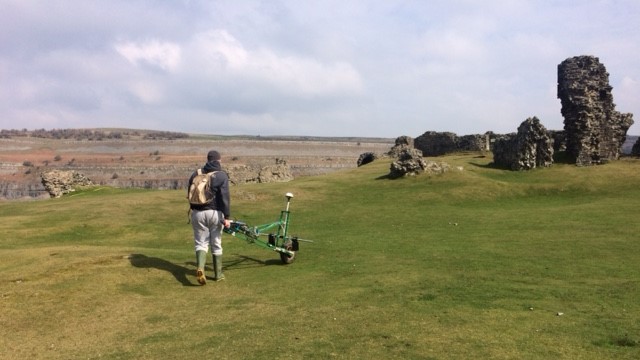
In 2016, geophysical survey by Neil Ludlow and Dyfed Archaeological Trust (DAT) revealed the remains of long-vanished buildings, and other features, at Pembroke Castle. This work would not have been possible without the Castle Studies Trust, which funded the entire project.

Pembroke is famous for its large round keep, built by earl William Marshal, and a complex of other stone buildings is preserved in the inner ward. But the large, outer ward has been an empty space since at least the eighteenth century. Nevertheless, very dry summers had revealed ‘parchmarks’ here, showing that ruined walls lay just below the surface. These showed up particularly well during 2013 when they were photographed by Toby Driver of the Royal Commission on Ancient and Historical Monuments (Wales), and were published by Toby, with Neil Ludlow, in Archaeology in Wales.

This was the genesis of the current programme of investigation at the castle. The geophysics that followed used a combination of magnetometry, resistivity and Ground Penetrating Radar, to confirm the parchmark evidence and also show that a number of further buildings, and other features, formerly lay in the outer ward. The most exciting of these is a large building which may represent a free-standing, double-winged mansion-house from the late Middle Ages. If so, it would be quite exceptional: grand buildings of this particular kind are unusual in castles, and particularly in outer wards which are normally thought to have contained the more lowly buildings associated with everyday castle life.  It means that the outer ward, at Pembroke, may have been ‘gentrified’ – at least in the fifteenth century. This may make sense of historical accounts which place the birth of the future king Henry VII in the outer ward: it may have occurred within this very building.

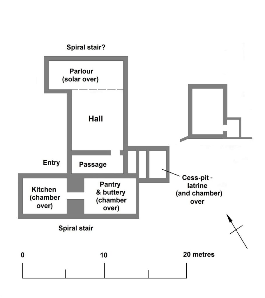
What the geophysics and parchmarks seem to show is a large, central hall, flanked by two wings. If the building was anything like others of its kind, one wing will have contained the kitchen and ‘services’ – the buttery and pantry – while the other represented more private accommodation. The outer ward was partly excavated in the 1930s – sadly, without record – but a photograph shows a large, stone-lined pit, apparently leading off the hall, which may be the cess-pit mentioned in an account from the period. A square annexe showed up here in the survey work.

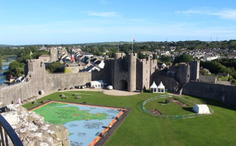
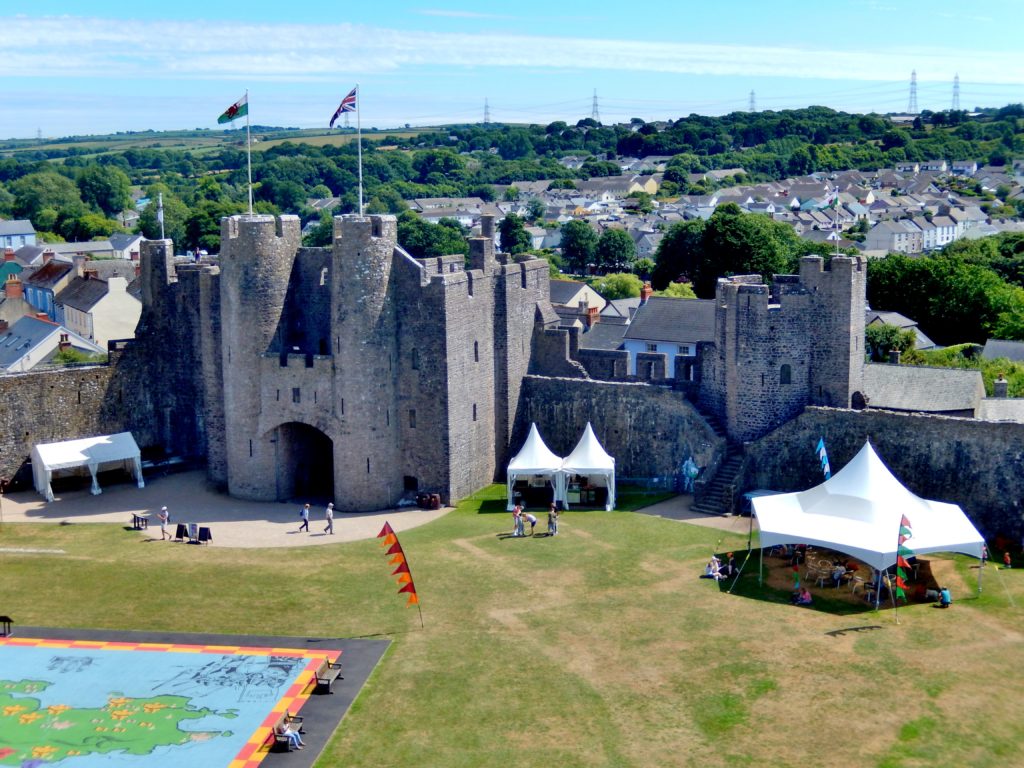
Just inside the castle beside Pembroke’s main gate are parchmarks (where the white tents are). They show the position of a late medieval hall. ©Neil Ludlow

While the results showed what can be achieved through geophysics – and generous grant-aid – their interpretation is, at the moment, still speculation. Only educated guesses can be made about the exact form, date and function of the building. But it has the potential to make a big contribution to the study of castles, and late medieval history, at a national level. So Neil got together with James Meek of DAT to decide how best to get answers to these questions. Only excavation could really provide the answers but, given the sensitivity of the site, which is a Scheduled Ancient Monument, and the importance of the building, minimum intervention, for now, was the preferred approach – a small excavation, primarily just to see how much has survived. This was agreed by Cadw, who granted permission for the hand-excavation of two trial trenches, one across the hall and possible cess-pit, the other across one of the wings. Overburden will be removed, and hopefully the remains of the medieval walls, and any floor-surfaces, will be revealed. It is not intended to go down any further – or at least, not in the present project which will effectively be an evaluation.

We also don’t know how much was removed during the 1930s excavation. While we know there must still be walling, as it shows up in the geophysics and parchmarks, it is possible that the medieval floors may have gone. We hope not, and we also hope that the cess-pit wasn’t emptied, as its deposits could contain valuable information on diet, health, bugs and parasites, while finds that are important to us may have been dumped there as rubbish.

Neil and DAT decided once again to approach the Castle Studies Trust who, very generously, again awarded a grant for the work. This will be supported by help in kind from Pembroke Castle Trust. One of the things also missing at Pembroke is a really accurate measured ground plan, with levels, so for the first time a full topographic survey will also be undertaken. We hope the castle can be persuaded to reveal a few more of its secrets.

Possible layout of the winged building in Pembroke’s outer ward,
based on Cothay Manor, Somerset, and others. ©Neil Ludlow

Don’t miss out on more news from our projects. We’ll have regular updates from Pembroke on our social media, and if you haven’t already please subscribe to our quarterly newsletter. We are entirely reliant on donations, so please consider giving to support our work.

The six projects we’re funding this year

From 15 high quality applications we had to choose which ones we could fund. It certainly wasn’t an easy decision, but we have managed to support six different projects – the most we’ve supported in a single year – with a total of £22,000. You can learn more below, and if you would like to hear about the results when they are ready be sure to sign up to our newsletter.

Old Bolingbroke, Lincolnshire, England

Photo by David Hitchborne, licensed CC BY-SA 2.0.

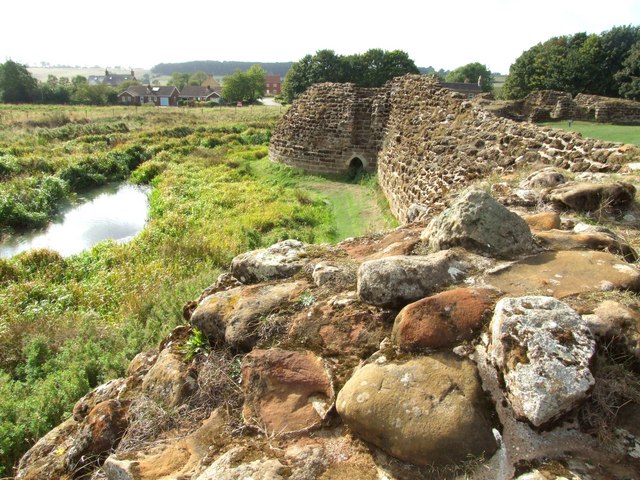
Bolingbroke Castle was built by the Earl of Chester in the 1220s and Henry IV was born here in 1367. It is unclear how the Rout Yard and Dewy Hill were used, so Heritage Lincolnshire will carry out geophysical surveys at the castle to find out more about the site.

Pembroke, Pembrokeshire, Wales

Photo by ‘Jez‘, licensed CC BY-SA-NC-ND 2.0.

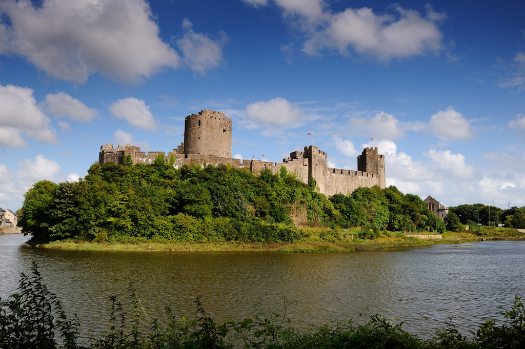
Founded in 1093, Pembroke is the oldest castle out of this year’s projects. Rebuilt by William Marshall, one of the most famous knight of his age, the castle was also the birthplace of Henry VII. Neil Ludlow and James Meek’s project will excavate in the outer ward to find out more about a late medieval hall. We also funded a geophysical survey at the castle in 2016.

Dig It!, castles of southern Scotland

With funding from the Castle Studies Trust Dig It! will be producing a series of eight videos exploring castles in southern Scotland, and sharing them with an online audience. By making it easier to access information about these important historic sites through YouTube and Wikipedia the project aims to inspire the next generation of castle enthusiasts!

Keith Marischal, East Lothian, Scotland


The Castle of Keith belonged to the powerful Keith family. The castle has since been demolished, with some parts built into Keith Marischal House which now stands on the site. Miles Kerr-Peterson and and Rose Geophysical Consultants will be carrying out a geophysical survey to search for the castle’s lost tower and great hall.

Laughton-en-le-Morthen, South Yorkshire, England


The castle is undocumented in medieval sources, but the earthworks of the motte-and-bailey castle are impressive: the motte itself is 9m tall. To find out more about Laughton-en-le-Morthen Castle, Duncan Wright will be carrying out a geophysical and aerial survey.

Ruthin, Denbighshire, Wales

Photo by Eirian Evans, licensed under a CC BY-SA 2.0 licence.

First documented in 1277, Ruthin Castle was controlled by Reginald de Grey in 1282. This once great castle is a ruin today and much in need of interpretation. To help with this, Chris Jones-Jenkins will create a digital reconstruction of Ruthin. Chris also worked on the reconstruction of Holt Castle, which was built around the same time some 18 miles to the east.

Stay in touch!

We will have updates from these projects throughout the year. Be sure to subscribe to our newsletter so you don’t miss out.

Subscribe to our mailing list

* indicates required


Another Bumper Crop of Applications for the Castle Studies Trust to Consider

The deadline for grant applications passed on 15th December. We’re going through the various projects now. Altogether the 15 projects, coming from all parts of Britain, are asking for over £63,000. They cover not only a wide period of history but also a wide range of topics. For a little more detail, here are the applications we’ve received:

  • Caldicot, Wales – a geophysical survey of the scheduled area of Caldicot Castle using magnetometry, resistivity, and Ground Penetrating Radar (GPR)
  • Dig It! 2017 Castles of South Scotland – enhancing public understanding and knowledge of some castles in southern Scotland, their purpose, their history and their relevance, particularly the lesser-known and least visited sites.
  • Dunyvaig, Scotland – co-funding a project to provide better understanding of the landscape context of the castle by conducting detailed topographic and geophysical surveys and carrying out trial trenching to gain key information regarding the preservation and the depth of the buried deposits.
  • Keith Marischal, Scotland – geophysical survey at Keith Marischal House, in search of a lost medieval castle and renaissance palace with a great hall reputed to be second in size to that of Stirling’s.
  • Lathom, England – excavations to find out the true size of Lathom Castle. You may recognised them from 2017’s grants when we funded analysis of masonry recovered from excavations between 1997 and 2009.
  • Laughton-en-le-Mortain, England  comprehensive archaeological investigation of the motte and bailey castle of Laughton-en-le-Morthen, South Yorkshire and its surrounding landscape.
  • Loch Kinord, Castle Island, Scotland – radiocarbon dating an early island castle: Castle Island, Loch Kinord, Aberdeenshire
  • Old Bolingbroke, England – revealing the history of Old Bolingbroke’s Castles: What can researching Bolingbroke Castle’s Route Yard and Dewy Hill tell us about Bolingbroke Castle?
  • Pembroke, Wales – test trenches at one of Wales’ greatest castles to confirm the site of the late medieval structure revealed in the geophysical survey funded by the CST in 2016.
  • Ruthin Denbighshire – co-funding reconstruction drawing of this great Welsh Edwardian fortress. Ruthin was the town where Owain Glyndwr’s rebellion against English rule started.
  • Sheffield, England – record and examine the architectural fragments stored on the site of the castle found in previous excavations.
  • Skipton, England – an archaeological/architectural survey will be produced of the gate structures and flanking round towers of the inner ward of Skipton Castle.
  • Snodhill, England – geophysical survey and excavations to answer some key remaining questions of this important Welsh border fortress re: the castle namely where was the entrance and function of the North Tower.

The applications have been sent to our expert assessors who will go over them. You can see how the assessment process works in one of our earlier blogs.

A Study of Hay Castle

This guest post was written by Mari Fforde.

Hay Castle, in Hay-on-Wye, is undergoing a major restoration which will result in an exciting visitor destination and a centre for culture and arts. The Heritage Lottery Fund granted nearly £5 million toward the project. So far, a substantial amount of archaeology has been undertaken to help inform planning applications, conservation management plans and structural engineering solutions.

The site, a Scheduled Ancient Monument, embodies an astonishing array of architecture, including a Norman keep, an important medieval gateway, a Grade I listed Jacobean mansion and later Victorian and Edwardian additions. The keep was probably incorporated into a late medieval domestic building and then this was retained within the double-pile mansion built in the first half of the 17th century. The mansion was itself subjected to alterations in the 18th and 19th centuries and twice partly gutted by fire in the 20th century. The gate and curtain wall were retained and appear to have been repaired as garden features.

Fifteen archaeological test pits have enhanced our knowledge of the site in a variety of ways. Digs were undertaken within the derelict mansion to establish where the new lift could be situated. Just below the surface runs a medieval stone structure, at least 3.5 metres wide running along the north face of the mansion. The angle and relationship with the keep suggests that this is the 13th century curtain wall. A glimpse of the underground stonework will remain visible in the restored mansion.

Investigations also revealed that much of the site comprises about two meters of infill. Two boreholes were drilled giving results of approximately 2–3 metres of made up ground, 2–3 metres of sub soil and then at 7 metres the Raglan mudstone bedrock. It is thought that this infill was brought in when the Jacobean mansion was constructed, thus heightening it from the lower medieval ground level.

On the north face of the keep, facing town, a test pit revealed a wall of tufa. Large regular well-cut blocks measuring around 40cm long by 20cm high appeared to extend below the level of excavation. In his report, lead archaeologist Peter Dorling stated: “This finding appears to support the interpretation of the tower as the original castle gateway. The west side of the tufa forms a straight edge, which at this level was perhaps associated with a seating for a bridge/drawbridge”. This is an exciting find as freshly quarried tufa around a gateway arch would have been very striking and certainly would have had a strong visual impact.

Volunteers from the community have helped on a dozen or so of the digs. The Hay History Group and the Young Archaeologists Club have taken part. Further archaeological exploration will be undertaken, mainly in the derelict mansion to establish locations of new footings. In addition, it is hoped that ongoing archaeology will help determine the existence of the earlier gateway within the keep.

Construction is expected to begin in October and will take two years, when Hay Castle will be fully open to the public for the first time in many centuries.

Visit Hay Castle’s website for updates on their upcoming work.