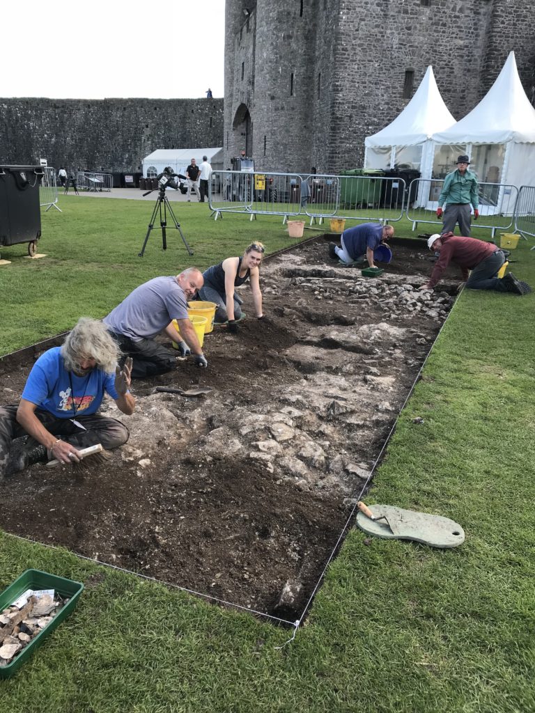
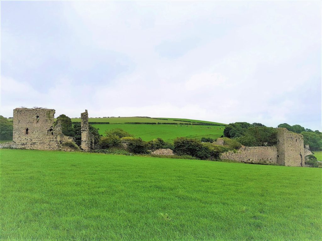
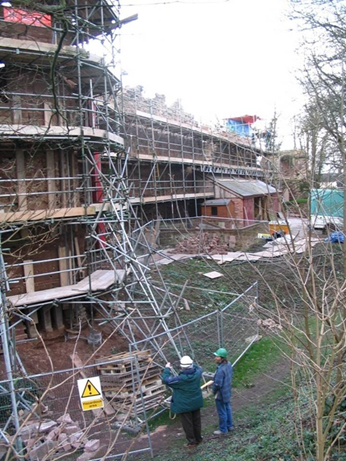
To help keep you entertained during this strange and hopefully unique Christmas the Castle Studies Trust has prepared a Christmas quiz. Can you name the castles these pictures are or images are taken from either our projects from all years or blog posts during the year?
Malcolm Hislop, researcher and author, writes about some of the themes of his most recent book.
Often thought as a highpoint of English military architecture, the castles of Edward I and his followers in north Wales hold a special place in hearts and minds of many in this country and abroad. Scholars have spent much time and effort on researching this (relatively brief) episode of intensive castle construction. We feel we know these buildings so well, and yet, notwithstanding the many accounts of individual castles, it is strange to relate that no lengthy general survey of the architecture (as opposed to the building history) has ever been published. Nor, despite presenting an obvious opportunity for furthering our understanding of the manner in which architectural style was formulated and disseminated in the late thirteenth century, have the influences on and of the Edwardian castle been widely discussed.
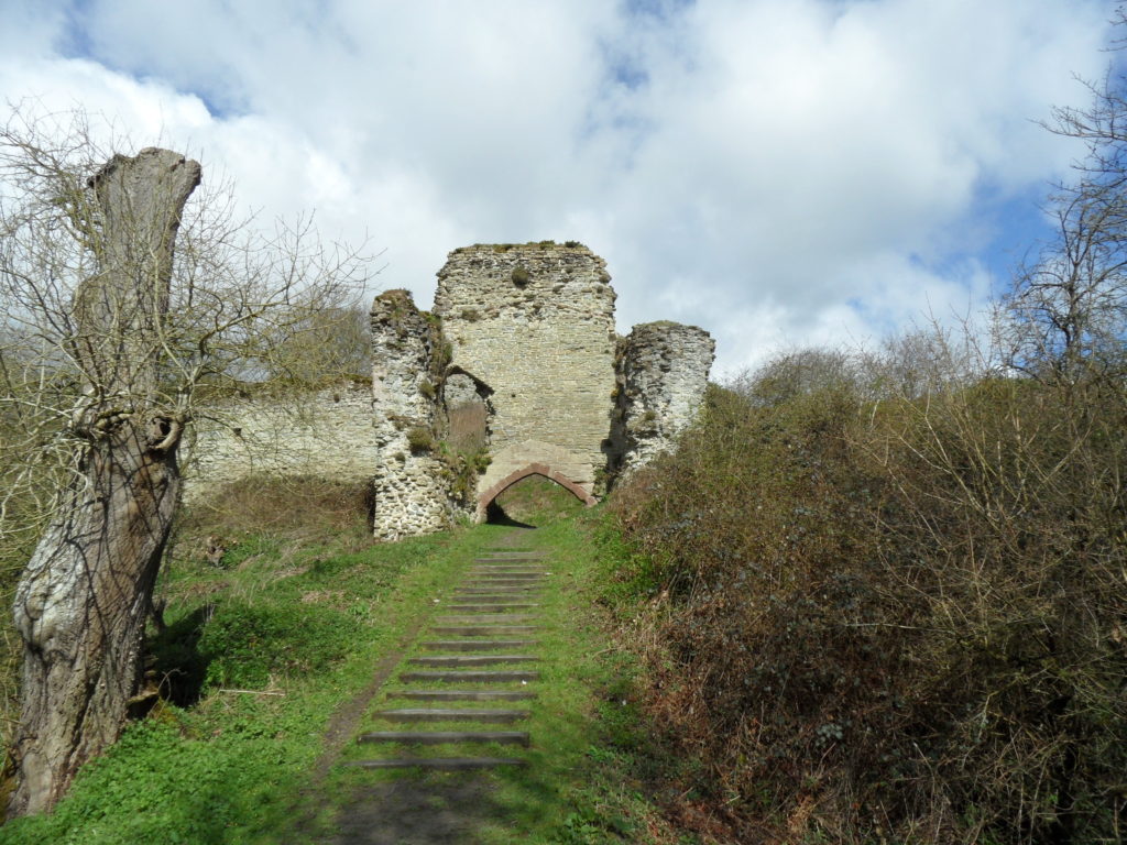
Conwy. The outer gatehouse and truncated approach ramp of c. 1283 by James of St George.
Edward’s Welsh castles are inextricably linked to the technical mastermind behind the project, the Savoyard mason, James of St George. Castle builders (in the practical sense) tend to be less well known than their patrons. The ones who can be identified are far outweighed by those who remain anonymous. Moreover, a master builder whose career can be reliably reconstructed to a significant degree is a rarity to be cherished. Master James is one such exception, his reputation as an architect of international repute being established in one of the great historical detective stories of the later twentieth century, which did much to personalise the often anonymous process of medieval construction.
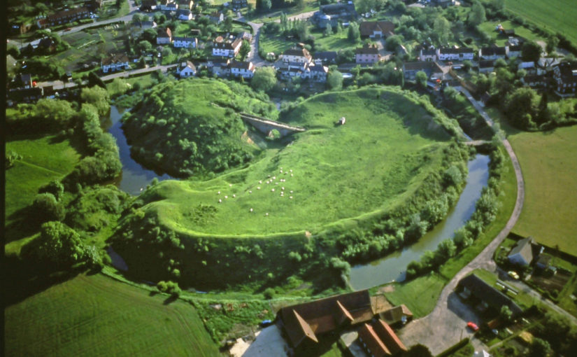
Beaumaris. The North Inner Gate of c. 1295 etc. by James of St George.
Master James’ star has not ridden quite so high in recent years. His architectural role questioned, his artistic contribution doubted, James now seems a slightly diminished figure, with only his organisational and planning abilities remaining unchallenged. There were certainly other master builders employed on the royal works who exercised a degree of independence; it is clear too that there were other influences on the royal works in Wales than can be accounted for by Master James’ accumulated experience in Savoy. In particular, what was the part played by Walter of Hereford, the technical and artistic master mind behind Vale Royal Abbey, and resident master at Caernarfon from 1295? These are interesting issues requiring a greater depth of enquiry, but the initial conclusions of a broader than usual sweep of the architecture are that in addition to his organisational and technical responsibilities Master James also exercised a significant creative role.
Duffus. The great tower of c. 1305 built in Moray with Edward’s assistance.
Edward’s crushing of all resistance in north Wales was swiftly followed by an attempt to subjugate Scotland. Building work in Wales was mothballed and James of St George and Walter of Hereford were redirected northwards. The impact of Edward’s invasion of Scotland on castle building in the northern kingdom tends to receive little attention. Most of the royal works were in timber, little survives above ground level, and archaeology has not yet revealed much that can enlighten the subject. On the other hand, it is becoming increasingly clear that there is a good deal more to say about the contemporary building works of his supporters, that survival of which is much greater, and that in a number of instances there was an English contribution to design and construction. The story of Edwardian castle building in Scotland is only just beginning to take shape.
Newark. The river front of c. 1300, probably influenced by Caernarfon.
Another under-researched theme is the effect of the Edwardian castles in Wales on the architecture of England. There has been an understandable tendency to view the years immediately following the Edwardian conquest of Gwynedd as an anti-climax in English castle building, and that there is little continuity from the Welsh project. Yet the craftsmen dispersed, and building went on, not in such concentrated or dramatic fashion, but often in small quiet ways that escape the notice of the wider world. The full extent of this influence on fourteenth-century castle design is yet to be recognised, but it includes both the broader aspects and the smaller details and represents the final chapter in the story of the Edwardian castle.
Malcolm Hislop’s book James of St George and the Castles of the Welsh Wars (September 2020) is published by Pen and Sword. Hardback, 302 pages, 175 colour and monochrome illustrations.
The deadline for grant applications passed on 1 December. We’re going through the various projects now. Altogether the 14 projects, coming from all parts of Britain, one from Ireland, are asking for £88,000. They cover not only a wide period of history but also a wide range of topics.
In a little more detail here are the applications we’ve received:
Caerlaverock, Dumfriesshire: The aim is to understand the chronology and geography of extreme weather events in the high medieval period, and the effects they wrought on archaeological features that led to the abandonment of the old castle in favour of the new.
Georgian Castles: This project explores two castles in County Durham—Brancepeth and Raby—that were fundamentally reshaped and transformed in the eighteenth century to become notable homes in the area, and it advances not only our understanding of these two buildings in the period, but also the afterlife the castles in the area and the layers of history that they record.
Greasley, Nottinghamshire: The production of an interpretative phased floor plan for Greasley Castle in Nottinghamshire. The castle, built in the 1340s, has an obscure history and the understanding of its architectural phasing is at best very cloudy.
Laughton-en-le-Morthen, South Yorkshire: To provide professional illustration and reconstruction which will also be integrated into the co-authored academic article. Part of the monies will be used to produce phase plans of Laughton during key stages of its development, and a small percentage will pay for a line drawing of the grave cover.
Lost medieval landscapes, Ireland: To develop a low cost method, using drone and geophysical survey to identify native Irish (also termed Gaelic Irish) medieval landscapes and deserted settlements.
Mold, Flintshire, post excavation analysis: Post-excavation analysis from excavation on Bailey Hill of the castle
Mold, Flintshire, digital reconstruction: Visual CGI reconstruction of Mold Castle using the new-found evidence of further masonry on the inner bailey structure and using information gathered by the Bailey Hill Research Volunteers, showcasing the many changes that have happened on this site from a Motte and Bailey Castle to present time as a public park.
Old Wick, Caithness: Dendrochronological assessment of timber at the Castle of Old Wick, Caithness thought to be one of the earliest stone castles in Scotland.
Orford, Suffolk: recording the graffiti at the castle through a detailed photographic and RTI (Reflectance Transformation Imaging) survey will add to our understanding of how the building was constructed and the ways the building was used over time, particularly 1336-1805, during which the documentary history of the castle provides little evidence of how the site developed.
Pembroke, Pembrokeshire: A second season of trial-trench evaluation of the suggested late-medieval, double-winged hall-house in the outer ward at Pembroke Castle, which is of national significance. The evaluation builds on the results of the works undertaken through previous CST grants: geophysical survey (2016) and 2018 whereby two trenches were excavated across the possible mansion site. The evaluation will again establish the extent of stratified archaeological deposits that remain within the building, which was excavated during the 1930s.
Pevensey, East Sussex: GPR survey of the outer bailey and immediate extramural area and UAV (aerial) survey of the castle to build up a 3-D model of the site.
Richmond, North Yorkshire: Co-funding a 3 week excavation of Richmond Castle, one of the best preserved and least understood Norman castles in the UK. The aim is to understand better the remains of building and structures along the western side of the bailey.
Shootinglee Bastle, Peeblesshire: Funding post-excavation work from the 2019-20 excavation season in particular some charcoal deposits from a C16 burning event.
Warkworth, Northumberland: Geophysical survey to explore evidence for subsurface features in and around the field called St John’s Close in a field adjacent to the castle.
The applications have been sent to our assessors who will go over them and prepare their feedback for the Trustee’s who will meet in late January to decide on which grants to award.
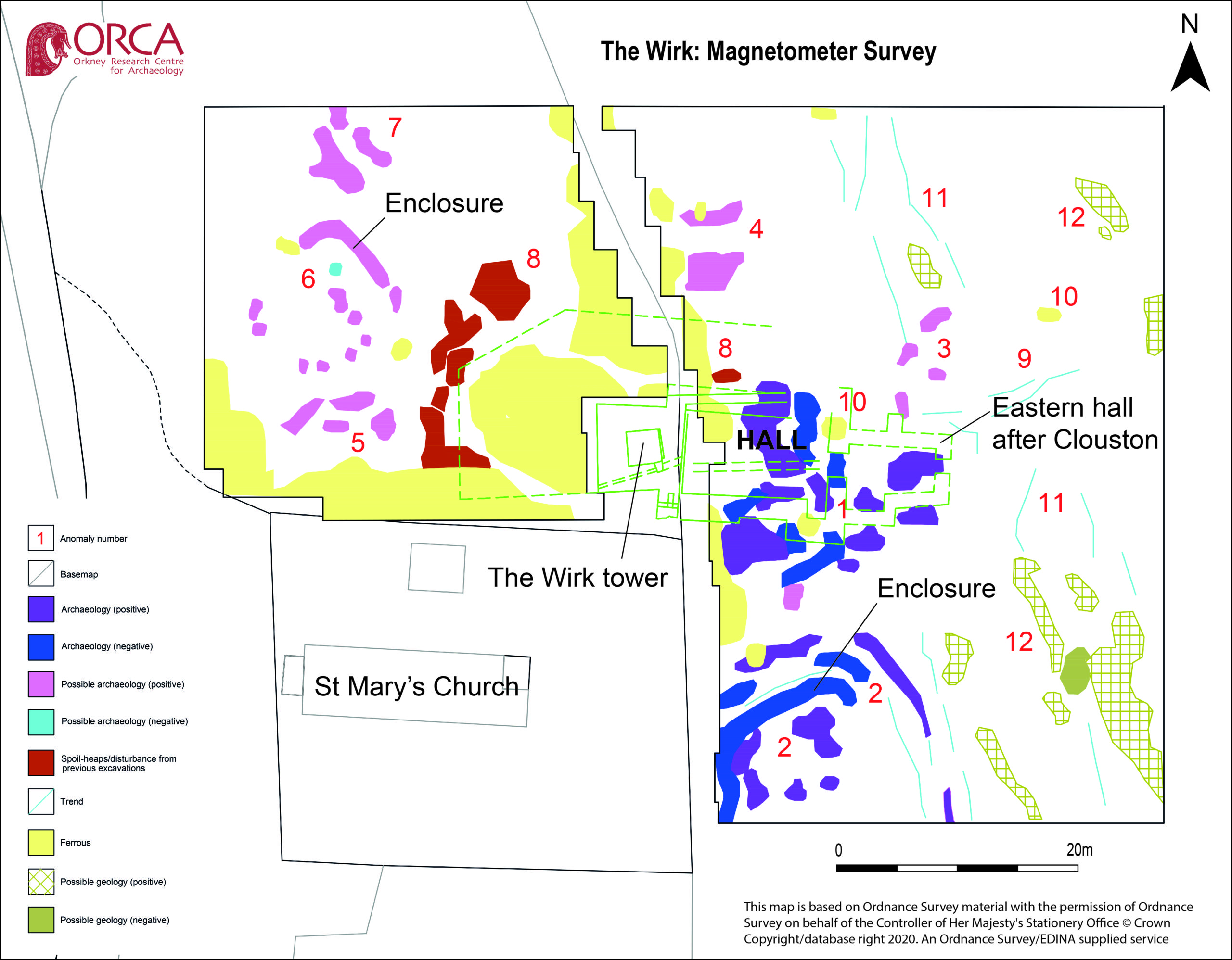
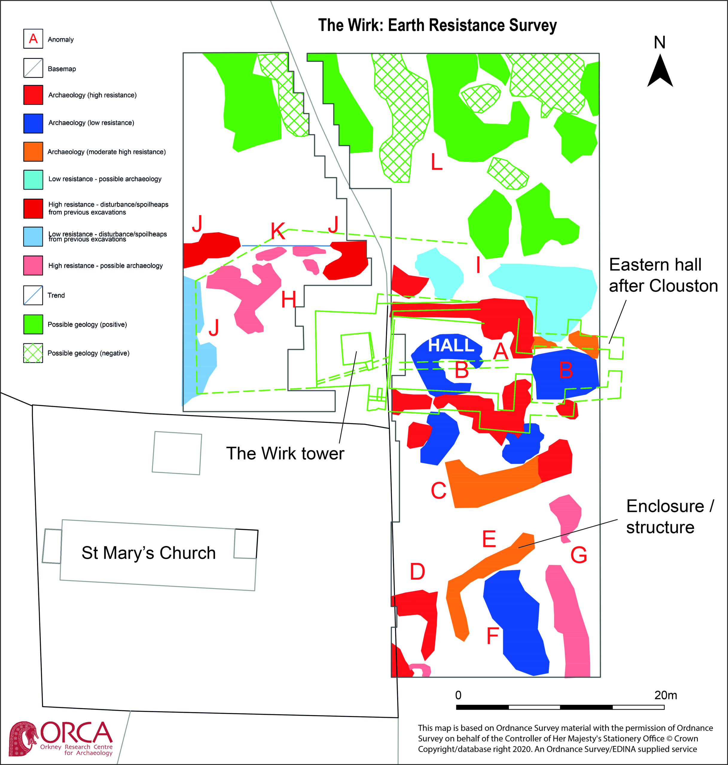
Project leads, Drs Sarah Jane Gibbon and Dan Lee reveal the results of the geophysical survey part of their project on The Wirk funded by the Castle Studies Trust.
Thanks to a grant from the Castle Studies Trust, ateam from the Orkney Research Centre for Archaeology undertook geophysical survey at The Wirk, Westside, on the island of Rousay, Orkney in September, despite the challenges. Long grass was cleared from the site and a grid was established to the north, east and west of the stone-built tower. Two techniques were used: magnetometer survey (good for identifying magnetically enhanced material from burning and settlement activity) and earth resistance (good for locating walls and structures).
The aim is to better understand the nature and date of the tower which has variously been interpreted as a 12th century Norse Castle, a hall-house tower, a defensive church tower and a 16th century tower and range. Previous excavations by J. Storer Clouston in the 1920s cleared the stone tower and exposed a large range to the east, although phasing of the buildings remains unclear. The tower was left exposed but the area to the east was backfilled. A scale plan was made but recording and description of the built remains was minimal.
High-resolution magnetometer survey and targeted high-resolution earth resistance survey was undertaken across the site in order to characterise the buried structures, put the tower and hall in context and inform trench location. Clear anomalies were identified in both surveys at the site of the hall, with potential wall lines (high resistance) matching the main part of the building in Clouston’s plan to the east of the tower. This suggests that wall footings are likely to survive just below the ground surface. Other high resistance anomalies to the south of the hall could indicate the presence of additional structures. Results from the magnetometer survey showed strong positive and negative anomalies within the footprint of the hall and confirmed the presence of a possible enclosure to the south. A curvilinear positive anomaly to the north-west of the tower, beyond the apron, could indicate the presence of another small enclosure.
Overall, the geophysical survey has demonstrated that the footings of the hall survive to the east of the tower, accompanied by newly discovered enclosures with possible structural elements to the south and north-west. The extent of the site appears to extend beyond the visible remains with anomalies continuing into the kirkyard.
Dr Edward Impey, one of the UK’s leading castle experts and patron of the CST examines some C13 graffito can boost our understanding of castles.
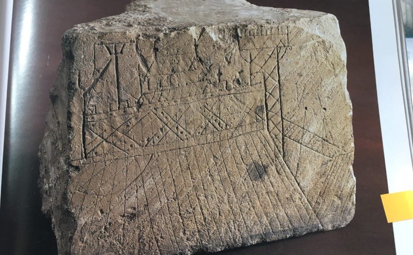
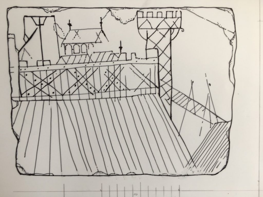
As every castle book reminds us, the defences of most castles before the mid-13th century, and the buildings within them, were built of earth and timber. The perishable nature at least of the timber parts, and their replacement in many cases in stone (obviously) makes their structural detail hard to understand, although Robert Higham and Philip Barker’s Timber Castles of 1992, and their publication of Hen Domen (Montgomery) in 2000 achieve a great deal in this direction. As most evidence is archaeological, however, it tends to be confined to plans and layout. Herein lies the importance of this graffito, scratched into a re-used ashlar in the early 13th century and found during the excavation of the long-demolished donjon in the castle at Caen in 1966: it shows, in elevation, what is unquestionably a timber-framed castle, or part of one – either a ringwork or a motte.
The graffito re-drawn, omitting the underlying mason’s tooling and lines probably unconnected with the original image.
To begin our description with the mound on which the buildings stand, this is marked with a series of lines inclining inwards towards the top, which may be the draughtsman’s device to give it substance, or, possibly, represent baulks of timber covering the slope – a variant of the arrangement found for example at South Mimms (Hertfordshire) and elsewhere. To the extreme right, similarly striated, is what must be the counterscarp of the ditch, and springing from it, possibly propped by two trestle-like structures, is the bridge across it: this is of the so-called ‘flying form’ shown in the Bayeux Tapestry and found archaeologically at Hen Domen. At its top end the bridge abuts a tower, necessarily a gate tower, its side scored with the diagonal intersecting lines, probably representing cross-bracing of the form found in the bell towers at St Leonard’s, Yarpole (1195-6) and St Mary’s, Pembridge, of 1207-23 (both Herefordshire); variants are known in France and over forty post-medieval examples in central Europe. The arrangement is also shown in a carving at Modena cathedral, and in numerous 12th -and 13th– century bestiary illuminations of timber towers on the backs of elephants, prompted either by Pliny the Elder’s or the Books of the Maccabees. Siege towers could be similarly constructed, hence the French term beffroi.
. The re-drawing numbered to indicate the main features described in the text. 1. Revetted earthwork slope 2.The moat counter-scarp 3.Bridge 4.Possible trestles supporting bridge 5.Gate tower 6.Oversailing platform at tower top 7.Timber wall 8.Possible second tower 9.Battlement 10.Hoist 11.Hall? 12.Second building within the enclosure Third building
Abutting the tower is the battlemented wall or palisade, composed of edge-to-edge vertical timbers, reinforced by a horizontal rail at top and bottom and by massive diagonal or ‘X’ braces, face-nailed to the uprights.
Inside the enclosure, our draughtsman has shown at least three buildings. The most prominent has a pitched roof terminating in finials, with a row of four round-headed windows under the eaves. Conceivably this was intended as a chapel, but the windows more probably belong to the clerestory of an aisled hall, as survive in the single-aisled hall of c.1160 in the castle at Creully, seventeen kilometres north of Caen, and has been inferred in the 12th-century timber examples at Leicester castle and the Bishop’s Palace at Hereford. In front are two lower buildings with pitched roofs, one carrying a finial.
To the left of the hall is a structure consisting of a vertical pole, a cross-bar at the top, propped by diagonal braces. At first sight rather puzzling, this is clearly identifiable as a crane or hoist, thanks to the dozens of near-identical examples in medieval images, conveniently gathered together by Günther Binding’s compendium of 2001. To the right of the pole hangs a rope, taut as if being pulled or winched downwards, and which is carried over the cross-bar and two faintly-indicated pulley wheels, beyond which it hangs down again and appears to be in the act of hauling a large timber into the air.
The value of the depiction can be summarised as follows. First, it may be the only contemporary representation of a timber-built motte-top or ringwork complex, and is valuable in showing the whole apparatus of palisade, battlements, bridge, gate tower and buildings within. Second, along with the Abbaye aux Dames capital, it is one of only two known representations of face-nailed ‘X’ bracing – an arrangement by definition untraceable archaeologically – which would have endowed the palisade with immense lateral strength and was perhaps widely used. Third, this may be the only contemporary representation of a Romanesque aisled hall – if that is what it is – within a castle. Fourth, as the battlemented platform at the top of the tower oversails its sides, forming a machicolation, it is one a number of images showing that such things did not derive from hourds, but were integral at least to timber towers long before appearing in stone. Fifth, while it has long been assumed that medieval defensive towers in timber were structurally akin to 12th- and 13th-century bell-towers, this is, apart from the Modena carving, the only one to actually show this to be so. Finally, although representing a well-known type, the crane certainly adds liveliness and interest to the composition.
Who the draughtsman was is, obviously, unknown. So is whether the graffito represents a real or imaginary place, although the inclusion of the crane, in use, could be taken as a hint that a particular site, where building works were under way, was indeed intended. What is clear is that it is not a picture of the castle at Caen, nor indeed of Creully, both of quite different form.
Let’s hope that this blog and the forthcoming article (in French) will encourage the identification of other wooden castles scratched in stone, and help with their interpretation and of excavated evidence in the future.
Featured image: The graffito (reproduced by kind permission of the Musée de Normandie, Caen)
To find out more about the working being done at Caen you can visit her: https://caen.fr/actualite/un-parc-paysager-la-conquete-du-chateau
Bibliography
M. Baylé, La Trinité de Caen: sa place dans l’histoire de l’Architecture et du plate et du Décor Romans (Paris, 1979),
A.R. Boucher and R.K. Morriss, ‘The Bell Tower of St Mary’s Church, Pembridge, Herefordshire’, Vernacular Architecture, vol. 42, issue 1, pp.23-35
G. Binding, ed., Der Mittelalterliche Baubetrieb in zeitgenössischen Abbildungen, (Darmstadt, 2001), available in translation as Medieval building techniques, (Stroud, 2004).
M. De Boüard, Le Château de Caen (Caen, 1979)
R. Higham and P. Barker, Timber Castles (London,1992)
R.Higham and P.Barker, Hen Domen, Montgomery – A Timber Castle on the English Welsh Border (Exeter, 2000),
Karel Kuča & Jiří Langer, Dřevěné kostely a zvonice v Evropě (Timber Churches and Bell Towers in Europe), 2 vols.(Prague 2009)
N. Molyneux, ‘The detached bell tower, St Leonard’s Parish Church, Yarpole, Herefordshire, Vernacular Architecture, vol. 34 (2003), issue 1, pp.68-72
Bill Klemperer is the Principal Inspector of Ancient Monuments for Historic England – advising on aspects of national policy and casework around the country – especially the midlands where he is based in the Birmingham office. Here he talks about four important border fortresses he has helped save.
Altogether there are many hundreds of castles in the Welsh borders most of which are scheduled – protected by law under the 1979 ‘Ancient Monuments and Archaeological Areas Act, 1979’ and part of my job is to help look after them. One of my predecessors, the late Anthony Stretten, undertook a survey in the 1990s to identify those castles that would require most effort to save them for the future. A ‘top four’ emerged – all with significant stone buildings that required repairs – Wigmore Castle just west of the village in north Herefordshire, Hopton Castle in south Shropshire west of Leintwardine, Wilton castle on the River Wye at Ross-on-Wye, and Clifford castle further up the Wye just north of Hay-on-Wye. They have now all been repaired – but the solutions have been different in each case.
Wigmore. This was a case of state intervention. Following a collapse the then Secretary of State, Peter Walker, agreed to take the castle into public ownership – so it is now maintained by English Heritage as a free visitor destination. The ruinous state of the castle was an issue – with multi-phase buildings all higgledly-piggledy all over the place. Twenty years of careful excavation was going to cost too much and would have destroyed much of the later evidence in revealing the earlier phases. So a different approach was agreed – the walls would be consolidated as they were – and the site would retain its importance for flora and fauna – a stabilised place of wonder to be discovered and explored. This became the type site for ‘soft capping’ that now has become mainstream practice. The grass on the wall tops protects the walls from the weather and after twenty years is still doing a good job. Some limited archaeology was done to inform stabilising works,but these few trenches produced amazing findings – so do get the report to find out more
Wigmore Castle Excavation
Hopton castle. An impressive earthwork site with motte and bailey and later gardens and associated buildings are evident, and also the site of a nasty civil war massacre and siege. When I first saw it I was struck that the impressive tower of c.1300 that dominates the site could be abandoned in a field without access. A condition report revealed that the north west corner was about to fall off – but how to get the money to fix it? We talked to the locals and the Hopton Castle Preservation Trust was born. English Heritage funded a condition survey and work to prepare a lottery bid and the committee decided – by the Chair’s casting vote – to award about a million pounds! Archaeological ‘clearance’ followed and CBS Conservation came in to do the works. The Duke of Gloucester helicoptered in for the official opening. The site now has free access every day of the year and is secure for the future.
Hopton Castle Restoration – mini railway to clear rubble
Wilton Castle was done at about the same time as Hopton in the first decade of the millennium. Here the ‘White Knight’ solution came to the fore in the shape of owners Alan and Sue Parslow. Wilton is a multi-phase stone castle and much work was needed to repair the walls and towers. This was jointly funded by the Parslows and English Heritage. Various different conservation techniques were used – full roofs were put back on the north west and south west towers – the former complete with chimney found in the excavation of the basement! A ‘hidden’ lightweight modern roof put onto a large 13thC east tower. Gracile [DO YOU MEAN GRACEFUL?] walls were supported by buttresses in contrasting material, wall walks discovered and replaced, a section of curtain wall rebuilt, and decayed stone, including some lintels and cills replaced. The site is now safe and the owners have open days each year.
Wilton Castle Reconstruction Work
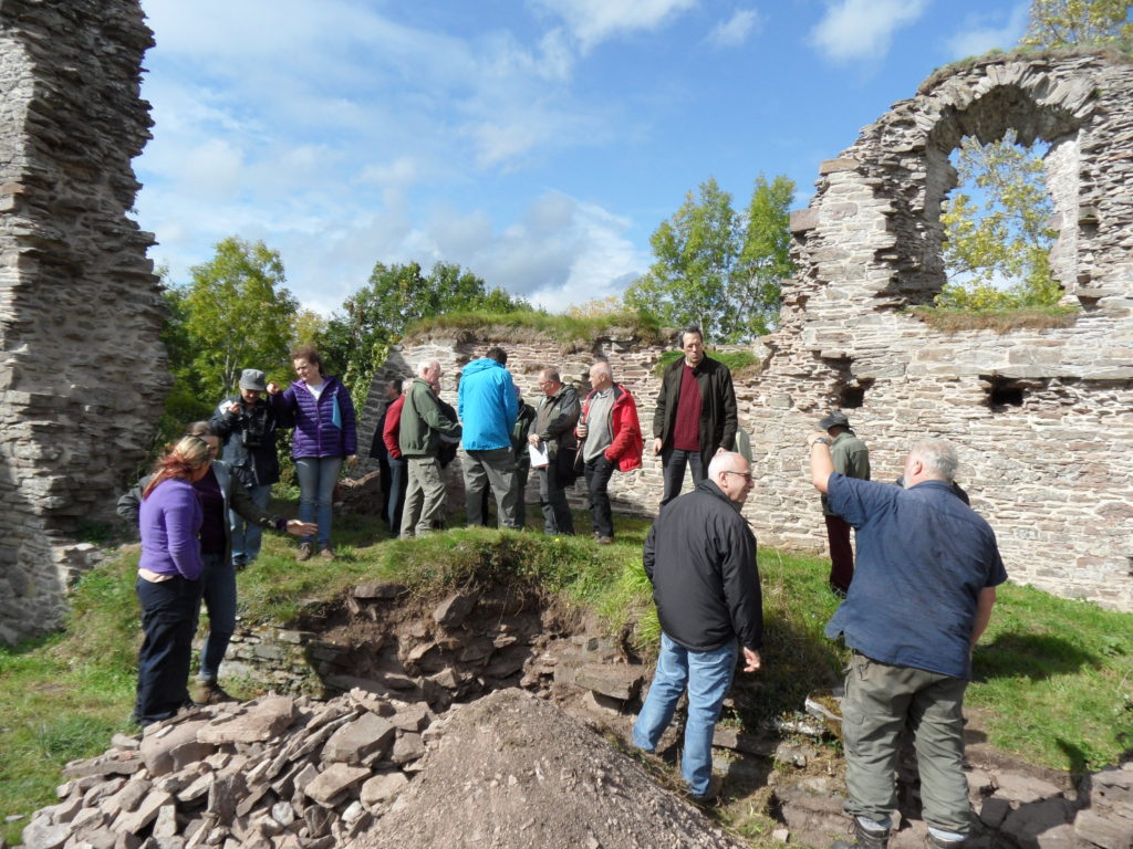
Clifford was the most recently repaired – and this came about when the site came into the new ownership of Keith and Ann Hill, who are also keen to care for the castle in their care. Historic England (as we became in 2015) gave a grant to help the owners repair the buildings on top of the motte and this was done by Treasures of Ludlow – a well-known firm of conservation builders. Archaeological interpretation of the buildings has been undertaken by Nigel Baker while the Castle Studies Trust funded a geophysical survey and excavations there too. Amongst the tightly packed stone buildings on the large flat-topped motte is the so-called Rosamund’s Tower. Rosamund Clifford – the ‘Rose of the World’ – was brought up at Clifford Castle, daughter of the Marcher Lord Walter de Clifford. She became the mistress of Henry II and died, still not 30 in 1176. The site with its large bailey containing remains of an interesting barbican can be visited by appointment with the owners.
Clifford Castle CST Excavation Study Day – chamber block on the mott
Much work has been done and much more remains to be done. The ‘local Trust model’ is achieving spectacular results at Snodhill castle near Peterchurch in Herefordshire’s Golden valley. Another notable success in recent years has been the repair of the rare shell keep at Kilpeck castle south of Hereford. All of these places are part of our shared inheritance Looking after them is our responsibility to future generations so they can share in that wonder.
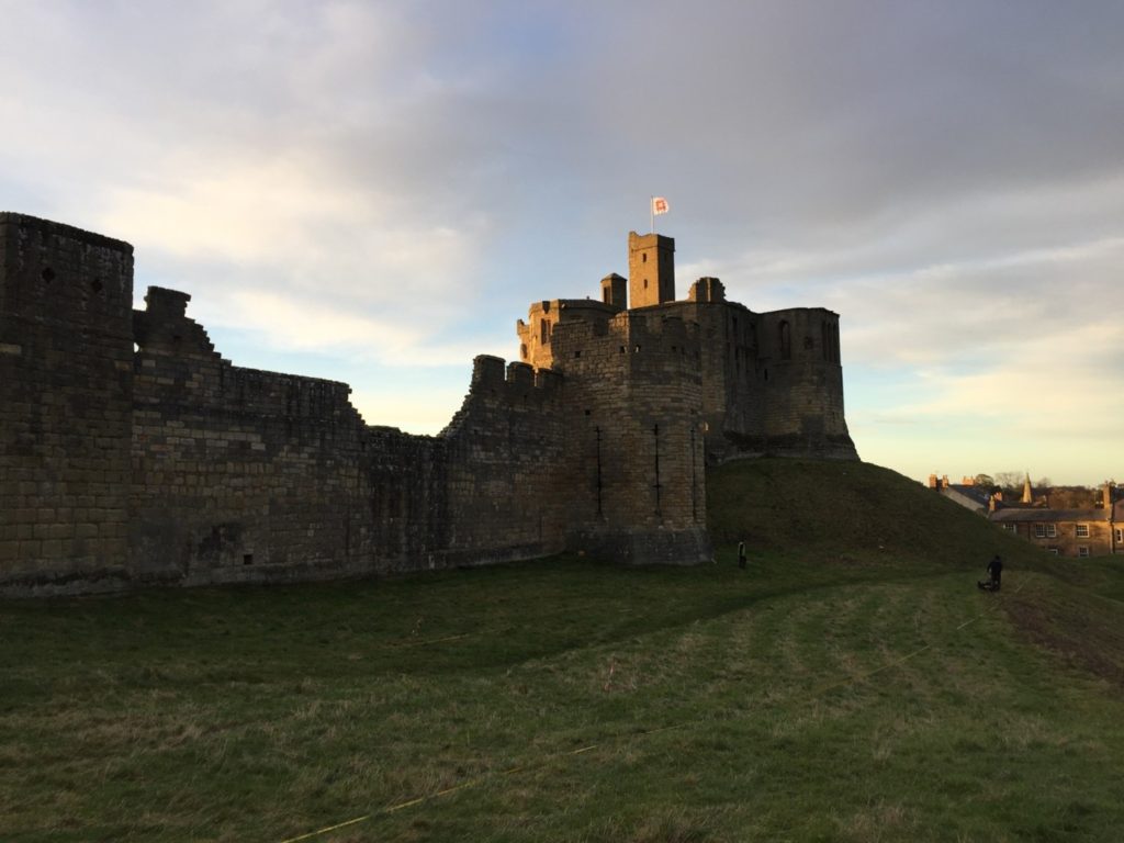
William Wyeth, Properties Historian at English Heritage Trust and project lead on the Castle Studies Trust funded project to geophysically survey Warkworth Castle explains what he hopes the survey will achieve.
In 2019 English Heritage, a charity which looks after over 400 historic properties and sites across England, began a project to change the way in which the stories of the people and buildings at Warkworth Castle in Northumberland were told. The castle is a popular destination in the county, and is both connected with notorious figures from the past as well as featuring an iconic piece of medieval architecture and design in its late 14th-century Great Tower.
Figure 1. Warkworth Castle from the south-east. The Great Tower, in the background, sits atop a large motte. In the foreground, the curtain wall is punctuated by the Grey Mare’s Tail tower. Archaeologists from Archaeological Services – Durham University are surveying the unenclosed strip of bailey
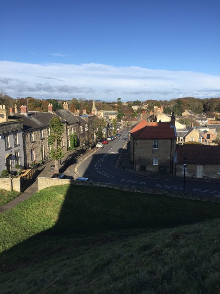
Warkworth is located at the foot of a narrow loop in the River Coquet, in coastal north-eastern Northumberland, about 25 miles north of Newcastle-Upon-Tyne and 30 miles south of Berwick-Upon-Tweed, themselves both significant fixtures of the late medieval history of this area. Just north of the castle proper and nestled on three sides within the river loop is the small village of Warkworth, arrayed in quite typical medieval layout. At the north end of the high street, sitting on a rough north-south axis, is the parish church of St Lawrence, probably an early medieval foundation, as well as a bridge with a toll-collecting tower built in the later 14th century. South of the church, numerous narrow parallel plots of land spread out at right angles from the high street. The southern trajectory of the street is abruptly broken by the enormous motte (earthen mound) of the castle, which acts to physically separate the village from the land south of the river.
Among the most famous historical figures connected to the castle was Henry Percy, eldest son of the 1st Earl of Northumberland, though he is more familiar to us today as Harry Hotspur. The origin of his martial nickname is not certain, but is accounted for in several traditions, all of which confirm that they drew from his short-tempered and violent character. One later 16th-century source rhythmically noted “For his sharp quickness and speediness at need / Henry Hotspur he was called in very deed.”
Though the early history of the Percy Northumberland earls and associated figures will form a key part of the story of the castle when the interpretation project is completed in 2022, other questions about the castle, and especially its earlier history, remain as yet unresolved. Among these is the relationship of the earthworks – the motte and bailey – with the stone structures atop them, the oldest of which date to the later 12th century. The Castle Studies Trust has graciously agreed to fund a geophysical survey of much of the castle earthworks to resolve three big questions.
The first touches upon the motte, which features the Great Tower of the 1370s, but was probably topped by an earlier structure. By assessing buried deposits around the tower, we aim to reveal traces of this earlier structure. But we also want to establish evidence for the means by which the Great Tower may have been provisioned, via a secure door to the motte-top outside the enclosing curtain wall which gave access to storage areas for beer and food in the tower’s north-west segment.
The second question relates to the bailey. In common with other castles of this type, the bailey was filled with buildings, often (as at Warkworth) in their earliest phases arrayed along the inner face of the enclosing wall. But were there buildings here before, or were there also buildings here from later periods, but for which above-ground evidence has been lost? Findings from the survey here will greatly influence how we understand the formal approach to the bailey’s principal buildings – its Gatehouse, Great Hall and Chapel – but also the late medieval Great Tower. The results may also shed light on the peculiar overhauling of spatial arrangements in the bailey occasioned by the construction of a 15th-century Collegiate Church which straddled the span of the bailey, arguably fundamentally changing how the castle was to be experienced.
The last question also relates to the bailey, but here to a strip of the bailey which sits outside the embrace of the late 12th-early 13th-century stone curtain wall, on the eastern side of the castle. The omission of this area from enclosure is unusual, though it is not without analogies from elsewhere, which suggest areas like this could contain gardens. It may be instructive that just within the bailey and adjacent to this strip was the location of late medieval stables – perhaps this area came to be used for the grazing of horses, though whether this was its original intended purpose remains to be seen. In addition to all of this, however, is the possibility that when the motte-and-bailey was built, perhaps well before the earliest stone parts of the castle were erected, the earliest enclosing wall of the bailey also embraced this eastern strip, thereby creating a larger bailey than the present one.
We hope that the survey will allow us to answer at least some of these questions. Whatever the outcome, it is certain that the results will help change how we understand the story of Warkworth Castle and its previous inhabitants.
Heidi Richards, doctoral research at Durham University, looks at Pendragon Castle and how medieval romance literature impacted later medieval castle building.
Since childhood, I’ve been fascinated by castle ruins, stories of King Arthur, and a golden age of chivalry that existed somewhere back in time between history and fantasy. Fast-forward twenty years, and I’m currently finishing my doctoral thesis looking at the impacts medieval romance literature had on late medieval English castles.
Former arguments in castle studies subjected castles into a martial vs. status dichotomy, but current research embraces the duality of these aspects of the castle, providing space to explore possible symbolisms built into castle architecture and wider landscapes.
My research explores the importance of romance literature and legend within medieval society’s most elite, and through wills, commissions, dedications, and gifts, we find that romances were highly valued. Of primary importance though, was Geoffrey of Monmouth’s (c.1138) Historia Regum Britanniae (History of the Kings of Britain). While not technically a romance, this work brought legendary heroes into an ancestral pseudo-history of the kings of Britain (including Constantine and King Arthur) and provided source material for romance narratives and characters. Many members of the elite alluded to this highly prestigious “ancestry” to legitimize and justify power, especially within the political propaganda and ambitions of Edward I.
Edward I was indeed an Arthurian “enthusiast” (as he has been called in previous research). He hosted many “Round Table tournaments” (more theatrical than regular tournaments and usually included Arthurian role-playing) to celebrate significant events, such as his Welsh victory in 1284. He exploited his “Arthurian ancestry” in a grand ceremony at Glastonbury Abbey in 1278 to reinter Arthur and Guinevere’s bodies—essentially conducting a spectacular funeral for Arthur, during which he used “Arthurian” relics (including Arthur’s crown) to legitimize his “inherited” power. He also wrote a letter to Pope Boniface in 1301 to claim land in Scotland on the basis that it was once owned by his ancestor, Arthur. A grand feast was also held at Westminster in 1306, during which Edward I swore oaths on a swan, in typical romance style, and knighted Edward II along with 267 others.
Every effort was made to continue Edward I’s Arthurian prestige and chivalric legacy when Edward II succeeded the throne. On his deathbed, Edward I charged his closest barons with assisting Edward II as his reign began; one of whom was Robert Clifford, who organized an enormous, chivalric celebration for Edward II’s coronation in 1308.
Edward II soon began to show that he was not the chivalric king his father was, staunchly contradicting the values of Edward I’s chivalric legacy. Records claim that he enjoyed working in the garden (which was uncustomary and inappropriate for a king), he didn’t like hunting, he didn’t participate in tournaments, and he thoroughly annoyed the barons with his infatuation over Piers Gaveston. As baronial unrest and tensions increased, we begin to see Arthurian allusions made by Edward II’s principal opponents—the same ones closest to Edward I.
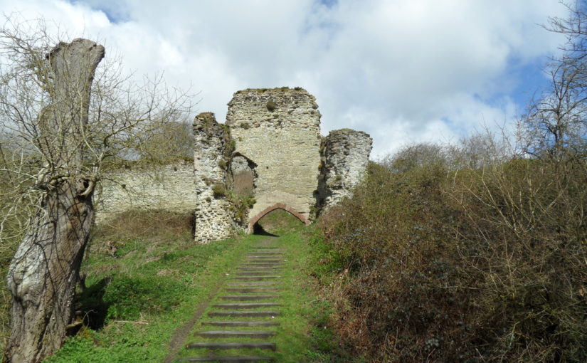
This brings us to Pendragon Castle (Cumbria, previously Westmoreland), inherited by Robert Clifford as the “castle of Mallerstang,” along with other nearby castles, including Brough, Brougham, and Appleby. Clifford renovated Brougham and Pendragon Castles in preparation to host Edward I during the Anglo-Scottish wars in 1300, but whilst his other castles were renovated in contemporary architectural styles, Pendragon retained its archaic image. Architectural archaism was a trend in castle construction, used to symbolise continuation of power and ancestral prestige. In 1309, Clifford was granted a license to crenellate, changing the “castle of Mallerstang’s” name to Pendragon Castle.
Pendragon Castle (from the moat), photo by Heidi Richards
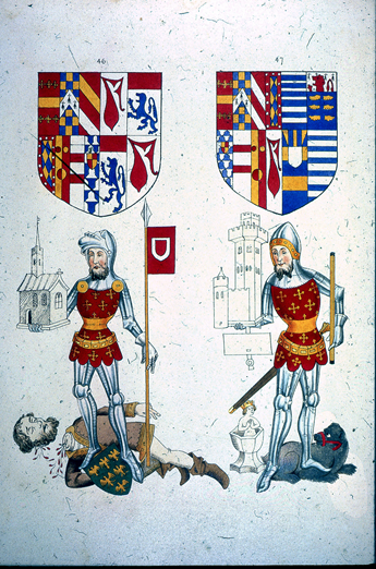
In 1312, Guy Beauchamp, 10th Earl of Warwick, presided over the trial of Piers Gaveston, whose greatest crime, according to the commemorative Warwick ancestral “Rous Roll” (c.1484), was stealing King Arthur’s round table. The Earls of Warwick already had long-standing connections with Arthur and displayed romantic “relics” inherited from their “ancestors.” Robert Clifford and Thomas Lancaster also participated in Gaveston’s trial and execution, and in 1322, Lancaster signed a treasonous document to James Douglas in Scotland under the pseudonym “King Arthur.” In 1327 and 1328, Roger Mortimer, the lover of Edward II’s queen, Isabella, celebrated the marriages of his children by hosting multiple Arthurian themed Round Table tournaments in the style of Edward I, each lasting several days and sparing no expense.
Image S-42-23 from The Heraldry Society 1845 edition of the Rous Roll, images 46 (left) showing Guy Beauchamp, 10th Earl of Warwick standing over the executed Piers Gaveston, and 47(right) shows his son, Thomas, portrayed with silver cup—heirloom relic of the fictional Swan Knight. The c.1484 original (British Library MS 48976), includes a caption below Guy’s image accusing Gaveston of selling “out of the land the round table of silver that was King Arthur’s and the trestles…” Link to Guy Beauchamp’s image in the Rous Roll (c.1484) British Library MS 48976 https://imagesonline.bl.uk/asset/143267
In the wake of Edward I’s chivalric legacy, those who were closest to him (including Clifford, Warwick, Lancaster, and Mortimer) developed ways to emulate Arthurian prestige in their opposition to Edward II, and it is within this context that Pendragon Castle comes into view as one of several homages to King Arthur, Edward I, and the not-so-distant golden age of chivalry.
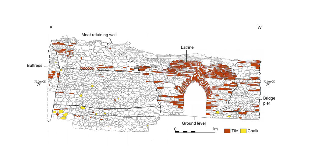
Since the publication of the article on Pleshey Castle in Current Archaeology (Issue 344, Nov. 2018, CST blog 15/09/20), we have been able to reconstruct in detail the gatehouse of the timber bridge over the motte moat, whose upper chamber is identified from building accounts for 1460-1 as the Queen’s privy chamber (‘Q’ on Fig.1). It would have been occupied by Queen Margaret of Anjou, wife of Henry VI, who held Pleshey between 1445 and 1461. Pottery dating, documentary evidence and the style of the floor tiles, however, suggest that the gatehouse was built in the 1380s by Thomas of Woodstock, duke of Gloucester, and the upper chamber would originally have been occupied by his wife, the duchess Eleanor. In the late medieval period, it was usual for accommodation to be provided above gateways. This gatehouse at Pleshey closed off the keep and the lord’s private quarters from the rest of the castle, but although it would have provided a degree of security it should not be confused with the heavily fortified gateways of castles with a more obviously military role.
FIGURE 1: Plan of the castle, with the queen’s chamber over the bridge gatehouse (Q) and the king’s chamber (K) immediately to its east, with the line of the timber bridge shown in blue. (Drawn by Iain Bell).
The physical character of the gatehouse can be reconstructed from specialist building material reports by David Andrews, Paul Drury and Nick Wickenden. The gatehouse was built of flint, with greensand dressings for the foundation plinth, corner stones, and door and window mouldings, with a peg-tile roof and lead gutters. Together with the chapel and the keep (which was timber but had a stone façade) it was one of the few stone buildings in the castle, as even the great hall in the bailey was of timber on stone sleeper walls. The ground floor room next to the gateway had a simple gravel floor and was probably a guardroom, but the upper chamber was luxurious. Its floor was of decorated glazed tiles made at Penn in Buckinghamshire, with three different roundel patterns (Fig. 2). Fragments of glass and lead cames show that the chamber had leaded glazed windows, while part of a chimney pot found in a spread of demolished roof tile implies that it was heated by a fireplace. The walls were plastered and decorated with simple painted designs, rather like modern wallpaper.
Three designs of Penn decorated tile floors as reconstructed by Paul Drury, based on tiles found in the demolition rubble of the bridge gatehouse. (Drawn by the Drury McPherson Partnership).
The chamber would have been dominated by a large four-poster bed with richly embroidered silk or fine wool hangings for curtains around it, as well as the tester for its canopy and the valence at its base. Several sets of these hangings are described in an inventory of goods seized from the castle following Thomas of Gloucester’s arrest and murder in 1397 (Dillon and Hope 1897). The chamber may have had tapestry wall hangings, also described in the inventory. The carpets that are mentioned would have been more like rugs and most of the decorated floor would have remained uncovered.
There was a general improvement in the private living quarters in the castle in the late 14th century, especially with the addition of fireplaces and privies. In the 1450s, when Pleshey was held by Queen Margaret of Anjou, the building accounts suggest that the keep had become guest accommodation, with the Queen’s chamber in the gatehouse and the King’s chamber next to it, approached by a ‘revealing’ or audience chamber (‘Q’ and ‘K’ on Fig. 1; Ryan 2010, 252). Queen Margaret would have been an absentee landlord as she spent most of her time at court, but these chambers would have been prepared for occasional visits. One such visit probably occurred when she ordered major building works at Pleshey early in 1458. After the defeat of the Lancastrians in 1461 Pleshey passed to the Yorkist Edward IV and, from 1465, Queen Elizabeth Woodville. Several entries in the building accounts for the 1460s record cleaning and refurbishment work before royal visits, and the gatehouse accommodation would still have been of a high standard, fit for a queen, eighty or so years after it was built.
Dillon, Viscount and Hope W.H.St.J. 1897, ‘Inventory of the goods and chattels belonging to Thomas, Duke of Gloucester and seized in the castle at Pleshey, Co. Essex, 21 Richard II (1397); with their value as show in the escheator’s accounts’, Archaeol. J., 54, 275-308 (transcript from PRO E 136/77/4): Available: