Investigating Dunoon Castle

Dr Manda Forster of DigVentures and independent historical researcher Dr Louise Turner set the scene for our next project getting under way – the geophysical survey of Dunoon Castle, Argyll.

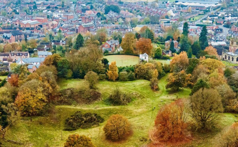
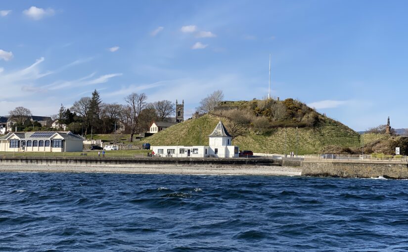
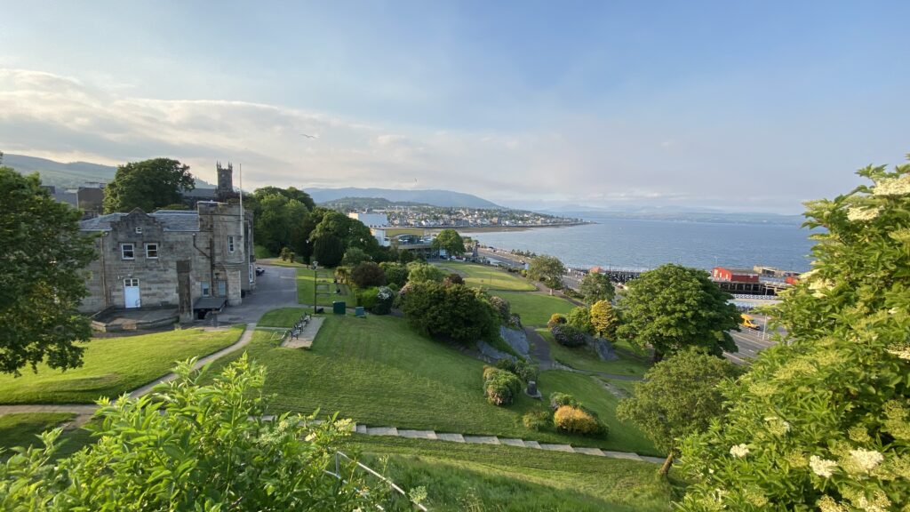
On Friday 21 July, members of the public will be joining archaeologists from DigVentures to investigate the remains of Dunoon Castle (NGR: NS 1796 7868; Canmore ID: 40729). The medieval castle site occupies a prominent, partly-modified hill within landscaped gardens which overlook the seafront in the coastal town of Dunoon, Argyll. The town itself is located towards the south end of the Cowal Peninsula at the narrowest point of the Firth of Clyde. This part of the peninsula forms the western shore of a distinct body of water – the north to south oriented sea loch named ‘Holy Loch’ – which adjoins the lower reaches of the Clyde that continue onwards following a more east to west course past Toward Point in the south.

Subscribe to our quarterly newsletter
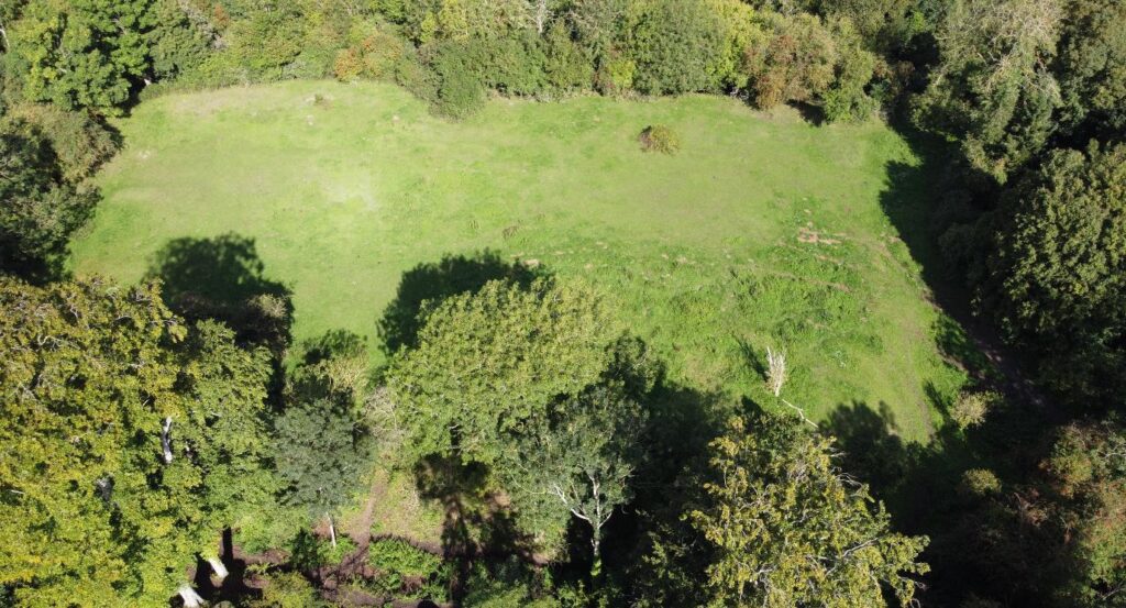
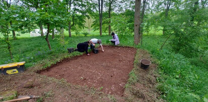
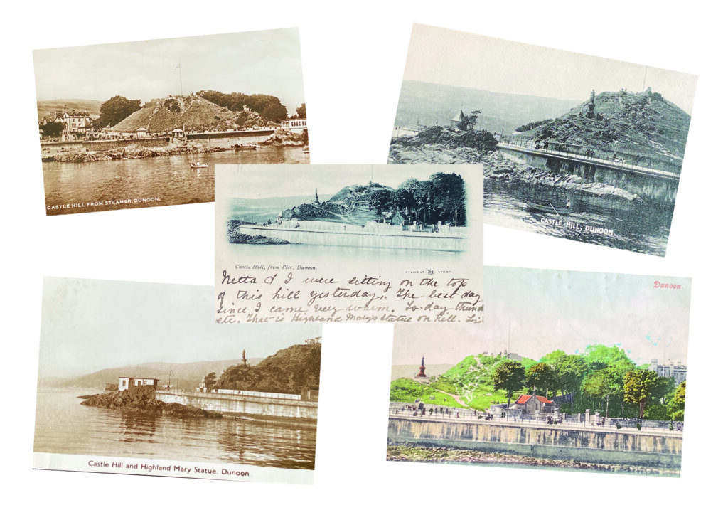
This community-based investigation, supported by a grant from the Castle Studies Trust, aims to raise awareness of the significant archaeology which sits in the town. Working with local people, the team will explore the archaeology of the site to add detail to the few visible earthworks at the top of the mound with geophysical and topographic survey, including photographic building recording and a drone survey. To get families involved, we’re hosting tours and a character trail around the site, as well as running activities with the Castle House Museum inspired by postcards of the castle and a nod to the town’s history as a visitor destination for those heading on a trip ‘doon the watter’. The project is a collaborative venture by DigVentures with Dunoon Area Alliance, Dunoon CARS and the Castle House Museum which aims to raise awareness of the significant history of the site and find out more about the buried archaeology through a programme of geophysics.

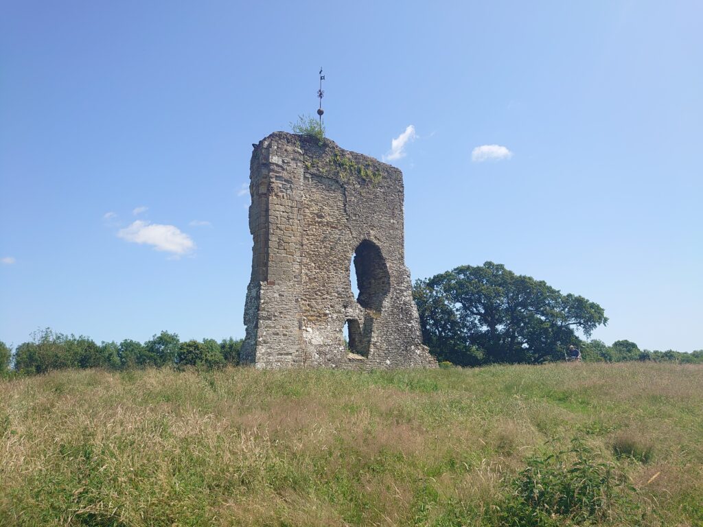
The remains of Dunoon Castle, and the hillock on which it stands, are a designated Scheduled Monument (HES ID: SM5450). The site has a long and complex history linked inextricably with its prominent strategic location in the Firth of Clyde – and with the success of the town itself. The castle hill played a crucial role in the military history of the Clyde Coast during both world wars, and in the town’s success as a holiday destination during the later nineteenth and early twentieth centuries. As a result, the archaeology of the hill extends beyond the medieval castle itself to encompass built elements associated with the nineteenth century landscaped park and gardens.

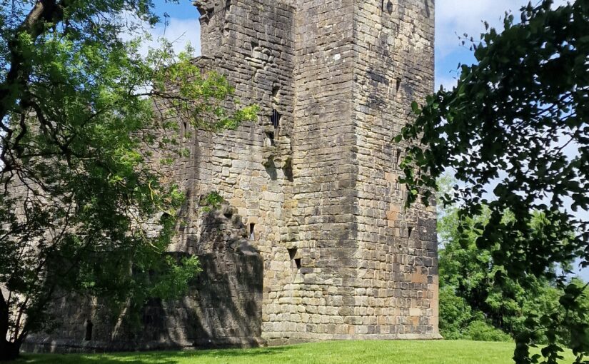
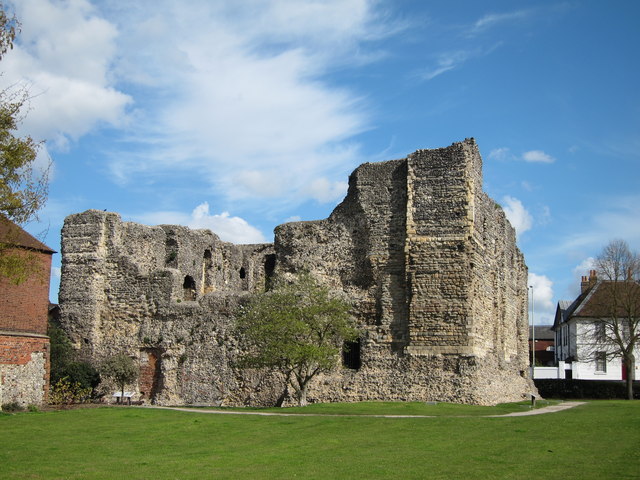
Dunoon Castle looking north copyright Manda Forster

Little is known or evidenced for early occupation at the site, although ‘seven or eight’ cist burials were discovered in the grounds of Castle House in 1822, during its construction. The description of the burials is comparable with nearby examples of medieval long cists from Innellan (just south of Dunoon), which have been radiocarbon dated to the late tenth century. Early ecclesiastical activity would not be unexpected, and could focus around the site of the modern Dunoon High Kirk. Historically, the earliest documentary mention of the castle was made in 1257 in reference to ‘John of Dunown,’ who was steward to the Earl of Lennox in 1253. From then on, the castle and its associated people, which includes two successive bishops (mid-fifteenth century) and a visit from Mary Queen of Scots in 1563, take a prominent role in the region. The Campbells acquired Dunoon Castle in the 14th century when Sir Colin Campbell, 3rd Lord of Lochow, was granted title of ‘Hereditary Keeper of Dunoon Castle’. The Campbells then retained Dunoon Castle throughout the remainder of the medieval period, and beyond. A document dated 15th January 1472 outlines their responsibility for the upkeep of the castle and the maintenance of its fabric, as well as the power to appoint constables, porters, jailors, watermen and other officers. By the end of the medieval period, Campbell influence was growing ever greater in this SW corner of the Cowal peninsula but, following the grisly Dunoon Massacre* in 1646, the castle seems to have been deserted. After its abandonment, stone from Dunoon Castle was probably used locally for housing, including for the construction of Castle House and associated structures (now the location of the museum).

Postcards of Dunoon through the ages

The site itself retains its nineteenth century character, having been retained within a larger area of landscaped gardens. The planned investigations have the potential to explore whether there are undiscovered features relating to earlier occupation of the castle mound (Phase 1) and provide an updated record of the extant remains which relate directly to the medieval castle (Phase 2). In delivering the survey, we also hope to further refine our understanding of how the configuration of the gardens and landscaped grounds may have changed from the early nineteenth century to the present (Phase 3) and to record any extant evidence for the twentieth century coastal defences (Phase 4).

Subscribe to our quarterly newsletter
*The 17th century was brutal for the clans in the area as it was across Scotland, with a backdrop of war and switching allegiances. Within this context, the Lamonts and Campbells found themselves on opposing sides, and the Lamonts invaded Campbell lands killing 33 men, women and children. In 1646, the Campbells struck back, attacking the Lamont castles of Ascog and Toward (just down the coast) and capturing around 100 Lamonts who were sentence to death and executed. Thirty-six of the highest ranking were hanged from a tree in the graveyard. A memorial now stands to Clan Lamont at Tom A’Mhoid road.

The Castle Studies Trust five projects for 2023

The Castle Studies Trust have awarded five grants totalling £35,000 to support research into castles. This is a record amount for the Trust, and as we enter our tenth year as a charity, we could not have managed this without our supporters.

We will bring you updates from these projects throughout the year as the teams get stuck in. But first, let’s get to know them a bit better. They are from across England, Scotland, and Wales and take different approaches to understanding castles.

Subscribe to our quarterly newsletter.

Bamburgh

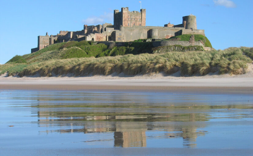
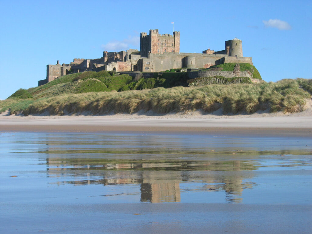
A stone building with a square tower in the middle. It stands on an outcrop, prominent in the landscape. In the foreground is a beach.
Bamburgh Castle on the coast of Northumberland. Photo by Michael Hanselmann via Wikimedia Commons, licensed CC-BY-SA 3.0.

Standing on a rocky outcrop on the coast of Northumberland, Bamburgh’s history stretches back to the early medieval period when it was home to a palace of the Kings of Northumbria. Bamburgh Castle itself was owned by royalty at various points, and rebuilt in the 18th century.

Bamburgh is a massive site: its history has been illuminated by excavations, and there is still more to learn.

Dr. Joanne Kirton and Graeme Young of the Bamburgh Research Project plan to carry out a geophysical survey and a masonry survey of the castle’s outworks.

Dunoon

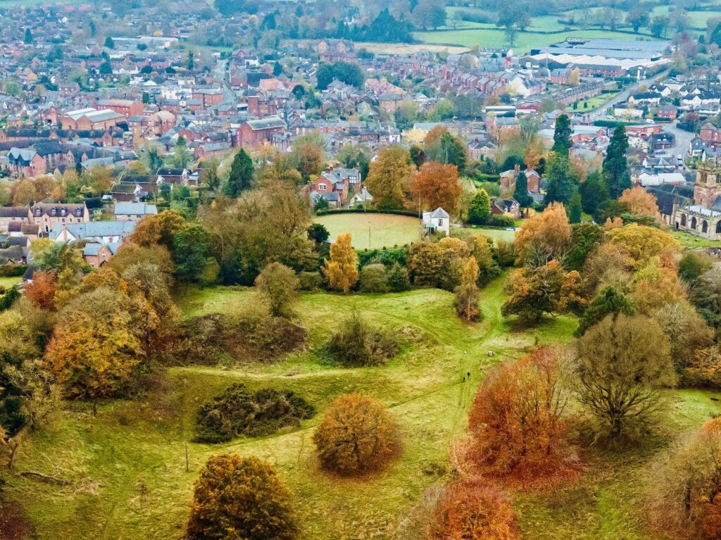
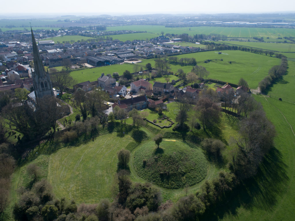
The mound at Dunoon Castle. Photo by Rosser1954 via Wikimedia Commons, licensed CC-BY-SA 4.0.

A castle at Dunoon was first mentioned in the late 13th century but may be older. The ruins visible today date from the 14th century. It stands on a hill on the coast of the Firth of Clyde. The castle was besieged and captured multiple times over its centuries-long history and became a royal residence.

Despite the castle’s royal links, little is known about its layout and dating. Dr. Manda Forster’s team at DigVentures will carry out geophysical surveys (resistivity and magnetometry) of the mound and the area around it to find out where there may be buried walls, foundations, or other archaeological remains.

They will also organise workshops for the local community to learn how geophysics work. So as well as learning more about the castle, they may inspire the next generation of archaeologists!

Lowther

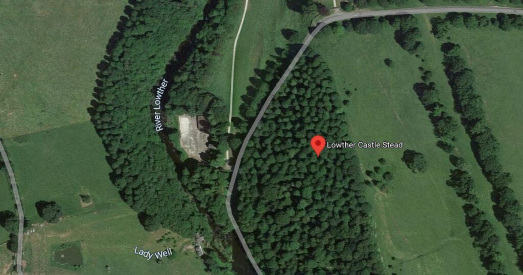
Google Map of the medieval Lowther Castle

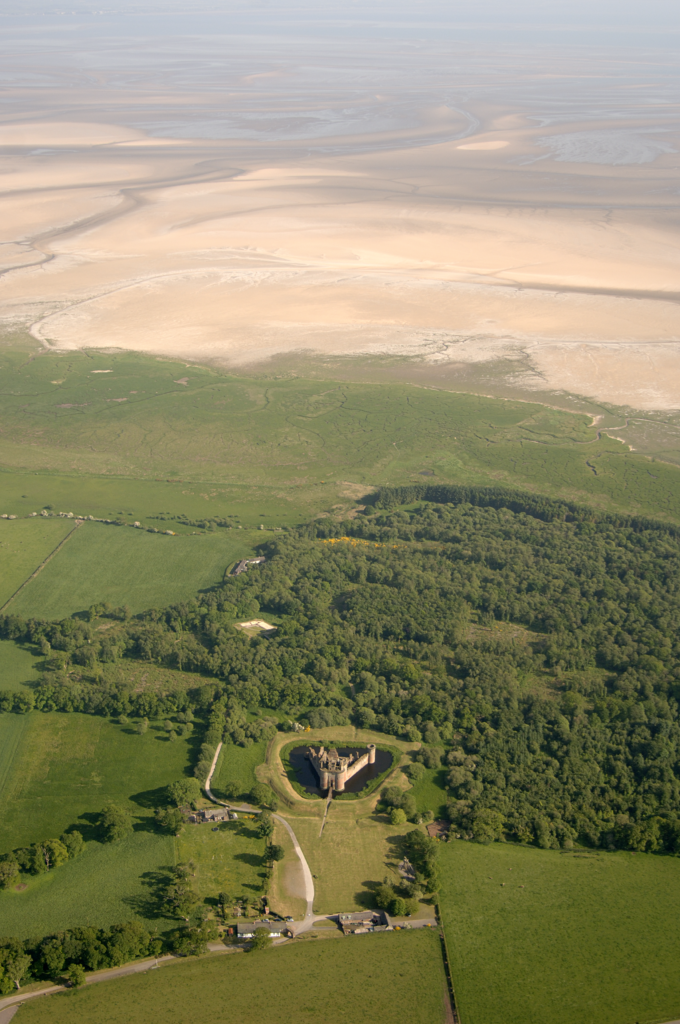
The present Lowther Castle was built in the 17th century, but a few hundred metres north lie the medieval remains of a castle and possible deserted village. Lancaster University Archaeology Unit surveyed the earthworks in the 1990s, but there has been no other archaeological investigation since.

Being able to date the site would be a crucial step in understanding the Norman influence in the region. Could this be part of the remains of the Norman conquest of the Kingdom of Cumbria in the late 11th century?

Dr. Sophie Ambler has devised the project to carry out geophysical surveys at Lowther Castle followed by excavations. Working with the University of Central Lancashire and Allen Archaeology, this aims to establish the site’s building chronology.

Picton

Picton Castle in 2021 by Ruth Sharvile, via Geograph. Licensed CC-BY-SA 2.0.

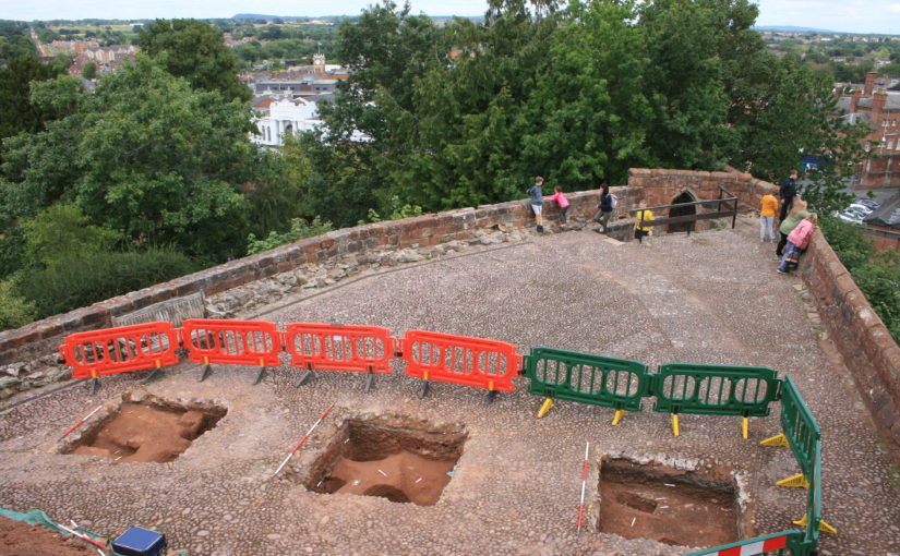
Pembroke’s Picton Castle is a medieval building with later alterations and additions. It is uncertain when it was built and by who, but it is likely to have been established in about 1300 by Sir John Wogan. Picton has an unusual layout but may have parallels with French medieval castles.

Neil Ludlow and the Dyfed Archaeological Trust will carry out a measured survey of the building, recording its structure and creating a photographic record of the site. This will be an invaluable resource to understand the site, and help show the castle’s development over the centuries.

Wigmore

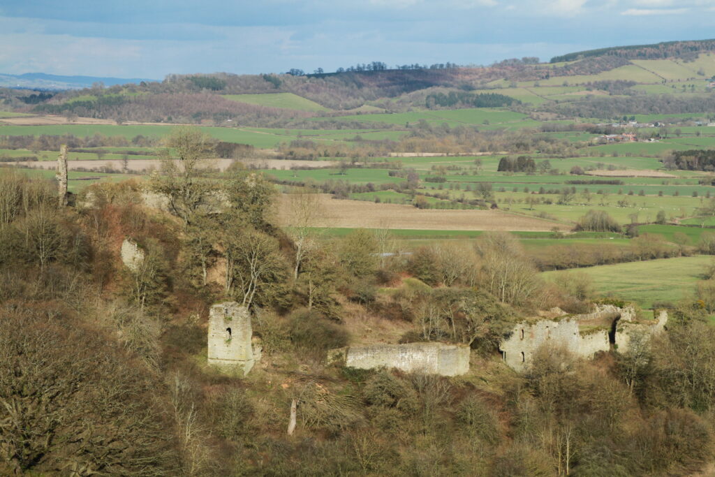
Photo of Wigmore © Philip Hume

Wigmore was amongst the early castles established in England in the wake of the Norman conquest. It was founded by William Fitz Osbern, Earl of Hereford and later became the home of the Mortimer family. They were an influential family in the Welsh marches, and they developed the castle to reflect their growing power.

Small-scale excavations at Wigmore and geophysical surveys in the 1990s demonstrated the archaeological potential of the site, but what is missing is a reconstruction of how it looked during its heyday.

Chris Jones-Jenkins will create a reconstruction of how Wigmore Castle used to appear. This will draw on archaeological and historical sources to bring the reconstruction to life. You may also have seen Chris’ work with his reconstructions of Ruthin and Holt.

Subscribe to our quarterly newsletter to receive updates on these projects and our other ongoing work in the field of castle studies.

Header image: Bamburgh Castle by Michael Hanselmann via Wikimedia Commons, licensed CC-BY-SA 3.0.

A large and eclectic crop of fascinating applications asking for over £100,000 for the Castle Studies Trust to Consider

The deadline for grant applications passed on 1 December. We’re going through the various projects now. Altogether the 15 projects, coming from all the home nations and one from Ireland, are asking for over £110,000. They cover not only a wide period of history but also a broad range of topics.

We will not be able to fund as many of these projects as we would like. To help us fund as many of these projects as possible please donate here:

Kindlink Donation Form App

In a little more detail here are the applications we’ve received:

Bamburgh, Northumberland: The aim of the project is to better understand the outworks to the north of the castle, by using various geophysical survey techniques and a preliminary survey of the masonry remains, it will include a 3D model of the recently excavated Elmund Tower and provide materials for interactive displays.

Barnard Castle, Co Durham: The aim of the project is to try and understand a lot more about the outer ward of the castle, using a variety of methods including geophysical survey, aerial survey and test excavation

Cavers Castle, Roxburghshire: Through a combination of building survey and excavation to try to understand the early form of this important baronial castle.

Dunoon, Argyll: A community-led geophysical survey project to understand better the form and scale of this important castle that was the seat of the Lord High Stewards of Scotland. The original castle dates back to the 1200s and the remains above currently ground date from the fourteenth century.

Fun Kids, Castle Podcasts for 7-13 Year Olds: To produce a series of 8 podcasts for children aged 7-13 to engage children to explore a what, how and why of 8 castles. The series will focus on a variety of castles and build awareness of less common castles that families can explore.

Galey, Co. Roscommon: Geophysical and topographical surveys to explore the possible motives behind the placement of, as well as immediate landscape context, morphology and any attached settlement and industrial activity, that occurred at a lakeshore-sited late medieval Gaelic-constructed tower house castle.

Hartlebury, Worcestershire: The seeks to explore what looks like a possible civil war bastion ditch, which seems to have been partially revealed in a 2022 drone survey of this former bishop’s palace with remains dating from the fifteenth century. This will be done through geophysical survey and excavation.

Lowther Castle, Cumbria: Through a combination of geophysical survey and excavation to try to learn more about this ringwork castle and settlement, thought to date from the late eleventh century. the aim is to try to discover if it dates from this period and was therefore a Norman plantation; and also its history after its foundation.

Millom, Cumbria: The project will involve a drone survey to assess the condition of the 14th century fortified manor combined with a geophyisical survey to understand if there is any link between it and the nearby church and monastery.

Muncaster, Cumbria finds assessment: To make a complete assessment of the finds from the 2021 excavations which took place near the 14th century tower along with two nearby kiln sites.

Muncaster, Cumbria geophys and archaeology survey: To carry out a geophysical survey of the area surrounding the castle and to investigate a large stone feature in the cellar of the castle to understand its purpose and possible date

Northern Frontier, Beacon Hill Yorkshire: A geophysical survey of Pickering Beacon Hill, a siege castle used for the siege of Pickering in the lead up to the Battle of the Standard (1138) to better understand the landscape at the time and see how much life was disrupted during the period known as the Anarchy.

Picton, Pembrokshire: The aim of the project is to achieve a full understanding of the form, functions and affinities of the medieval part of Picton Castle through a building survey. It has an unusual plan with no close parallels within Great Britain, but shows some affinities with castles further afield including, possibly, Gascony in France

Snodhill, Herefordshire: Excavation to explore the early masonry defences and attempt to resolve the entrance arrangements and to do a geophysical survey of the Eastern Bailey

Wigmore, Herefordshire: To provide a digital reconstruction drawing of Wigmore Castle using a mixture of archaeological and archival evidence

We will not be able to fund as many of these projects as we would like. To help us fund as many of these projects as possible please donate here: Kindlink Donation Form App

The applications have been sent to our assessors who will go over them. You can see how the assessment process works from our blog back in January 2016: How the Castle Studies Trust Selects its Projects – Castle Studies Trust Blog

Is The Wirk a Castle? Archaeological investigations in Rousay, Orkney

Dr Sarah Jane Gibbon and Dan Lee (UHI Archaeology Institute / ORCA) project leads for the Castle Studies Trust funded project explain the reasons behind the excavations they are undertaking at The Wirk in the Orkneys and what they hope to achieve during their two week dig.

Located on the south-western coast of Rousay, The Wirk is located in one of the most archaeologically rich parts of Orkney. The Orkney Research Centre for Archaeology (ORCA) is undertaking geophysical survey, archaeological excavations and 3D modelling at this enigmatic castle site (pending approval from HES).

Subscribe to our quarterly newsletter

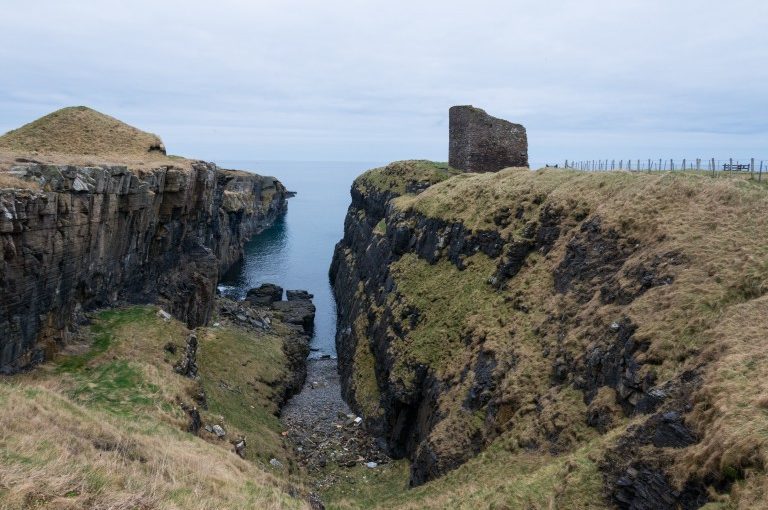
The Wirk, meaning stronghold in Old Norse, and with the alternative name Westness Castle, is a small stone tower located close to the coast. It has variously been interpreted as a 12th century Norse Castle, a detached fortified bell-tower, a 13th century defensive tower for an incomplete church, a hall-house garderobe tower and most recently a 16th century tower and attached range.

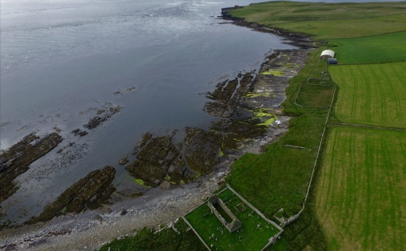
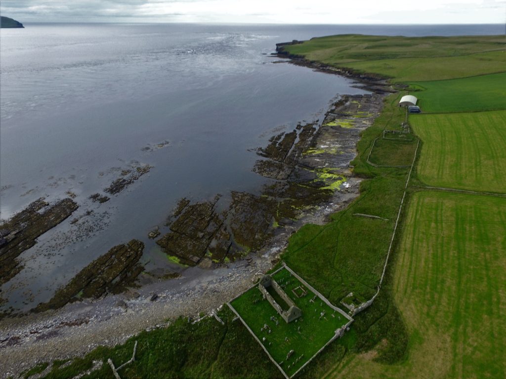
View of The Wirk, located on the righthand corner of St Mary’s Church yard in the foreground, looking northwest to Midhowe and the Atlantic Ocean (Image: Bobby Friel @TakeTheHighView).DCIM100MEDIADJI_0558.JPG

Minor clearance and excavation in the 1920s identified similarities in construction between The Wirk and the 12th century Cubbie Roo’s Castle, on the nearby island of Wyre, considered to be one of the earliest stone keeps in Scotland. The Wirk is located in Westness which has been a large estate since at least the 12th century when it was the home of the Norse chieftain Sigurd of Westness (Orkneyinga saga). It is adjacent to Rousay parish church, likely to date from the 12th century, with standing remains of 16th century date on earlier footings.

Recently, the 12th/13th century date attribution of The Wirk has been rejected in favour of a 16th century date. This new interpretation is based on the built remains and 16th century architectural fragments which were found in the 1920s. However, architectural fragments of 12th/13th century date were also present and nearby archaeology, particularly the discovery earlier this year of a Norse hall at Skaill by the UHI Archaeology Institute would suggest this was a high-status place in the saga period. This is not to dispute that The Wirk may also have been in use in the 16th century when the estate was owned by a prominent Orkney family. One of the objectives of this project is to excavate trial trenches over Clouston’s excavation and at the eastern end of the site to identify the earliest phases of the tower and adjacent building. Upper parts of the tower were substantially rebuilt in the 19th century and so excavation will allow us to record parts of the site that have not been knowingly rebuilt.

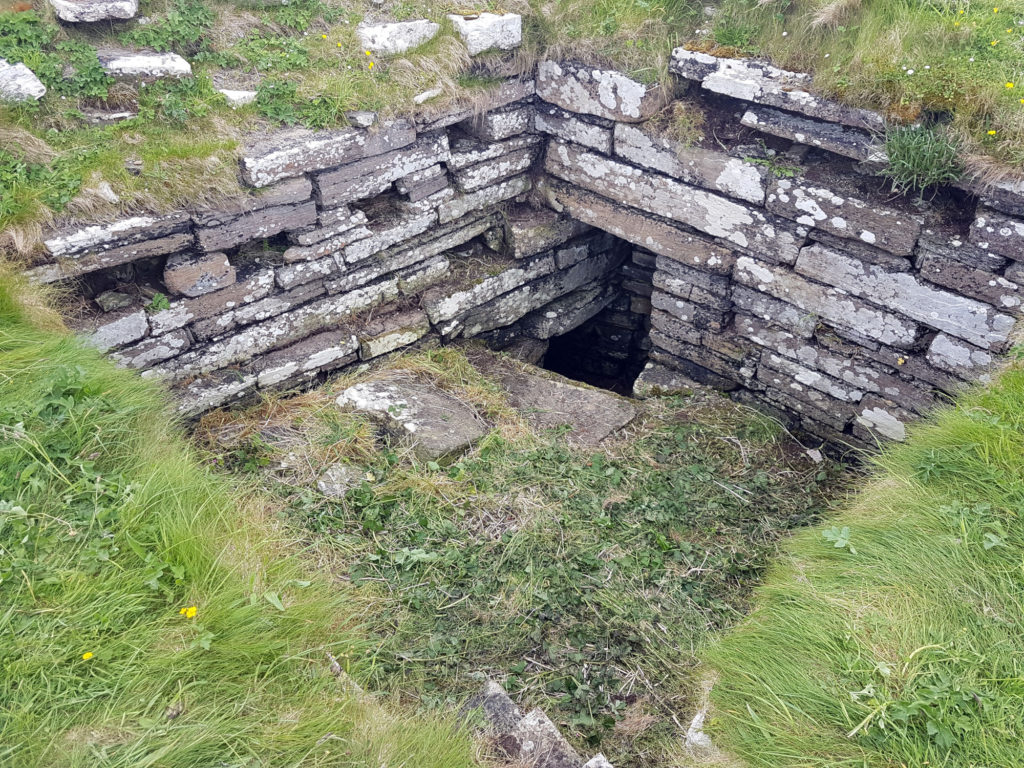
Inside The Wirk tower, looking southeast, showing the entrance to an underground well or passage (Image: Dan Lee)

Along with the excavations, targeted geophysical survey around The Wirk undertaken in September 2020 aims to better understand any relationships between the tower and the buildings/features which surround it. The results show that the walls planned by Clouston are accurate and that they likely survive just below the ground surface. 3D modelling of The Wirk and Cubbie Roo’s Castle will enhance our understanding of these comparable sites and allow the public to explore the remains online.

 The start of the project was delayed in 2020 due to the Covid-19 pandemic, and we will be glad to finally get on site for the excavations in July.

Subscribe to our quarterly newsletter

References and further reading:

Clouston, JS 1931 Early Norse Castles. The Orcadian. Kirkwall

Castle Studies Trust 2021 Grant Awards

The Castle Studies Trust is delighted to announce the award of six grants, totalling a record £31,000 not only covering a wide geographic area but also a wide range of different types of research:

Subscribe to our quarterly newsletter

Caerlaverock new castle with old behind it and the coastline Crown Copyright Historic Environment Scotland

Caerlaverock, Dumfriesshire

The aim is to understand the chronology and geography of extreme weather events in the high medieval period, and the effects they wrought on archaeological features that led to the abandonment of the old castle built in c.1229 in favour of the new built 200m away in c.1277. The latest thinking is that it was a series of extraordinary storm surge events which pushed a series of storm driven gravel ridges across the River Nith.

The methodology to find this out is interdisciplinary, using scientific methods to enhance understanding of archaeological fieldwork. The fieldwork will involve the establishment of a series of transects across the site and surrounding landscape from which cores and samples will be extracted for sediment description, stratigraphic analysis, and Carbon 14 dating.

Depending on Covid restrictions, the aim is to start doing the work in May this year with the receipt of the final data in the autumn.

Greasley_Castle from air copyright Neil Gabriel

Greasley, Nottinghamshire

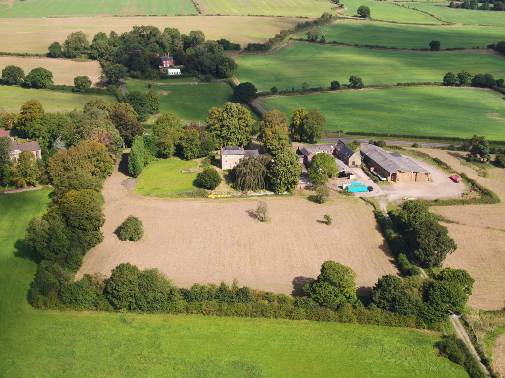
The production of an interpretative phased floor plan for Greasley Castle in Nottinghamshire.  The castle, built in the 1340s, has an obscure history and the understanding of its architectural phasing is at best very cloudy. The site is now a working farm and a number of post-mediaeval structures have been conglomerated around the remains of what is suspected to be a fourteenth century courtyard house with projecting corner towers.

The survey will act as baseline research data for a site which has not previously received serious fieldwork or publication and provide a basis for further research but also for any future conservation needs.

Work on the project will start in the early summer when covid restrictions ease.   

Laughton-en-le-Morthen motte and bailey castle and church

Laughton-en-le-Morthen, South Yorkshire

To provide professional illustration and reconstruction which will also be integrated into a co-authored academic article based on the two previous research projects carried out on the site by Dr Duncan Wright and funded by the Trust. A geophysical survey and then small-scale excavation which give a strong indication that the Normans had built a motte on the site of a high-status Saxon dwelling.

Part of the monies will be used to produce phase plans of Laughton during key stages of its development, and a small percentage will pay for a line drawing of the 11th century grave cover incorporated into the fabric of the nearby church. The aim will be to start the work as soon as possible.

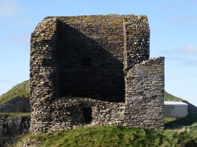
Old Wick Tower copyright Historic Environment Scotland

Old Wick, Caithness

Dendrochronological assessment of timber at the Castle of Old Wick, Caithness thought to be one of the earliest stone castles in Scotland dating from the12th century and the period of Scandinavian ascendency. Current thinking though ascribes the date to the 14th century. Analysing these samples will hopefully provide an answer.

With no architectural features or physical “independent” evidence analysing the remains of a timber joist-end (in poor condition) in one of the joist ends remains the best chance of being able to find an answer. 

The taking of the samples is likely to take place in September when conditions are still going to be favourable as the castle is situated next to the North Sea and the sample can only be found 8 metres above ground level. 

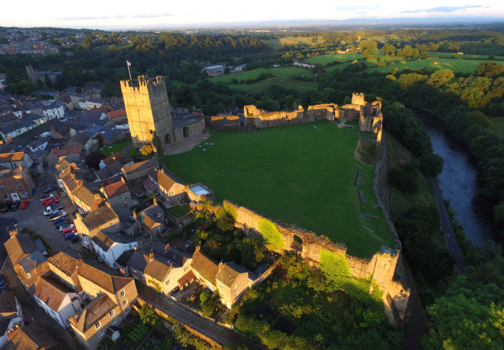
Richmond Castle copyright English Heritage

Richmond, North Yorkshire

Co-funding a three-week excavation of Richmond Castle, one of the best preserved and least understood Norman castles in the UK. The aim is to understand better the remains of buildings and structures primarily along the eastern side of the bailey including near the 11th century Robin Hood tower and near Scolland’s Hall.

Subject to the scheduled monument consent being granted the excavation will take place in late July.

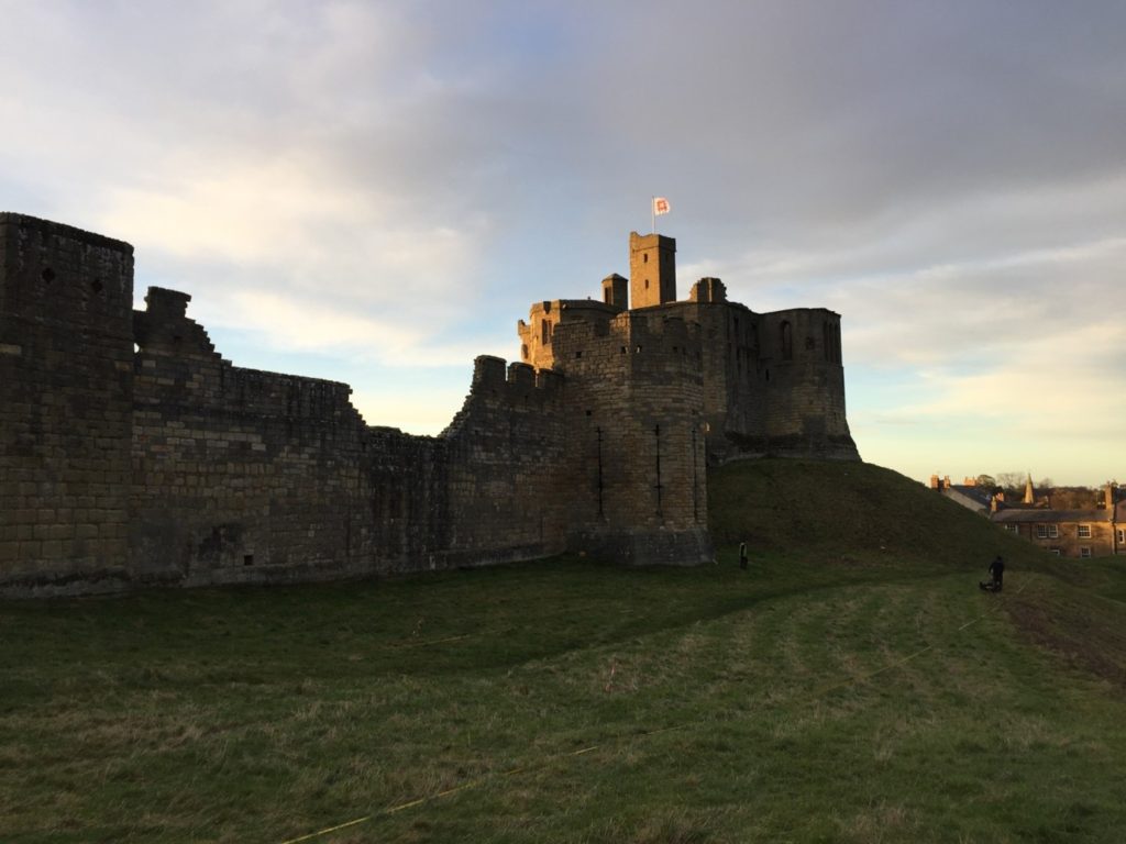
Warkworth Castle, copyright William Wyeth

Warkworth, Northumberland

Geophysical survey to explore evidence for subsurface features in and around the field called St John’s Close in a field adjacent to the castle with the aim to establish the location and eastern extent of the castle’s deer park in the 16th century as well as its entrance way. It also hoped to find evidence of a routeway running parallel to the possible park boundary which could represent an early route to the castle’s gatehouse from the south-west.

The plan is to do complete the geophysical survey by the end of March.

To keep up to date with how these projects progress over the coming months you can:

Subscribe to our quarterly newsletter

And if you donate at least £50 here and be invited to our exclusive visits to these projects: https://donate.kindlink.com/castle-studies-trust/2245 

Featured image: Old Wick Castle, Caithness, copyright Historic Environment Scotland

What lies beneath: what a ground penetrating radar survey reveals of Druminnor Castle

Lead Archaeologist on the Druminnor Castle excavation, Dr Colin Shepherd, looks at the results of the ground penetrating radar (GPR) survey of the castle in funded by the Castle Studies Trust in 2019 and what that means for future work at the site.

As a consequence of the GPR geophysics, that were generously funded by the Castle Studies Trust, we have a number of new and potentially interesting anomalies to be investigated. Furthermore, the GPR research has also been instrumental in clarifying other aspects of previously excavated evidence. This has been made possible as, contrary to most instances, the geophysics at Druminnor have been incorporated into the ongoing investigation rather than simply as a precursor to excavation.

Subscribe to our quarterly newsletter

The GPR generated 286 ‘radargrams’ or sections across the site and much time and effort has gone into analyzing these. The radargrams were compared to actual excavated sections. This permitted the creation of a ‘key’ that has allowed us to extrapolate from the excavated sections to unexcavated parts of the site. As a result, we can, fairly comfortably, suggest a developmental plan of Druminnor spanning the 13th to 18th centuries (Figure 1).

Suggested phasing of Druminnor Castle by Colin Shepherd

The GPR has suggested the extent of a hardcore platform that appears to have supported the ‘Old Tower’. This was thought to have been the earliest part of the castle but without hard evidence. We hope to test the presumed limit of this platform as we extend our trench southwards from the well that sat within the tower. (As you will recall, the GPR alerted us to that remarkable feature that became a focus for our 2019 season.) The GPR suggests that there may be a revetment supporting the platform at that point. Also, any relationship between this platform and the mid 12th-century kiln will be important in attempting to date that platform and, by extension, the Old Tower itself.

Well found in tower as a result of the GPR survey

The radargrams have also demonstrated the probable line of a terrace and sunken formal garden (red hachures on plan) and permits the excavated section of revetment and steps (shown in black) to be placed in its proper context. This garden probably dates to the 16th or 17th century, though exactly when is still debatable. The construction of the terrace removed all trace of the earlier (early to mid 15th century) ditch and so must post-date that. A late 17th-century Dutch pipe bowl found in the fill of a post hole associated with the steps suggests its removal at around that time or shortly thereafter. No trace of the terrace appears on the estate plans of c.1770.

The line of the defensive ditch has been shown by the radargrams to extend westwards from the excavated portion in Trench 11. This gives us an accurate alignment permitting its course to be drawn, even though the middle section was removed by the terrace. Where its return is at the western end of the site is still a mystery. The eastern arm was excavated in Trench 2 lying beneath the later (early 16th-century) lower courtyard. The 15th-century upper courtyard incorporated the tower with the surviving hall block (shown in blue). The courtyard’s west range can be estimated from remains found during the kiln excavation, but its eastern boundary was removed when the lower courtyard was added.

Finally, the GPR revealed the line of the outer enclosure wall as depicted on the estate plans. This was sampled in 2019 and the base of the wall found. The date of this feature is presently unknown and further work needs to be done to try to clarify that matter.

Evidence of landscaping material in outer enclosure copyright Iain Ralston

Sadly, work planned for 2020 included the extension of the ‘well trench’ in the car park to look for the possible revetment suggested by the GPR as well as opening a much bigger area across the outer enclosure wall, as located by GPR. This sits beneath a good metre and a half of later landscaping material (see picture, courtesy of Iain Ralston) and, for safety and archaeological reasons, demands a much larger trench. The keyhole sample trench indicates good survival and, it is hoped, evidence will be found to date the feature and to help explain when this became the northern boundary of the castle enclosure.

The excavated evidence together with the GPR results permit this developmental plan to be made and rough dates affixed. It is worth noting that, prior to our investigations, Druminnor was believed to have consisted solely of the surviving hall block with an attached tower at its western end. Everything not in blue on the plan, therefore, was formerly completely unknown.

Access in 2021 is still, sadly, in the laps of the Gods owing to Covid, but it is hoped that we will be able to get back on track later this year to look for more goodies!

Subscribe to our quarterly newsletter

Castle Studies Trust Christmas Quiz – the Answers

So how many did you get right? Find out below

  1. Lincoln (2020 project)
  2. Pembroke (2018)
  3. Shrewsbury (2018 and 2019)
  4. Pulverbatch, Shropshire (2017)
  5. Pleshey, Essex (2015)
  6. Druminnor, Aberdeenshire (2019)
  7. Thornbury
  8. Warkworth (2020)
  9. Ruthin
  10. Ravenscraig, Aberdeenshire
  11. Hoghton Tower, Lancashire (2019)
  12. Wigmore
  13. The Wirk (2020)
  14. Slingsby, Yorkshire – article by Bethany Watrous on her digital reconstruction
  15. Caus, Shrophshire (2016)
  16. Gleaston, Cumbria (2015)
  17. Laughton (2018, 2019)
  18. Shrewsbury again (found during 2018 execavation)
  19. Clifford, Herefordshire (2017)
  20. Ballintober, Ireland (2014)

Subscribe to our quarterly newsletter

Castle Studies Trust Christmas Quiz

To help keep you entertained during this strange and hopefully unique Christmas the Castle Studies Trust has prepared a Christmas quiz. Can you name the castles these pictures are or images are taken from either our projects from all years or blog posts during the year?

Subscribe to our quarterly newsletter

  1. Where is this?

2. Where did this CST funded excavation take place?

3. Where is this?

4.What motte and bailey castle, which we funded a geophysical survey for, is this?

5. Where can you find this bridge which the Trust co-funded post excavation work on?

6. In which Scottish castle did the geophysical survey we funded find this well?

A latter coming protruding from a circular opening in the ground.
Photo by Iain Ralston and licensed under a Creative Commons Attribution ShareAlike 4.0 licence.

7. Where is this?

8. Where is this great tower?

9. This is a reconstruction drawing of which castle?

10. Where is this castle built by a queen?

Subscribe to our quarterly newsletter

11. Where is this castle?

12. The entrance to which border castle is this?

13. Where is this base a tower? It’s one of the projects the CST has funded

14. Where is this?

15. The plan of which castle is this, which the CST funded work on?

16) Which castle is this? We funded a building survey on it previously?

17. For which castle are these aerial images of, which include results of the geophys survey the CST funded on it?

18. These pieces of Saxon pottery were found at which excavation the CST funded?

19. This is a CST study day at our first ever excavation we funded? Which castle?

20. The CST funded a buildings survey of this castle. Where is it?

Subscribe to our quarterly newsletter

A Large and Eclectic Crop of Fascinating Applications for the Castle Studies Trust to Consider

The deadline for grant applications passed on 1 December. We’re going through the various projects now. Altogether the 14 projects, coming from all parts of Britain, one from Ireland, are asking for £88,000. They cover not only a wide period of history but also a wide range of topics.

We will not be able to fund as many of these projects as we would like. To help us fund as many of these projects as possible please donate here: https://donate.kindlink.com/castle-studies-trust/2245

In a little more detail here are the applications we’ve received:

Caerlaverock, Dumfriesshire: The aim is to understand the chronology and geography of extreme weather events in the high medieval period, and the effects they wrought on archaeological features that led to the abandonment of the old castle in favour of the new.

Georgian Castles: This project explores two castles in County Durham—Brancepeth and Raby—that were fundamentally reshaped and transformed in the eighteenth century to become notable homes in the area, and it advances not only our understanding of these two buildings in the period, but also the afterlife the castles in the area and the layers of history that they record.

Greasley, Nottinghamshire: The production of an interpretative phased floor plan for Greasley Castle in Nottinghamshire. The castle, built in the 1340s, has an obscure history and the understanding of its architectural phasing is at best very cloudy.

Laughton-en-le-Morthen, South Yorkshire: To provide professional illustration and reconstruction which will also be integrated into the co-authored academic article. Part of the monies will be used to produce phase plans of Laughton during key stages of its development, and a small percentage will pay for a line drawing of the grave cover.

Lost medieval landscapes, Ireland: To develop a low cost method, using drone and geophysical survey to identify native Irish (also termed Gaelic Irish) medieval landscapes and deserted settlements.

Mold, Flintshire, post excavation analysis: Post-excavation analysis from excavation on Bailey Hill of the castle

Mold, Flintshire, digital reconstruction: Visual CGI reconstruction of  Mold Castle using the new-found evidence of further masonry on the inner bailey structure and using information gathered by the Bailey Hill Research Volunteers, showcasing the many changes that have happened on this site from a Motte and Bailey Castle to present time as a public park.

Old Wick, Caithness: Dendrochronological assessment of timber at the Castle of Old Wick, Caithness thought to be one of the earliest stone castles in Scotland.

Orford, Suffolk: recording the graffiti at the castle through a detailed photographic and RTI (Reflectance Transformation Imaging) survey will add to our understanding of how the building was constructed and the ways the building was used over time, particularly 1336-1805, during which the documentary history of the castle provides little evidence of how the site developed.

Pembroke, Pembrokeshire: A second season of trial-trench evaluation of the suggested late-medieval, double-winged hall-house in the outer ward at Pembroke Castle, which is of national significance. The evaluation builds on the results of the works undertaken through previous CST grants: geophysical survey (2016) and 2018 whereby two trenches were excavated across the possible mansion site. The evaluation will again establish the extent of stratified archaeological deposits that remain within the building, which was excavated during the 1930s.

Pevensey, East Sussex: GPR survey of the outer bailey and immediate extramural area and UAV (aerial) survey of the castle to build up a 3-D model of the site.

Richmond, North Yorkshire: Co-funding a 3 week excavation of Richmond Castle, one of the best preserved and least understood Norman castles in the UK. The aim is to understand better the remains of building and structures along the western side of the bailey.

Shootinglee Bastle, Peeblesshire: Funding post-excavation work from the 2019-20 excavation season in particular some charcoal deposits from a C16 burning event.

Warkworth, Northumberland: Geophysical survey to explore evidence for subsurface features in and around the field called St John’s Close in a field adjacent to the castle.

We will not be able to fund as many of these projects as we would like. To help us fund as many of these projects as possible please donate here: https://donate.kindlink.com/castle-studies-trust/2245

The applications have been sent to our assessors who will go over them and prepare their feedback for the Trustee’s who will meet in late January to decide on which grants to award.

Mary of Guelders and Ravenscraig Castle

Amidst the tower blocks and industrial landscape of Kirkaldy in Fife is an unexpected sight. Perched on a triangular promontory overlooking the Firth of Forth stands the crumbling ruin of a fifteenth-century fortress. Now fiercely guarded by an abundance of resident seabirds, Ravenscraig is one of Scotland’s lesser-known medieval castles, yet it deserves a closer look, not least because it is a rare surviving example of a castle commissioned by a woman, in this case Mary of Guelders, queen of Scotland (d.1463).

Mary of Guelders and James II

Mary of Guelders first arrived in Scotland on the 18th June 1449 when she stepped onto the shores of Leith ahead of her marriage to James II at Holyrood Palace. Born in Guelders (today the province of Gelderland in Holland) and raised at the Burgundian court, Mary brought illustrious connections to her new home. The match, it seems, was met with approval on both sides: in 1457, Mary’s uncle the Duke of Burgundy sent James the gift of Mons Meg, the famous cannon which can still be seen at Edinburgh Castle today. James’ love of artillery, however, was to also be his downfall. Three years later at the Siege of Roxburgh the 29-year-old king met an untimely end when another of his cannons exploded and killed him. Mary, as this previous blog post has shown, was present at the siege, and following her husband’s tragic death, the newly widowed queen ordered for Roxburgh to be razed to the ground. From 1460 until her own death three years later, Mary acted as regent of Scotland, ruling on behalf of her young son, James III. It is also from this point that she becomes visible to us in the historical record as a prolific patron of architecture.

Mons Meg, Edinburgh Castle. Photo by Lee Sie, licensed CC-BY-SA 2.0.

The nature of the evidence means that we don’t know too much about Mary’s actions during her marriage, but the few glimpses we can glean suggest that she played a relatively active role as consort, including at her husband’s first parliament in 1450. She was also present at the siege of Blackness Castle in 1454 (which James afterwards gave her as a gift to celebrate the Scots’ victory), and she appears to have been the driving force behind the couple’s foundation of a hospital at Fale near Glasgow. It is during her brief stint as regent, however, that Mary’s enthusiasm for building projects really becomes apparent: she not only commissioned Ravenscraig, but also Trinity College Kirk in Edinburgh, as well as improvements to Falkland Palace, which included the first recorded instance of a gallery in Scotland. Recent dendrochronology carried out by Dr Coralie Mills and Hamish Darrah on the tower of St Giles’ Cathedral in Edinburgh on behalf of Historic Environment Scotland has also revealed Mary’s likely involvement in the fifteenth-century alterations there. Ravenscraig was therefore one of a number of works which Mary undertook during her regency.

The Apse of Trinity College Kirk, Chalmers Close, Edinburgh. This is all that remains of Mary’s foundation, which once stood on the site of Waverley train station and was partially rebuilt in its new location during the nineteenth century. Photo © Rachel Delman.

Shortly before his death, James II had gifted the estate of Dysart to Mary, after which she funded her major works at Ravenscraig entirely from her own revenues. We know from the Exchequer Rolls that she spent 600 pounds Scots on the castle, but it could have been considerably more, as the accounts of the queen’s lands for the first term after the king’s death are missing. Building began in the east, but Mary died before she could see the castle finished, at which point the regular flurry of works ceased altogether. Part of the castle was inhabitable before her death, however, as in 1461, the queen’s steward was able to stay there for 25 days along with several of her servants.

A view of the east range of Falkland Palace containing the sixteenth-century royal apartments of James V and Mary of Guise. Mary of Guelders’ apartments and gallery are no longer visible, having been demolished to make way for the current buildings. Photo © Rachel Delman.

From the outset, Ravenscraig appears to have been intended to have a strong military appearance and is believed to be the first castle in Scotland designed to withstand cannon fire. For this reason, it has been treated as something of an enigma by historians and heritage professionals, who often regard the military design as being at odds with its supposedly intended use by Mary as a dower or “retirement’’ house. Yet the two are not necessarily incompatible. Mary’s decision to fortify the castle and to protect a vulnerable piece of coastline made perfect sense given the changeable nature of relations with the English at this point.

Ravenscraig Castle, looking north. Photo © Rachel Delman.

It was also not unusual for women elsewhere in Europe to be involved in military endeavours at this time. Mary’s contemporaries in Renaissance Italy, for example, frequently acted as military managers, fortifying towns and cities and supplying provisions and resources. Closer to home, Margaret of Anjou, with whom Mary negotiated terms in 1460, was also commissioning works on several English castles around this time, including the refurbishment of the keep of Pleshey Castle in brick. Equally, Mary’s aunt, Isabella of Portugal, in whose court the queen of Scots had been raised, was a politically active and energetic architectural patron. Mary therefore came from a tradition whereby architecture was commonly adopted as a language of female power. It is also possible, particularly given the circumstances of James’ death, that Mary intended for Ravenscraig to be part of a larger commemoration project for her husband, which also included her mausoleum at Trinity College Kirk in Edinburgh.

The termination of the works at Ravenscraig upon Mary’s death in 1463 suggests that she was very much the driving force behind them. James III showed little interest in his mother’s project, instead granting the castle to the Sinclair family, who completed the building. Nevertheless, the remains stand as a testament to the ways in which Mary chose to materially express her authority as regent. They also pose a challenge to the overwhelmingly male narrative that has long dominated castle studies, reminding us that women could, and did, play active and sometimes innovative roles in shaping the physical and social life of late medieval castles.

Ravenscraig Castle is now owned by Historic Environment Scotland. It is free to visit and open all year round. For updates from the Castle Studies Trust, subscribe to our quarterly newsletter.